This resort is located in Sitio Kalunutan, Barangay Maligaya, Palayan City (Nueva Ecija). You can Google the place or click this link.
It was my first time to visit this place as the location of the Wedding Reception Party of the Wedding that I attended during the weekend. I stayed overnight in one of their “cabanas” which are huts constructed on the side of the mountain. The hut is complete with amenities and has a porch overlooking the mountain and the cities of Palayan and Cabanatuan. I am sorry that I could not tell how much would it cost to stay in this place for one day/night because it was paid by my friend.
I am familiar with the place when there was no resort yet ten years ago. I was able to conduct a recon by tracing the trail system in the mountains adjacent to the said barangay. I started at the Philippine Army CAFGU Detachment at Barangay Tanawan all the way down to Barangay Aulo, then to the Aulo Dam and Lake. It was a whole day trekking and hiking adventure with another trail runner who was familiar with the place. From what I have experienced before, I was able to determine the exact location where I made my recon in relation to the location of the Resort. I was in the mountain in front of the Resort when I did my recon. The place where the Resort is located was still full of trees and tall grasses then. I think the owner of the Resort (which is a Corporation) was the one who constructed the road leading to the place, coming from Palayan City and from Barangay Tanawan Road/Highway.
I was able to eat late lunch, dinner, and breakfast the following day and I would say that the food is okey and the prices are reasonable. There is only ONE THING that I dislike during my stay in the said resort. There are so many flies….in the restaurant and in my “cabana”. Maybe, the flies that were inside my hut were able to enter the place when I opened the door leading to the porch when I sitted on one of the chairs and then took some video and pictures surrounding the place. While were eating our late lunch there were so many flies trying to land on our food but we used our hands to drive them away. We tried asking for candles from the staff but they can not produce any. Instead, we asked for one stand fan to be used to drive the flies away from our food and table.
The amenities inside the hut is average. The space is not big or small. It is just average. The bathroom is too small. The lockers are very simple. However, the bed with comforter is nice and the air-con is new and efficient. I had it adjusted to 22-degree Centigrade and I was able to sleep soundly. I was not able to get any TV Channel or Cable in the TV available. The WiFi Internet connection is good, too! Once you are inside the hut/cabana, everything is silent! The sound of the air-con is the only one that you can hear which eventually unnoticeable!
It was drizzling with rain in the late afternoon and the surrounding path was slippery. I am glad I was wearing my heritage boots and it got better traction than wearing some sneakers of dress shoes. However, during nighttime, the place was so beautiful because of the lighting system and the beautiful garden and plants within the resort. It was a nice place to take night pictures.
Before breakfast the following day, I was able to hike and walk around the resort and the place looks so beautiful with the blue sky. It was a perfect time to have beautiful selfies and pictures of the swimming pool, the garden, buildings, cabanas/huts, and the pathways of the resort.
If not for the flies, this place is perfect for a getaway and silent place to stay for the weekend. Being a private place, this place is only reached by driving your own private vehicle as there are no public transportation reaching this place. If I need to write a book and find a quiet place, I would not think twice to travel to this place again and stay for two to three days! How I wished I should have brought my swimming attire and goggles and be able to swim in their clear swimming pool.
If you need a place to relax and enjoy a quiet environment in the mountains for the weekend, I highly recommend this place. You can visit their Facebook Page and find out more things about this place. Good luck! Thanks for reading this post.
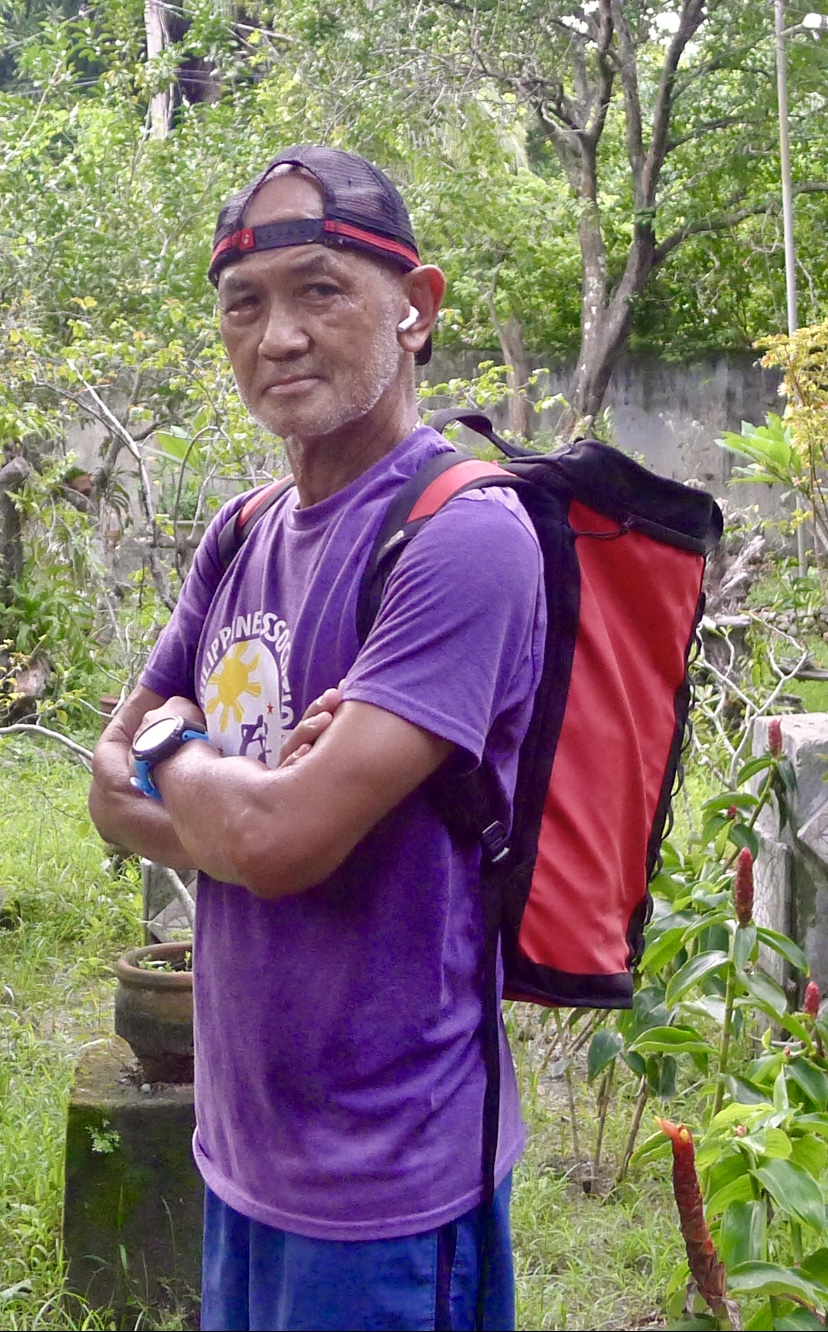
One of the training tips that my Coach had given me when I complained about my knee pains as a result of my long runs in the mountains is for me to try hiking into the mountains instead of doing my easy long runs there. However, he told me that I should carry a weighted backpack with me starting with 10-15 pounds for my first try or experience in hiking to the mountains. This workout of hiking with a weighted backpack should be done once a week.
This advice or tip was given to me way back last December 2019. It was good that I bought a North Face backpack which is made with thick material and does not have so many pockets or dividers inside it. I would use 2-liter bottles filled with water as the weight I would carry inside my backpack. Since then, I have been hiking with a weighted backpack once a week in going to the mountains for a hike of 3-4 hours and steadily progressed on making my backpack weight up to 25 pounds. Despite the fact that I would be enticed to run the downhills, I forced myself to be patient and slow on the downhills. On those hikes with weighted backpack for the past weeks and months, it gave me more strength on my legs and thus, I was able to finish my ultra trail races (local and international) since then up to the time Covid-19 Lockdown was imposed.
During the Lockdown period (past 4 months), I have been doing my daily runs in my Backyard Loop and I would be doing my hiking with a weighted backpack once a week. After I rested for one week of no running, I resumed my hiking with a weighted backpack yesterday with a reduced weight of 20 pounds. However, I did it in my Backyard Loop. After one mile, I started to perspire and after one hour, I was able to hike a distance of 3 miles.
Hiking With A Weighted Backpack
It was good to be back hiking with my weighted backpack again and I am eager to go back to the mountain trails in the coming days and weeks.
Some of my subscribers to this blog have requested me to feature Gear Reviews on the Apparel/Running Kit that I am using in my races, running workouts and hikes. And so for this year 2020, I am featuring my first Gear Review whose brand name is not so popular as a Sports brand name and it is considered as a brand for Casual Wear. This is the UNIQLO brand which had been introduced in this country few years ago and had expanded in almost all the key cities in the country. This is a Japanese brand and it suits to us as Asians.
For this post, I am featuring the UNIQLO HeatTech Crew Neck Long-Sleeve Shirt which I bought few weeks ago purposely as a casual wear, an inside shirt, for my Business Suit/Coat which I intend to use during my International Flights outside the country. Actually, I bought three (3) pieces of this shirt. I got the Dark Green, Red, and Blue colors. Each has a tag price of P 790, a price which is very much cheaper than any of the long-sleeve shirts with a popular sports brand name.
UNIQLO Red Long Sleeve Crew Shirt
It says in its item specification that the shirt is light and warm but not bulky. It has cropped sleeves and stay hidden under shirts or jacket, if used as an undershirt when wearing under a jacket, coat or another buttoned shirt. The comfort features include bio-warming, insulating, moisturizing, moisture-wicking, anti-static, anti-microbial and self-deodorizing. The material of the shirt is stretchy and has a shape-retaining material. I got size SMALL and it feels comfortable to my body as it is not fitted like a compression shirt.
At noon time today, I went out from my house for a two-hour hike into the hills and along the slopes of Mt Roosevelt (the highest elevation in my Playground which is almost 2,000 feet above sea level). As a part of my training, I was carrying a backpack with a weight of 24 pounds of water bottled in four 2-liter bottles and an additional frozen water in one 1-liter bottle. I was carrying also some trail foods and a cellphone.
Having started at noontime, the sun was hot and the sky was without clouds, I was surprised that I started to perspire after two kilometers of intense hiking on a continuous uphill terrain. I usually start to perspire after running for one kilometer. But with the heavy weight I was carrying, I thought I would perspire after hiking a few meters from the gate of my compound. The shirt was very comfortable as I started to perspire as I was going up to Mt Roosevelt as I passed the distance of two kilometers. Even if the color of my shirt was in dark green, the feeling of my skin from the shirt was not too hot but it was cooler than what I expected. It was only after I reached the peak of a hill where the base of an electric power tower is located that I felt that I was drenched with perspiration. I reached this peak in 1:05+hours and I decided to have this place as my turn-around point.
I decided to bring down my backpack and bring out the trail food and my cellphone at the base of this electric transmission tower for some rest, hydration and ingest my nutrition. My UNIQLO shirt was entirely wet from my perspiration but I have observed that the damp of my shirt provided me the coolness to my body. After a few minutes of eating, drinking and taking some “selfies” from my cellphone, I started my hike again and back to where I started.
Even if it was too hot while I was on my way back, I still feel that my body was so fresh and refreshed by the damp shirt. The wet shirt has a cooling effect to my body and I felt I was not perspiring while I was hiking on the downhill and uphill. I finally reached the gate of my compound after 2:17+ minutes. As I removed the shirt from my body, I have observed that the shirt did not retain much moisture and it was very light as compared to other moisture-wicking shirts from popular sports brand names where they are very heavy once they are drenched with my perspiration.
With the price of 790 Pesos, the shirt has eight (8) colors: White, Light Gray, Dark Gray, Black, Red, Dark Green, Blue, and Navy. I am planning to look for a white color for this Uniqlo shirt in my next visit to their store.
With its cheap price, comfortability, and lightness when wet, I am highly recommending this Uniqlo shirt for Ultra Runners, whether they are on the road or trails.
Mountain Hiking With UNIQLO Dark Green Long Sleeve Crew Shirt
(Note: I am NOT a Sponsored User of UNIQLO Products)
Despite the protests and demonstrations in Hongkong during my trip last week, we enjoyed our two-day “back to back” runs in Lantau Island in Hongkong. We were not affected by the situation thereat as the Transportation Facilities (MRT/Subway and the Ferry Ride) were providing normal operations to the Public. Although the fare to and from the island is quite expensive which is about One Hundred Hongkong Dollars for each of us to include our food and water before and after our workout, the experience is priceless as we did not have to pay any Permits, Guide Fees, or any related fees in using the Lantau Trail. As compared to the trails in the Philippines, there are so many expenses or fees one has to incur in going to popular trail destinations near or outside Metro Manila.
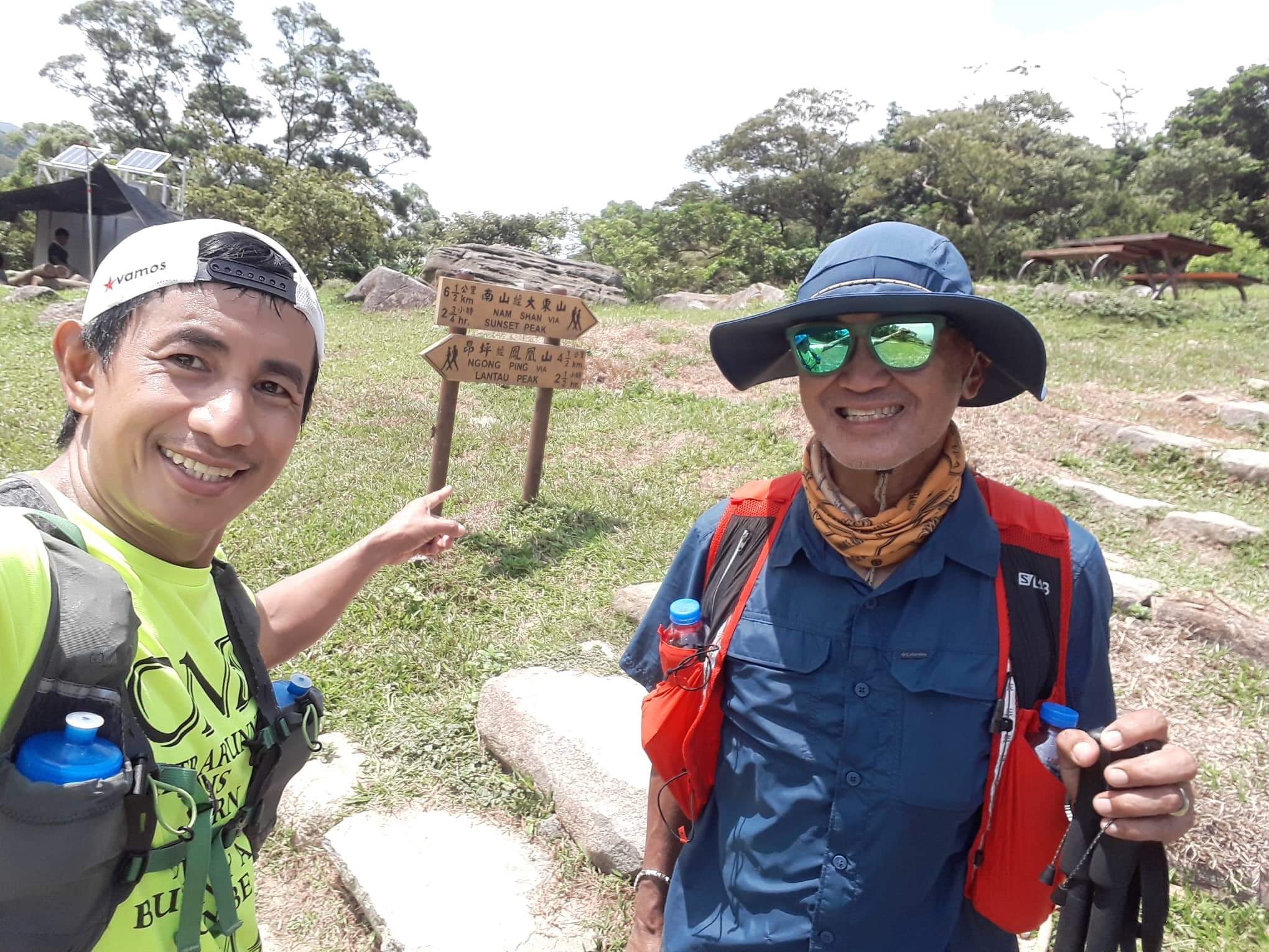
Thomas was able to completely had an insight and orientation of the Lantau Trail knowing that he will be on this trail on the early evening of the second day of the event. Due to this recon run, he told me that he is confident to run the whole trail during nighttime. On the first day, he estimates that he was able to run and hike a distance of almost 25 kilometers. On the second day, he was able to run almost 30 kilometers. Those missing sections which he was not able to reach are the sections of Lantau Peak, Ngong Ping, and those flat areas in Tai Po.
As for me, on the first day, I was able to cover 11 kilometers with an elevation gain of almost 3,000 feet and on the second day, about 15 kilometers with an elevation gain of almost 1,800 feet. I am satisfied with my workout despite the heat and humidity; and the lack of training. Actually, I did more hiking in the ascents and descents, and tried to jog on the flat sections of the trail.
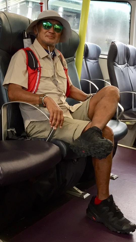
For two days, I have been using hiking attire except for the trail shoes. My shirt and shorts are from Columbia which are popular to hikers and mountaineers. My “Tilley” Hats that I used were bought at DecathlonHongkong and I find them to be comfortable and could easily dry when wet with my sweat or when I douse my head with cool water from the water spring/streams along the trail. My trail shoes is the Salomon Speedcross 5 which I found out to have a wider forefoot but I have problem with its insoles as they have the tendency to fold on my descents. It was suggested by Thomas that I have to glue the insoles inside the shoes to make them permanently immovable. I was using the Gipron Trekking Poles and they gave me the necessary aid and balance support in the ascents and descents. My hydration vest is the 8-liter Salomon SLAB Sense Pack where I stashed my money/Octopus Card, cellphone, space blanket, hydration bottles, dry clothes, light jacket, and power bars. It was my first time to use my Goodr Sunglasses (Green Lens) which I bought in A Runners Circle (ARC) Store in Los Angeles, California, USA two years ago. The socks that I used were newly-bought from the Decathlon Store in Mongkok, Hongkong.
This recon run will be helpful to me as I am registered for the 2020 Translantau 50K Trail Ultra which is scheduled on March 1, 2020. Hopefully, by that time, I will be well-prepared as in my past finishes in the Translantau 100K.
If I have a chance to return to Hongkong before the end of this year, I would gladly go back again to Lantau Trail and MacLehose Trail if time permits.
Trip To Hongkong (2nd Trip For 2019) August 12-15, 2019
This is my second trip to Hongkong for this year (2019). I was in Hongkong during this year’s Chinese New Year to support the participation of Thomas Combisen in the Hongkong 4 Trails Ultra Challenge on the second week of February. Unfortunately, Thomas was not able to make the cut-off time for him to reach the last leg of the Lantau Trail during the race. I promised to Thomas to bring him back to Hongkong purposely to run the Lantau Trail which has a distance of 70 kilometers.
Weeks prior to our trip this month, news had been around about the Protests and Demonstrations that had been occuring in the different parts of Hongkong. Sine we have purchased and made our reservations for our accommodation weeks ahead, we decided to take the risk and continue with our scheduled plan for this trip.
It was supposed to be a trip for four trail runners, including myself, but two of our companions were not able to make it due to personal circumstances. The overall plan for the trip was to recon the Lantau Trail starting from Original Trailhead and from the End of the Trail going on a reverse route. We planned to do this in one day and the rest of the days will be devoted to food trip, shopping, and side trip to Macau.
We left Manila at 5:50 AM of Monday, August 12 and arrived in Hongkong at 8:00 AM. After loading some money into our Octopus Cards, we took the regular bus to Mongkok, where our regular hostel is located. We had been a regular client/customer in the said hostel since I have started joining trail running events in Hongkong. Although I have stayed in more expensive hotels in Tsim Tsai Tsui, Kennedy Town, and Jordan, I always prefer to stay in Mongkok for the authentic Chinese cuisine which are very cheap and lots of shopping in the nearby streets and Nathan Road.
Another interesting reason for this trip to Hongkong is for my new hobby of Seiko Watch Limited Edition Collection! Before this trip, I have been asking some of my FB friends who are residing in Hongkong as to where to buy these Seiko Watches and they gave me some tips. Earlier this year, I was fond of the Onitsuka Tiger sneakers and I had to look and buy a particular model in Causeway Bay. I am done already with the OT sneakers and now I am crazy with Seiko Limited Edition Watches!
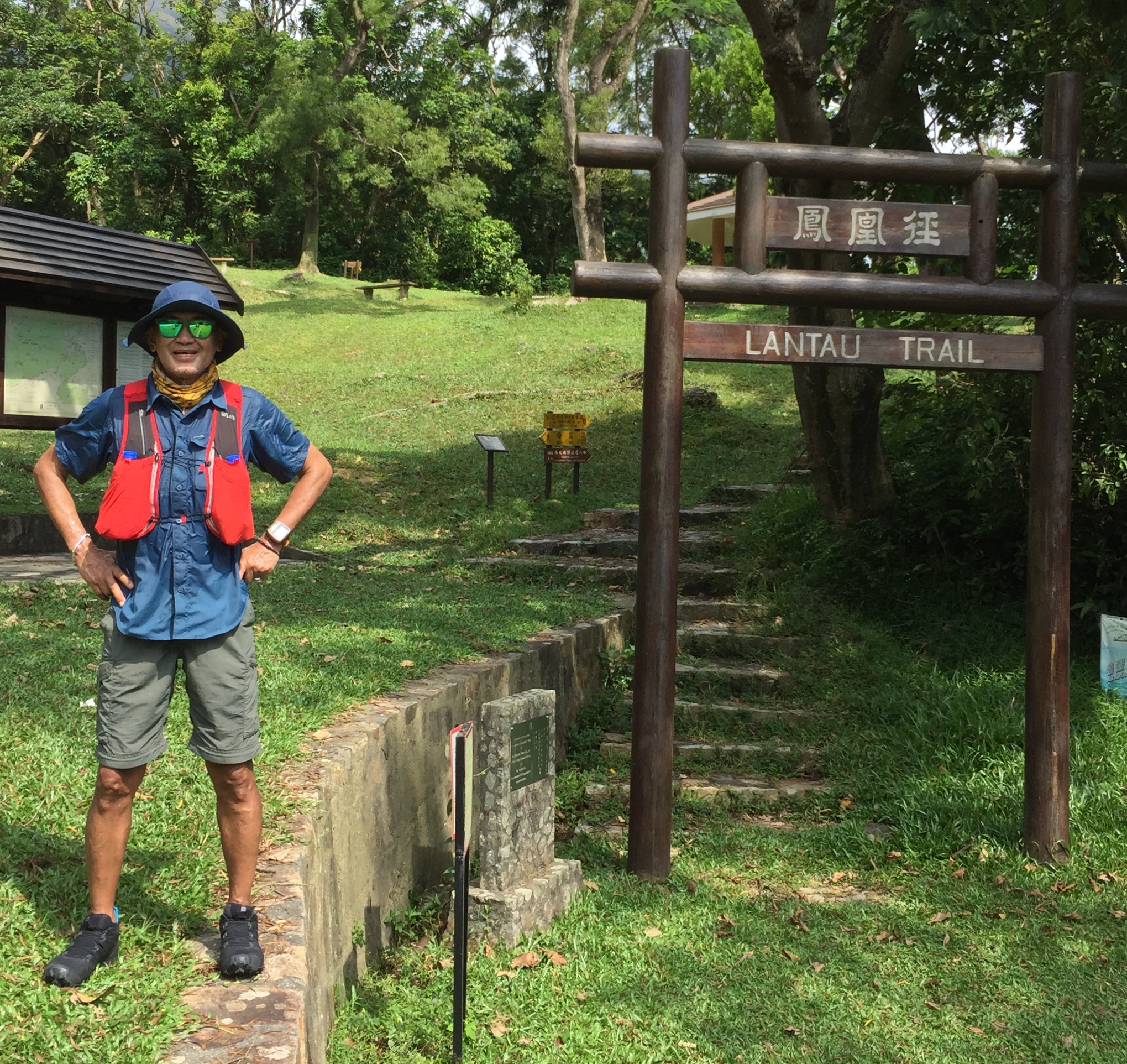
Starting At The Trailhead LT Post 001
On Tuesday morning, Thomas and I took the MRT from Mongkok to Central and then walked to the Ferry Terminal Port #6 for our trip to Lantau. After one hour and half, we were at Mui Wo and walked along the Tun Chung Road going to the Trailhead of the Lantau Trail and it was already 9:30 AM. The distance from the Mui Wo Bus Terminal to the Trailhead is about 2 kilometers which is an uphill road. As we reached the trailhead, we were already sweating because of the hot/warm weather in the area. Thomas and I made an agreement for him to proceed and run the trail as fast as he can while I would hike and jog to the next trail camp and try to follow him. If in case he would determine if his target mileage for the day is done, he can just backtrack along the trail and try to find me. From there we could take the bus in going either to Tun Chung or back to Moi Wo Bus Terminal.
So, that was what we had done. From the trailhead, it was an uphill climb to Sunset Peak and then descend to the next trail camp/rest area and then cross the National Road in going to Lantau Peak. It was a very hard hike for me because of the heat and lack of training. I had to rest for three times before reaching the Sunset Peak and stopped every flowing stream to douse some cold water to my head and body. There is also a water reservoir where there was a faucet on its side that gave me lots of water to fill up my bottles and rehydrate myself. A white guy in trail shorts and shirt passed me on the first 2 kilometers of my ascent; I met two white guys and a lady going down from Sunset Peak; three white guys with big backpacks on my descent from Sunset Peak which I found later that they are from California, USA for some Para-Sailing activity in the area; and two local young guys who were taking selfies on my way down near the trail camp/rest area.
Descending From Sunset Peak
I attempted to start hiking the first kilometers towards Lantau Peak but I could no longer endure the heat of the sun and I was already exhausted due to lack of training. I went back to the waiting shed at the trail camp and wait for Thomas to arrive.
I really don’t know how many minutes I was able to doze off when Thomas arrived. Thomas was also complaining of the heat and humidity but he was happy to recon the place. He was longing for an ice cold Coke that we decided to walk towards the next village along the National Road. But to our surprise, the village was still too far that we decided to stop our hike in a Bus Stop and waited for our Bus Ride to Mui Wo.
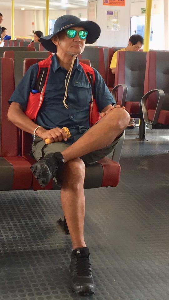
In a few minutes, we took our Bus ride and immediately changed to dry clothes at the last row of seats inside the said bus. We went directly to the McDonalds at Mui Wofor our first meal of the day with a Large Ice Cold Coke and Double Cheeseburger!
After our McDo meal, we waited for our ferry ride back to Central. This time, the Ferry was an Air- Conditioned with higher fare BUT with NO Wi-Fi as compared with the slower one, cheap with Wi-Fi which we rode on our way to Lantau.
Thomas and I @ The First Resting Camp
It was good to be back to Lantau Island to run and hike after finishing the Translantau 100K for two times in the past. Well, I was then a younger and a stronger trail runner then!
On an early Monday morning, I woke up at 3:30 AM and drove all the way to the trailhead of Mount Baldy with the thought that I would be the first one to “summit” the peak for the day.
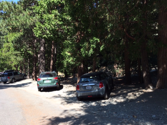
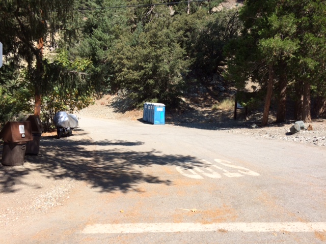
From my house to the trailhead was an easy drive for 45 minutes and it was still dark when I arrived at the Parking Area at Manker Flats. While I was preparing my things (hydration pack and shoes), another vehicle arrived and parked across the road where I was preparing my things. The other vehicle had two hikers in it and they immediately opened their vehicles’ trunk to retrieve their packs and went directly to the trailhead. They were 5 minutes ahead of me when I finally started after taking a pee in one of the Portalets.
Parking Area Beside The Road
Trailhead Going To The Mt Baldy Falls
They were wearing headlights as I saw them in front of me for about 200 meters. I was not wearing a headlight and I was confident that the light from the moon could easily illuminate the dirt road towards the commercial establishment at the Ski Lift. Before I was able to hit my first mile, I had already overtaken them after I greeted them. As I moved ahead of them, I could still hear their conversation as they were taking their time for the hike.
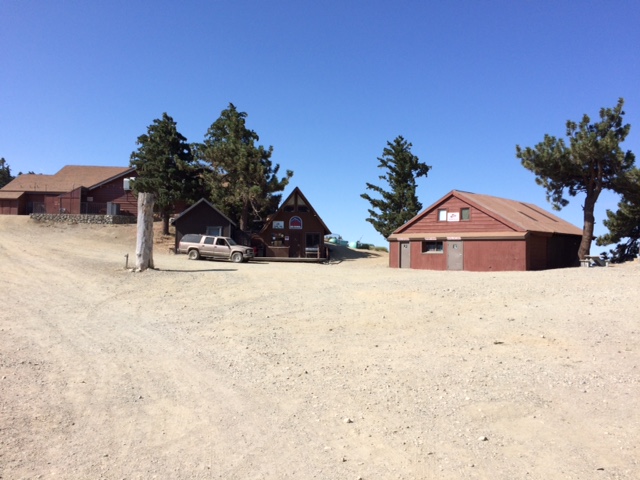
Being confident that I was already the first one on the trail, I maintained my hiking pace until I reached the Ski Lift’s Commercial Center. It was already daybreak when I reached the place and nowhere I would find find the two hikers behind me.
Mt Baldy Ski Lift & Commercial Center
As I passed the Ski Lift’s Commercial Center towards the Devil’s Backbone Trail, I saw a Rescue Truck parked at the end of the Fire Road, the farthest that a four-wheeled vehicle would reach towards the peak of Mt Harwood. I was thinking that those guys aboard in it were just ahead of me but as I saw at the horizon and the trails above me, I would not see any individual/hiker ahead of me towards the peak of Mt Baldy.
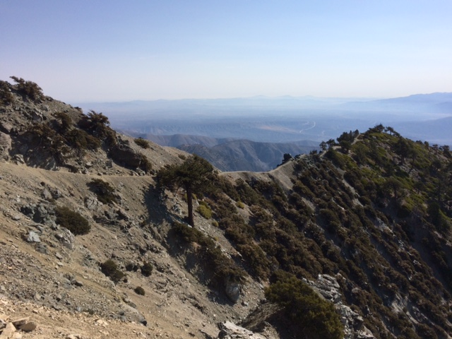
Devil’s Backbone Trail
Looking at a distance ahead of me, I would see the Devil’s Backbone Trail and it looks like a very challenging and intimidating ascending part of the trail where both sides have steep slopes that the lowest portion could not be seen. If anybody would slip or feel dizzy and plunge to any of the sides of the slope, I would suspect that a hiker would be hard to be rescued from atop the trail. But if you are already standing and doing your hike at the said place, you can feel that your courage is slowly taking over your mind and for you to be able to cross this dreaded part of the trail. As you passed this trail, you are rewarded with a higher elevation and a flatter portion of the trail with the peak of Mt Harwood in front of you!
Mt Harwood’s Peak
I decided not to “peak bag” Mt Harwood as I was trying to be fast as possible in reaching the peak of Mt Baldy. As I was hiking on this flatter portion of the trail, I had my first sip of water and I started to feel some perspiration on my back as I was wearing my Uniqlo Water Repellant Windbreaker.
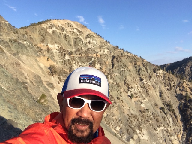
Finally, I was on my last mile before the peak of Mt Baldy! After about 200 meters, I saw a hiker going down from the trail and I said to myself that the guy could have started way ahead of me! He looks like he is a good hiker with all those beard and moustache on his face and the hiking boots he was wearing. He was not using trekking poles. A simple greeting and look on each others eyes as we met were part of the usual practice among hikers and it feels a good sign of showing respect to one another on the outdoors.
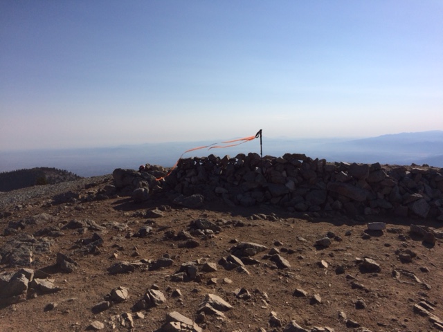
At Mt Baldy’s Peak With Piles Of Rocks With Orange Ribbons
On my final 100 meters towards the peak of Mt Baldy, I met two hikers with backpacks and trekking poles telling me that a helicopter will be arriving at the peak in 45 minutes and my understanding of the message was that there was an urgency for me to reach the peak and spend a short/quick time at the peak. I said thank you to the two hikers as I moved faster and closer to the peak.
Few meters from the peak, I have observed that there were lots of stakes with orange ribbons tied on them that were placed surrounding the peak of the mountain. I concluded that those ribbons were markers for the pilots of the helicopters for them to visually know where exactly they would land. On the peak, I saw three (3) guys with big backpacks and orange jackets whom I assumed to be those who rode in the Rescue Truck parked along the trail going to the mountain. They were lying on their backs and talking to each other and not minding about my arrival in the area. They were inside the area where those pile of rocks formed in a semi-circle which I believed is being used for those hikers who would set their tent and sleep for over night in the area. The pile of rocks is so high that it can protect strong winds from hitting a pitched tent inside the semi-circle area.
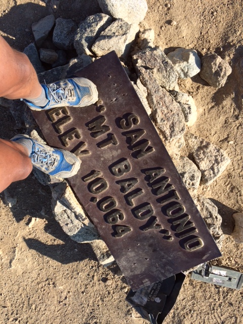
Mandatory “Selfie” At The Peak’s Marker
I could still remember where one of my ultra friends who lives in Los Angeles had to stay and camp at the peak of Mt Baldy for one week as part of his training for the 2015 Angeles Crest 100-Mile Endurance Race. He would pitch his tent at the peak and then hiked and run towards the Ski Lift’s Commercial Center and then back to the peak during the duration of his stay in the mountain. I guess, camping in the said area is FREE as long as one has an Adventure Pass displayed on ones vehicle at the trailhead. As a result of his training, the guy finished the race in less than 24 hours!
I spent almost 30 minutes at the peak, taking some “selfies” and eating my nutrition bars/trail mix fruits & nuts, before starting my descent from the peak. On my way back, I started to move faster and run the flatter sections. If the descending part of the trail is smooth and without any roots or rocks, I would run and quicker with my pace.
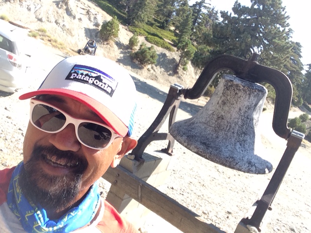
“Selfie” At The Bell Near The Commercial Center
I did not stop at the Ski Lift’s Commercial Center as they were still closed but three (3) SUVs suddenly arrived at the area full with “newly-recruited” Park Rangers and they were instructed to proceed to the establishments. I said to myself that I had to run 3.5 miles down to trailhead and be able to finish my hike before 10:00 AM.
As I was running down along the Fire Road, I could hear the sound of an approaching Helicopter to the mountain but sad to say that I could no longer have the view of the peak of Mt Baldy. Whatever, the activity that was being done in the area was part of the regular training being done in response to any contingency or emergency situation that is usually being experienced among hikers in the area. This is what I call being prepared and work’s efficiency among those people responsible in the safety and protection of the parks.
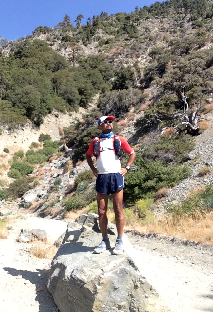
Mandatory Pose After The Hike Overlooking The Mt Baldy Falls
At 10:30 AM, I was driving on my way back to the house in Downtown, Los Angeles.
My next plan will be to pitch a tent at the peak and sleep thereat for an overnight stay!
I did not realize that I’ve been through with four weeks of my training since I’ve started for the 2015-16 Ultra Trail Running Season. I started my training on August 3, 2015 and the first day was a Rest Day with some stretching exercises.
I am still following a training schedule program which I’ve been using for the past two years with a little adjustment on my weekly training volume which I’ve increased within the range of 5-10 miles per week which are mostly done in my weekend LSDs. Before, I was doing an average of 50-55 miles per week but for the past weeks, I’ve have reached a peak of 66-67 miles per week. I feel okey, healthy, and pain-free from my knees and legs and had no bouts of leg cramps or “bonking”. I guess, there must a lot of good reasons why at my age of 63, my knees are still holding up and I could still hike some steep mountains.
Surprisingly, the bottle of Aleve that I bought lately have not been opened yet and for the past four months, I’ve never taken any pain-killer tablet in my races and trail running workouts.
My past failures to finish a 100-mile mountain trail run were caused by nutritional and hydration problems on my part. It took me two or more years to experiment what is good for my body. I really don’t have any problems with 50Ks, 50-milers, and 100K trail races with regards to nutrition but when I join 100-milers in higher elevations, my nutrition just put me down on the last 30 miles of the race. Following my experiences in the 100Ks that I’ve finished, I would only take in Energy Gels and Water and some solid foods offered at the Aid Stations and I would finish the course without any problem. I bought some nutrition books for endurance athletes and made some researches on the Internet. In addition, I was able to get some suggestions and advise from the Filipino veteran ultra runners residing in the United States. These suggestions from them confirms the studies and researches that I’ve read on books and on the Internet.
On this new training season, I’ve concentrated on my nutrition, not only before during, after my workout, but completely observed my daily nutritional intake to my body. I don’t count the calories of the food that I ingest but I make sure that I have Carbohydrates, Fats, Proteins, and Vegetables/Fruits in my 3 meals a day. Snacks in between meals would be anything, whether it is a fruit juice, milk, fruits, yogurt, or snack bars. I’ve never drink milk when I was in the military up to 2 months ago. Lately, by accident, I found out that Organic Fresh Milk does not give me stomach trouble caused by lactose intolerance. I’ve indulged myself in eating avocado as part of my meal or snacks and ate more foods rich in fats.
On my nutrition before my runs, I would have a breakfast of coffee, oatmeal or cereal with milk, avocado with milk & sugar, yogurt or fruit juice.
During my runs, I would hydrate every time my GPS watch would beep to indicate that I’ve covered a mile and have to strictly do the said “drill” every time I hear a beep. For my runs less than 8-9 miles, I would just drink water and ingest one 1 capsule of S’Cap every hour and after the workout. But for my LSDs on weekends which are more than 9 miles, I would carry with me a Tailwind Mixed with water in two bottles and purely Water in my 1.5-liter hydrapak on my backpack. I would alternately, drink Tailwind and water every other mile. I would also ingest 1 capsule of S’Caps every hour. At the turn-around or after finishing the first half of my run, I would eat any solid food I brought with me like, boiled potatoes, power bars, dried fruits, and some baby foods (fruit/vegetable).
I’ve stopped using Energy Gels in my runs since the start of this training but I still carry at least two packs just in case of emergency. I’ve have observed in my past races that Gels, after ingesting about 10 pieces, I would end up throwing up even if I use different flavors and flavors that I liked that didn’t give nauseated feeling in my past ultra runs.
My post-nutrition intake would be immediately after the workout——lots of water, one can of coke or one bottle of Ensure and a Power Bar. Once I arrive home, I would eat a complete meal. For the rest of the day, I would continuously hydrate myself with water, sometime consuming 1.5 gallons of water, and strictly adhering to my complete meals—carbohydrates, fats, protein, vegetable and fruits.
I have also incorporated “speed” workouts in my weekly program. Wednesday is usually my “speed” day where I do it on a flatter ground and paved road. This is the only time that I don’t go to the trails and mountains. Since there is no oval track near my place, I would go to a Public Park (Echo Lake Park) where the streets that surround it has a total loop distance of exactly one mile. I would do 1 mile X 5-6 repetitions or 2 miles X 3 repetitions with at least 5-6 minutes rest/jog intervals in between repetitions. In the mountains/trails, I usually do some “strides” or fast & quick leg-turn-overs on flatter portions within a distance of 50-100 meters just to give some “wake-up” drill to my tired leg muscles.
Once or twice a week, I would go to a mountain which has an “up and down” route where I have measured on each way (2.5 miles up & 2.5 miles down). I would wear my hydration vest full of 2 water bottles and 1.5-liter of hydra pack on my back with solid foods. I would practice “power-hiking” on the UP portion of the course and never attempt to do any run or jog. I would register the time from the start up to the time I reach the peak of the mountain. I have observed that I had been improving my time to reach the peak every week. The 2.5-mile distance has a vertical distance of 1,280 feet and my best time so far is 43 minutes for the power hiking in the UP direction.
On the ridge of the mountain, I would continue jogging and hiking for about 2 to 3 miles. On my way back, I would start my fast “downhill run” on the measured portion where I had my “power-hiking” workout. My attitude here in the fast downhill run is a “go for broke” one! A fast and continuous downhill hill run for 2.5 miles would “thrash” my legs! I am surprised that my old knees can still withstand the hard pounding of my feet on the ground. Every week, I would improve on my time on this downhill run! My fastest time for the downhill run is 20 minutes!
Power Hiking and Fast Downhill Running made me register a faster pace and speed for my daily runs!
Two years ago when I shifted to trail running, I did not give any attention to the vertical distance (total ascent/descent) in my workouts but it was later last year that I have concentrated more on the vertical distance of the trails I’ve been into. However, since I’ve started this new training season, I made sure that my weekly totals on the vertical distance will not be lower than 6,000 feet.
On Mondays and Fridays, I would do some stretching and calisthenics/core strengthening exercises. I would also do “foam rolling” to my legs for about an hour with more concentration to my calves, hamstrings, quads, and butt muscles. I stopped my lap swimming for the past weeks and by the end of the 7th or 8th week, I would incorporate (stationary) cycling in my weekly workouts.
On my weekend LSDs, I don’t eat a heavy breakfast (ingesting only coffee) as I want to simulate how I would apply my nutrition and hydration strategy when I am about to reach my “bonking” period which is about 1-2 hours after the start of my run. This is where I would observe how my body would react to any food or fluids that I take in, whether it is water, Tailwind, S’Caps, solid foods (power bars/baby foods/power bars/dried fruits), electrolyte mix, or Clif Bloks. So far, my maximum LSD distance was 20 miles in 6 hours, carrying a heavy load of water in my hydration vest (2-20 oz of water bottle & 1.5-liter hydrapak on my backpack + solid foods). However, if I use my 2-16 oz Simple Hydration bottles (tucked in my race belt with power bars) and one hand-held 12 oz handheld water, that same distance of 20 miles is usually done in 5 hours or less!
On the technical aspect and the monitoring of my body’s feedback on my performance every workout, my Suunto Ambit 3 Peak GPS Watch, had been very useful in monitoring my Heart Rate, VO2, Cadence, Calories Consumed/Burned, and Recovery Period. From these data, I would be able to know on what to do for my rest and recovery for the next workout. My daily workouts are properly recorded in a notebook/journal that I would religiously write every time I finish a workout, to include, what I feel before, during , and after the workout.
In summary, I attribute my faster and better performance in my 4 weeks of trail running due to the following: (1) Better nutrition before, during , and after every workout; (2) Constant hydration with water every mile with Tailwind every other mile; (3) Speed workouts on Wednesdays and incorporation of “strides” in my daily runs; (4) Adapting my body to ingest S’Caps/Salt Sticks during the run on hotter days without any negative reaction to my body; (5) More vertical distance and higher altitude hiking/downhill running would acclimatize my respiratory system; and (6) “Foam Rolling” & Stretching with Core Exercises twice a week.
I’ve been using my Hoka One One “Speedgoat” Trail Shoes for my LSDs and most of my daily runs while my Inov-8 Race Ultra 270 Trail Shoes and Hoka One One Challenger ATR would be used in my recovery and tempo runs.
Monthly Mileage (August 2015): 238.65 Miles or 381.84 Kilometers
My Thoughts & Plans On The General Aguinaldo Trail
As I am trying to re-trace the route that General Emilio Aguinaldo and his entourage took in his journey to avoid being captured by the American Forces during the Filipino-American War/Insurrection War in 1898-1902, from Candon, Ilocos Sur to Palanan, Isabela, the following thoughts played into my mind.
More or less, these thoughts will be implemented in the events that I would conduct and share to interested persons or groups who would like also to experience what our forefathers have trekked in this historic route.
1. The General Aguinaldo Trail is a HIKING destination. Going through what General Aguinaldo and his entourage had taken almost 115 years ago in five months and 18 days with a perceived armed enemy on their tail is beyond comparison to what the present day hiker would do along this route. There NO need for a hiker to be fast and come up with a new hiking record to travel on foot along the said route. However, anybody can do this kind of risk on their own.
2. A hiker can be on self-support, carry his/her own tent, sleeping bag, and his food provision. A hiker can take advantage of the Barangay Halls or Village Centers along the route or residences of the locals in the area as their resting places. There are also convenience stores and eateries along the route as most of the parts of the road are being used for commerce and visitors.
3. The route is no longer pure trail or dirt road. Some parts of the original Aguinaldo Trail are now paved where transport system is well established. Commercial transport as well as private vehicles can now travel along this route. However, the challenge on the elevation gain and loss is still there.
4. Honor System is encouraged to all the hikers from the start up to the finish.
5. Patterned after the famous trails like, Pacific Crest Trail (PCT), Continental Divide Trail, Appalachian Trail and other famous trail systems in the world, an Association will manage the entry and processing of each hiker that will pass through the route. Actually, I have created “The General Aguinaldo Trail Association, Inc.” and have it registered to the Securities and Exchange Commission as the sole association that will process interested hikers to this route.
6. Registration to Hike on this trail will be for “Thru-Hikers” Only. “Thru-Hikers” are those hikers who will stay along the route from start up to the finish or until they reach the final destination. If a hiker decides to take a break or rest in Baguio City or Manila or in his/her place of residence and then proceed back to where he/she stopped to continue the hike, this is NOT considered as “thru-hiking”. A hiker is considered DNF once he/she leaves the trail beyond the radius of 10 kilometers. It should be NOTED that there is only ONE Direction in “thru-hiking” this route—from Candon, Ilocos Sur to Palanan, Isabela. If a hiker decides to hike a section of the route, then there is NO need to register.
7. Registration to hike along the General Aguinaldo Trail will be On Line through my blogsite at http://www.baldrunner.com and/or through the General Aguialdo Trail Group Page on Facebook. This system/ arrangement is temporary while a dedicated Website for the General Aguinaldo Trail Association, Inc. is being constructed.
8. A corresponding registration/processing fee will be paid by each hiker (officially registered) which will cover the following:
a) Passport and Map/Directions of Route
b) Commemorative Shirt (Short-Sleeved)
c) Finisher’s Medal
d) Finisher’s Certificate
e) Finisher’s Shirt (Long-Sleeved, Dri-Fit)
f) Donation for the Establishment of Permanent Markers along the route.
i) Postage/Shipping Charges (For the Finisher’s Medal, Finisher’s Shirt and Finisher’s Certificate)
9. The details of my thoughts and plans will be duly coordinated with the Department of National Defense, Armed Forces of the Philippines, Philippine National Police, Department of Interior and Local Government, Department of Tourism, Department of Transportation and Communication, and the LGUs (Provincial, City and Municipal Levels)
10. Passport must be duly marked and stamped by the Municipal Tourism Officer or Philippine National Police in the Municipality with Signature of the Person On Duty with the appropriate Time & Date of Check-In in the stated office/s.
11. The following trail/route marker will be seen along the way to guide the hikers:
Route Marker
12. There is a possibility that some portions of the route will be used for ultra running events in the future. Details of these events will be announced through this blog or on Facebook.
13. Hopefully, the General Aguinaldo Historic Trail will be open for “official registered hikers” by January 1, 2015. This will make the “General Aguinaldo Historic Trail” as the FIRST Thru-Hiking Destination In The Country!
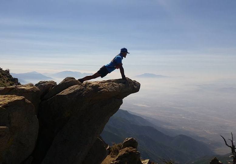
This picture says it all about my present condition. I’ve been hiking, sometimes jogging, for the past weeks.
During my dull moments, I’ve been making a lot of research about hiking the wilderness and the art of “fast and light” backpacking and its techniques which are abundant in printed references, journals, and through the Internet. We will see what this activity will offer us in the future as an incoming “senior citizen”.
By the way, do we have a national government office in the Philippines that administers all the National Parks and Wilderness Areas in the country?


You must be logged in to post a comment.