Since I finished the 2nd Zamboanga Mountain 50K Run, I did not run regularly for the next 3 weeks and then resumed my daily training two weeks prior to the conduct of this event. Most of my daily training consisted of road runs where I included “strides” and tempo runs within the middle of each running workout. I made some hill repeats per week and two weekends of long hikes in my mountain trail “playground” which lasted for 5-6 hours every workout. On those two weeks of training, I made it a point to have a full day rest on Mondays and two days rest before the event.
While on training, I was eyeing to join the shorter event which is 25K because I wanted to finish the race in 4 hours; go home to Manila early during the day; and my long runs prior to the race were less than 25K. However, while driving to Doña Remedios Trinidad (DRT), Bulacan, I have finally decided to join the longer distance event which is 50K with the thought of going around the 25K-loop twice. Knowing how organized and loaded with logistics in all the MGM’s events that I’ve joined (I guess, I joined all of them!), I finally decided to join the 50K event as soon I checked-in at the Starting Area.
Sometimes, I need to challenge myself and take the risk as to how far I can go in terms of testing my physical and mental limits as a result of my limited period of training; test my gears/equipment; and test my nutrition and hydration strategies.
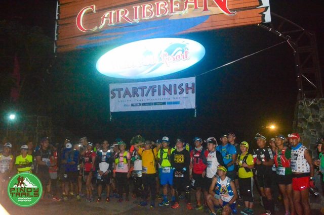
While it was still dark (2:45 AM) at the Caribbean Resort in Doña Remedios Trinidad (DRT), Bulacan when we arrived, I could see lots of personal vehicles parked and runners wandering around inside the resort; preparing their gears; and taking their nap while waiting for the event to start. I could see the “usual suspects” or “addict” runners in trail running but I could not see lots of the faster ones. I was wondering if there is another trail running event being held for the weekend or it is a sign that most of them are still recovering from the trail event a week before this one.
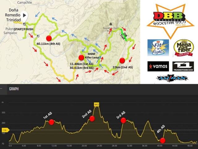
Few minutes before the start, the Race Director briefed us about the course/map; elevation profile; and the locations of the Aid Stations/Checkpoints/Marshals. However, the briefing did not specifically mention about the rivers to be crossed; the slippery rocks to be climbed/trekked and the numerous waterfalls to be climbed. From the description of the course, I expected that my shoes will be wet throughout the race so that I decided not to use gaiters and calf sleeves. Instead, I used my light Salomon S-LAB Trail Shoes and the thinnest Drymax socks. I took time to review the map course and asked for some clarifications as we have to pass a certain checkpoint for three times. We were advised that the Marshal in the said checkpoint will write a certain “mark” on our Race Bibs to show or indicate that we have passed the said checkpoint for three times. (Looking at my Race Bib after the event, I saw the numbers 1-2-3 written on my Bib). I made sure that I will not get lost during the race.
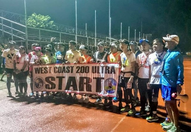
Group Picture Before The 50K Start (Copied From Facebook)
The race started promptly at 4:00 AM for the 50K distance event. I took time to walk the first few meters while I turned on my PETZL Reactik+ Headlight. From the entrance of the Carribean Resort, we turned right into an asphalted road and after a flat portion, it was all uphill where I would hike and run trying to keep up with the pace of the other runners in front of me. But I have to maintain my pace with the thought that I would not like to “bonk” on the last half of the run.
For almost one hour and 45 minutes, I was running and hiking trying to focus on what my headlight’s beam was directed in front of me. I was quite bothered with the Nathan Handheld bottle that was strapped on my left palm that the water inside in it was getting out from its sipping valve as I swing my arms. To keep the water from being wasted, I had to drink the water regularly instead of just ignoring the leak. With this situation, I was always in need of water 2-3 kilometers away from the next Aid Station but I just relaxed with my predicament as I can easily scoop some water to drink on the rivers and waterfalls along the route, this is to include the free-flowing water from hoses in some of the houses in the area and man-made wells along the side of the road.
It was already daybreak when I reached the peak of the first “major” climb of the course and it was relatively downhill and flatter portions of the course. Some of the road was paved but most of it was wide smooth dirt road. I tried to increase my pace even if I would glance on my watch that I was having an average speed of 4.2 miles per hour. To me, this is already a big improvement and I was happy that my training (“strides”/hill repeats/tempo runs) is paying off and getting positive results on my numbers/data from my GPS Watch.
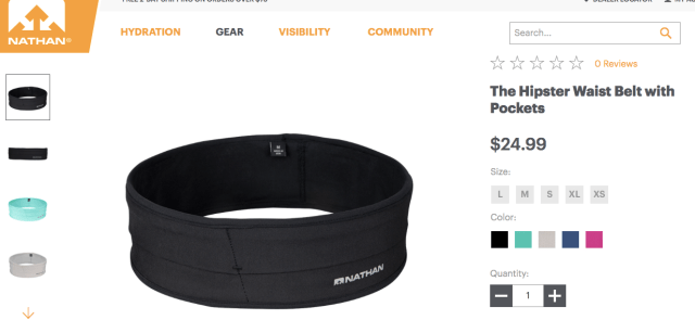
NATHAN Hipster Waist Belt (Medium)
I was regularly ingesting 2 capsules of Salt Sticks every hour and made sure that I have at least two pieces of Coffee Candies inside my mouth. Every 2 hours, I would ingest those packs filled with “Jason Koop’s Bacon & Egg Rice Balls” which I copied from the Ultrarunning Book of Jason Koop. On the major climbs/ascents, I would ingest CLIF Energy Gels (Mocha) with water. All my nutritional needs were stashed inside the pockets of my NATHAN Hipster Waist Stretchable Belt (Size: Medium). I prepared 4 packs (each pack in a ZipLoc) of Jason Koop’s Rice Balls which is equivalent to eight (8) balls. At the Aid Stations, in total, I only ate 4-6 pieces of Jelly Ace, one piece of Hopia, drank two glasses of Ice Cold Coke, and ate 3 slices of native “Biko”/native rice cake. With this regular concern on my hydration and nutritional needs, I did not experience any “bonking” or any cramps on my legs during the run even if it was already hot on my last 10K to the Finish Line.
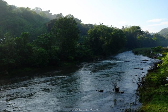
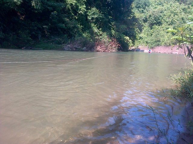
Lots of River Crossing & River Running
For the 50K runners like me, we were treated with so many surprises! I was thinking that we just simply cross a lot of streams and rivers but in reality, we were practically running with and/or against the flow of the water! And these streams and rivers where we have to run have a lot of slippery rocks underneath the water which made my running and hiking unstable. And for the rivers, some are deep up to one’s breast (depending on your height) and most of them have strong current but the current would bring one to a shallower portion of the river.
“Killer” (Small) Loop River Crossing For Two Times
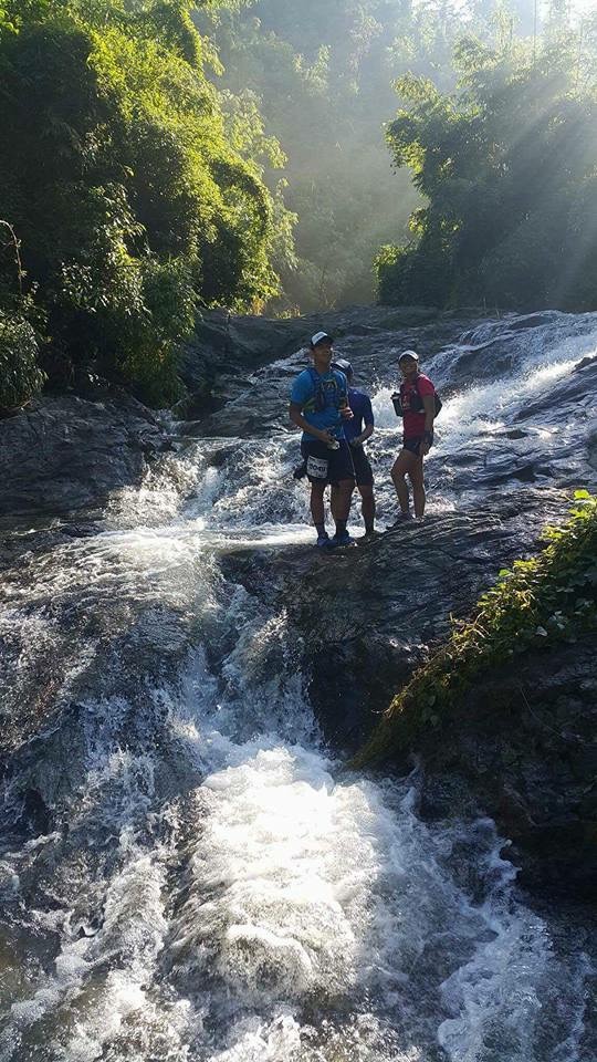
For the lots of waterfalls? I thought the route would lead the runners to just simply pass the bottom of the falls but we were wrong! We had to climb the waterfalls and reach the source of the water because that is where the route was! I could not believe it! Aside from climbing these falls up to where the water is coming from, we have to descend from the falls, too! In doing these ascents and descents on raging waterfalls and on the sides of these waterfalls, the rocks where one has to hike were slippery and sometimes you have to take time to select a small notch or crevice on the rocks to place your shoes and fingers to propel you upwards. Practically, were crawling or “rock climbing” on a slippery waterfalls on our way “up or down”. As these waterfalls were inside a forested area, I had to switch on my headlight just to be sure and see where I would hold on those slippery rocks! I am just wondering how those women runners were able to pass through these parts of the route. I highly appreciate their strong will and courage to go through these challenging parts of the course. My snappy salute to you! This “loop” is the most significant part of the course as I have to slow down but I enjoyed the challenge while I was tailing the first women to win this course!
One Of The Waterfalls (Photo By RT Hernandez)
The so-called “small loop” of the course is also challenging but not as hard as the first loop with those river running and waterfalls’ rock climbings. However, the “small loop” has the deepest river crossing and lots of steep uphill climbs but I tried to run the downhill and flatter sections and “power hike” those ascents. One has to go through this “small loop” for two times and this was where the heat of the sun would take its toll to most of the runners. I have to take time to dip my body to the rivers to cool off and drink lots of water on “small wells” along the route.
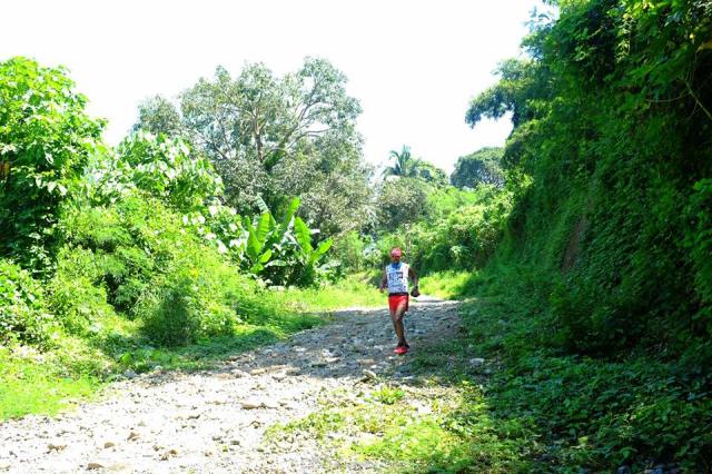
Finally, I was on my last 15K of the course before the Finish Line. One kilometre from the last Aid Station, a photographer was waiting and ready to take my pictures. I saw some water falling on the side of the road that I have to take time to have my “shower” to bring down my body temperature. The photographer asked for a “selfie” and I acceded to his request. He told me that the next Aid Station (last one) is already near.
Last 12K To The Finish Line (Photo By Niche Sio Jensen)Cooling-Off (Photo By Niche Sio Jensen)
The wide trail ended on the banks of a wide river where I could see a rope. I took time to rest and look around and found out that there are markers/ribbons leading me towards a hanging bridge, not knowing that I have to go back to the same river after coming from the last Aid Station and now using the rope to cross the wide river! So, I was treated with “Biko”/native rice cake and ice-cold Coke at the last Aid Station. I engaged some conversation with the volunteers and I sensed that they don’t know me. I found out that this is the first time that we, “outsiders”, were the “first” to run on these trails as most of the forests and lands are not yet exploited by “squatters and illegal upland farmers”. They told me that I could still catch up with the 3 runners ahead of me but I was not sure about their information. I was glad that they provided me with with some positive thoughts!
The paved road from the Aid Station led me to the same river that I’ve crossed using the Hanging Bridge but I have to cross now the river with me holding the rope tied across the river. Next, the markers led me to a single-track trail going up to a mountain where the trail has a lot of slippery rocks and inside a forest. It took me some time to reach the peak and then the dirt and muddy road leading to the Poblacion of DRT, Bulacan. I have to run on the middle portion of this trail as both sides had been depressed and became muddy due to the tire tracks from a truck that goes up to the peak of the mountain. It was a mix of jogging and power hiking as the trail is rolling in terrain and once I was out of the forested area, I could see already the roofs of structures of the town of Doña Remedios Trinidad (DRT), Bulacan. I know that once I hit the paved road, everything will be downhill to the Finish Line.
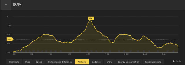
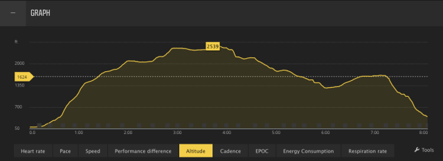
Course Map By My SUUNTO Ambit 3 Peak WatchElevation Profile From My SUUNTO GPS Watch
I finished the race in 8:45:50 hours. The staff at the Finish Line was expecting me to finish later in the afternoon and they were surprised to see me approaching the resort’s gate/entrance earlier than they have expected.
As a word of advise, don’t bring your iPhone to this event. I did not bring my phone as I did not want to be distracted with the temptation of taking some pictures of the route and I made a good decision. The remaining salt tablets after the last river crossing got melted and the candies became sticky syrup but my rice balls were properly sealed in their ZipLoc that they were dry all the time. If you decide to bring your iPhone, make sure to use a hydration system that have pockets higher than your breast/chest and have them sealed in a waterproof plastic packs.
Self-Explanatory
I highly recommend this event to those who are looking for nice scenery, “laid back” trail running event, well-organised/stocked Aid Stations and well-marked course, and very challenging course.
Congratulations to Dabobong Angeles and his Team for this successful event. Congratulations also to all the Finishers of the 50K & 25K events!
On an early Monday morning, I woke up at 3:30 AM and drove all the way to the trailhead of Mount Baldy with the thought that I would be the first one to “summit” the peak for the day.
From my house to the trailhead was an easy drive for 45 minutes and it was still dark when I arrived at the Parking Area at Manker Flats. While I was preparing my things (hydration pack and shoes), another vehicle arrived and parked across the road where I was preparing my things. The other vehicle had two hikers in it and they immediately opened their vehicles’ trunk to retrieve their packs and went directly to the trailhead. They were 5 minutes ahead of me when I finally started after taking a pee in one of the Portalets.
Parking Area Beside The RoadTrailhead Going To The Mt Baldy Falls
They were wearing headlights as I saw them in front of me for about 200 meters. I was not wearing a headlight and I was confident that the light from the moon could easily illuminate the dirt road towards the commercial establishment at the Ski Lift. Before I was able to hit my first mile, I had already overtaken them after I greeted them. As I moved ahead of them, I could still hear their conversation as they were taking their time for the hike.
Being confident that I was already the first one on the trail, I maintained my hiking pace until I reached the Ski Lift’s Commercial Center. It was already daybreak when I reached the place and nowhere I would find find the two hikers behind me.
Mt Baldy Ski Lift & Commercial Center
As I passed the Ski Lift’s Commercial Center towards the Devil’s Backbone Trail, I saw a Rescue Truck parked at the end of the Fire Road, the farthest that a four-wheeled vehicle would reach towards the peak of Mt Harwood. I was thinking that those guys aboard in it were just ahead of me but as I saw at the horizon and the trails above me, I would not see any individual/hiker ahead of me towards the peak of Mt Baldy.
Devil’s Backbone Trail
Looking at a distance ahead of me, I would see the Devil’s Backbone Trail and it looks like a very challenging and intimidating ascending part of the trail where both sides have steep slopes that the lowest portion could not be seen. If anybody would slip or feel dizzy and plunge to any of the sides of the slope, I would suspect that a hiker would be hard to be rescued from atop the trail. But if you are already standing and doing your hike at the said place, you can feel that your courage is slowly taking over your mind and for you to be able to cross this dreaded part of the trail. As you passed this trail, you are rewarded with a higher elevation and a flatter portion of the trail with the peak of Mt Harwood in front of you!
Mt Harwood’s Peak
I decided not to “peak bag” Mt Harwood as I was trying to be fast as possible in reaching the peak of Mt Baldy. As I was hiking on this flatter portion of the trail, I had my first sip of water and I started to feel some perspiration on my back as I was wearing my Uniqlo Water Repellant Windbreaker.
Finally, I was on my last mile before the peak of Mt Baldy! After about 200 meters, I saw a hiker going down from the trail and I said to myself that the guy could have started way ahead of me! He looks like he is a good hiker with all those beard and moustache on his face and the hiking boots he was wearing. He was not using trekking poles. A simple greeting and look on each others eyes as we met were part of the usual practice among hikers and it feels a good sign of showing respect to one another on the outdoors.
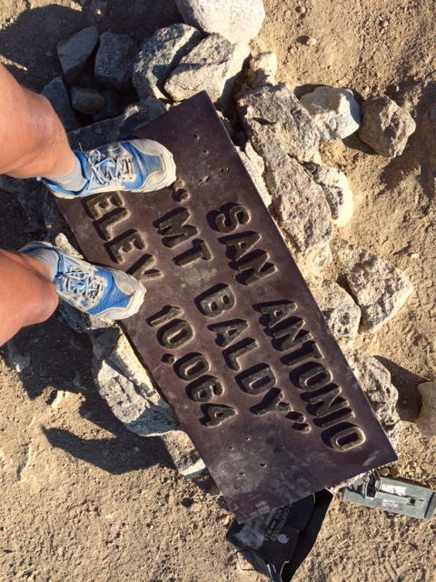
At Mt Baldy’s Peak With Piles Of Rocks With Orange Ribbons
On my final 100 meters towards the peak of Mt Baldy, I met two hikers with backpacks and trekking poles telling me that a helicopter will be arriving at the peak in 45 minutes and my understanding of the message was that there was an urgency for me to reach the peak and spend a short/quick time at the peak. I said thank you to the two hikers as I moved faster and closer to the peak.
Few meters from the peak, I have observed that there were lots of stakes with orange ribbons tied on them that were placed surrounding the peak of the mountain. I concluded that those ribbons were markers for the pilots of the helicopters for them to visually know where exactly they would land. On the peak, I saw three (3) guys with big backpacks and orange jackets whom I assumed to be those who rode in the Rescue Truck parked along the trail going to the mountain. They were lying on their backs and talking to each other and not minding about my arrival in the area. They were inside the area where those pile of rocks formed in a semi-circle which I believed is being used for those hikers who would set their tent and sleep for over night in the area. The pile of rocks is so high that it can protect strong winds from hitting a pitched tent inside the semi-circle area.
Mandatory “Selfie” At The Peak’s Marker
I could still remember where one of my ultra friends who lives in Los Angeles had to stay and camp at the peak of Mt Baldy for one week as part of his training for the 2015 Angeles Crest 100-Mile Endurance Race. He would pitch his tent at the peak and then hiked and run towards the Ski Lift’s Commercial Center and then back to the peak during the duration of his stay in the mountain. I guess, camping in the said area is FREE as long as one has an Adventure Pass displayed on ones vehicle at the trailhead. As a result of his training, the guy finished the race in less than 24 hours!
I spent almost 30 minutes at the peak, taking some “selfies” and eating my nutrition bars/trail mix fruits & nuts, before starting my descent from the peak. On my way back, I started to move faster and run the flatter sections. If the descending part of the trail is smooth and without any roots or rocks, I would run and quicker with my pace.
“Selfie” At The Bell Near The Commercial Center
I did not stop at the Ski Lift’s Commercial Center as they were still closed but three (3) SUVs suddenly arrived at the area full with “newly-recruited” Park Rangers and they were instructed to proceed to the establishments. I said to myself that I had to run 3.5 miles down to trailhead and be able to finish my hike before 10:00 AM.
As I was running down along the Fire Road, I could hear the sound of an approaching Helicopter to the mountain but sad to say that I could no longer have the view of the peak of Mt Baldy. Whatever, the activity that was being done in the area was part of the regular training being done in response to any contingency or emergency situation that is usually being experienced among hikers in the area. This is what I call being prepared and work’s efficiency among those people responsible in the safety and protection of the parks.
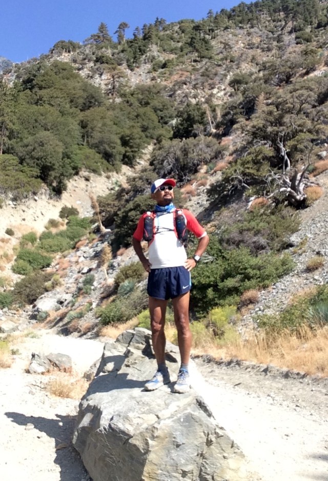
Mandatory Pose After The Hike Overlooking The Mt Baldy Falls
At 10:30 AM, I was driving on my way back to the house in Downtown, Los Angeles.
My next plan will be to pitch a tent at the peak and sleep thereat for an overnight stay!
After I finished the first edition of this race last year, I promised to myself that I would join every edition of this race as long as I am still strong to run an ultra distance event. I would make this race as my evaluation run as part of my training for my future ultra races here and abroad.
Three months ago, I have started my training for this race but instead of doing it on the trails and places where there are considerable elevation gain and/or loss, I have to do my training on the paved streets. I have to follow the usual training program and daily mileage which I have followed for the past three years of ultra running training. However, these street running workouts had to last for about two months before I had to go back to trail running.
The only difference with my training this time as compared for the past 3 years, is my desire to be faster as I grow older. I placed more emphasis on the conduct of “strides” during my daily runs and do at least two times of “tempo” runs during the week. Weekends would be devoted to long runs up to 18 miles with a faster average pace.
On the third month, I did a lot of hikes in the mountains on weekends which would last up to 6-7 hours and on weekdays, I would do 8-9-mile runs on trails with an elevation gain/loss of at least 2,000 feet every workout. This is where I would train myself on my hydration and nutrition with only water as my fluid intake. I tapered for about two weeks which consisted of hikes and easy runs in my “playground”.
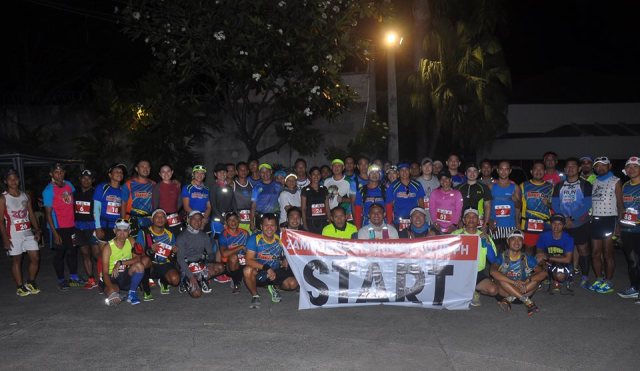
The Mandatory START Group Picture
What is good with this race is that the Hotel (Palmeras De Zamboanga) where I stayed is the Starting and Finish Line of the event. I went out of my room 20 minutes before the start with enough time to greet and have “photo-ops” with the other runners. Before I went out of the Hotel, I was greeted with free sandwich and hot coffee at the end of the hallway and was able to take advantage of this offer as part of my stay in the hotel. I knew that the coffee and the sandwich would be enough for my food intake before I reach the first Aid Station at Km #8.
The race started promptly at 5:00 AM after a short prayer and 57 starters left the starting line. It was still dark when we were running along the street leading to the Pasonanca Park but the streetlights were enough to light up our way. Knowing that the first kilometre is flat, I made an easy pace and just followed the runners in front me. At Km #3, a runner started a conversation with me and I asked if my prevailing running pace would be maintained up to the finish line and replied him, “Yes”. And then asked permission if he would be allowed to pace with me during the duration of the race. And I said, “Yes”! We would be running side by side from this point up to the Finish Line. At that time, we were on a speed of 4 miles per hour as gleaned from my Suunto Watch.
It was my intention to maintain the said speed throughout the race. As I had predicted before the race, I have announced on Facebook that I intend to improve my ranking of #17 and finish time of 8:34+ hours from the result last year. Actually, my target goal was to finish the race below the 8-hour time and maintain the speed of 4 mph up to the Finish Line.
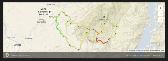
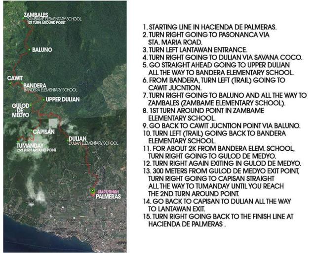
Route Map & Description
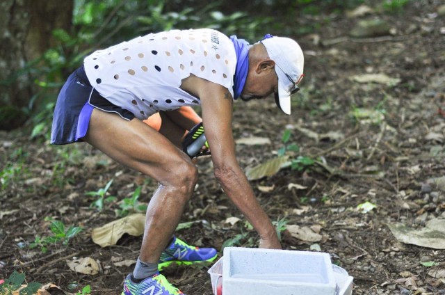
We reached the 1st Aid Station (Km #7) without any problem and tried my best to run through those ascents without any brief walks or hikes. I took me less than 2 minutes to refill my bottles with ice cold water and eat some suman. From the Aid Station, we had to follow the paved road as the route became a “roller-coaster” and it started to be warm. After about 4-5 kilometers, we reached the 2nd Aid Station in front of an Elementary School. I had to refill my hydration bottle with ice-cold water, douse some ice-water on my head and face as the day was starting to be hot. I ate two ripe bananas and I was back on the way. From this Aid Station, it was the start of a single-track technical trail which has some rocks, mud, and flowing water.
Course’ Elevation Profile
As I tried to speed up my pace on the descending portion of the trail which was muddy and slippery, I started to feel some “cramp” on my left calf and I asked the runners behind me to pass while trying to walk my way down the trail. I was still running downhill but I made sure to slow down my pace. I brought out some of salt tablets and ingest some and kept it to my mind to regularly ingest some every hour during the run. After a few seconds and minutes, I was able to regain my pace and it was just a matter of time before we would reach the first Turn-Around point which happens to be the Zambales Elementary School.
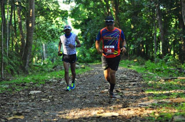
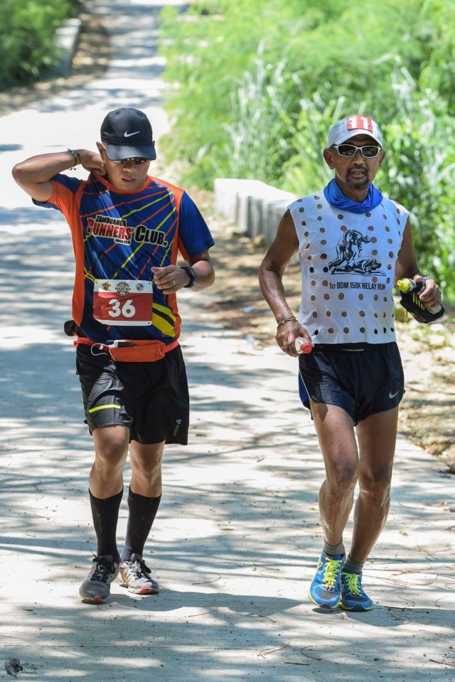
Marvin Sicat, My Running Partner During The Race
At the start of a newly cemented road inside a thickly vegetated area in the course, we met the two leading runners. This is where I started to hike the ascending parts and run the flat portions and descending parts of the route and kept on drinking my water in my handheld bottle during my hikes. As we got nearer to the Turn-Around point, we had to meet those runners who just left the 3rd Aid Station at the Turn-Around Point which happens to be in a School. As I count the number of runner that I and my companion-runner would meet, I was ranked as #12 runner with my partner as #11.
In last year’s edition, I stayed in this Aid Station (Km #16) for a longer time as I tried to ingest more food and drink lots of water and craved for sweeter drinks. I even had more pictures taken with the other runners whom I was able to catch up in the said Aid Station. For this year, I was surprised to see a Zamboanga local runner who was still sitting and trying to cool off in the Aid Station when I arrived. “Chabby” is a very fast and strong ultrarunner and he beat me last year by almost one hour. I had to ask him his situation and he said that he was ok. But, I was brief in my stay by having my bottles refilled with water and then take in a mouthful of spicy noodles which gave me a little “jolt” and in less than 5 minutes, I was out of the Aid Station with my “partner” in tow.
It is a continuous uphill climb from the Aid Station and after about 1 kilometre, we started to meet the other runners behind us who were on their way to the Aid Station at Km #16. After passing the newly-paved road inside the thick forest, we were back again to the single-track trail before reaching the next Aid Station. Unknowingly, Chabby was few seconds behind us and we were together at the said Aid Station. However, he opted to stay behind as he changed his attire and wanted to rest for awhile. After refilling my bottles and eating some fruits, hard-boiled eggs, and rice delicacy, we were out of the Aid Station. The dreaded “Gulod De Medio” was already in my mind as I left the Aid Station! However, we passed another runner after about a kilometre away from the Aid Station. That makes me #11 and my partner as #10 as we battle the next ascent and the heat of the sun!
Steepest Climb @ Gulod De Medyo
As my running “partner” and I were about to climb the “Gulod De Medio”, we saw a runner clad in black attire (with 2XU tights) in front of us within a distance of 20 meters. I made my pace faster with the intention to close the gap with between us with the runner in front of us. As we were in the steep ascent of the “Gulod De Medyo”, the runner saw us trying to get nearer to him but as soon as he reached the peak, he started to run faster! At the middle of the steep ascent, I started to slow down due to fatigue and the heat of the sun but I had to exert more effort but slowed my pace just to be able to reach the peak. I knew that as soon as I passed the peak, it was a gradual descent to the next Aid Station.
I took some Ice Cold Coke and native rice delicacy at the Aid Station and after refilling my water bottle, we left in a hurry! I knew that the course/route to the next Aid Station was a generally downhill. However, the heat of the sun was the one which prevented us from increasing our pace. At this point, it was our last 18 kilometres and in a matter of time, we would be able to reach the next Aid Station.
Finally, we reached the Aid Station and the lady volunteers were excited to see me that they asked me to have some pictures with them! Since I needed time to rest and ingest more food, I allowed them whatever pictures they could take while I was there. I guess, this is the Aid Station that I rested the longest time on the course because of the heat of the sun and the fact that the course will be uphill from this point to the next/last Aid Station. I ate drank a lot of Coke while ingesting two pieces of their local Suman with Latik which are bare (without any banana wrap). I thanked the lady volunteers for being there and for being able to serve us with the foods we needed. This one of the very reasons why I keep coming back in this race——very happy, very encouraging , and very helpful and beautiful lady volunteers!!!
Fighting It Out With The Heat Of The Sun
I consider the next segment of the race as the hardest as one has to go uphill to the last Aid Station. It is not about the steepness of the segment but it is the continuous and gradual ascent that will force the runners to hike on the exposed portions of the road from the heat of the sun. This is where we could see again those who are trying to catch us from behind and from the distance we had made as a “buffer”, we can safely say that we will be able to maintain our rankings up to the finish line!
Reaching the last Aid Station was a relief as from this point, it is the last 7 kilometres of the course which is all downhill. We did not stay long in the Aid Station after we refilled our hydration bottles and ate some bananas. I carried a “Sakto” Bottle of Coke and my Handheld Bottle filled with water and I was confident that my liquid/water was enough for me up to the Finish Line but I was wrong! My running partner had to share some of his water and the Race Organizer had to place another Aid Station in about 3-4 kilometres from the Finish Line because of the heat of the sun. The descending portions of the course was steep and some are still rough with gravel and small rocks but the concrete pavement was too much for my knees but my legs were surprisingly prepared for the beating and pounding of my feet. My strides were short but quick and I was able to increase my pace as I took advantage of the gravity. It was the heat of the sun that really gave some problems to my body. However, I was prepared for it as I brought a lot of salt tablets and “coffee” candies; and really focused on my hydration strategy. The Aid Station at the last 3-4 kilometres was very helpful to everybody and I was able to regain my strength and keep my pace up to the finish line.
Lots Of Ice @ The Aid Stations & Emergency Aid Stations
On the last 1.5 kilometres to the Finish Line, my running partner begged off that he should stop and slow down for awhile because of leg cramps and I replied to him that we should finish together. But he started to walk while I was maintaining my running pace. I guess, he was very courteous and respectful enough to offer the 10th place to me as a guest and a Senior Citizen! At the Finish Line, I found out the complete name of my running-partner, Marvin Sicat, who happens to be a close friend of one of my “pioneer” runners in the Bataan Death March 102 Ultra Marathon Race.
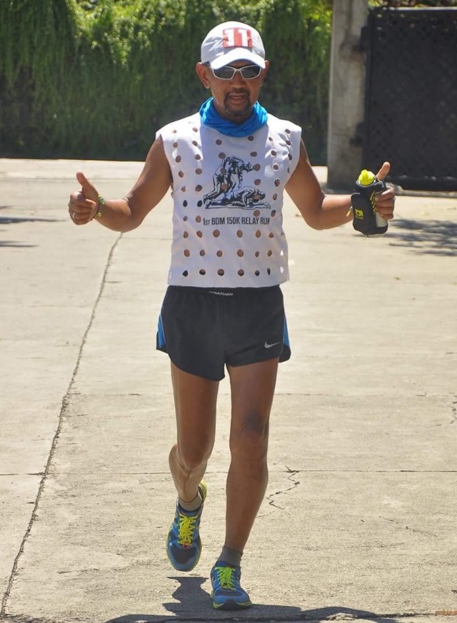
Finally, I crossed the Finish Line in 8:04:30 hours even if my plan was to finish in sub-8 hours with a ranking of 10th finisher. I was able to improve my time for almost 30 minutes and my overall ranking by 7 slots and I attribute my improvement to my quick turn-around at the Aid Stations; having a running partner/“pacer”; training with more “strides” and tempo runs on paved roads on the first two months; and later on the last month prior to the race on my hikes to mountains with higher altitude. My focused nutrition and hydration were also followed where I had to drink water regularly, eat solid foods in the Aid Stations, ingest my salt tablets regularly every hour, and regularly placing some coffee candies in my mouth.
Crossing The Finish Line
The Zamboanga Runner’s Club and their Race Sponsors did an outstanding job for this race to be a successful one. I highly recommended this race to all my readers to this blog, most specially to those who are ultra runners, local or foreigners. It is worth the trip to Zamboanga City. Next year, I will be back!


You must be logged in to post a comment.