Race Route Description: Taklang Damulag 100-Mile/50-Mile Endurance Run


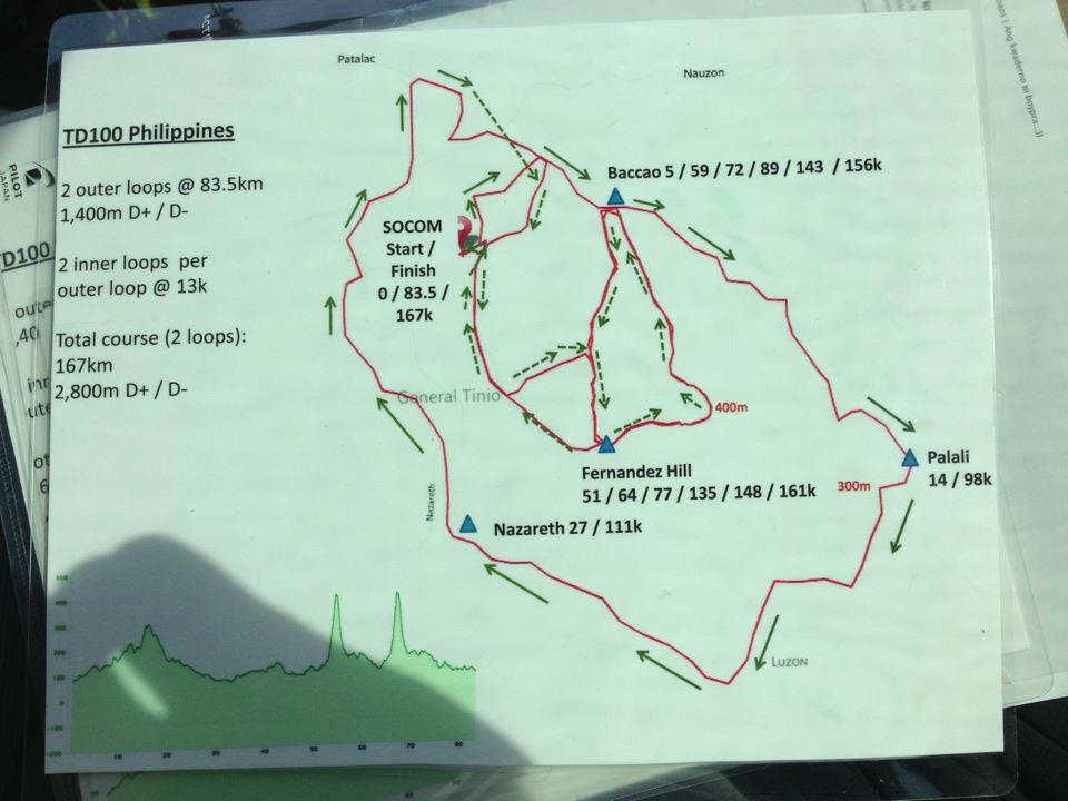
Race Route Description: Taklang Damulag 100-Mile/50-Mile Endurance Run (TD 100/50)

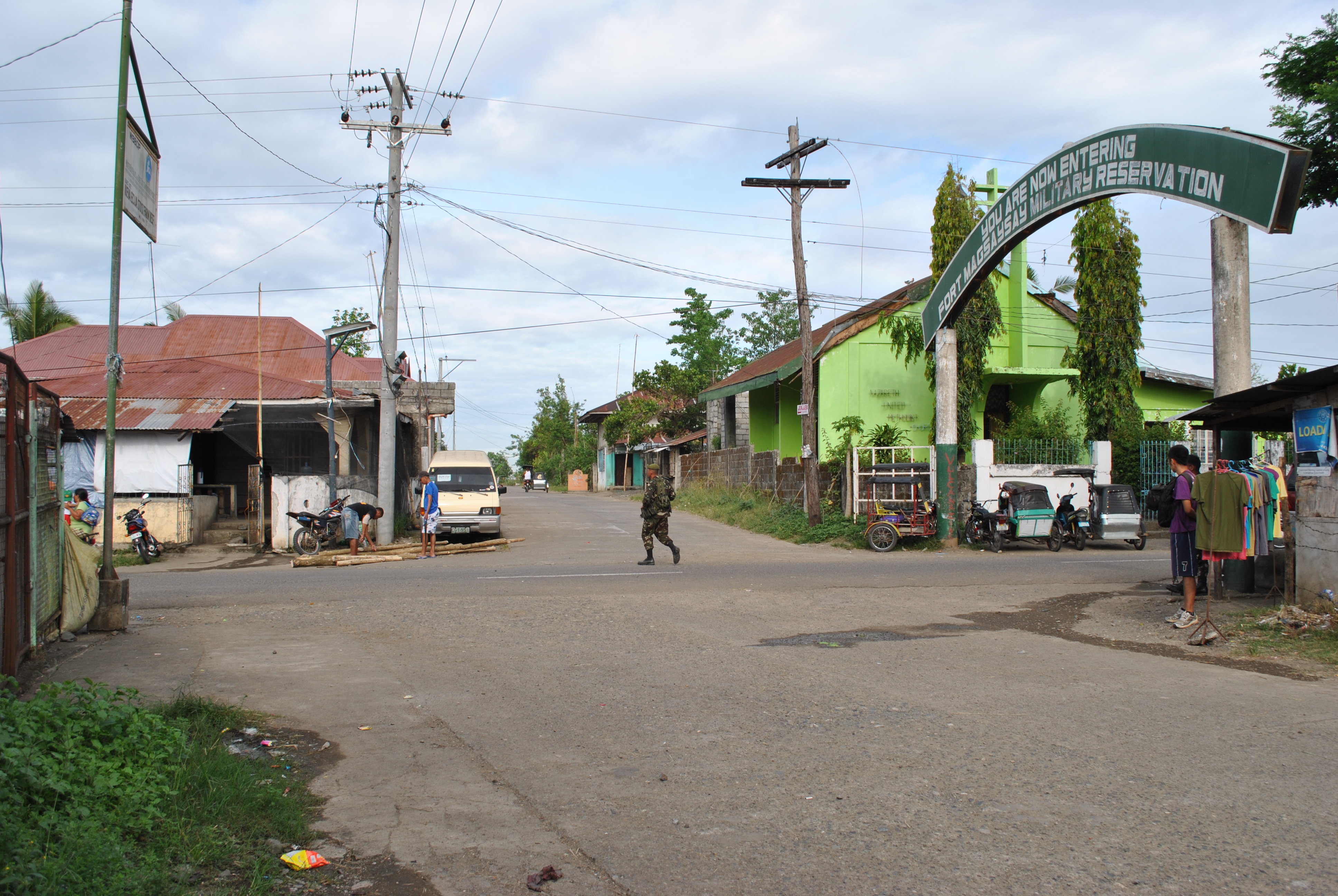
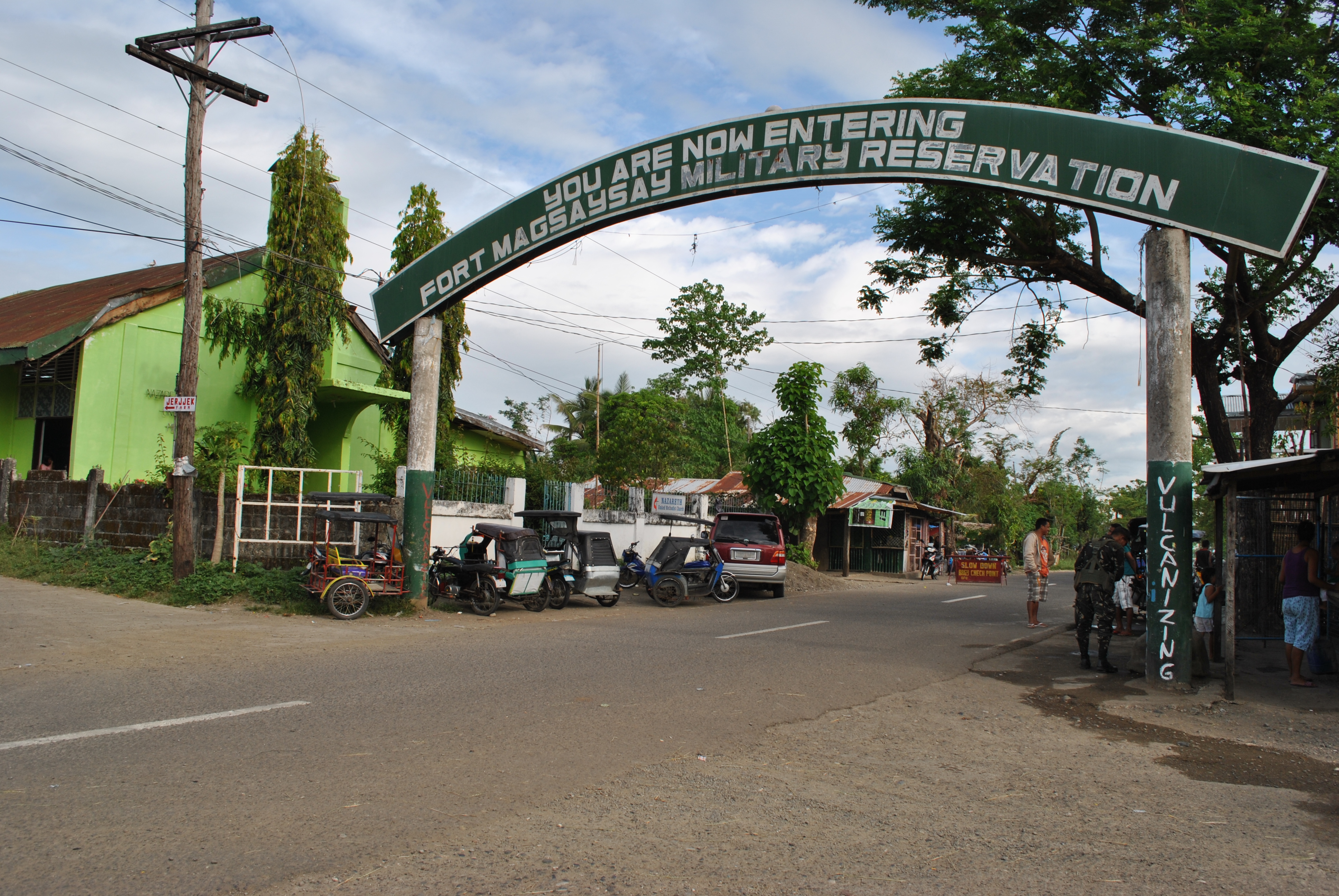
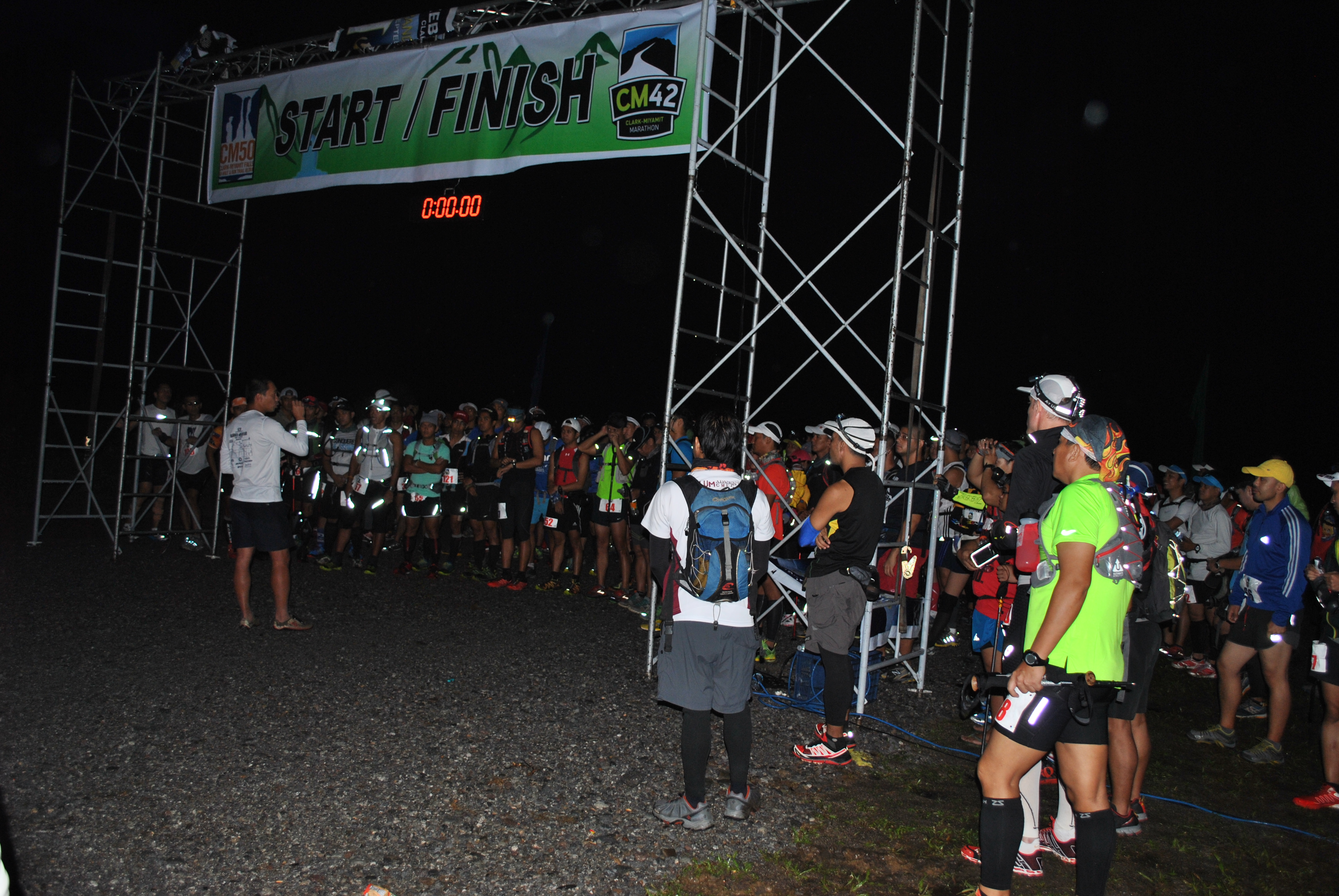
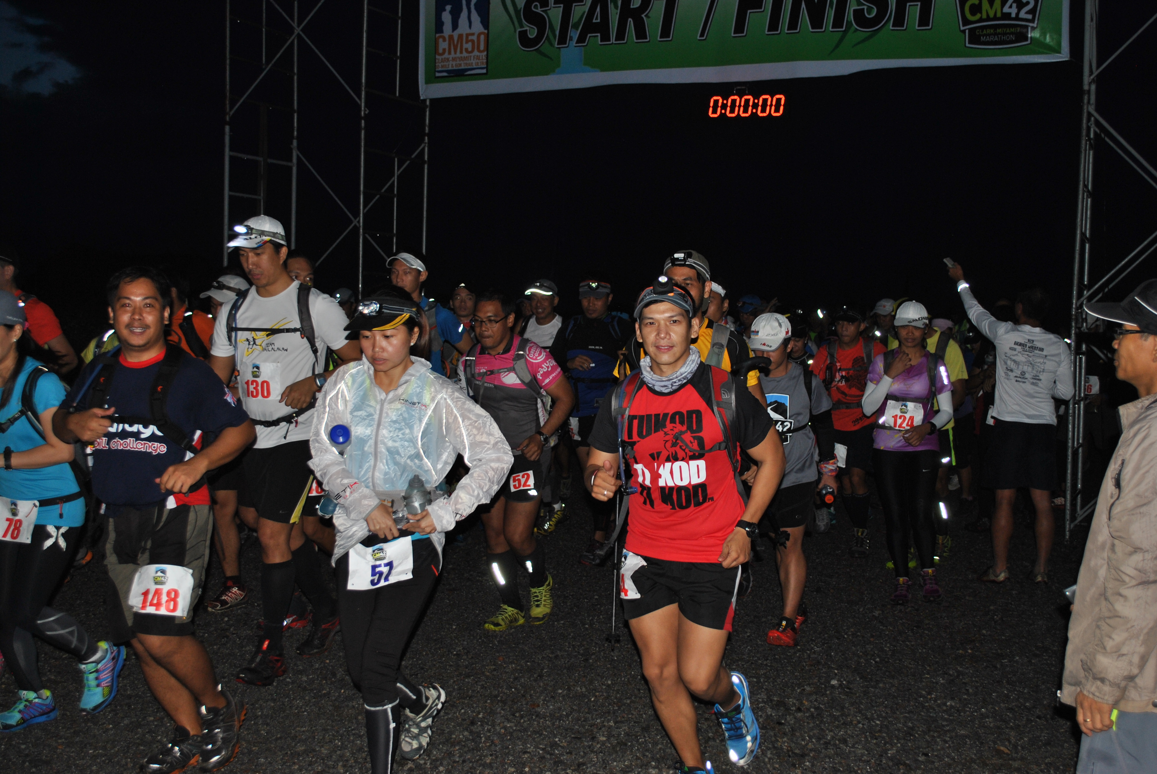
1. The race starts at the vicinity of the Special Operations Command (SOCOM), Fort Magsaysay, Palayan City (Nueva Ecija). The SOCOM Headquarters is located at the Abundo Area Complex inside Fort Magsaysay, the largest Military Camp/Reservation Area of the Philippine Army. The race starts at 5:00 AM of Saturday, December 14, 2013 together with the Taklang Damulag 50-Mile Endurance Run.

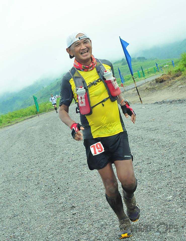
2. This is a solo race. The cut-off time for the 100-Mile Race is 32 hours. The cut-off time for the 50-Mile Race is 16 hours.

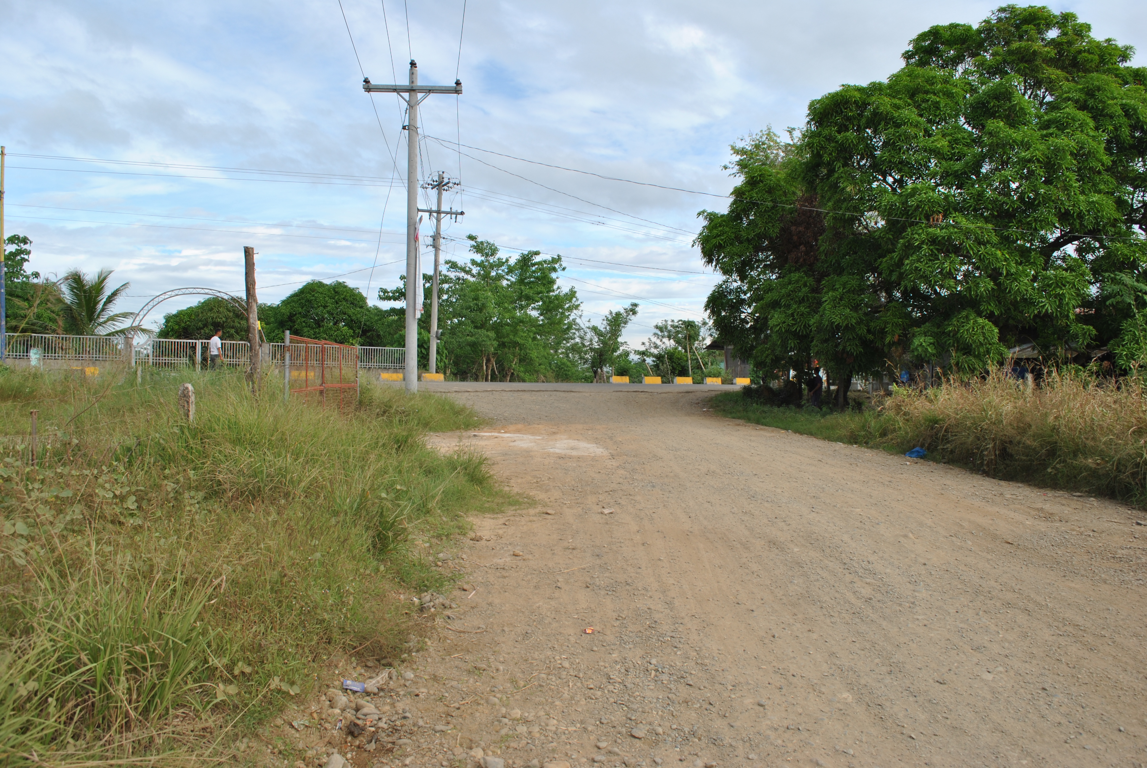
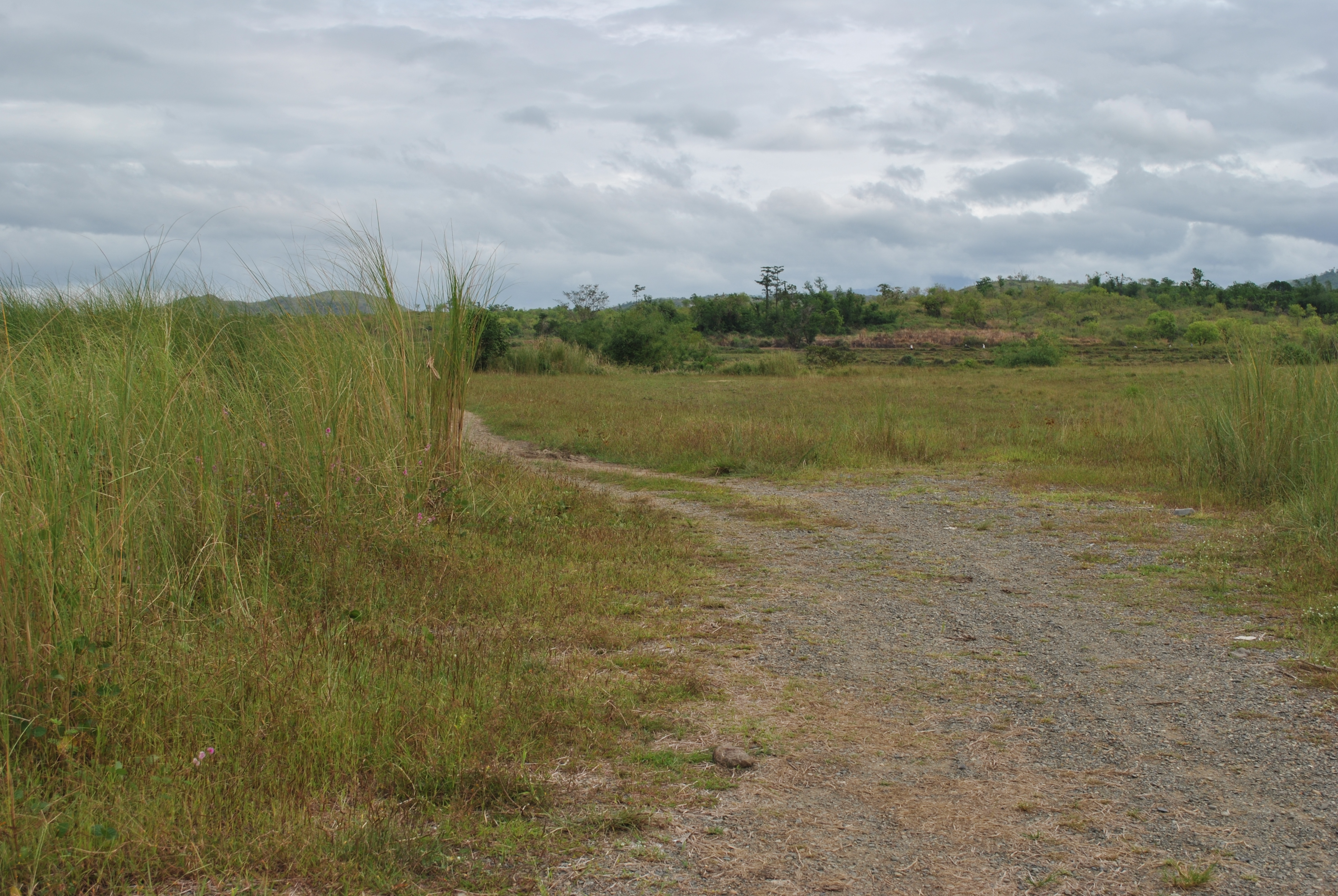
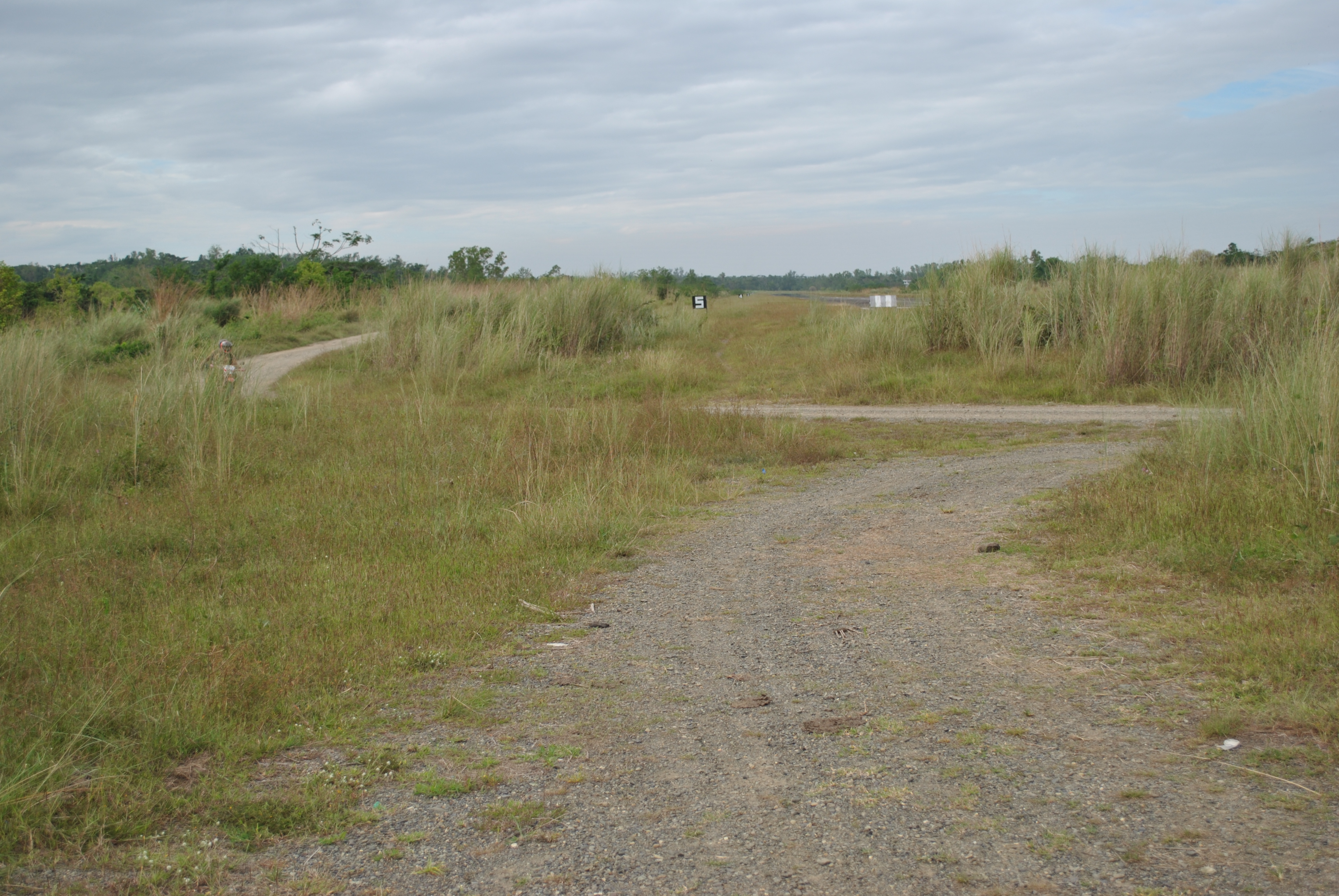
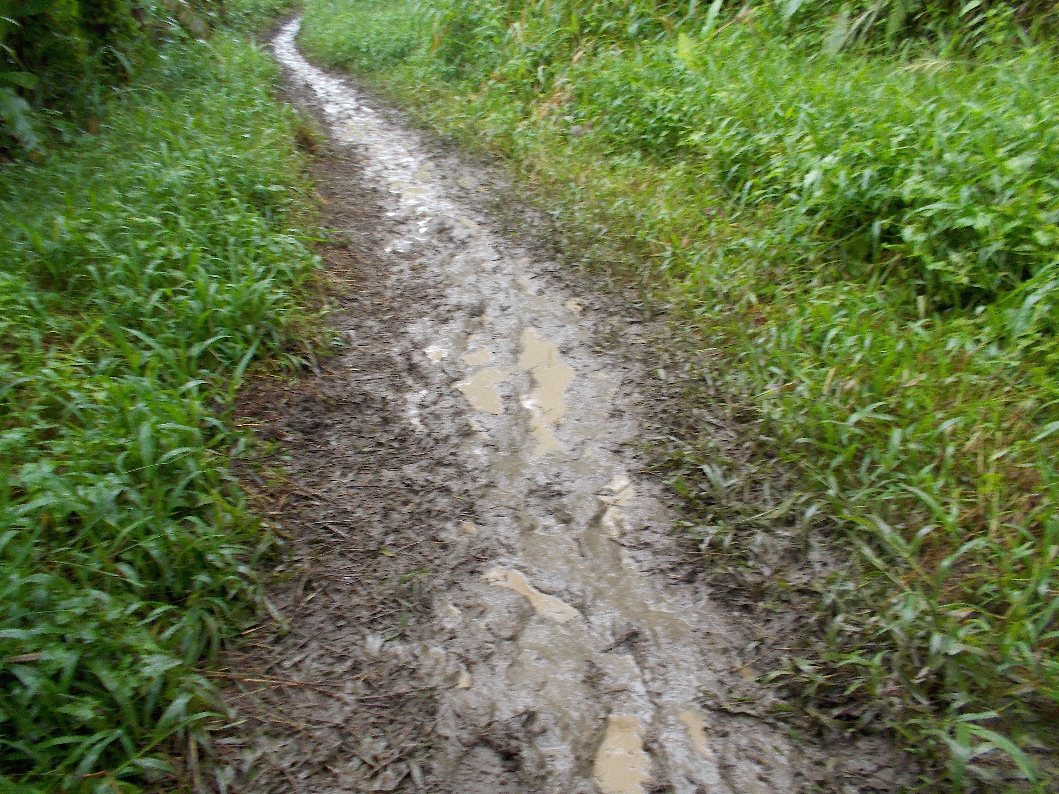
3. From the starting line, runners will proceed towards an east direction to a dirt road which is parallel to the Fort Magsaysay Airstrip. The airstrip is located on the right side of the runners. This dirt road has a lot of potholes and uneven portions. Runners must be able to have their headlights/handheld flashlight on this part of the course since it is still dark at 5:00 AM.

4. After almost 500 meters, runners have to TURN LEFT upon reaching an intersection. It is still a dirt road which leads the runners to the newly-constructed Fort Magsaysay-Laur Road after getting out from the Gate of the Camp. This dirt road goes down and slightly uphill towards the Gate. The distance of this road is about 700-800 meters.

Dirt Road To The Fort Magsaysay-Laur Highway

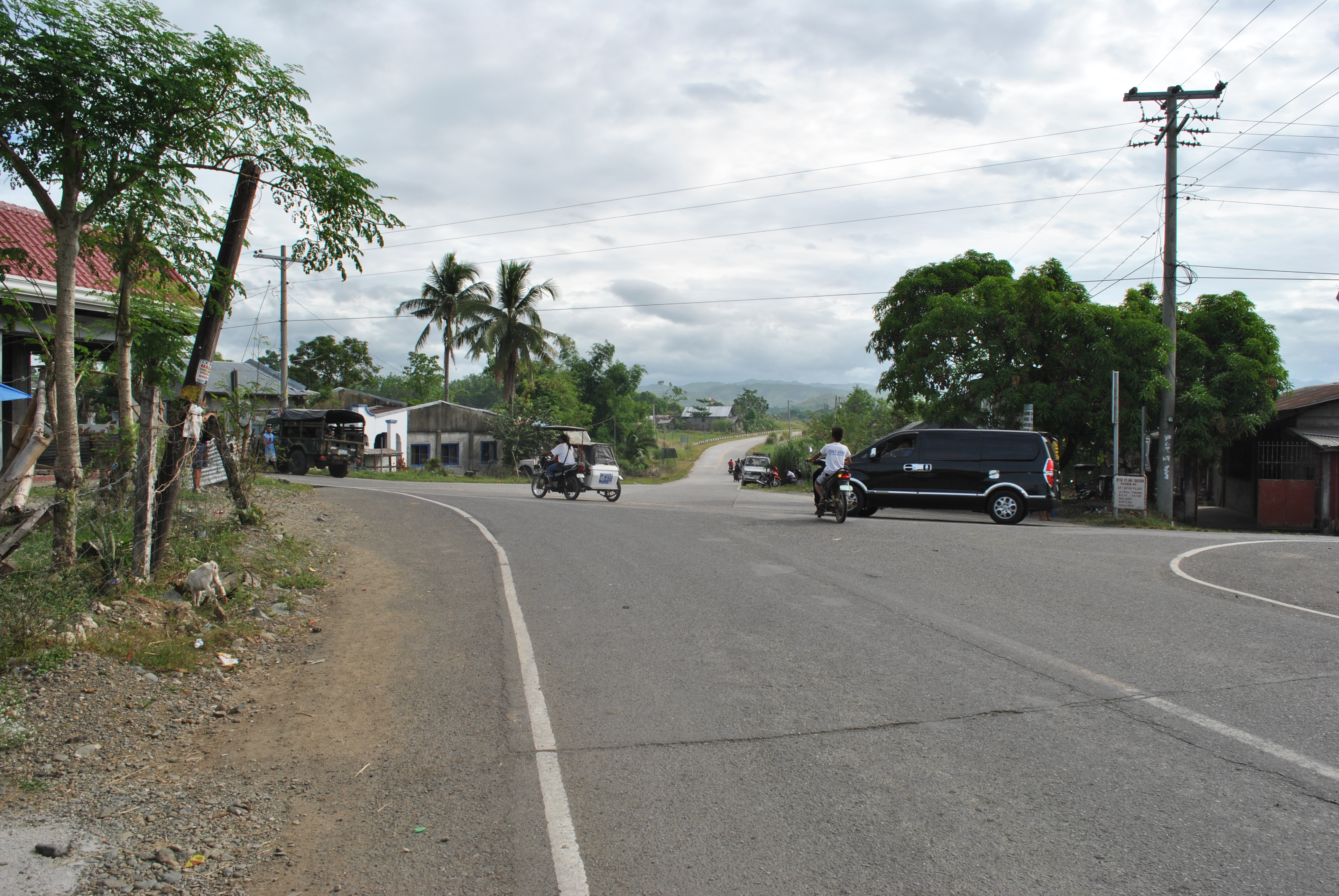
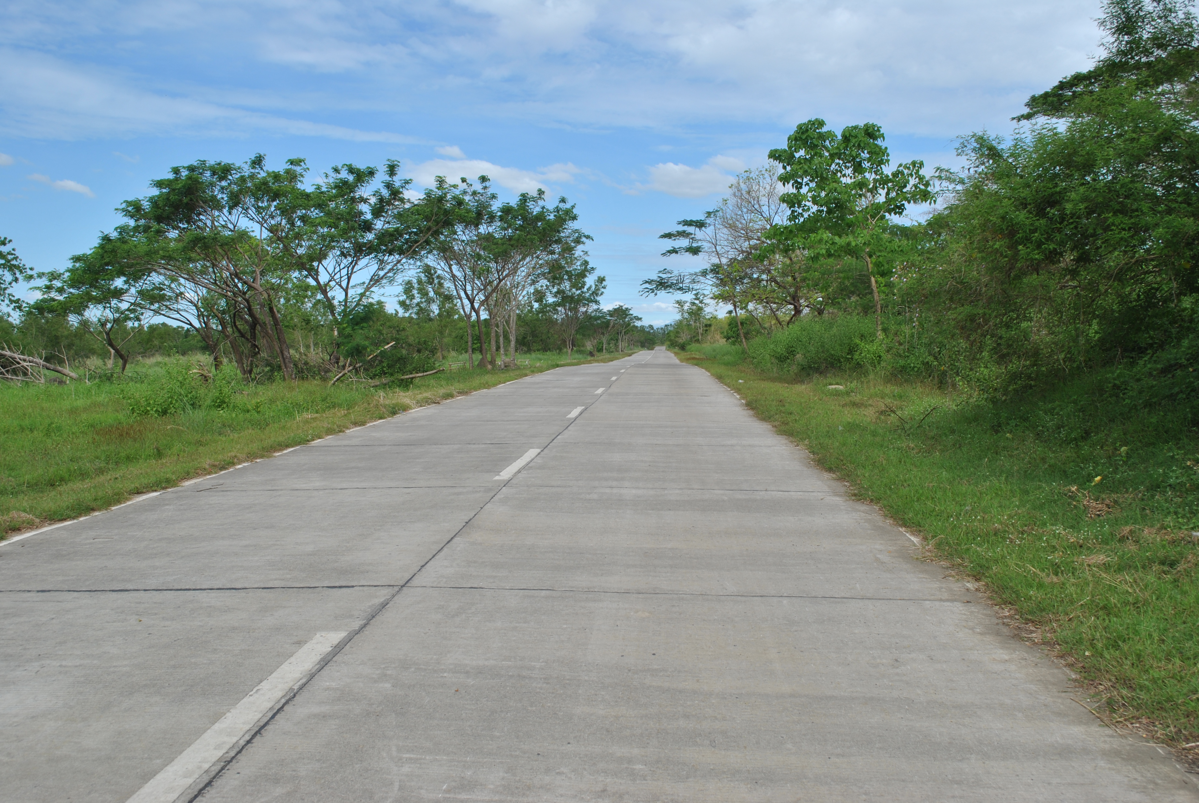
5. Runners shall TURN RIGHT on the paved/cemented Sta Rosa-Fort Magasaysay-Laur Road. This is the same road on the first 3K of the Fort Magsaysay To Dingalan 65K Ultra Marathon Race.

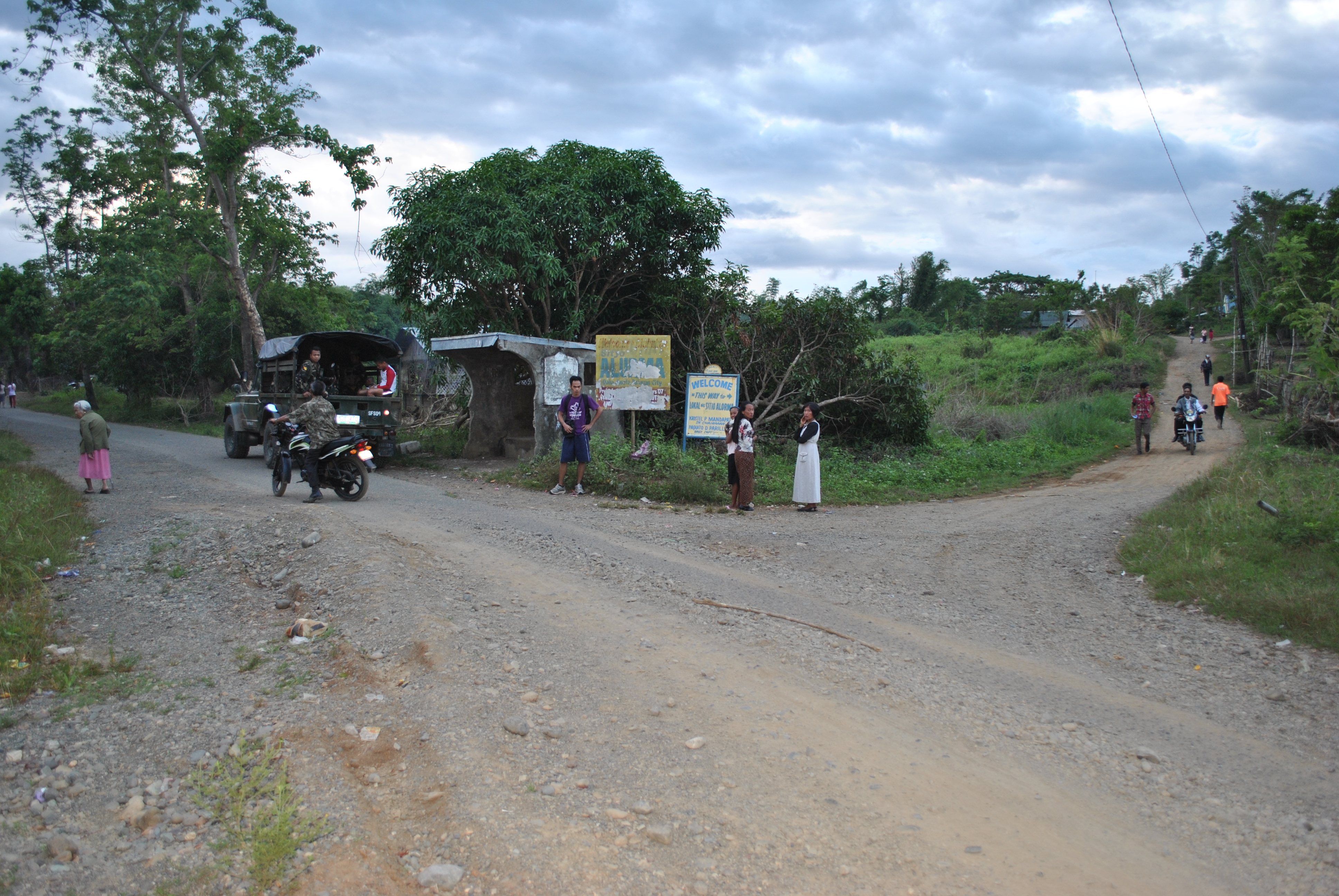
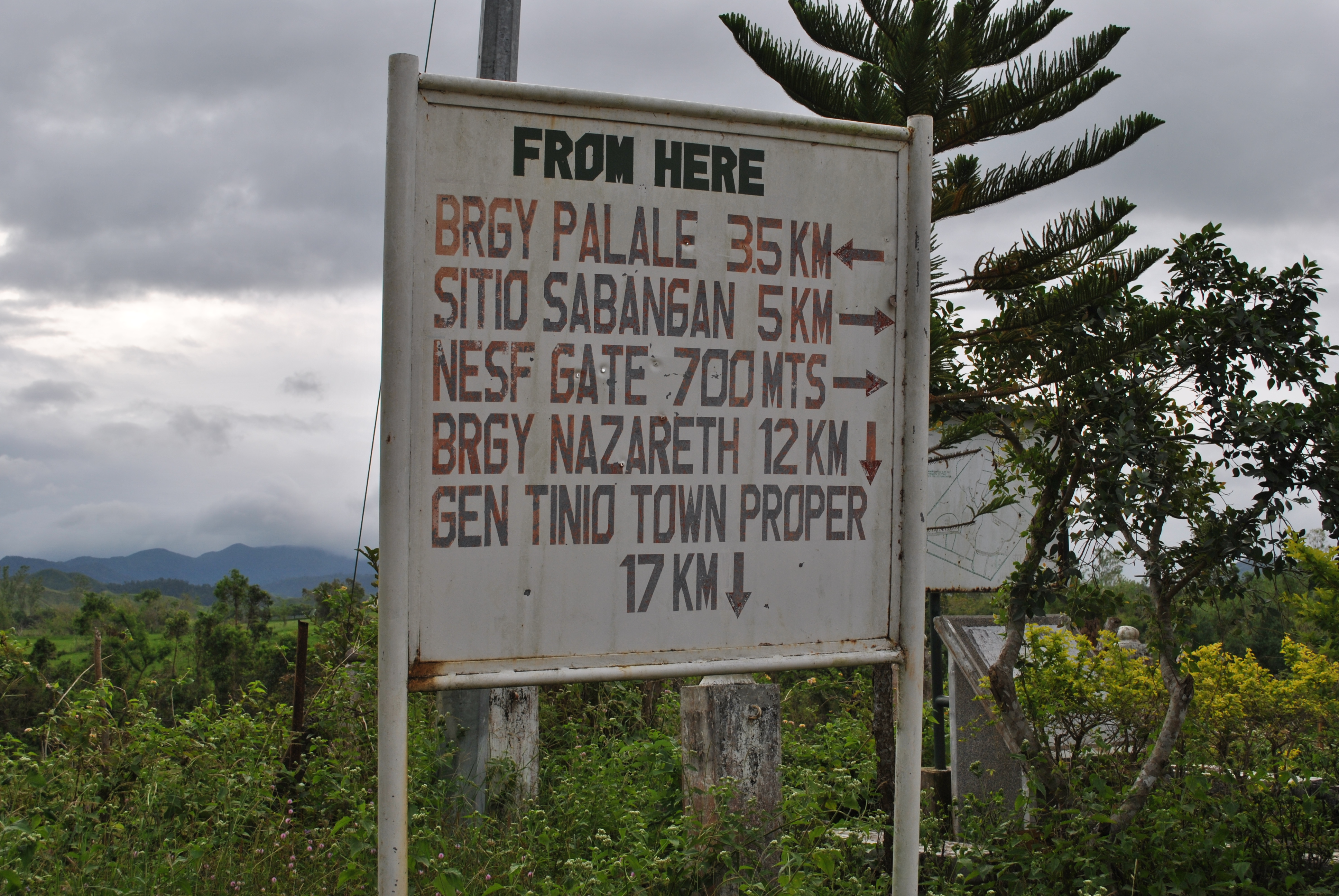
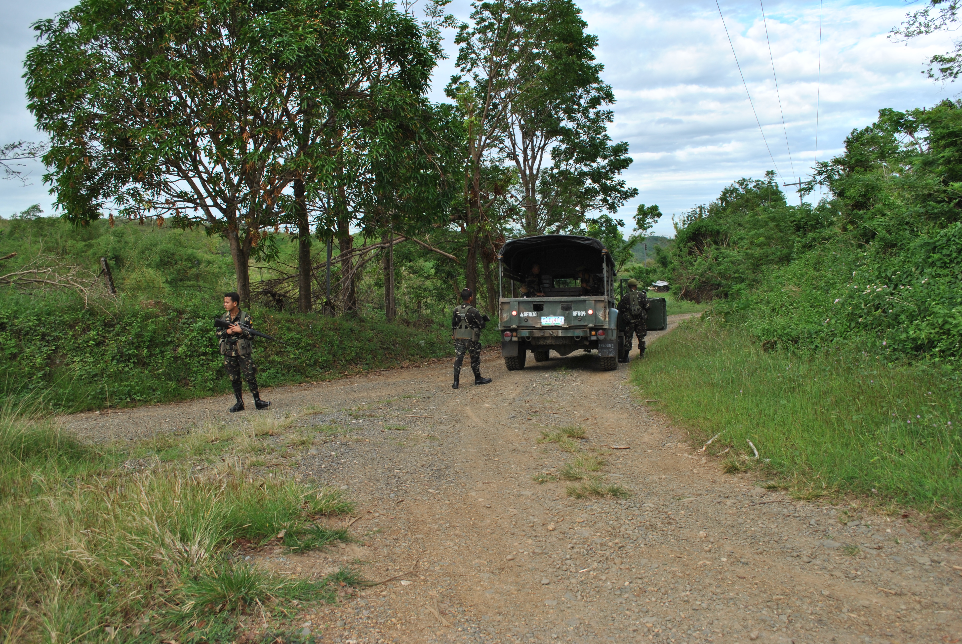
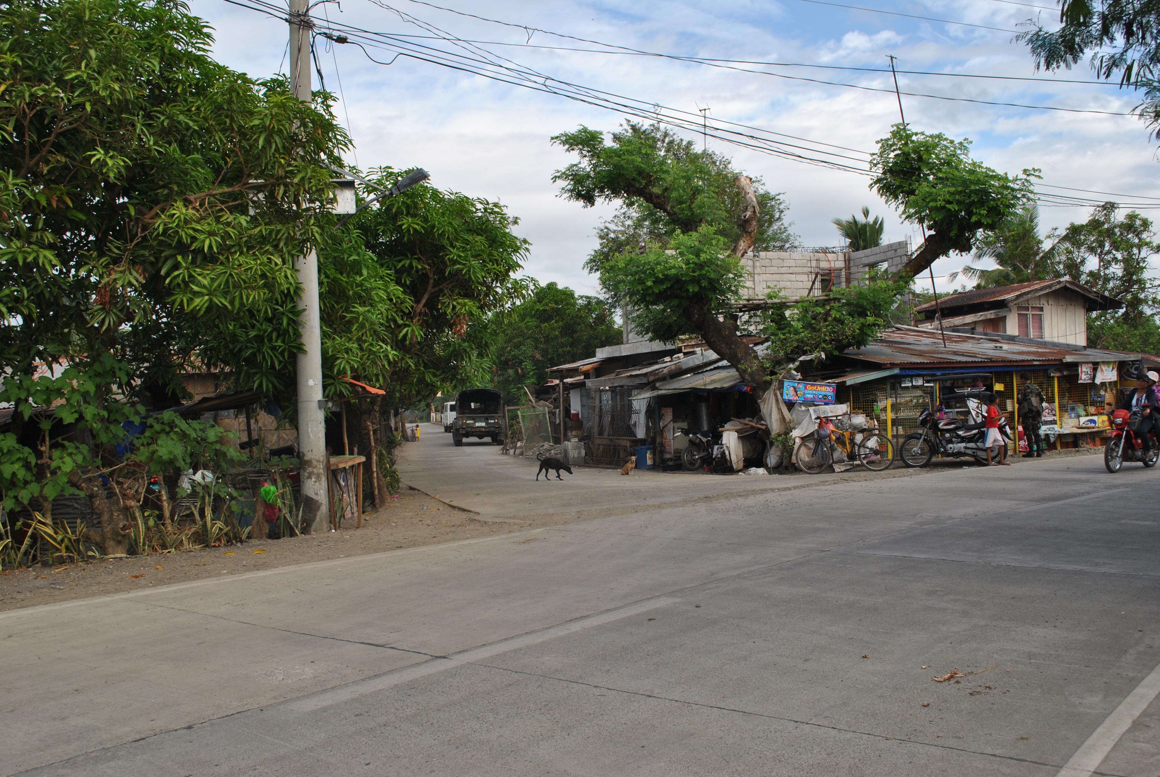
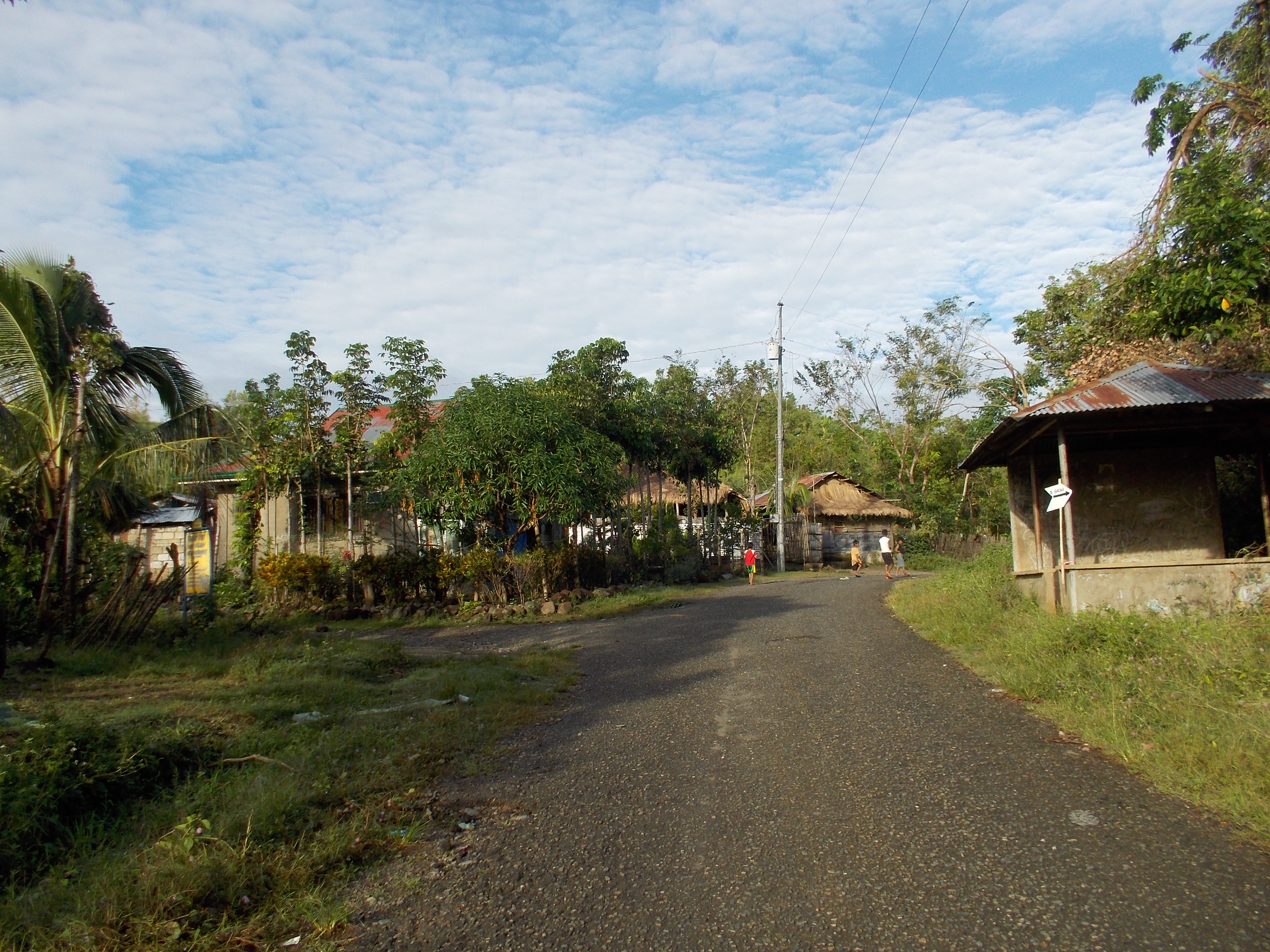
6. There will be an INTERSECTION after running for almost 2 kilometers along the Sta Rosa-Fort Magsaysay-Laur Road. There is a Detachment and Military Checkpoint on this intersection. Runners will have to TURN RIGHT on this intersection which leads to Barangay Dona (Donya) Josefa. Runners will be able to pass on the intersection of Sitio ALORMA and Sitio BACCAO. Runners will have to follow the asphalted road up to Barangay Dona Josefa.

TURN RIGHT Towards Barangay Dona Josefa
INTERSECTION @ Sitio ALORMA (Right Side of the Road)
BRGY BACCAO Intersection (On the Right Side of the Road)
SITIO BACCAO Intersection (On the Right Side of the Road)

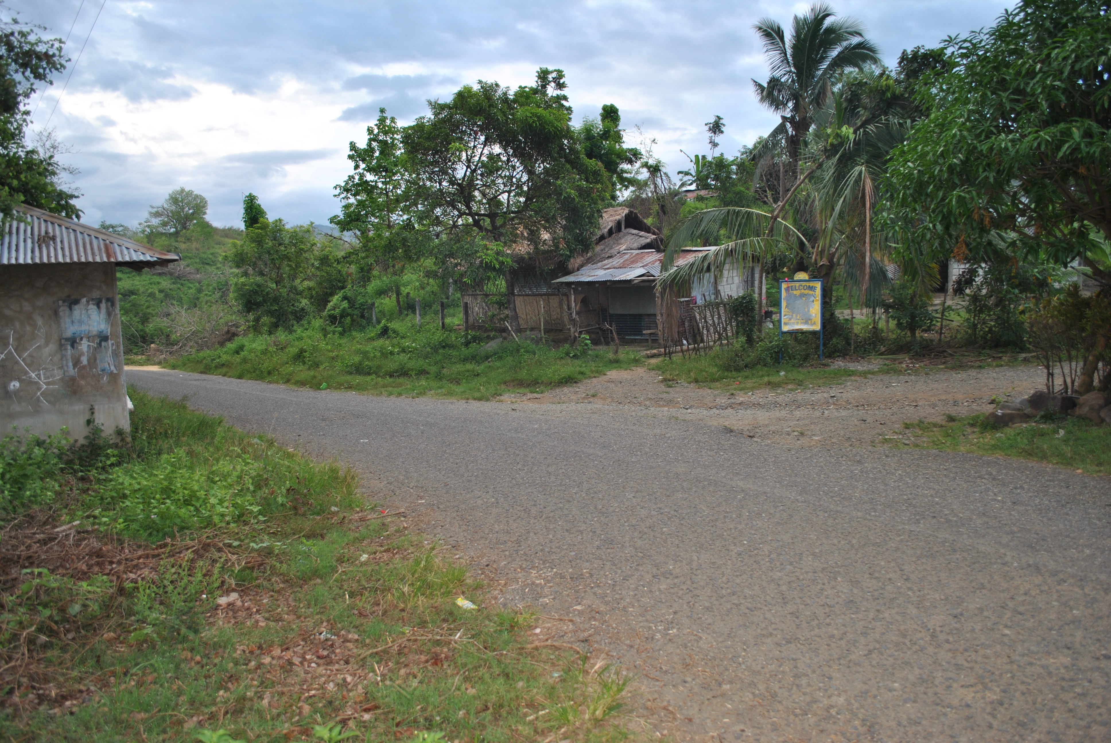
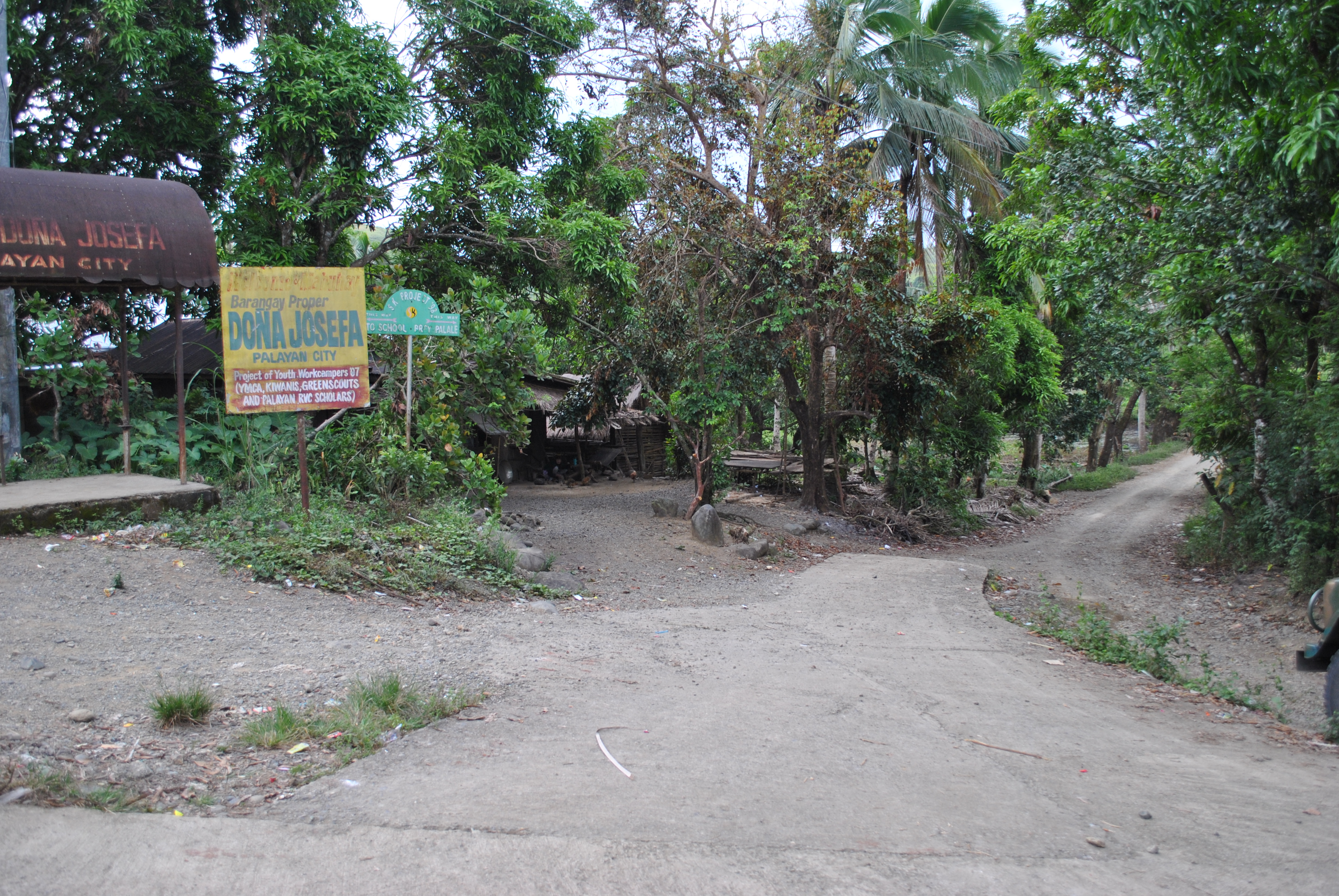
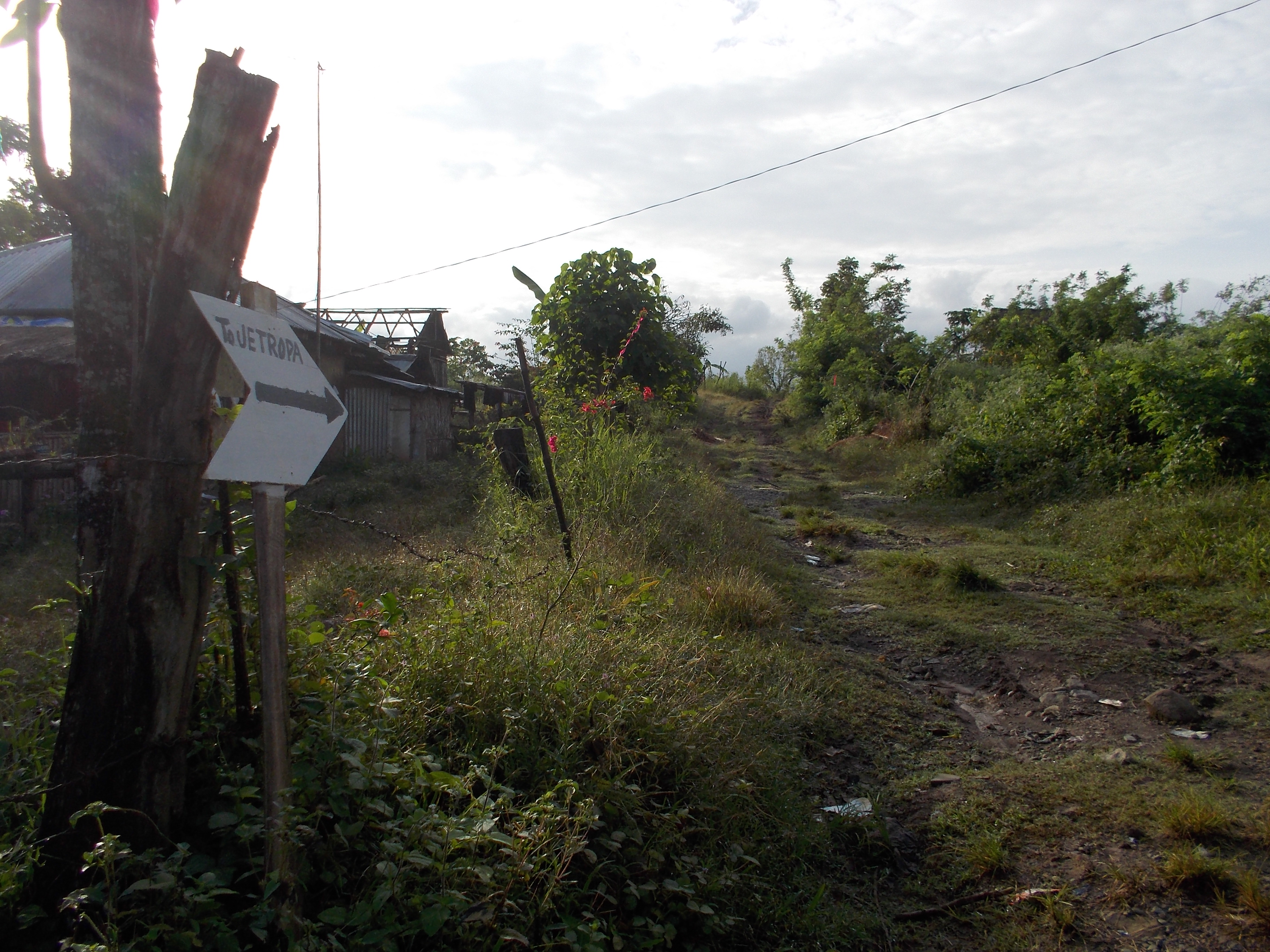
7. Once the runners will reach the center of Barangay Dona Josefa, turn RIGHT and just follow the dirt road. Do NOT take the road towards the LEFT Direction as it ends at the Dona Josefa Elementary School.

@ BARANGAY Dona JOSEFA
TURN RIGHT TO BRGY PALALE

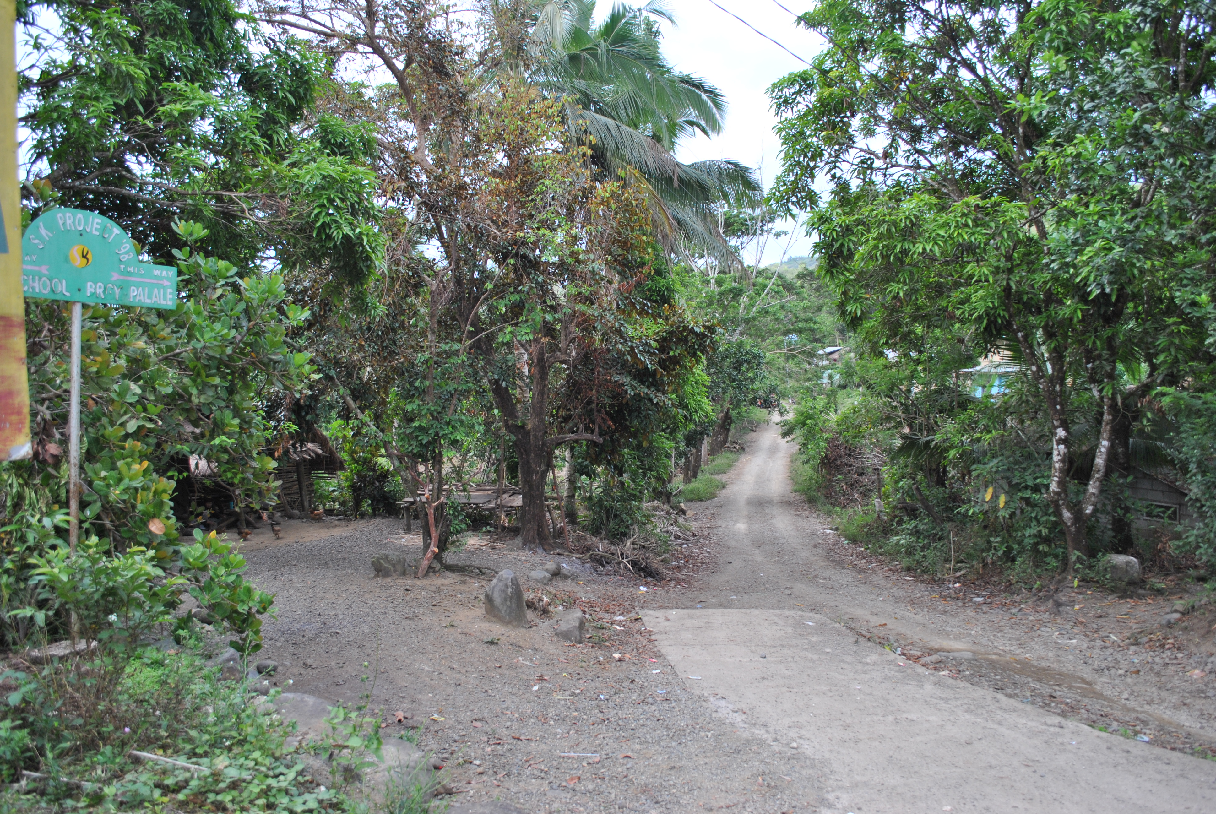
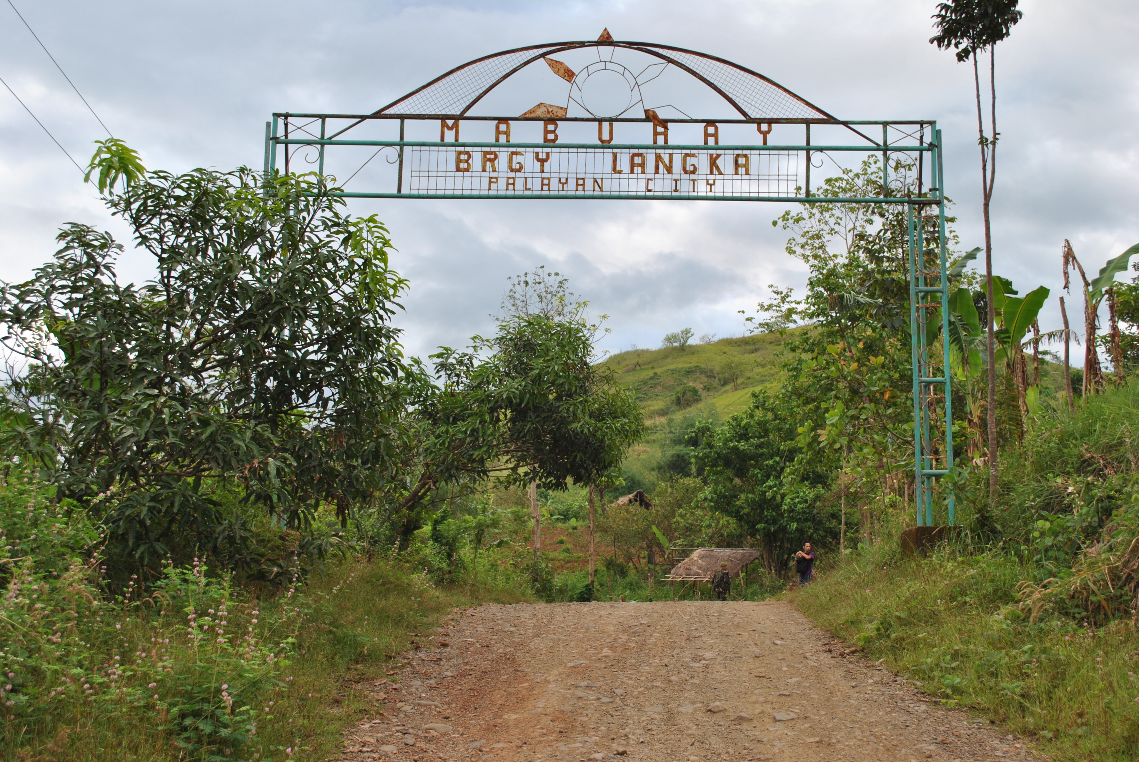
8. Runners will reach the first Spillway and after passing the Spillway, it will be an uphill climb and a steel arc will be seen with the markings “WELCOME TO SITIO LANGKA”.

First Spillway Before Barangay Langka Welcome Arc
Barangay LANGKA Welcome Arc

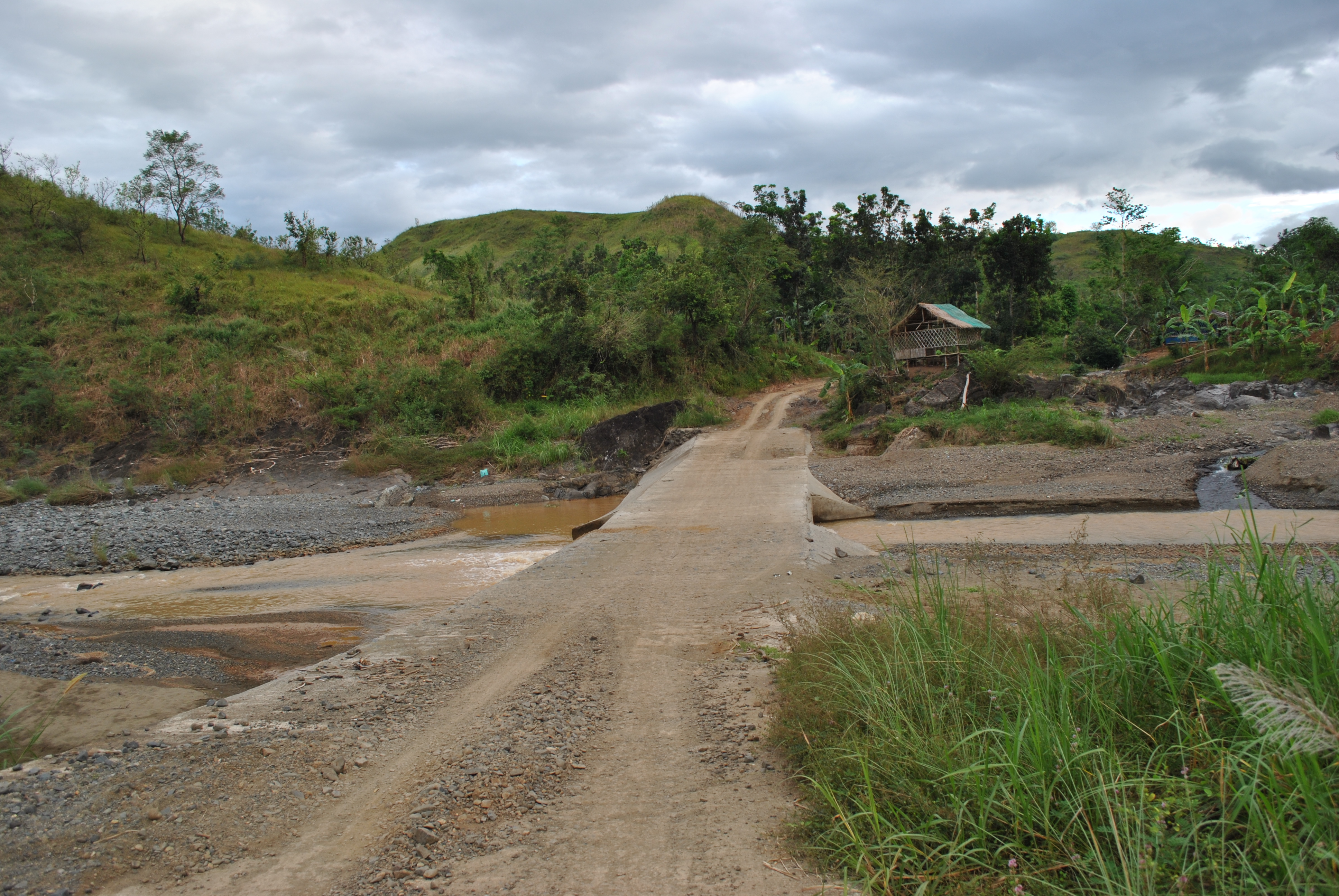
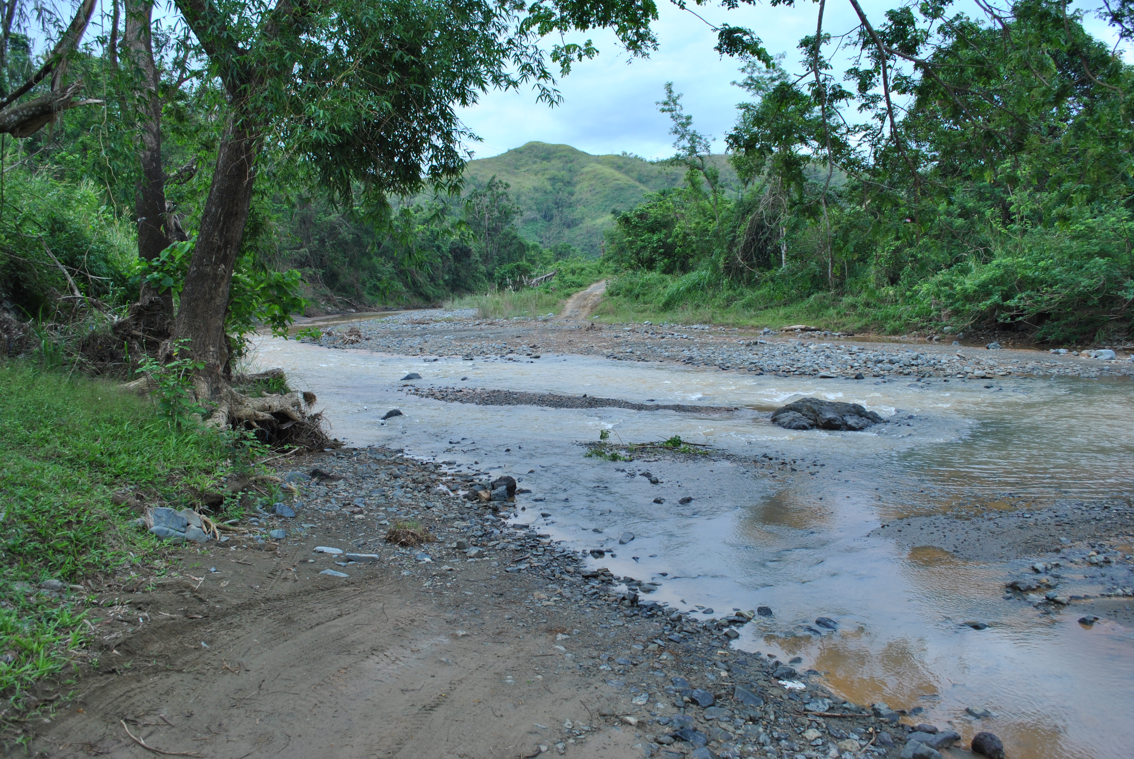
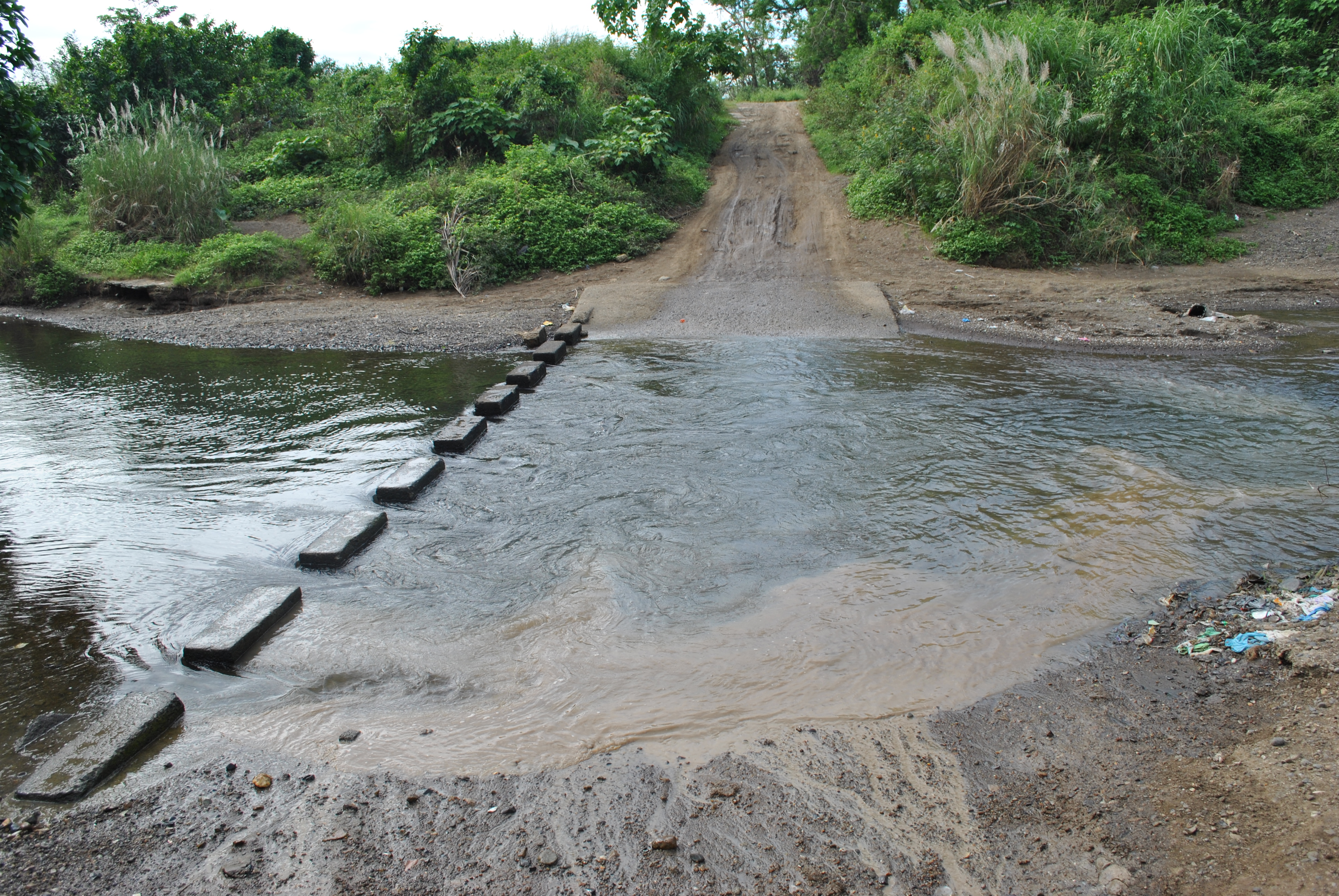
9. After passing the BARANGAY LANGKA Arc, at about 20 meters, there will be a Y-intersection. TURN RIGHT on the Y-intersection and it will be the start of more uphill climbs and descending parts of the route. Ultimately, the runners will be crossing the Palale River.

TURN RIGHT After Brgy LANGKA Arc

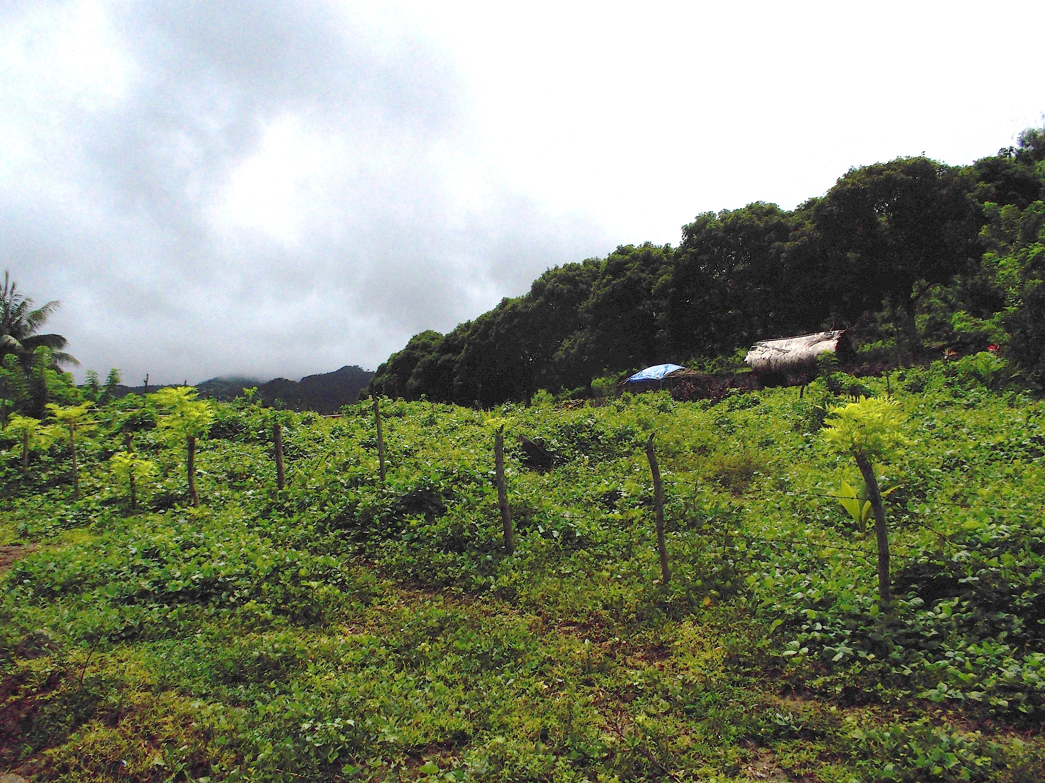
10. After crossing the Palale River, runners will be able to reach the center of Barangay Palale after few meters. There will be an Aid Station in this Barangay. There are also sari-sari stores in this area.

PALALE RIVER
PALALE RIVER
Center Of Barangay PALALE
TURN RIGHT on the Right Most Road

11. Runners will take the road on the RIGHT as one leaves the center of the barangay. Runners will be going to the direction of the Provincial Cattle Stock Farm.

Approaching The Provincial Cattle Stock Farm
Take Note Of This Road Markings

12. Once the runners reach the Provincial Cattle Stock Farm, TURN RIGHT on the intersection. This road will lead the runners to Barangay NAZARETH.

TURN RIGHT On This Road Going To Barangay NAZARETH

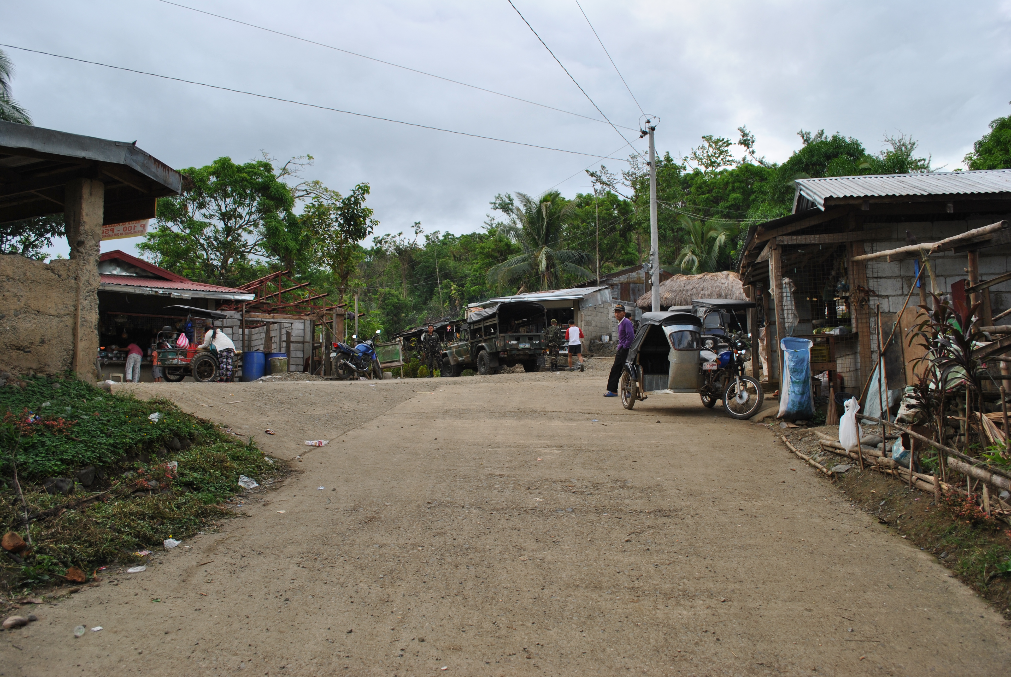
13. Runners shall reach the intersection of GAPAN-PAPAYA-FORT MAGSAYSAY Road which is a paved/cemented, once they reach the center of Barangay Nazareth. The Aid Station is located at the Barangay Hall of Nazareth. At this intersection, runners have to TURN RIGHT going to a north direction.

Barangay NAZARETH Intersection
TURN RIGHT On This Road

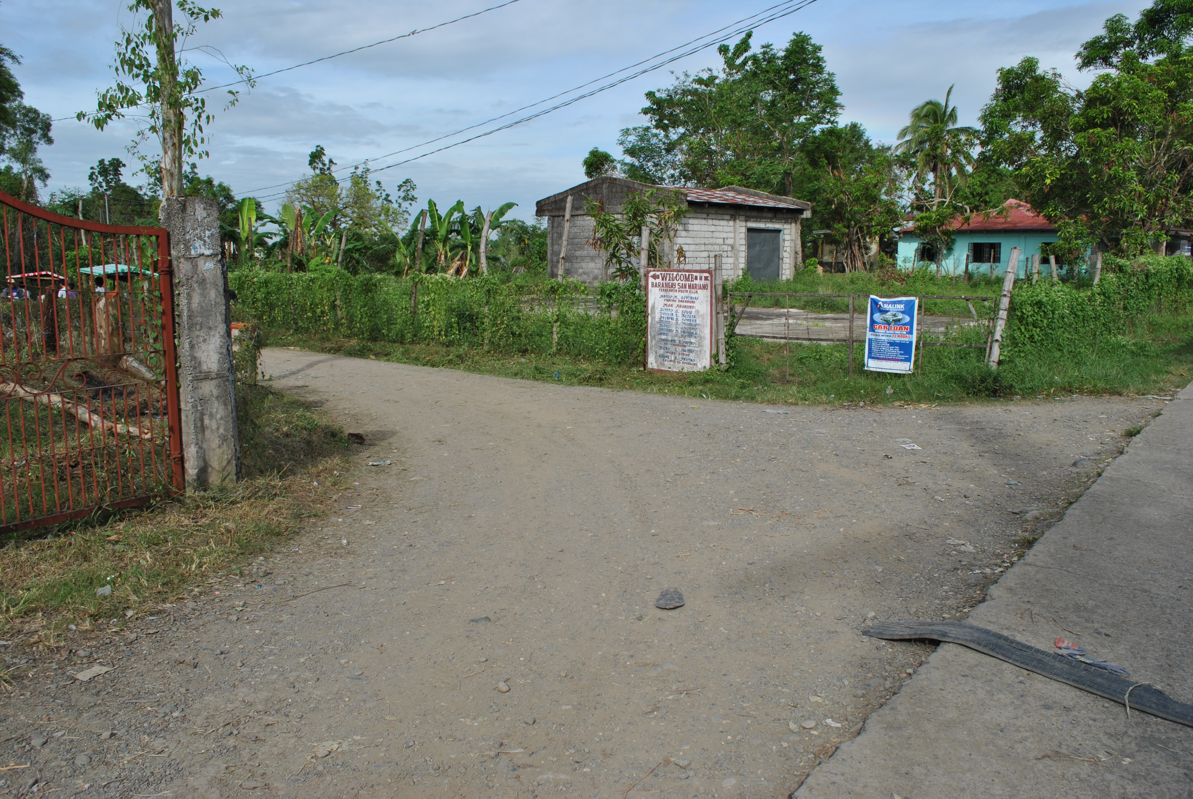
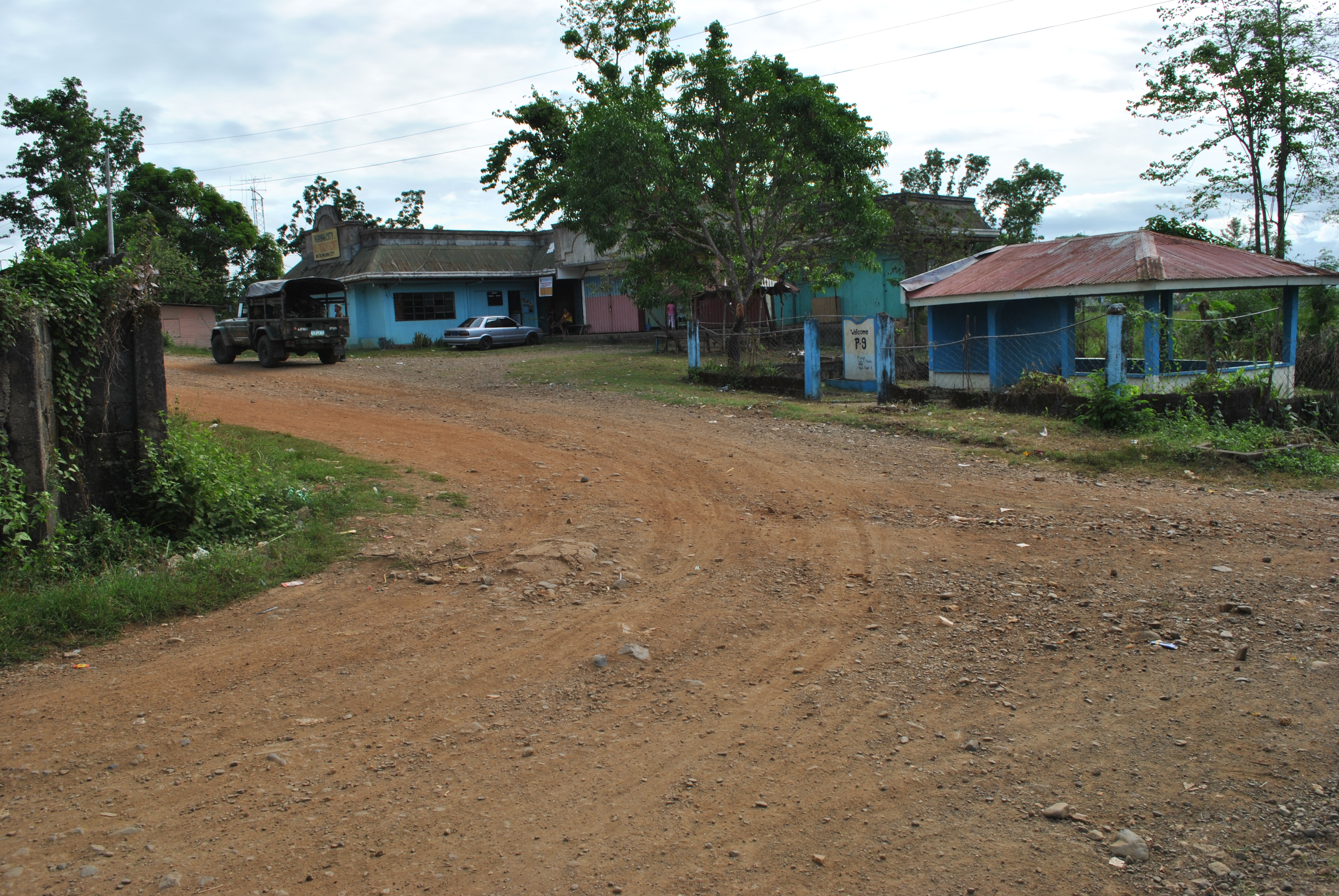
14. After 1.5 Kilometers, runners have to TURN LEFT in an intersection that goes to San Mariano/Purok 9/Barangay Militar. On this dirt road, runners shall always take or turn LEFT on intersections along the way.

TURN LEFT On This Road Towards Barangays San Mariano, Purok #9, Barangay Militar
TURN LEFT To Barangay Mariano/Purok #9/Barangay Militar
SPILLWAY On The Western Side Of Barangay Militar

15. Runners must be able to pass/cross an SPILLWAY on western part of Barangay Militar. After an uphill climb from the SPILLWAY, the runners will reach the PUROK #9  . From Purok #9, the runners will be approaching an intersection with the Santa Rosa-Fort Magsaysay-Laur Road/Highway.

S-Curve @ Purok #9
S-Curve @ Purok #9
Approaching The Santa Rosa-Fort Magsaysay-Laur Road/Highway
Approaching The Santa Rosa-Fort Magsaysay-Laur Road/Highway. TURN RIGHT
TURN LEFT Towards Barangay BANGAD On This Intersection

16. After about 1.5 kilometers, runners will reach a busy road intersection (Bangad To Gate 1 Fort Magsaysay Road & Santa Rosa To Laur Road). Runners should TURN LEFT towards Barangay Bangad, Palayan City.

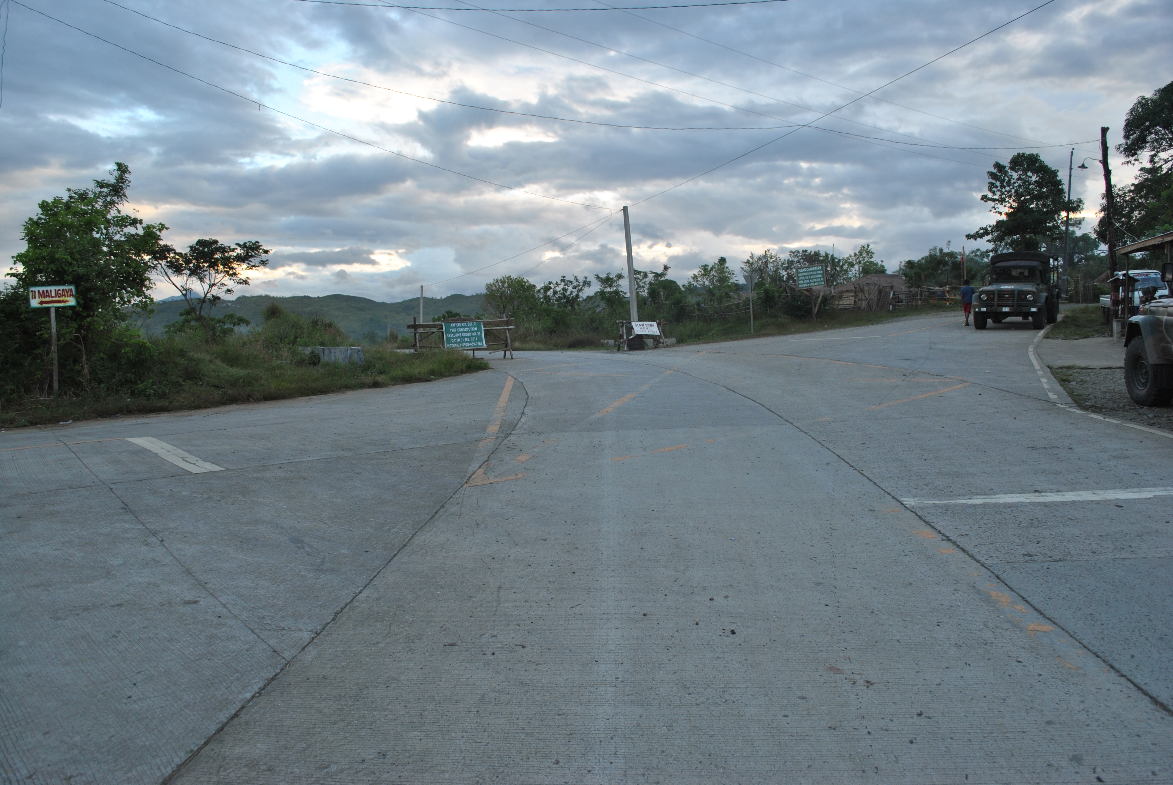
17. After running for 2 kilometers along the Fort Magsaysay-Bangad Road (going North), runners will see a green steel arc with the markings “FORT MAGSAYSAY RESERVATION AREA” and a Waiting Shed on the right side of the road. There is a Y-intersection after passing the Arc and Waiting Shed. Runners shall TURN RIGHT on the road that goes to Barangay MALIGAYA.

Before The Y-Intersection Going Barangay MALIGAYA
Road To Barangay MALIGAYA

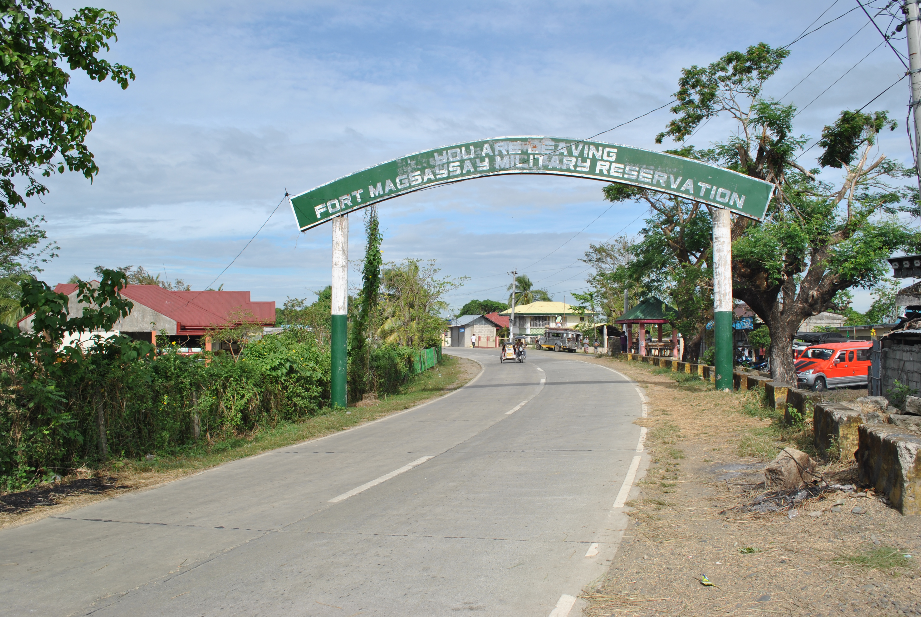
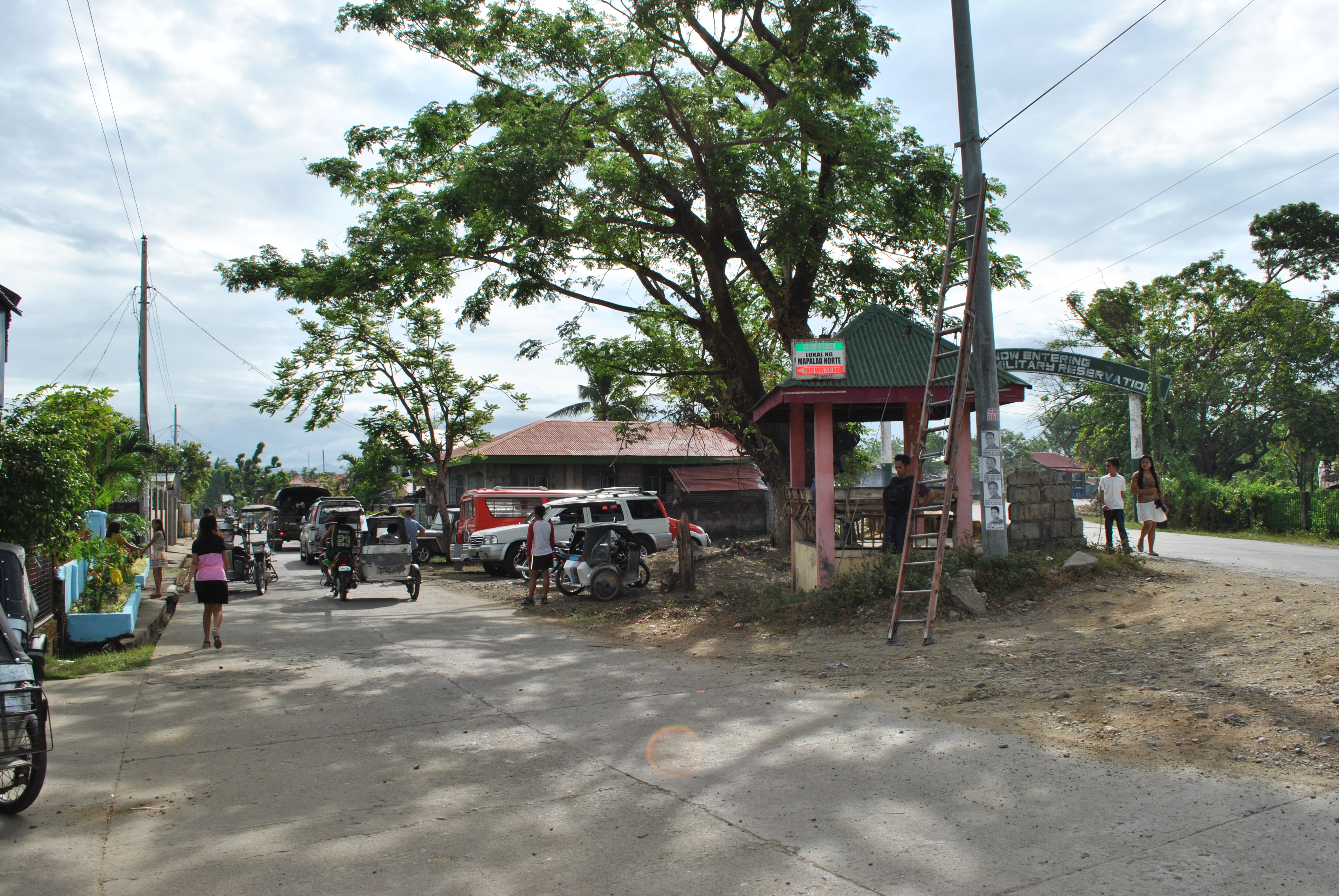
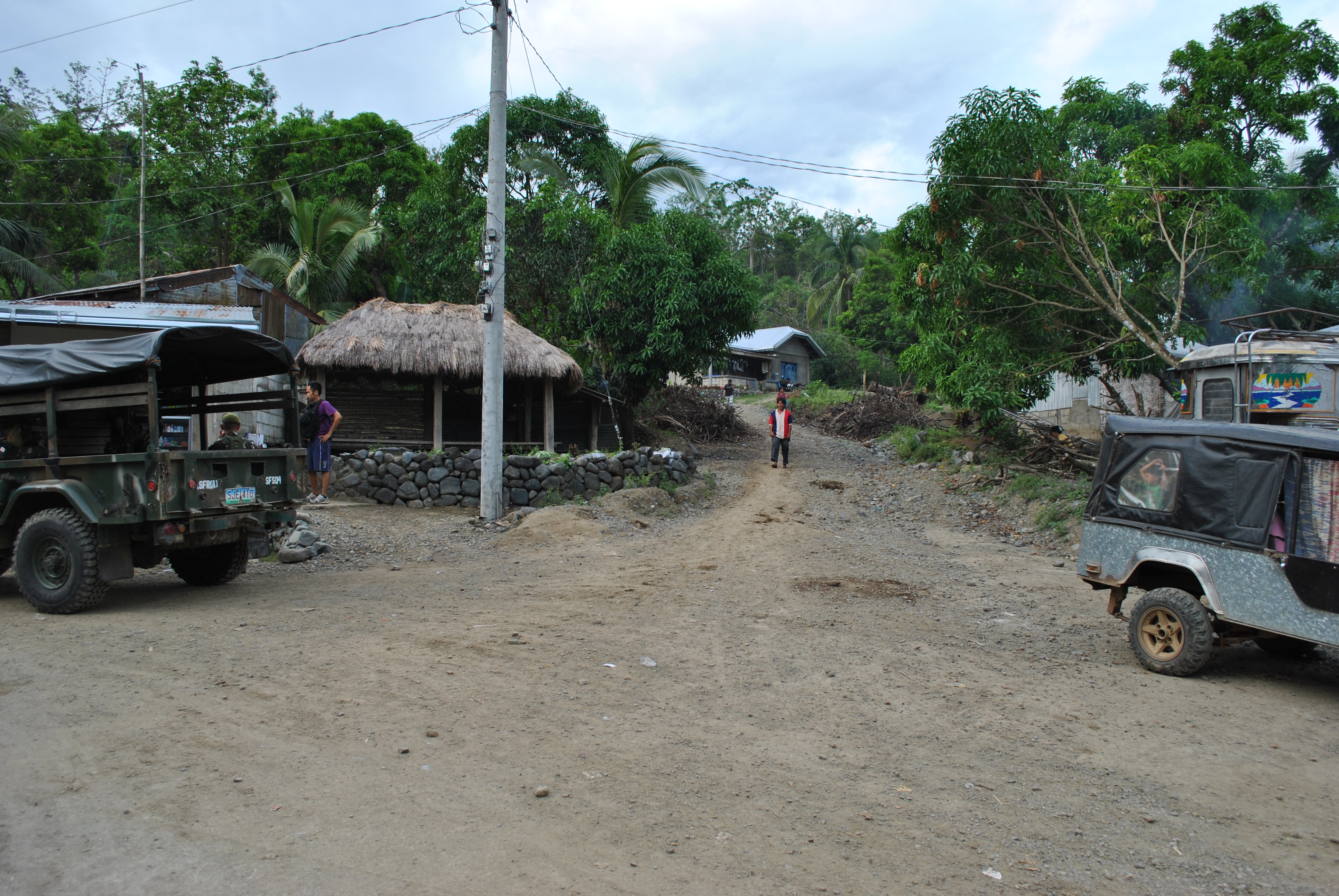
18. After runners had passed Barangay MALIGAYA, the road will lead them to the FIRST intersection with a Military Checkpoint & Detachment along the Santa Rosa-Laur Road. Runners shall cross the Paved Road (Santa Rosa-Laur Road) on their way to Barangay Dona Josefa. At this point, runners shall have circumnavigated the outer perimeter of the Camp’s Cantonment Area.

TURN RIGHT @ The Intersection of SITIO ALORMA
TURN RIGHT @ The Intersection of SITIO ALORMA (Going To The Airstrip)
Runners Will Be Reaching This Place From Sitio ALORMA

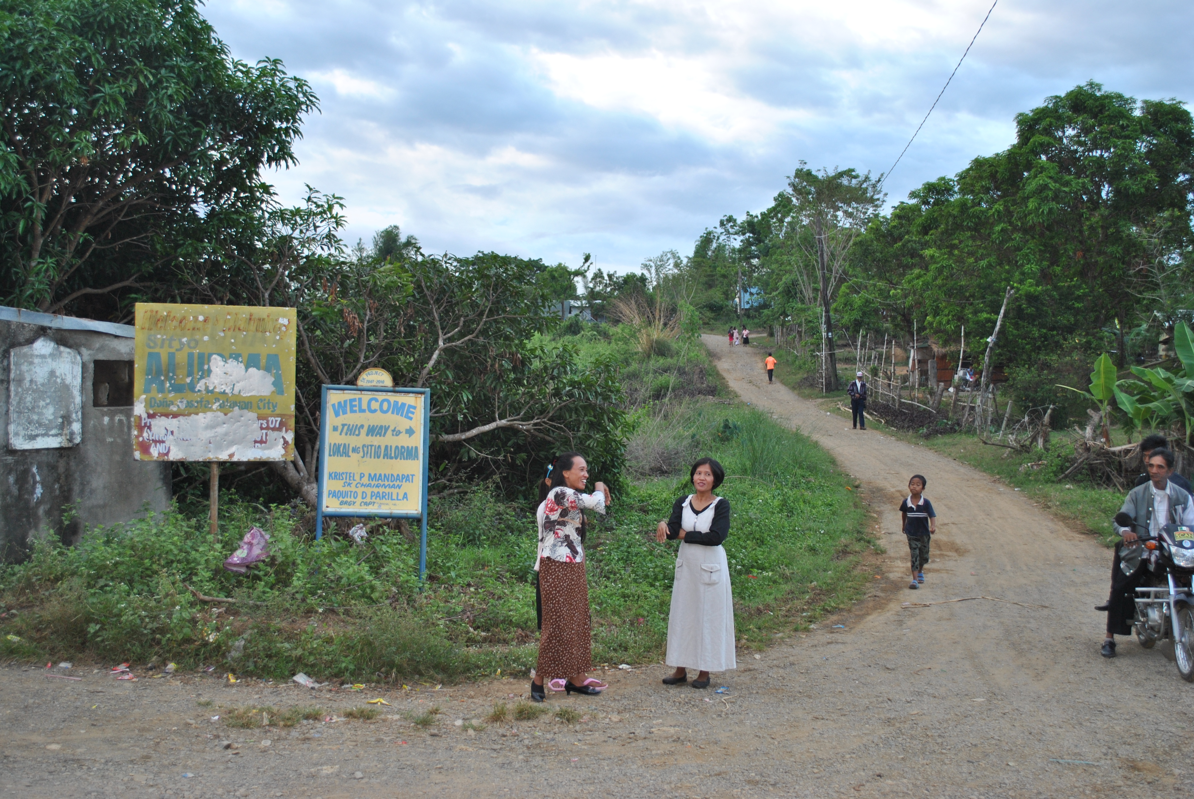
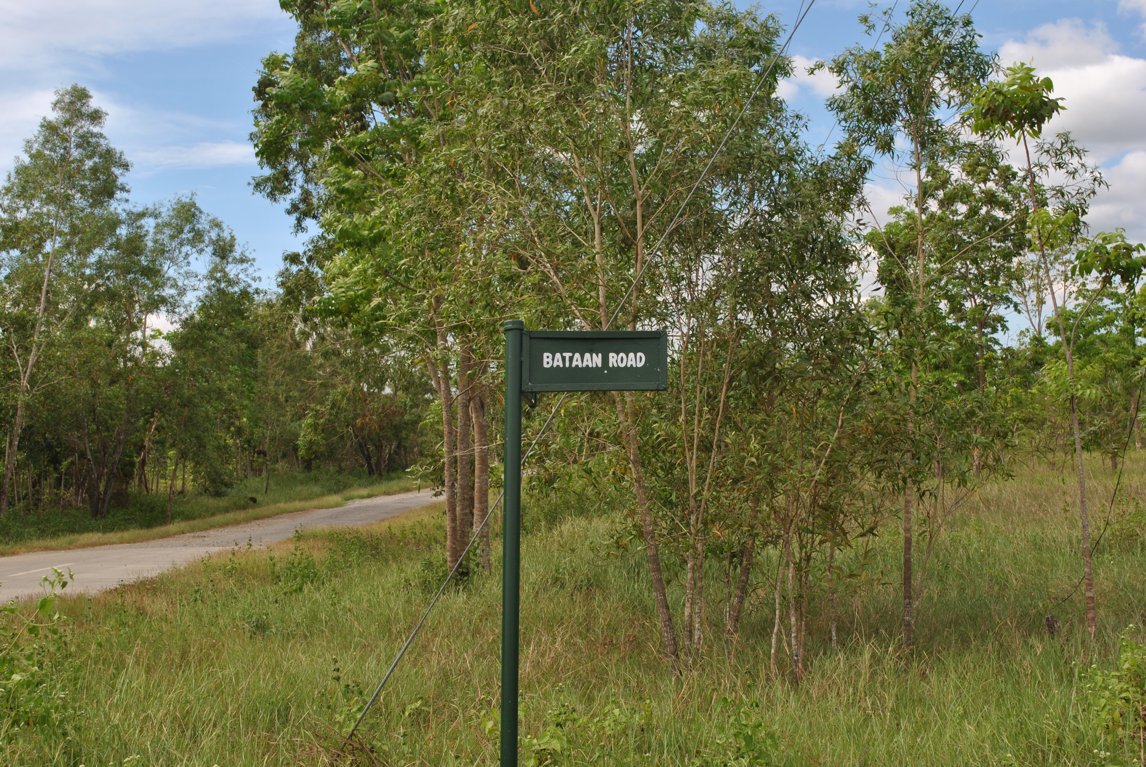
19. Along the Barangay Dona Josefa Road, runner should be ATTENTIVE. The first intersection is at SITIO ALORMA. TURN RIGHT at Sitio ALORMA intersection and go  STRAIGHT uphill. The trail will lead the runners to the end of the airstrip. At the end of the airstrip, there is a Y-intersection. TURN LEFT on the said intersection. The road will lead the runners to BATAAN ROAD and the runners will be going to a SOUTH Direction.

END OF THE AIRSTRIP. Runners Shall TURN LEFT Towards Bataan Road

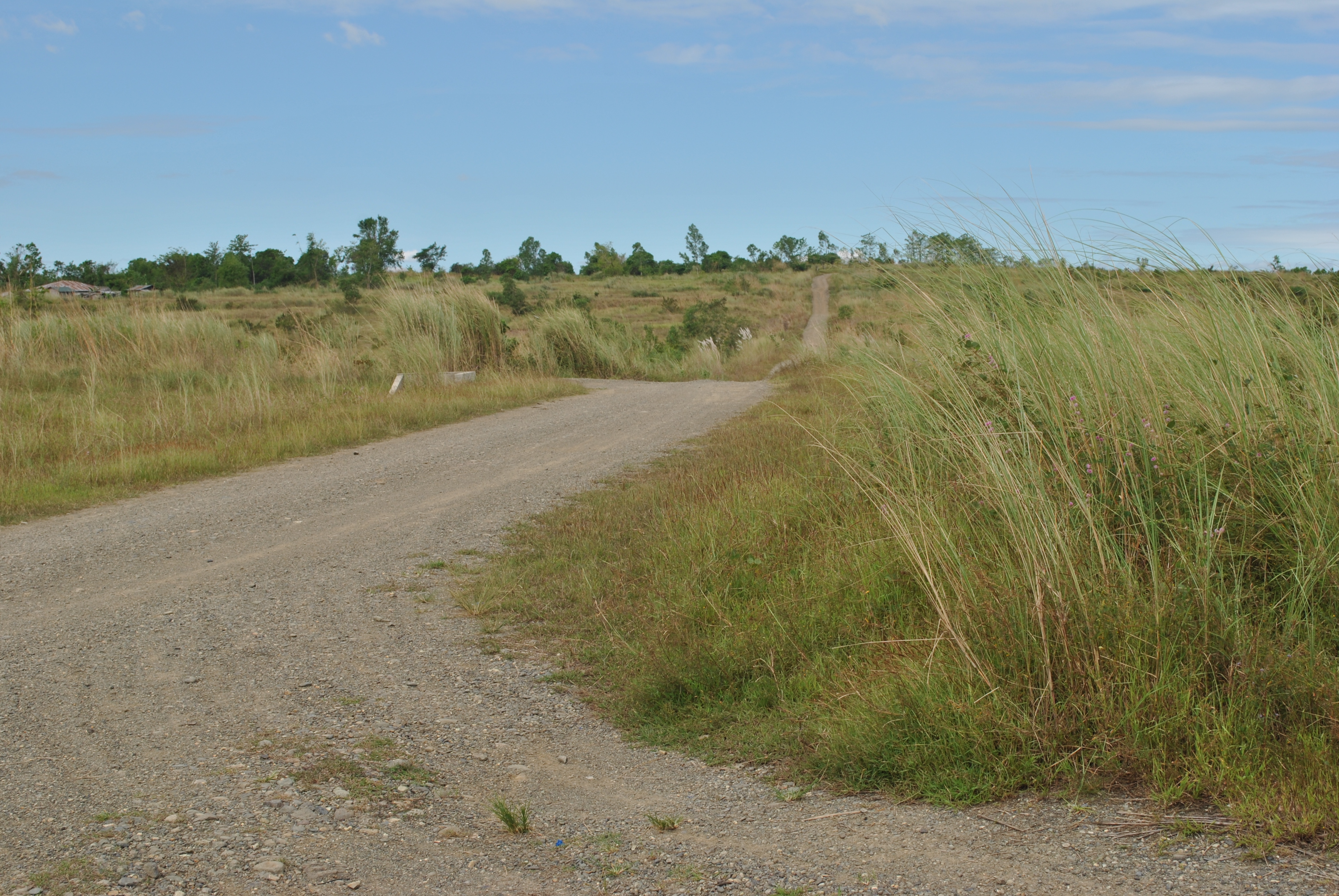
20. Along BATAAN ROAD, runners will see FIRING RANGES on their LEFT and a GOLF COURSE on their RIGHT. Runners will follow the Bataan Road until they will reach the intersection going to CORDERO DAM.

BATAAN ROAD
BATAAN ROAD
Street Sign/Marker @ Bataan Road

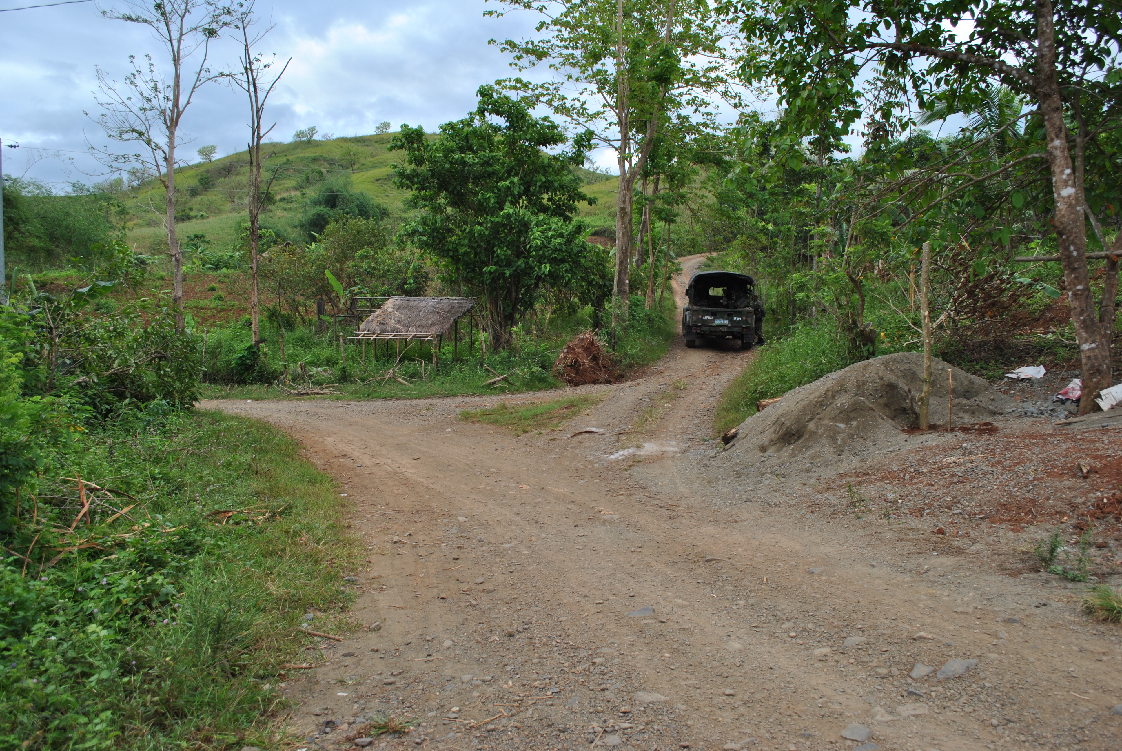
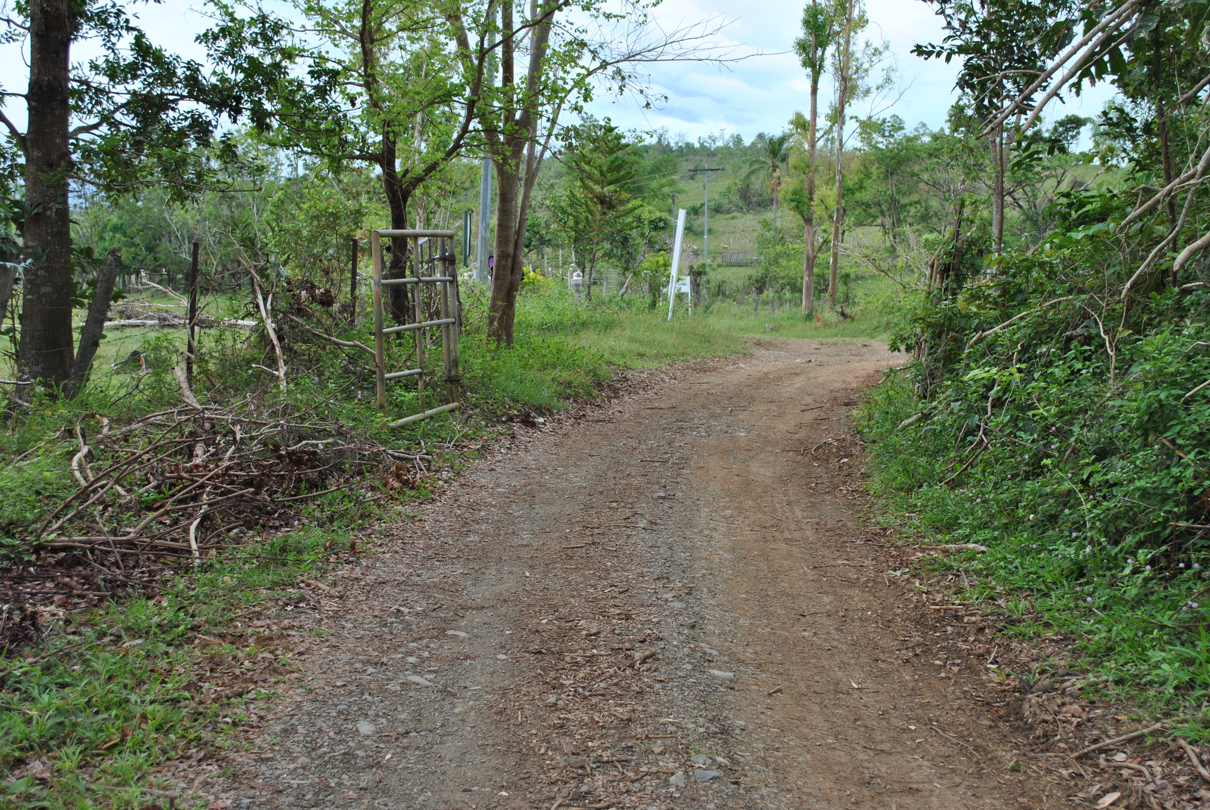
21. Runners have to TURN LEFT on a dirt road that goes to CORDERO DAM. After 2 kilometers, there is a Y-intersection. Runners shall TURN RIGHT on this intersection. This trail will lead the runners to the Special Forces School and then to FERNANDEZ HILL.

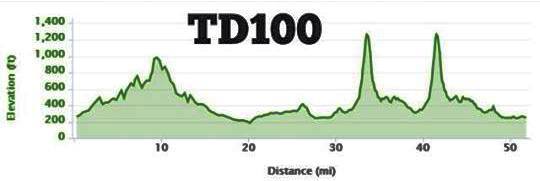
22. Fernandez Hill is the location of an Aid Station. Runners will have to pass this Aid Station for six (6) times for the 100-Mile Race and three (3) times for the 50-Mile Race.

@ Fernandez Hill With Mt Taklang Damulag At The Background

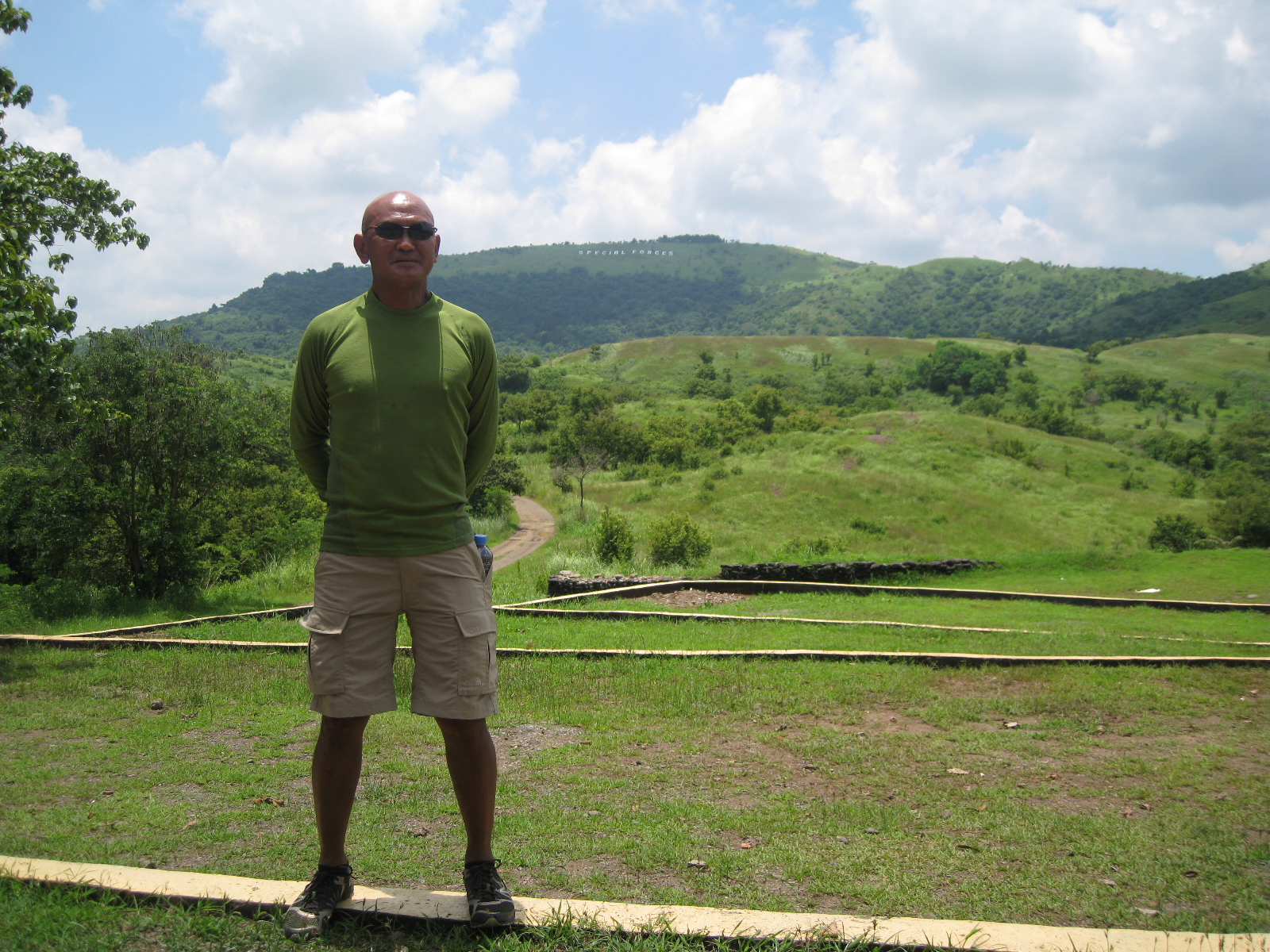
23. From Fernandez Hill, runners will have to proceed to the peak of Mt Taklang Damulag and then descend on its northern part. The descending trail leads to SITIO BACCAO (along the Barangay Dona Josefa To Barangay Palale Road). Upon reaching the asphalted road, runners shall TURN LEFT and proceed to SITIO ALORMA Crossing/Intersection.

Trail Coming From Taklang Damulag To Dona Josefa-Palale Road
24. Runners shall TURN LEFT at Sitio ALORMA intersection (Going To Cordero Dam). After about 20 meters, TURN LEFT on a trail that leads to CORDERO DAM/LAKE. (Going UPHILL will lead the runners to the end of the airstrip. Don’t take this UPHILL dirt road!)
Going South To Brgy Alorma Intersection (400 Meters)
Going South To Brgy Alorma (Going To Cordero Dam) Intersection (400 Meters)
TURN LEFT On This Intersection Going To Cordero Dam
TURN LEFT On This Trail (20 Meters From The Intersection)

25. Once the runners are in CORDERO DAM/LAKE (on the right side of the runners), they will reach a Y-intersection (the same Y-intersection that runners had passed after coming from BATAAN ROAD and upon reaching CORDERO DAM/LAKE). At the intersection, TURN LEFT and the runners will be going to the Special Forces School and then to Fernandez Hill. This completes the 12K inner loop.

26. Runners will have to run along the Taklang Damulag course (12K inner loop) for two times.

27. After finishing two loops, from Fernandez Hill, runner will follow the asphalted road that goes out from the Molave Complex (location of the Special Forces School and Fernandez Hill/Taklang Damulag). Runners must pass the Checkpoint/Gate of the Molave Complex that goes directly to BATAAN ROAD.

28. Runners will be running along BATAAN ROAD on their way back to SOCOM Headquarters/Starting Area. At the dirt road at the end of the airstrip, there will be an intersection (the first intersection on a dirt road after 800 meters from the Starting Line), TURN LEFT on this intersection. The dirt road will lead the runner to the Starting Area/SOCOM Headquarters.

TURN LEFT On This Dirt Road In Going Back To The Starting Area (SOCOM Headquarters)

29. This completes the FIRST HALF of the 100-Mile Course. The LAST HALF of the course will be a repetition of the FIRST HALF.

TD 100 Route Map
TD 100 Route Map
TD 100 Elevation Profile

30. 100-Mile Race Runners must be able to finish the FIRST HALF in 15:30 Hours. Cut-Off Time for the 50-Mile Race Runners is 16 Hours.

31. On the SECOND LOOP, runners must be able to reach FERNANDEZ HILL in 25 hours before starting their last TWO (Small) Loops at Mt. Taklang Damulag.

Good Luck & Have Fun!

Good luck to all the runners!

(Note: Rules & Regulations Will Be Posted Soon!)

“Purist”


What is the problem with some of the people watching movies in movie theaters? They go to the movies to eat their snacks; tinker with their cellphones; do some conversation and talking with their friends while the movie is playing; or worst, they are there to simply sleep.

In terms of watching movies in movie theaters, I am a “purist”. The bonus for me is that I am free to watch any movies within the city/place where I reside in Metro Manila being a Senior Citizen. I don’t bring any food or drinks inside the theater. I just simply relax on my seat and concentrate my sight and hearing on the screen and enjoy the movie. I guess, this defines what is a “purist” for somebody who would watch a movie.

I am not a camper who goes out to the mountains and spend a day or two on its peak and my understanding is that one goes to the mountain to enjoy the outdoors and spend some time with nature—-breath some clean air; enjoy the challenge of carrying one’s pack/tent and provisions on top of the mountain; dip oneself to a water pool; enjoy the beauty of sunrise, nighttime, and sunset; enjoy the scenery; and to simply enjoy the simplicity of being away from the city. I could say that a camper is “purist” if he or she does all these and simply enjoy the beauty of nature and the serenity of being alone in the mountains.

For an ultra trail runner to where I am drifting to be identified, I simply go the nearest mountain and follow its trails by running or hiking. Equipped with reliable trail shoes and hydration vest/bottles, I could run to where the trails would lead me and after one hour of running, I would retrace back to where I’ve started and my running workout for the day is done. I think this is the “purist” way that I can describe in trail running.

I Love The Mountains!

RD’s Report: 4th Mt Pinatubo 50K Trail Challenge


Five years ago, I went to Mt Pinatubo together with a group of ultra runners where five of us were training for the 1st BDM 102. While the 5 of us were having our “pit stop” at the edge of crater lake, I started to discuss with the group about my plans in promoting ultra marathon events in the country. And the rest is history. The ultra runner’s group whom we asked to join in our trek to Mt Pinatubo just completely “vanished”. I wonder why.

Every edition of the Mt Pinatubo 50K Trail Challenge has a unique story and experiences to every runner as the landscape of the route would completely change every year. In short, there is a different story for every runner every year. And the challenges brought about by the landscape, the river, the lahar, the rocks, the elevation, the heat and the rains make this event totally different from the other trail running events in the country. This is a trail running event where you need agility, quick thinking, smart running strategy and orienteering skills in order to run safely back to the finish line.

If you look closely on the elevation profile of the race route, this could be the first ultra “FKT” (Fastest Known Time) event held in the country. The fastest recorded time was 5:35:09 hours by Marcelo Bautista while the Lady’s Course Record is 8:00:59 by Majo Liao. These course records stand up to the present.

Mt Pinatubo Elevation Profile

For this year, the event was held after a day when Typhoon Santi’s strong winds had devastated the towns of Tarlac, Pampanga, Bataan and Zambales. The roads to the starting area, Barangay Santa Juliana in Capas, Tarlac had been filled with fallen trees and debris but with the immediate response from the Local Government Disaster Committee, the roads were cleared for traffic.

Much to my desire to personally recon the route on the day before Race Day, I was advised by the local authorities that It would be best to wait for the river’s depth to subside and start the race when there would be natural lighting as the sun arises.

I was expecting only 52 runners to join this race. I guess, 3 of the runners who requested to be included in the list of registered runners decided not to join the race as a result of the typhoon. I decided to run the race as the “sweeper” and safety marshal for the last runners.

Most of the runners arrived at the assembly area few hours before the start of the race and they were surprised to see the devastation brought about by Typhoon Santi. I made clear to all the runners that the race start would be delayed for us to wait for the day’s sunlight to appear. At exactly 5:35 AM, the race started in front of the Barangay Hall of Santa Juliana, Capas, Tarlac with 49 runner-starters. My salute goes to these runners who braved to be at the starting area.

Runners who had their first time to join the race are always surprised with the first river crossing which is about 1.3 kilometers from the starting area. It is always the same feeling and apprehension for all the runners. The river had been wider and some portions are deep and the current is strong. Runners would cross the river deliberately in groups trying to test the depth and current of the flowing river. At a distance, every runner would see the road that leads to the cogon/tall grasses and that was the target of all the runners.

Due to the loose and unstable ground brought about by the typhoon, the first 4 X 4 vehicle to serve the runners as the Aid Station had been stalled at Km 8. The 2nd 4 X 4 vehicle move on to about a few kilometers.

I started to run the race after 5 minutes from the Gun Start time. I purposely made myself as the “sweeper” and safety runner for the runners at the rear. After one hour of hiking and running, I was able to spot the stalled 4X4 vehicle and the last runners leaving the Aid Station. I immediately called my staff at the Starting Area to send another 4X4 vehicle to reach Kilometer 17, if possible.

I have to wait for about 45 minutes for the replacement 4X4 vehicle to arrive at the stalled vehicle. Once it arrived, I continued my run with the instruction for the replacement vehicle to move forward closer to Km 17 if the condition of the ground and the river permit. The replacement vehicle passed me somewhere in Km 10 and I could still see the last runners in front of me with a distance of about 500 meters. However, the driver of the replacement 4X4 vehicle had to stop the vehicle about 1-2 kilometers ahead of me due to loose ground and deeper parts of the river.

The race marshals and volunteer that I requested to be positioned at the Crater Lake had to walk for about 6 kilometers but decided not push through to the peak of Mt Pinatubo due to the lack of time. With this situation, the runners who will be reaching the turn-around at the Crater Lake will not be able to see my Race Marshals.

I was amazed and surprised to see the landscape to have completely changed after a year! Gone are the temporary trail where the 4X4 vehicle would run through. Another landscape of rocks and lahar had appeared. The temporary waiting area for the 4X4 vehicle at a place called “GMA” is completely gone. Most of the runners at the rear were lost at this portion but with the presence of the Race Marshals and Volunteer, they were advised to go to their position and were able to get their proper direction.

When I reached the “GMA” area, I was able to catch up with the last runner. The distance to the peak is still 7-8 kilometers from this point. From here, I pushed the last runner to continue the race and be able to reach the turn-around point. The first runner going back to the finish just dropped by at the “GMA” as we started our trek to the peak. After about 500 meters, we met the 2nd runner, Robert Watson and the third runner, July Oconer was 200-300 meters behind. After 15 minutes of hiking, we met the 4th runner, Graciano Santos. As we reached the Waiting Sheds at the foot of Mt Pinatubo, we were able to meet a group of 5 runners coming from the peak. More runners would be going down from the peak as we were trying to trek the last 2 kilometers to the peak of the mountain.

As we reached the peak of Mt Pinatubo, we were able to catch up with the last 4 runners who just came from the Crater Lake. After a brief “pit stop” at the Crater Lake, we were ready to move on for the last half of the course.

Coming from the peak and going back to the finish line could had been very easy if not for the numerous rocks to step on, more time spent on looking for open ground to land your feet, and the river to cross. After a few kilometers, the last runner, Joel and I were able to catch up with the 4 last runners.

It was already noon time and the sun was already on top of us as the sky went clear from clouds. It became hotter and we tried to conserve the water we had in our hydration bottles and tried our best to reach the Aid Station at Km #11/49. Three of the runners of the last 4 runners went ahead of us and the 4th runner, Allenstein joined us as the last 3 runners.

After hiking, jogging and telling some “running” stories with my companions, we were able to reach the Aid Station. This is where we ate boiled eggs and bananas; refilled our hydration bottles; and drank lots of soda drinks sponsored/provided by our ultra runner and friend, Jun Padilla.

I was surprised to see that the river had subsided and became narrow. More lahar grounds were exposed as a result of few hours of sunshine but some were not stable as our feet would sink for a few inches when walking. At one point, I would remove my shoes and clean them from the accumulated lahar/sand with the flowing river. The flowing river carries a lot of sand/lahar and they ultimately gets inside the shoes and accumulate on the toe box/sole portion of the shoes.

After a few kilometers, we reached the last Aid Station and we were able to catch up with the rest of the runners as some would eat, refill their bottles and wash their shoes from the lahar/sand. It was the last 8 kilometers to the finish line but some runners have the tendency to be lost on this part of the route.

I was with another runner-friend, Many Ocampo, from this point as I tried to encourage him to run with a faster pace and by taking the shortest route/trail to the last river crossing. After some “hit and miss” and “bushwacking” on tall grasses, we were able to reach the 2nd to the last river crossing that would lead us to the trail to the last river crossing.

At this point, I became the “guide” for the rest of the runners at the rear on the last 3 kilometers of the course. I felt strong and faster with my pace from this point. It is just a matter of time and I know I would be able to finish the race in less than 12 hours!

The following were the observations made and some adjustments to be implemented on the next edition of this race:

  1. Despite the more challenging situation of this year’s edition, all the starters were able to finish the race. I could see that our runners are becoming braver, stronger and smarter.
  2. Runners attempting to join this race must have some knowledge on orienteering. Some skills on tracking would also be needed. A runner is smart if he/she tries to look for marks/foot prints or signs of runner’s track along the rocks and trails.
  3. Most of the runners are “repeaters” in this event and I am glad they were able to act as guide/pacers to other runners. This is the essence of trail running—everybody helps each other to overcome the challenges along the route and be able to finish the race safely.
  4. Integrity of the race was maintained and the runners went down to the crater lake despite the presence of eroded portion of the stairs. Next time, I would advise that handheld digital camera will be required for each runner and for them to submit a “selfie” picture of themselves with the Crater Lake as the background as an evidence that they reached the turn-around point. This is an “out of the box” way just in case the Race Marshals would not be able to reach the Crater Lake.
  5. Since I included a First Aid Kit as a required equipment carry-on for each runner, this will be thoroughly inspected before the race. I am glad there were no serious accidents during the race.
  6. Runners must be always vigilant and observant with the course features that they would pass on their way to the peak. These land and river features would be needed for the runner to guide him/her back to the finish line. There are steel towers along the left side of the open space/river as the runner would run towards the peak. The same towers would be seen on the right side of the runners as they go back to the finish line.
  7. Last year, we had time to prepare for ribbons tied on bamboo sticks but on race day, most of the sticks were taken by Aeta kids and made as souvenirs. What is worse was that most of the runners were not able to see these ribbons that we placed along the route on the first 5 kilometers as most of the runners followed the trails. For this year, we were not able to place those ribbons but runners were smart to follow the river and made their run with due direction towards the South.
  8. The Aetas/local tribe in the area were very helpful that they made some access trails on the steep banks of the river for the runners. They even see to it that they give instructions on where to go to avoid the deeper parts of the river. Nobody from the tribe asked for any food or money from the runners.
  9. If not for the typhoon, we could have pushed the 4X4 vehicles to reach “GMA” where runners would be able to replenish their hydration before their final trek to the peak of the mountain. I know that some runners were asking for some water after coming from the peak but they persevered until they reach the stalled 4X4 vehicle on the last 12 kilometers. On the next edition, we will see to it that every runner must be able to carry at least 2 liters of water on the last Aid Station before their trek to the peak or before reaching the turn-around point.
  10. All Finishers were able to receive new versions of the Finisher’s T-Shirt and Finisher’s Medal.
  11. On the next edition of this race, we have to add some amount for the registration fee in order for us to offer Cash Prizes to the podium finishers. We will adopt what we will do with the next edition of the Tagaytay To Nasugbu 50K Ultra Marathon Race.
  12. We will continue to announce the details of the next year’s edition through our Facebook Event Page.
  13. Every year, we have Foreigners in this race and we hope to continue accommodating them in our next editions.

Official Results can be seen here:

https://baldrunner.com/2013/10/15/result-3rd-mt-pinatubo-50k-trail-challenge/

Pictures of the Event Can Be seen Here:

https://www.facebook.com/kampuger/media_set?set=a.10153349894720585.1073741891.718340584&type=3

https://www.facebook.com/kampuger/media_set?set=a.10153349934690585.1073741892.718340584&type=3

Pictures at the Start & Finish Can Be Seen Here:

https://www.facebook.com/baldrunner/media_set?set=a.10201638082527538.1073741860.1043179758&type=1

Mt Pinatubo's Peak & Crater Lake
Mt Pinatubo’s Peak & Crater Lake

“Spoon Feeding”


One of the reasons why I require a Marathon Finish for the participants of my Ultra Events is that he/she would have gone through the “mill” of starting from being a 5K runner to Half-Marathoner for a certain period of time. The period could be a number of months of continuous training or a year of dedicated preparation for the 42K distance.

It is assumed that the Marathon Finisher had experienced what it is like and what it takes to finish the distance.

If a Marathon Finisher takes the plunge to Ultra Marathon, he/she looks for an entry-level distance ultra race which is the 50K distance. Depending on his/her choice, it could be a road or a trail ultra event. But for easier transition to ultra events, I highly recommend for a runner to do a road ultra.

Starting this year, a runner has already a choice of 50K road ultras as compared to the past 3-4 years. However, what stands out as the number one choice of marathon runners who would like to be “baptized” as ultra runner/ultra marathoner is the famous Tagaytay To Nasugbu 50K Ultra Marathon Race, simply called as “T2N”.

For the past months, weeks and days, I have been receiving a lot of questions from runners who would like to run in my Ultra Events. Some of the runners have already finished ultra events from other Race Organizers and they would like also to try my Ultra Events. I have no problem allowing or accepting their intention to run in my races. However, I have the following conditions for them to follow and satisfy:

  1. Strictly follow my Events’ Rules and Regulations.
  2. Runner must know the meaning of the words: Honesty & Integrity.
  3. I don’t “spoon feed” information to runners about my Ultra Events.
  4. Go to my blog at www.baldrunner.com and type the name of the Ultra Event in the SEARCH “slot”. My blog serves as the website of my Ultra Events.
  5. If you don’t know my blog, simply “google” the title of the Ultra Event.
  6. Except for my new Ultra Events which I introduced this year, most of the Ultra Events’ Rules and Regulations, Official Results, Race Report/s, and RD’s Reports had been posted/published in my blog.
  7. Even if I posted an Event Page on Facebook with details/information, it is best to visit and browse on my blog about such Event.

I hope I am very clear on these conditions.

Lace up, get out of the door and run!

Assembly/Starting Area of T2N

Result: 4th Mt Pinatubo 50K Trail Challenge


4th Mt Pinatubo 50K Trail Challenge

5:30 AM-5:30 PM October 13, 2013

Barangay Sta Juliana, Capas, Tarlac To Crater Lake, Mt Pinatubo and Back

Number Of Starters: 50

Number Of Finishers: 50

Cut-Off Time: 12 Hours

Rayman delos Angeles 6:48:39 Champion (Men)    
Robert Watson 7:15:59 1st Runner Up (Men)    
July Oconner 7:29:27 2nd Runner Up (Men)    
Graciano Santos 7:47:35      
Arnold Eming 9:07:34      
Nicolas de Leon 9:08:16      
Andro Garcia 9:10:34      
Jon Borbon 9:10:40      
Richelle Perez 9:28:05 Champion (Women)    
Meljohn Tezon 9:28:06      
Benj Termulo 9:34:02      
Goldy dela Cruz 9:53:59 1st Runner Up (Women)    
Arnold Banaay 10:01:20      
Michael Dauz 10:01:36      
Junar Layug 10:01:40      
May Santos 10:02:49 2nd Runner Up (Women)    
Januarius Padilla 10:11:23      
Dexter Tabaug 10:17:37      
Randy Bierso 10:17:52      
Allan Bulos 10:27:41      
Mon Iti 10:27:43      
Orlando Ylaya 10:29:31      
Rochelle Sumagang 10:31:28      
Ruben Herrera 10:31:36      
Merwin Torres 10:31:37      
Mish Miravilla 10:34:25      
Wesley Oraña 10:34:26      
Mark Sigue 10:36:58      
Rexie Jane Saldivar 10:37:31      
Timothy John Tiburcio 10:37:32      
Gringo Aquino 10:40:16      
Paul Ian Japay 10:40:17      
Christian Almendrala 10:54:16      
Doodsie Mallari 10:55:30      
Alfred delos Reyes 10:55:39      
Simon Pavel Miranda 10:55:40      
Jean Lim 10:55:41      
Mark Banatlao 10:57:11      
Michael Flores 10:58:14      
Jovenal Narcise 11:15:37      
Kathleen Fresnido 11:17:53      
Ian Mabilangan 11:22:27      
Gerson Yuson 11:23:59      
Kelly Lim 11:24:02      
Jonathan Moleta 11:24:03      
Mark Capistrano 11:24:04      
Marlon Saracho 11:24:32      
Manny Ocampo 11:36:14      
Joel Sison 11:41:12      
Allenstein Co 11:44:00      

Pinatubo Run 2013

Pictures of the event can be seen here:

https://www.facebook.com/kampuger/media_set?set=a.10153349894720585.1073741891.718340584&type=3

https://www.facebook.com/kampuger/media_set?set=a.10153349934690585.1073741892.718340584&type=3

Pictures of Start & Finish of the Event can be seen here:

https://www.facebook.com/baldrunner/media_set?set=a.10201638082527538.1073741860.1043179758&type=1

Congratulations to the “Warriors of Mt Pinatubo”.

My special thanks to the Northern Luzon Command (NOLCOM), AFP, Philippine Air Force, Tarlac and Capas PNP, Light Armor Division (LAD) of the Philippine Army, Barangay Sta Juliana Personnel, Jun Padilla for the Pepsi Products & Drinks, Ronnel Go for the Photo Coverage, Volunteers, and Staff of Bald Runner’s Events for their untiring efforts to make this event safe for the runners and for the success of this event.

See you again next year!

Lace up, go out of the door and run!

Pathfinder


In the military, there is a training or school for “Pathfinders” and they invaluable in airborne operations. They “Light The Way” for the incoming paratroopers and make sure that their landing zones are properly marked and safe. Such expertise and skill can be learned with a 3-week training in a Pathfinder’s School/Training Facility.

I had the chance to meet and see how these airborne soldiers were trained when I was in the US Army Infantry School in Fort Benning, Georgia, USA in the mid-80s.

I did not realize that this will be my role as the promoter of ultrarunning/ultra marathon events in the country. Since I started to love ultra marathon, I have been a pathfinder for ultra routes whether it is on the roads and trails.

It was very convenient to be a “pathfinder” on the road ultras as I can easily pinpoint the route or place on the map and then actually run through the route on my own. Most of the ultra marathon events that I organize and direct were born or established this way–actually run the route and find out the elevation and distance.

As I shifted more on trail runs in the mid-part of this year, I practically transformed myself as a “pathfinder” in my playground. As I get farther and farther on the distance that I could cover during the day, I would take note of places where I could rest, refill my hydration bottles with water, “engage” people or residents along the route/trail, and establish distance markers or points.

It is the responsibility of the “pathfinder” that his “follow-on” forces will not be lost as he leads them to their “landing zones”. For the past weeks, I had been accepting interested runners to have a glimpse of my playground and most of the time, someone among the group gets lost. But I am glad some would find their way back to where we started or just keep still in their location until we find them where they are located. Sometimes, I would laugh and tell the person/s who got lost that they are my “offerings” to those spirits that guard the mountains!

As of now, the trails that I’ve “found” in the mountains are for training purposes for me and for those who are interested to see the place. I don’t usually invite runners to join me in my training in the mountains as most of them have family and work to attend to during the weekdays. For some, they have also their respective “playground” which is more accessible to them from their residences and offices.

Being a “pathfinder” is a hard task as it takes a lot of time of patience and discipline. But if you love nature and the outdoors, your time in the mountains looking for trails and other land features is worth the task as you can share it to other people to see and to feel.

Lace up, go out of the door and run!

To The Mountains!
To The Mountains!

No Gadgets, Faster Run


This is one of those days that I have decided to leave my GPS Watch/Garmin Forerunner 305 from my starting place. I just brought my hydration vest and two 20 oz. bottles with me where one bottle is filled with water and the other one is filled with First Endurance EFS Mix.

I selected the first trail course which I discovered in my “playground” and has a distance  of 6.2 kilometers. It ends in a small hut on top of a hill which is near a steel antenna. I usually have my first “pit stop” in this place during my long runs. From this point, I would go back to where I started to complete a distance of 12.4 kilometers. Basically, it is an “out and back” course where the first half is an uphill/ascending to a higher elevation and the second half is descending to the place where I started.

I took off knowing what was the time of the day when I left the starting line. It was 3:20 PM. I comfortably started with a short brisk walk as the first few meters were steep incline for about 60 meters. After I was over with the steep road, I started to jog until I reached a stream to cross. From the other side of the stream, I started to jog continuously and I started to breath heavily. Then I started to perspire profusely and that is the signal that I have to take a sip on my energy mix and then with my water. I would estimate that I’ve been running for almost 22-25 minutes.

Before I would approach the last two kilometers to the hut & antenna where I would enter into the last gate of a fence, I would take another sip of my energy mix and water and continue to attack the ascending portions of the hills ahead.

I usually reach the hut/antenna in 1:20 hours during my regular running workouts in the area. Once I reached the turn-around point, I took again a sip of my hydration bottles and then simply walk around the hut for about 30 seconds and I am back again on the trail expecting to be faster on the downhill sections of the route.

I try my best to practice my downhill running technique, keep my balance and make quick decisions on where to land my feet considering that the trail is uneven and sometimes muddy and slippery.

Since I’ve been running on this course for weeks and months already, I would know what to expect to most of the sections of the route. I even know how many more kilometers I would have to run and cover before I finally reach the stream that I’ve crossed. After crossing the stream, only one kilometer remains before the finish line. I usually stop and clean my legs and shoes from the flowing water of the stream. But for this time, I just crossed the stream and did not mind soaking my tired legs or washing my legs and shoes to clean them from the mud.

No Stopping On This Stream

Finally, I reached my finish line and immediately went inside the place where I am staying and looked for my watch. It was 5:30 in the afternoon. It means that it took me 2:10 hours to cover the distance of 12.4 kilometers. I was able to improve my time by 20 minutes!

This is the result of my run on the said course in one of my regular runs—-http://connect.garmin.com/activity/380093984

Lace up, go out of the door and run!

Race Report: Clark-Miyamit 42K Trail Marathon


Just like in my participation to the Pagsanjan To Majayjay 50K Road Ultra last September 1, Clark-Miyamit 42K Trail Marathon was not a part of my training as an intermediate race in preparation for my target race but knowing that all the known fast trail runners and “hardcore” ultra runners that I know of are going in the event, I finally decided to join the said event barely one week before the scheduled date.

CM42 Logo
CM42 Logo

The Race Director, Atty Jonnifer Lacanlale was kind enough to accept my request to join the event together with one of my elite runners, Danin Arenzana, who happens to have won in last year’s CM60K Trail Run. Danin had been my training partner for the past 3 months in my training ground and running after him during the race served as my target-competitor to force me to keep on moving relentlessly from start to finish.

Due to my numerous visits to the Miyamit Falls and recon runs previous to this event, I was confident of finishing this race better than those times that I had visited and trained in this place.

Clark-Miyamit 42K Elevation Profile (Courtesy of Rey jimenez)

I was prepared to arrive at the starting area at 3:30 AM last Sunday, September 22, 2013 but due to a text message from Jonel Mendoza of frontrunner Magazine that the race start time will be delayed for a hour due to the inclement weather in the area and some problems with the transport of the volunteers/marshals to the peak of the mountain, I took my time to travel and prepare the things/logistics  I will be needing in the race.

At 4:30 AM, I arrived at the assembly area and got processed where I was able to sign some papers and got my race bib. It was raining and the temperature was cold and refreshing. I was able to talk to some of the runners and it was some sort of reunion among ultra runners and trail runners. They jokingly told me that I was so serious to say in my blog that I will be on a Race Mode, thus, I will not have any time to talk or “socialize” to any of the runners during the race. I just smiled to them and wished them good luck and have fun during the race.

All the runners were called under the Start/Finish Arc for the final briefing by the Race Director 15 minutes before the start time. There were some pointers and warnings issued by the RD for the runners to know due to the weather condition of the day. I positioned myself at the back of the runners while listening to the briefing. At exactly 5:30 AM, the race started and I was with Jonel as the two of us were last runners to leave the Starting Line.

Final Briefing By RD Jon Lacanlale
Still Dry & Looking Fresh @ The Starting Area
The Gun Was Fired And We Were Off!

My race strategy was to position myself at the back of the pack at the start and then slowly pick-up the pace as the race progresses. The first two kilometers were made as my warm-up period with a slow and easy jog as this part of the course is flat and slightly going down. Most of the runners picked-up their pace immediately on the 1-2 kilometers of the route. As soon as I hit the first uphill of the course, I was already sweating, though I was hiking briskly.

On this very challenging trail race, I always see to it that I “brisk-walk” or power hike the uphills and once I reach the top, I force myself to jog and run on the flat and downhill parts of the course. This drill is being repeated from start to finish. However, if the uphill is not too steep, I would attempt to jog over it by taking small gaits/steps but with faster cadence. In order to be consistent in this, I would briskly pump my arms, over swing them and breath faster. Of course, I would do this in my training runs and comfortably apply this in my races.

Jonel & I Were The Last Runners To Leave The RD

At the back of my mind, I would like to register a “negative split” of my time in this race by being slower on the first half and then going faster on the last half of the race. Obviously, that will happen because the first half is an uphill climb to Mt Miyamit/turn-around point  which has an elevation of about 1,150 meters above sea level and then the last half will all be generally downhill. But such conditioning to the mind did not happen because of the weather condition that brought about with those slippery, muddy, and water-soaked trails.

On the second half or downhill part of the course, the trail was so slippery that most of the runners would look for the sides of the trail where they would land their feet without falling on their butts or worse, on their faces. The muddy condition of the ground had also slowed down most of the runners. But all these were part of the challenge and I really enjoyed running on these muddy, slippery, loose, and water-covered trails.

Runner Falling On His Butt To The Ground Due To Muddy & Slippery Trail
Runner Falling On His Butt To The Ground Due To Muddy & Slippery Trail (Picture Courtesy of CJ “Miles” Escandor)

After the Km #10/AS 3 as I was going up to the peak/turn-around point, I was trying to count the number of runners that I would meet in order to find out my ranking among the runners. It was fun to see these faster runners as they go back to the finish line. I would not be surprised to see these top runners as they see me going up to the turn-around point. But I could see in their faces how surprised they are when they see me as I get nearer to the turn-around point! They are also surprised that they have a few meters gap from me from their backs! As I reached the turn-around point, I was able to count 47 runners that I met along the way which makes me as the 49th runner (Danin was the 48th runner).

A Part Of The Easier Sections Of The Course

Everything that happened in this race was so fast, except when I was going up from the checkpoint at the foot of Miyamit Falls up to the Aid Station #3. I practically walked this uphill stretch of about a mile/1.5 kilometers and it took me 31 minutes! I was not sure if I was exhausted or needed some “sugar” to my body system. I took this opportune time to eat more solid foods (hard-boiled eggs with salt) and take in a GU Gel.

On the last 10 Kilometers to the Finish Line, I tried my best to run and jog all the way except for some delay on those steep downhill slippery parts of the route where I have to walk slowly. I maintained a steady pace and Ultra Runner Jon Borbon kept me company as he was tailing me throughout the said distance.

Wet, Dirty, & Tired But Still Smiling Towards The Finish Line (Picture By Photo Ops)

I finally reached the Finish Line with an Official Time of 7:57:58 hours with a rank of 36th runner among the 115 Finishers. The RD was at the Finish Line to award the Finisher’s Medal and congratulate me for finishing the race.

Finishing at 36th place was more than a success to me since I have targeted a conservative goal for this race to place on the top 50% of the runners. As a result, I landed among the upper 31% of the finishers!

I would attribute such accomplishment on the following:

1. Consistency—I have followed a structured training program for the past 3 months + one week leading to the race where I have completed a total distance of 1,627 Kilometers or 1,017 Miles. Since this mileage was done in 85-90% of mountain trails, I can roughly estimate my total workout for about 325 hours (1,627 kilometers X 12 minutes/kilometer).

2. Specificity of Training—As shown above, almost all my training was done in the mountain trails where my 61-year old body slowly adapted to the challenges of the environment. Speed was put behind and more focus was concentrated on endurance and proper footing/feet-landing techniques on different kinds or situations on the mountain trails. The more slippery or muddier the train is, the better for me!

3. Nutrition & Hydration—In my training, I have experimented on my nutrition and hydration, most specially on my weekend long runs. Such experimentation was applied during the race. For the race, I ate a simple breakfast of steamed rice + 2 pieces of hotdog + hot coffee, 45 minutes before start time. Some runners who greeted me at the Starting Line saw me eating this stuff. I took in some water with the food. Twenty (20) minutes before start time, I took in my first Espresso Love GU Gel. From the start up to the finish, I took this GU Gel every 40-45 minutes and hydrating with Perpetuem Mix and Water every 20 minutes in an alternate manner. At the turn-around point, I started eating my Hopia as my solid food. On my way from Miyamit Falls to the Finish Line, I was able to eat 2 pieces of hard-boiled eggs with salt. I have also six pieces of Butterscotch from Biscocho Haus of Iloilo City in my pack as my reserve food. At the end of the race, I was able to consume eight (8) GU Gels; 4 pieces of Hopia;  2 pieces of hard-boiled eggs; 40 oz. of Perpetuem Mix; and 40 oz of Water. This nutrition & hydration strategy was strictly followed to keep me from “bonking” and reacting to it and as a result, I was being proactive to the needs of my body during the race. It is like being attached with an Intra-Venous (IV) fluid where every drop of  fluid enters the body every second.

One Pack Of Hopia
Two Packs Of Hopia

4. Running Kit & Apparel—-My Patagonia Shorts kept my iPhone on its back pocket with 6 GU Gels (3 pieces on each side pocket). My Patagonia shirt was very light even if it was damp/wet the whole race. The Ultimate Direction AK Vest which I use in my training kept my 2 bottles  for hydration and food at the back pack; my tiny Nikon Camera on my right shoulder pocket; and two GU Gels on my left shoulder pockets which I used also to keep my trash during the run. I was wearing my favorite Giro Cycling Gloves which was very useful during the run (I guess, I need to post  a separate story for this!). Calf sleeves were used to protect my legs from the sharp leaves of wild grasses along the trails. I also used Gaiters to protect debris and other dirt from entering my shoes. I’ve chosen my ASICS Gel-Mt Fuji Racer Trail Shoes instead of Inov-8 Mudroc 290 due to its lightness and easy drainage of water entering the shoes and it gave me the much needed confidence to paddle through water-soaked, muddy, and slippery trails. My Under Armour running cap and Buff which were damp and wet were also useful in maintaining a lower body temperature on my head and nape.

ASICS Mt Fuji Racer Trail Shoes

5. Rest, Recovery, Taper—-From Wednesday up to Friday before the race, I had full sleep during nighttime of not less than 8 hours per night. On Saturday night, I was able to sneak in at least 5 hours of sleep. During my training period, I have to fully rest (without any runs) on Mondays—it’s the day when I eat my favorite food, walk and watch a movie in the malls, and/or read some books. One day before the race, it was completely a rest day for me.

6. Knowledge of the Terrain and Be Able To Acclimatize with the Environment—-Having been to the route at least one month before the race with the same weather condition, I already knew what to expect and I even tried to locate for points/places along the route where I could slow down or speed up or where I would take in my nutrition. I was able to test and find out what would be my running apparel/kit for the race during my last recon run to the place. I was able to test also the amount of fluid and food I would need for the race proper, thus, it would lead to the next factor to consider as stated next to this.

7. Not Stopping At The Aid Stations—–It is enough to hear the cheers and greetings from the volunteers and then for me saying, “Thank you for being here for us” to them as I continue my run and pass every Aid Station along the route. It is either I slowed down with my run or simply hiked/walked as I reached the Aid Stations to greet the volunteers. For the Aid Station on the wider road, I would just wave my hand or give them a “thumb-up” sign to acknowledge their presence on the trails even with the rainy weather condition. The cooler atmosphere and rainy condition contributed for my body not to perspire so much and I was able to conserve my intake of hydration fluid. It was only at the place where the 4 X 4 vehicles were parked where I was able to ask for water refilling on my way back to the finish line.

8. Listening To My Body—My HR Monitor was my basis to get feedback why I would breath heavily during the run. I would see to it that I was maintaining an Average HR of not more than 150 beats per minute. There was only one instance where my Average HR reached to 152 bpm and I had to slow down with my power hike on a steep trail. I would feel some pain on my knees and quads on the second half of the race and that I would slow down and observe if such pain would disappear or not. Generally, I did not experience any severe pains/injury or muscle cramps in any parts of my body up to the end of the race.

Success and being able to reach one’s goal in any race is not developed and attained overnight or for a short time even if one has had finished harder and more challenging races in the past. It takes a lot of planning, attitude, determination, patience and handwork.

In short, this is in my own words is called, “discipline”!

Congratulations to RD Atty Jonnifer Lacanlale for a successful race and my special thanks to those volunteers who braved the inclement weather in the mountains to make sure the safety and well-being of all the runners on the night before the race as well as, after the last runner had crossed the finish line. Good job, guys!

Lace up, go out of the door and run!

(Note: For more details & data of my run, please check on this link: http://connect.garmin.com/activity/380094060)

Mountain People #1: Weeler Orogo


I met Weeler Orogo in one of my mountain runs as the trail cuts through his property/farm. His farm registered a distance of 15 kilometers from the place I started my trail running workout. My running companion had a chance to talk with Weeler few days had passed and he was the one who gave directions on the exact trail route that goes all the way to Barangay Tala, Orani, Bataan which is the trailhead in going to Mt Natib.

House & Farm
House & Farm

In my conversation with Weeler, he told me that he is a native of Guinobatan, Albay and he came to the area of Bataan to follow his brother who worked for a businessman in the early 90s. One thing leads to another and eventually, he liked the place and decided to permanently stay in the province with his wife and children.

He said that he bought a 15-hectare area in the mountains which is his present location with the amount of P 18,000 in 1992 which is I think the purchase of the Declaration of Rights of the said land. He immediately started planting coconut, mango, kasoy trees when he acquired the land and cultivated the land with vegetables and root crops for his daily needs. I saw one of his mango trees cut into pieces ready for burning to be transformed to charcoal. I asked him why he has to cut his mango tree and he said that the trunk had been rotten and it is already unproductive.

He has 9 children, 8 sons and one daughter. All the son’s names start with the letter “W”. I jokingly asked if one of them is named as “Wonka or Waldo” and he said he did not know such names exist. He has 33 grandchildren which include few grand grandchildren. He named his only daughter as “Coronacion”, the Crown of their family!

Talking With Weeler & His Wife

He is 73 years old and I would assume that he was in his early 50s when he decided to permanently stay in Bataan and bought his mountain property/farm. As part of my interview to evaluate mountain people’s knowledge on current events, I usually ask “Who is now the President of the Philippines?” Well, I got the right answer from him and his wife. They have a transistor radio inside their house made of bamboo and cogon grass as their roof!

Fresh Coconut From Weeler's Farm
Fresh Coconut From Weeler’s Farm

As we went further with our conversation, I found out that he was once a Barangay Councilman somewhere in Quezon Province in his younger years and has a cousin who was a Colonel in the Philippine Constabulary way back in the 60s/70s. He admitted that armed insurgents would drop and pass by his farm when they were still active in the province. However, he assured me that there are no longer armed insurgents in the area since a wide trail road reached his property as more neighboring lots had been sold/bought as pasture land and orchard for mangoes and coconuts.

Weeler Doing His Hobby

Nowadays, his exercise is his hobby, making wooden mortars & pestle for his relatives. The mortars are made from acacia wood and they are heavy. I asked him to make one piece for me and he said affirmatively, subject to the availability of acacia wood. He was generous to share us his fresh coconuts and declined my offer to pay for them. He even went to the extent of asking the contact number of one of my boys so that he can immediately inform me if there is a wild boar’s meat from his hunting trips in the area!

Well, it was a nice feeling talking to such person who enjoys living in the mountains. For me, he is a rich man who enjoys his life to the fullest without any pressure or stress—-no bills to pay, no processed food to eat, zero crimes in his locality, no traffic, no pollution and above all, no politics & Facebook!

Keep on running!

Dogs & Snakes


These are the two most popular potential “enemies” of ultra marathon runners in the country.

On the roads, the famous street dogs or what we fondly call as “askals” (Asong Kalye) are the number one “attackers” of runners. These dogs usually bark and run after you on daytime or nighttime. If you are not alert and don’t do some immediate measures to thwart their attack, most likely they will bite your legs.

I had been a victim of a dog bite when I was running at nighttime during one of my adventure runs in San Narciso, Zambales. I am glad I was using a calf sleeve that the bite did not puncture my calf muscle. It was a wound and scratch but I still need to have the dog bite treated immediately. I cancelled my run and went back to Manila for the much-needed medical attention on the next day.

On the mountain trails, the snakes are the most popular creature that you can see crossing your path or even meeting you head-on while one is running. They are even seen hibernating on the branches of big trees in the forest. As always, whenever I go on my daily trail runs, I always see a snake at least once a week or the most, two times a week crossing a few meters in front of me. However, my latest encounter was a snake that was coming head-on directly to my legs! I had to immediately jump from the trail and stopped. The snake’s body diameter could be at least 1 1/2 inches, about one meter long and it is colored black. I am not sure what kind of snake it was but I was glad it did not bite my leg.

Snake On Dog (Picture From Google)

Since the time I’ve been bitten by a dog, I stopped using my iPod and headphone. I became smarter in dealing with astray dogs along the streets that I have to stop, walk and try to avoid getting nearer to a dog few meters before the location of the dog. I also prepare to hold my water bottle and be able throw it to the dog if there is imminent act of attack or just simply pick up a stone on the side of the road.

Treatment on dog bites are very expensive but they are also readily available in hospitals and famous drugstores. You need injections for anti-rabies and anti-infection and such injections are being administered on scheduled dates or interval of days. There are also vaccines that would prevent one from being infected by rabies.

I’ve never been bitten by a snake but there are preventive measures to undertake. Expect snakes to be present in cooler and thick vegetation. Do not attempt to thread on thick vegetation without any trail. Always keep your feet on the cleared trail. Be alert when hiking/running on thickly shaded trails, most specially in forested areas or virgin forests. Be alert also for snake encounters on the early morning or early evening as these are the times when I usually encounter them in my “playground”. In case of snake bite, this could be helpful—http://www.wikihow.com/Treat-a-Snake-Bite

I may not be superstitious but I usually consider my encounters with snakes as my “lucky” moments. And most of the time, I regard the snakes as the “gods” that guard the mountains and the nature thereat. So, if I see a snake crossing or heading to my direction, I don’t have the intention of catching it or playing with it. These creatures deserve some respect from us.

Dogs are considered as the men’s/women’s best friends and snakes are mysterious and beautiful but when you are in the outdoors always stay alert and show some respect to these creatures.

Keep on running!