You can “google” the word if you want to know what the word means. These are stone or rocks being compiled or grouped together to form a certain structure. They are mostly made by men on top of mountains or hills or in a certain part of a trail. The cairns could be seen as a pile of stones and rocks or simply some formations of rocks or stones.
In the history of making cairns, there are so many meanings and purposes why people would make these structures. From one continent to another, their purposes are varied. Some are simply markers to signify that you are at the peak of the mountain/hill. Some would point to a certain direction; some would symbolize as a mark of honor to somebody; or some would simply wish good luck for one’s trip or hike in the mountains.
I am not sure if we practice on making cairns in our country. In my peak bagging activities last year, I haven’t seen any cairns on the peaks of the mountains that I visited. I think I might as well start the said practice of making cairns on the peak that I bagged or visited. Well, it takes some extra effort to collect such stones or rocks within the area of the peak of the mountain but the effort is worth if the purpose is well meant and comes from the heart.
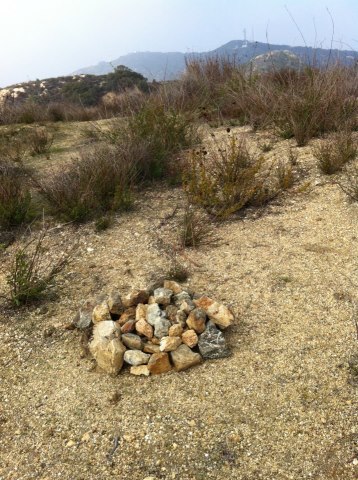
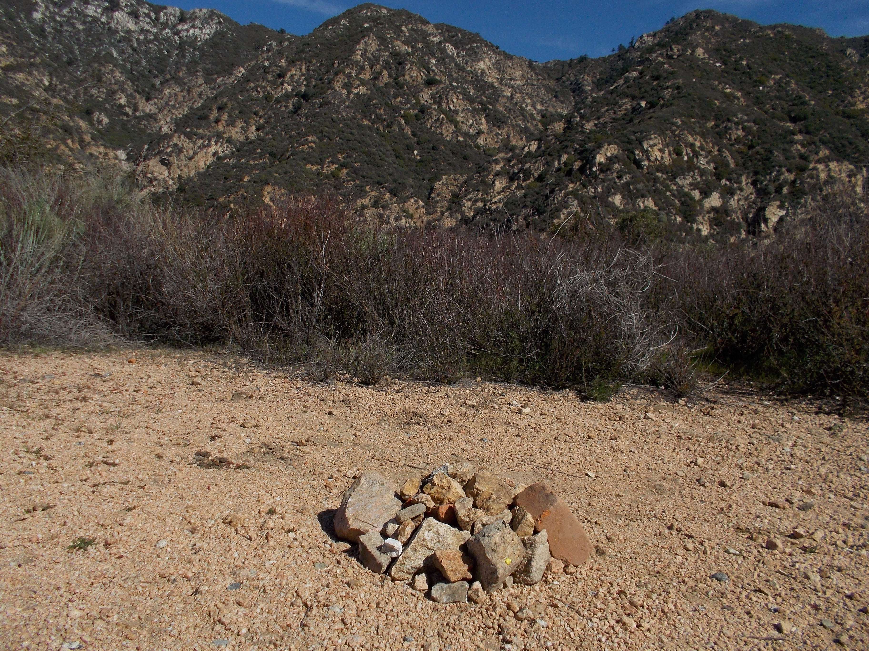
So, I’ve started making some cairns on the peaks of hills and mountains that I’ve visited for the past days and weeks. These cairns had been dedicated to special friends in the ultra running community to wish them good luck in their present condition. Miguel De Alba is supposed to join the 2013 BDM 160 Ultra last January but due to an accident during the “test run” last December, he is now recuperating from a broken bone in his right leg. I have dedicated the cairns that I’ve made in one of the peaks of the Verdugo Mountains in Glendale, California and at the peak of Mt Lukens in Arcadia, California.
Cairn @ One of the Peaks at the Verdugo Mountains For Miguel De AlbaCairn @ The Peak of Mt Lukens For Miguel De Alba
In my visit to the Echo Mountain in Pasadena, California, I made a cairn for my good friend, Andre Blumberg of Hongkong, as a symbol of appreciation to the selfless support to my elite ultra runners for their participation to the Vibram Hongkong 100K Trail Run for the past two years. It is also my way of wishing him good luck for his participation in the 2013 Ultra Running Grand Slam in the United States.
Cairn @ The Peak of Echo Mountain (Pasadena, CA) For Andre BlumbergAnother View of the Cairn For Andre Blumberg
If ever you will be visiting on these places where I made some cairns for these gentlemen, you are requested to add more more rocks into them.
As I continue in my peak bagging feats, I will be making more cairns and feature their pictures in this blog. Their purpose will be to honor the “gods” of the mountain for them to keep us away from harm and danger and at the same time wish good luck to our hike/trek on the said mountain. And if you happen to see these cairns, you are enjoined to add more rocks into them.
See you on the mountain trails and peaks in the coming days, weeks and months!
In Special Units in the military, you always hear their mantra as, “Train As You Fight”. Among elite runners, their mantra should be “Train As You Race”.
In order to have a quick look and observation on the training & preparation of Gerald Sabal and Marcelo Bautista for the 2013 Vibram Hongkong 100K Trail Run in Baguio City, I have to personally see for myself how their training was on-going with regards to their acclimatization to cold weather environment, altitude training, and feedback about their training program & workout. I went up to Baguio City and see the progress of their training. I had a chance to join in one of their daily workouts.
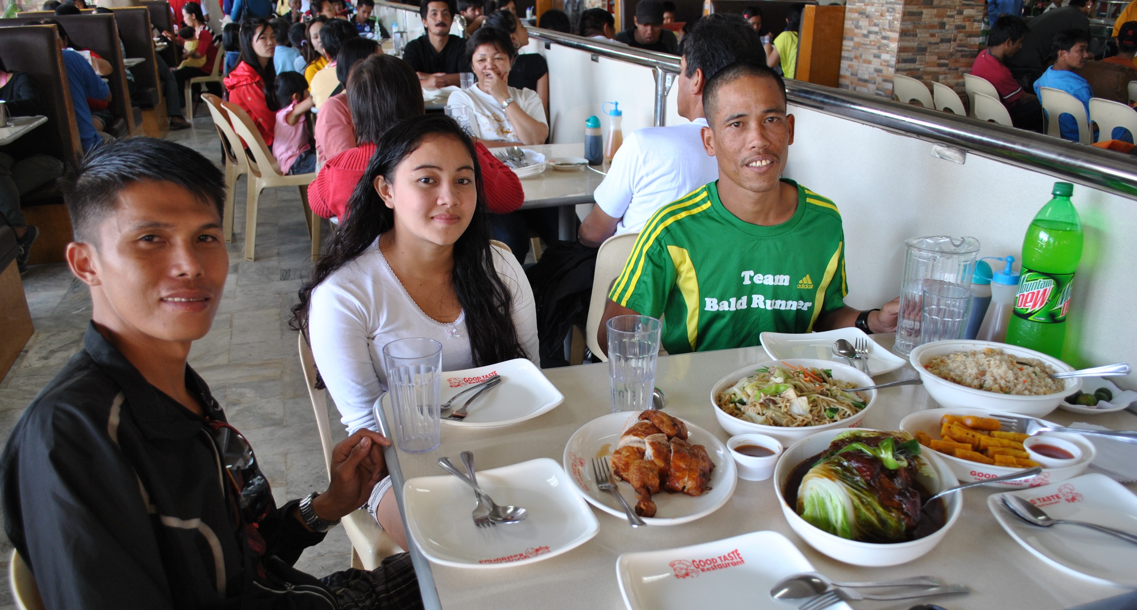
On my first day in Baguio City, I treated them to a lunch and it was there that I was able to give my instructions about their schedule of training; suggested running route in the city and its environs; and gave them their running apparel/kits and their nutrition needs, courtesy of Andre Blumberg who brought the items from Hongkong to Manila during his participation in the latest edition of the TD 100 Ultramarathon Race.
Gerald, Girlene (Wife of Gerald) & Marcelo @ Good Taste, Baguio City
Gerald and Marcelo were instructed to use the Hammer Perpetuum as their source of nutritional needs during the race in order to minimize spent time in stopping in every Aid Station for their food intake. And they should be used to be taking such food mixture/supplement every time they have their daily workouts until it becomes natural for them during the actual race. I clearly explained to the two runners on how to mix the Hammer Powder with water in their hydration bottles and how the mixture is being consumed during the run.
I asked them to run with me all the way to the peak of Mount Santo Tomas on the following day and be able to start using the Hammer mixture as their food intake during the run. We started at 4:00 AM when the temperature in Baguio City was at its coldest at the Marcos Highway & entry to the Green Valley Subdivision. It was still dark and we were able to use our headlights and hand-held flashlight. The two runners were using their respective Salomon S-Lab 5-Liter Hydration Pack where one bottle is full of Hammer Mixture and the other bottle was full of water. As for me, I brought a single bottle of Simple Hydration filled with water and no gels or Power Bars.
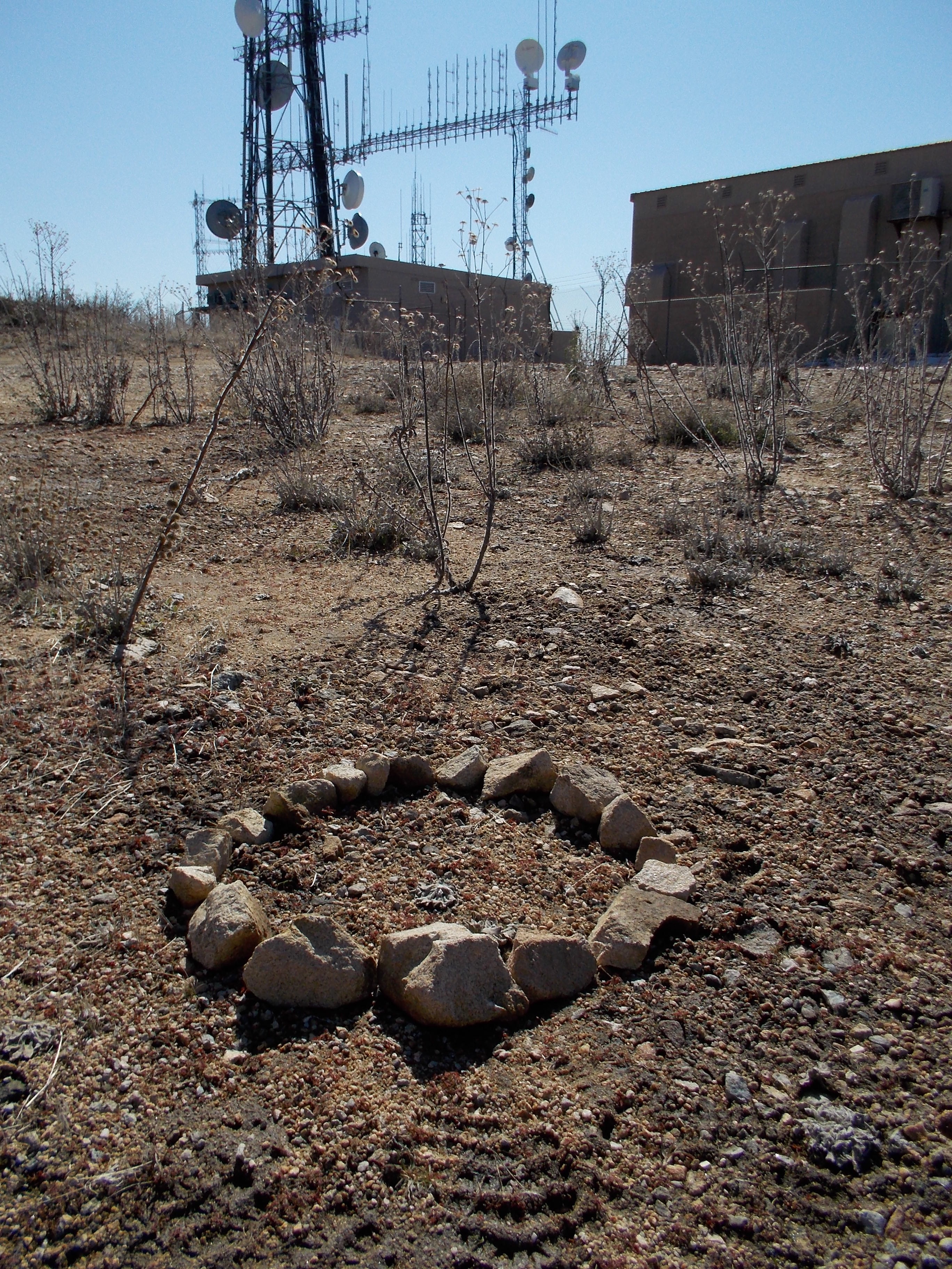
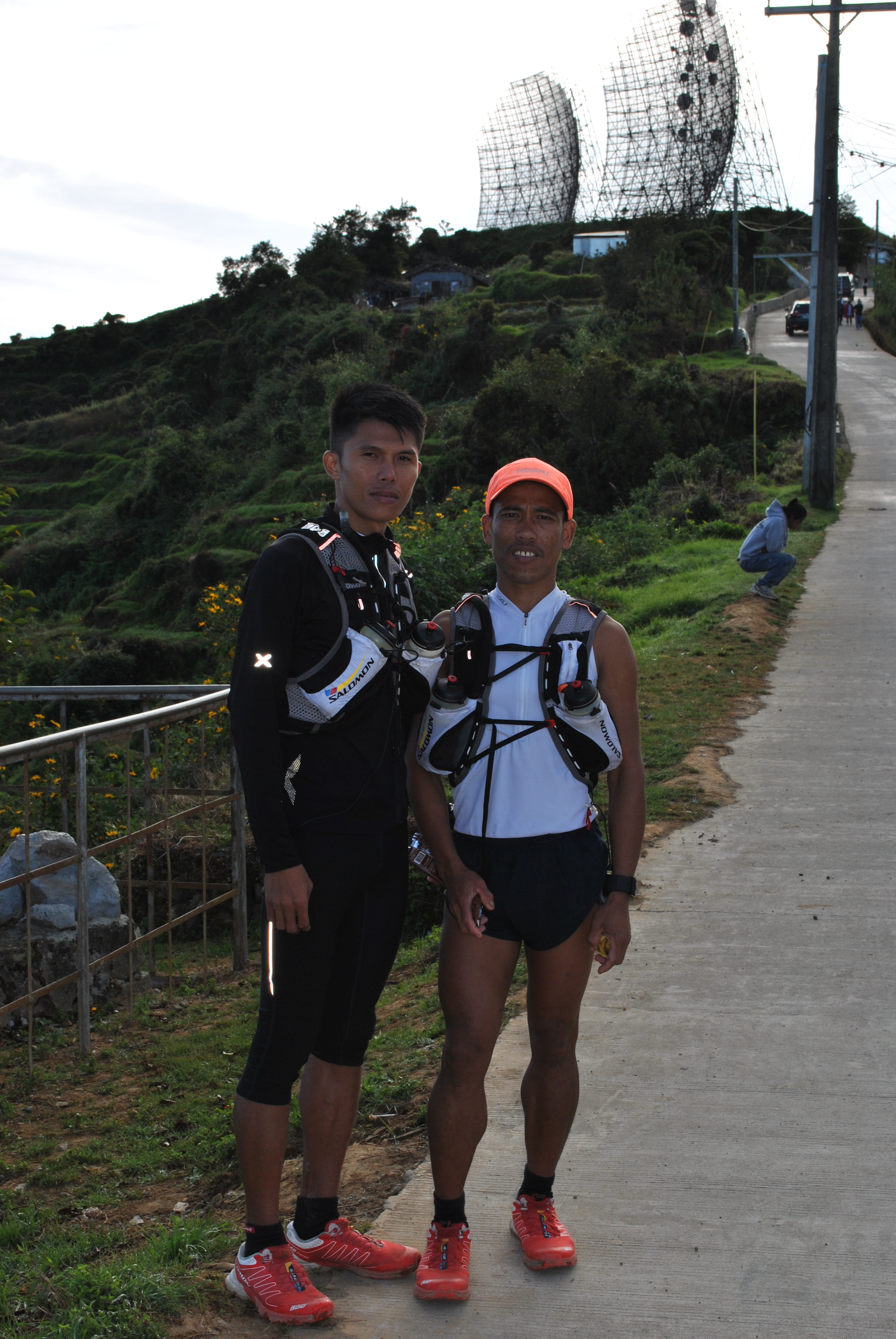
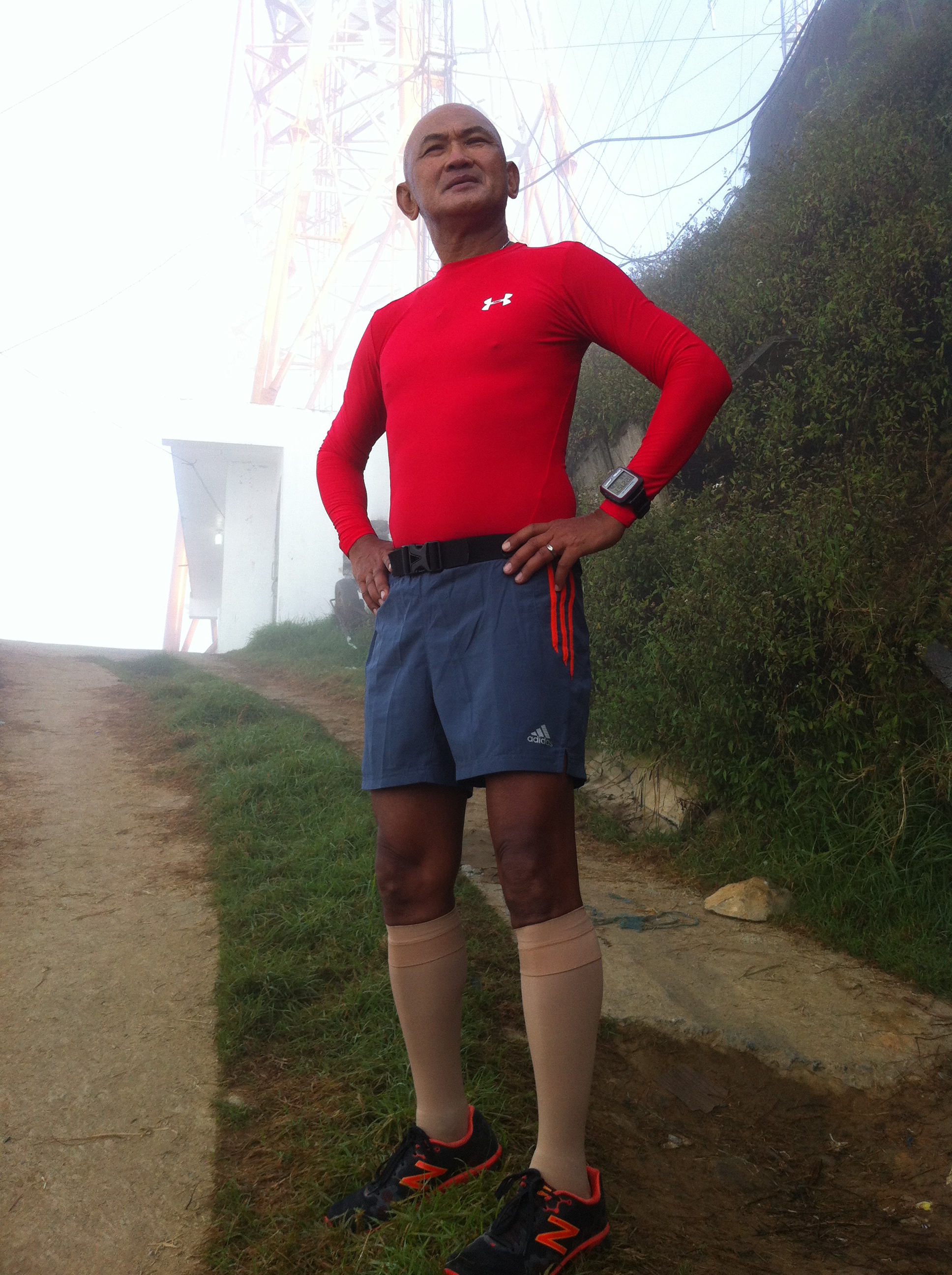
At sunrise, we were already at the peak of Mt Cabuyao and it was cold and windy. We pushed, jogged and brisk-walked, for another 4 kilometers until we reached the peak of Mount Santo Tomas. Before we reached the peak of Mt Santo Tomas, I felt all my fingers were already numbed and could hardly clench my fist because of the cold temperature. The wind had become stronger, producing a distinct loud sound within the surroundings. Marcelo told me that it is always cold and windy as one approaches the top of Mt Santo Tomas. We end up on the building structures and antennae on the peak of the mountain and we had some picture taking moments.
At The Peak Of Mt Santo Tomas (2,250 MASL)
After a few minutes, we started our descent towards Mt Cabuyao but my fingers were still numbed and hard! It was an easy jog in going back to Mt Cabuyao. From Mt Cabuyao, I took some pictures of the two elite runners going down towards Marcos Highway.
My run to the peak of Mount Cabuyao and Mount Santo Tomas officially started my next season of “peak bagging” feats. It is a “short” but long 24K run but it took me 4 hours & 20 minutes for the said workout.
After the workout, I had another chance to get feedback from my runners. They told me that they like the Hammer Mixture and they did not have any stomach issues. I instructed them to use it every time they have their workout until they taper down before the event.
For one of their long runs before tapering, I told them to run the Baguio City-Ambuklao Dam-Baguio City route and be able to use the Hammer Mix during the duration of their run. They were able to follow my instruction and they were able to finish the course in 7+ hours! The feedback was that they liked the Hammer Mix and they did not have any stomach issues.
A good teamwork developed between the two runners for the three weeks that they have trained together in Baguio City. The two shared their strengths and weaknesses and I could see that both runners respect each other. Practically, both runners lived together in one place during the duration of their training.
I can’t consider myself as their Coach & Manager but I think I am a “facilitator” and a “father-figure” to them with regards to their training and preparation for the “Big Dance” in Hongkong. Sometimes, I would still act as a Military Commander & General to them just to stress and give importance to what I am telling them. However, the bottom line of what I’ve been telling them is all about Discipline& Being Focused to their Goal! And impressed on them the mantra, “Train As You Race”!
As these two runners are tapering for the running event and preparing for their departure to Hongkong in one week’s time, I would like to take this opportunity to thank the runners, local & international, who contributed financial support to these two runners and to Andre Blumberg of Hongkong who is the Principal Sponsor for our Pinoy Elite Runners to the 2013 Vibram Hongkong 100K Trail Run. Thank you very much!
This is a very unique BR’s Picture of the Week because it consists of successive pictures that tell a story of the people living in our mountains. For this particular Picture Story, all pictures were taken while I was on my “peak bagging” run at Mt Miyamit, Porac, Pampanga last Saturday. The following pictures are self-explanatory but I would still put some captions to each of them.
Brisk Walking Towards The Top Of The Mountain With A Boy On A Carabao & Sled Infront of Me“Sidestepping” To Pass The Carabao & Sled (Note: “Makahiya” Plants On the Side of the Trail). Kid’s Companions Are On TopWas Able To Join The Group (One Family) & Talked To The Father. The Family Would Stay In The Mountains For Days To Hunt For Food & Harvest Banana Blossoms (Puso Ng Saging) To Be Brought To The Market.Initial Picture With The FamilyThe Whole Family Plus The Kid On The Carabao (Not In The Picture), A Family of 9 Children!
My message in this Picture Story is to remind us that we are blessed with so much material things within our grasps as compared to this Family that I met in the Mountains. Next time that you go to the mountains, find time to engage them in a conversation, the least that you can do if you don’t have a spare of cash or food with you which you can share to them. Maybe, on my next “peak bagging” runs, I will make sure that I will bring something to give to these people in the mountains.
Happiness in a family is not measured by material possessions, title and money but on the unity and bonding of each member.
“High Peak” was the name/title of the Event Page as posted on Facebook by Bong Alindada.
One day after my “Run For Peace” in Negros Island, I was on my way to the Dampay Salaza Resettlement in Palauig, Zambales to experience peak bagging to Mount Tapulao, the highest moiuntain peak in Central Luzon!
I was invited by Bong Alindada and the rest of the Team Maligno whose members are seasoned ultrarunners and peak baggers. Even if I knew I will be directly involved in the “Run For Peace” and will be running a distance of 87 kilometers, joining these ultrarunners will be fun and worth the experience. I would not miss the camaraderie of this team/group.
Planning and Schedule were duly published and discussed on Facebook’s Event Page and the details of the event was set. All was needed was for me to rest the whole day of the 22nd of September (Saturday) and travel early to Palauig, Zambales on the next day.
Dampay Salaza Resettlement Area is the trailhead to the peak of Mt Tapulao. It is a resettlemt area for those families affected by the eruption of Mt Pinatubo in 2001 whose houses were buried by lahar. Most of the families are Aeta tribe and residents in most of the barangays of San Marcelino, Zambales.
If one has a personal vehicle, it can be reached through the Olongapo-Alaminos Highway going north. After passing the Poblacion of Palauig, Zambales, there is a road crossing going east from the Highway before reaching the town of Candelaria, Zambales. An appropriate directional board of the Resettlement Area can be seen along the said Highway. For those who would like to commute by bus, they can take the Victory Liner Bus up to Iba, Zambales and then hire those tricycles at the Bus Station. Although it is more expensive, hiring one tricycle would cost P400 which could accommodate 4 persons. The distance from the Highway Crossing to the Resettlement Area is 7.8 Kilometers.
Team Maligno/Runners To The Peak Of Mt Tapulao (Minus the Photographer)
I met the Team at Dampay Salaza Resettlement Area at 6:30 AM of Sunday, 23 September and with a few minutes of preparation and picture-taking, we were off to the peak of Mt Tapulao.
Mt Tapulao is very popular among Mountaineers. The trek to the peak of this mountain and camping overnight serves as the Initiation Climb for the new mountaineers in almost all the famous Mountaineering Clubs in Luzon & Metro Manila.
Entry To The Trail Is Full Of Rocks Already
A gradual and non-stop incline awaited us as soon as we left the Barangay Hall of Barangay Dampay Salaza which serves also as the Office of the Barangay’s Tourism Office. I think we paid Twenty Pesos per Climber for the Registration Fee and each climber has to register at the said office before he/she climbs the mountain.
What is very distinct and different among the other mountains that I peaked is that this mountain’s trail is full of small, medium, and large rocks. The trail is wide for a 4 X 4 jeep or truck to traverse or travel. I have the suspicion that the PNOC had constructed the trail for their heavy equipment to reach the peak of the mountain. The trail’s construction has a similitarity with that of Mt Natib’s trail to its peak. The PNOC could have been exploring for possible source of energy as these mountains are considered as volcanoes.
These Are The Small Rocks!
I was in the company of my ultra friends from Team Maligno. We had 9 males and one female. I brought two of my men who served as the official photographer and “mule” for our food and water provisions not knowing that there are many sources of water along the trail. Not only I had running friends but also mountaineers as well and those who I have influenced in peak bagging. Bong Alindada served as our guide as he became the “talk of the folks in the barangay” for having registered the fastest time to reach the peak of the mountain a month ago! Team Maligno was in good hands and there was no chance for anybody of us to get lost on the “assualt stage” towards the peak of the mountain.
The people at the Barangay could not believe when we said to them that we would be back before sunset when they noticed that we did not bring any heavy backpacks for our camping needs and extra food & water provisions.
Our ascending pace was very fast! I was left behind with my two men and for having ran a 87 kilometers two days ago gave my leg muscles and knees a “recovery” workout! It’s weird but I think I considered this peak bagging event as my “after ultra recovery workout”. I tried to keep in pace with the last man of the front group making sure that the main group was always on my sight!
Brief Meeting & Talk With “Jeffrey”
Our first “pit stop” is a water source (spring) at Km # 6.3 and we enjoyed our water and food. I shared hard boiled eggs which appeared to have their shells separated from the egg itself due to the jarring effect caused by eggs knocking each other inside a “tupperware” container! It wasn’t a problem, the egg is still an egg and it’s a nice food for endurance athletes if dipped with some salt! I offered some boiled sweet potatoes, too! The next water source is at Km # 9.
We received information from the Barangay Tourism Office that there are at least 75 persons who climbed the mountain the day before and they slept with their camping tents at the base of the peak. Some of the persons are with the DENR who are conducting some studies on the “birds’ habitat & presence” in the area.
Our Pit Stop!Jeffrey With The Smiling Team Maligno
While we were resting in our first “pit stop”, an adult Aeta who appears to be taller than the usual height of the tribe, reached our resting place and he was carrying half sack of rice and other supplies for the DENR personnel at the peak. We invited him to join us, shared our food and tried to engage him in a conversation. He brought down to the ground the things that he was carrying and we had some conversation with him. I asked his name and he said that his name is Jeffrey. I immediately said that I am naming him as “Jeffrey Mutai”. He looks like he is from Kenya! He works as a porter for climbers and he is being paid P 300.00 per day with free food from his client-climber!
As we resumed our trek to the peak of the mountain, Jeffrey was left behind as he took some rest. However, after a few minutes, he was already on our tail. Jeffrey’s sight behind us became our gauge if we are dropping our pace during our trek!
Rocks Galore To The Peak
As we got nearer to the Bunkhouse and getting higher in elevation, we met some of the climbers who are already going back to the resettlement Area/Barangay’s Tourism Office after staying overnight at the peak. We usually greet them as we meet along the trail with the usual “Good Morning” greetings. However, one of the climbers going down was aked by one of us if there are many more of the climbers still at the peak and we got a different answer! He replied that we still have a few more kilometers to walk/trek before we reach the “bunkhouse” which is the last kilometer plus hundred meters before the peak of the mountain. Weird answer, ha?
Pine Trees Ala-Baguio CityAnother Group Picture Near The Abandon Guardhouse
Getting nearer to the peak became positive as we started to see big pine trees, ala-Baguio City and the presence of lots of piles of chromites ores on the sides of the trail. This could be the reason why the trail is so wide and established that there is a local mining as cottage industry in the place! We could see the clouds enveloping the mountain and we felt cooler and more refreshed. We had smiles on our faces that finally, after running/jogging and brisk walking for 14 kilometers, we will be able to reach the Bunkhouse and be able to replenish our water ration from the spring thereat.
The sight of the Bunkhouse brought happiness in all of us. But it was a temporary one as we have to make the final assualt to the peak of the mountain. All of us knew already what to expect. It will be a very steep single track trail and some slippery ones, too! One Kilometer plus a change of 400 meters was the distance of the assualt climb which we targetted to be done in One Hour!
The Bunkhouse. On the Right Side of the Pine Tree is the Assualt Trail To The Peak
I was the one who led the group during the Assualt with Bong on my back! We could have made it to the peak in less than one hour but those DENR nets which acted as a BIG FENCE on the peak of the mountain (used to catch flying birds) prevented us from doing so. But we were blessed to have reached the peak with no clouds and the sight all around us was magnificent!
Group Picture Before The Assualt!
The group selected a place where we can lie down/sit or eat our light ration at the peak. I selected a place that was inclined and took a nap after eating some food. I did not mind the heat of the sun as I was totally tired from the trek. I think I was able to get a nap for about thirty minutes. I guess, it took us 4 hours plus to reach the top of the mountain from where we started, a distance of almost 16 kilometers!
Finally, At The Peak!Foreground Is The Hole At The Peak
Our peak bagging was not complete without some pictures as evidence that we peaked the mountain. Bong selected the place with the big hole at the peak (where story abounds the digging of an object the hole and it was transported out of the mountain through a helicopter!) and later with the whole Team Maligno clinging on the branches of the ONLY Oak Tree at the Peak! Our picture on that tree was EPIC in proportion! It showed so much fun on the faces of each of the member!
I am The Photographer!Best Picture Of The Team!
It was time to go down from the peak! Of course, it was faster but it started to drizzle and later, it would rain. Once we reached the Bunkhouse, we replenished our water supply and started our way back to the Resettlement Area.
Descending the mountain is very hard when it is raining! Why? The whole trail and the rocks are slippery. Being positioned from behind of the group, I was able to see members of the group falling down with their butt hitting the ground. I jokingly asked each member what was their score for the number of times that they slipped to the ground. Some had score up to 4X until they reached the starting area! Well, my score was zero!
Last Picture Shot Before Our Descent (Note: Birds’ Trap Nets On The Right).
We passed more of the campers who started to leave the peak earlier than us. And they are amazed to see that we hopped and jogged on those slippery ground and rocks! It was fun doing this on the first half of our descent from the Bunkhouse but it became harder when fatigue seeps in to our body with the rocks come in contact with our shoes. Pain on my feet and leg muscles were already becoming unbearable. Everything was mental postive attitude on my last 5 kilometers of the trek down to the Resettlement Area.
My The North Face Trail Shoes I used was a mess! The whole sole of both shoes just came off as we were ascending to the peak. On our way back, I removed those dangling soles and took extra careful on my footing and tried to be light. My trail shoes failed and this was my fourth shoes with the same brand that its soles gave up and got separated from the whole shoes! It’s time to cease from buying this kind of trail shoe brand!
My The North Face Shoes Before Reaching The Bunkhouse
Before it became dark, I finally reached the Resettlement Area with the “front group” cheering on me. I could not smile to them because I was already in pain and was simply exhausted! They knew the solution as I approached them—they offered me an ice-cold 1.5-liter bottle of Royal Tru-Orange! I was already smiling after I saw what they have prepared for me!
Already Smiling After A Shower At The Barangay Tourism Center
All the members of the Team Maligno reached the Resettlement Area safe and happy after reaching the Tourism Office! We proved to the Barangay folks that we can go up to the peak and be back to the Barangay for the period from sunrise to sunset!
I could no longer count how many mountain peaks I’ve bagged since I’ve started doing this kind of adventure!
Directional Sign Along The Olongapo-Alaminos Highway & Crossing To The Resettlement Center
Two weeks after, I was already in the Office of the Provincial Governor of Zambales telling the good Governor and his staff of my proposal to conduct a running event to the peak of Mt Tapulao as part of my FKT (Fastest Known Time) Mountain Runs to be scheduled for next year!
See you at the Starting Line!
(Note: Mt Tapulao’s Peak is 2,040 Meters Above Sea Level)
This is the real stair climbing workout. It is not stair climbing using the StairMaster or any machine at the gym that mimics stair climbing.
Since I’ve been going to the mountains for the past months, I was trying to find out a simple workout that mimics how I would scale on those mountains. Aside from the fact that I’ve been trying to strengthen my quads and calf muscles through squats and lunges and/or stationary cycling, I wanted a short workout that could be easily accessible to where I am staying.
Lo and behold! I thought of doing the stairs where I am staying. I am presently residing in a 8-storey condo with 32 steps of stair per floor/storey and starting from the ground floor up to the 8th floor, I would be able to step on 256 steps. If I do 10 sets or reps, I would be able to make 2,560 steps upward and another 2,560 steps downward! On my average easy pace, I could complete the 10 sets of stair climbing in 1:20 to 1:30 hours!
To make the workout more challenging, I would put on my backpack filled with water bottles and other items inside it that would make it weight to 10-15 pounds or more. I still do a minimum of 10 sets up to a maximum of 20 sets with the backpack. I do this workout twice a week!
This workout makes my quads and calves cry in pain most especially when I incorporate some speed in my steps towards the top floor using my weighted backpack and going down to the ground floor. But I know, this workout will make me a stronger runner and hiker in my “peak bagging” activities.
If you are staying in a condo, you can do this workout once you wake up in the morning or before/after having your dinner! If you are working in a high-rise building, you can do this workout during your coffee break time or during your Facebook time or lunch time.
A day after the 1st KOTM Trail Marathon in Mt Ugo, Kayapa, Nueva Vizcaya, I was on my way to Mt Timbac, the 3rd highest mountain peak in Luzon with a registered elevation of 2,717+ meters above sea level coming from Baguio City. Mt Timbac is ranked as the #9 highest peak in the entire country.
Since the mountain is located along the Halsema Highway which is the only paved access road to Bontoc, Mountain Province, I was confident that I could reach the place in a few hours and be back to Baguio City before dinner time. If there such thing as “day hike” for a mountain peak, there is also a “day trip” where you can visit a certain place and be back to where you came from before evening.
As per my research, the intersection that goes to the trailhead towards the peak of Mt Timbac is located near the vicinity of DPWH Kilometer Post #55, which means that one has to travel 55 kilometers north of Baguio City in order to reach the place. I estimated to reach the place in 1 1/2 hours.
I was surprised to notice that there are lots of changes along the road to La Trinidad as compared during those times when I have to attend my ROTC training at the Benguet Agricultural College in La Trinidad, Benguet during the late 60’s (1968-69).
During my early years in the active military service, I had two occassions of travelling along the Halsema Highway aboard a Volkswagen “Sakbayan” with Bontoc, Mountain Province as the place of destination. I could still recall the highway to be very narrow that only single lane for vehicles were used most of the portions of the road. The road was full of sharp rocks and it was too dusty. The trip was very slow and long and our body was being “massaged” throughout the trip.
I am glad that the Halsema Highway is already paved/cemented and with two lanes. Although there are still patches of construction for repairs along the road, the trip was easy and relaxing. However, one has to prepare to see that the road you are looking ahead is getting progressively higher and higher up to the peak of the next mountain! This is where you will appreciate what the DPWH had done to this part of the country.
Two kilometers from Mt Timbac’s foot or road access is the View Deck which is marked as the Highest Point of the Highway System of the Country in an elevation of 7,400 feet above sea level (2,242 meters above sea level). From this view deck, you can see Mt Pulag, Mt Tabayoc, and Mt Ugo.
After almost 1 1/2 hours of easy driving, we reached Km Post #55 and after asking some of the locals along the road, we were able to turn right to a road that leads to the mountain’s peak. The single lane road is concrete and it leads to an elementary school where I parked my vehicle. I was able to meet Alexis Estenor hiking down along the way as he and his friends just came from the peak of the said mountain.
From the school, the walk to the peak was very easy as most of the 1st kilometer is paved and the other half is an uphill trail with rocks used as steps. The hike has a distance of 2.1 kilometers which took me 30 minutes to reach the peak. I was guided by two kids who belong to the families cultivating some of the vegetable gardens along the slopes of the mountain.
After taking some pictures and short conversation with the kids, I was on my way back to my parked vehicle. My GF 305 watch registered 2,737 meters above sea level as its peak elevation.
While driving down to reach the Halsema Highway, I saw a group of farmers harvesting their potato garden and I asked the owner if I can buy some. For a P 50-bill, she gave me an estimated 4-5 kilos of her potato harvest!
My trip would not be complete if I did not stop at the Halsema Highway View Deck where the Highest Point of the Country’s Highway System is located. I took some pictures of the mountain ridges all-around this place and thought of possibilities that the place could offer in terms of tourism, economy and development.
Driving back to Baguio City was an easy one. My “recovery hike” after the 1st Mt Ugo Trail Marathon and 4th “peak bagging” experience were done!
(Note: The 2nd to the last picture is the peak of Mt Timbac as seen from the Halsema Highway View Deck. Tha last picture is the peak of Mt Pulag as seen from the Halsema Highway View Deck)
March 29, 2012 @ Mt Natib, Barangay Tala, Orani, Bataan
Mt Pulag is more than twice as high as Mt Natib in Barangay Tala, Orani, Bataan.
Exactly 14 days after Mt Pulag’s “peak bagging”, I was on my way to Bataan and try find out if I can reach the peak of Mt Natib within half day. It started with a simple Personal Message on Facebook with a “friend” who happens to be the Military Commander of the Northern & Central Luzon Areas and then later with telephone calls to two subordinate commanders whose areas are within Bataan and other provinces in Central Luzon. After 12 hours from the time I sent a PM on Facebook, everything was set and I could run and hike up to the peak of the famous Mt Natib the following day.
Two days before joining the 1st King of the Mountain Mt Ugo Trail Marathon, I was on my way to Balanga, Bataan to visit the Commander of the 7th CMO (GWAPO) Battalion, Colonel Benny Doniego, who gladly received and escorted me to the 73rd DRC Detachment in Barangay Tala, Orani, Bataan where I would start my run & trek to the peak of Mt Natib. I was surprised that he prepared a breakfast for me and my staff! It was nice to see Col Doniego after I’ve retired from the military service for the past almost 5 years. He happens to have served under me when I was assigned at the 7th Infantry Division in Fort Magsaysay.
Not only did Colonel Doniego prepared a breakfast for me, he even went to the extent of providing me with one officer and one team/squad of soldiers (9 soldiers) as my escorts. His parting words for me was that there will be fresh coconut juice and my favorite dish of “sinampalokang native na manok” waiting for me as soon as I arrive running/trekking from Mt Natib for lunch! Wow! What a nice incentive to finish the activity in a faster mode!
With military escorts infront and on my back, I started my run/hike from the Philippine Army Detachment at 9:30 AM. From the starting point, everything was going uphill until I reached the place which they call “Pinagbutasan” which happens to be a wide man-made “pass” or “breakthrough” on a mountain so that a trail was made on the other side of the mountain. There is a steel gate/fence that protects the unnecessary use of the trail from 4-wheeled vehicles. From this point, you could see the nice vista and mountains/ridges overlooking the towns of Morong and parts of the Subic cove.
The trail is wide with hardened soil/earth on the first part of the route from “Pinagbutasan” and then it transforms to a trail that has lots of stones and rocks. I was informed that the trail was made/constructed by PNOC on their digging explorations on the said mountain years ago. It is worthy to note that Mt Natib is considered as a dormant volcano and I have the suspicion that PNOC was looking for a geothermal source on the said mountain due to its nature as a volcano. Geothermal is one of the alternative sources of power energy. Unluckily, PNOC was not able to find any geothermal source in the said mountain as evidenced by their exploration diggings covered with concrete cement. You can ask your guide if you are interested to find out where these diggings are located.
On this rocky & stony portion of the trail, it is mostly covered with trees and plants. The terrain is not steep and I was able to jog on most parts of this shaded portion of the trail.
It was cloudy and cold during the day that I had my trek on this mountain and I could hardly see its peak. What went into my mind was to be able to reach its peak, take some pictures, and then descend from the mountain peak for my warm and tasty lunch!
After the shaded portion of the trail, an opening of two small hills beckons with tall grasses with the trail on the middle. I could only see the clouds that cover the mountain and the tall grasses as I proceeded with my power hike. More tall grasses on both sides of the single-track trail and then I was told by our guide to turn left towards a clearing.
There was a clearing which they call “Area 1”. It is actually a camping site which is good for 3-4 tents and located on the very base of the peak of Mt Natib. There is a number “06” marker on one of the trees around the campsite. This site is the start of the “final assualt” to the peak of the mountain!
Aside from the soldiers as my escorts, I had with me two of my elite runners who were there as my personal photographer and assistant. We started our final climb towards the peak with me located in between my two runners on single file. The runner in front of me would clear the way for branches and twigs/thorny vines and the other on my back was there to make sure that I will not roll down from the mountain if I tripped or slipped on the rocks. It was raining then and the trail was slippery. It was more slippery on the rocks that we have to use extra effort to push our feet up to the trail.
After 50 meters on the trail, the first runner suddenly stopped and started to retrace his footings backwards. He told me that there is a snake infront of us crossing our path. I told him to get nearer to it and find out where the head is located! He hesitated! I was the one that went nearer to the snake and it was really big but we could hardly see its head! I was about to hold its tail and yanked the whole body out of the thick foliage but I thought that it was not my main “mission” to look for snakes. I am not a hunter and I am not looking for food or for a pet! I am after the peak of Mt Natib, stick and stay focus to the very simple mission! In a split of a second, I instructed my runner on my back to give me my camera and I was able to get a close-up picture of its tail portion as the snake went to the thicker foliage part on the side of the trail.
After the snake encounter, we went higher and higher with more caution. Then, we were faced with a “vertical wall” which is about 10 meters! It’s good there is a nylon rope where one could hold for a nice rapelling experience! However, the challenge was for the the foot anchor to be firm on every leg push and strong arms pull on the rope towards the top of the wall so that there would be no slipping or sliding due to the slippery wet rocks brought by the drizzle. Going up on top of the wall was very slow and deliberate. There is no point of making it fast to reach the top of the wall. Patience is needed in this kind of situation.
After the first wall, there are rocks as part of the trail that I had to crawl just to be sure that I would not slip. Patience paid off. But there was another mini-wall (about 5 meters) with a rope (again!) to be climbed to its top. After passing this last wall, everything was a smooth uphill and in about 50 meters, I was greeted with the Peak/Summit Marker of Mt Natib! Finally, I was able to “peak bagged” Mt Natib!
Three of us, my two runners and I, were the only one who reached the peak. Our escorts were not able to make it! We spent our almost 20 minutes taking pictures and trying to survey the whole area of the peak. There was no view to be seen from the top of the mountain as it was raining and we were covered with clouds. However, I was able to take note of the trashes being scattered on the different places on top of the mountain. In my estimate, the peak can acommodate at least 8-10 tents (solo or double) and there seems to be no attempt to clean and maintain the area. I said to myself, I will be back to clean the mess here on the peak of Mt Natib in the days to come!
We reached the peak in 3 hours. And we were all in a hurry to go back to where we started at the Philippine Army Detachment. However, we needed more patience and more deliberate footing as we went down the two “walls” and rope rapelling. We spent more time in going down on the “final assualt” portion of the mountain. As soon as we reached “Area 1”, we started to jog and brisked walked. Since we did more on jogging and power walking as almost parts of the trail were descending, we made our way to the detachment in almost 2 hours. My GF 305 recorded an elevation data of 1,296 meters at the peak of Mt Natib!
The trip was concluded with a sumptous late lunch at the Battalion Headquarters with Colonel Doniego and I told him of my plan of going back to the peak of Mt Natib during a day with a nicer weather in the company of my running friends. I also told him of my plan to conduct Operation Linis on the said mountain with an specificied date. It will be April 15, Sunday! His answer was affirmative!
Well, this proves that I am already addicted to “Peak Bagging”!
Next….Mt Ugo…in the 1st King of the Mountain Trail (42K) Marathon…after two days!
On my way to Kayapa, Nueva Vizcaya along the Benguet-Nueva Vizcaya Highway, I saw a directional sign that points to the Mt Pulag National Park. It was at the PNP Station in Barangay Gurel, Bokod, Benguet that changed my intention of going to Mt Ugo in order to recon the Marathon Route of Jonel’s race.
I said to myself, “Mt Pulag is the highest peak in Luzon and I am already here, maybe, I’ll drop by first on this mountan and then proceed later to Mt Ugo!” As I turned left at the intersection, there is no point of turning back. I am back again to my habit of being a “risk-taker”!
The road from the Gurel Junction to Barangay Ambangeg, Bokod is almost completely paved as some parts are still on road cementing construction. The road is winding and uphill and I did not notice that I traveled 9 kilometers up to the DENR Office/Police Detachment.
I am not a trained mountaineer and I am ignorant on the protocol of climbing peaks and mountains in the country. What I needed was the guts to ask questions and have the patience to listen…and listen intently! This thing was entirely new to me but I guess, I quickly learned some of the basic protocol in mountaineering. Everything boils down to “common sense” and respect to the culture and beliefs of the people in the community.
Although it was already almost 4:30 PM when I was given the usual briefing presentation by the DENR about the mountain I am going to visit, the sun was still shining brightly and I have to deal with the fact that I am taking my time from taking one step of the process at a time. There is no point to worry if my trek to Mt Pulag’s peak will be realized the following day.
After the usual briefing and payment of permit fee, additional information was provided by the people assigned in the said office. Permit fee per person is P 200.00 but you will be issued two receipts from the Bureau of Treasury. Since I am not with a group of mountaineers on a group tour, the office personnel advised me to contact a certain “Julius” to bring me to the Ranger Station in Ambangeg aboard a motorcycle. The fee for one-way is P 300.00 per person.
I was also advised to get a guide at the Badadak Ranger Station, the place where I am going to start my trek to the peak of Mt Pulag. The guide’s fee at the Ambangeg Trail is P 500.00. I found out later that the guide’s fee is more expensive if the entry point is from the Akiki Trail which is obviously a longer route to the peak. It can cost you P 1,800.00 but one guide may be good for a group of 6-7 hikers. It is a “must” to get a guide in trekking in most of our mountains in order to avoid of being lost.
The problem with Barangay Ambangeg is that there is no place to stay for the night! The nearest place where there is a dormitory-type of accommodation is at the Poblacion of Kabayan—a good 1 1/2 to 2 hours drive of unpaved road! There was no other choice but to go to Kabayan. The adventure continues and it is a part of touring and knowing the place for the first time.
It was already nighttime when I entered the quiet town of Kabayan. Only one establishment was still open with food to be cooked and ordered at 7:00 PM. Our overnight stay in the one and only dormitory in town cost us P 200.00 per person! One has to sleep on two-deck beds with basic mattress and pillow. The dormitory has a communal bathroom and toilet with separate bathroom for the ladies. There was no hot water or shower but the ever-reliable pail and “tabo” were there!
On that night that we stayed in the said dormitory, two European couples were with us and four males working with a company that delivers and sells bulbs and lighting fixtures to every barangay in the towns of Benguet. A simple greetings and smile was enough for the foreiners but for the people I’ve met along the trip, being an Ilocano was already an asset during my trip as the people in every place in Benguet could easily understand my dialect. I could easily communicate with them!
We left Kabayan after a simple breakfast and we arrived in Ambangeg, Bokod after almost 2 hours of slow driving and taking pictures along the way. I saw the entrance to the Akiki Trail along the road and I found out that this is the harder entry towards the peak of Mt Pulag. I took some pictures of the place and promised myself to be back and make an assault to the peak using this entry.
“One-time deal” parking fee in Ambangeg cost me P 100.00 from 10:00 AM up to the time we left the place. I think, it was already 7:00 PM. I left my car and I was in tandem with Julius on his motorcycle on our way going higher to the foot of Mt Pulag. It was my first time to be riding in tandem on a motorcycle ride and Julius was complaining that I was doing some unnnecessary movements with my butt. He didn’t know that the bumpy road made me fly a few inches from the saddle/seat and the continous butt-jumps made me nervous that I might fall off from the motorcycle! My light weight made me unstable riding on a motorcycle on rocky/bumpy road!
Wow! That was the most horrible ride I’ve experienced! The 9+ kilometers with rocks and slippery mud on the uphill path could be the longest 40 minutes of my life! Finally, we arrived at the Ranger Station in Sitio Badadak, Ambangeg. The Ranger assigned in the station was having his Lunch Break at 11:30 AM and there was no person to whom I would show the receipt that I paid as my permit fee. I just thought that I would see the Ranger once I’ll be back from the peak of the mountain.
After 15 minutes of waiting for a guide, Edgar came forward and signed up to guide me in my trek to the peak of Mt Pulag. I told Julius and company to return to the Ranger Station to pick us and bring us to where my car was parked at exactly 5:30 PM. Julius was surprised and made a statement that with the limited time, I might not be able to reach the peak of the mountain with such time. I just smiled at him and told him that I’ll be waiting for him at the Ranger Station on the said time.
Mountaineers (with packs) usually reach the peak in 4-5 hours from the Badadak/Ambangeg Ranger Station. Well, Julius and the rest of the people at the Ranger Station didn’t know that I will be running, jogging, trotting and brisk walking to and from the peak of the mountain! And so I did!
At 4:30 PM, I was back at the Ranger Station! I was able to reach the peak of Mt Pulag by “assualting” it through its steepest approach trail (last 50 meters) in 2 hours! Spent 15-20 minutes on the peak for picture taking and moving around the topmost portion and admiring the damp brown dwarf bamboos. The temperature at the peak was freezing as it was raining and the peak was covered with clouds! In a few minutes, my fingers were numb and my body started to feel the cold temperature. I kept on walking on the open space of the peak but the freezing temperature would make my body shiver.
On my way to the peak after passing Camp 1 and before entering to the “Mossy Part”, I was able to meet a couple, a male foreigner and a Filipina, and I greeted them while I was jogging. As soon as I reached the place they call “Grassland”, I met a group of 18 campers/mountaineers with their guide and porter. This is the same group that I would catch up at Camp 1 on my way back to the Badadak Ranger Station. This group is from Lufthansa Airline Company. I would found out later that these campers whom I met along the Ambangeg Trail had been on the trail for 2 days as they have started their climb from the Akiki Trail and they had camped at a placed called “Saddle or Camp 3” before reaching the peak of Mt Pulag.
While waiting for Julius and his motorbiking friends to arrive at the Badadak Ranger Station, I asked Edgar, my guide, where I could buy some snacks—native hot coffee and some local bread. Edgar invited me to his parent’s house and I enjoyed sitting at a place where it is near their stove. Julius and company arrived with a delay of almost one hour. It was okey with me since I had a nice time talking to Edgar’s folks and brothers. The 30-minute downhill ride to the center of Ambangeg took a longer time due to faulty brakes on the motorcycle I was riding. After some stops and quick-repair/disassembly & assembly of rear brakes & tire, I was able to reach my parked vehicle. It was already nighttime.
My trip to Kayapa, Nueva Vizcaya has to be postponed and I decided to do my “peak bagging” to Mt Ugo on Race Day itself for the 1st King of the Mountain Mt Ugo Trail Marathon. I was already tired. I need the comfort of a nice bed in Baguio City. After a 2 1/2 drive to Baguio City, I was able to take my late dinner and I was in my favorite hotel room in Baguio City—taking an ice-cooled bath and sleeping under soft and clean linens!
This was my first experience of “peak bagging” on the highest mountain peak in Luzon and 3rd highest in the country! For the round-trip distance of 15K from the Badadak Ranger Station to the peak of Mt Pulag and back, I was able to register a time of 5 hours to include my stay at the peak and “pit stops” in every Camp that I reached. I started from an estimated elevation of 2,400 meters and was able to reach the peak of the mountain where my GF 305 registered an elevation of 2,940 meters!
After some research in the Internet and other blogs, I found out that there are events in Europe, particularly in England where mountain trail runs are called “fell running”. And there are also trail running events that would last for 24 hours or more where the number of mountain peaks are considered and counted to be reached as part of the route. Reaching those peaks is called “Peak Bagging”!
This is my own way of applying such event that I’ve learned from “fell running”. The procedure is so simple. Target one mountain peak at a time, run and walk through it, take some pictures at the peak, and run/jog downhill to where one has started. This is the “travel lite” of mountain trekking or climbing without the intention of camping overnight on each mountain. With my first experience of “peak bagging” at the highest mountain peak of Luzon, I guess, a new frontier and form of trail/road running is born!
Now, if you ask me if I enjoyed my experience? You bet! “Peak Bagging” is addictive!!!
Surprisingly, the road distance from the Gurel Junction along the Benguet-Nueva Vizcaya Highway up to the peak of Mt Pulag through the Ambangeg Trail is exactly 25 kilometers! And if you double the distance by going back from the peak of Mt Pulag to the Gurel Junction, the total distance would be a good 50 kilometers!
This could be the most challenging 50-Kilometer Ultra Run in the country!


You must be logged in to post a comment.