Mt Kalbo


“Kalbo” means Bald.

Three years ago on my first trek to the peak of Mt Natib, the highest mountain in the Bataan Natural Park, I noticed a mountain peak without any trees or vegetation on it as seen on the right side from the trail going to a place called “Binutas”. The “peak” is located on a nearby mountain ridge and it is very noticeable because of its bare appearance.

Rounded Peak Of Mt Kalbo

Due to curiosity, I asked the guide if the peak has a name or something that would identify it among the local people in the area. The guide said that the mountain popularly known in the area as “Mount Kalbo”! I laughed and asked from the guide if he is really serious, and he said, “Yes”. The mountain peak is really called “Mount Kalbo” among the locals living in the area and I thought that someday I would be able to peakbag the said mountain.

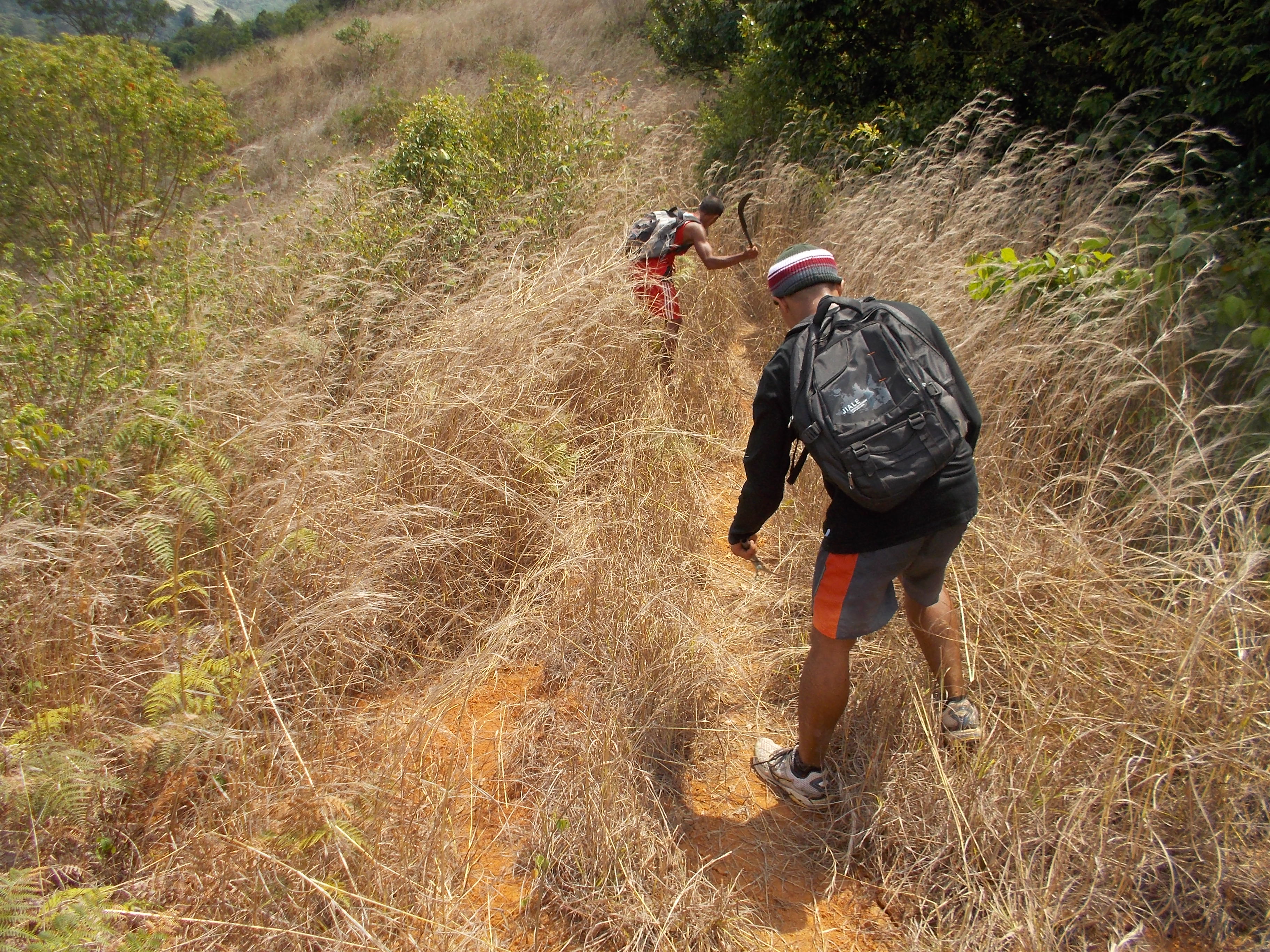
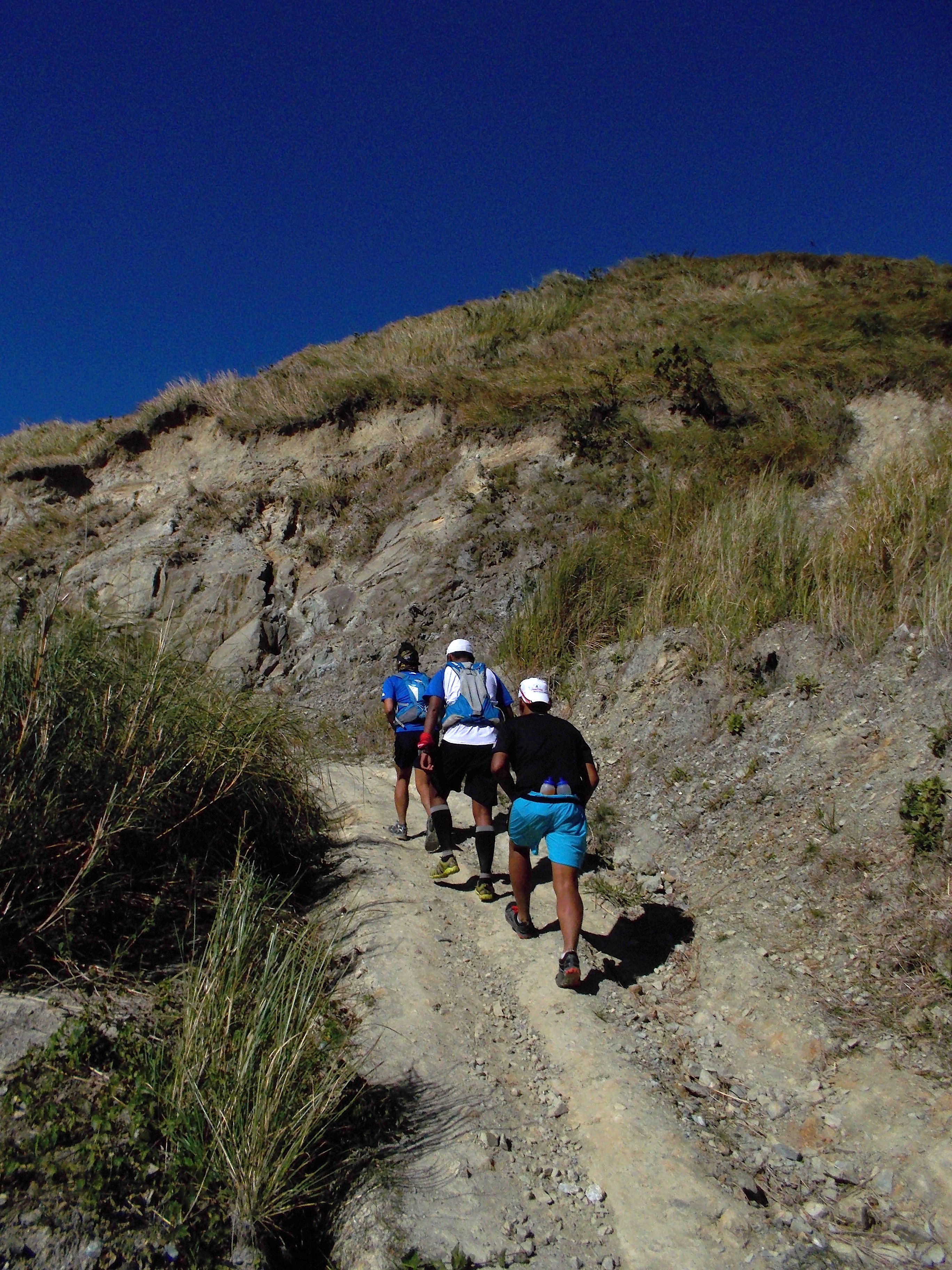
After two years, I was able to trace a trail from my Playground to the peak of Mt Natib. But the trail is very challenging that it took us some time to really re-trace the trail which is being used by the hunters in the area. I brought some of my running friends to join me in trying to connect the trail from where I stopped with my training partner up to the place called “Binutas”. Due to the lack of time, we decided to turn-around and returned to where we started. It was a good 30K trail blazing experience among friends.

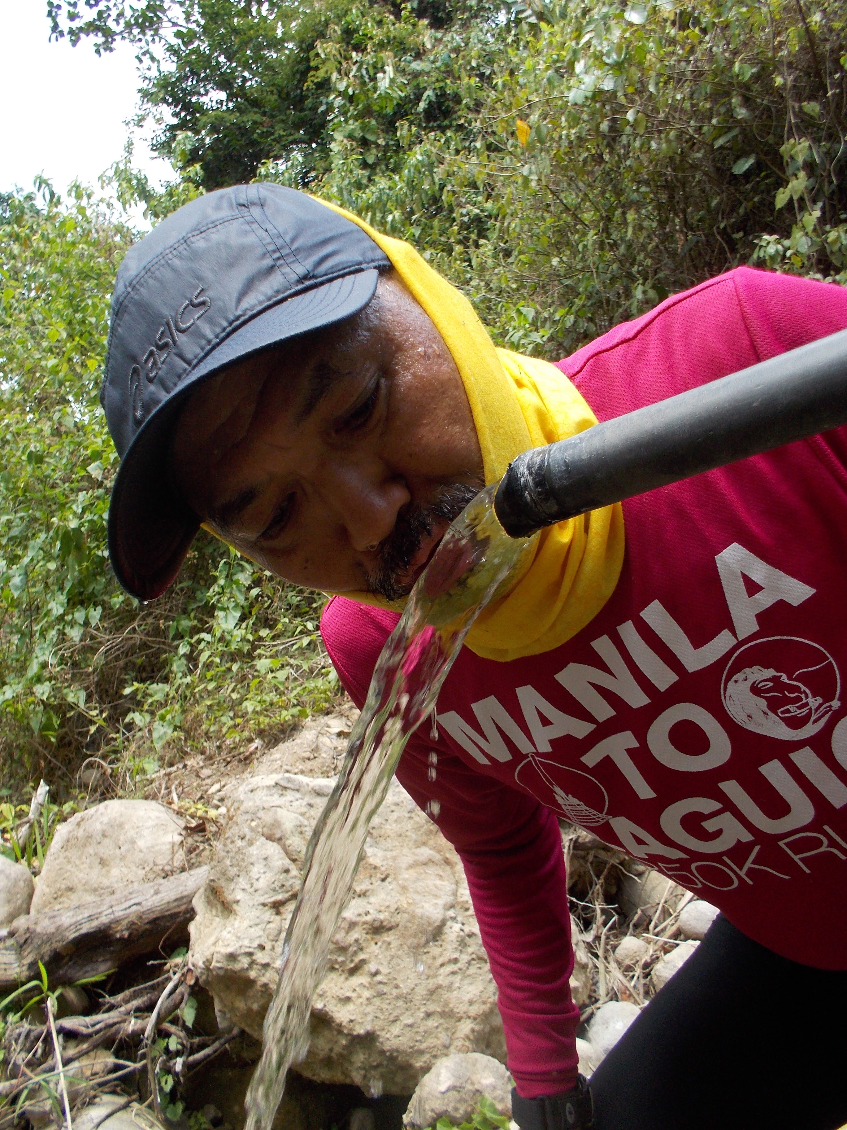
Finally, after starting very early in the morning, my training partner, Danin and I were able to reach “Binutas” after coming from the North side trail approach to Mt Natib, which means that we came from the Subic/SBMA area. It was a 40K total of “out and back” course and we came to know that we only had to trek for about 5 kilometers from the point we turned around with my running friends. On our first successful attempt, we had to deal with tall grasses; vines, and plants with thorns on those rarely-used trail.

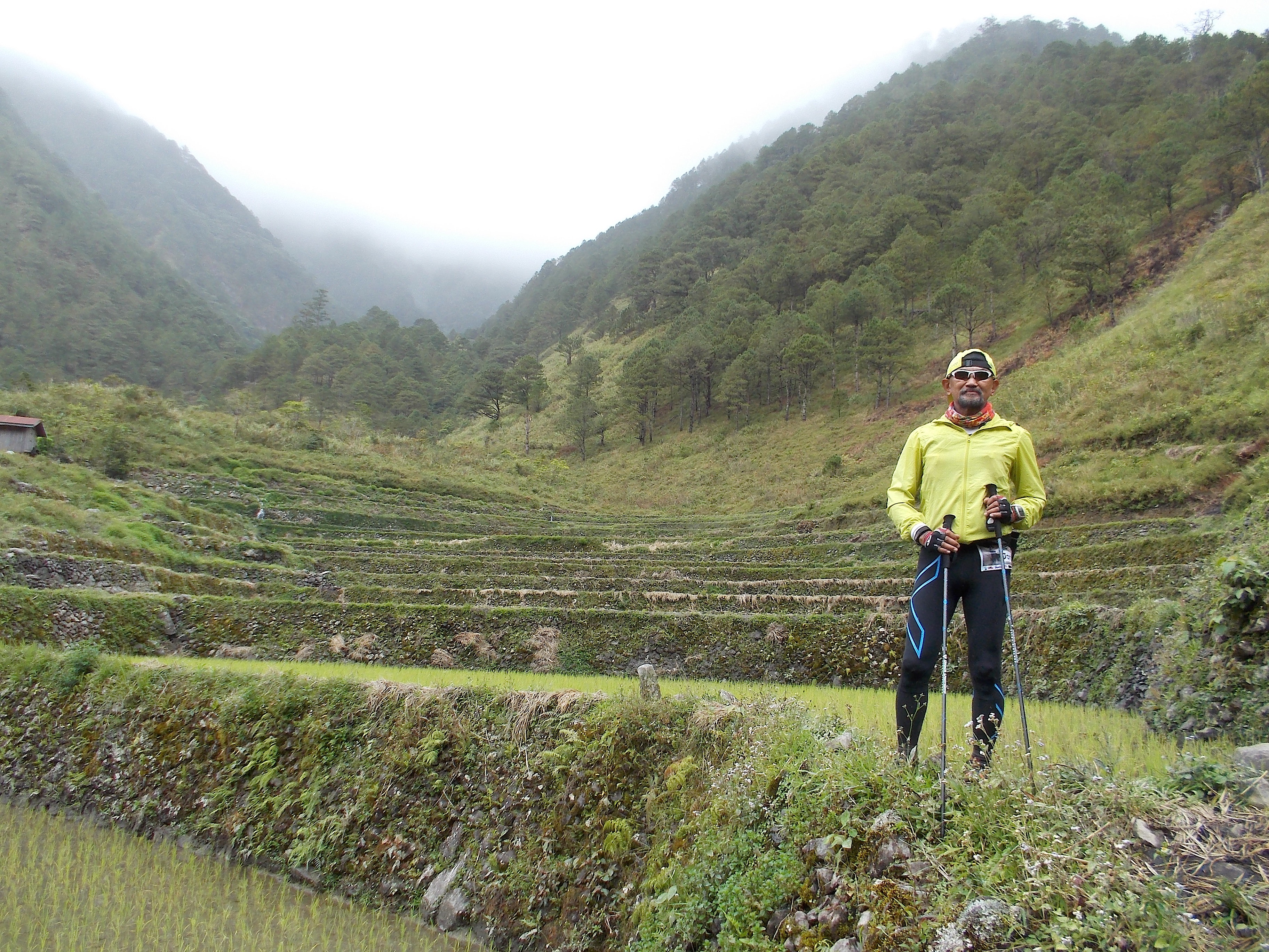
To my surprise, on the last 1.5 kilometers before reaching the place called “Binutas”, we could see the peak of Mt Kalbo which is situated on the right side of the trail. I think my training partner and I would pass the foot of the peak for about 5-6 times already on our regular training runs to “Binutas” and Mt Natib since we discovered that Mt Kalbo was within our reach.

Playground BRAVO 50K Trail Run Participants
@ "Binutas", Near Mt Natib During The Playground BRAVO Race
@ “Binutas”, Near Mt Natib During The Playground BRAVO Race

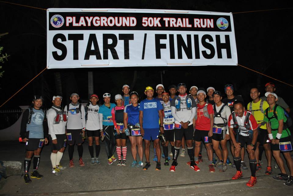
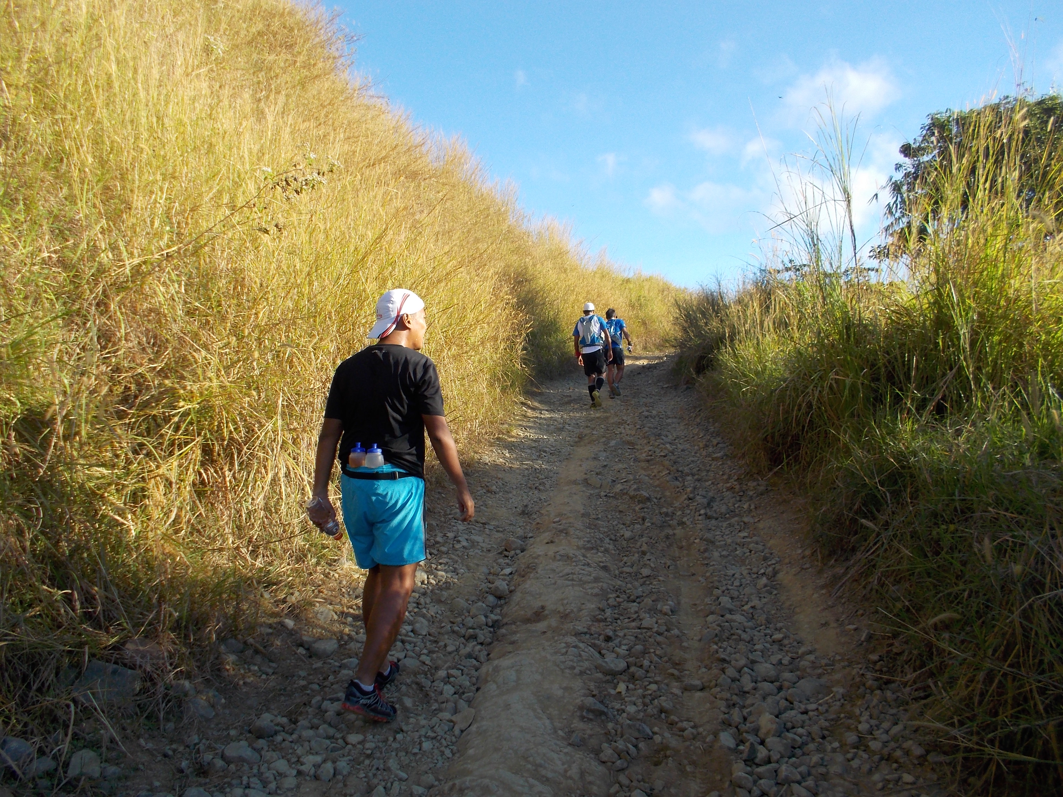
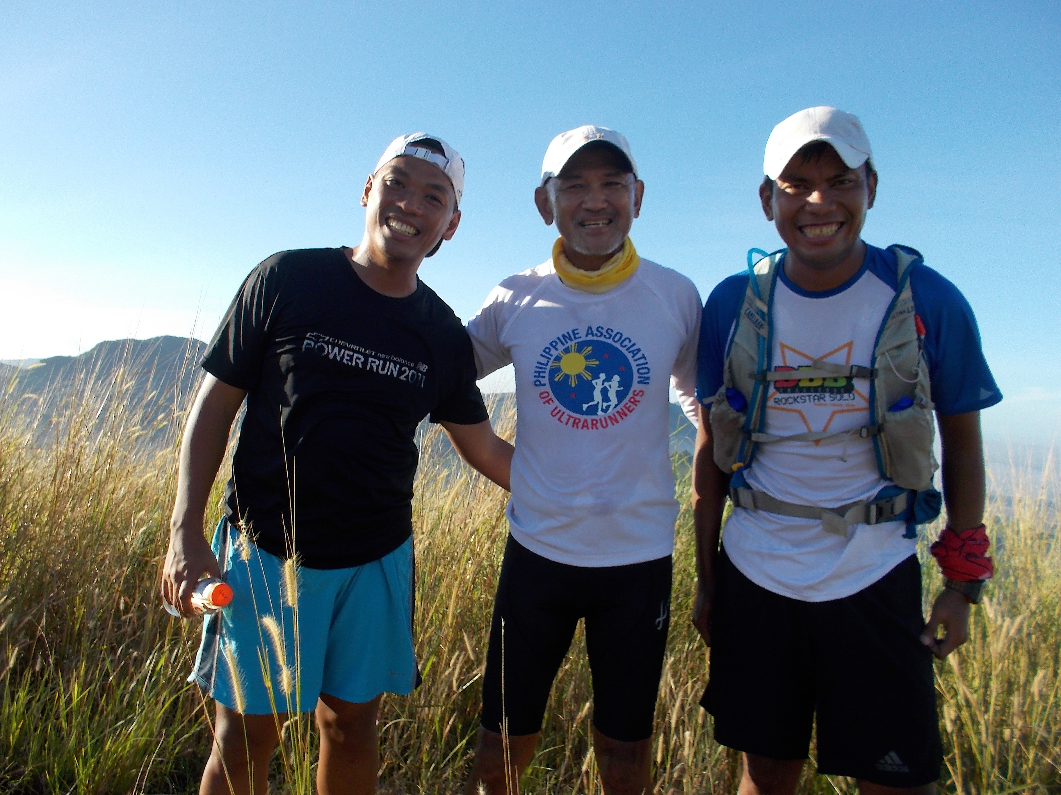
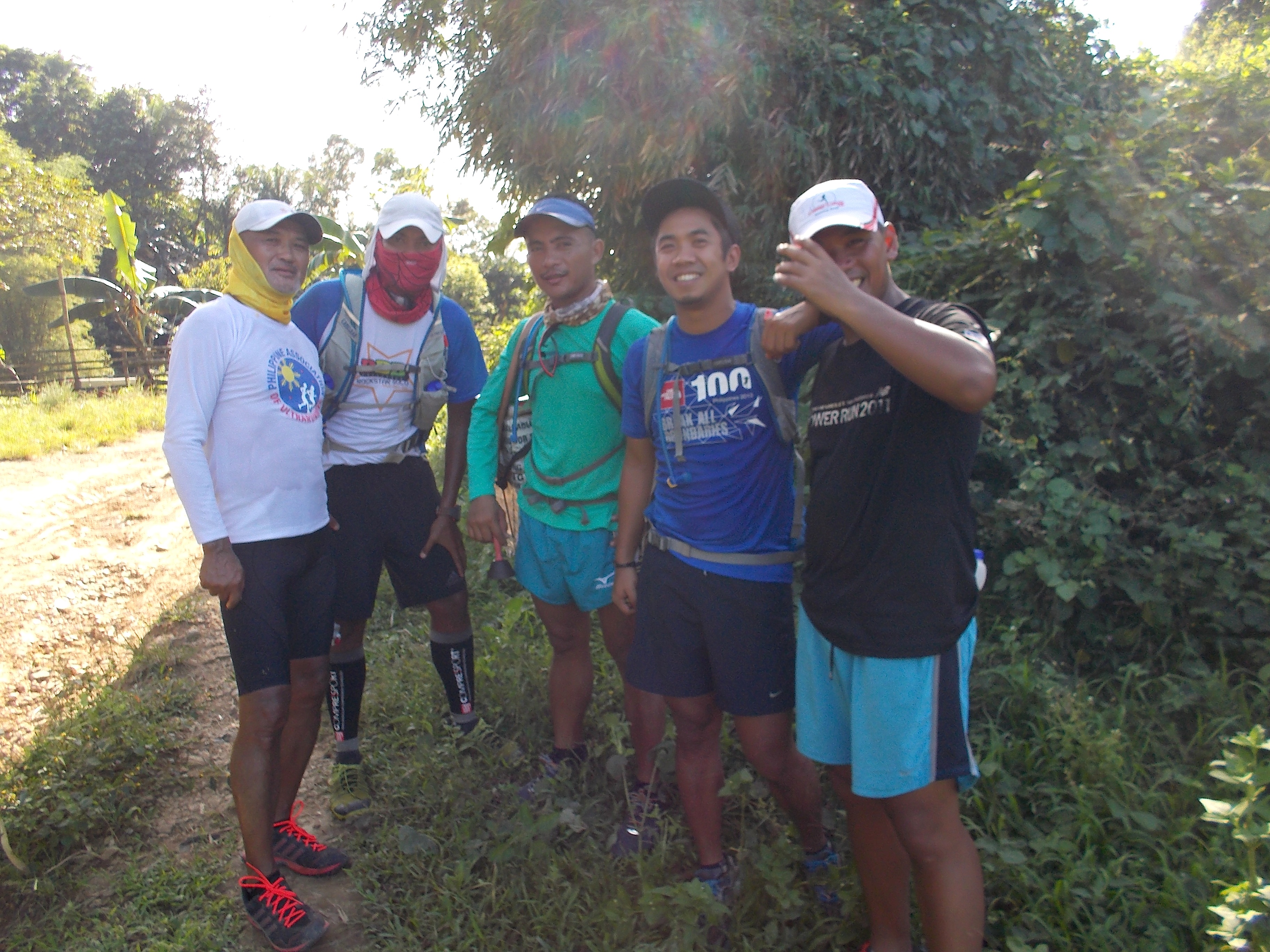
Two weeks ago, four (4) brave trail runners attempted to run the North Trail Course to Mt Natib in a trail race dubbed as “Playground BRAVO 50K Trail Run” which is actually a 51-Kilometer “out and back” course and only three (3) runners finished the course. Although they experienced the usual sharp blades of grasses, thorny vines and plants; and leaf-covered vines on the ground that traps ones feet, these runners were able to pass the tests of this trail with flying colors, not to mention the brutal elevation and the heat within the area.

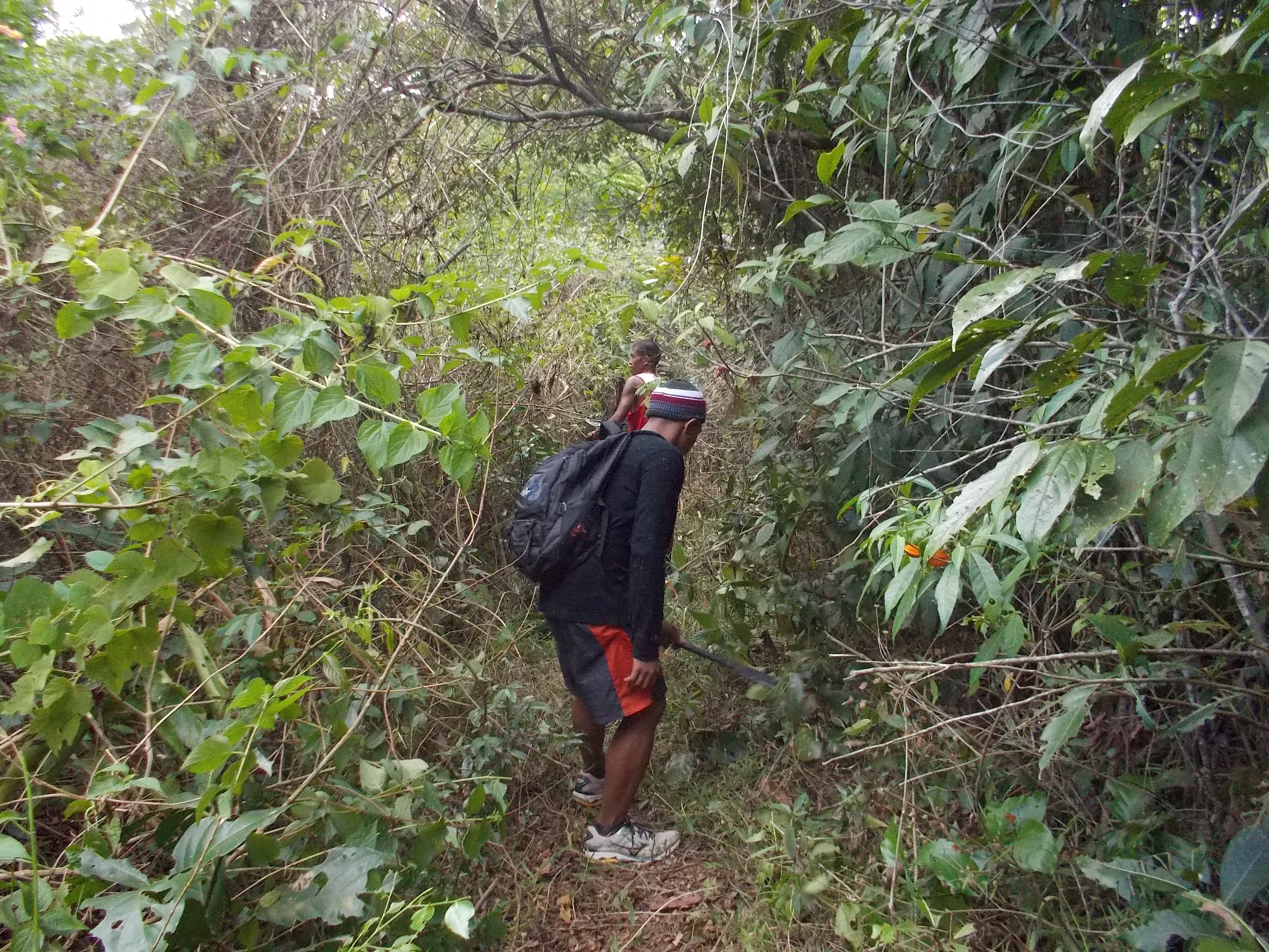
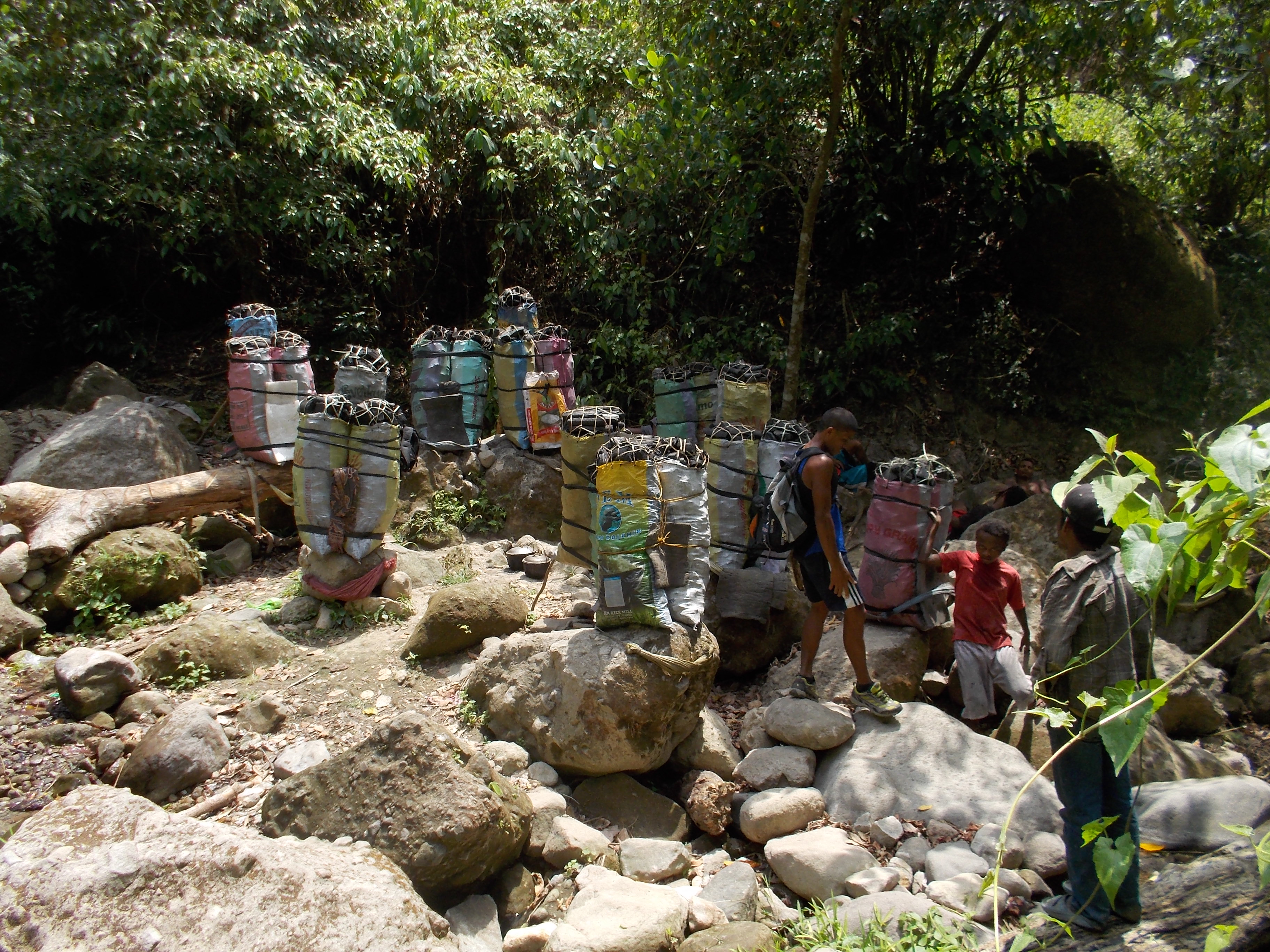
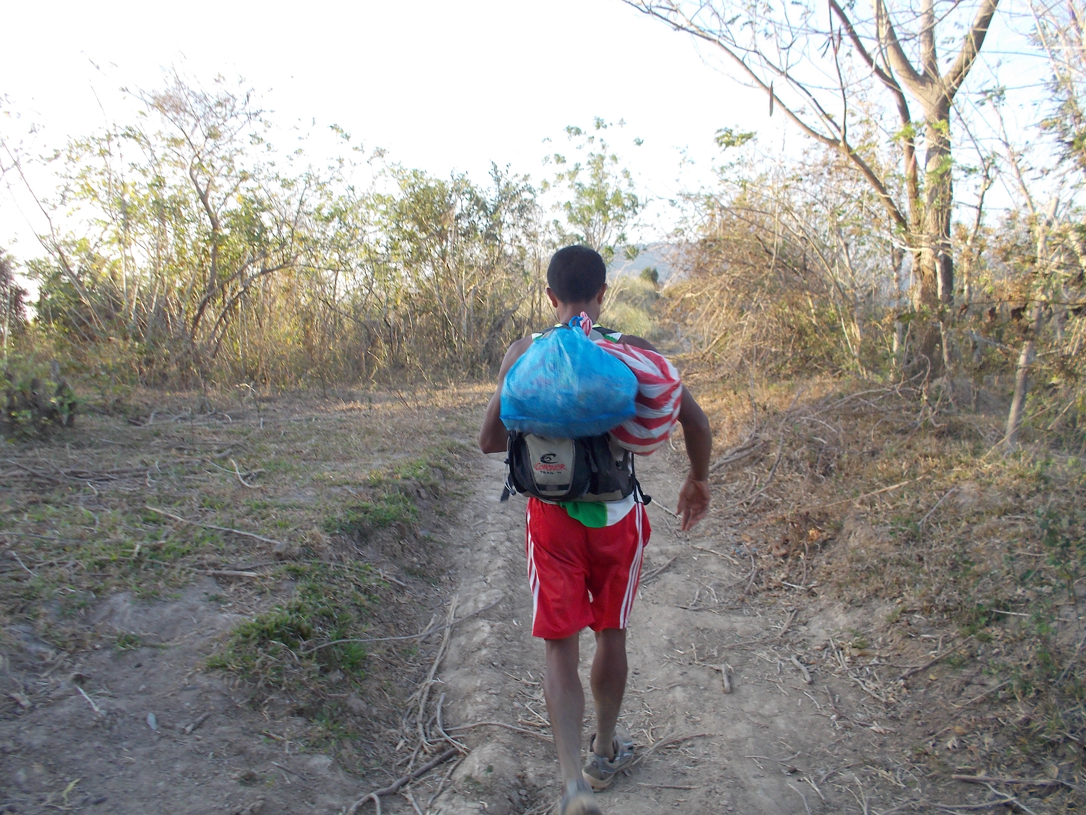
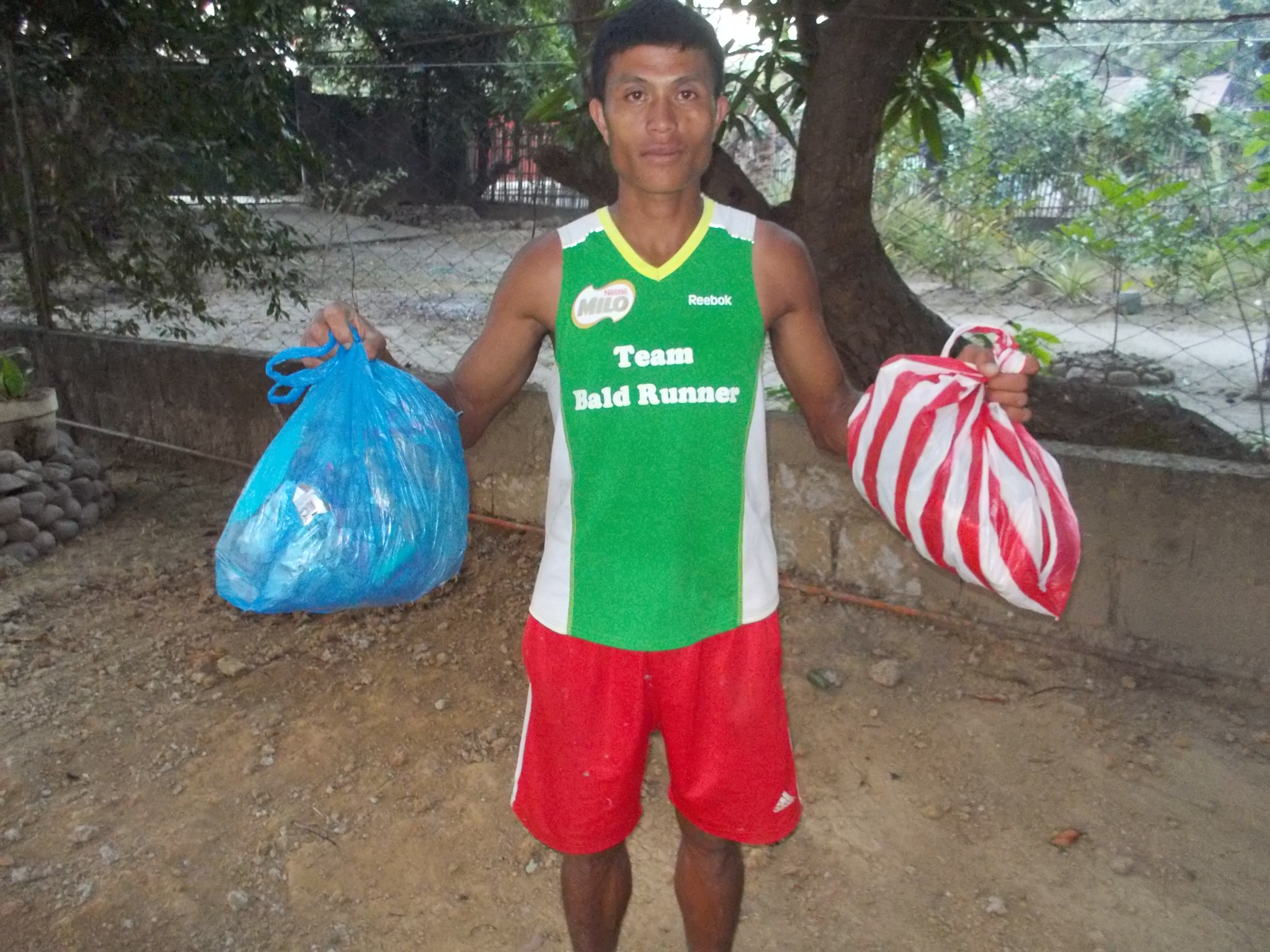
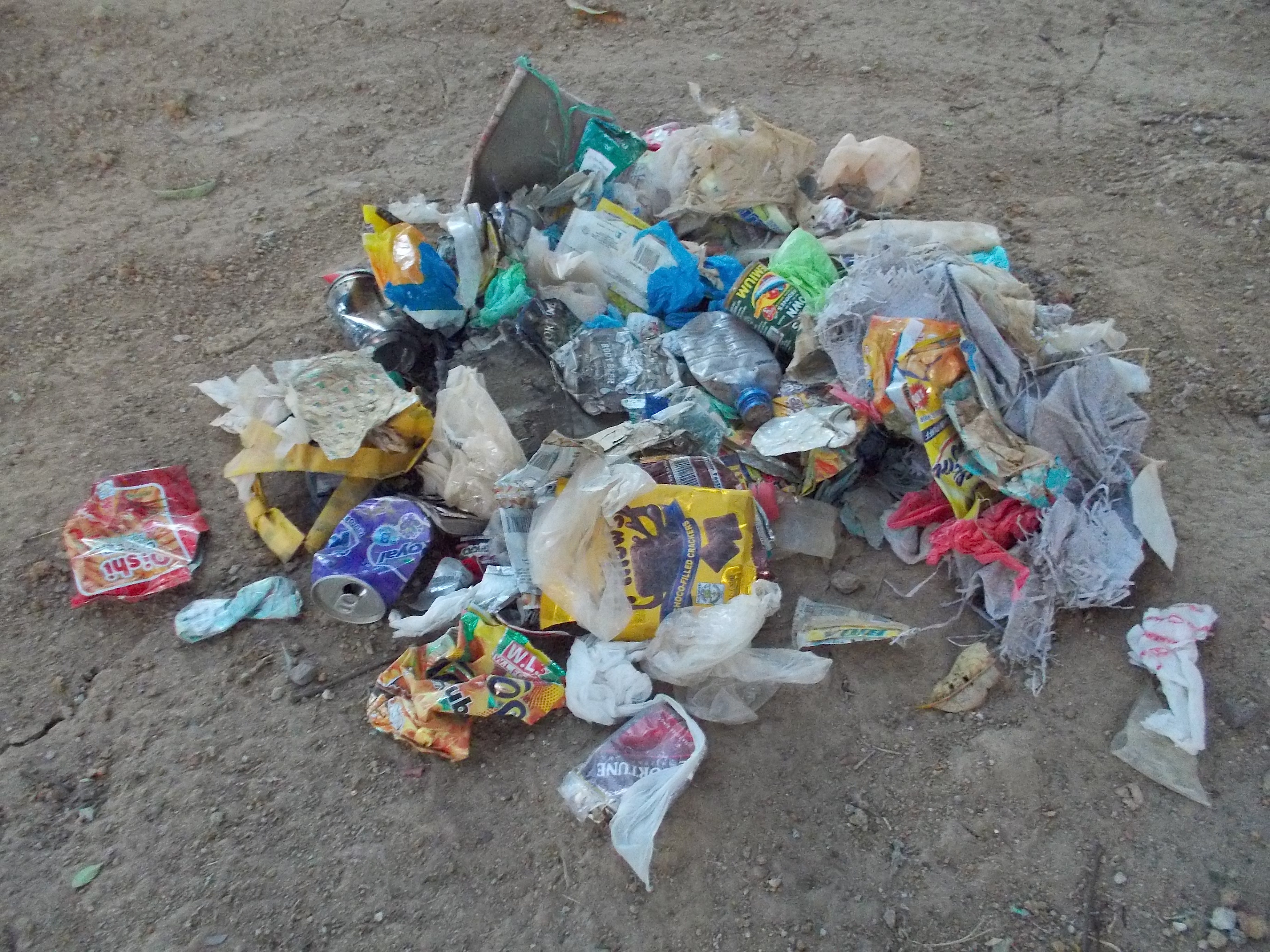
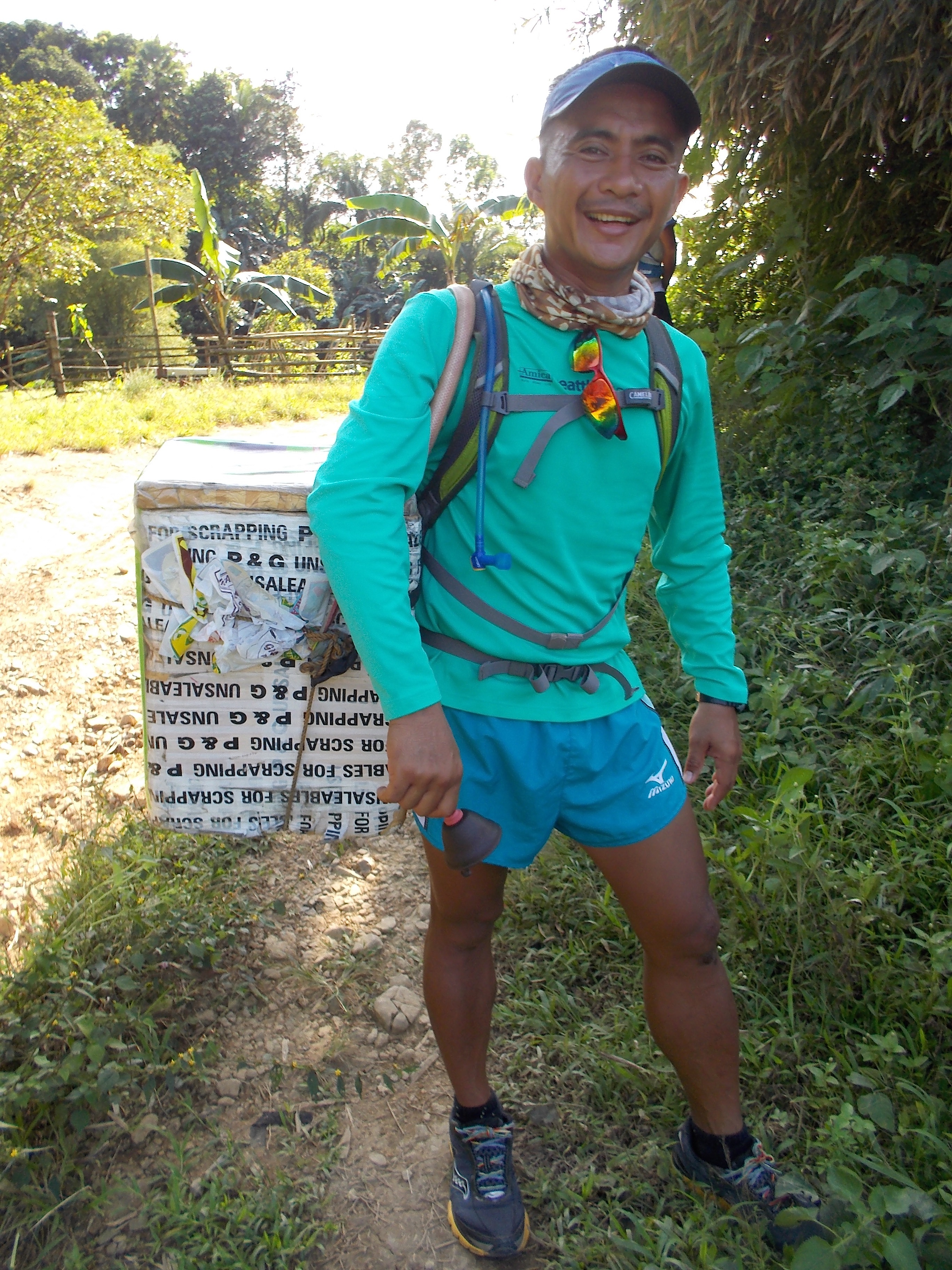
In my desire to clean the trail from these grasses, vines, and thorny plants, I brought two of my men with their bolos and foods/drinks to once and for all clean the trail for easier running and trekking.

Cleaning Of The Trails

After one hour of cleaning the trail within the vicinity of the foot of Mt Kalbo, I finally decided to instruct my men that we have to “peakbag” it and trace whatever trail that can be seen towards its peak. From the trail where we were cleaning, everything was an assault towards the pointed part of the mountain.

More Cleaning In The Forest

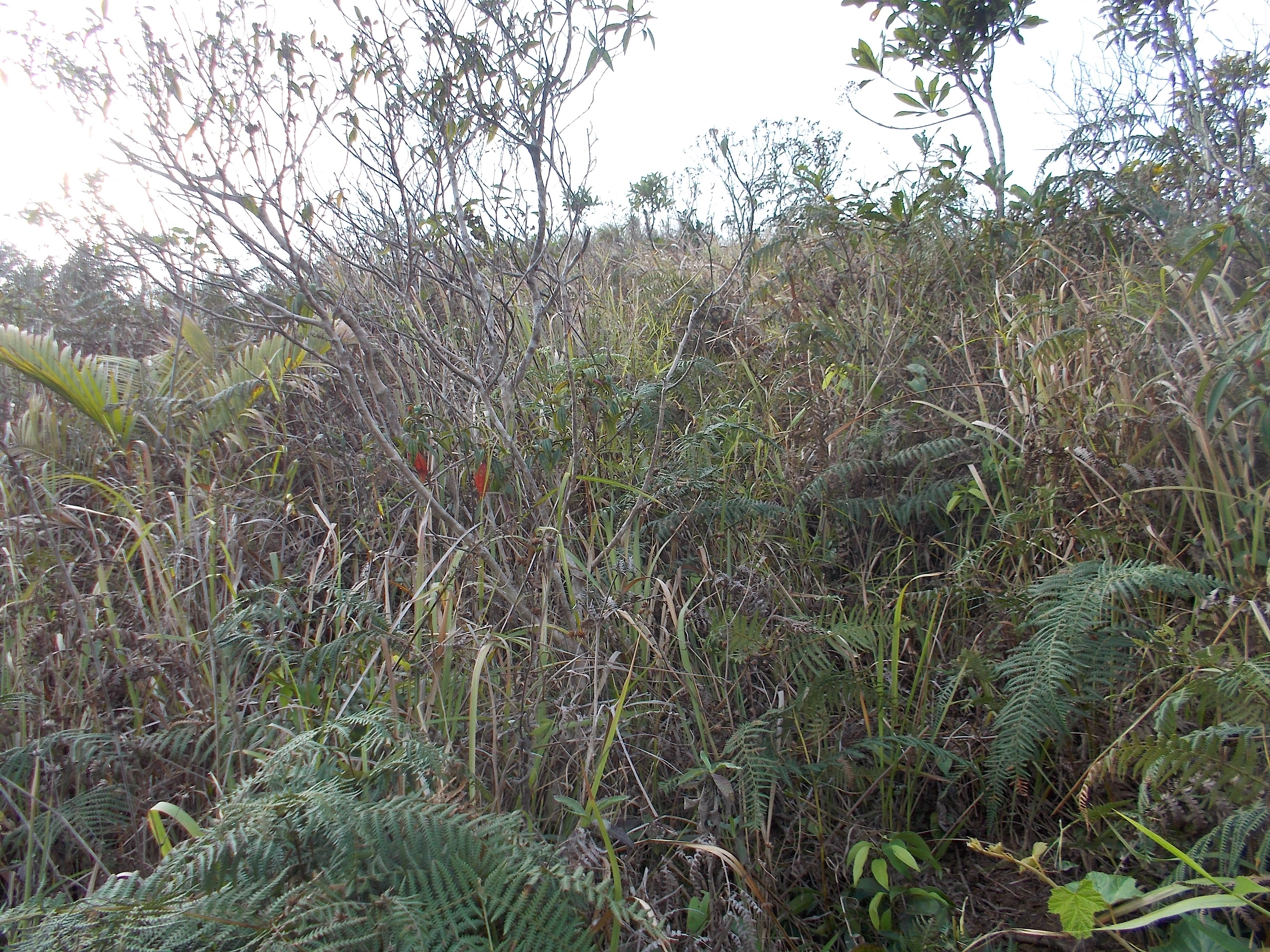
We had to slowly put our foot one after the other as we go up the peak and hold whatever plant or growth as we pulled our bodies upward. It was a very slow and deliberate pace as we got higher in elevation. After about 350 meters of steep inclined approach, it leveled up and I started to see a lot of rocks surrounding the last assault to the peak. More rocks can be seen on the last 50 meters towards the peak of the mountain.

The Assault Trail To The Peak
The Final Approach To The Peak

Finally, we were able to “peakbag” Mt Kalbo! It appears that the reason why there is no thick vegetation or trees on the peak is because of the presence of a lot of rocks. Only the cogon grasses thrive on the peak and it gives a semblance of its appearance as a bald mountain, most especially when the cogon grasses start to turn to brown and dried during summer.

Finally, A Pose At The Peak With Mt Natib In The Background

More rocks can be seen on the flat portion of the peak but I have observed that the same vegetation that can be seen at the peak of Mt Natib is the same with that of Mt Kalbo. There are wild plants; cogon grasses; and orchids that can be seen at the peak.

There is a trace that an industrial drill had been used to bore a hole from the peak of the mountain and it has a cement marker that is almost disintegrating due to the elements. There is also a wooden pole which drilled to the ground that we could hardly pull from the ground. I guess, the wooden pole was placed beside the cement marker where one can place a flag or a cloth marker on top of the peak.

Cleaning The Peak & Exposing The Rocks

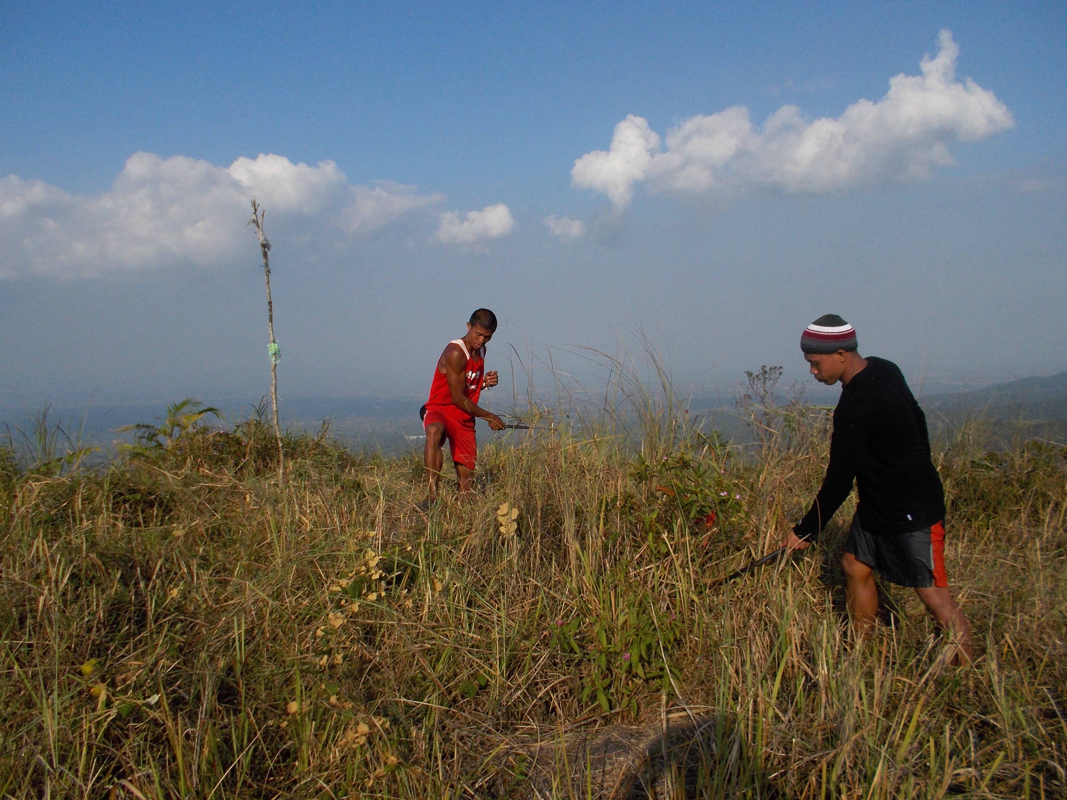
After some photo-ops, I instructed my men to clean the peak of the mountain and cut those tall grasses in order to expose the rocks on top of the peak. How I wish these rocks will not be vandalized by people who will be visiting this place.

Rocks At The Peak Of Mt Kalbo
My Men & Training Partners

Many thoughts and ideas came into my mind as I inspected every inch and foot on top of the peak of Mt Kalbo. I guess, Mt Kalbo Trail Run is coming soon as a challenge to trail runners.

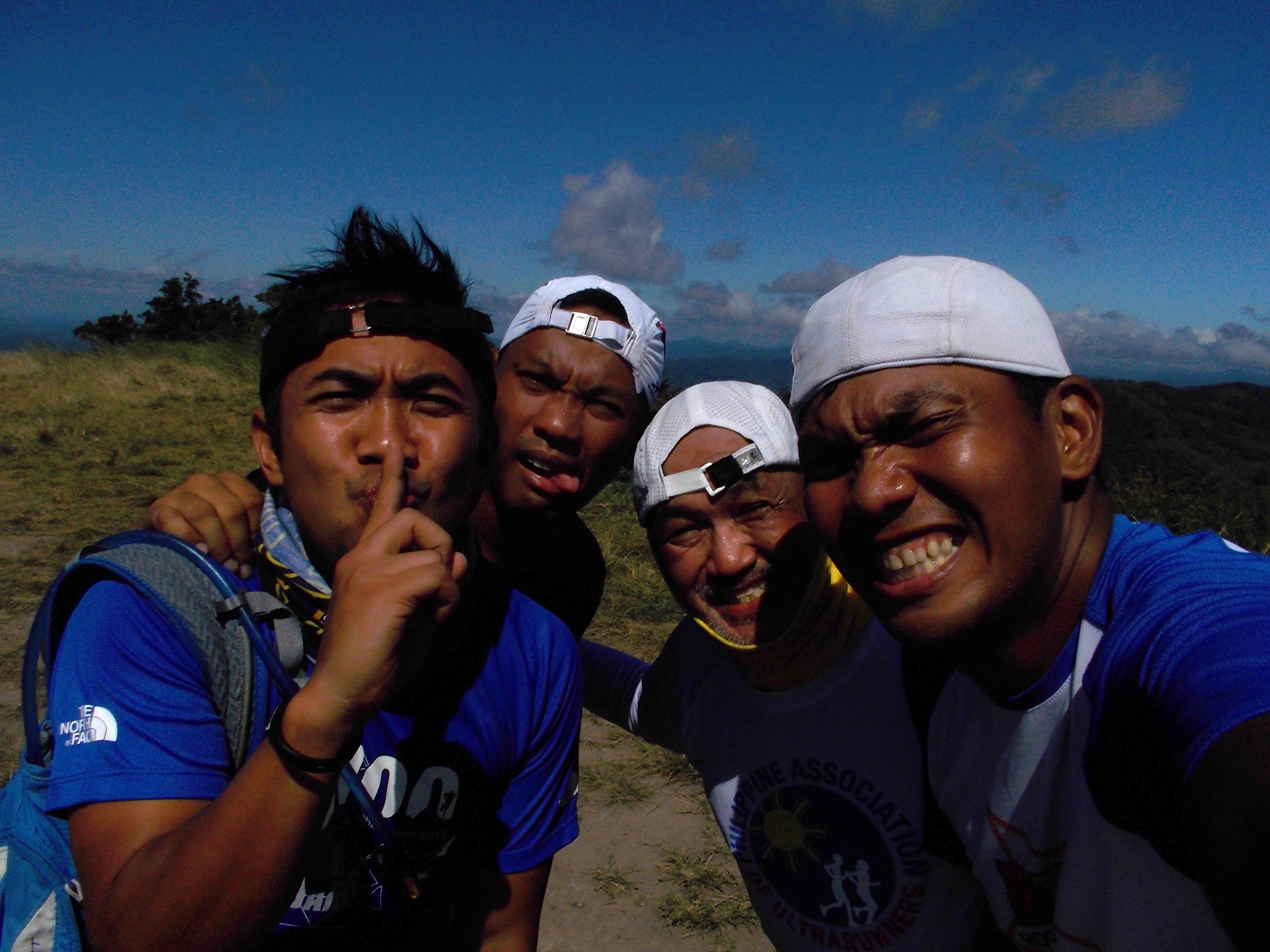
After about 45 minutes at the peak, we decided to go back to the place where we started. It was a good 12 hours in the mountain and we finally reached our place at 9:45 PM.

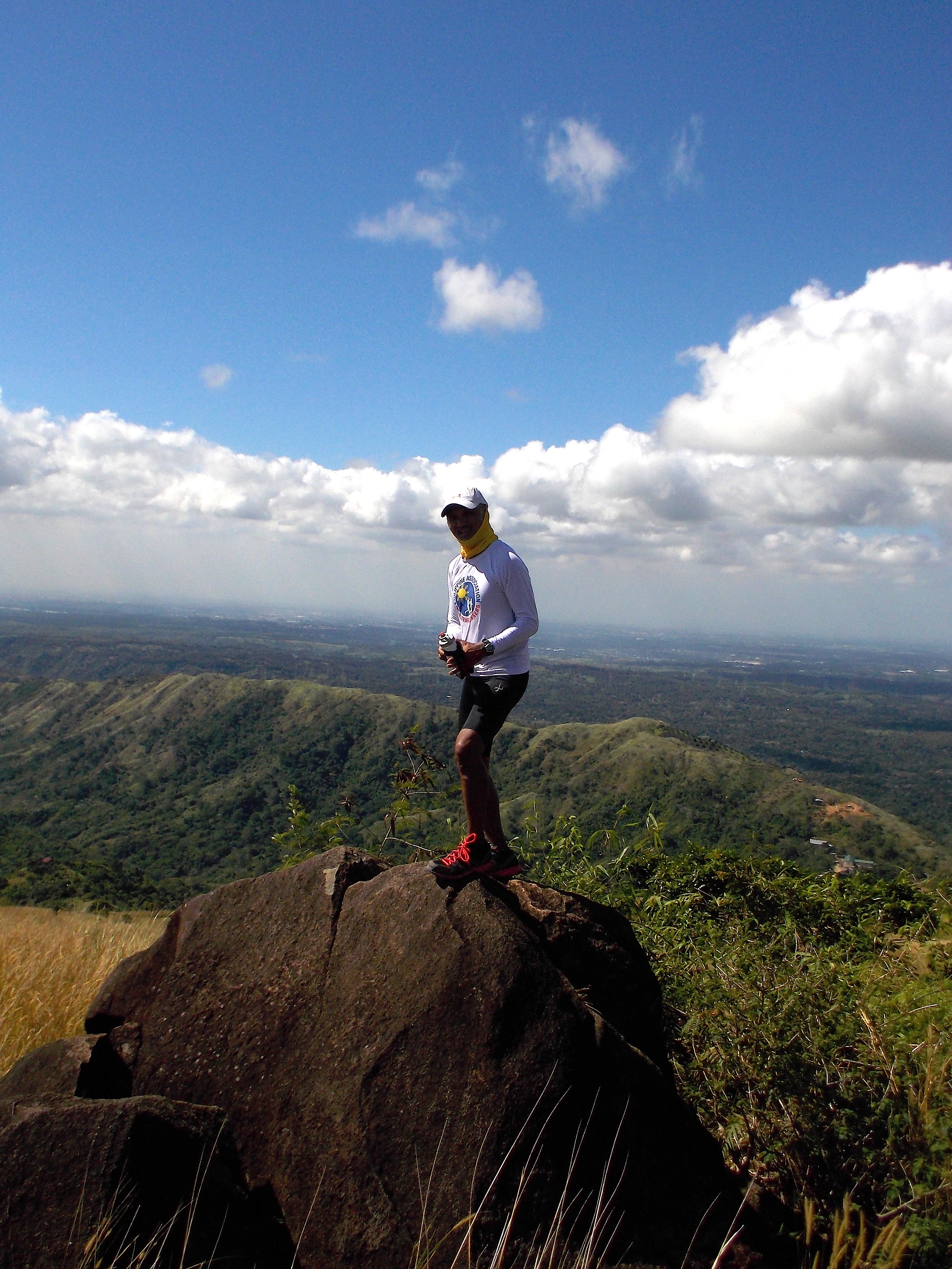
My Garmin Watch registered an elevation of 930 meters at the peak. The whole 40K course also registered an Elevation Gain/Loss of 7,000 feet.

It was a good 40K “out and back” distance for the day! We officially “peakbagged” Mt Kalbo. And I am officially inviting bald trail runners/mountaineers to visit the place and I am also declaring it as the Official Mountain of the Baldies!


Result: 2nd Playground “Alpha” 50K Trail Run


2nd Playground ALPHA 50K Trail Ultra Run (“Two Antenna” Loop Course 50K Trail Run)

Pastolan, Hermosa, Bataan

5:00 AM March 30, 2014

Number Of Starters: 10

RANK RACE BIB # NAME TIME (HRS)
1 15 Jon Borbon (Champion) 10:37:23
2 9 Ed Yonzon (1st Runner-Up) 10:42:35
3 20 Dhannie Tan (2nd Runner-Up) 11:18:23
4 26 Brian Tan Seng 11:20:59
5 24 Bong Anastacio 11:32:14
6 17 Luzel Tibo-oc (Champion, Female) 14:14:41
7 19 Mark Anthony Tibo-oc 14:14:43

Pictures: https://www.facebook.com/baldrunner/media_set?set=a.10202951564603769.1073741919.1043179758&type=3

Congratulations To All The Finishers!

2nd Playground Alpha 50K Trail Run Champion: Jon Borbon

Benson: An Aeta Friend


In one of my trail running adventures, I was able to meet Benson, an Aeta residing in a Resettlement who is trying to earn a living by making and transporting charcoal in the mountains of Bataan. I was on my way to discover trails within my backyard when I met him. I asked him to orient myself in the different trails in the mountains and he was glad to help me.

I met Benson while he was on his way back to his residence in the Aeta Resettlement. He was carrying two sacks of charcoal which heights are taller than him. I can not believe how he was able to carry those sacks of charcoal with his thin and short body. What impressed me more was that he was using a rubber sandal walking/hiking on those mountain trails. His hiking pace was faster than me and my companion. He was really fast despite the fact that he was using a rubber sandal and carrying those two sacks of charcoal which are heavier than his weight.

Benson With My Men
Benson With My Men

While we were in our pits stops and water resupply points, I find time to talk to him and was able to gather a lot of information about him. He is married to another lady Aeta who just gave birth to their first child two months ago. He burned his bamboo hut which he constructed in the Aeta Resettlement Area and he gave me a vague statement/answer on the reason why he burned his hut. Since he does not have a place of his own, his child and himself are staying in the hut of his mother-in-law.

We asked some directions from him on how we can explore the mountains in the area and we asked the presence of mountain trails within the area. He is willing to be our “guide” if we intend to explore the nearby mountains and he asked that we should be in his place/resettlement area before 6:00 AM.

In our pit stops, we shared our bottled water/drinks and bite foods. Upon reaching the resettlement area, he invited us to the hut of his mother-in-law and offered us a beehive full of pure honey. Instead, we offered him and the rest of the children in the hut with our Cloud 9 Chocolates and Pan De Sal (local bread). After about, 10 minutes of rest and changing his shirt, he offered his service to guide us to the road that leads to the main Highway.

Picture With Benson Before We Parted Ways

After hiking for 3 kilometers, he pointed a paved road that leads to a subdivision and gave some instructions and information about the description of the paved road. I brought out some cash in my hydration belt and I gave my money but before I can hand him my money, he asked not to be given such cash. He said that the money we have will be used for our fare for our tricycle and jeepney ride in going back to where we started. However, I asked and begged him to get the money for the milk of his baby and he gladly accepted it.

From there, we left him as he walked back to the resettlement area. And for us, we still have 14 kilometers more of dirt and paved roads before we reached our final destination.

One of these days, I and my training partner will be going back to get the service of Benson as our guide to the mountains in the area.

I hope we can explore and measure another 30 kilometers along the mountain trails so that I can have a 100-mile mountain trail route in my playground.

Sacks Of Charcoal


It has been awhile when I had my last post in this blog. I was too busy in the mountains where I could hardly get a good connection to the Internet. Aside from my trail running training, I’ve been busy preparing and directing my road and trail races which are scheduled for the past months.

In my desire to look for trail routes within the vicinity of my “playground”, I had been exposed and had observed some of the local people in the area to be involved in charcoal making in the mountains. I almost meet a group of locals with their sleds being pulled by a carabao (water buffalo) stacked with sacks full of charcoal on a daily basis. Sometimes, I would pass by a place where two locals would be guarding a makeshift underground “oven” where they process or burn the woods cut in pieces and wait for these woods that would turn to charcoal.

I really don’t mind or give any interest or even stop to start a conversation with these people in the charcoal transport and processing “industry”. It is enough that I greet them while I am running or simply wave my hand just to show that I really don’t care about their trade. Anyway, they simply know me as a crazy trail runner in the mountains where they do their business.

Last week, in one of my adventure runs in the mountains trying to look for trails, I was surprised to see a band of charcoal “carriers” or persons who carry sacks of charcoal from the mountains to be brought to the populated community. Most of these carriers are our indigenous people called the “Aetas”. I met these band of Aetas resting in a shaded part of the mountain where there is a pipe with water freely flowing from it. Most of them were resting and some of them were taking their lunch as I can see some cooking pots near the sacks of charcoal.

The following pictures will show the number of sacks of charcoal resting on the rocks along the trail and you can imagine the number of trees being cut by these charcoal makers in the mountains in order to produce these sacks of charcoal:

Spring Water & Rest Area In The Mountains
Sacks Of Charcoal On Top Of Rocks
Closer Look On The Sacks Of Charcoal

I am not here to post these pictures and make any judgement or opinion on what I have seen and observed in the mountains. It is enough that you can see and conclude for yourself what is really happening on those hidden valleys and cliffs in the mountain ranges which you can see far away while you are in the comfort of an air-conditioned bus or driving your personal vehicle along the highway on your way to the province and from the city.

As usual, I had to greet the Aetas and went on to refresh myself by drinking the fresh and cold water freely flowing from the plastic pipe that was inserting in between two big rocks on the cliff. And then douse my head, face, nape and back with the flowing water.

After a few seconds, I waved my hands and told to the resting Aetas that I will be ahead of them in going to their resettlement. And I am glad they waved their hands and replied to my greetings.

My mountain trail running must go on and as I was nearing the trailhead near the Aeta Resettlement Area, I could see more mountains and more trails to explore in my next outing.

Trail running in the mountains reminds me how blessed I am and the rests of us living in the lowlands.

Result: 1st Playground “Alpha” 50K Trail Ultra


***By Invitation Only

5:30 AM March 16, 2014

Pastolan Trails, Dinalupihan, Bataan

Number of Starters: 21

Number of Finishers: 17

@ The Start/Finish Area


RANK BIB # NAME TIME (HRS)
1 2 Wilnar Iglesia (Champion) 6:50:32
2 6 Raffy Gabotero (1st Runner-Up) 7:22:06
3 7 Bong Alindada (2nd Runner-Up) 7:57:10
4 1 Graciano Santos 9:23:42
5 14 Daphne Codilla (Champion, Female) 9:44:00
6 8 Jay Lamela 9:55:46
7 4 Venn Lamela 9:55:47
8 160 Ronnel Go 9:59:32
9 32 Marc Conrad Molina 10:00:11
10 311 Manny Ocampo 10:20:39
11 22 Michael Lafuente 10:33:01
12 10 Ryan Garcia 11:08:49
13 11 Roy Garcia 11:08:50
14 5 Lady Dianne Palongan (1st Runner-Up, F) 11:10:11
15 50 Januarius Padilla 12:40:10
16 30 Jonathan Moleta 13:17:26
17 42 Jon Ogsimer 14:21:44
Champion Wilnar Iglesia
Runners @ The Turn-Around Point (Km #25)

Pictures:  https://www.facebook.com/baldrunner/media_set?set=a.10202845708757439.1073741898.1043179758&type=1

Congratulations To Everybody!

Picture Of The Week #23


@ Sitio Happy, Cabayo, Kayapa, Nueva Vizcaya

4th Week Of Training (January 27-February 2, 2014)


January 27, Monday—Rest Day

2-Hour Massage

January 28, Tuesday: @HPA Parade Ground (Paved & Dirt Roads)/Start: 6:51 AM

Distance—-16.2 Kilometers/10 Miles

Time—-1:40:06 Hours

Average Pace—-6:10 mins/km

Average Speed—-9.7 kms/hour

Total Calories—-1,117 cal

Total Ascent—-518 meters/1,700 feet

Total Descent—-500 meters/1,640 feet

Weather—-Cooler on the 1st Half and Early Morning Sun’s Heat on the 2nd Half

Shoes—Hoka One One Stinson Evo

January 29, Wednesday: @Remy Field Oval Track/Start: 3:30 PM

Distance—13 Kilometers/8.1 Miles

Time—-1:14:16 Hours

Average Pace—-5:42 mins/km

Average Speed—-10.5 kms/hour

Total Calories—-883 cal

Total Ascent—-355 meters/1,164 feet

Total Descent—-361 meters/1,184 feet

Weather—-Sunny/Hot

Shoes—-ASICS Gel-Lyte Racer

Note: Speed Workout—Tried “1-2-3-2-1” Speed Intervals (One Minute @ 5K Pace with One Minute Recovery Run; Two Minutes @ 10K Pace with Two Minutes Recovery Run; Three Minutes @ 21K Pace with Three Minutes Recovery Run; and then back to 2 minutes @ 10K pace then one minute @ 5K pace. Followed by 3 Reps of 800-meter Intervals with 800-meter recovery run after each repetition.

January 30, Thursday: @Pastolan Trails/Start: 10:37 AM

Distance—-21.13 Kilometers/13 Miles

Time—-3:37:20 Hours

Average Pace—-10:17 mins/km

Average Speed—-5.8 kms/hour

Total Calories—-1,077 cal

Total Ascent—-1,107 meters/3,631 feet

Total Descent—-1,098 meters/3,601 feet

Weather—-Sunny On The 1st Half; Windy & Cloudy/Overcast On The 2nd Half

Shoes—-ADIDAS Vigor Trail

Nutrition—-2 pcs of Hopia (Chinese Bread) + 20 oz of Gatorade + 60 oz of Water

January 31, Friday: @ Pastolan Trails/Playground “Alpha” Loop/Start: 9:40 AM

Distance—-26.21 Kilometers/16.4 Miles

Time—-5:29:53 Hours

Average Pace—-12:35 mins/km

Average Speed—-4.8 kms/hour

Total Calories—-1,254 cal

Total Ascent—-2,377 meters/7,796 feet

Total Descent—-2,300 meters/7,544 feet

Lowest Elevation—-42 meters/137 feet

Highest Elevation—-510 meters/1,673 feet

Weather—-Sunny/Hot & Windy

Shoes—-TNF “Single Track” Trail Shoes

Nutrition—-Steamed Rice, Hard-boiled Egg, Hotdog, 2 pcs of Hopia + One GU Gel on the last 5 Kilometers + 80 oz of water

February 1, Saturday: @Pastolan Trails (10.5K Route-Out & Back)/Start: 1:32 PM

(Note: @7:00 AM—-30-Minute Stationary Cycling)

Distance—-21.16 Kilometers/13 Miles

Time—-3:39:28 Hours

Average Pace—-10:22 mins/km

Average Speed—-5.8 kms/hour

Total Calories—-1,040 cal

Total Ascent—-1,079 meters/3,539 feet

Total Descent—-1,084 meters/3,555 feet

Lowest Elevation—-42 meters/137 feet

Highest Elevation—-390 meters/1,279 feet

Weather—-Cloudy/Overcast & Windy

Shoes—-ADIDAS Vigor Trail

Nutrition—-3 pcs of Hopia + 40 oz of Water + 1 GU Gel mixed with 20 oz of water

February 2, Sunday: @Bataan Death March Route (Km Post #50 – Km Post #83)/Paved Road/Start: 6:56 AM

Distance—-32.40 Kilometers/20 Miles

Time—-4:42:19 Hours

Average Pace—-8:42 mins/km

Average Speed—-6.9 kms/hour

Total Calories—-1,862 cal

Total Ascent—-801 meters/2,627 feet

Total Descent—-818 meters/2,683 feet

Weather—-VERY HOT

Shoes—-Hoka One One Bondi Speed

Nutrition—-Fresh Fruits (Sliced Apples & Korean Pears); Hopia; and Gatorade Drinks

Note: Heat Training For 4 Hours

Total Distance For The Week: 130 Kilometers/81 Miles

Total Vertical Distance (Ascent): 6,237 Meters/20,457 feet

More Trails For This Week

Friday Trash Run


Starting last Friday, Danin (my training partner) and I had put in our training schedule some time to spend cleaning the rivers/streams along our trail running route and pick-up/collect the trashes that we see scattered along the trail.

From the start of our 26.2K-loop, we started picking up trashes we saw on the trail until we reached where we started. We also cleaned the streams from dried twigs, branches and leaves.

Pool Cleaning Along The Trail

It made our running workout slower but what we did during the said workout was all worth it. If there is a simple thing to do for the good of the environment, picking up of trashes along the trails is a “no brainer” for a trail runner to do. It may not have an immediate result or impact on the environment but the thought of maintaining cleanliness in the environment has a personal satisfaction for me and Danin.

I did not expect that the trash we collected ended up in two plastic bags which we brought as our garbage bags. As we were going back to where we started, Danin thought of tying the bags on his backpack. One can see from the picture of Danin how big are the volumes of the two garbage bags full of trash!

Danin Running With The Bags Of Trash
Two Bags Full Of Trash!

From the contents of the garbage bags, most of them are non-biodegradables—plastics, water bottles, soda cans, junk food plastic bags, candy wrappers, cigarette packs, and plastic bags.

The Collected Trash
The Collected Trash

Danin and I will be doing this “exercise” once a week along the trails in my playground.

I hope this personal effort to save the environment will have its “spread” effect to the other trail runners and trekkers of our mountains.

3rd Week Of Training (January 20-26, 2014)


January 20, Monday—Rest Day 

2-Hour Massage

January 21, Tuesday: @HPA Parade Ground (Paved & Dirt Roads)/ Start: 7:52 AM

Distance—10 Kilometers/6.2 Miles

Time—57:15 minutes

Average Pace—5:42 mins/km

Average Speed—10.5 kms/hour

Total Calories—686 cal

Total Ascent—323 meters

Total Descent—232 meters

Weather—Cloudy

Shoes—HOKA One One Stinson Evo

January 22, Wednesday: @Remy Field Oval Track/ Start: 7:14 PM

Distance—13 Kilometers/8.1 Miles (Tempo Run: 4K Easy Run; 5 X 800 with 800 as Recovery in between repetition @ 4:00-4:10 minutes per repetition)

Time—1:16:09 hours

Average Pace—5:50 minutes/km

Average Speed—10.3 Kms/hour

Total Calories—897 cal

Weather—Night Run/Cold/Windy

Shoes—ASICS Gel-Lyte Racer

(Note: Slower Time due to Lots of Runner & Walkers on the Oval Track)

23 January, Thursday: @ Mt Natib Trail Route/Start—10:15 AM

Distance—42 Kilometers/26 Miles (Trail Run with Power Hike)

Time—10:50:09 Hours

Average Pace—25 minutes/mile

Total Calories—1,757 cal

Elevation Gain—1,780 meters/5,873 feet

Elevation Loss—1,778 meters/5,868 feet

Minimum Elevation—30 meters/95 feet

Maximum Elevation—865 meters/2,852 feet

Weather—Sunny and Windy

Shoes—Helios, La Sportiva

24 January, Friday—Rest Day

30-Minute Stationary Bike (PM)

25 January, Saturday: Start: 5:00 AM

Race Director—2014/4th Edition of the Bataan Death March 160K Ultra Marathon Race

26 January, Sunday—Rest Day

40-Minute Stationary Bike

Total Weekly Mileage: 65 Kilometers/40.6 Miles

Total Vertical Distance (Ascent): 2,415 Meters//7,921 Feet

@ Kilometer #7 To Mt Natib
@ Kilometer #7 To Mt Natib (100-meter uphill paved road of the trail route)

“Charcoal Men’s” Trail @ Mt Balagbag


(Note: Mt Balagbag is located in Rodriguez, Rizal and can be accessed through Quezon City)

A day after the conduct of the Rizal Day Run 50K & 32K at Camp Aguinaldo last December 29, 2013, I was invited by Ultra Runner Ronnel Go aka Kampuger for a trail run on his running group’s “playground” which is very near Quezon City/Metro Manila. This was my first time to visit the mountains near Metro Manila but I had a chance to join a half-marathon road race in one of the towns in Rizal four or five years ago which is located within this area.

Ronnel Go became my tourist guide while we were joined by Ariel Tuto Aquino and Dr Marc Conrad Molina. We parked our cars at the Barangay Hall of San Isidro, Rodriguez, Rizal and from there we started our hike. Knowing that Ronnel Go had just finished the Rizal Day Run 50K Ultra Race where he placed as the 2nd Runner-Up and Dr Marc Molina finishing the race, I advised the group that we will power hike the whole route even if it will take us to finish it the whole daytime. The trail tour was some sort of a recovery hike for the two runners while Ariel made some running on the flat and descending portion of the trails to have some easy long run  workout for the day. I was there as a hiker trying to orient myself in the place.

First 5K of the Trail
Resting Is Picture Taking

I was informed that we were taking the reverse route where most of the hikers would avoid because the approach to higher peaks are steeper. So, we power hiked and enjoyed every scenery we could see around us as we go higher to some of the hills and later to the mountains. We have to stop and take some pictures of the places where one could see up to the vastness of Metro Manila, Laguna De Bay, and the mountains of Rizal and Bulacan.

Billiard Table In A Store

We stopped in a store where there is a billiard table and we took our first snacks and rest. We made a re-supply of our water bottles and continued our hike. As we moved higher to more peaks, we felt cold winds all around us and the sky was overcast. It was a perfect weather for a hiking in the mountains and my companions would make some remarks that it was their first time to experience such cold, windy and overcast sky in the area.

Single File!
Single File!

I could hardly feel any tiredness and exhaustion as we moved to a higher elevation. The stories, jokes and laughter with the group make our hike enjoyable plus the nice scenery all around us. The group brought me to their “signature” locations where one would take ones picture. They have this favorite “rock” and ascending trail until one would reach the peak of Mt Balagbag.

Group "Selfie" At The Peak Of Mt Balagbag
Group “Selfie” At The Peak Of Mt Balagbag

The peak of Mt Balagbag has a flat portion for campers where they could “fix” their tents. We stayed for a longer time in the place to see the places around us and take some group pictures. From the peak, everything were all descending until we reach Barangay Licau-licau but before we reached this place for our lunch, we dropped by a store where we had our second snacks for the day.

Barangay Licau-licau is a crossroad to a descending road that goes back to a barangay with garbage and to San Isidro; the ascending road that goes to Mt Balagbag; and a flat road that goes to the populated area within the barangay. There is a store with “turo-turo” (ready cooked) food and this where we had our lunch. This is the place also where we met another ultra runner, Lao Ogerio, who placed 1st Runner-Up in the Rizal Day 50K Run. He was there also for his recovery run a day after the race.

2014 BDM 160 Ultra's 1st Runner-Up Lao Ogerio As Ice Cream Vendor
2014 BDM 160 Ultra’s 1st Runner-Up Lao Ogerio As Ice Cream Vendor
Group Picture With The Ice Candy Vendor

From Barangay Licau-licua, we became five in the group. Lao Ogerio became our lead hiker until we met a local who was selling ice candy/popsicle. He carried the ice box of the local guy to shaded portion of the trail and we had a rest while enjoying the sweet and cold taste of the popsicle. After paying the local guy for the popsicle we ate, we continued our hike until we reached the highway that led us to the Barangay Hall of San Isidro, Rodriguez, Rizal.

It was Ronnel who was wearing a GPS watch and it registered a distance of 34 kilometers with 9 hours of elapsed time since we started our hike. I did not ask for the total ascent & descent of the place but I know this is a place where one would make himself or herself a strong runner.

Now I know why the group of Ronnel and the other runners who make this place as their “playground” are very strong in ultra running and trail running. I happened to know also that some of the top contenders of my PAU Races come here in this place for their weekend long runs. No wonder they are strong and fast in my ultra races.

If you ask me why I call the trail as “Charcoal Men’s” Trail, it is because the local people whom you meet in the area are carrying with them 3-4 sacks of charcoal in going up and down the mountain trails.

@ The Rock In Mt Balagbag