Race Report: 2nd Zamboanga Mountain 50K Ultra Marathon Race


Race Report: 2nd Zamboanga Mountain 50K Ultra Marathon Race/September 18, 2016

After I finished the first edition of this race last year, I promised to myself that I would join every edition of this race as long as I am still strong to run an ultra distance event. I would make this race as my evaluation run as part of my training for my future ultra races here and abroad.

Three months ago, I have started my training for this race but instead of doing it on the trails and places where there are considerable elevation gain and/or loss, I have to do my training on the paved streets. I have to follow the usual training program and daily mileage which I have followed for the past three years of ultra running training. However, these street running workouts had to last for about two months before I had to go back to trail running.

The only difference with my training this time as compared for the past 3 years, is my desire to be faster as I grow older. I placed more emphasis on the conduct of “strides” during my daily runs and do at least two times of “tempo” runs during the week. Weekends would be devoted to long runs up to 18 miles with a faster average pace.

On the third month, I did a lot of hikes in the mountains on weekends which would last up to 6-7 hours and on weekdays, I would do 8-9-mile runs on trails with an elevation gain/loss of at least 2,000 feet every workout. This is where I would train myself on my hydration and nutrition with only water as my fluid intake. I tapered for about two weeks which consisted of hikes and easy runs in my “playground”.

2016-zambo-50-start
The Mandatory START Group Picture

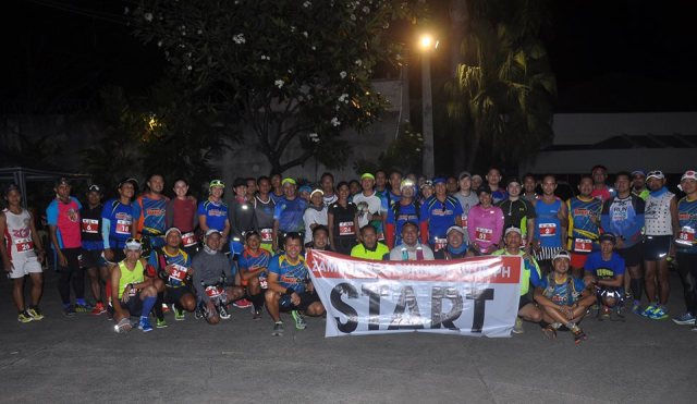
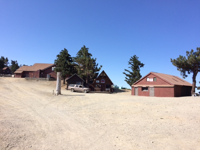
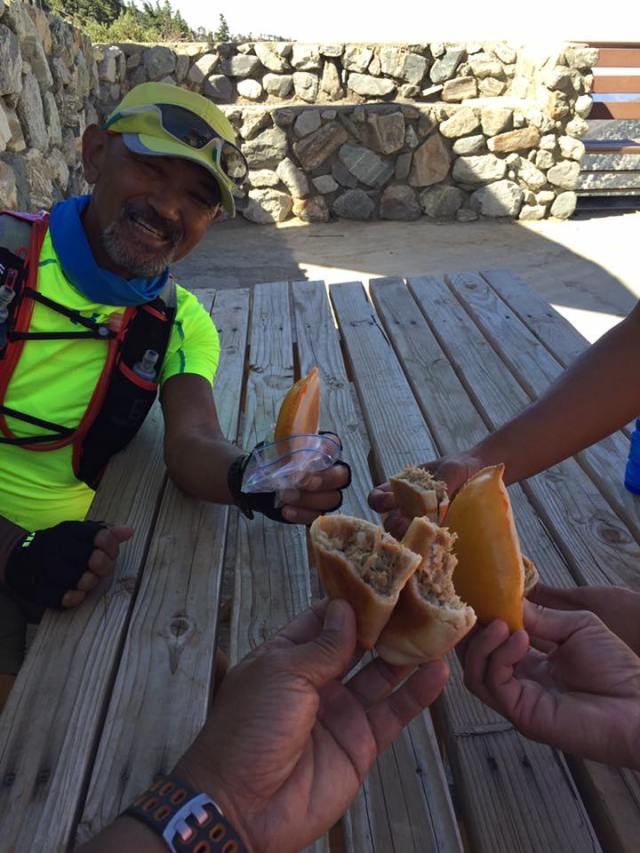
What is good with this race is that the Hotel (Palmeras De Zamboanga) where I stayed is the Starting and Finish Line of the event. I went out of my room 20 minutes before the start with enough time to greet and have “photo-ops” with the other runners. Before I went out of the Hotel, I was greeted with free sandwich and hot coffee at the end of the hallway and was able to take advantage of this offer as part of my stay in the hotel. I knew that the coffee and the sandwich would be enough for my food intake before I reach the first Aid Station at Km #8.

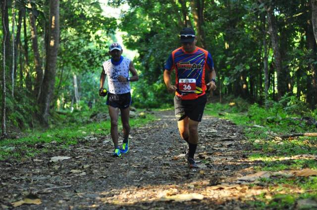
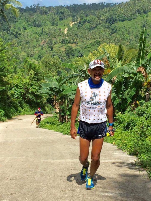
The race started promptly at 5:00 AM after a short prayer and 57 starters left the starting line. It was still dark when we were running along the street leading to the Pasonanca Park but the streetlights were enough to light up our way. Knowing that the first kilometre is flat, I made an easy pace and just followed the runners in front me. At Km #3, a runner started a conversation with me and I asked if my prevailing running pace would be maintained up to the finish line and replied him, “Yes”. And then asked permission if he would be allowed to pace with me during the duration of the race. And I said, “Yes”! We would be running side by side from this point up to the Finish Line. At that time, we were on a speed of 4 miles per hour as gleaned from my Suunto Watch.

It was my intention to maintain the said speed throughout the race. As I had predicted before the race, I have announced on Facebook that I intend to improve my ranking of #17 and finish time of 8:34+ hours from the result last year. Actually, my target goal was to finish the race below the 8-hour time and maintain the speed of 4 mph up to the Finish Line.

2016-zambo-run-01
Route Map & Description

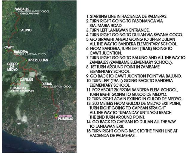
We reached the 1st Aid Station (Km #7) without any problem and tried my best to run through those ascents without any brief walks or hikes. I took me less than 2 minutes to refill my bottles with ice cold water and eat some suman. From the Aid Station, we had to follow the paved road as the route became a “roller-coaster” and it started to be warm. After about 4-5 kilometers, we reached the 2nd Aid Station in front of an Elementary School. I had to refill my hydration bottle with ice-cold water, douse some ice-water on my head and face as the day was starting to be hot. I ate two ripe bananas and I was back on the way. From this Aid Station, it was the start of a single-track technical trail which has some rocks, mud, and flowing water.

2016-zambo-elevation-profile
Course’ Elevation Profile

As I tried to speed up my pace on the descending portion of the trail which was muddy and slippery, I started to feel some “cramp” on my left calf and I asked the runners behind me to pass while trying to walk my way down the trail. I was still running downhill but I made sure to slow down my pace. I brought out some of salt tablets and ingest some and kept it to my mind to regularly ingest some every hour during the run. After a few seconds and minutes, I was able to regain my pace and it was just a matter of time before we would reach the first Turn-Around point which happens to be the Zambales Elementary School.

2016-zambo-run-10
Marvin Sicat, My Running Partner During The Race

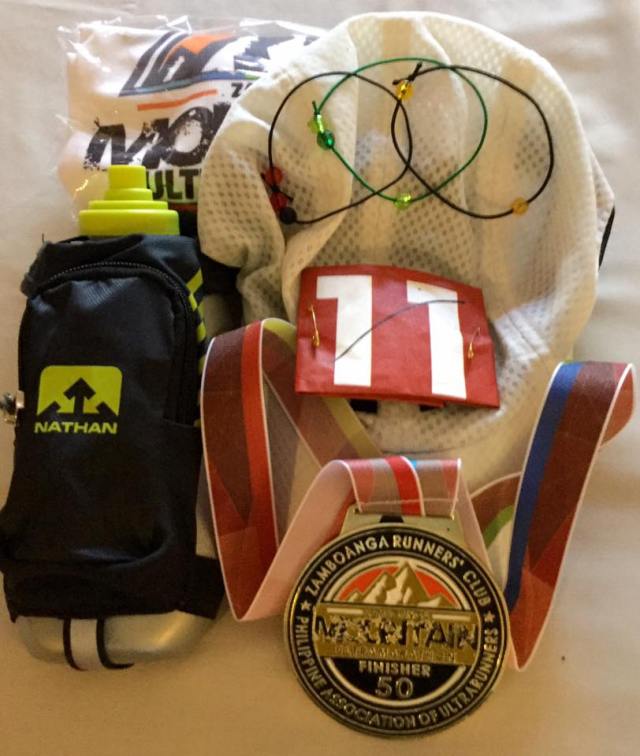
At the start of a newly cemented road inside a thickly vegetated area in the course, we met the two leading runners. This is where I started to hike the ascending parts and run the flat portions and descending parts of the route and kept on drinking my water in my handheld bottle during my hikes. As we got nearer to the Turn-Around point, we had to meet those runners who just left the 3rd Aid Station at the Turn-Around Point which happens to be in a School. As I count the number of runner that I and my companion-runner would meet, I was ranked as #12 runner with my partner as #11.

In last year’s edition, I stayed in this Aid Station (Km #16) for a longer time as I tried to ingest more food and drink lots of water and craved for sweeter drinks. I even had more pictures taken with the other runners whom I was able to catch up in the said Aid Station. For this year, I was surprised to see a Zamboanga local runner who was still sitting and trying to cool off in the Aid Station when I arrived. “Chabby” is a very fast and strong ultrarunner and he beat me last year by almost one hour. I had to ask him his situation and he said that he was ok. But, I was brief in my stay by having my bottles refilled with water and then take in a mouthful of spicy noodles which gave me a little “jolt” and in less than 5 minutes, I was out of the Aid Station with my “partner” in tow.

It is a continuous uphill climb from the Aid Station and after about 1 kilometre, we started to meet the other runners behind us who were on their way to the Aid Station at Km #16. After passing the newly-paved road inside the thick forest, we were back again to the single-track trail before reaching the next Aid Station. Unknowingly, Chabby was few seconds behind us and we were together at the said Aid Station. However, he opted to stay behind as he changed his attire and wanted to rest for awhile. After refilling my bottles and eating some fruits, hard-boiled eggs, and rice delicacy, we were out of the Aid Station. The dreaded “Gulod De Medio” was already in my mind as I left the Aid Station! However, we passed another runner after about a kilometre away from the Aid Station. That makes me #11 and my partner as #10 as we battle the next ascent and the heat of the sun!

2016-zambo-00
Steepest Climb @ Gulod De Medyo

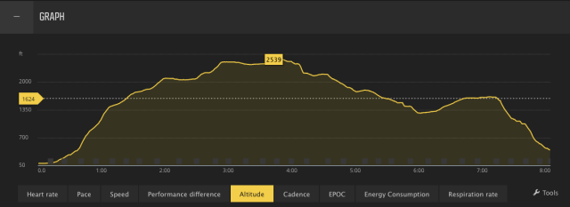
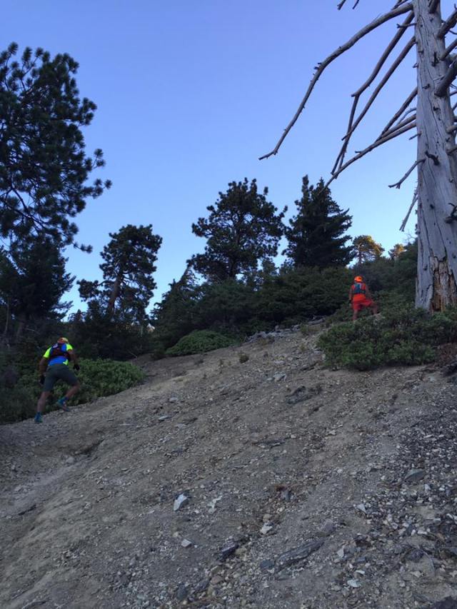
As my running “partner” and I were about to climb the “Gulod De Medio”, we saw a runner clad in black attire (with 2XU tights) in front of us within a distance of 20 meters. I made my pace faster with the intention to close the gap with between us with the runner in front of us. As we were in the steep ascent of the “Gulod De Medyo”, the runner saw us trying to get nearer to him but as soon as he reached the peak, he started to run faster! At the middle of the steep ascent, I started to slow down due to fatigue and the heat of the sun but I had to exert more effort but slowed my pace just to be able to reach the peak. I knew that as soon as I passed the peak, it was a gradual descent to the next Aid Station.

I took some Ice Cold Coke and native rice delicacy at the Aid Station and after refilling my water bottle, we left in a hurry! I knew that the course/route to the next Aid Station was a generally downhill. However, the heat of the sun was the one which prevented us from increasing our pace. At this point, it was our last 18 kilometres and in a matter of time, we would be able to reach the next Aid Station.

Finally, we reached the Aid Station and the lady volunteers were excited to see me that they asked me to have some pictures with them! Since I needed time to rest and ingest more food, I allowed them whatever pictures they could take while I was there. I guess, this is the Aid Station that I rested the longest time on the course because of the heat of the sun and the fact that the course will be uphill from this point to the next/last Aid Station. I ate drank a lot of Coke while ingesting two pieces of their local Suman with Latik which are bare (without any banana wrap). I thanked the lady volunteers for being there and for being able to serve us with the foods we needed. This one of the very reasons why I keep coming back in this race——very happy, very encouraging , and very helpful and beautiful lady volunteers!!!

2016-zambo-02
Fighting It Out With The Heat Of The Sun

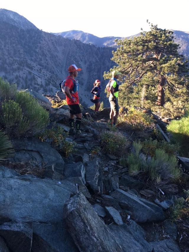
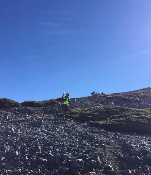
I consider the next segment of the race as the hardest as one has to go uphill to the last Aid Station. It is not about the steepness of the segment but it is the continuous and gradual ascent that will force the runners to hike on the exposed portions of the road from the heat of the sun. This is where we could see again those who are trying to catch us from behind and from the distance we had made as a “buffer”, we can safely say that we will be able to maintain our rankings up to the finish line!

Reaching the last Aid Station was a relief as from this point, it is the last 7 kilometres of the course which is all downhill. We did not stay long in the Aid Station after we refilled our hydration bottles and ate some bananas. I carried a “Sakto” Bottle of Coke and my Handheld Bottle filled with water and I was confident that my liquid/water was enough for me up to the Finish Line but I was wrong! My running partner had to share some of his water and the Race Organizer had to place another Aid Station in about 3-4 kilometres from the Finish Line because of the heat of the sun. The descending portions of the course was steep and some are still rough with gravel and small rocks but the concrete pavement was too much for my knees but my legs were surprisingly prepared for the beating and pounding of my feet. My strides were short but quick and I was able to increase my pace as I took advantage of the gravity. It was the heat of the sun that really gave some problems to my body. However, I was prepared for it as I brought a lot of salt tablets and “coffee” candies; and really focused on my hydration strategy. The Aid Station at the last 3-4 kilometres was very helpful to everybody and I was able to regain my strength and keep my pace up to the finish line.

2016-zambo-05
Lots Of Ice @ The Aid Stations & Emergency Aid Stations

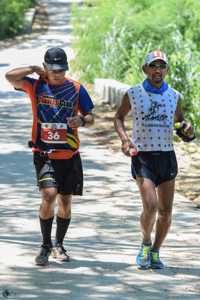
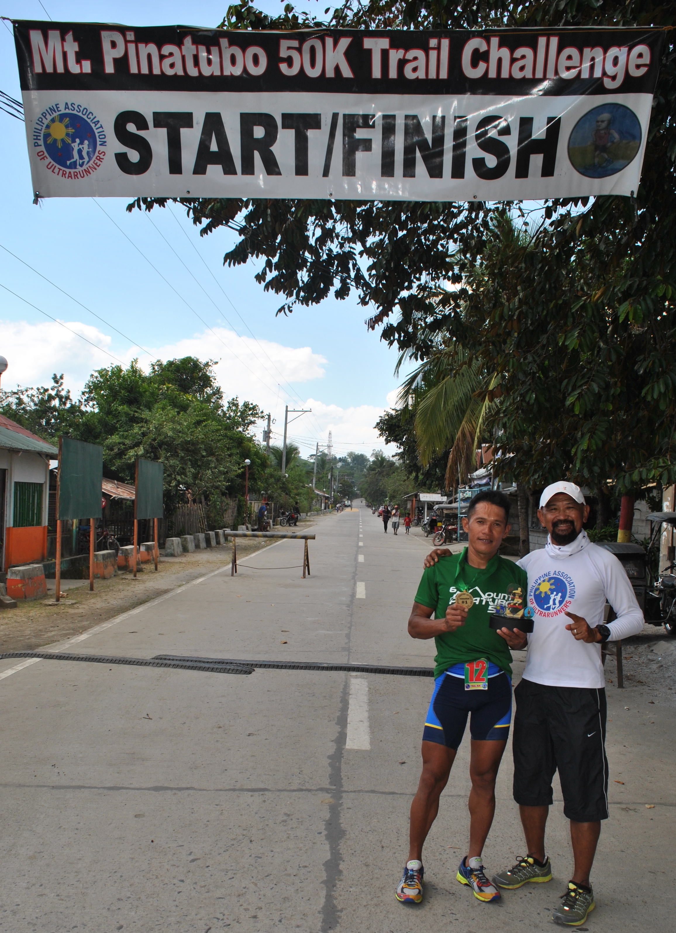
On the last 1.5 kilometres to the Finish Line, my running partner begged off that he should stop and slow down for awhile because of leg cramps and I replied to him that we should finish together. But he started to walk while I was maintaining my running pace. I guess, he was very courteous and respectful enough to offer the 10th place to me as a guest and a Senior Citizen! At the Finish Line, I found out the complete name of my running-partner, Marvin Sicat, who happens to be a close friend of one of my “pioneer” runners in the Bataan Death March 102 Ultra Marathon Race.

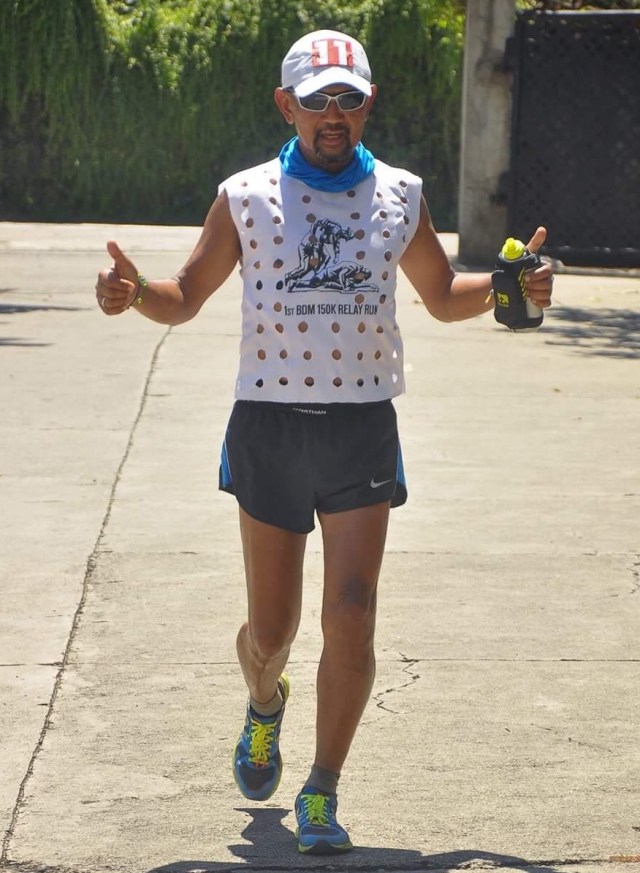
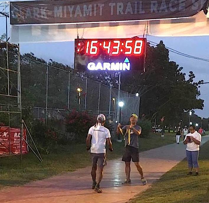
Finally, I crossed the Finish Line in 8:04:30 hours even if my plan was to finish in sub-8 hours with a ranking of 10th finisher. I was able to improve my time for almost 30 minutes and my overall ranking by 7 slots and I attribute my improvement to my quick turn-around at the Aid Stations; having a running partner/“pacer”; training with more “strides” and tempo runs on paved roads on the first two months; and later on the last month prior to the race on my hikes to mountains with higher altitude. My focused nutrition and hydration were also followed where I had to drink water regularly, eat solid foods in the Aid Stations, ingest my salt tablets regularly every hour, and regularly placing some coffee candies in my mouth.

2016-zambo-04
Crossing The Finish Line

The Zamboanga Runner’s Club and their Race Sponsors did an outstanding job for this race to be a successful one. I highly recommended this race to all my readers to this blog, most specially to those who are ultra runners, local or foreigners. It is worth the trip to Zamboanga City. Next year, I will be back!

https://www.facebook.com/notes/zamboanga-runners-club-ph/2nd-50k-zamboanga-mountain-ultramarathon-official-results/1463020747052863

2016-zambo-finisher
Swags: Nice Finisher’s Shirt & Heavy Finisher’s Medal

Trekking Poles (2016)


I have discovered the use of trekking poles in my readings in the Internet about 5 years ago where it was used to aid older people in their walking and hiking on the road and on the trails. As we know, these trekking poles or first popularly known as ski poles which were always being seen in every event in the Winter Olympics and other skiing sports in temperate countries. Some writers would say that the origin of these trekking poles came from the European countries where trekkers, hikers, and trail runners (during the Summer Season and drier months) would use them for balance as well as to preserve their leg strengths for the long haul and also aid them in steep ascents and descents.

For the past few years, almost in all the European Trail Running Events as well as Ultra Trail Running Events you would see almost all the participants carrying with them trekking poles during the race. I would have the impression that the routes of these events have very steep ascents and descents that one would need these trekking poles.

When I first used these trekking poles on the paved road, I received some laughs and negative comments from cyclists who would pass me along the road to the point that they would ask me where is the SNOW and my SKI? But a few months after such incident, I would see Marshall Ullrich using these trekking poles on his successful USA Trans-Continental Run few years ago. If only these cyclists would see the video and read the book of this famous ultra runner, they would be convinced that trekking poles are also used in ultra running.

Trekking Poles Adventure Runs
Using Trekking Poles In My Adventure Runs

Lately, I’ve seen that some of the Ultra Trail Running Events in the United States have already allowed the use of these trekking poles as compared when it was then a “no-no” for runners to use these poles. Some would say that one is having an undue advantage from the other runners who would not use these poles. Some would say that it is a form of cheating in ultra trail races. But whatever it is worth, I have a personal experience in using these trekking poles on the road and on the trails.

Let me first give some suggestions on the use of trekking poles with the following enumerated observations:

1. Do not use trekking poles for the first time in a trail running race without having used them extensively in your training. It follows the over-used advice in racing of not using something new during race day.

2. If the trail running event is a marathon distance or 50K, do not bother to bring or use these trekking poles if the total elevation gain is less than 3,000 feet or in a relatively flat course.

3. If the number of runners is more than 300 runners where the course is 100% single-track trail with less than a marathon distance (42K), don’t bother to use trekking poles as it will slow you down, slow down the runners behind you, or you might hurt somebody else in front or behind you. Use good judgement in using trekking poles on a single-trail trail, most specially in a most populated trail running event.

4. It is highly recommended to buy those trekking poles which could be folded in 3 parts as they could be easily stashed and held by the hands as if one is holding a baton while running. Since they are light, their weight is insignificant and they could be easily brought back to their intended lengths in a few seconds. There are hydration packs that have strings or elastic bands that could hold these poles or stashed/held by the pack while they are folded. Make some practice in removing or stashing the poles to and from the hydration pack during your training runs.

5. If you carry the trekking poles with your hands, while running, on its expanded length, make sure that there is no one behind you as you might poke the tip of the trekking pole to the runner while swinging your arms. If there is somebody behind you, make sure you don’t excessively swing your arms to the point that you might hit the runner behind you. You can have the option to carry the trekking poles with only one hand and be able to control that arm from excessive swinging or you can simply fold the poles and stashed them in your hydration pack or hold them with your hands.

Michael Wardian Trekking Poles
Michael Wardian At San Diego 100 Carrying Trekking Poles

6. If you intend to use the trekking poles with their extended length and if you are a slow runner or if you intend to power hike the first half of a 100K or 100-mile run, I suggest you start behind the runners and not mingle with the faster runners behind the starting line. However, if you are a fast runner and intend to be in the podium finish, you can have you folded trekking poles stashed with your hydration pack or just simply hold them with your hands.

7. In my experience of using trekking poles and seeing the faster runners using effectively these poles, I highly recommended buying a longer length from the suggested size or length that is based on your height. Three years ago, I bought a Black Diamond Ultra Distance Z-Poles with the length of 120 cms and I found it to be useful in my training runs as well as in my races. Last year, I bought another Black Diamond Ultra Distance Carbon Z-Poles with the length of 110 cms thinking that they are lighter and which are specifically recommended for my height. But I would find them to be the same weight with my 120-cm poles and I found them a little short for my height. In my ultra races in Hongkong, I found out that most of the trail runners have longer trekking poles than what their recommended size for their height and I tried one of my friends’ trekking poles which are 130-cm in size and I found them to be more adapted to my hiking/running style. Hopefully, I would be able to buy them soon!

Having stated my experiences and observation in the use trekking poles in running events, the following are their advantages and disadvantages:

Advantages:

1. If used in 50-milers, 100Ks and 100-milers and other longer trail runs, these poles will preserve ones leg power and strength for the long haul.
In a technical route and with lots of stream/water crossings, the poles with provide an extra “leg” for balance and stability for the body, instead, of falling or injuring oneself along the route.
2. For safety and protection from wild animals and “creatures” along the route. The poles can be used to ward off snakes and other creatures in the forest/mountain that have the tendency to attack you. I once used my poles to “whack” or strike on the head of an attacking and barking dog in one of the populated areas in the mountains. My swing with the poles to the dog was so strong that it tumbled down as if the dog was knocked out by a baseball bat!
3. For contigency purposes, the poles can be used as a support to ease the pain or body imbalance just in case one has rolled an ankle, or in cases when a runner is injured. In cases of extreme accidents where there is fracture to the runner, I guess, these poles could be used as emergency splints!
4. I’ve seen a runner during the Translantau 100K where he was holding a very long trekking pole and I’ve seen him using the poles as “pole vault” as he jumped along the sides of a single-track trail while overtaking a group six runners on a single file! He did it while we were descending on the said trail. The runner was so fast that I was not able to see his back even if I was able to pass these six runners after him.
5. In this year’s Translantau 100, the winds on the second night was too strong that my body would not be able to stand on my own. But having my trekking poles as extra “anchor” to the ground as I was ascending on the last two mountains of the course, I would have stopped or crawled along the slope up to the peak of the mountain avoiding to be knocked down by the strong winds with almost zero visibility due to thick fog. I was glad that I had my trekking poles with me while trying to keep my sight on the couple of runner in front of me.

Translantau 100 Trekking Pole
2016 TransLantau 100K With Trekking Poles

6. One time when I first joined the TNF Philippines 100, the trail was blocked by two water buffalos/carabaos and I with the rest of the runners behind me could hardly drive them away from the trail. By using the trekking poles as extension of my arms and raising them into the air, the carabaos thought that I was a BIG figure to contend with and slowly I was able to drive them away from the trail. But that incident and delay wasted a lot of my time and I eventually DNFd after one kilometre away from the place of incident. The trail was supposed to be the start of an ascending trail route towards Mt Santo Tomas which considered as the most challenging part of the course.

Disadvantages:

1. Obviously, it is an additional gear to be carried by the runner which means additional weight. Even if the trekking poles has a total weight of 280 grams, carrying it or holding it on a 50-mile, 100K or 100-mile or within a duration of 30 hours would be taxing to the body and you may end up carrying a total of about ten kilos or 5 pounds on the course. Additionally, it will delay you for some seconds in unfolding and folding them while you are running. If you add these few seconds within the distance of 100 miles, they will add up to minutes of maybe half an hour! Without proper training and technique on how to effectively use these trekking poles would mean a delay in finishing ones race.
2. In my three-year successive finishes of the Clark Miyamit 50-Mile Run (CM50), I have never used my trekking poles. I was then 61 years old when I had my first finish in this race and I would outpace and pass younger and stronger runners on my way up to the highest elevation of the course which happens to be the turning point of the race back to the Start/Finish Line. Simply put, if you have the proper training and preparation, there is no need to use those trekking poles in a 50-mile race. If you are less than 50 years old and I see you using a trekking pole while we are competing in the same race, my smile to you would mean that you are a “weak & newbie” trail runner!
3. In some of the international races, they allow runners to carry trekking poles but if the route is a “single-track” trail, they advise you not to use them, most specially if you have runners in front or behind you who are one or two steps away from you. There are also ultra races that require the runners not to use their trekking poles at the first 20-25 miles as most of the runners are running near to each other. Make sure that to ask from the Race Organizer/Face Director if the use of trekking poles are allowed in the race if their use is not stated in its rules and regulations.
4. Do not use trekking poles for the first time in a race you are going to compete. You will be saving the strength of your legs but your shoulder and arms muscles will take a lot of beating that you might no longer move your arms during the later part of the race or after the race.

At my present age of 64 years old, the trekking poles are my “necessities” and mandatory gear in my training and future races. I will be using them more often as I have already bought the proper size for me.

Trekking Poles
Training With Trekking Poles Has Started

I have one year to train with them in preparation for my plan to join the @CCC in Chamonix, France next year, hoping that I will be in the race after the lottery.

Go out and run!

Hike & Run To Mt Baldy (2016)


Almost every time I visit and stay in Los Angeles, California, I always make a schedule to trek to the peak of Mt Baldy. I have read a lot of blogs and FB status of running friends in Los Angeles that they would go and hike up to the peak of the said mountain. One of my ultra running friends, Benjamin Gaetos, is a regular visitor of this place and one time, I asked him for directions in going to Mt Baldy. And he generously stated the directions and the things to be required to be able to park ones vehicle near the trailhead. This was 4-5 years ago. From then, I was a regular visitor/hiker to Mt Baldy (Mt San Antonio).

Coming from Downtown, Los Angeles, I would drive to Highway 2 North and enter Highway 134 until it merges to Highway 210 East going to Pasadena up to Azusa/La Verne area. I have to exit at Baseline Road, turn Left at the Stop Light/Intersection and then drive towards Padua Street. At Padua Street, turn Right until I would reach the Mt Baldy Road. Turn right at Mt Baldy Road and go north, passing through the big lawns and nice houses in Claremont, until I would reach Manker Flats. A few yards (along the paved road) above Manker Flats, there is a road on the left with Portalets and within the said vicinity is where anybody could park their personal vehicle. The trailhead is the start of the road called “Mt San Antonio (Baldy) Falls Road”.

San Antonio Falls Trailhead
San Antonio Falls Trailhead (BR’s Photo)
Trailhead
Trailhead With Four (4) Portalets (BR’s Photo)

However, one has to display an “Adventure Pass” on Dashboard of the Vehicle to be able to park in this hiking destination. The “Adventure Pass” can be bought in any of the REI Stores in Los Angeles and some of the Outdoor Stores in the area. It costs $35 which is valid for One Year. One-time Day Pass is also available for the price of $5.

Parking Trailhead
Parking Area (Side Of The Road). Adventure Pass Needed (BR’s Photo)

On my first hike, I would follow the “Fire/Dirt Road” going up to the mountain from the trailhead by following where the Ski Lift would end. At the end of the Ski Lift which has commercial establishments and Public Toilet, I would turn left on another Dirt Road that would lead me to the Devil’s Backbone Trail, Mt Harwood, and to the peak of Mt Baldy. Round Trip distance would be 14 miles and it would take me almost 8 hours for the first time that I hiked to the peak.

Commercial Establishments
Ski Lift Commercial Establishment/Water Refilling Station (BR’s Photo)

But later on, on my yearly visits, I would be introduced by running friends on some of the shorter distance and steeper trails towards to the peak of the mountain.

For this year’s visit, it will be my 5th visit to “peak bag” the mountain. And I could make it with my 6th “peak bag” before I would leave Los Angeles for Manila.

Rowell Ramos, an ultrarunner from Los Angeles, invited me to join their group, for my 5th hike to the said mountain. For Rowell and his friends, it is their “bread & butter” as they would peak bag the mountain almost every week. Rowell would sometimes hike alone by starting early in the morning and then before 10:00 AM, he is done with his hike.

2016 Mt Baldy 14
Very Steep Trail & Impossible To Run Or Jog

I joined Rowell, Peachy Poso, and Rico Bagayawa on this hike which was done on the first Saturday of August 2016. We met and assembled at Manker Flats at 6:00 AM and we started to hike as soon as possible. We took the steepest trail leading to Mt Baldy where we veered left after hiking along the Mt Antonio Falls Road for about a mile. But before going to the said mountain, we “peak bagged” Mt Harwood first which is one mile away from Mt Baldy. This “new” trail experience was very challenging as I have to stop along the way for me to adjust slowly to a higher elevation. For the past weeks before this hike, I’ve been running on the road and never had the chance to accumulate vertical distance in preparation for this hike. However, slowly along the way, I was able to adjust my breathing as I positioned myself at the back of the group.

2016 Mt Baldy 18
Brief Rests & Stops To Adjust The Body To Higher Elevation

We started to meet the gusty winds from Mt Harwood but the wind temperature was not too cold that I would be able not to use my Windbreaker/Jacket. After a brief stop at the peak of Mt Harwood, we immediately proceeded to Mt Baldy. I was telling to the group that the same intensity of the wind was the same wind that stopped the race in this year’s TransLantau 100 in Hongkong. After a short descent from Mt Harwood, we were on our final assault to the peak of Mt Baldy. After 30 minutes of relentless hike, we finally reached the marker of San Antonio or popularly known as “Mt Baldy”.

2016 Mt Baldy 17
Short Downhill Run From Mt Harwood

It is self-explanatory that the mountain is called as such because it is devoid of any kind of vegetation, except for a few shrubs on the side of the mountain. From a distance, you can see see its peak as whitish in color.

I think we stayed at the peak for about 30 minutes, taking some of our pictures and talking to some of the other hikers who happen to be friends of Peachy Poso. I was able to eat my energy bar and drink some of my water.

2016 Mt Baldy 16
Final Assault To The Peak Of Mt Baldy
2016 Mt Baldy 10
Finally, At The Peak of Mt Baldy (Rico, Rowell, Peachy, & BR)

We were trying to locate where Mt Baden-Powell was located in relation to Mt Baldy as the 2016 Angeles Crest 100-Mile Endurance Run was being held on that day that we were in Mt Baldy. I was supposed to be in that race but because of lack of training, I opted not to join the said race.

From the peak, we descended via the Devil’s Backbone Trail all the way to the Ski Lift Commercial Area. Since it was all descending trail, we took advantage to run and jog until we reached the commercial establishment. We had some water refill on the public faucet and ate some Empanada brought by Rowell Ramos. After a brief rest, Rowell and Peachy had to continue their trek to the Triple T Peaks which is another 10 miles before reaching the trailhead while Rico and I had to return to the Mt Baldy Falls Road Trailhead which has a distance of 3.5 miles from the Ski Lift Commercial Center.

2016 Mt Baldy 13
Descending Run From Mt Baldy
2016 Mt Baldy 12
Running Along The Devil’s Backbone Trail (Do not look at your sides!)

Rico and I were done before noon time and we parted ways. I was able to hike and run a distance of 10.4 miles with a total elevation of 4,937 feet. The details of my hike & run could be seen here—https://connect.garmin.com/modern/activity/1291507392.

2016 Mt Baldy 15
Filipino Empanada As Trail Food

I promised to be back to this mountain for another solo hike and run before leaving for Manila.

If you happen to be in Los Angeles and would like to hike a mountain, Mount San Antonio (Mt Baldy) is a must!

(Note: Pictures and Empanada Were Provided By Rowell Ramos)

Why I Hate “Selfies” In Running Events


In my early years of joining running events, which is about 40 years ago, runners then were not particular with their pictures before, during, and after finishing a race. What was important to them was to finish the race, get their Certificate of Finish and hoping that the race result will be published in the daily newspapers. It was only the Top Male & Female picture that would be featured in the next day’s newspapers, if the race is a Marathon distance. It was only the Marathon Races that award Finisher’s Medal to the runners!

Now that we are in the Age of the Internet and Social Media, the tendency is that you need an evidence that you are participating in a running event by posting a picture of yourself in the Internet/Social Media showing that you are really in the said event. Added to this is a “bragging right” to your friends that you are really a legitimate endurance athlete. No evidence, no “bragging rights”! And the more your pictures is being SHARED and have LIKES, the better for you that your feat is being recognized.

Let me define what I mean by “selfies” or a “selfie” picture. “Selfies” are those pictures taken by ones digital camera or cellphone’s camera where you click the shutter button by yourself with your face or body and the surroundings as a product/result in the said picture. Sometimes, I can consider “selfie” pictures when I see runners stopping by the trail or road to take a picture of the scenery or the surroundings. I don’t consider “selfie” pictures taken by official photographers as well as pictures taken by the support crew or pacer of a runner.

Let me then tell you the reasons why I hate “selfies” in running events and they are the following:

  1. Runners taking “selfies” with another runner on the background or taking a “selfie” behind another runner don’t ask permission to take a picture of you as the background. Most of the time on these “selfies”, they would show that I was walking or having some “low/down moments” when these pictures are taken while the one taking the “selfie” is smiling or laughing happily behind my back or in front of me. Just imagine what the picture would depict if it is posted in the social media.
  2. It slows me and breaks my racing momentum in races. Ok, I admit that I am a very positive person and I don’t say “No” to the requests of other runners to have a “selfie” during a race. But for God’s sake, please don’t ask for a “selfie” with me at the peak of a mountain in a trail race if I am about to continue my run to proceed on the descending/downhill part of the course. As a rule, never ask another runner for a “selfie” during the race. Every runner has their goal to finish the race as fast as they can and that is the simple essence of race!
  3. “Selfies” or pictures taken at the Turn-Around Points in trail runs are also annoying as it delays the momentum of a runner. Simply have the Race Marshal on these points/locations to take note or write the Bib Number and time of arrival of the runner and don’t delay the runner from finishing the race. Just imagine if you are in a group of 4-6 runners in that turn-around point and each runner would wait for his/her turn for him to pose a picture showing that he/she actually reached or passed the said place!
  4. In the Aid Stations, Race Marshals and Volunteers should not take “selfies” with the runners while they are being helped with their food and while refilling their hydration bottles or packs. These requests for “selfies” would alter or disturb the runner’s focus on what he decides to do in the Aid Station at the fastest time possible. Once a runner’s focus is unnecessarily disturbed, his or her temper would spike most specially if his target time to reach that Aid Station/Checkpoint is not met. To be safe, never ask a “selfie” to those who are fast and runners who are focused to improve their finish time/s in a race. Moreso, if they are elite international runners or “good-looking” lady international runners.
  5. Let it be known that even if I am already 64 years old, I am still a competitive runner. Having said this, I have target pace, speed, and finish time in all the races that I join. I would be happy and contented to race with the younger runners in road and in trail races, whether they are non-ultra or ultra distance events. So, a simple delay for a “selfie” would be a reason for my targets to be altered, resulting to slow performance or sometimes, bad temper!
13336014_1144616122267656_2275559872737707322_n
I am already tired!

So, what is my advise on “selfies” or taking of pictures during the race?

  1. If you want to improve your PR in a certain race, leave your cellphone/camera behind. Aside from being a distraction (of taking selfies/pictures), carrying a cellphone or camera adds weight to your body.
  2. If you have a blog or planning to document your races and need to have some pictures of scenery or places along the race route, do a recon run along the route and you can have all the time to take pictures along the route. On race day, your only goal is to focus to finish the race without any distractions.
  3. If you are a fast runner, you have all the time to take your pictures but do not distract or interrupt other runners and request them to take your picture or ask them to have “selfies” with you. In one of my trail races, a runner in front of me suddenly stopped along a single-track descending part of the route and requested me to take a picture of him that I wanted to deny his request. But I just smiled and did the favour to take a picture of him…not once but three times!
  4. In international races, don’t be stoked to world-class/elite runners by asking them to have “selfies” with them during the race. You can have “selfies” with them during the Race Briefing (a day before the race) or after the Race. These international elite ultra runners are kind and easy to talk with as they would accommodate a “photo-ops” with them once you request them to have one. I never had any problem talking to these people before and after the race.
  5. In races where one of the mandatory gears is a cellphone, the cellphone is a gear that is very vital for your survival just in case of any emergency/accident or serious injury that will happen to you. Bringing out ones cellphone to take pictures of the scenery and “selfies” adds up to the extra time spent in the course, most specially if you are “cut-off time beater” like me. If you successfully finished the race within the prescribed cut-off time, you can register again for the next year’s edition if you intend to run it faster and have a chance to take selfies during the race.
  6. You must be warned also with runners who intentionally request you to have “selfie” with them must specially if you running ahead of them. This kind of runner will destroy or impede your momentum in the race and after taking a “selfie” and making some time to pack or stow your cellphone or camera in your pocket, the one who requested you to have a “selfie” with your will just leave you without even saying “thank you”. Just when you realised that you have been tricked by this runner for stopping, you would see him almost one hundred yards ahead of you with a blistering pace.

“Selfies” are already a “norm” in most of the Social Media outlets and platforms and they are already part of being a runner and as an avid outdoor adventurer. But if you don’t have any time to beat, it is fun and self-satisfying because it creates memories to your activities or events.

With or without “selfies” running is still fun but don’t do it to me when I am racing.

Go out and run!

H1 Recon 02
Smiling But Actually Tired

DNF @ 2016 Hardcore 100-Mile Mountain Trail Run


DNF (Did Not Finish) @ 2016 Hardcore 100-Mile Trail Run

I have a lot of DNFs in my previous attempts to finish a 100-mile mountain trail run here and abroad and many are wondering why I would just simply finish one of my ROAD 100-mile ultras in my races and earn those buckles that I have designed. One of the important reasons why I insist on finishing a 100-mile trail run is because I have already transformed myself as a mountain trail runner after the conduct of the 1st Taklang Damulag 100-Mile Endurance Run. Since then, I limited my exposure to road racing as well as training on paved roads.

Maybe, my old age is fast catching up on my body that I need to spend more time in the mountains. However, more effort is exerted on my muscular and respiratory systems while I am in the mountains but after every run or hike I feel energized and more relaxed. It could be due to the following: the nice sights & scenery of the place where I came from, the clean and unpolluted air that I inhaled, or the variety of the ground where my feet would land that makes me more agile and fast in thinking. And the list gets longer with so many more reasons…

Fast Forward…The Hardcore 100-Mile Mountain Trail Run is very close to my heart as I was a part of the RD’s team to recon and measure the route for the first time within the duration of three consecutive days. We started in Kayapa, reached the peak of Mt Pulag, spent two nights in Balite, and then exited on the trailhead in Ambaguio, Nueva Viscaya and later linked up with our Support Team along the Maharlika Highway in Bayombong, Nueva Viscaya. We braved to fight the rains, the heat of the sun and the challenges of the mountainous terrain in Benguet and Nueva Viscaya. And the rest is history.

I made my first attempt to join the race in 2014 and I got lost on the first 14 kilometres due to error in judgment and arrived in Babadak Aid Station (Km #62) beyond the cut-off time of 16 hours. I was totally exhausted upon arrival at Babadak Aid Station even though I was well-prepared for the said event as I tried to catch-up from the loss of time I made from the Start to Pangawan. As compared this year, my preparation in terms of mileage and vertical distance is not even one-half of the mileage in put into the race in 2014.

I did not have any intention of joining this year’s Hardcore 100 but after my TransLantau 100 “abbreviated” finish last March where I was awarded only 2 UTMB points instead of 3 points, I decided to join the Four Lakes 100 where I could earn 3 UTMB points. I finished the Four Lakes 100K with a time of 26:45+ hours and it gave me the boost to try my luck again for the Hardcore 100 after asking the RD if I can still join the race. Instead of joining the TNF 100, I opted to join this year’s H1 Recon Run/Hike for me to familiarise again the first half of the route. Practically, my training for the event started immediately after I finished the Four Lakes 100 and I knew that the allotted time between FL 100 and H1 was not enough to gain more vertical distance and mileages appropriate for the event. But the hard-headed attitude in me prevailed and I know that any runner would not need “luck” to finish this race.

You may think that I was too ambitious to join this event and brave enough to toe the line with the rest of the Starters at the Starting Line but there is no shame in me because I am already 64 years (with nothing to prove anymore) and I would be happy to count the number of younger runners whom I could pass along the way which is, one or the other, would boost my morale to continue the race. So, my objective in this race was to catch up any runner whom I would see in front of me even if they are mountains ahead of me as long as I can see them and at the same time be able to build-up some buffer time before those designated cut-off times in the different checkpoints along the route.

h1updatedmap
Hardcore 100 Route Map & Elevation Profile

The Journey To DNF

The race started at exactly 12:01 AM Friday, May 20, 2016 at the Kayapa Elementary School’s Multi-Purpose Covered Court with 134 starters for the Hardcore 100. Having considered myself as the Oldest Runner among the participants, I positioned myself at the back of the pack and started walking. I think I walked on the first 200 meters because it was an uphill along the Highway until we entered the trailhead which was a short downhill where I started to run and jog. I practically jogged the flatter part of the course and brisk-walked on those uphill climbs. I knew that it was an 8-kilometer distance of uphill before we reached the short climb to the trail of the “Mossy Forest”. However, upon reaching Km 7, it started to rain and I had to bring out my Patagonia Water-Proof Jacket to prevent my body from getting cold and wet. I was happy to see that there is a Marshal manning the short climb up to the Mossy Forest as this was where I got lost in 2014. I tried to run inside the Mossy Forest and I was comfortable with my pace until I was knocked down with a branch of tree that fell down years ago across the trail. I resumed with my run until I reached Pangawan and I refilled my bottle with water. The RD and the rest of the volunteers were there cheering us and telling us our split time as we arrived at the Aid Station. My time was 3:02 hours for 14 kilometres and I was 32 minutes late/slower from the “time plan chart” that I prepared and carried with me. Instead of losing hope, I have to think positively and made my brisk walking faster on the next 3 kilometers of uphill climb to Dayap.

I think I was able to shave off some minutes of my delay from Pangawan to Dayap because of better footing on the ground even if it was raining. The road has a concrete tire track and the exposed ground is too hard to become a muddy one as it was not saturated with the rain. I took advantage to improve my pace after leaving Dayap. However, the road to Banao (newly-graded for widening and improvement) became very muddy as more parts of the trail became ankle-deep mud with water. There are even landslides, too where barely one-foot of track could be passable on the edge of the mountain cliff. This made my pace slower even if I had the aid of my trekking poles to prevent me from sliding and landing on my butt on the ground.

Hardcore 100 39 Hours
Cheat Sheet: Time Plan Reference For A 39-Hour Finish

Before reaching Banao, I was able to pass 8 runners and most of them did not have any trekking poles as they deliberately and slowly selected/chose the drier parts of the trail where they would avoid sliding on the muddy road. Even if the course profile on this part of the route is steeply going down, a runner would not dare to run a faster pace with the mud and slippery nature of the trail. So, instead of getting faster and improving one’s pace in this portion, I had to move slowly and deliberately instead of falling down and getting injured in the process. One false or mistake move on my part would mean a fracture or two on my ribs or bones. Better to be safe than landing in a hospital and giving a problem to the RD. One of the runners whom I passed just simply sat beside the trail wearing his raincoat and declared himself as DNF for having blurred vision! Before reaching Banao, the sun was already on the horizon, the rain had stopped and I could see signs from the cloud formation that the day will be a hot one!

As I looked at my watch, I was already delayed for almost one hour due to the muddy road (and slow start up to Pangawan) and decided to continue without dropping by at the Banao Aid Station. Knowing the different natural and free-flowing water sources along the trail, I was confident that I could easily refill my hydration bottles and bladder with water. It is a steep downhill run from the Banao Aid Station until you reach the bottom where one has to cross the 2nd Cable Hanging Bridge along the course. From the bottom, one has to go uphill again until one will be running along the edge of a mountain where on your left is a big & wide raging river. This is where you will pass the famous Sitio Happy, Kabayo where one will be running on the middle of a mini-rice terraces. Just be careful on your footing that you might land or fall down on the lower level rice terrace which has a height of at least 10-12 feet. There are more Cable Hanging Bridges to cross along this part of the course and be careful not to slip on those wooden planks. The course seem to be flat as the trail becomes flat as one has to run beside the raging river. Sometimes, you will run a flat trail with a narrow irrigation canal on your left side after passing the ABAT Elementary School until you reach a “meadow” where some houses are located. From the houses, it will be a deep descending part of small rocks on the trail where is a wooden fence on your right and a big trunk of fallen tree on the middle/left side of the trail. Take advantage of picking up your pace on these flat and descending parts of the course. After crossing the longest Cable Hanging Bridge in Kabayo, be ready for the next 7 kilometres of relentless climb up to the trail intersection/crossing of Napo-Tuyak which is still one kilometre away from the Aid Station/Checkpoint.

ToNapoTuyak
The Longest Hanging Bridge Towards Napo-Tuyak

I started to slow down on the last 5 Kilometers to Napo-Tuyak because of the heat of the sun and the steep climb to the crossing/intersection before the Aid Station. It was only on the last 2 kilometres that I thought of ingesting some solid food and taking in my first Salt Tablets that I was able to recover some strength to beat the cut-off time in Napo-Tuyak by 2 minutes. The “pit stop” to eat and rest on the last 2 kilometres was costly that I squandered 20-25 minutes of my “buffer” time.

I was the #124th and last runner to arrive within the cut-off time of 11 hours at Napo-Tuyak (Km 45). How I wished there was an Ice Cold Coca-Cola drinks to greet me at the Aid Station but there was none. The newly-cooked Camote just arrived and I picked-up one or two pieces which were still hot to eat. I put them in my pocket and proceeded to the store where I could buy some Coke. After eating some solid foods and the newly-cooked camote with the Coke, I started my climb as the last runner to Grassland without any hope of arriving at the next Aid Station/Checkpoint within the cut-off time of 16 hours!

It is a consolation that it was my 4th time to trek on this very steep climb from Napo-Tuyak to Babadak no matter what time will I arrive at the next Checkpoint. There was still light as it was before sundown when I finally reached the Grassland. There is no need to bring out my Cellphone as I was here for so many times since started in trail running. From the Grassland, I was on a Hiking Mode to Babadak and hoping that I would be transported back immediately to Kayapa for my shower, tooth-brush, hot food and warm bed.

I missed the cut-off time of 16 hours in Babadak Aid Station/Checkpoint and I was declared “DNF” (Did Not Finish).

Things To Be Improved To Myself:

  1. Fighting With Age & Body Deterioration——I am so lucky and blessed that I’ve reached this age without any major illness or living a life while taking in some “preventive maintenance” drugs/medicines to buy more time in existence in this world. All I could do is to maintain my health/physique and continue what I love doing which is trail running and hiking up and down the mountains. I will be going back to Kayapa next year and finish this course and be declared as the “Oldest Finisher in this Event”.
  2. More Mileage, More Vertical Distance But More Rest——For one to successfully finish this race within the cut-off time of 40 hours, one needs the whole year to train and prepare for it. An average runner knows what is meant by periodization and one must follow this principle of training. For my age, I would strictly follow this principle and make the H1 as my A-1 Priority Race and consider the rest of the races of the year as part of my training and evaluation leading to this Main Event. The training cycle of 3-4 weeks will be observed as to give time for my body to rest and recover for the workouts I’ve put in to my body. Hopefully, I will be devoting more sleeping hours during the days and nights during my training period.
  3. Strengthening Exercises——My strengthening exercises and drills at the Gym for 4 weeks leading to the race complemented or substituted in some of my absences and missed trail running days in my weekly schedules. I did not feel any attacks of cramps or tightening of my muscles on my legs and arms except for some pain on my lower back which needs more “core exercises” during my climb from Napo-Tuyak to Grassland. I think those gym workouts which were concentrated on my leg muscles to include my butt muscles had greatly helped in my run and hike without any signs of any pain or developing any injury to my legs.
  4. Tool or Devise To Remind Me To Eat——I usually use the “beep” sound of my watch every time I complete one mile as a reminder for me to take in my liquid and food but most of the time, I would not hear the sound while on the run. There are times also that I become hard-headed not to drink or eat even if I hear the sound and focus more on what I see in front of me while running. I think I have to practice or train on this using my iPhone as a reminder device or use my iPod music, too! My faster pace between Banao to Kabayo and then to Napo-Tuyak contributed on my lack of concern on my nutrition to the point that I forgot that I had with me in my Hydration Pack lots of Clif Chews which could be eaten easily and gave me the needed energy just like when I ran the TransLantau 100. Age is catching so fast on my memory that I forgot also to take my Salt Sticks/Tablets on the early part of the race when the sun was out and I was sweating profusely and only to remember to take in some when I was about to be totally drained from my energy on the last 2 kilometers to Napo-Tuyak! Next year, this thing will never happen again! Can anybody suggest those “talking” Applications to be downloaded for my iPhone?
  5. Weather, Expect For The Worst——I’ve used my ALTRA Superior 2.0 in my successful runs for the Translantau 100 and Four Lakes 100 but it did not perform well on muddy and slippery trails of H1. Aside from not being aggressive on holding my feet from sliding on muddy trails, the insole kept on folding-up front inside my shoes! I thought that a lump of mud had accumulated inside my shoes that I had to dip my feet/shoes on every running water I could pass along the route just to remove the mud inside. I had some slips but I was glad I had trekking poles to balance myself. I think I have to go back to my Inov-8 Mudclaw or New Balance Trail Shoes with Vibram Soles if this event will be scheduled on this part of the year where I would anticipate some rains during the event. As with my Patagonia Jacket, it passed flying colours on what it is used for as a raincoat and warmer outfit to prevent me from the cold winds in the Grassland. I have used a The North Face Waterproof Jacket during my Recon Hike two weeks before the race as it rained from Napo-Tuyak to Grassland and it passed with flying colours, too!
  6. Trekking Poles——I used my almost 4-year old Black Diamond Trekking Poles which is 120 cm in length. I used them in my past TNF Races, Mt Ugo Marathon, Translantau 100s, Four Lakes 100, and CM50 editions and they are very useful. Now that I am becoming an expert on the use of trekking poles, I feel that I need a longer one in size for more stability. I will buy the same brand of trekking poles with 130 cm in length.
  7. Need For More Speed On The Trail——Hardcore 100 is a very unique mountain trail running event. One has to need some Speed or Faster Pace on the first half of the race and then maintain a comfortable jog-walk pace on the second half of the race. If you don’t have a “buffer time” of 3 hours upon reaching the Napo-Tuyak Aid Station/Checkpoint (Km 45), be ready to DNF at the Babadak Aid Station/Checkpoint (Km 62). If you are arrive at the Babadak Aid Station within the cut-off time of 16 hours in good condition, you have a 50-50 chance of finishing the race within the 40 hours cut-off time. In order to have a “buffer time” of 3 hours at Napo-Tuyak, I have to run an average pace of 5.6 kilometres per hour from the Starting Line up to Napo-Tuyak! Considering the total gain in elevation of about 13,000+ feet within the distance of 45 kilometres, the said pace is a very fast one for me. In my training, I could only manage to have my fastest average pace up to 4.9 kilometers per hour with a lower total gain in elevation by almost 3,000 feet. I have one year to improve my average pace appropriate for the first 45K of the course, hopefully! This will be the first thing that I will improve on in order to have a greater chance of finishing the race.
  8. More Recon & Visits To The Route—-Aside from doing more practice runs on the first 62 kilometres of the route (Start to Babadak), it is also a “must” to know and feel how it is like to run and hike from Napo-Tuyak back to Dayap (Km 102) during nighttime. From Dayap to the Finish Line is the “reverse” version of the Four Lakes 100 route but there is still challenge to it as one has to reach the peak of Mt Ugo before going to the Finish Line. Hopefully, I will be able to do my practice runs and hikes by segment or section on this part of the route when the body is already weak and exhausted. We will see!

As a closing note in this post, I know that there are so many younger, stronger, and more experienced trail runners who have declared themselves as DNF in this race, to include our foreign friends/neigboring countries’ mountain trail runners who have finished other challenging races in other parts of the world and this Hardcore 100 event is something that we could be proud of. This international event could not be possible without the vision and advocacy of Jonel Mendoza and his Team to bring Sports Tourism in this part of the country and establish an added economy for the people of Kayapa and its environs. Let us support this event whether you are a trail runner or a volunteer and hopefully, the government and/or private entities will come into play and be aware of this event and come up with “projects” or establishments for better living conditions and accommodations for the people joining this event.

And for those local Pinoy Runners, Men & Women,  who took the Podium Finish Positions and up to the Top Ten Overall Ranking, they have proven that they could Break The Course Record in the previous year/s and even performed well within the standards of the world’s elite international trail runners. This outstanding performance of our Local Trail Runners shows and proves that we can compete among the top international elite trail runners in the world. I just hope that our local as well as our multi-national Outdoor Corporate Brands and Private Business Establishments, and of course, our Government will have the INITIATIVE and CONCERN to bring these outstanding trail runners to international competitions and exposure.

To those who experienced running in this event and about to join  this most challenging trail running event in the country, always remember, you came to join this event not to brag to have tried or finished it but you came here to prove that you can endure the most painful experience you can inflict on to yourself because of mountain trail running…thus, you will know more about yourself and what you are capable of from the strength of your mind and body.

Congratulations to those who endured the pain and victorious to have defeated the mountains and had successfully finished the race. To those who failed, we have one year to prepare, train, and save some money.

See you next year!

Race Report: KOTM’s Four Lakes 100K Mountain Trail Race (Part 2)


In about one month, I will turn to a 64-year old mountain trail runner and I have accepted the reality that I am getting old and about to retire from ultra mountain trail running with the hope to leave some legacy to the next generation of runners, most especially to the local ultra runners. I also accepted the fact that I am becoming the “cut-off time chaser” in all my past international ultra races. But for the past months, I improved on my nutrition strategy; more rest and recovery in my training; and getting smarter during races. And because of these reasons, I became more confident to finish the ultra races that I intended or scheduled to join this year. I guess, I might not retire in the near future after all.

I was surprised with my performance in last month’s Translantau 100K in Hongkong even if I was stopped at Km 90 due to severe weather conditions in the mountains. If only the race was not stopped by the Race Organizer, I would have improved my previous finish time last year by one hour or more. Instead of earning 3 UTMB Points, all of us who were stopped along the course were considered as Official Finishers and were given 2 UTMB Points. Due to this setback to earn 9 UTMB Points in 3 Ultra Races, I decided to join the 2016 KOTM’s Four Lakes 100K (FL 100) Trail Run and earn 3 UTMB Points from it.

Here are the reasons why I did good in this race:

More Time To Recover & Rest—-The Translantau 90K that I’ve finished 2 weeks before the FL 100, became my “peak LSD” in preparation for the said race. And the last 50K LSD “heat training” that I did one week before the race was my taper run. Within those two weeks, I did two sessions of leg workouts and the rest were devoted to rest and more sleep. However, before the Translantau 100, I finished the Condura Skyway Marathon (42K) and my Fort Magsaysay To Dingalan 65K Ultra Marathon Race.

Total Elevation Gain——As a mountain trail runner, this is the most important factor to consider in one’s training and looking at the data gathered and recorded by my Suunto Ambit 3 Peak GPS Watch, I was able to satisfy the suggested Total Elevation Gain that I have to attain within a certain distance. For example, if the 100K trail course has a total elevation gain of 15,000 feet, one must be able to train in a course that has at least, a total elevation gain of 1.500 feet within a distance of 10 Kilometers, 3,000 feet in 20 Kilometers, and so on. My playground offers a Total Elevation Gain of 2,100 feet within a distance of 8 kilometers and if I extend it to 22 kilometers, I would attain a total elevation gain of 4,250 feet! This explains why I have the endurance to go up to the peak of any mountain during races.

Screen Shot 2016-04-03 at 11.10.39 PM
Four Lakes 100 Elevation Profile From SUUNTO Ambit 3 Peak GPS Watch

Nutrition & Hydration Strategy——Don’t wait till you feel you are hungry or thirsty that you start ingesting your food or drink your water/hydration mix. To be safe, once my GPS Watch beeps to register that I have completed ONE MILE (1.6 Kilometers), it usually reminds that I have to eat a bite food or drink my hydration mix. If I have an average speed of 3 miles per hour, then I would hear 3 beeps within the hour which means that I ingest any solid food and drink my water 3 times within the hour. Drinking and Eating are done while on the move which I usually do during my training runs.

Train Heavy, Race Light——I usually bring a lot of water during my training runs but in my races, I only carry enough water to sustain me in between the Aid Stations. But I carry my CarboPro mix packs which I programmed to sustain me for the whole course in my pack. For this race, I carried 12 packs (1 pack/serving in every two hours of running/hiking) but in the end, I only used 7 packs for the whole course. The pack that I carried during the which consisted of the mandatory kits and extra solid foods which was lighter in weight than the pack that I carry in my training runs.

Running Kit——The ASICS Running Shorts that I’ve been using in my ultra trail races since last year’s CM50 is becoming my favourite and my best running shorts so far. The ALTRA Superior 2.0 which I used in Translantau 100 is becoming my favourite choice for my 100K trail races, too! My Salomon 5-liter Advance Skin 3 Pack with its accessible pockets had been also helpful that I could easily reach for my bite foods and candies while on the move. My reliable PETZL Tikka XP which is very light gave me more confidence to run during nighttime.

Reduction of Stop Time in the Aid Stations——It would have been smarter not to stay long in the Aid Stations but I committed some mistakes in having unnecessary “long breaks” in between Aid Stations to sit and eat my food. My experience in the FL 100 taught me some lessons and with the hope to improve on them in my next races.

Screen Shot 2016-04-03 at 11.06.31 PM
SUUNTO Ambit 3 Peak Data

Looking at the data that had been recorded by my SUUNTO Ambit 3 Peak GPS Watch, I will have to improve on my average pace by eliminating some of the mistakes that I’ve committed in this race. I think I brought so many CarboPro Packs and bite foods in my pack. My lack of knowledge on the route from East Market Proper to Dayap made me slower during the race. I think I was also overdressed when the heat of the sun was at its strongest along this part of the route. Hopefully, I will be able to correct all these mistakes on my next race!

FL 100 Results
Ranked #109 Out Of 127 Finishers

I will be back to this race next year!

Race Report: 2016 TransLantau 100K Ultra Trail Race


Last year, I joined this race for the reason to visit Hongkong and at the same time, find out if my training on trail running was making some progress and improvement on my capability to run in ultra mountain trail races. For this year, I joined this race for the purpose of earning “points” for the UTMB with the hope of joining this race in 2017 or year after (if my knees are still intact and strong!). This is my Race Report last year.

I was satisfied with the result of my last year’s finish with a time of 28:50+ hours and I’ve earned 3 points for the UTMB registration. I’ve earned another 2 UTMB points in last year’s Clark-Miyamit 50-Mile Trail Run. So, I still need 4 points to complete 9 points within this year for me to be qualified to join the 2017 UTMB. On second thought, I am now qualified for the UTMF in Japan this year with the 3 points for UTMB I’ve earned in last year’s TransLantau 100 or maybe, join in next year’s CCC 100K which needs only 3 points to register.

The main goal for me in this year’s TransLantau 100 was to finish the race within the cut-off time of 32 hours, without any injury, and be able to earn another 3 UTMB points. Improving my finish time was considered as a “bonus”, knowing what to expect on the terrain, the stairs, location of Checkpoints/Aid Stations, and the weather (where I assumed that the weather last year was the same for this year’s edition). I did not have any jitters or nervousness on the last few days and hours before the event. I was totally relaxed and ready for the challenge.

But along the course before I finished the race, the prevailing weather for the day turned to be very dangerous to the runners (as per the Race Organizer’s view) and the following is my story about it.

Map Of Lantau
Map of Lantau & Race Route Of TransLantau 100

Pre-Ritual Activities

The usual ritual that I’ve done last year before the race was done again for this year—the trip from Tsim Shai Tsui to Central’s Pier 6 to Mui Wo via the Boat/Ferry (faster one this time); eating McDonald’s Quarter Pounder Hamburger at the Mui Wo Ferry Port; meeting with other SouthEast Asian runners (from Malaysia); and finally waiting for the race to start with my Pinoy Ultrarunner-Friends—Tess Leono, Myk Dauz, and Mic-mic Flores.

We had more than two hours to spare waiting for the Race to start at the Public Park (with Comfort/Bath Rooms and Concrete Benches with Barbecue Grill Areas) and we just sat in one of the benches covered with a roof. All our bottles and hydration packs were ready and we adhered to the instructions that we had to bring the race’s mandatory gears.

photo-30 copy 24
The Four Brave Local Pinoys Of 2016 TransLantau 100 Edition (L-R, Myk, BR, Tess, Mic-Mic)

On Mandatory Gears & Nutrition

I brought two jackets with me, a Water Repellant Down Jacket by Uniqlo and Water Repellant Columbia Jacket with a thin Heat Blanket on the inside portion. I was thinking of what to wear for the race as I’ve observed that the prevailing temperature for the race was colder than last year’s. Finally, I decided to wear the Down Jacket by Uniqlo which is very light and easy to stow in my hydration pack. But I decided to bring the Columbia Jacket with me just in case I need to change my jacket. Just in case of extreme weather condition, I still have my Salomon’s Heat Blanket stowed in one of the pockets of my Salomon Hydration Pack.

I brought also an extra handheld flashlight aside from the Petzl (Tikka XP) Headlight that I was already wearing before the start of the race. I have also extra batteries in my pack just in case my new batteries will be drained during the two nights thatI will be on the course. Last year, my headlight became very weak on my last 10K and I’ve learned a lesson from that experience.

One glaring and significant change in my running gear as compared to my last year’s participation is the use of trekking poles. I have trained for almost 3 weeks using the trekking poles and I was glad I made the right decision as I will explain later in my story.

On my nutrition, this is the first time that I have not used a single GU Energy Gel but just the same , I brought 4 pieces just in case of emergency or “bonking” as compared to last year’s 24 pieces of GU stashed in my shorts’ pockets and hydration pack. However, I brought, at least, 12 servings of CarboPro with me which kept me moving forward without a feeling of being hungry and weak.

Screen Shot 2016-03-15 at 5.15.24 PM
Elevation Profile Of TransLantau 100

Race Proper

There is NO Public Address System, an Emcee or the RD talking to the runners and giving last instructions prior to the start of the race and it had been like that last year. Once the Lion Dance and Beating of Drums are seen and heard, it is a signal that the Race is about to start. At this point, the four of us Pinoys entered the chute and comfortably waited at the back portion for the race to start. There were NO Gun Start and Cowbells and we just followed the runners in front of us to clear the Start/Finish Arc. The first 100 meters was running on the sand and finally went up from the beach to the paved area of the park until we reached the streets of Mui Wo.

Start Of The Race
Start Of The Race @ Silvermine Beach Park, Mui Wo, Lantau Island, Hongkong (Photo From Translantau FB Page)

Except for the brief stop due to traffic of runners entering the trailhead, running was done on a paved trail and almost in a flat terrain. I was at the back of my Pinoy friends (Myk, Tess, and Mic-Mic) at this point and I was running on a steady pace trying to observe when my body would start perspiring. I was thinking of removing my Down Jacket once I started to perspire but I was hard-headed not to stop and remove it. I decided not to remove it until I reached the halfway part of the course (Km 44).

I reached the 1st Checkpoint at Chi Ma Wan (Km 7) in 1:09:21 hours with a ranking of #608 out of about 1,000+ starters. I stopped to refill my Simple Hydration Bottle with a CarboPro in it and I was on the go again. Knowing that it was the start of the ascending portions of the route, I immediately removed the trekking poles that were tied on the back of my Salomon Hydration Park and it was time to apply what I’ve trained for using these trekking poles.

After 10 kilometers of relentless and non-stop ascents on rock-stairs using my trekking poles, I reached the 2nd Checkpoint at Pak Hung Au (Km 17) in 3:21:57 hours with an overall ranking of #577. The Aid Station is located beside a Highway and the building structure is a big circular shade/hut with all the foods and drinks in front of it. I refilled my Simple Hydration Bottle and grabbed some bite foods and I was eating and drinking while leaving the Aid Station. I took the opportunity to pass most of the runners who were still eating in the Aid Stations and it was the start to tackle the highest elevation of the course, the Mt Lantau Peak.

The Lantau Peak is the highest elevation in the island and the second highest peak in Hongkong with an elevation of 934 meters above sea level (masl) or (3,083+ feet). In last year’s race, Lantau Peak was Km #70 and this year was made as Km #20. The Race Organizer placed the hardest part of the course in last year’s event on the first half of the race and I felt good with it because my legs and knees were not yet spent and exhausted after reaching the Lantau Peak. The approach to the peak on this side of the route was more forgiving as there are less steeper stairs to step on.

I reached the Lantau Peak in 4:32+ hours and it was starting to be foggy and windy. I was not tempted to take a picture using my iPhone at the peak because I’ve promised myself to refrain from taking any “selfies” along the course and be able to improve my finish time. It was time to go down from the peak but if you think it was an easy one, you are wrong! This is where you can see the steepest rock stairs made in the whole of Hongkong that you have to be slow and deliberate in taking the next lower step. For the 2 kilometers of descending stairs, it took me 35 minutes! Finally, I reached the 3rd Checkpoint at Ngong Ping (Km 22) in 5:08:47 hours with an overall ranking of #522. As a result, I was able to gain a buffer time of 1 hour & 52 minutes (almost 2 hours) and I’ve passed 55 runners within the said section of the course! From Checkpoint #1 up to Checkpoint #3, I gained and improved in 86 positions/rankings! Not bad!!!

I did not stay long in Ngong Ping #1 Aid Station after I refilled my Simple Hydration Bottle and grabbed some bite foods and walked away while eating and drinking. From the Aid Station, it was a Road Running event for about 2 kilometres as we went down along the Highway before going back to the trails. This is where I passed the younger runners and somebody challenged me to a faster pace but I left him behind me as he stopped to walk.

At the Checkpoint #4 in Kau Ling Chung which is located along the Drainage Facility/Canal (a big one!), I did not notice the Marshal to have taken my time as I joined a group of runners reaching the said Aid Station. Anyway, I remember this place where I stayed longer in last year’s event as I was already exhausted and tired that I had to eat a lot here with the help of Filipina volunteers manning the Aid Station. As compared this year, I was still strong and fresh! I just grabbed some Nutella Sandwich and a fistful of raisins and walked away from the Aid Station eating my foods!

Lo Fu Tao Mountain
Trail To Keung Shan (549 MASL)

After one kilometre away from the Aid Station, it was time to go back to the trails and this part made some runners to pass and miss the said entry. The entry to trail from the Canal/Drainage Facility is a quick and sharp left turn where the ribbons on each side of the trail are tied and located. It was time again to go to the ascending trails towards the next peak which was the Keung Shan that has an elevation of 459 meters (1,515+ feet). This time there are less stairs to tackle before reaching the peak. However, from the peak, it was a mix of trail and rock stairs. At a vantage point, one can see the beautiful mountains and town of Tai O. I knew that I will be running along a pedestrian bridge (where a photographer was located last year) before reaching the town and the next Aid Station.

I reached the 5th Checkpoint at the Tai O School in 10:53:55 hours gaining 3 hours as buffer from the cut-off time of 14 hours at this point. I improved my ranking with only one spot (#521). At this Aid Station, I ate Hot Noodles mixed with Salami slices; drank Coke; refilled my bottles with Water and CarboPro; and then changed my wet Down Jacket with the Columbia Jacket with Heat Shield on the inside portion. I think I spent at least 15 minutes in this station. I knew I was faster in my “pit stop” than last year’s time because I left the place leaving those runners who was ahead of me in reaching this place.

As I left the School/Aid Station, I saw Myk, Mic-Mic and Tess approaching the Checkpoint and I assumed that I was 20-25 minutes ahead of them. I was eating some Crackers and Cliff Bloks when I entered the fishing community in Tai O. It was starting to drizzle and I immediately put on the hood of the Columbia Jacket on my head. In anticipation of the draining of my Suunto Watch battery/power, I asked one of the Chinese runners behind me to please get the black wire on the back pocket of my Salomon Hydration Pack and he gladly did it. After “kicking their asses” on the first 50K, I finally asked them to help me. And they did! From here, it was an alternate of jogging and hiking while watching the bridge construction in the middle of the sea which was going on since last year on the left side of the route.

I was surprised that there was the 6th Checkpoint/Aid Station (with water only!) along this part of the course which is a favorite Hiking Area for the locals at Sham Watt (Km 50) where I was timed at 12:13:11 hours and improved my standing to #502. I was thinking that in a short distance from here, it will be the entry to the single-track trail towards Ngong Ping where all the runners “bushwacked” towards the peak and Cable Car Station in last year’s edition. I was wrong as we were made to continue following the paved path all the way to the direction of Tun Chung!!!

After jogging and hiking for about 5 kilometres from the Sham Watt Checkpoint (6th Checkpoint), I noticed that the entry to the Ngo Ping Trail is still far basing it from the Elevation Profile Copy which I brought with me. At this point, I was feeling weak and need to ingest some solid foods before going up to Ngong Ping! I finally decided to drop in one of the stores and asked to buy a can of Coke and later found out that the store serves some sandwiches and hot noodles. The owner and at the same time cook promised me that he can prepare an Egg Sandwich in ONE Minute! And he did! I paid HK$ 14 for the sandwich and HK$ 8 for the Coke In Can. While eating, I noticed lots of taller and younger Chinese runners and European runners would pass in front of the store while I was eating. I was laughing inside my mind how in the hell I was able to run faster than these guys! By the way, I had some HK$ with me because it is part of the event’s mandatory “gear”.

Ngong Ping Stairs
Ngong Ping Stairs & Wooden Planks

Feeling stronger this time, I continued my run until I reached the intersection of the new race route towards Ngong Ping! Later, I found out that the trail going to the top of Ngong Ping is called “Ngong Ping 360 Emergency Rescue Trail” which is 5.6 kilometres long consisting of footpath, cemented stairs, and wooden stairs and boardwalks! It was not so hard in the beginning as I progressed my way along the stairs as the elevation was going higher and higher. And then I reached the “wooden stairs” going down to a flat portion until it ended quickly! The rock stairs had started again thinking that the wooden stairs/trail that I’ve passed was the only one along the route! I was wrong! There will be more wooden stairs and flat wooden planks along the way, piece by piece, segment by segment, to the point that I was already cursing since the wooden planks were wet due to the drizzle as you go up to the mountain. Aside from the fact that most of these wooden planks do not have hand rails on both sides where one could hold on, the planks are slippery!

One by one, even if it was very foggy, I could see that every peak that I reached was the location of each steel post/Tower of the Cable Car that crosses the island of Lantau. I think I slowed my pace in this section for the fear of sliding on the wooden planks plus the steepness of the route! Finally, I reached the 7th Checkpoint/Ngong Ping #2 with a time of 16:17:36 hours with a ranking of #521. I was passed by 19 runners along this segment of the course, 4 runners at the “wooden stairs/planks” and 15 runners while I was eating my Egg Sandwich! I knew it was a temporary set back on my ranking but I knew very well that I really needed solid foods to arrest my body from “bonking” and I could bounce back in the next segment of the course.

I did not stay long in Ngong Ping after quick hot noodle soup & Ice Cold Coke (I really needed more hot & solid foods & sugar rush after my silent curses before reaching this Aid Station). I knew that it was all downhill up to the Canal/Drainage Facility before going back again to Pak Hung Au and jogged most of the way. I followed a very fast runner and hiker and tried to keep in step with him until we reached the flat Canal Area Road. At the flat Canal/Drainage Road, I simply “power hiked” with a tall European runner in front of me using the grasses and unpaved area beside the road to step on in order to relax the feet from the pounding of the hard paved road. At the entry to Pak Hung Au from the Canal/Drainage Road (small paved bridge across the Canal/Drainage Facility), most of the runners in front and behind me took some rest by sitting on cemented barriers along the road. I went alone on the ascending stairs and on midway, I was already being trailed by the runners I left behind by a few steps.

It was already very dark when I reached the 8th Checkpoint Pak Hung Au with most of the runners behind me with a time of 20:02:54 with a ranking of #482, improving my standing by 39 slots! I did not stay long as I only refilled my Simple Hydration Bottle with my CarboPro mix. I left the rest of the runners and I was alone on my way to the Sunset Peak with an elevation of 854 meters (2,820+ feet). It was a very slow and steady climb as I knew this will be the last most challenging part of the before the Finish Line. At the midway of the climb, I became uneasy as I saw nobody coming behind me as I tried to look for light flashes from a distance coming from their headlights! As I got worried that I was the only one going to the peak, the gusty winds started to be stronger as I stepped from one rock stair to a higher one! Just to break my loneliness in the dark, foggy surroundings, and strong gusty winds, I would shout loudly by challenging from the One Above to make the winds stronger!!! And I think He heard my wishes, the winds became stronger! In a short time, I was passed by a couple (lady and a guy, I think they are Locals). I made them as my guide/target for my pace but I ceased from shouting anymore!

I observed that the couple would also be slowed by the strong winds that both of them would sit down in every turn of the rocky stairs and sometime crawl from one rock step stairs to another higher one. For me, instead of my trekking poles landing directly in front of me, both my arms and poles would be landing on the left side of the trail and it was a big effort on my part to maintain my line in front of me instead of going sideways from the trail due to the gusty winds. The trekking poles gave me a BIG help in preventing me from falling down and being swept away by the strong winds! To distract myself from this situation, I would glimpse at my Suunto Watch from time to time and monitor the progress of the elevation data reading on it. I started at 1,500 feet elevation and from there I would know how I progress in my climb as the number of feet gets higher and higher. When I was doing this drill, I could no longer see the couple and their lights even if they are just above me due to the thick fogs as we got higher in the mountain.

I was thinking that my Columbia Jacket’s Hood had been ripped and torn out from my head due to the gusty winds (which has the same intensity with that of Typhoon Lando which I’ve observed in Fort Magsaysay before I cancelled the 5th Fort Magsaysay To Dingalan 65K Run last October of last year). But I was wrong, the Jacket gave me protection from the winds, drizzle, and cold temperature as I trekked towards the peak of the mountain. As I glanced the 2,800 feet reading on my watch, I felt relieved that I would be on the other side of the mountain and being able to escape successfully from the gusty winds. But the winds were relentless even if I was going down the mountain coupled by the zero visibility due to fogs and intermittent drizzle.

On my way down to the 9th and last Checkpoint before the Finish Line at Pak Mong, I peed almost 3 times that some runners would overtake me but in the end I would pass them later because of the slippery trail due to muddy condition and slippery rocks. I was in the company of two other fast downhill runners (one Local and one European) on the last 3 kilometres before the Checkpoint that they finally vanished along the trail after keeping up with them for the 1st kilometer.

Race Stopped
Live Tracking Update Where I Was Stopped

Finally, I reached the last Checkpoint in Pak Mong in 23:37:57 hours and I was ranked #482 and I still have 11.5 Kilometers to the Finish Line which I would confidently finish in 3.5 to 4 hours. However, Richard, Marshal of the Event (which I learned the following day that he is the Manager of the Event) was there to inform me that the Race had been stopped two hours earlier because of the prevailing weather conditions in the mountains. He said that all the remaining runners that had been stopped will be declared “Finishers” and we have to get our Finisher’s Medal at the Finish Area in Mui Wo the following day. I found out that I was one of the 35 runners who had passed the last Checkpoint at Pak Hung Au on the time that the Race was declared to be stopped. I can just imagine how many more runners had to be stopped upon their arrival at Pak Hung Au Checkpoint (Km 75). No amount of appealing and arguing to him that I have to reach the Finish Line on foot with my personal knowledge of the route could allow me to continue the race. So, I asked him for directions for the Bus Terminal in Tun Chung and he gave a detailed instruction which I followed. Once I left the Checkpoint, I came into a parked Van that was instructed to bring me to the Bus Terminal.

More runners would join me in the Van to be transported to the MTR & Bus Terminals in Tun Chung. While we were in the Van en route to our destination, a 50-ish age British guy sitting beside me asked if the windy and foggy situations in the mountains scared the hell out of me and I said, “How I wished the winds were stronger and the drizzle turned into rains like in my country’s typhoons. Actually, I was praying hard to make the winds and rains stronger while I was in the mountain!!!” And he said, “You are Hardcore, Man!” and we both laughed! The guy did not know whom he was talking to. But before we parted ways, we called each other, “Buddy”!

Going back to Lantau Island the following day to get our Finisher’s Medal which became a Day Tour, Eating & Shopping Events was another story.

To be continued.

Race Report: 2015 Clark-Miyamit 50-Mile Ultra Trail Run (CM50)


There are three (3) important things or information that I would like to report on this challenging ultra trail run here in the Philippines: First, I finished this race with a faster time as compared to my last year’s performance; Second, This is my third consecutive finish and I am on my way of getting the most coveted Baddest Ass Award for this event with two more editions to finish; and Third, I am still the Defending Oldest Finisher for three consecutive years for this Event.

Even if there is no specific award for the Oldest Finisher for this race, I am sure that I will be the First Senior Citizen to have coveted the Baddest Badass Award before the end of 2017. And maybe, it will mark my “retirement” from ultra trail running. Just maybe!

As compared to my last year’s five-month training preparation, I have a shorter training period for this year which are mostly done on the road, oval track, and hiking in the mountains on the first month of my 4-month training period. However, on the last six weeks/peak period, almost all my training long runs were done on the road, specifically on the road races that I have Race Directed since the middle of September. My Mt Batolusong 25K Trail Run participation was a test to validate my new nutrition strategy and narrow down the things that I need in a hot environment. However, I had more time to work on on my core and to rest/sleep as recovery for my running on the pavement.

Last year’s Race Report on my second time finish on this event was very detailed and it was divided into four (4) parts and I believe that this is now considered as the number one resource or reference material for those “newbies”/”first-timers” for the CM50-Mile Event. I will not go through to the detailed description of the course and the usual “section-by-section” narrative of my experience on this Race Report but rather state or tell those significant things that made me faster and more efficient in my finish this time. The following are the things that I’ve considered and applied during the race:

  1. Simplicity and Being Light—One week before the race, I’ve decided to use my two-year old New Balance MT  Minimus 1010v2 Trail Shoes which is very light (240 grams per shoe) and it proved to be the best shoes for this kind of trail running. Believe me, there was no grain of lahar that penetrated its upper mesh and therefore, its lightness did not change throughout the race. I did not use any Hydration Vest but I’ve used three (3) Simple Hydration Bottles with only one bottle filled with my nutrient mix (Carbo Pro) diluted with water; one bottle of Carbo Pro Powder only; and one empty bottle as my previsionary “Water Cup”. It was only from the AS4 to the Peak that the three (3) Simple Hydration Bottles were filled with Carbo Pro Mix and Water. On my way back to the Finish Line from AS3, I have one bottle filled with Carbo Pro mixed with water and one bottle filled with Water Only. Stashed in my UD Waist Belt Pockets are two (2) Clif Meal Bars & Whistle. I was not wearing a pair of Calf Sleeves.
  2. Familiarity of the Route—One month before Race Day, I went up to the “peak” and Miyamit Falls for a training run. It was on this run that I was able to “program” and plan for my hydration and nutrition requirements. I was able to register also my Average Pace on this part of the course in order for me to determine the “timeline” on each part of the course (from Km #24 to Km #56). I found out that I must be able to leave AS3 on my way to the Finish Line not later than 2:00 PM (13 hours elapsed time) so that I have enough “buffer time” before the cut-off time of 18 hours.
  3. Simple/Light Nutrition—-Eating a Full Meal (Rice & Meat “Adobo”/Beef Steak) before the Start of the Race (30 minutes before) with hydration (water + Carbo Pro), proved that I could last for the first 3 hours without any hydration or food intake. I took two (2) packs of Clif Bloks and One Meal Bar for the whole duration of the race. I would place a Coffee Candy in my mouth regularly in order to maintain a little sugar to my saliva. In every Aid Station, I would drink a lot of water and Coke/Sprite and ingest a number of watermelon bites. I never used the two (2) Sports Gels stashed in my gloves during the race. I did not have any Drop Bags, instead, I used a “FlipBelt” where I stashed my CarboPro Powder Mix and Clif Bloks.
  4. Heat Training & Hydration Strategy Training—One month before the Race Day, I’ve conditioned myself to start drinking my water after running 10 miles (16 kilometres) under the heat of the sun. Yes, I would carry a lot of water on my vest and waist during my training runs but I would finish my workout with only one-third being consumed. I suspect that my practice of ingesting Succeed Salt Capsules (it started last August this year) during my training runs had helped conditioned my body to take in a limited amount of water even if I was sweating profusely without having a “bonking” feeling/situation.
  5. Focused On Moving Forward—I did not spend a lot of time staying on the Checkpoints and Aid Stations. I guess, two minutes of stay was my longest and it could be when I asked one of my running friends to take a picture of me at the “Turn-around” Point at Km #40 and another picture taking at the Miyamit Falls’ Checkpoint. The rest of my brief stops in the Aid Stations were purely on refilling my hydration bottles and mixing my nutrition powder. Instead of stopping in sari-sari stores for ice cold sodas along the populated areas, I opted to take a “quick shower” in a place where the locals were washing their clothes and it made my core and body to be more relaxed.

There are also things that made me slow down during the run. First, I’ve experienced “muscle cramps” on the groin area of my legs along the section AS4 to the Peak that I needed to slow down and hiked on this section. I expected this to happen as I knew I lacked the necessary total elevation gain in my training. This experience never happened in my previous two editions. Second, The heat of the sun slowed me down on the section from the Miyamit Falls to AS4 that I spent almost one hour for a section that is ONE MILE long, instead of power hiking it for about 25 minutes during my recon run. And of course, I carried all my gear down to the Falls from AS4 and back. From AS4 to AS3, I “power hiked” alone on the trail and started running downhill when another runner from behind was trying to pass me.

Looking at my Suunto GPS Watch once I arrived at AS3, I began to be in a “panic” mode knowing that I was registering an Average Pace of 3.0 miles per hour. I knew that it will take me five (5) hours to reach the Finish Line from this point. So, I started to run, jog and power hike until I was able to pass runners who were either lost, simply walking, resting on the side of the trail, or those who would stop in each of the Aid Stations or Convenience Stores along the way.

Finally, I finished the race with a time of 16:43:58 hours, faster than the time I had last year (17:50+), with a ranking of #87 among the 132 finishers within the cut-off time of 18 hours. I am still the Oldest Finisher of this race and I have the intention of defending this title for the next two years. Hopefully, I will get the most coveted Baddest Ass Award of this Event.

Crossing The Finish Line
Crossing The Finish Line With RD Jonnifer Lacanlale

Congratulations To All The Finishers and Thanks to RD Jonnifer Lacanlale and his staff/marshals/volunteers for a successful event.

The training for the next year’s edition will start next week. Keep on running!


Official Result: 6th Mt Pinatubo 50K Trail Challenge


6th Mt Pinatubo 50K Trail Ultra Challenge

5:00 AM To 5:00 PM November 8, 2015 (Sunday)

Cut-Off Time @ The Crater: 6 Hours

Cut-Off Time @ The Finish Line: 12 Hours

Start/Finish Line: Barangay Hall, Barangay Sta. Juliana, Capas, Tarlac

Number Of Starters: 34 Runners

Number Of Finishers: 32 Runners

32 Starters + 2 Late Runners

RANK                             NAME                                   TIME (Hours)

  1. Ryan Mendoza (Overall Champion) ———— 5:39:51
  2. Ian Goff (1st Runner-Up, Overall) ————– 6:32:35
  3. Nel Valero (2nd Runner-Up, Overall) ———- 6:46:48
  4. Roy Garcia —————————————– 7:15:54
  5. Alain Vincent ————————————– 7:30:53
  6. Martin Jardbo ————————————- 7:31:03
  7. Lao Ogerio —————————————– 7:55:14
  8. Duckie Labayan ———————————– 8:26:03
  9. Rod Losabia ————————————— 8:26:04
  10. Julie Ann Luchana (Female Champion) ——- 8:33:13
  11. Khristian Caleon ————————————– 8:37:12
  12. Nino Edison Guerra —————————— 8:37:27
  13. Ron Ilana —————————————— 8:56:13
  14. Jerry Peralta ————————————– 8:56:15
  15. Joseph Ryan Serano —————————– 9:00:47
  16. Oliver Banag ————————————–9:00:49
  17. Loradel Hanopol (1st Runner-Up, Female)—-9:39:26
  18. Maricris David (2nd Runner-Up, Female) —-9:40:49
  19. Richard Reyes ————————————9:41:29
  20. Gene Parchamento ——————————-9:49:57
  21. Jeric Miranda ————————————-9:49:58
  22. Jawe Rivera —————————————9:49:59
  23. Benjie Dantic ————————————-9:50:20
  24. Adel Laking (Female) —————————10:08:21
  25. Bren Bulso —————————————10:08:23
  26. Rimberto Del Rosario ————————–10:11:09
  27. Ricardo Gregorio ——————————–10:18:41
  28. Kenneth Dela Cruz ——————————10:41:06
  29. Ryan Garcia ————————————–10:41:08
  30. Cleo Gevero (Female) —————————11:11:56
  31. Fernando Torres ———————————11:19:49
  32. Ted Araullo —————————————11:58:43
2015th Edition Champion Ryan Mendoza
2015th Edition Female Champion Julie Ann Luchana

Congratulations To All The Finishers!!!

Trail Running Etiquette & Reminders


First thing that a person should learn and keep in mind if he/she plans to engage in any activity or sports is to know the rules, regulations and the etiquette that go with it. Rules and Regulations are there to ensure orderliness and safety for everyone. Etiquette, whether they are written or not, are accepted norms which translate to good manners and courtesy among a group of individuals which encourages discipline and respect to one another.

In trail running or hiking the trail, a person’s etiquette gives some impact to himself, to others who are using the trail, and in general, to the preservation of the beauty of nature, the outdoors and our surroundings. If you know and apply etiquette on the trails, it is a reflection of who you are and the attitude you show to other persons and to the nature around you. In a broader aspect, you also try to maintain or preserve the nature around you.

For the past days, I’ve been reviewing my blog posts and trying to see if I was able to post a list of etiquette for persons using the trails. I found out that I simply made a link to a website where a Trail Etiquette was listed but that link is no longer available nowadays. So, it gave me the idea to come up with a list of Good Manners to observe while enjoying the trails so that anybody would have a reference or as a reminder. Most of the list of etiquette I will be posting are generally accepted practices but there will be some which are also emphasized for the local (Pinoy trail runners/hikers) to ponder and apply due to our culture and traditions in the locality/area.

  1. Strictly adhere to “Leave No Trace” Principle——This is the “umbrella” practice that should be strictly observed which covers almost all the detailed etiquette in the outdoors. It does not simply mean that you should dispose your waste properly but it should also mean that one should plan ahead and prepare properly before hitting the trails; do your running/hiking on established and durable surfaces; leave whatever thing/s you see or find along the route; respect the wildlife, whether they are plants or animals; and always be considerate and courteous of other visitors or co-users of the trail. In essence, do not alter or disturb the “cycle of nature” in the mountains, forests, and outdoors. Always consider yourself as a “guest or visitor” of the outdoors and you should stop the practice of getting “pasalubong” or gift for your friends or souvenirs for your collection or getting a physical evidence to brag about. A “selfie” picture with nature speaks a thousand words of appreciation or envy from your friends!

2. Stay On Marked And Established Trails——In the Philippines, most of the established trails were made by our tribal ancestors which they repeatedly used in “foraging” or hunting for food. Later, these trails were extended when they explore and expand their reach to other territories and lands or when they transfer from one place to another due to survival from the elements, wildlife, or from other tribes or factions. Except for the established communities and villages of our Mountain People/Tribes, most of these trails are single-track that became deeper and wider due to “flash floods” or raging waters coming from the peak of the mountains during the rainy season. These trails were used during those times when our forefathers were fighting against our foreign invaders during the Spanish, American and Japanese occupation periods. Now, insurgents, bandits, and illegal settlers/loggers/miners are the ones using these trails in the unexplored mountains, deep forests, and some of the known trails in the country. It is sad to observe that most of the trails do not have any names or any markings. There is no initiative from the central government as well as from the local government to establish these trail markings. Maybe, it will take another one or two generations for these trails to be properly marked. In short, in the Philippines, it is safer to run or hike on trails which are often and usually used by the locals and tourists. If one has to make some exploration, a runner/hiker must have an appropriate land navigation/map reading skills.

Pacific Crest Trail Marking
Pacific Crest Trail Marking (Cycling NOT Allowed)

3. Leave Your Itinerary To Your Parents, Relatives Or Friends——Whether you are going to the trails alone or with a friend or group of group of friends, make sure that somebody who is left behind in your home/house knows your itinerary. Let him/her know how many hours or days you will be in the outdoors and if possible, provide an information on the expected time of the day that you will be arriving back in your house. In this age of Internet and fast communication or GPS technology, it would be easy to communicate to your loved ones through mobile cellphone connections or through the Social Media. In a group of hikers/runners, it is mandatory that at least one among the group is very familiar on the trail systems in the area who will be automatically designated as the official guide of the group. If not, get a local guide at the nearest barangay where the trailhead is located. In the Philippines, it is mandatory to inform the Barangay Captain or village chief or his/her designated representative of your presence in the area. Most of the barangays have a registry or logbook/journal where each of the visitors are required to sign in upon their entry to any of the trail system in the area. It is also a part of the protocol to inform the Barangay upon your exit from the area.

4. Weather Forecast Means Everything——Whether it is sunny or with a chance of rain or thunderstorms, one must be able to prepare for any eventuality or contingency that may arise as a result of the situation. When it is sunny or dry, one has to prepare for hydration and appropriate nutrition. Depending on your rate of sweating (as per experience) you can determine the volume of water that you will be bringing with you. If you have planned for your route and know of sources of potable along the way, you can at least arrange for the proper re-supply of your hydration needs. In case of chance of thunderstorm, decide properly if you intend to push through or not with your outdoor activity, most specially if the place where you are heading is under the Area of Influence of the rain or thunderstorm. In crossing rivers and streams during thunderstorm, it is better not to cross the river and decide to look for a higher ground and establish your camp or look for a nearby village where you can rest and wait for a better weather condition. If you are with a group of trekkers/backpackers, make sure to always bring a considerable length of rope which could be used in crossing rivers. If you plan to be in a place where there is an occurrence of daily rain or thunderstorm, a water-proof jacket is a must in ones pack. Bottomline, do not fight with nature, it always win in the end!

5. Stay On Switchbacks——This is related to #2. It is with ease, comfort and feeling of being relaxed to be running and hiking a switchback towards the top/peak of a mountain. It is more energy-sapping and mind-breaking to be slogging it out on a direct, assault and steep trail towards the peak as compared to going along a switchback. However, on the way back from the peak to the foot of the mountain, it is very tempting to cut the switchbacks and take the direct route down the mountain taking advantage of one’s gravity/weight and this is where most of the violations occur. Aside from altering the landscape of the mountain and creating a footpath for others to follow, it will also have a great impact on one’s knees and quads to be overworked and stressed due to heavier load on the downward motion of the body. These additional paths due to making shortcuts on switchbacks will ultimately become another trail in due time and ultimately, the starting point of erosions during flash floods or heavy rains.

6. Warn & Say Something Before Passing A Runner/Hiker——If you intend to pass a slower runner or hiker on the trail, make a distinct sound to warn that you are behind the person. The sound could be a “fake cough”, a “tweet” sound from your lips, or a sound from the pounding of your feet on the ground. or a simple clapping of your hands. Once you are few feet or “hearing distance” from the back of the person, you can say that you are passing him/her on the left or right. Simply say, “On Your Left” if you are passing him/her on the left or “On Your Right” if you are passing on the right. If the person would stand aside or give way for you to pass, don’t forget to say “Thank You” or “See You Later On The Trail” just to be polite and very encouraging to the runner that somewhere along the trail, the person whom you passed will be able to catch you. If you are meeting somebody head on along the trail, the slower one should step aside from the trail and give way to the faster runner. This is best exemplified if the faster runner is going downhill on a single-track trail while the slower person is going uphill. Don’t try to impede or distract the speed and momentum of a faster runner you meet on a trail. Also, It is customary to greet anybody whom you meet along the trail with simple greetings of “Good Morning”, “Good Afternoon”, “You’re looking great”, or simply say, “Good Job”. It is best if you say such greetings with a smile! If you can’t speak, just simply nod or wave your hand with a smile to the other runner/hiker.

7. Know The Capacity Of The Trail——If you are a Race Organizer, you should know the Capacity of the Trail or the number of persons that could pass or use the trail without causing any damage, erosion, or that will cause the widening of the trail or establishing another new parallel trail from the old one. If the trail is single-track, make sure that the runners are spaced on a single file in running/hiking through it. Have a good judgement in conducting a trail running event if the trail can accommodate more than 100-300 runners without endangering the original condition of the trail. In my observation in the Philippines, trail running events shorter than a marathon distance with hundreds of participants is not “healthy” to the preservation of our trails, most specially of the event is held during the rainy season/months.

8. Expect To Be A Dirty Trail Runner——Expect a lot of dirt, dust, mud, debris, and skin scratches in a trail running event. It is a given fact that a clean runner at the start will become the dirtiest and most obnoxious runner at the finish line. This is true in the country due to our extended rainy season/monsoon rains and the presence of stream and river crossings. To add to the dirt & mud, we have a lot of leeches, snakes, mosquitoes, ants, ticks/biting insects and sharp grasses & thorny bushes in our mountains and forests. If you are a victim of leech-attacks, expect to have your blood to be flowing on your body. If you fall on slippery and muddy trails, expect your shorts and shirts to be dirty and your butt to be full of bruises. However, there is always a chance to come out clean if the trail passes through a flowing stream or river where one would have a dip and a chance to wash the dirt and mud from ones apparel or body.

10. Unload Your Body Wastes Properly——I am already an expert in urinating while I am trotting or jogging on the trail provided nobody is around to see me doing it. As for the ladies, it takes a lot of guts for them to pee on their tights while running. As practiced by many, a person would look for a place where he/she could hide while urinating in about some distance from the trail and this is a good practice for everybody. However, if the time on how fast one can do it will be considered, there are a lot of techniques that one could follow to pee efficiently. These techniques are efficiently done if one is using the traditional running shorts. For men, one way to do it is to pull down the front waistband of the shorts and bring out ones “thing” and let the urine flow. The other way is to pull the inseams of the shorts (bottom of the shorts) inward and let ones “thing” out of the panty-liner of the shorts and allow the urine to flow. If you want to be nearer to the ground, you can take a “lunge” position or kneel to the ground while peeing. For the ladies, it is fast for them to bring down their shorts as they squat nearer to the ground and once the shorts is clear from the flow of urine, their problem is solved. The other way is for them is to grab and stretch the inseam of their shorts while they squat nearer to the ground until there is no impediment as to the flow of their urine. If these techniques are put into practice during training, there will be lesser time to be wasted during the race. For the more difficult task of taking a crap on the trail, it is either you do it in the Aid Station (if there is a facility) or do it along the route but it should be far enough that the smell of your crap & fart would not affect the breathing of the other runners passing the place where you take your crap. You can prepare a shallow hole or depression on the ground where you can “shoot” your crap and then cover it with soil, debris, dry leaves, or anything that you could see on the ground. Make sure to bring your toilet paper or used “wet wipes” with you for disposal at the next Aid Station. If there is a stream or river along the trail or near the trail, it is the best option to relieve yourself on the water and let the flowing water clean your butt!

11. Of Burps, Farts, and Vomits——Whether you are a casual or serious trail runner, hiker or outdoors lover, you will not miss having some GI (gastro-intestinal issues) due to what we are eating or drinking during our activity. Drinking carbonated liquid or sodas results in burping, as always. Last year after one of the many treks to the peak of Mt Baden-Powell in Wrightwood, California, I immediately drank one can of ice cold Coca-Cola from my Ice Chest at the back of my car parked at Vincent Gap and took a sit at the baggage compartment. In a few seconds, I had the loudest burp in my life that it created an echo within the parking area. A lady who was fixing her things in her car after coming from the mountain had an immediate reply to the sound by saying, “I heard that!” I immediately replied, “I am sorry!”. She was laughing and brought out her arm with a thumb’s-up sign! If you are in a company of other runner or hikers, you can burp while covering your mouth with your buff or hands and if you can not control the sound, just release the sound and then say that you are sorry. Farts or farting on the other hand are totally different matter or situation that could be dealt with properly with “class” or proper demeanor. Whether your fart has sound or not, you must step aside from the group or go behind the group but make sure that nobody is behind you when you release the air! If you can not control the release of the air, you can alert the group that a “good fart” is coming! It is best to accept that you are the source of the “bad air” if you are the “silent-type” of hiker/trail runner. You can also jokingly say that you stepped on a frog or you can create a loud sound while doing your fart. As for vomits, simply step aside from the group and the trail and let your “food burst” come out of your stomach and mouth. There is no harm with nature if you just leave what you vomit on the trail, the liquid form will be absorbed by the ground while your digested food will be devoured by the insects and/or animals around the forest/mountain.

12. Be Courteous To Others——In the country, while in the mountains, you will encounter locals in the area who are involved in farming/“kaingin”; illegal loggers; charcoal makers; hunters; other hikers/backpackers; firewood gatherers; armed security guards in private areas; patrolling soldiers or policemen; or if you are lucky, you can meet also armed insurgents or bandits. It is for this reason why one has to register at the nearest barangay hall (local government unit in the area) where the trailhead is located upon arrival and then upon departure from the area. The best way to deal with these people is to greet them and communicate with them briefly by telling them that you are a visitor in the area and that you want to share the use of the said trail. Talk to them nicely with respect and good intention. In other countries, you could meet bird watchers; painters; photographers; equestrians; shepherds; mountain bikers/cyclists; hikers/backpackers/campers; rock climbers; and other outdoorsmen. Simply greet them if they are on your way or pass them with “Good Morning”, “Good Afternoon”, “Have a good day”, or “Good Job”.

13. Right Of Way——In other countries, there are trail markings that states who has the right of way. These trail markings could be seen in most of the Parks in the United States and in other countries which is depicted in a triangle which says that a Hiker gives way to an Equestrian; a Cyclist gives way to a Hiker and an Equestrian. However, there are also trails that are exclusively for Hikers Only.

Trail Markings (USA)

14. Follow The Rules——In countries where I have visited, like Hongkong, Taiwan, Singapore, and the United States, the use of the trails is FREE but each user is responsible to strictly follow the rules stated in the trailheads. If there are no rules/regulations posted in the trailheads or in the Park Stations, “common sense” and good manners is the way to go for you to enjoy the outdoors. In the United States, there are Parks within the City and populated areas which are FREE but one should be able to park his/her car on designated parking areas or street curbs without red or yellow paint (No Parking areas). In Mountain Parks, there is a need for a Permit or Pass which is displayed on the Dashboard if one needs to park his/her car/vehicle in the trailhead/Park Station. Such permit/pass is called “Adventure Pass” (California) which is worth $5.00 for a single day-use or $35.00 for One Year to any of these Mountain Parks. In higher elevation mountain parks, one has to make a request for a schedule of visit in the park through On Line or e-mail on the Park’s Website. Such request is efficiently answered if your request is approved or denied. Just the same, always bring with you your Adventure Pass.

15. Help & Give Back Something To Others-—In my exposure to trail races abroad and in the company of trail runners, I have observed that they stop and ask the condition of a runner who is on the side of the trail resting or simply sitting. In one of my races abroad, I have experienced tripping with my knees and arms landing on the ground. The runner behind me immediately stopped behind me and asked if I am okey and if I am hurt. I immediately forced myself to stand with his help and answered him that I was alright. Whenever I stop at the Aid Stations, I would be greeted by my FB/Ultra running friends and ask what I need to eat or ask if I need a refill to my hydration bottles. If I am being passed along the route, they would leave me with encouraging words like, “You got this!”, “See you at the next Aid Station”, “You are looking good and still strong”, or “See you at the Finish Line”. One time in a mountain race, I saw a pack of unused Amino Acid Liquid Mix and a Power Bar on the ground which I think was dropped from the pack of a runner ahead of me. Since there was no runner within my sight, I picked it up with the intention of leaving it in the next Aid Station. However, after trotting for about 15 minutes, I saw a runner ahead of me and asked him if he dropped the said liquid mix and he said “No”. So, I offered him to have the liquid pack and the energy bar since I observed that he was walking along the trail. He accepted the offer and thanked me. He said, “This is why I love this sports, runners take care with each other!” And I replied, “You are right, my friend!” There are so many ways for these ultra runners to give back something to the community. They volunteer as support crew and/or pacer to other runners new to the sports; they serve as marshals or personnel in the Aid Stations in Races; they help in the marking of the trail as well as in collecting these trail markings after the race; they also act “sweepers” for the last runner and race; they also provide HAM Radio Communication for the event; and volunteer as “cooks” for the food served at the Finish Line. What is good about these ultra runners is that they BLOG about their detailed experiences whenever they finish or do not finish their race. I think this is the only sports where the elite, average, and “back of the pack” runners SHARE their experiences through a blog on their training, nutrition, racing strategy & techniques, and racing experiences.

Always remember, be good to nature and nature, in return, will be good to you! Everything about etiquette is COURTESY & COMMON SENSE.