The WordPress.com stats helper monkeys prepared a 2013 annual report for this blog.
Here’s an excerpt:
The Louvre Museum has 8.5 million visitors per year. This blog was viewed about 270,000 times in 2013. If it were an exhibit at the Louvre Museum, it would take about 12 days for that many people to see it.
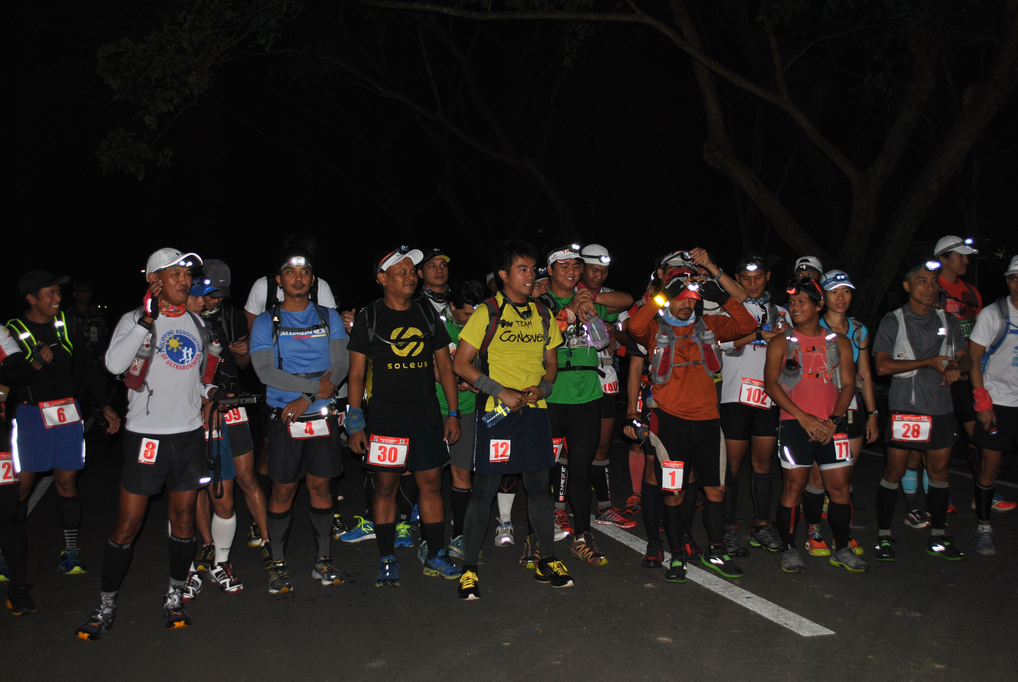
1. The events are SOLO Races. These races will Start at the same time and place on or about 5:00 AM of Saturday December 14, 2013 at the vicinity of the Special Operations Command Headquarters, Philippine Army in Fort Magsaysay, Palayan City (Nueva Ecija).
2. The race course is through paved roads, dirt roads and single-track trails. In the 100-Mile course, approximately 110 kilometers are dirt roads and single track trail and almost 57 kilometers are paved/asphalted roads. In the 50-Mile course, almost 55 kilometers are dirt roads and single-track trails and 28 kilometers of paved/asphalted roads.
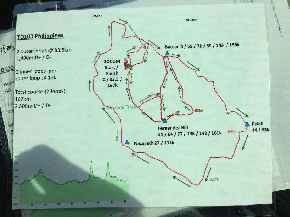
3. Runners in the 100-Mile Race has to finish Two Big Loops (One Loop is 83K) where each Loop has two Smaller Loops (12K-Loop around Mt Daklang Damulag) within it. Runner has to finish the course within the cut-off time of 32 hours.
4. Runners in the 50-Mile Race has to finish only One Big Loop (with two Smaller Loops around Mt Taklang Damulag). The cut-off time for the 50-Mile race is 16 hours.
5. Intermediate Cut-Off Times For 100-Mile Race:
50K @ Fernandez Hill—-8 Hours/1:00 PM Saturday, December 14, 2013
50K @ Fernandez Hill—-8 Hours/1:00 PM Saturday, December 14, 2013
83K/Finish Area/SOCOM Headquarters—-16:00 Hours/9:00 PM Saturday, December 14, 2013
7. Each runner must have the following basic gadgets/mandatory equipment with them:
a. At least 32 ounces of hydration (equivalent to two (2) Simple Hydration Bottles) fluids with them at ALL TIMES.
b. Basic First Aid Kit
c. Cellphone
d. Headlight/Handheld Flashlight
e. Whistle and/or Reflectorized Vest are NOT mandatory. It is enough that runners have reflectorized strips on their hydration pack or apparel.
f. Runners may use trekking poles.
8. Race Bib should be displayed on the FRONT part of the runner. Runner must be able to memorize his/her Race Bib Number.
9. Always run on SINGLE FILE and stay on the farthest LEFT side of the paved roads.
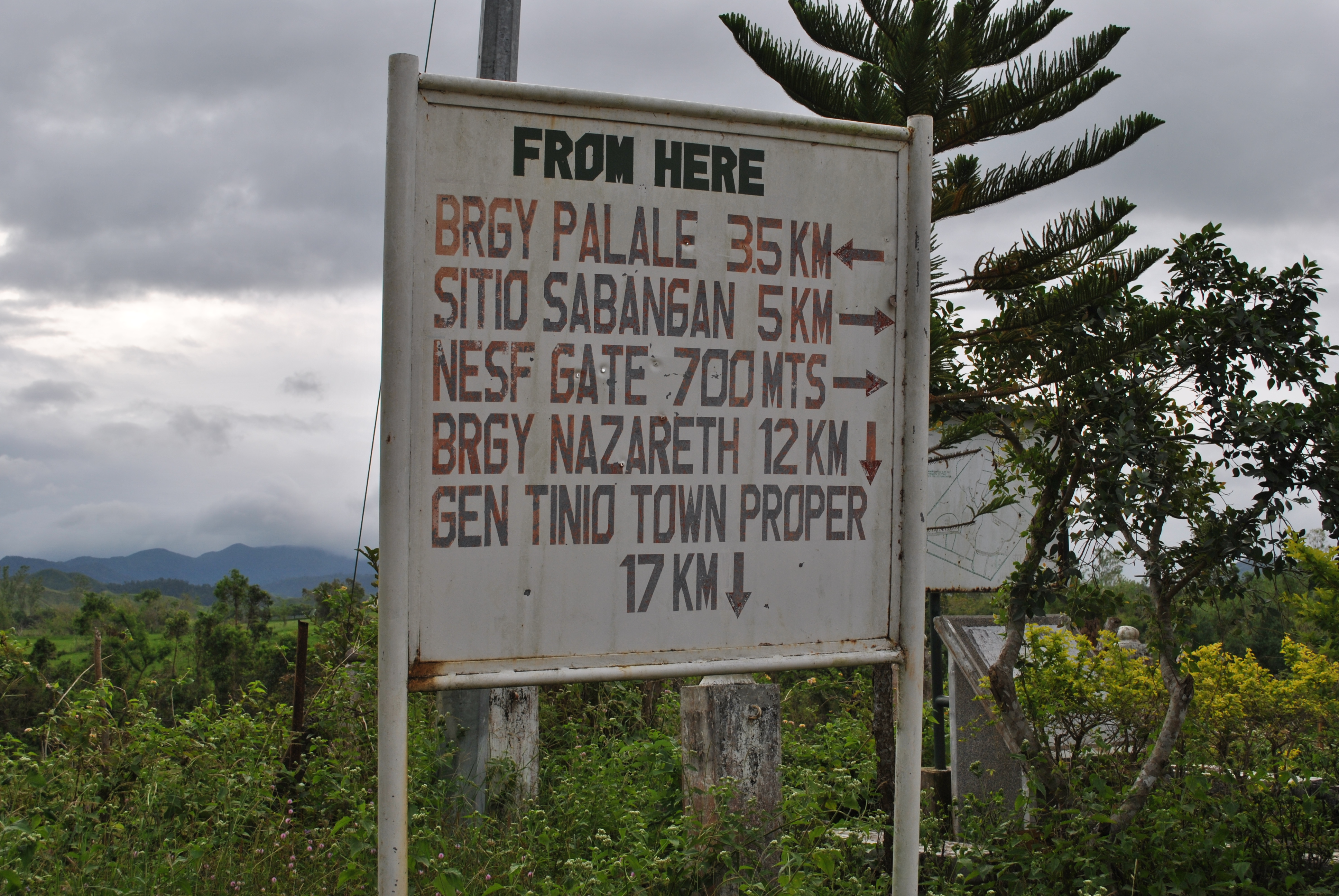
10. Drop Bags are allowed on the following Aid Stations:
a. Sitio Baccao
b. Barangay Palale
c. Barangay Nazareth
d. Fernandez Hill
e. SOCOM Headquarters/Start/Finish
Drop Bags will be collected at 4:00 AM and transported to their respective destination before the Gun Start. Drop Bags should be properly tagged/labeled with the runner’s Last Name, Bib Number & Location of Aid Station.
11. Support Vehicle is NOT allowed to “follow”; to “track”; or “leap frog” their runner along the course. Support Vehicle can ONLY have access to their runner/s at the designated Aid Stations. Support Crew can ONLY offer support to their runner within the vicinity of the Aid Stations.
12. A Pacer is ONLY allowed after the runner has completed the FIRST HALF of the course (83K) in the 100-Mile Race. A runner is only allowed ONE PACER at a time along the course. There will be NO Pacer for the 50-Mile Race.
13. Pacers are NOT allowed to carry any hydration, food, or equipment for the runner. Pacers are there as safety runners for the competing participant.
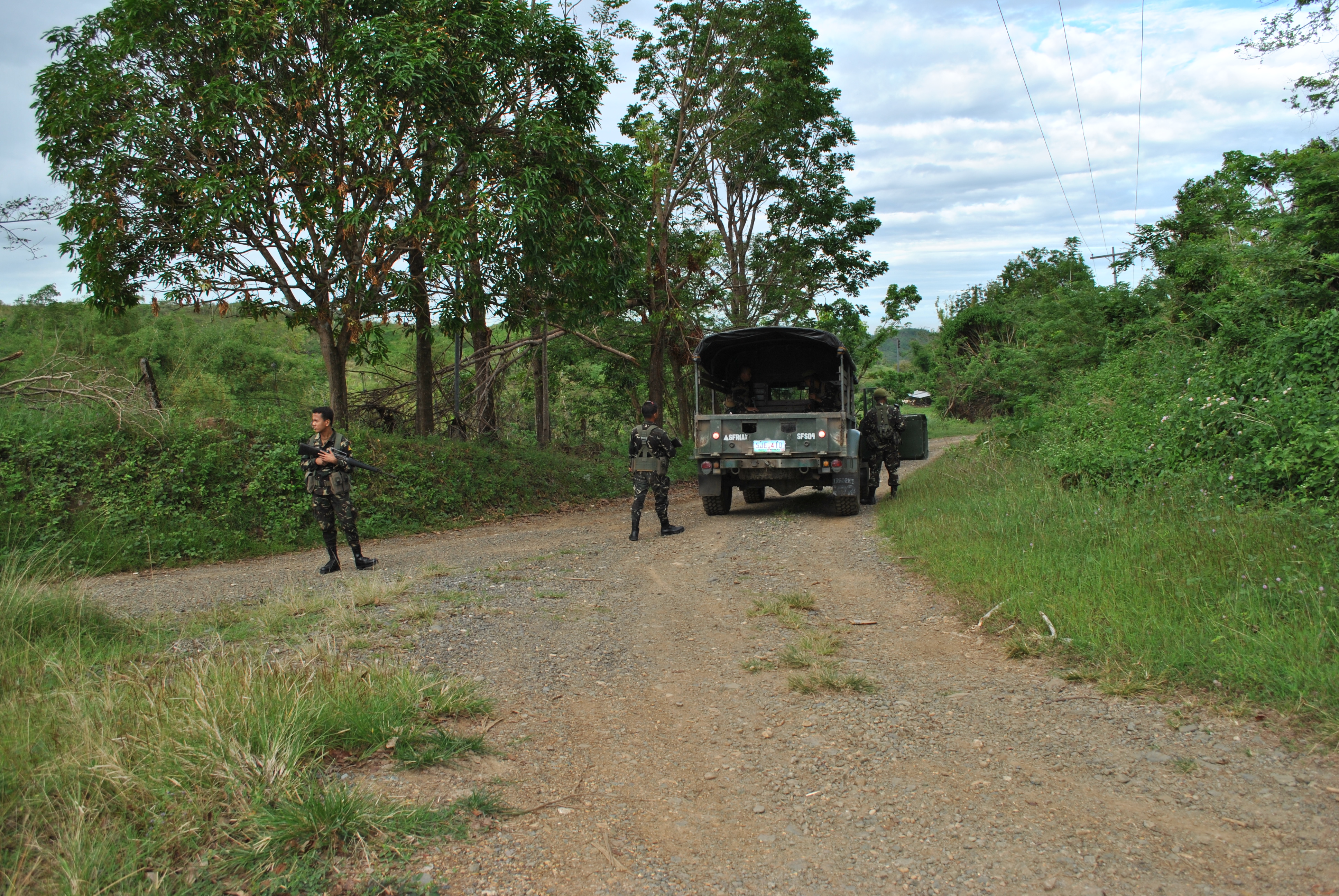
14. There will be Marshals on key intersections along the route. These are soldiers of the Special Forces Regiment of the Philippine Army and some of them will be manning the Aid Stations in Sitio Baccao, Barangay Palale, and Barangay Nazareth. Runners should be ATTENTIVE on these key intersections/Aid Stations on their FIRST LOOP as it is still DAYTIME. There is a possibility that some of these marshals could be sleeping/lying on the ground during nighttime in some of the key intersections in the Taklang Damulag Loop. Try to memorize these intersections!
15. Aside from the visible Marshals stationed on key intersections, there are also “invisible” (or hidden) marshals along the trails/dirt roads to monitor the runners passing along the route. They have a way to identify each runner passing on their respective station. These marshals are there to provide security to the runners.
16. In case of emergency, runner should contact Cellphone # 0918-965-9895 and/or # 0915-753-3834. Runner should state his/her name, location and the nature of emergency.
17. On the accommodation of runners, ONLY registered runners are FREE of charge. 100-Mile Runners are allowed two nights accommodation and the 50-Mile Runners are allowed one night only. Runners have the PRIORITY to be accommodated at the Special Forces Transient Facility and SF Alumni Center, near the SOCOM Headquarters. Three (3) Rooms (good for 4-6 people) had been reserved to be used for other runners and support crew at the 7th Division Army Transient Facility (near the Starting Area of the Fort Magsaysay To Dingalan 60K Ultra Run).
18. NO Bandits are allowed.
19. Runner must be able to provide the Name of their respective Pacer to the Secretariat before the Start of the Race.
20. It is the sole responsibility of the runner to have a thorough knowledge of the course. The course is MORE THAN 100 Miles or 161 Kilometers! This is NOT a valid reason for you to take a SHORTCUT or DETOUR along the course. Fort Magsaysay’s weather is always HOT during daytime. If you have complaints, please feel free to give directly to us your feedback immediately.
21. Maintain the Integrity of the Race.
“Pioneers” Of TD 100
Good Luck & Have Fun!
Administrative Announcement: There will be a Race Briefing & Dinner/CLP for the Registered Runners of the TD 100-Mile and TD 50-Mile Races at the SOCOM Headquarters, Fort Magsaysay, Palayan City o/a 6:00 PM of Friday December 13, 2013. Runners will be processed by submitting to the Secretariat/BR’s Staff their individual BPI Deposit Slips (For the Registration & Donation For the Typhoon Yolanda Victims).
Race Route Description: Taklang Damulag 100-Mile/50-Mile Endurance Run (TD 100/50)
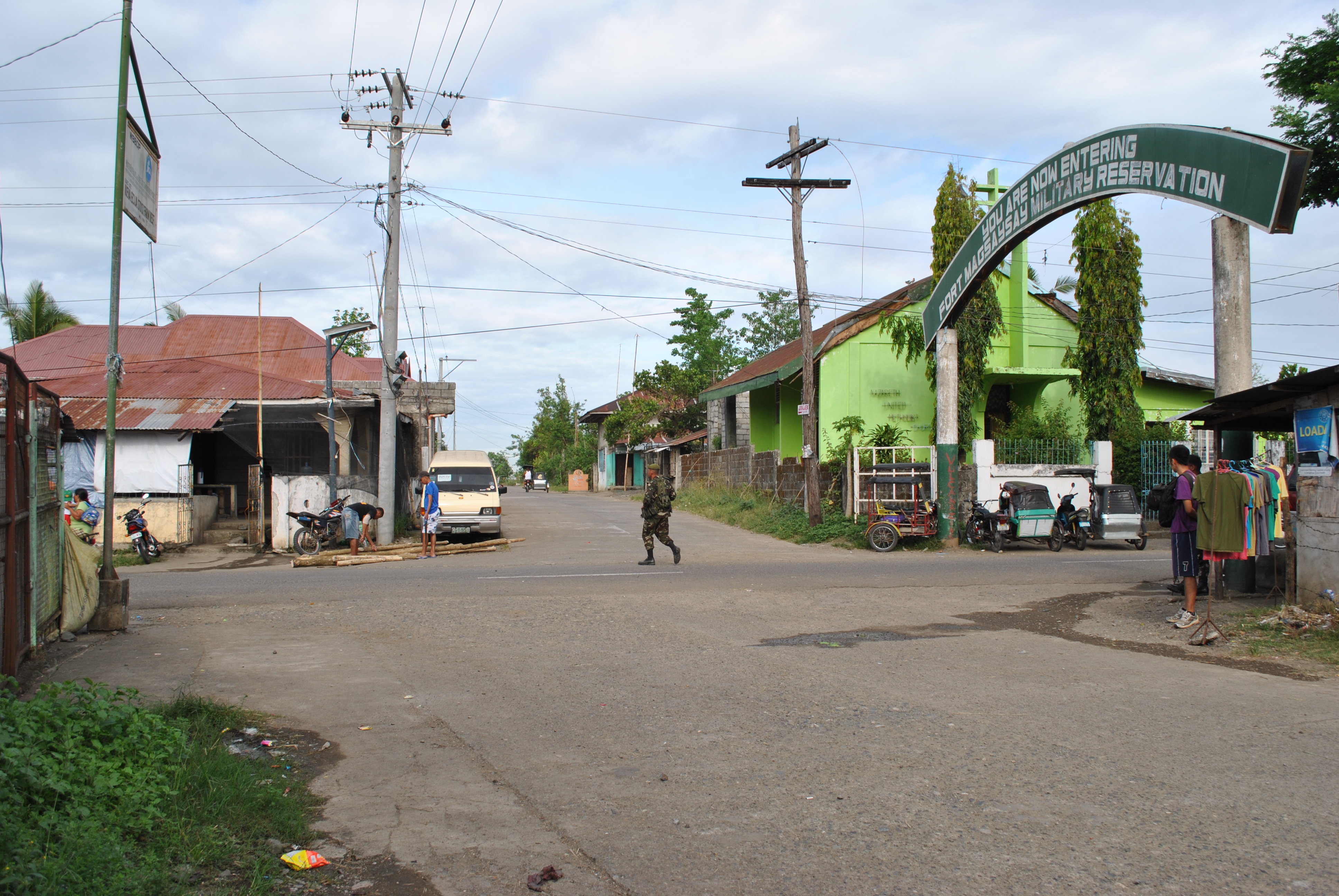
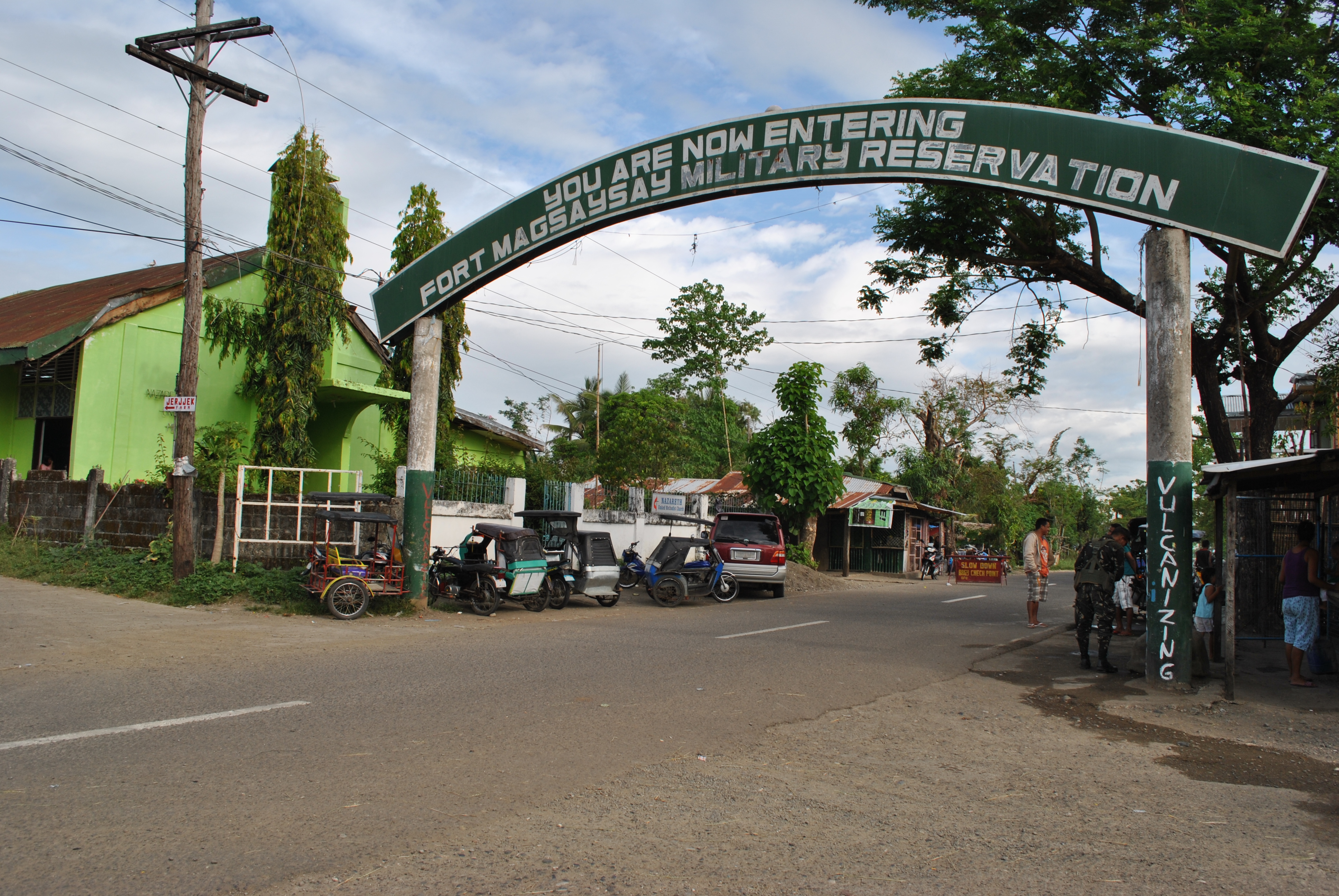
1. The race starts at the vicinity of the Special Operations Command (SOCOM), Fort Magsaysay, Palayan City (Nueva Ecija). The SOCOM Headquarters is located at the Abundo Area Complex inside Fort Magsaysay, the largest Military Camp/Reservation Area of the Philippine Army. The race starts at 5:00 AM of Saturday, December 14, 2013 together with the Taklang Damulag 50-Mile Endurance Run.
2. This is a solo race. The cut-off time for the 100-Mile Race is 32 hours. The cut-off time for the 50-Mile Race is 16 hours.
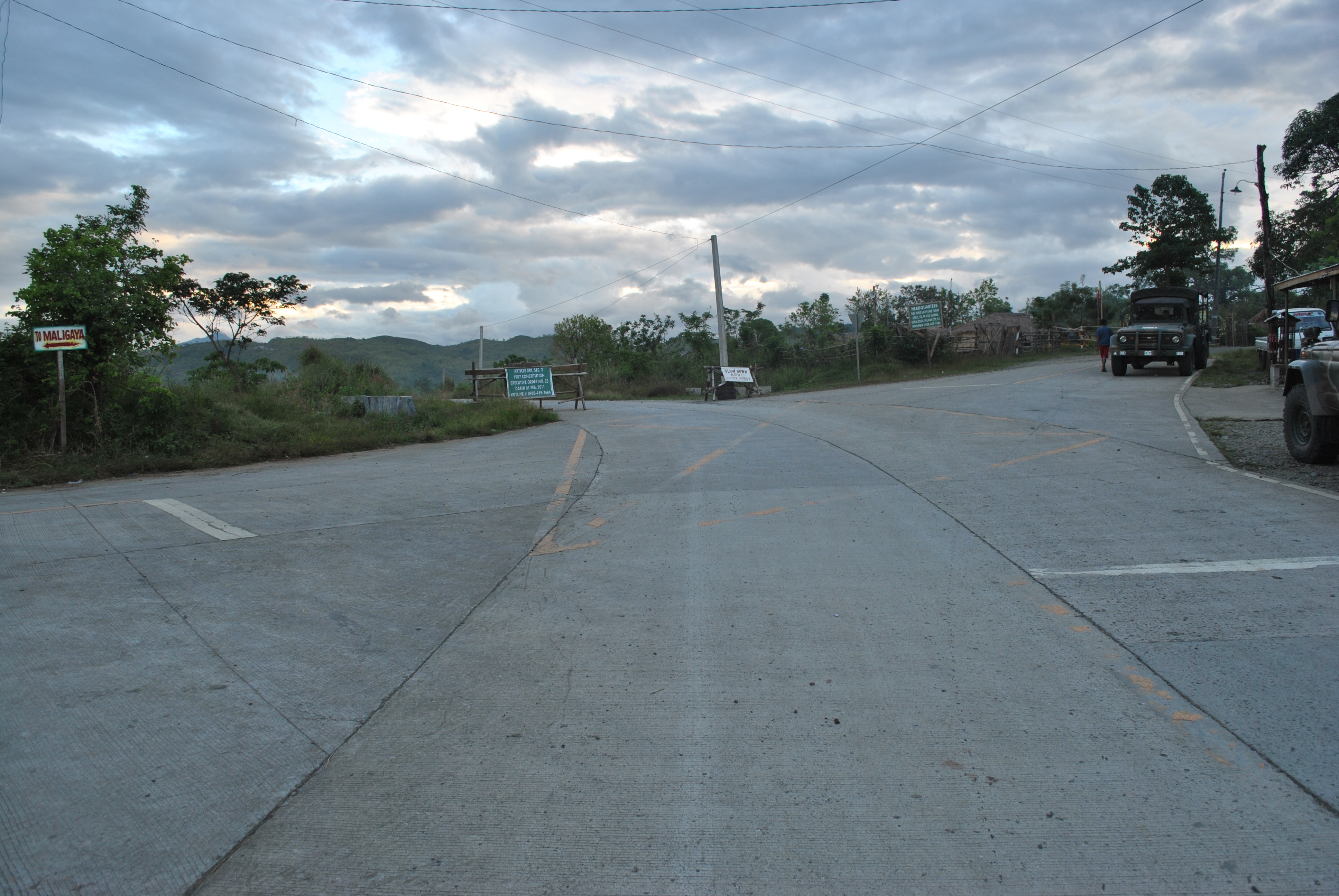
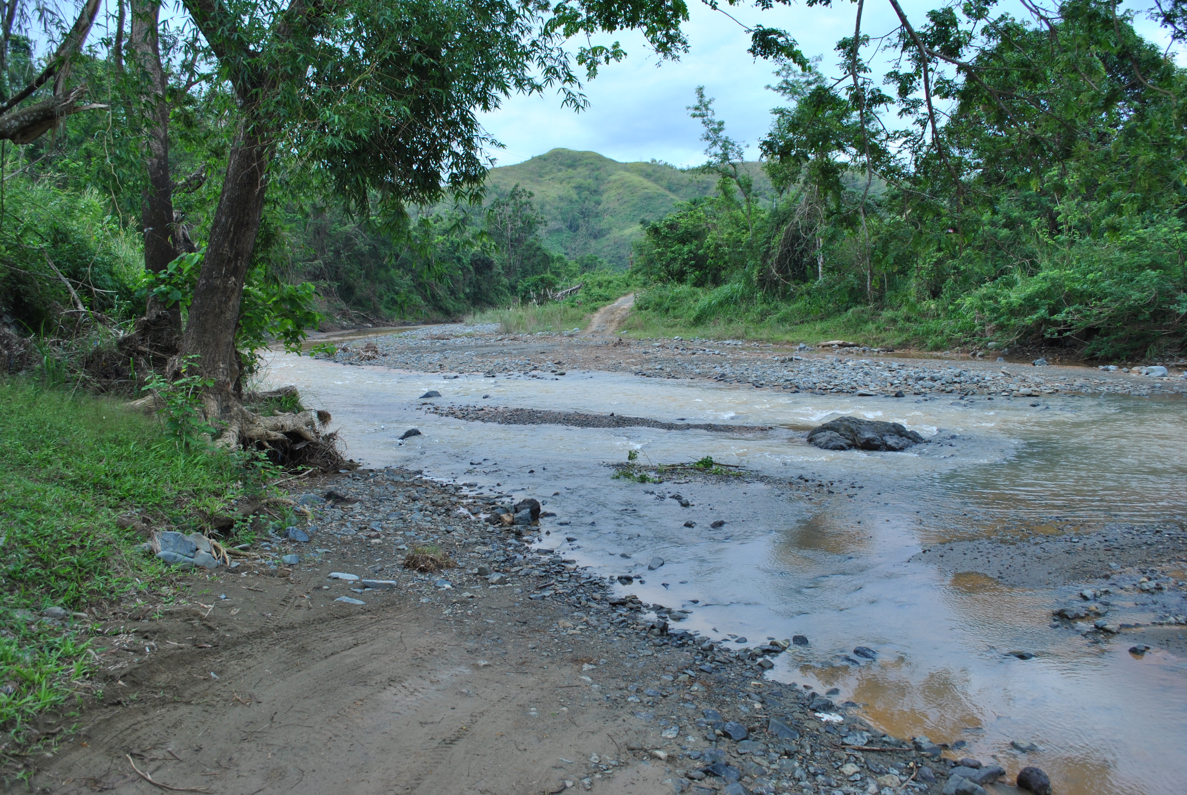
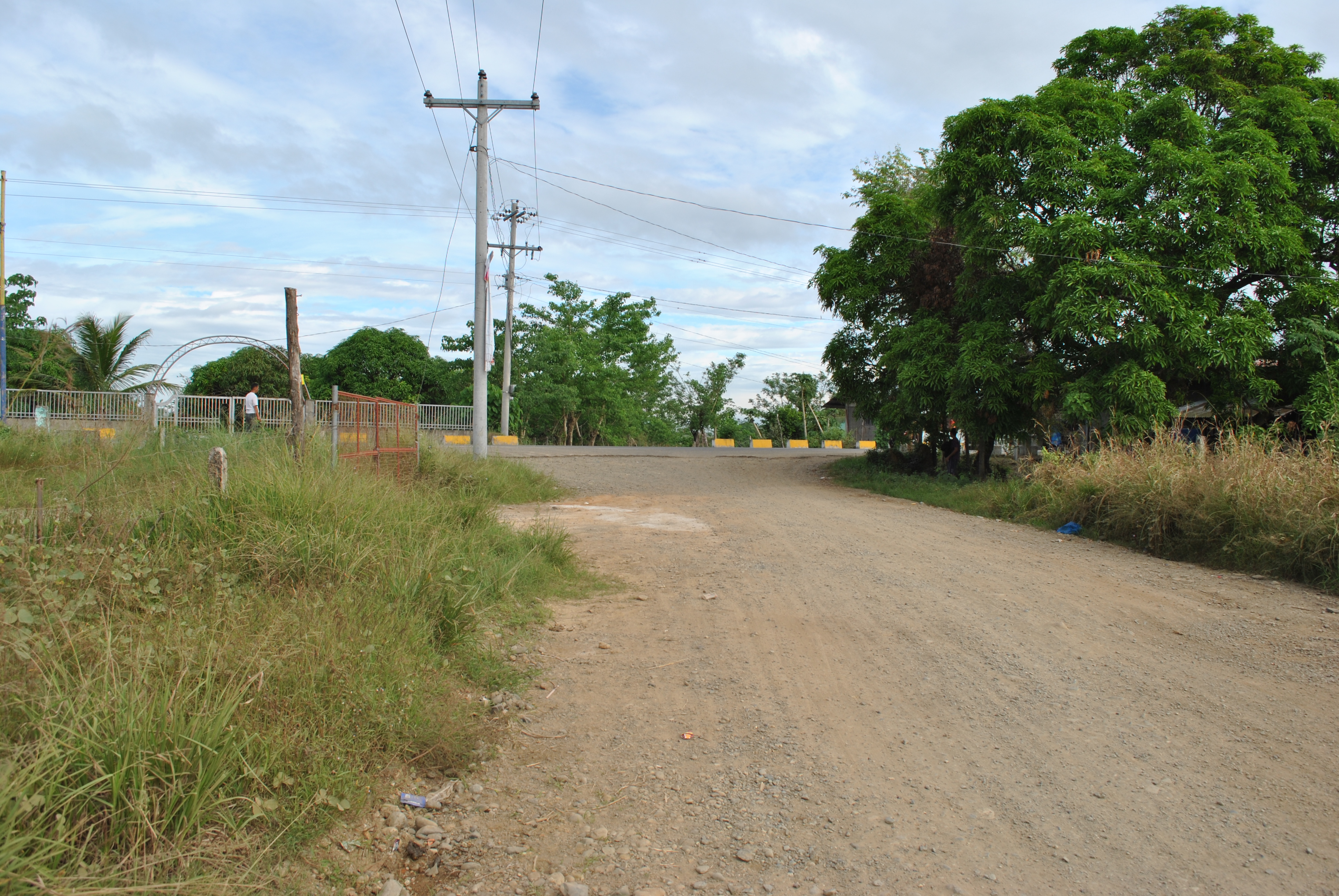
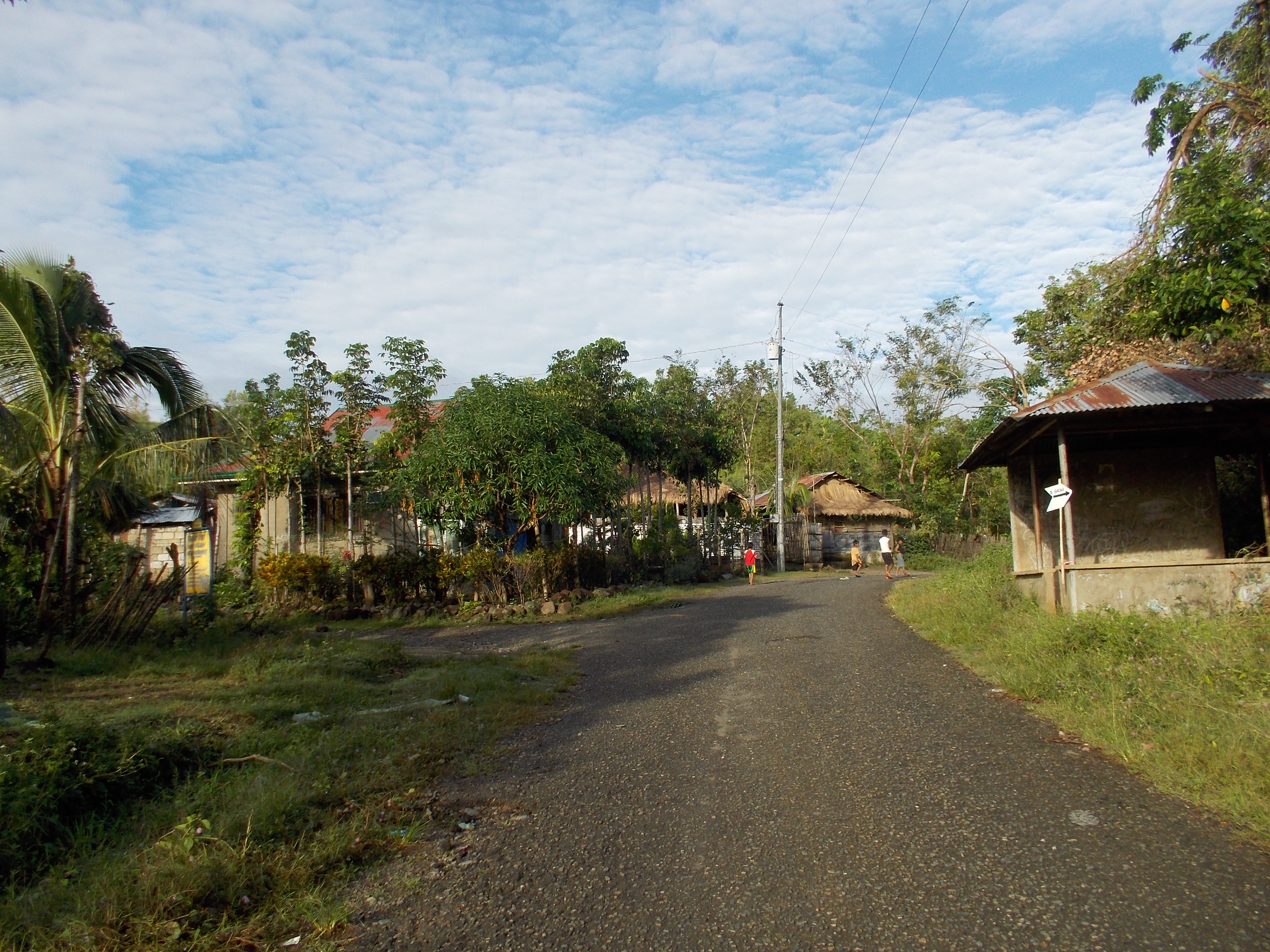
3. From the starting line, runners will proceed towards an east direction to a dirt road which is parallel to the Fort Magsaysay Airstrip. The airstrip is located on the right side of the runners. This dirt road has a lot of potholes and uneven portions. Runners must be able to have their headlights/handheld flashlight on this part of the course since it is still dark at 5:00 AM.
4. After almost 500 meters, runners have to TURN LEFT upon reaching an intersection. It is still a dirt road which leads the runners to the newly-constructed Fort Magsaysay-Laur Road after getting out from the Gate of the Camp. This dirt road goes down and slightly uphill towards the Gate. The distance of this road is about 700-800 meters.
Dirt Road To The Fort Magsaysay-Laur Highway
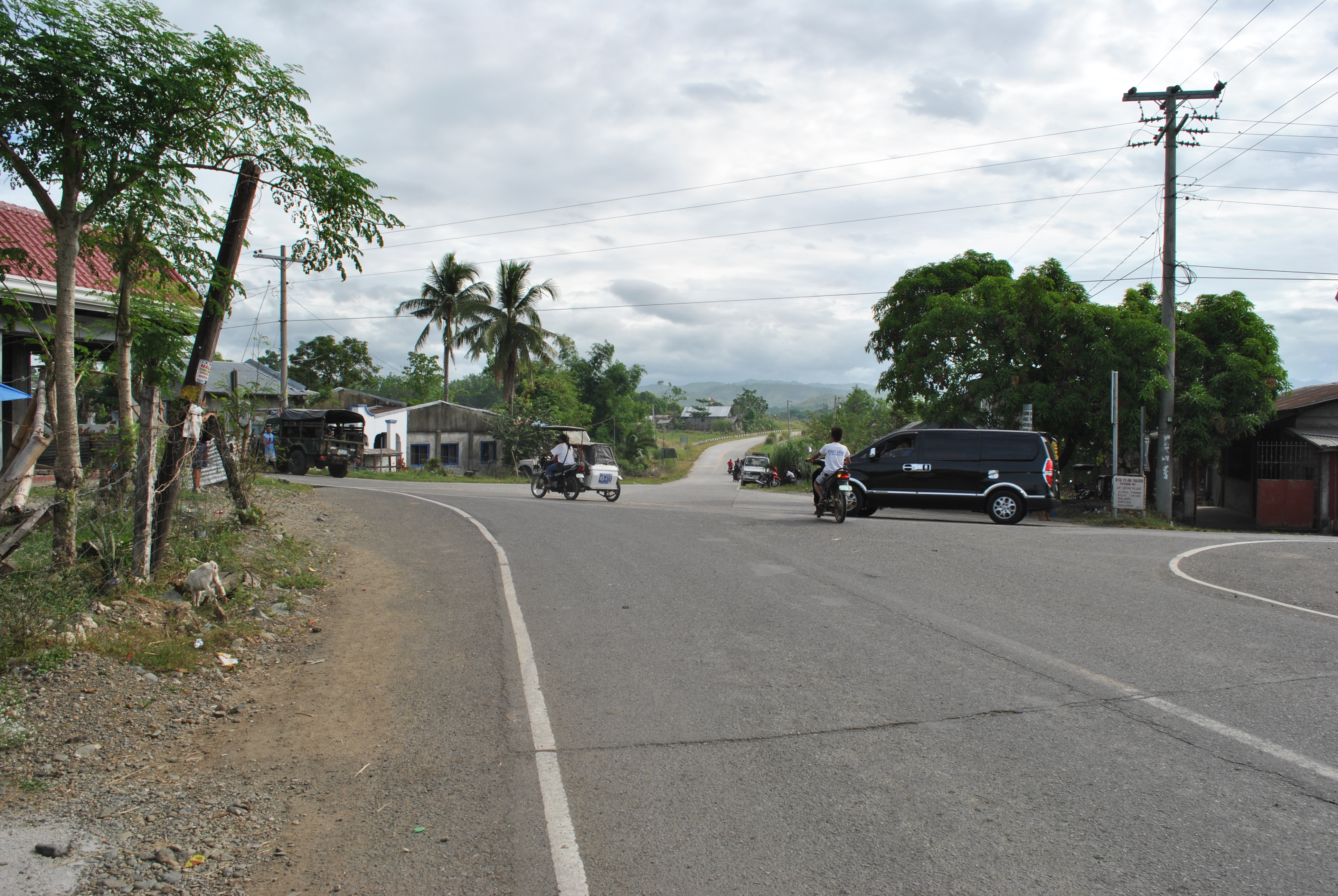
5. Runners shall TURN RIGHT on the paved/cemented Sta Rosa-Fort Magasaysay-Laur Road. This is the same road on the first 3K of the Fort Magsaysay To Dingalan 65K Ultra Marathon Race.
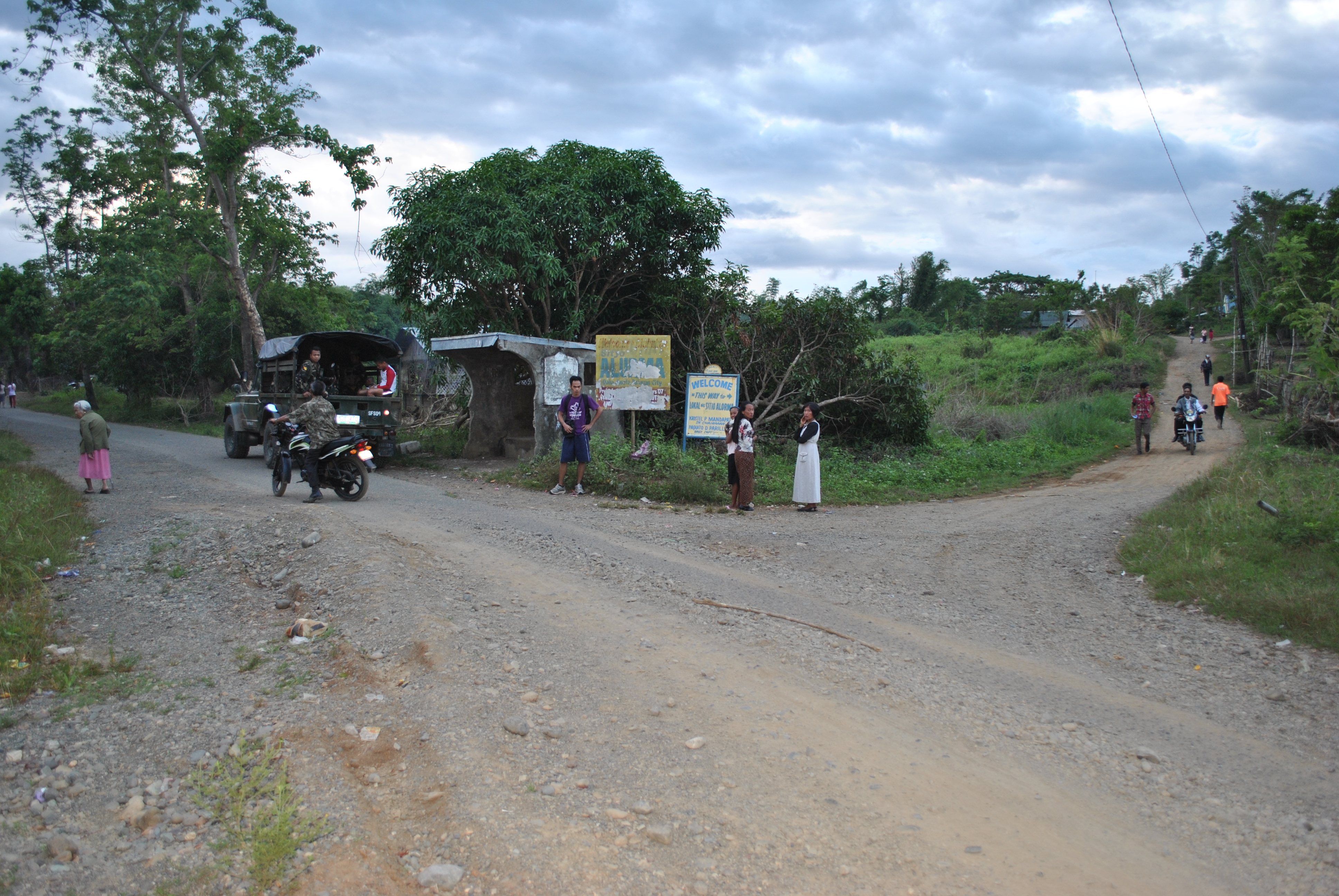
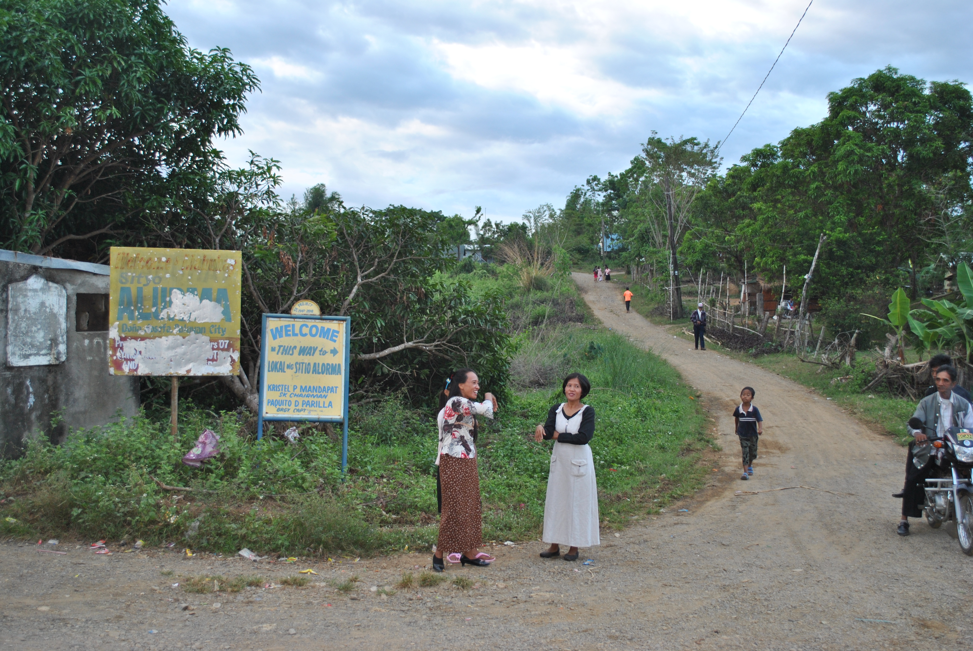
6. There will be an INTERSECTION after running for almost 2 kilometers along the Sta Rosa-Fort Magsaysay-Laur Road. There is a Detachment and Military Checkpoint on this intersection. Runners will have to TURN RIGHT on this intersection which leads to Barangay Dona (Donya) Josefa. Runners will be able to pass on the intersection of Sitio ALORMA and Sitio BACCAO. Runners will have to follow the asphalted road up to Barangay Dona Josefa.
TURN RIGHT Towards Barangay Dona JosefaINTERSECTION @ Sitio ALORMA (Right Side of the Road)SITIO BACCAO Intersection (On the Right Side of the Road)
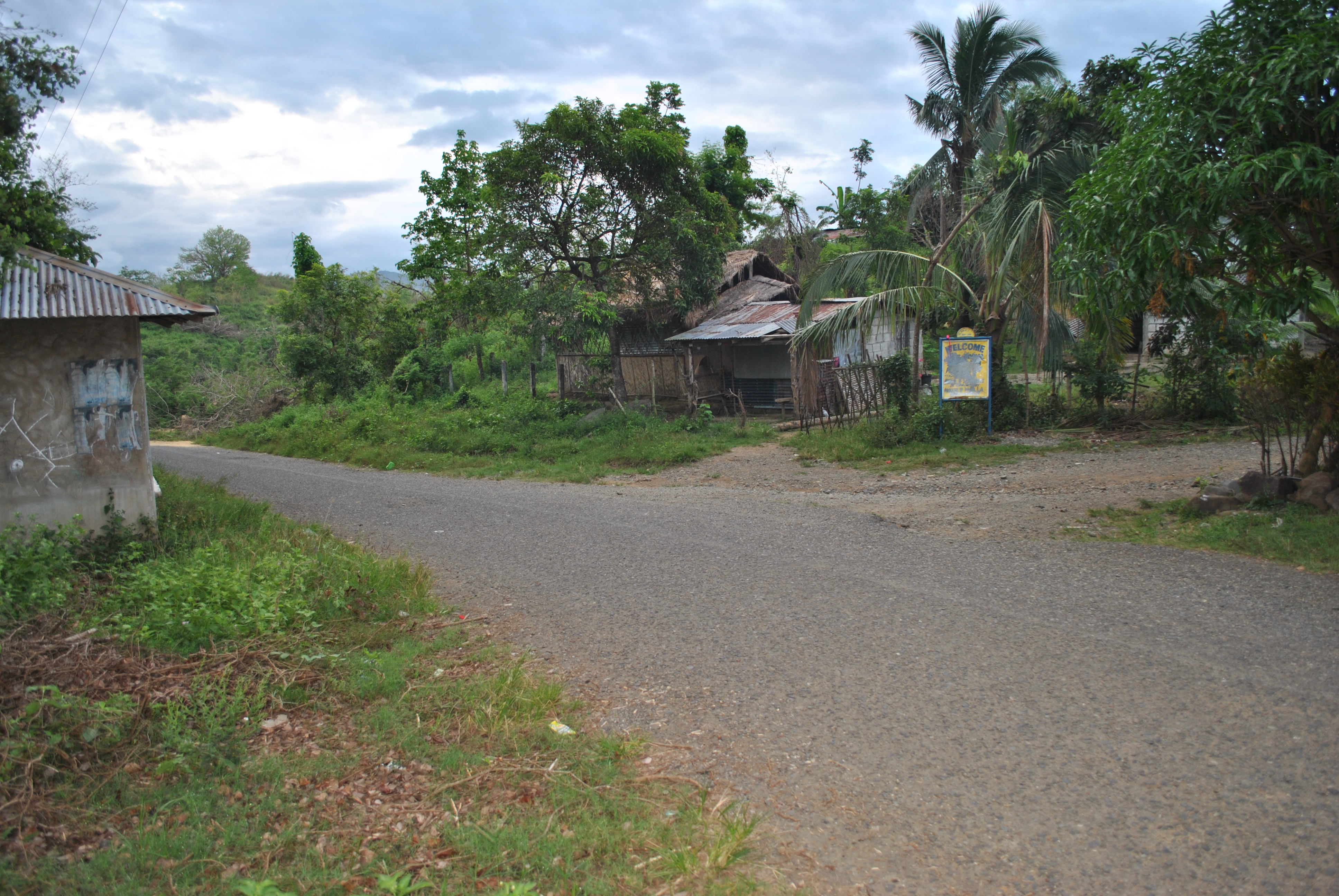
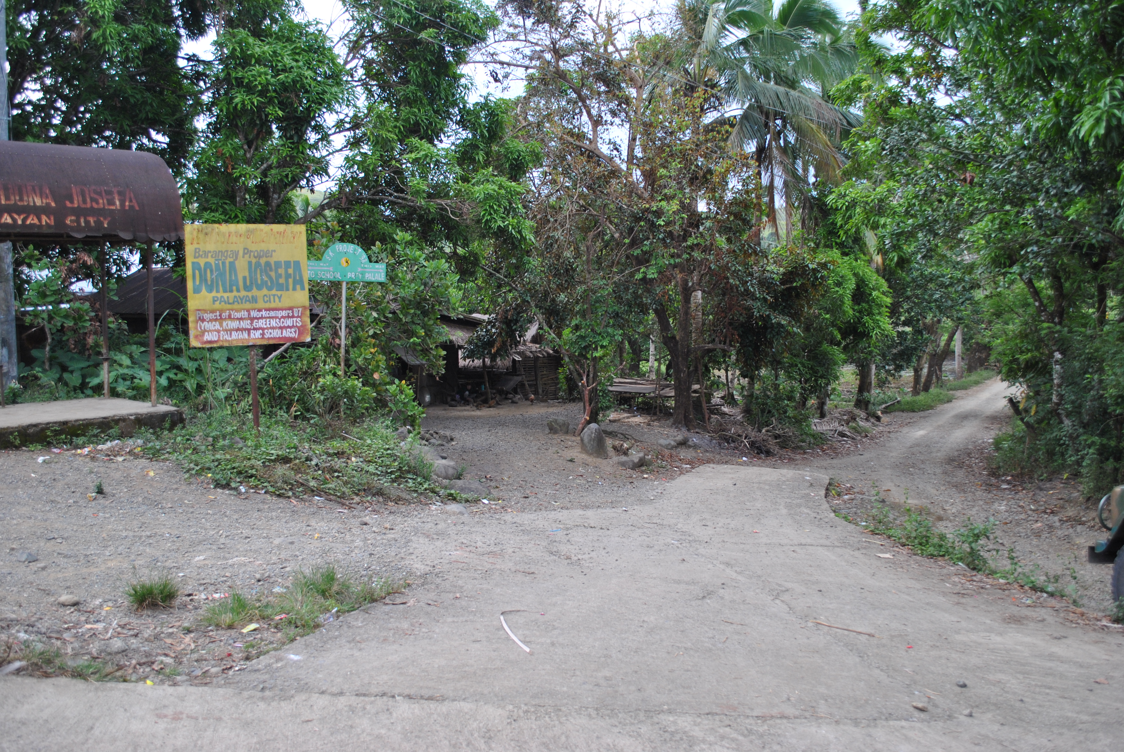
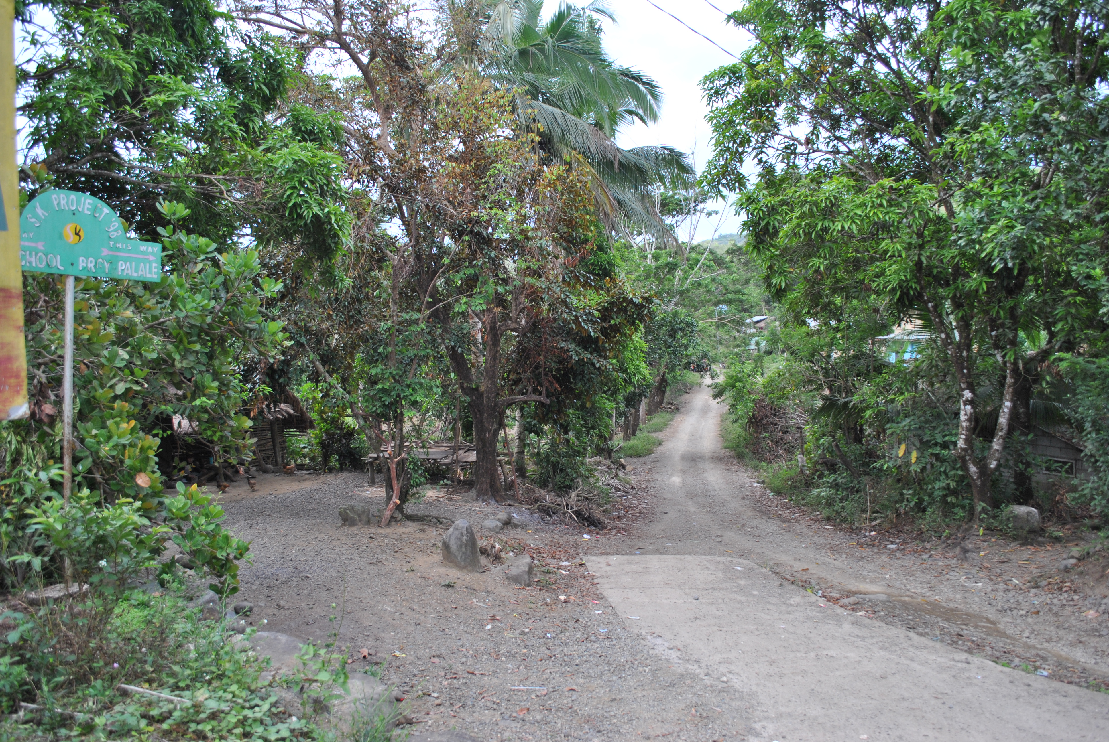
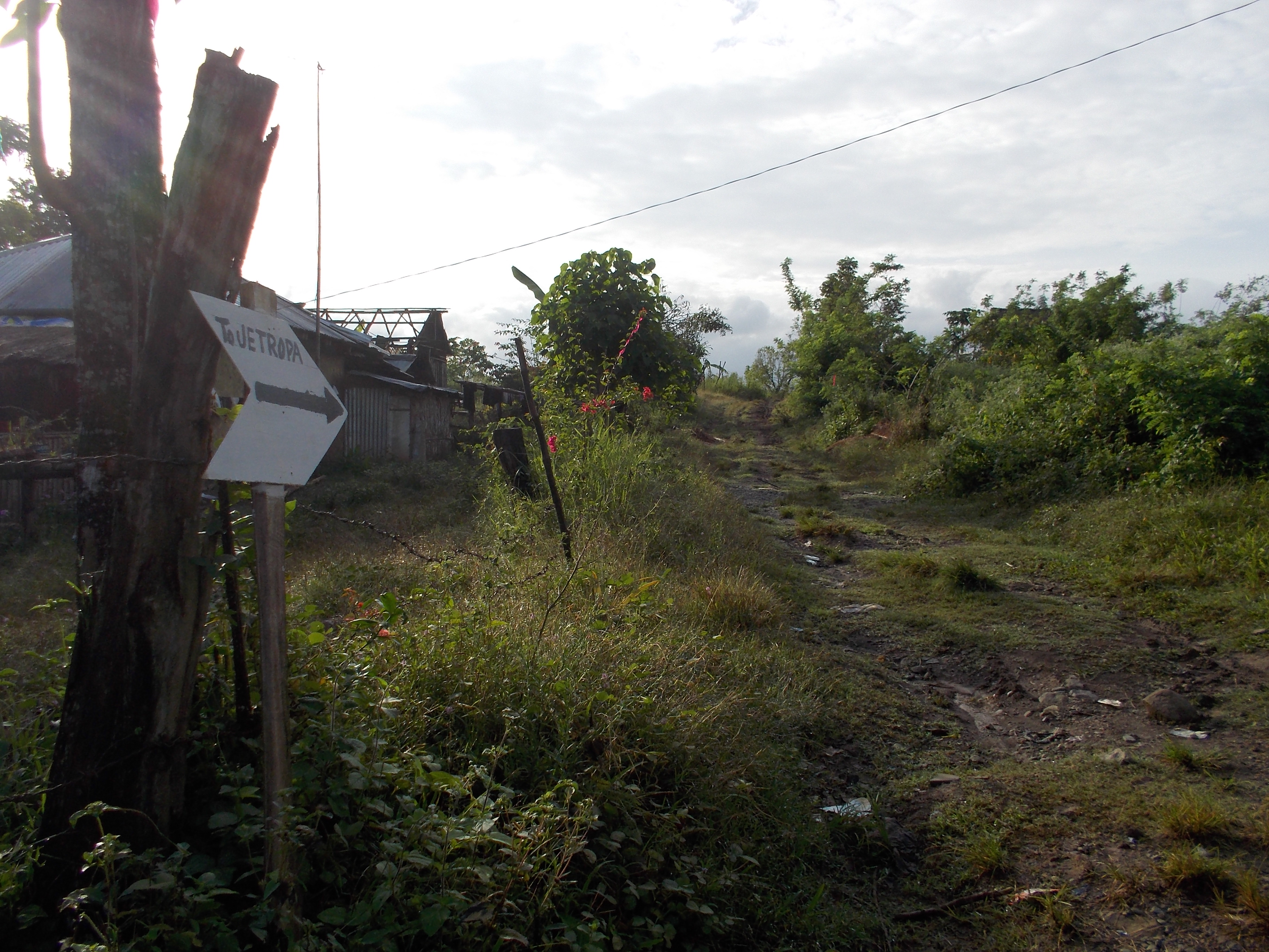
7. Once the runners will reach the center of Barangay Dona Josefa, turn RIGHT and just follow the dirt road. Do NOT take the road towards the LEFT Direction as it ends at the Dona Josefa Elementary School.
@ BARANGAY Dona JOSEFATURN RIGHT TO BRGY PALALE
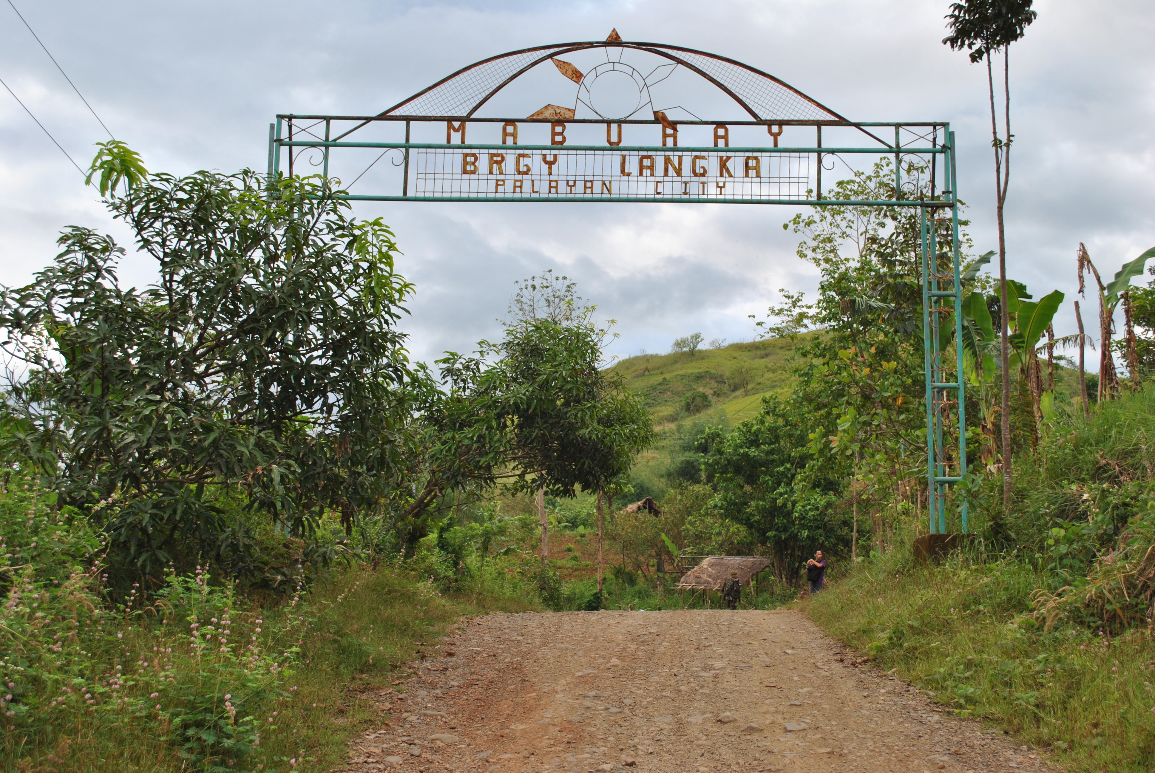
8. Runners will reach the first Spillway and after passing the Spillway, it will be an uphill climb and a steel arc will be seen with the markings “WELCOME TO SITIO LANGKA”.
First Spillway Before Barangay Langka Welcome ArcBarangay LANGKA Welcome Arc
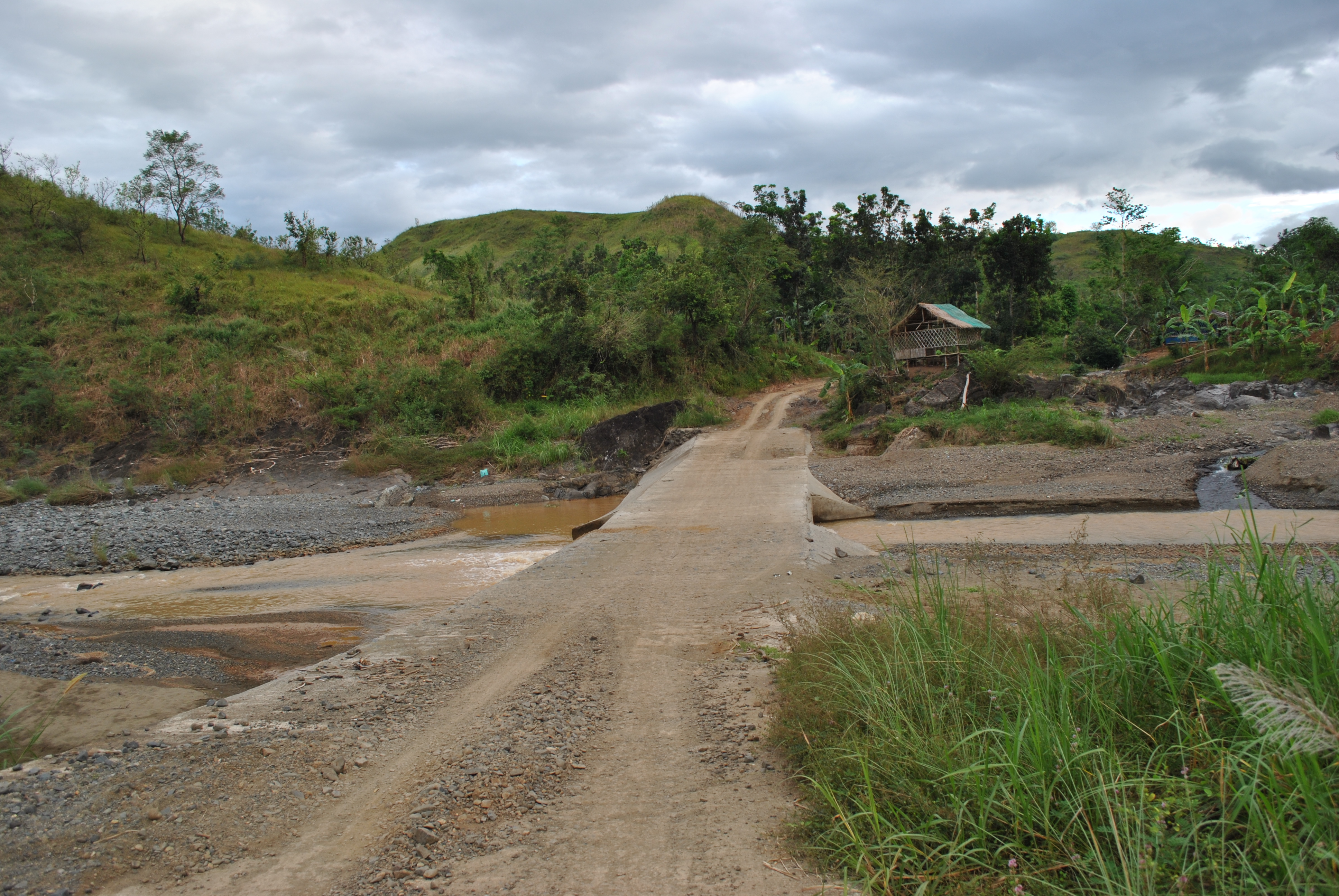
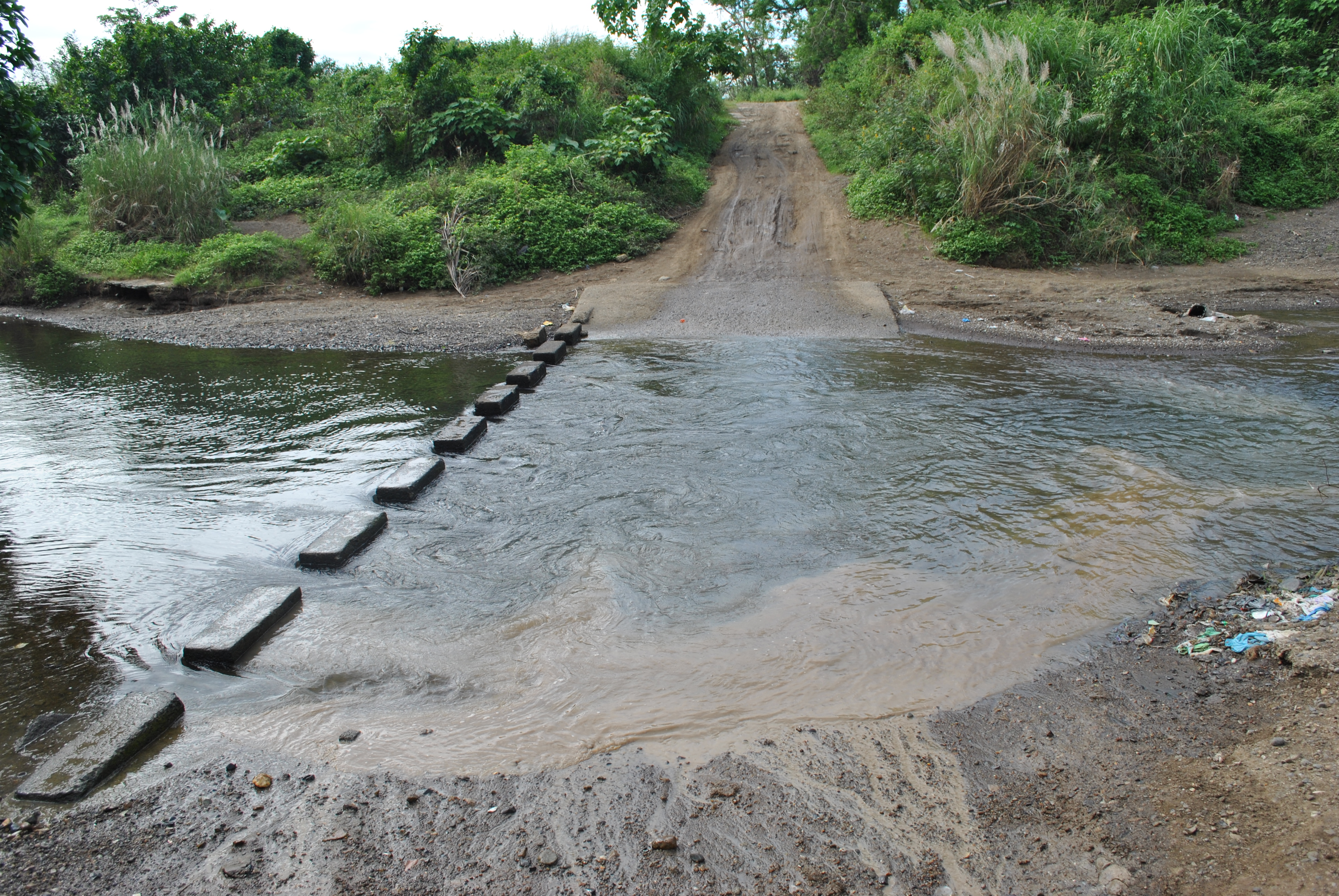
9. After passing the BARANGAY LANGKA Arc, at about 20 meters, there will be a Y-intersection. TURN RIGHT on the Y-intersection and it will be the start of more uphill climbs and descending parts of the route. Ultimately, the runners will be crossing the Palale River.
TURN RIGHT After Brgy LANGKA Arc
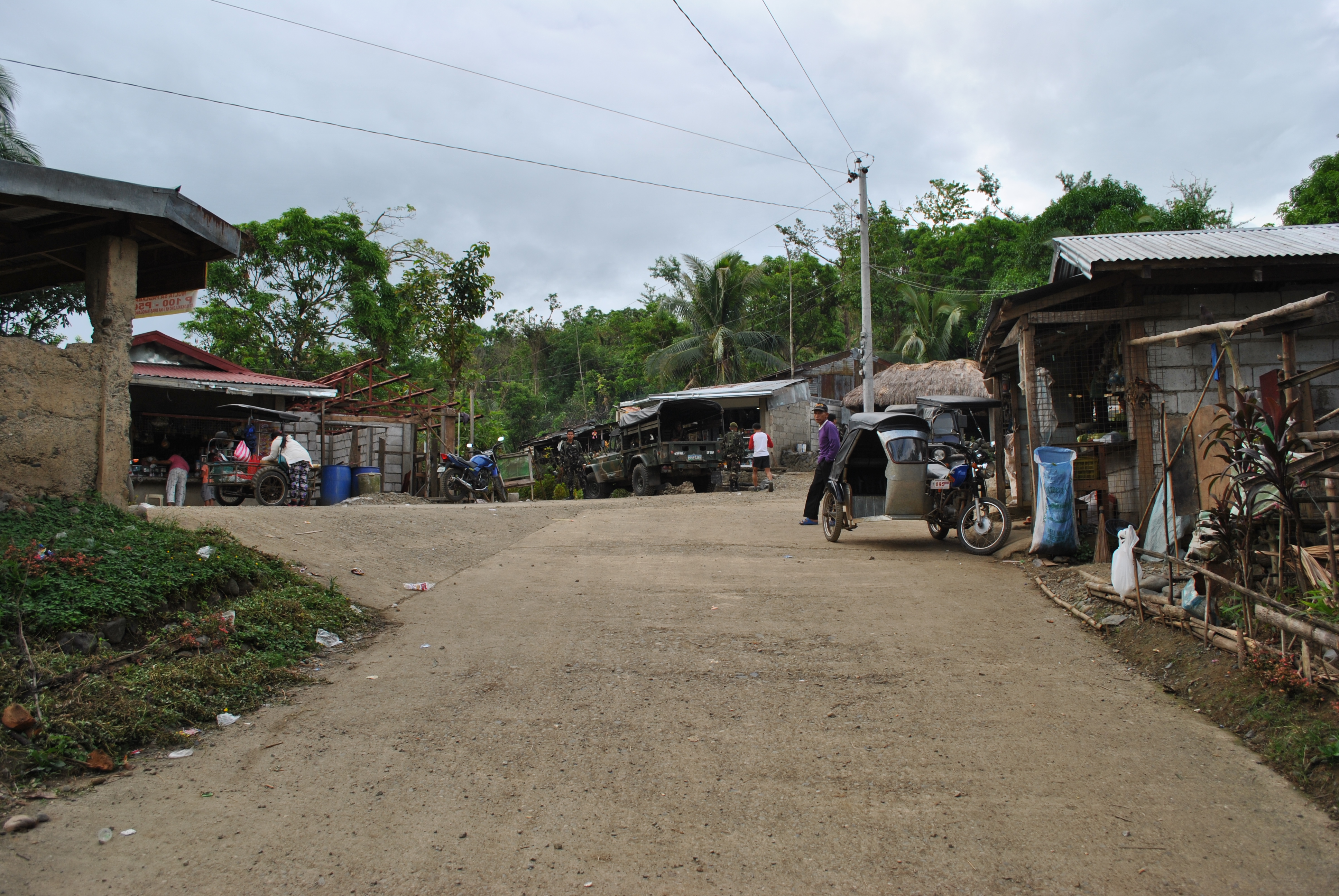
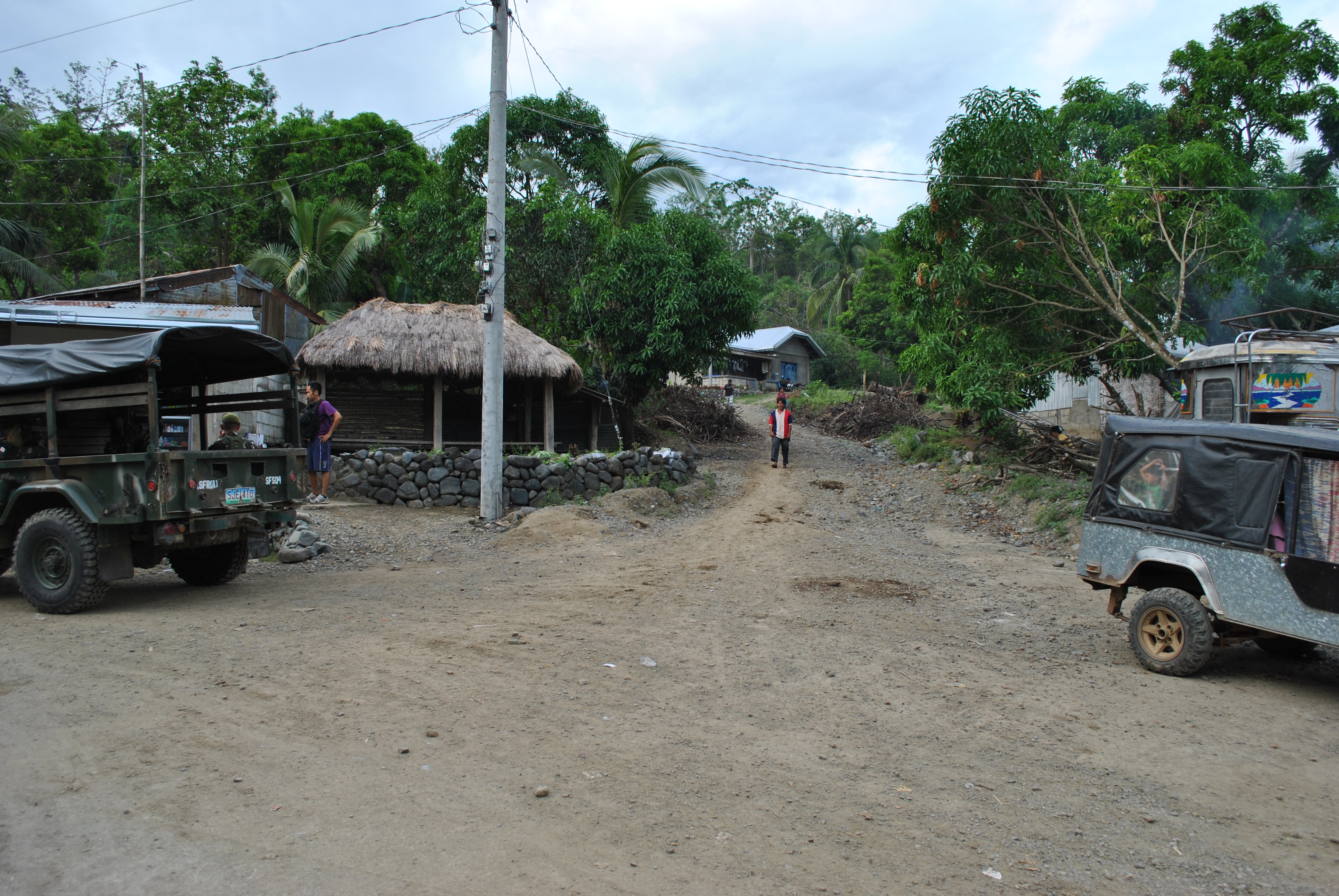
10. After crossing the Palale River, runners will be able to reach the center of Barangay Palale after few meters. There will be an Aid Station in this Barangay. There are also sari-sari stores in this area.
PALALE RIVERCenter Of Barangay PALALETURN RIGHT on the Right Most Road
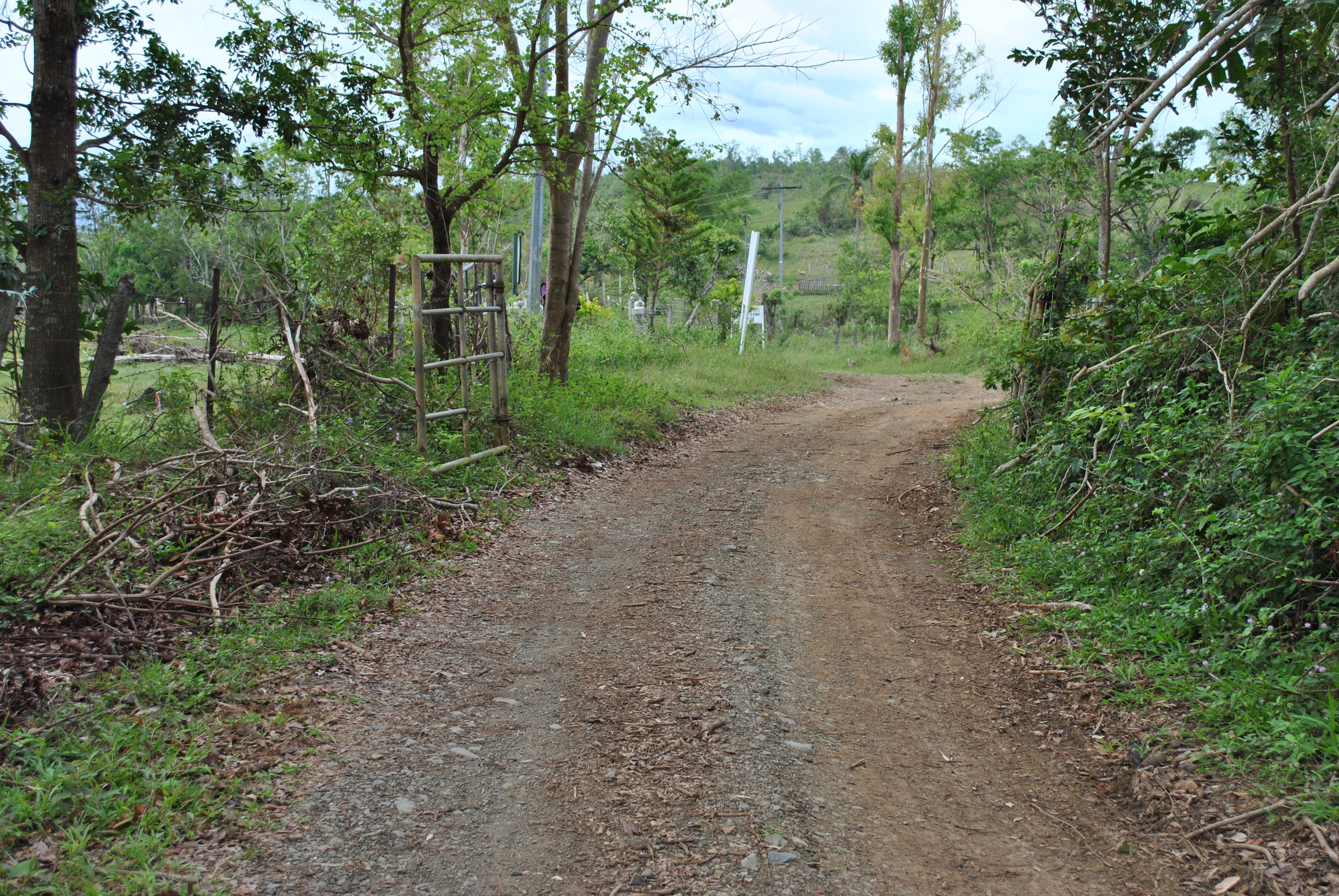
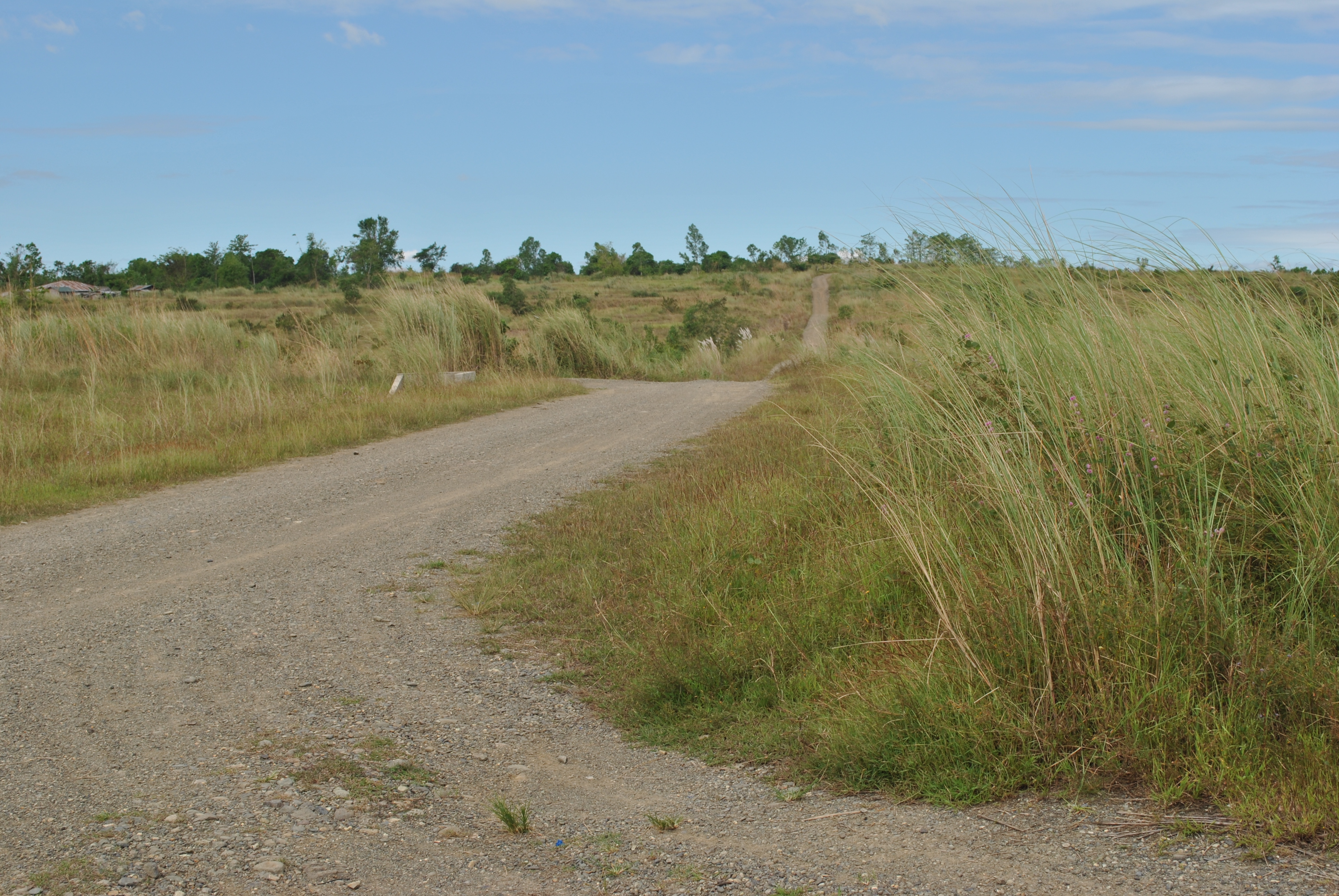
11. Runners will take the road on the RIGHT as one leaves the center of the barangay. Runners will be going to the direction of the Provincial Cattle Stock Farm.
Approaching The Provincial Cattle Stock FarmTake Note Of This Road Markings
12. Once the runners reach the Provincial Cattle Stock Farm, TURN RIGHT on the intersection. This road will lead the runners to Barangay NAZARETH.
TURN RIGHT On This Road Going To Barangay NAZARETH
13. Runners shall reach the intersection of GAPAN-PAPAYA-FORT MAGSAYSAY Road which is a paved/cemented, once they reach the center of Barangay Nazareth. The Aid Station is located at the Barangay Hall of Nazareth. At this intersection, runners have to TURN RIGHT going to a north direction.
Barangay NAZARETH IntersectionTURN RIGHT On This Road
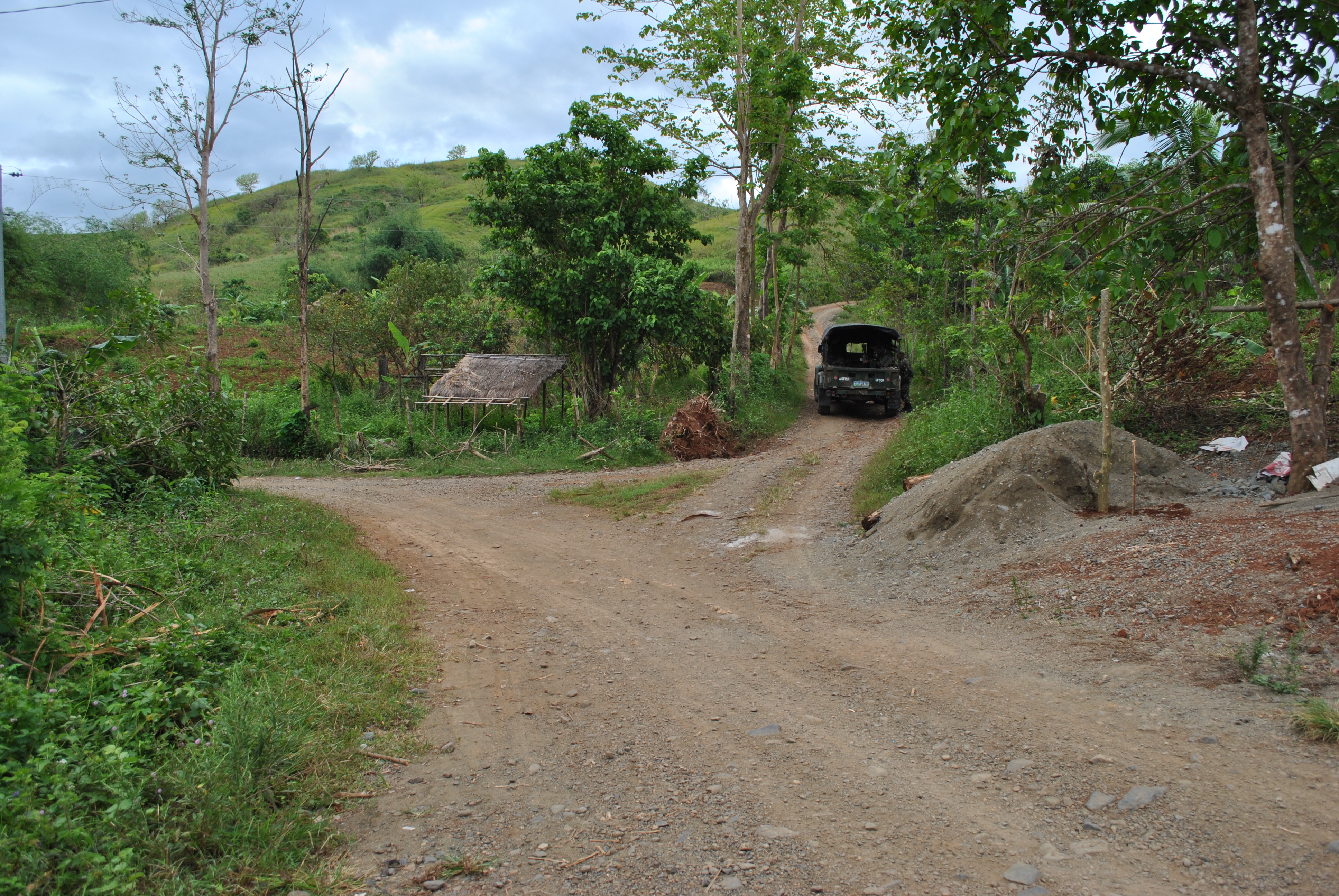
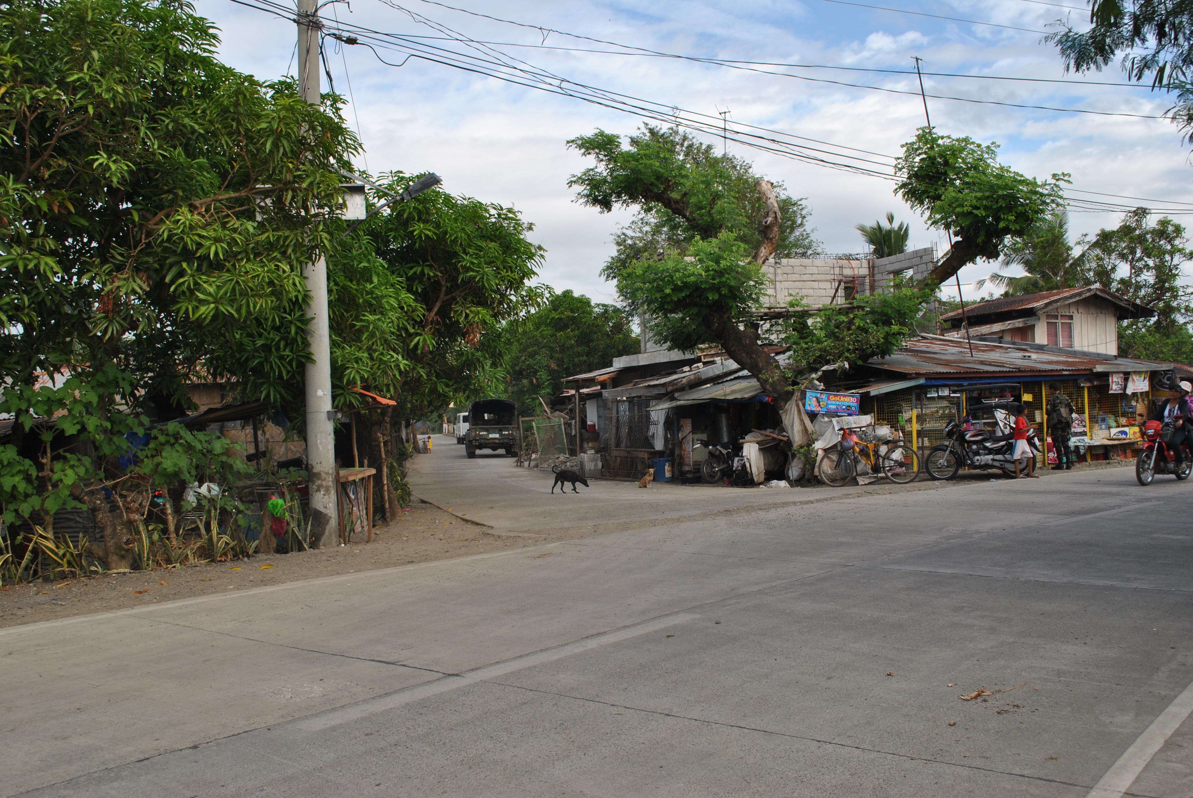
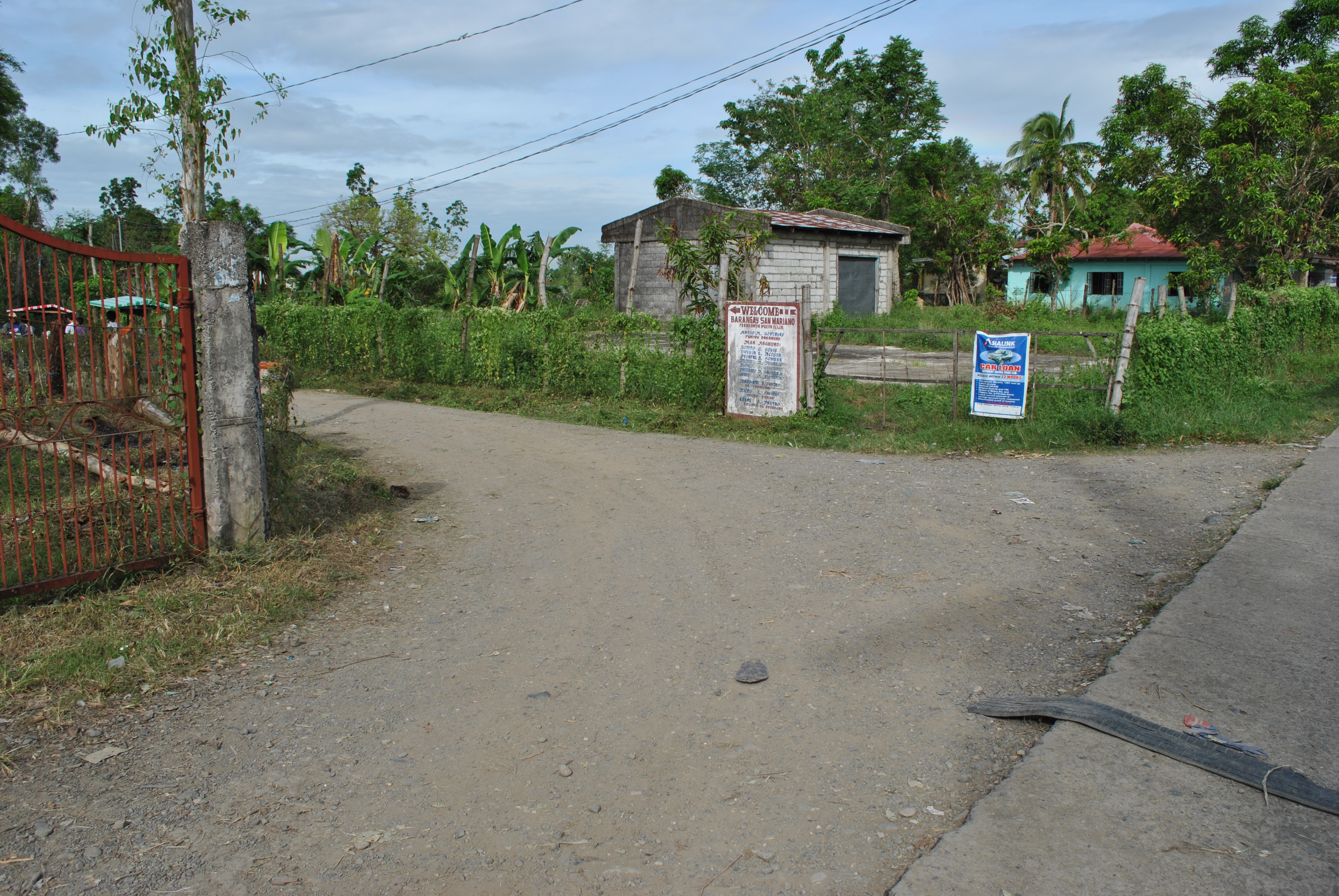
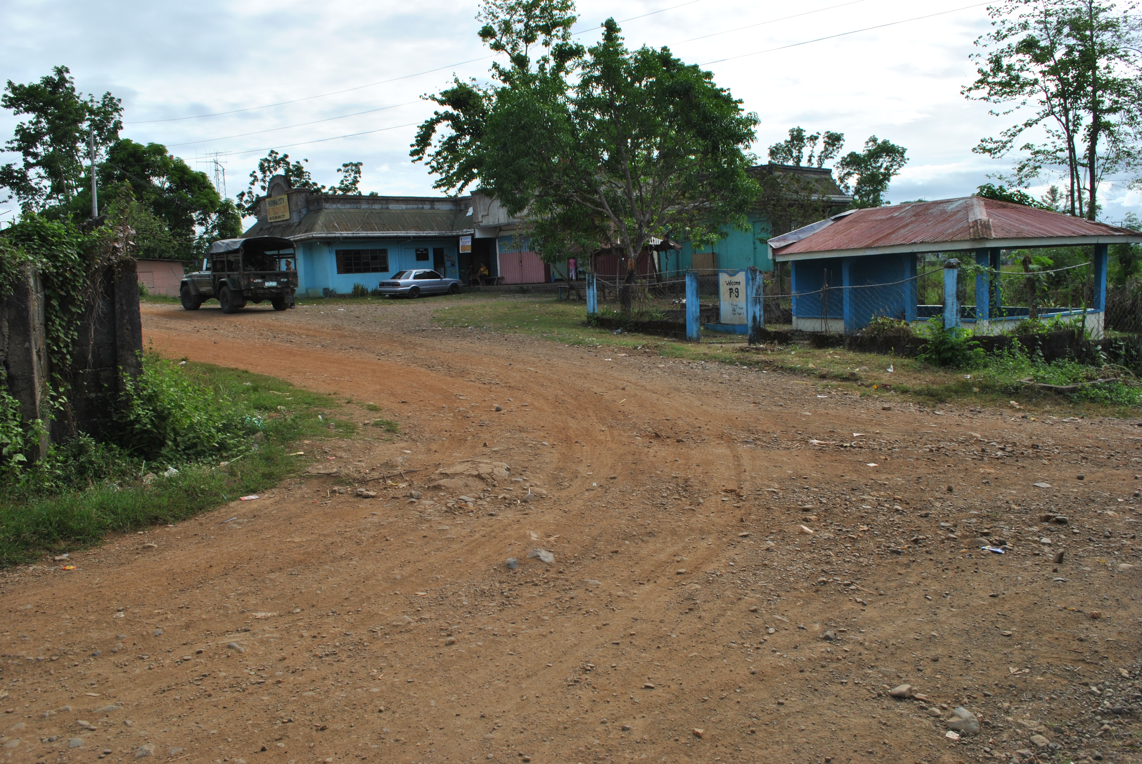
14. After 1.5 Kilometers, runners have to TURN LEFT in an intersection that goes to San Mariano/Purok 9/Barangay Militar. On this dirt road, runners shall always take or turn LEFT on intersections along the way.
TURN LEFT On This Road Towards Barangays San Mariano, Purok #9, Barangay MilitarTURN LEFT To Barangay Mariano/Purok #9/Barangay MilitarSPILLWAY On The Western Side Of Barangay Militar
15. Runners must be able to pass/cross an SPILLWAY on western part of Barangay Militar. After an uphill climb from the SPILLWAY, the runners will reach the PUROK #9 . From Purok #9, the runners will be approaching an intersection with the Santa Rosa-Fort Magsaysay-Laur Road/Highway.
S-Curve @ Purok #9Approaching The Santa Rosa-Fort Magsaysay-Laur Road/Highway. TURN RIGHTTURN LEFT Towards Barangay BANGAD On This Intersection
16. After about 1.5 kilometers, runners will reach a busy road intersection (Bangad To Gate 1 Fort Magsaysay Road & Santa Rosa To Laur Road). Runners should TURN LEFT towards Barangay Bangad, Palayan City.
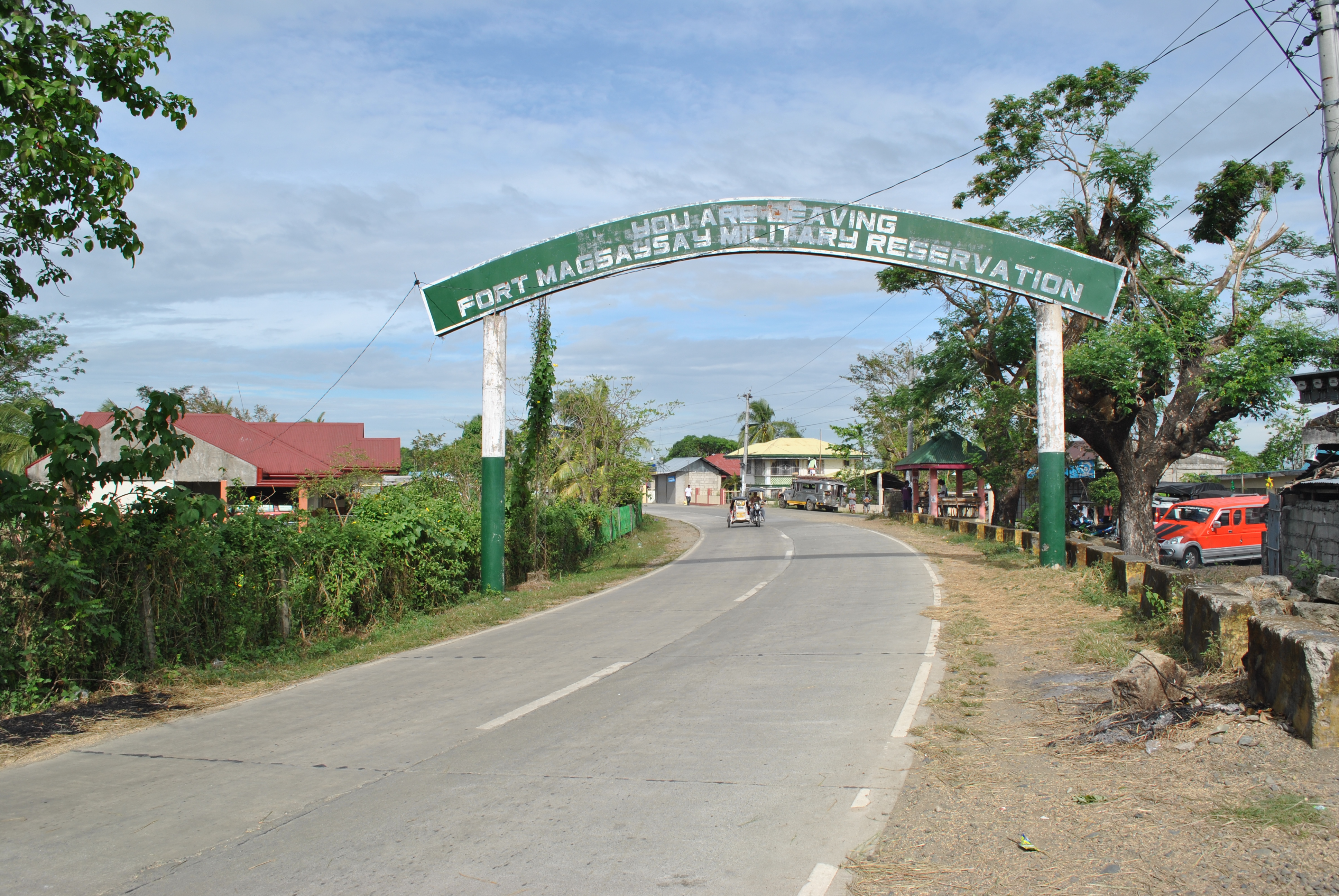
17. After running for 2 kilometers along the Fort Magsaysay-Bangad Road (going North), runners will see a green steel arc with the markings “FORT MAGSAYSAY RESERVATION AREA” and a Waiting Shed on the right side of the road. There is a Y-intersection after passing the Arc and Waiting Shed. Runners shall TURN RIGHT on the road that goes to Barangay MALIGAYA.
Before The Y-Intersection Going Barangay MALIGAYARoad To Barangay MALIGAYA
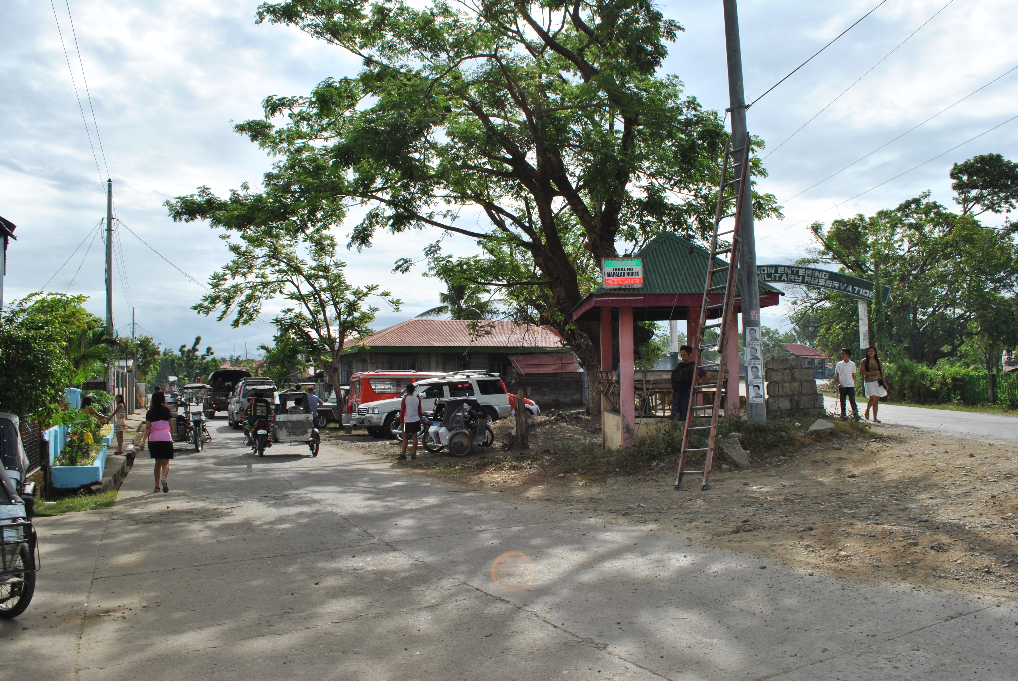
18. After runners had passed Barangay MALIGAYA, the road will lead them to the FIRST intersection with a Military Checkpoint & Detachment along the Santa Rosa-Laur Road. Runners shall cross the Paved Road (Santa Rosa-Laur Road) on their way to Barangay Dona Josefa. At this point, runners shall have circumnavigated the outer perimeter of the Camp’s Cantonment Area.
TURN RIGHT @ The Intersection of SITIO ALORMA (Going To The Airstrip)Runners Will Be Reaching This Place From Sitio ALORMA
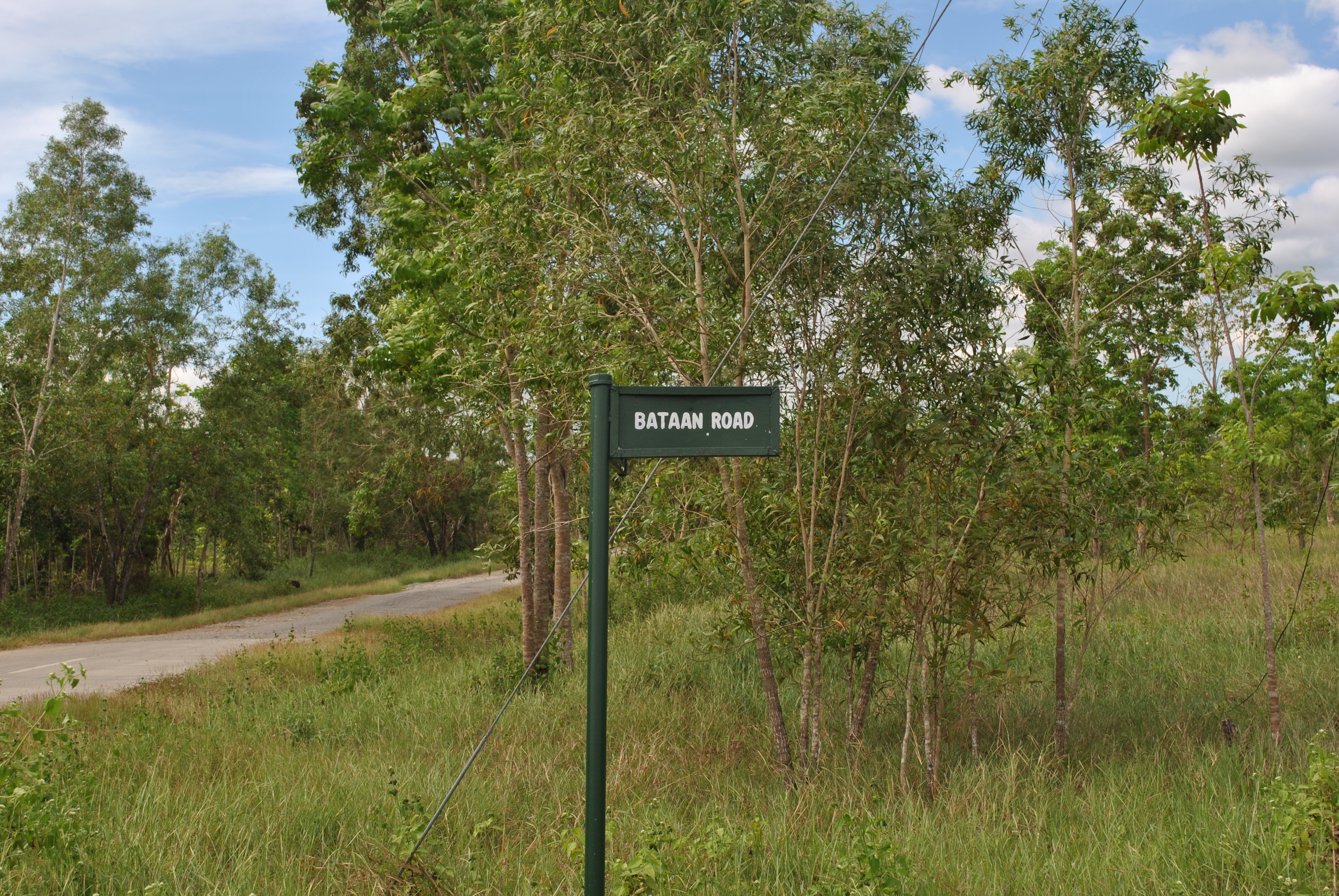
19. Along the Barangay Dona Josefa Road, runner should be ATTENTIVE. The first intersection is at SITIO ALORMA. TURN RIGHT at Sitio ALORMA intersection and go STRAIGHT uphill. The trail will lead the runners to the end of the airstrip. At the end of the airstrip, there is a Y-intersection. TURN LEFT on the said intersection. The road will lead the runners to BATAAN ROAD and the runners will be going to a SOUTH Direction.
END OF THE AIRSTRIP. Runners Shall TURN LEFT Towards Bataan Road
20. Along BATAAN ROAD, runners will see FIRING RANGES on their LEFT and a GOLF COURSE on their RIGHT. Runners will follow the Bataan Road until they will reach the intersection going to CORDERO DAM.
BATAAN ROADStreet Sign/Marker @ Bataan Road
21. Runners have to TURN LEFT on a dirt road that goes to CORDERO DAM. After 2 kilometers, there is a Y-intersection. Runners shall TURN RIGHT on this intersection. This trail will lead the runners to the Special Forces School and then to FERNANDEZ HILL.
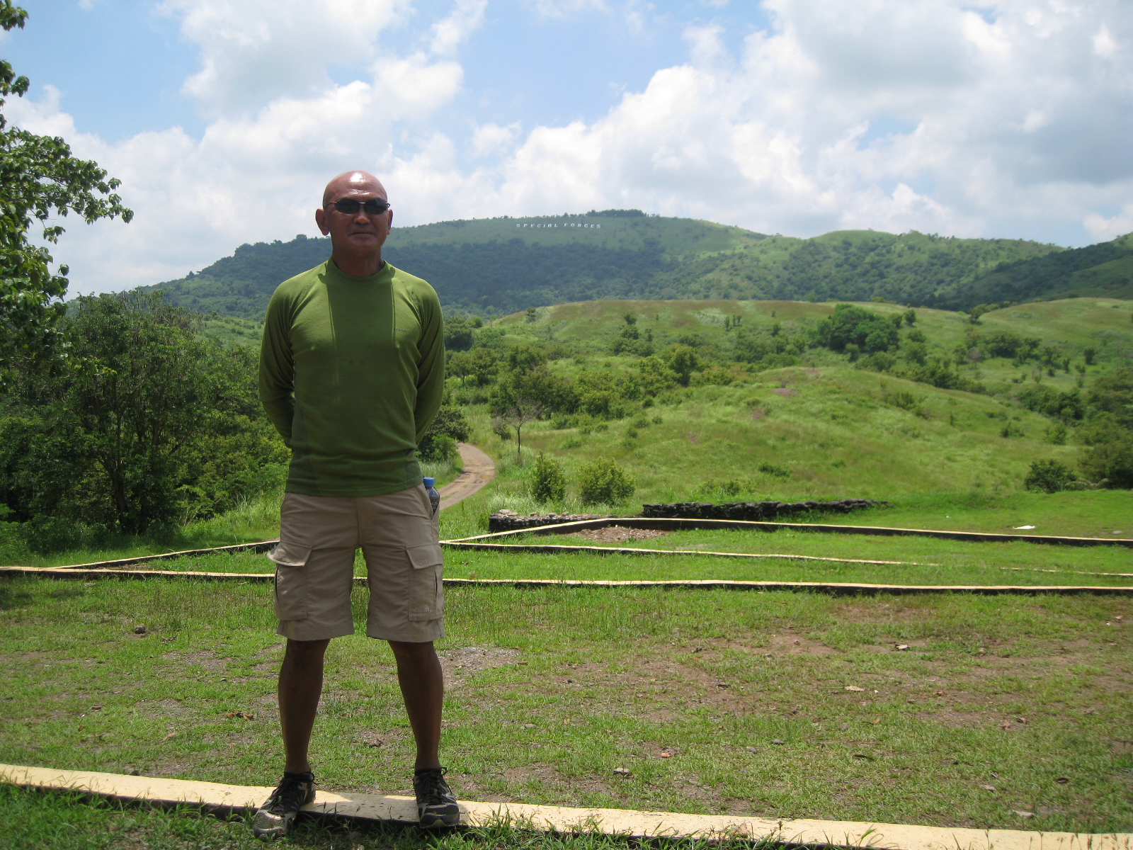
22. Fernandez Hill is the location of an Aid Station. Runners will have to pass this Aid Station for six (6) times for the 100-Mile Race and three (3) times for the 50-Mile Race.
@ Fernandez Hill With Mt Taklang Damulag At The Background
23. From Fernandez Hill, runners will have to proceed to the peak of Mt Taklang Damulag and then descend on its northern part. The descending trail leads to SITIO BACCAO (along the Barangay Dona Josefa To Barangay Palale Road). Upon reaching the asphalted road, runners shall TURN LEFT and proceed to SITIO ALORMA Crossing/Intersection.
Trail Coming From Taklang Damulag To Dona Josefa-Palale Road
24. Runners shall TURN LEFT at Sitio ALORMA intersection (Going To Cordero Dam). After about 20 meters, TURN LEFT on a trail that leads to CORDERO DAM/LAKE. (Going UPHILL will lead the runners to the end of the airstrip. Don’t take this UPHILL dirt road!)
Going South To Brgy Alorma (Going To Cordero Dam) Intersection (400 Meters)TURN LEFT On This Intersection Going To Cordero DamTURN LEFT On This Trail (20 Meters From The Intersection)
25. Once the runners are in CORDERO DAM/LAKE (on the right side of the runners), they will reach a Y-intersection (the same Y-intersection that runners had passed after coming from BATAAN ROAD and upon reaching CORDERO DAM/LAKE). At the intersection, TURN LEFT and the runners will be going to the Special Forces School and then to Fernandez Hill. This completes the 12K inner loop.
26. Runners will have to run along the Taklang Damulag course (12K inner loop) for two times.
27. After finishing two loops, from Fernandez Hill, runner will follow the asphalted road that goes out from the Molave Complex (location of the Special Forces School and Fernandez Hill/Taklang Damulag). Runners must pass the Checkpoint/Gate of the Molave Complex that goes directly to BATAAN ROAD.
28. Runners will be running along BATAAN ROAD on their way back to SOCOM Headquarters/Starting Area. At the dirt road at the end of the airstrip, there will be an intersection (the first intersection on a dirt road after 800 meters from the Starting Line), TURN LEFT on this intersection. The dirt road will lead the runner to the Starting Area/SOCOM Headquarters.
TURN LEFT On This Dirt Road In Going Back To The Starting Area (SOCOM Headquarters)
29. This completes the FIRST HALF of the 100-Mile Course. The LAST HALF of the course will be a repetition of the FIRST HALF.
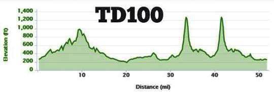
TD 100 Route MapTD 100 Elevation Profile
30. 100-Mile Race Runners must be able to finish the FIRST HALF in 15:30 Hours. Cut-Off Time for the 50-Mile Race Runners is 16 Hours.
31. On the SECOND LOOP, runners must be able to reach FERNANDEZ HILL in 25 hours before starting their last TWO (Small) Loops at Mt. Taklang Damulag.
Guidelines/Rules & Regulations For The 6th T2N (Tagaytay to Nasugbu) 50K Ultra Marathon Race
Assembly & Starting Area
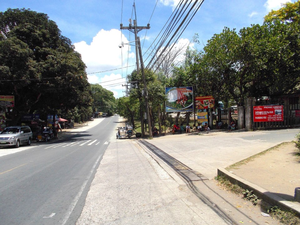
This is a solo race. The race will start at 4:00 AM of Sunday, December 8, 2013 in front of the Picnic Grove (near the Development Academy of the Philippines) in Tagaytay City. The Finish Line of the race is at the PETRON Gas Station in Nasugbu, Batangas which is located One Kilometer before the Poblacion.
The route of the race will follow the Highway from Tagaytay City to Nasugbu, Batangas. Runners will have to turn LEFT upon reaching the SHELL Gas Station at the intersection of Nasugbu and the Highway that goes to Matabungkay Beach Resort. Runners will have to run at least 500 meters before they turn-around and finally proceed to reach the Finish Line.
Runners should bring with them their Registration Deposit Slip (BPI Deposit Slip) and submit it to the Secretariat/BR’s Staff before the start of the said race. Runners should be at the Assembly Area not later than 3:00 AM of December 8, 2013 for processing. All runners/starters shall be accounted at the Starting Area before the race will start.
Runners are allowed to have their Support Vehicle & Crew but they are NOT allowed to have Pacers. Due to the absence of any Aid Station along the course, runners may run on “self-support” or “self-contained” making sure that they have an appropriate hydration system with them.
Runners shall ALWAYS run or stay on the farthest LEFT side of the road facing the incoming traffic. Runners are advised to be extra vigilant on vehicles approaching on their FRONT and BACK. Vehicles overtaking other vehicles on your back have the tendency to get more space on the Left Lane of the Road. To be safe, run/stay on the farthest side of shoulder of the road.
Runners shall ALWAYS run or stay on the farthest LEFT Side of the road on SINGLE FILE. We will be strict on this and we will warn any runner violating this rule before we declare DNF or disqualification in the said race.
Support Vehicles must be able to “leap frog” their runners. It means that the Support Vehicle should be waiting for their runner at an appropriate distance ahead of the runner. Runners are NOT allowed to be “shadowed” by their Support Vehicle. Support Vehicle must cruise along the route at the prescribed Speed Limit of the Highway. Support Vehicles are NOT allowed to turn on their Hazard Lights while they are plying on the race course.
Support Vehicles must ALWAYS park on the farthest RIGHT SIDE of the road/highway when waiting for their runner/s. Support Vehicles parked on the LEFT SIDE of the road will be a ground for the runner to be Disqualified.
Runner are NOT allowed to get inside their Support Vehicle during the duration of the race. Support Crew can provide portable/collapsible chair for the runner outside the support vehicle which can be seen by other passing runners.
Runners’ Bib Number should be pinned and displayed in front of the runner’s apparel. Bandits will NOT be allowed to run this event.
Runners are highly encouraged to bring and wear with them their respective hydration system/belt during the race.
Cut-off time of the event is nine (9) hours.
Race Route & Elevation Profile
Ipods, MP3s, and “wires” are allowed. However, users should be attentive and vigilant with their surroundings.
Finishers within the prescribed cut-off time will receive a PAU Finisher’s Medal, Finisher’s Shirt, and Finisher’s Certificate (to be given later). Official result will be posted at www.baldrunner.com.
Cash Prizes shall be awarded to Podium Finishers (Male & Female Categories) to include Trophies to the Top 3 in each of the categories. Cash Prizes shall depend on the number of registered runners. An amount P500.00 from the registration fee of each runner will be pooled as the source of the Cash Awards.
All runners must wear the following mandatory equipment/accessory: headlight and reflectorized vest or shirt with reflectorized strips. It will be still dark during the start of the race and these items are needed for the safety of each of the runner.
Corporate Logos are NOT allowed to be displayed on support vehicles. However, tarpaulins with the name of the running team/group is allowed to be displayed.
Maintain the Integrity of the Race. Runners are “deputized” to report any suspicion of cheating in the race. The RD has the authority to declare disqualification to any runner before, during and after the race.
Runners MUST be able to memorize their Race Bib Number. There will be Marshals who will be asking the runner’s bib number in the different Checkpoints along the route.
In case of emergency or report of a DNF, a runner/support crew can contact Cell Phone # 0918-965-9895 through call or text message stating the runner’s location and nature of emergency/cause of DNF.
Any infraction or violation of these guidelines/rules and regulations shall be dealt with accordingly and the RD shall immediately impose decision on such violation. The RD’s decision is FINAL.
It is the responsibility of the runner to inform his/her support crew and driver about the rules and regulations of this event/race.
The spirit of ultra running where runners are disciplined, honest, and caring /supportive to one another is highly encouraged. Remember to treat the other runners as your FRIENDS and SUPPORT to Finish the Race. The enemy lies within yourself and it is specifically located “in between your ears”.
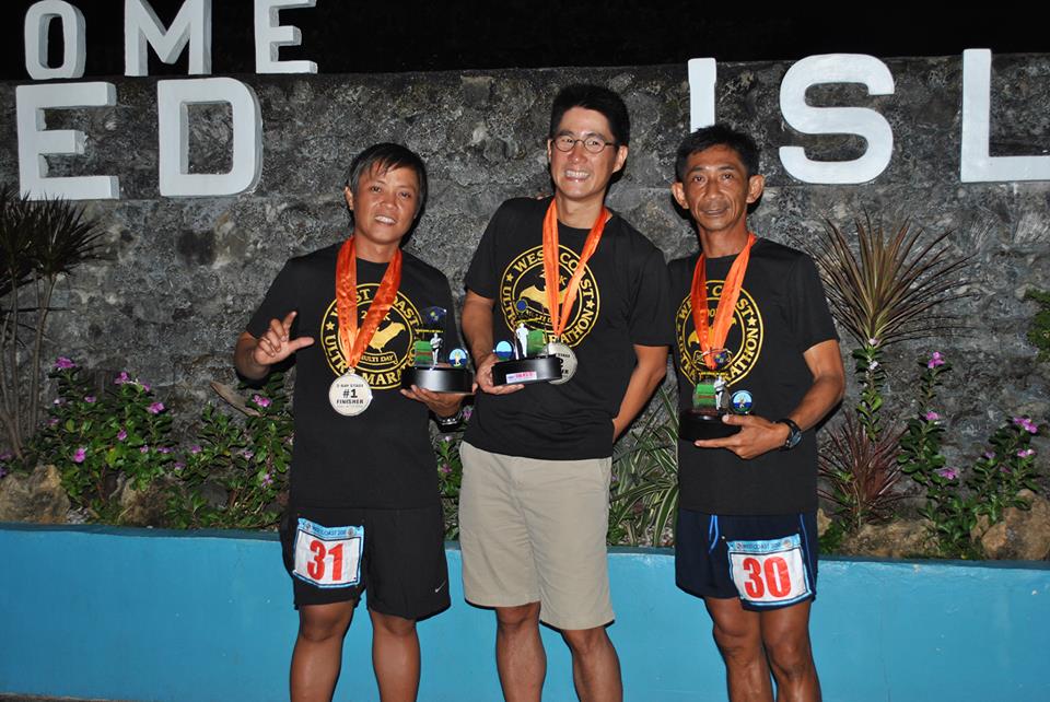
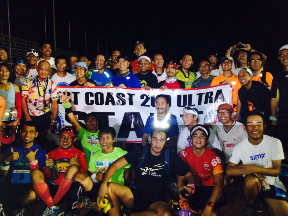
The following are the Rules & Regulations and Additional Information on the conduct of the 1st West Coast 200K Single Stage Ultra Marathon Race on November 1-3, 2013:
1. WEST COAST 200K Single Stage (WC200SS) is a single-stage solo run which will start o/a 5:00 AM of November 1, 2013 at the Remy Field Oval Track in Subic Freeport (Olongapo City) and ends o/a 5:00 AM of November 3, 2013 at the Port of Barangay Lucap, Alaminos, Pangasinan.
2. This is a SOLO run. Runners will run along the Olongapo-Alaminos Highway covering a distance of 200 kilometers. All runner-participants has the option to join as an unsupported or supported. A supported runner can avail of a support vehicle and support crew. An unsupported runner will be on his own as he/she can avail of convenience stores & eateries along the route.
3. Pacer/s are not allowed.
4. Runners should ALWAYS run on SINGLE FILE. Running abreast with other runner-participants will not be allowed. This is a cause for disqualification.
5. Runners should always stay on the farthest left side of the road facing the incoming traffic. The race route is an Open Road and the runners shall share the road with other vehicles. Be always vigilant on your surroundings and be alert on the vehicles in front and behind each runner.
6. A runner-participant is limited to only ONE support vehicle. However, a support vehicle can support a maximum of three (3) runner-participants.
7. Support vehicles should always park on the far RIGHT side of the Highway/Road. A runner will be disqualified if his/her support vehicle is parked on the Left side of the Highway. Support Vehicles shall not be allowed to “shadow” their runner. Only four-wheeled vehicles are allowed as support vehicles.
8. Runners will not be allowed to enter their parked Support Vehicle once the Race starts. Runners should bring a stool or portable chair or folding bed positioned outside their support vehicle (within the view of other runners & roving marshals) if they intend to sit or lie down. Runners will not be allowed to sit or lie on any part of their support vehicle.
9. Runners are required to display a piece of tarpaulin with the words “RACE IN PROGRESS” on any side of their Support Vehicle. Race Organizer will not provide such tarpaulin.
10. Only the NAME of Running Group or Team’s Name of the Runner will be displayed on the runner’s Support Vehicle.
11. Corporate Brands will not be allowed to be displayed on the runner’s Support Vehicle.
12. Runners with Support Vehicle must submit to the Race Secretariat the Type & Make/Model of Vehicle; Color; Number of Support Crew and Plate Number.
13. The prescribed cut-off time for the race is 48 hours. However, there will be intermediate cut-off times along the route on the following checkpoints:
Kilometer #40——7 Hours
Kilometer #80——15 Hours
Kilometer #100—–22 Hours
Kilometer #140—–32 Hours
Kilometer #180—–42 Hours
Kilometer #200—–48 Hours
14. Podium Finishers’ Awards/Trophies will be given to the Top 3 Male & Top 3 Female. Official Finishers (Finishers within the Cut-off time) will be awarded with a Finisher’s Belt Buckle, Finisher’s Medal, Finisher’s T-Shirt, and Certificate. Corresponding Award Points for the 2013 PAU Runner of the Year will also be awarded.
15. A runner is declared DNF once he/she could NOT cross each checkpoint within the prescribed cut-off time. The runner will not be allowed to run the course once he/she is declared DNF in the race.
16. In case of emergency and/or reports of DNF, the runner or support crew should contact Cellphone # 0918-965-9895 and provide the following information: Name of the Runner; Race Bib Number; Location of the Runner; and Nature of Emergency or Reason For Declaring as DNF.
17. There will be NO Aid Stations along the route. NO Drop Bags will be allowed.
18. It is mandatory for every runner to have his/her hydration system; headlight/lighting system; reflectorized vest; and first-aid kit. These items will be inspected before the start of the race. Unsupported runners must bring with them a cellphone.
19. Registered runners are advised to bring their BPI Deposit Slip to the Starting Area on Race Day and this will be used to redeem their Race Packet/Race Bib.
20. Each of the Municipal Plaza in Botolan, Zambales (Km #70) & Infanta, Pangasinan (Km #140) has a Covered Court (with Comfort/Bath Rooms) and Lawn Area where runners could sleep/rest and take a bath. Please don’t litter on these areas.
21. This is the FIRST 200K Run under the auspices of the Philippine Association of Ultrarunners (PAU) to be held in the country. Let us maintain the INTEGRITY of this run and be proud to be a participant and much more if you intend to finish the event.
22. It is the responsibility of the runner-participant to inform, advise, and instruct his/her designated support vehicle DRIVER and SUPPORT CREW on the Rules & Regulations of this Event.
23. Runners are reminded of the presence of dogs along the course. Take precautionary measures in dealing with them.
24. Runners are also reminded to talk politely to the locals and greet them as you pass them. There will be a lot of people and vehicles on the cemeteries along the road as the days of the event are declared as “Public Holidays” to honor the dead.
Five years ago, I went to Mt Pinatubo together with a group of ultra runners where five of us were training for the 1st BDM 102. While the 5 of us were having our “pit stop” at the edge of crater lake, I started to discuss with the group about my plans in promoting ultra marathon events in the country. And the rest is history. The ultra runner’s group whom we asked to join in our trek to Mt Pinatubo just completely “vanished”. I wonder why.
Every edition of the Mt Pinatubo 50K Trail Challenge has a unique story and experiences to every runner as the landscape of the route would completely change every year. In short, there is a different story for every runner every year. And the challenges brought about by the landscape, the river, the lahar, the rocks, the elevation, the heat and the rains make this event totally different from the other trail running events in the country. This is a trail running event where you need agility, quick thinking, smart running strategy and orienteering skills in order to run safely back to the finish line.
If you look closely on the elevation profile of the race route, this could be the first ultra “FKT” (Fastest Known Time) event held in the country. The fastest recorded time was 5:35:09 hours by Marcelo Bautista while the Lady’s Course Record is 8:00:59 by Majo Liao. These course records stand up to the present.
Mt Pinatubo Elevation Profile
For this year, the event was held after a day when Typhoon Santi’s strong winds had devastated the towns of Tarlac, Pampanga, Bataan and Zambales. The roads to the starting area, Barangay Santa Juliana in Capas, Tarlac had been filled with fallen trees and debris but with the immediate response from the Local Government Disaster Committee, the roads were cleared for traffic.
Much to my desire to personally recon the route on the day before Race Day, I was advised by the local authorities that It would be best to wait for the river’s depth to subside and start the race when there would be natural lighting as the sun arises.
I was expecting only 52 runners to join this race. I guess, 3 of the runners who requested to be included in the list of registered runners decided not to join the race as a result of the typhoon. I decided to run the race as the “sweeper” and safety marshal for the last runners.
Most of the runners arrived at the assembly area few hours before the start of the race and they were surprised to see the devastation brought about by Typhoon Santi. I made clear to all the runners that the race start would be delayed for us to wait for the day’s sunlight to appear. At exactly 5:35 AM, the race started in front of the Barangay Hall of Santa Juliana, Capas, Tarlac with 49 runner-starters. My salute goes to these runners who braved to be at the starting area.
Runners who had their first time to join the race are always surprised with the first river crossing which is about 1.3 kilometers from the starting area. It is always the same feeling and apprehension for all the runners. The river had been wider and some portions are deep and the current is strong. Runners would cross the river deliberately in groups trying to test the depth and current of the flowing river. At a distance, every runner would see the road that leads to the cogon/tall grasses and that was the target of all the runners.
Due to the loose and unstable ground brought about by the typhoon, the first 4 X 4 vehicle to serve the runners as the Aid Station had been stalled at Km 8. The 2nd 4 X 4 vehicle move on to about a few kilometers.
I started to run the race after 5 minutes from the Gun Start time. I purposely made myself as the “sweeper” and safety runner for the runners at the rear. After one hour of hiking and running, I was able to spot the stalled 4X4 vehicle and the last runners leaving the Aid Station. I immediately called my staff at the Starting Area to send another 4X4 vehicle to reach Kilometer 17, if possible.
I have to wait for about 45 minutes for the replacement 4X4 vehicle to arrive at the stalled vehicle. Once it arrived, I continued my run with the instruction for the replacement vehicle to move forward closer to Km 17 if the condition of the ground and the river permit. The replacement vehicle passed me somewhere in Km 10 and I could still see the last runners in front of me with a distance of about 500 meters. However, the driver of the replacement 4X4 vehicle had to stop the vehicle about 1-2 kilometers ahead of me due to loose ground and deeper parts of the river.
The race marshals and volunteer that I requested to be positioned at the Crater Lake had to walk for about 6 kilometers but decided not push through to the peak of Mt Pinatubo due to the lack of time. With this situation, the runners who will be reaching the turn-around at the Crater Lake will not be able to see my Race Marshals.
I was amazed and surprised to see the landscape to have completely changed after a year! Gone are the temporary trail where the 4X4 vehicle would run through. Another landscape of rocks and lahar had appeared. The temporary waiting area for the 4X4 vehicle at a place called “GMA” is completely gone. Most of the runners at the rear were lost at this portion but with the presence of the Race Marshals and Volunteer, they were advised to go to their position and were able to get their proper direction.
When I reached the “GMA” area, I was able to catch up with the last runner. The distance to the peak is still 7-8 kilometers from this point. From here, I pushed the last runner to continue the race and be able to reach the turn-around point. The first runner going back to the finish just dropped by at the “GMA” as we started our trek to the peak. After about 500 meters, we met the 2nd runner, Robert Watson and the third runner, July Oconer was 200-300 meters behind. After 15 minutes of hiking, we met the 4th runner, Graciano Santos. As we reached the Waiting Sheds at the foot of Mt Pinatubo, we were able to meet a group of 5 runners coming from the peak. More runners would be going down from the peak as we were trying to trek the last 2 kilometers to the peak of the mountain.
As we reached the peak of Mt Pinatubo, we were able to catch up with the last 4 runners who just came from the Crater Lake. After a brief “pit stop” at the Crater Lake, we were ready to move on for the last half of the course.
Coming from the peak and going back to the finish line could had been very easy if not for the numerous rocks to step on, more time spent on looking for open ground to land your feet, and the river to cross. After a few kilometers, the last runner, Joel and I were able to catch up with the 4 last runners.
It was already noon time and the sun was already on top of us as the sky went clear from clouds. It became hotter and we tried to conserve the water we had in our hydration bottles and tried our best to reach the Aid Station at Km #11/49. Three of the runners of the last 4 runners went ahead of us and the 4th runner, Allenstein joined us as the last 3 runners.
After hiking, jogging and telling some “running” stories with my companions, we were able to reach the Aid Station. This is where we ate boiled eggs and bananas; refilled our hydration bottles; and drank lots of soda drinks sponsored/provided by our ultra runner and friend, Jun Padilla.
I was surprised to see that the river had subsided and became narrow. More lahar grounds were exposed as a result of few hours of sunshine but some were not stable as our feet would sink for a few inches when walking. At one point, I would remove my shoes and clean them from the accumulated lahar/sand with the flowing river. The flowing river carries a lot of sand/lahar and they ultimately gets inside the shoes and accumulate on the toe box/sole portion of the shoes.
After a few kilometers, we reached the last Aid Station and we were able to catch up with the rest of the runners as some would eat, refill their bottles and wash their shoes from the lahar/sand. It was the last 8 kilometers to the finish line but some runners have the tendency to be lost on this part of the route.
I was with another runner-friend, Many Ocampo, from this point as I tried to encourage him to run with a faster pace and by taking the shortest route/trail to the last river crossing. After some “hit and miss” and “bushwacking” on tall grasses, we were able to reach the 2nd to the last river crossing that would lead us to the trail to the last river crossing.
At this point, I became the “guide” for the rest of the runners at the rear on the last 3 kilometers of the course. I felt strong and faster with my pace from this point. It is just a matter of time and I know I would be able to finish the race in less than 12 hours!
The following were the observations made and some adjustments to be implemented on the next edition of this race:
Despite the more challenging situation of this year’s edition, all the starters were able to finish the race. I could see that our runners are becoming braver, stronger and smarter.
Runners attempting to join this race must have some knowledge on orienteering. Some skills on tracking would also be needed. A runner is smart if he/she tries to look for marks/foot prints or signs of runner’s track along the rocks and trails.
Most of the runners are “repeaters” in this event and I am glad they were able to act as guide/pacers to other runners. This is the essence of trail running—everybody helps each other to overcome the challenges along the route and be able to finish the race safely.
Integrity of the race was maintained and the runners went down to the crater lake despite the presence of eroded portion of the stairs. Next time, I would advise that handheld digital camera will be required for each runner and for them to submit a “selfie” picture of themselves with the Crater Lake as the background as an evidence that they reached the turn-around point. This is an “out of the box” way just in case the Race Marshals would not be able to reach the Crater Lake.
Since I included a First Aid Kit as a required equipment carry-on for each runner, this will be thoroughly inspected before the race. I am glad there were no serious accidents during the race.
Runners must be always vigilant and observant with the course features that they would pass on their way to the peak. These land and river features would be needed for the runner to guide him/her back to the finish line. There are steel towers along the left side of the open space/river as the runner would run towards the peak. The same towers would be seen on the right side of the runners as they go back to the finish line.
Last year, we had time to prepare for ribbons tied on bamboo sticks but on race day, most of the sticks were taken by Aeta kids and made as souvenirs. What is worse was that most of the runners were not able to see these ribbons that we placed along the route on the first 5 kilometers as most of the runners followed the trails. For this year, we were not able to place those ribbons but runners were smart to follow the river and made their run with due direction towards the South.
The Aetas/local tribe in the area were very helpful that they made some access trails on the steep banks of the river for the runners. They even see to it that they give instructions on where to go to avoid the deeper parts of the river. Nobody from the tribe asked for any food or money from the runners.
If not for the typhoon, we could have pushed the 4X4 vehicles to reach “GMA” where runners would be able to replenish their hydration before their final trek to the peak of the mountain. I know that some runners were asking for some water after coming from the peak but they persevered until they reach the stalled 4X4 vehicle on the last 12 kilometers. On the next edition, we will see to it that every runner must be able to carry at least 2 liters of water on the last Aid Station before their trek to the peak or before reaching the turn-around point.
All Finishers were able to receive new versions of the Finisher’s T-Shirt and Finisher’s Medal.
On the next edition of this race, we have to add some amount for the registration fee in order for us to offer Cash Prizes to the podium finishers. We will adopt what we will do with the next edition of the Tagaytay To Nasugbu 50K Ultra Marathon Race.
We will continue to announce the details of the next year’s edition through our Facebook Event Page.
Every year, we have Foreigners in this race and we hope to continue accommodating them in our next editions.


You must be logged in to post a comment.