
The race starts inside the Bataan Death March Shrine/Park in Mariveles, Bataan. From the fenced Park/Shrine, runners will exit from the Gate and turn right towards the Highway going to the Poblacion of Mariveles, Bataan.

Runners will go straight along the Highway with the Jollibee and the Municipal Hall of Mariveles on the right and the sea on the left. Runners will run on the street along the sea until they will reach Ricarte Street. Runners must turn LEFT on Ricarte Street, staying on the Left Side of the road.


While on Ricarte Street, go North until one has to turn RIGHT towards Barangay San Isidro.

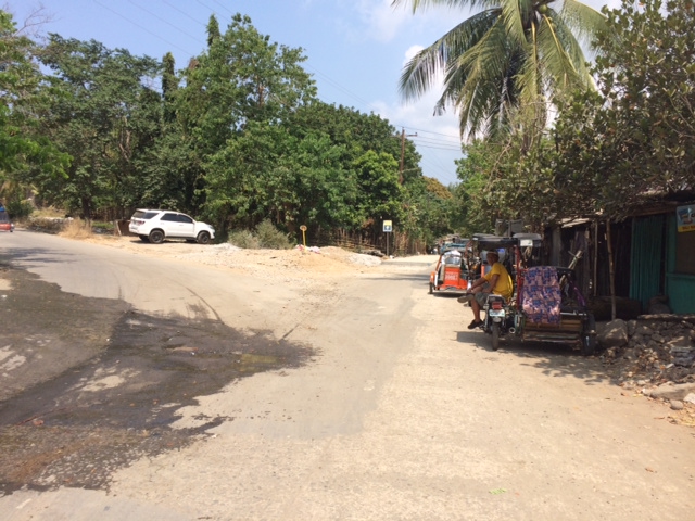
At the end of the Road along Barangay San Isidro, there is a Bridge that is under construction. It is either you follow the Detour or pass in between the Blue Tarp Fence.

The picture below shows the road after crossing the Bridge under construction. Take the road on the right which has a Camaya Coast Directional Sign seen on the Left Side of the road.
Follow the Camaya Coast Directional Sign up to the Gate of the Resort. The distance from the BDM Park/Shrine to the Gate of the Camaya Coast is 14 Kilometers.

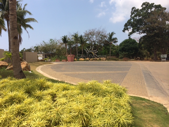
Once the runner reaches the Gate of the Camaya Coast, turn RIGHT after the CAFGU/PA Detachment which is located on the RIGHT of the Road. The entry to the wide dirt trail road will be descending and the dirt road road has a distance of 12-13 kilometres.
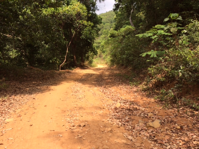

There will be intersections along the trail portion of the route but there is ONLY ONE Thing to remember—ALWAYS TURN RIGHT!

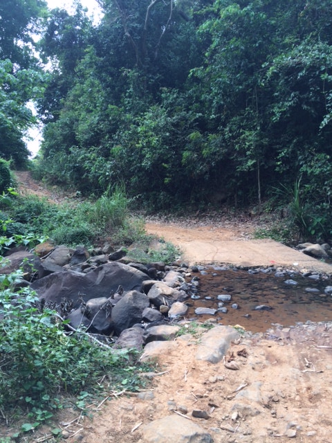
There are at least two river/stream crossings along the route. One is not too deep but the other one is waist-deep when one has the intention to make a dip into the river. One can cross both streams without ones shoes being wet.
After the first stream crossing, there is an intersection and one has to TURN RIGHT towards the direction of Bagac.


Some parts of the wide dirt road are under construction and I can predict that this route will be all paved by next year!

The picture below is the 2nd stream/river to cross but there are already culverts in placed along the flow of the river making us to cross the river with dry feet/shoes.

This is the first Kilometer Post that one can see after passing the wide dirt road and it tells that the distance to Bagac is 10 kilometers.

If ever you reach this Bataan Death March (BDM) Kilometer Post in Bagac, it means that you covered a distance of 45 Kilometers. One has to pass this Kilometer Post towards the Phil-Japan Friendship Tower and reach the 2nd BDM Post along the Bagac-Pilar Highway from the BDM Km Post 00 and then turn-around back to this BDM Km Post for the Finish.

There will be two (2) Aid Stations along the route. The first Aid Station will be positioned at the CAFGU/PA Detachment (in front of the Camaya Coast Gate) and the 2nd Aid Station will be located at the DPWH Kilometer Post #161, 10 Kilometers away before reaching Bagac, Bataan.
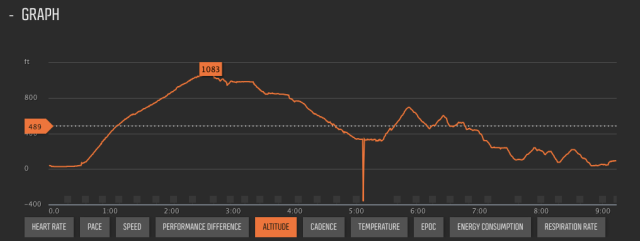
As shown in the Elevation Profile, the highest elevation is located at the Gate of the Camaya Coast Resort. From there, everything will be descending with some rolling hills up to the Finish Line.
Good luck to all the Runner-Participants!

BR, looks like another good race course. Just the right distance, not too long. I wish I was there to run in it. Maybe one of these days. Have a good one and thanks for all you do for our running/walking activities.
LikeLike