How do you measure or quantify your running workouts? Is it by the time that had elapsed covering the period you started your run up to the time you stop or by the distance or the number of kilometers or miles that you have covered?
When I started to train for my first 10K road race, I followed the first training program that I could read and it recommended running and walking by the number of minutes and later by the hours. As I progressed to train for the full marathon distance, I became aware to count the number of kilometers every running workout that I finish for the day.
When I started to train and run in ultra distances, I became aware of both the time that my feet were on the ground and the distance I would be able to cover within such period of time. I would later determine the average of mileage or number of kilometers that I would be able to cover within an hour or two.
It appears that I could cover an average distance of 7-8 kilometers per hour in my easy long runs; cover 10 kilometers for 65 minutes in my tempo runs; and I could finish the same distance of 10K in flat 60 minutes in my progression runs. These workouts are all done on paved roads with an easy elevation profile.
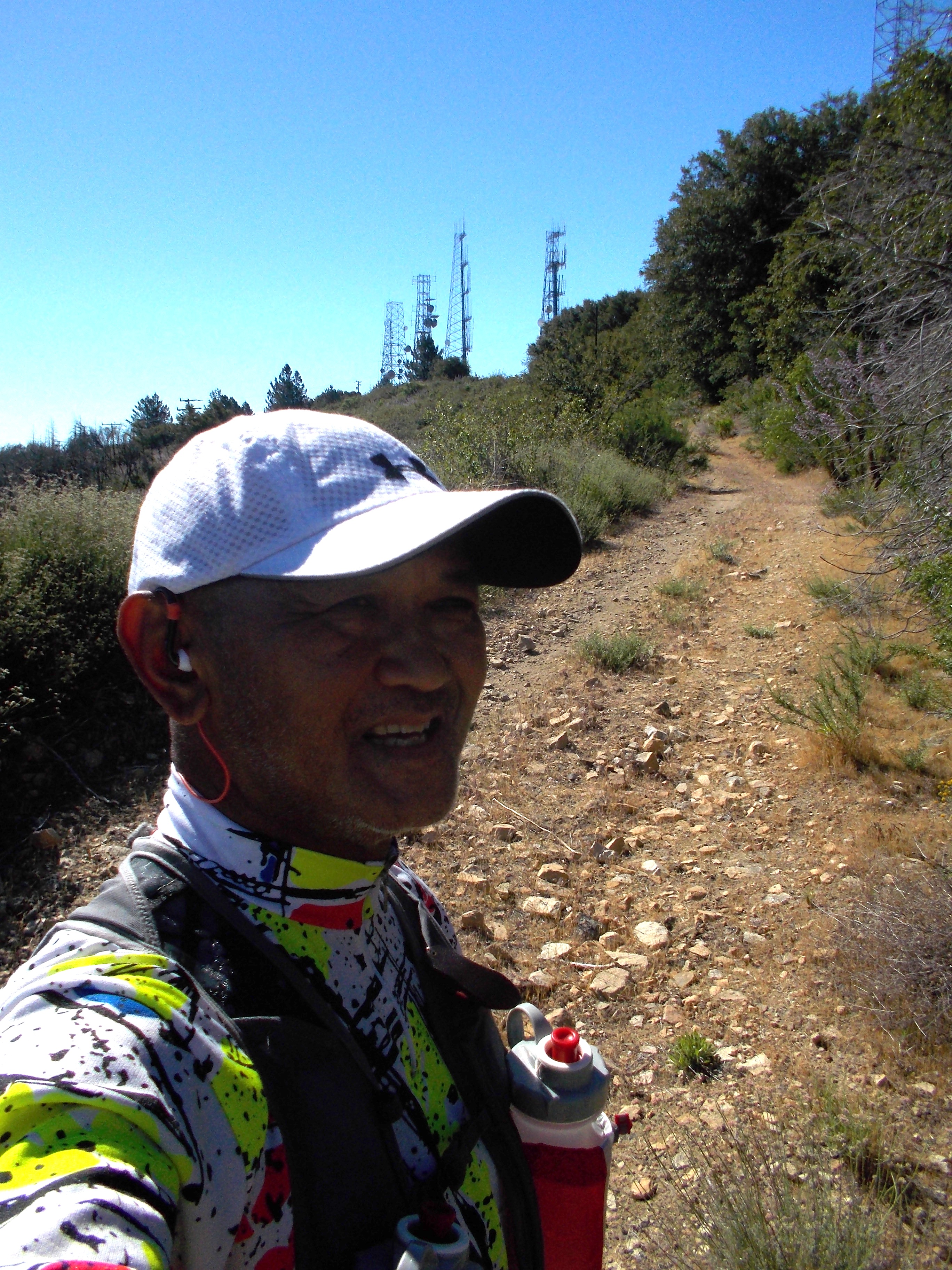
Trail @ Mt Lukens, Los Angeles, California
However, when I run on the trails, it is an entirely different story and the outcome seems that I am slower. On the trails in my playground in Los Angeles, California, I could cover an average distance of 7 kilometers in one hour because the ground is clean and my foot placement is even on the ground due to the absence of rocks or stones.
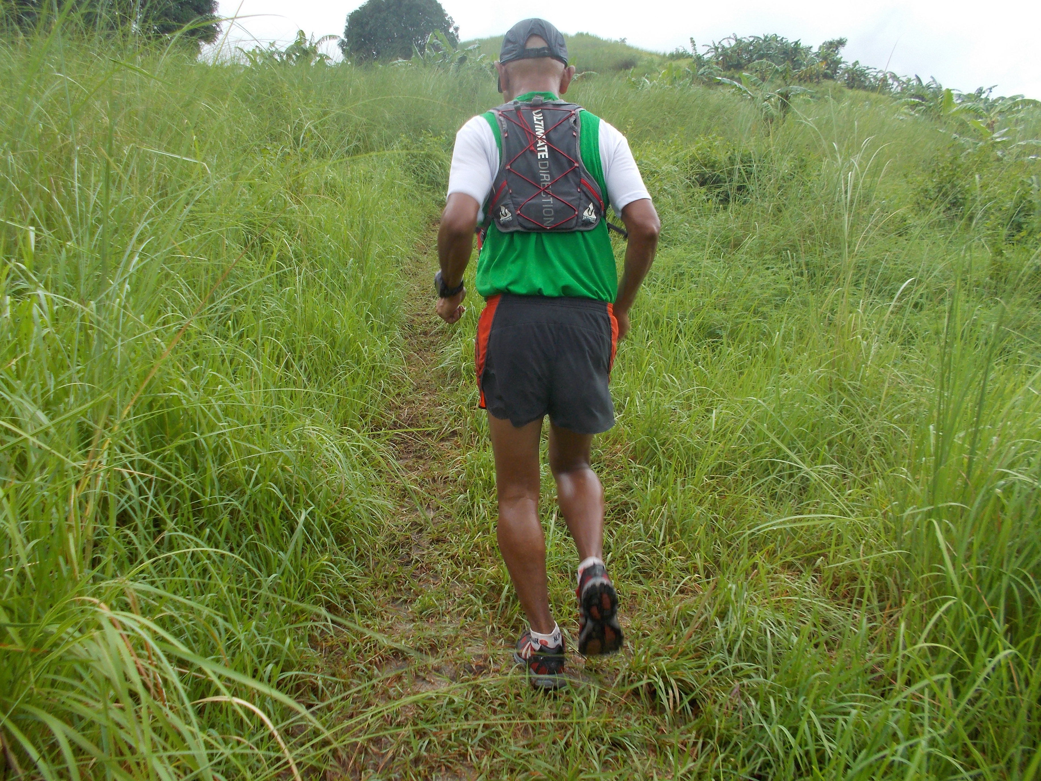
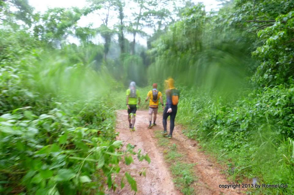
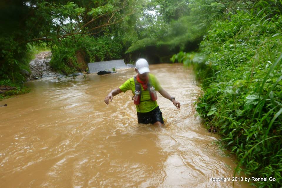
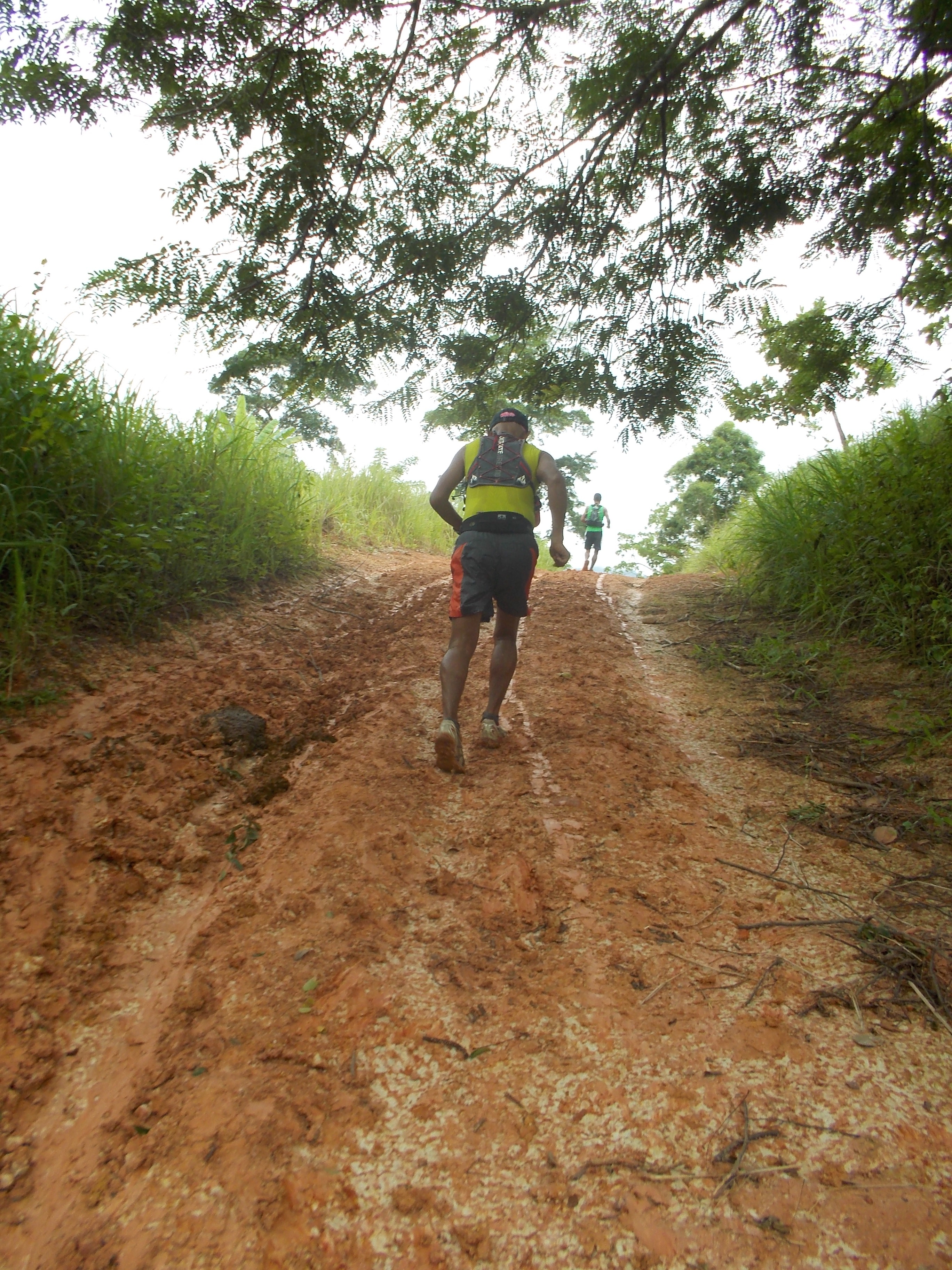
As compared with my running in my playground in the Philippines, I could cover an average distance of 6 kilometers in 70 minutes/1:10 hours due to river crossing, varying elevation profile, and technical single-track trail (uneven foot placement on the ground and muddy/wet grounds with grasses). On a regular basis, I’ve been running a trail route that covers a distance of 28 kilometers and I would be happy if I could finish the distance in 6 hours.
Typical Trail In My Playground In The Philippines
With this new training, I have been concentrating on my running workouts by counting the number of hours that I spent along the trails whether I am just hiking, crossing a river, resting for a taste of a fresh coconut juice or running those downhills along the route.
If you are training to become an ultra runner, whether on the road or trail, I highly suggest that you count the number of hours that your feet are on the ground rather than counting the number of kilometers that you have covered. For sure, you will be able to determine if you could finish your targeted ultra race within the prescribed cut-off time.
Good luck on your next ultra race and keep on running!
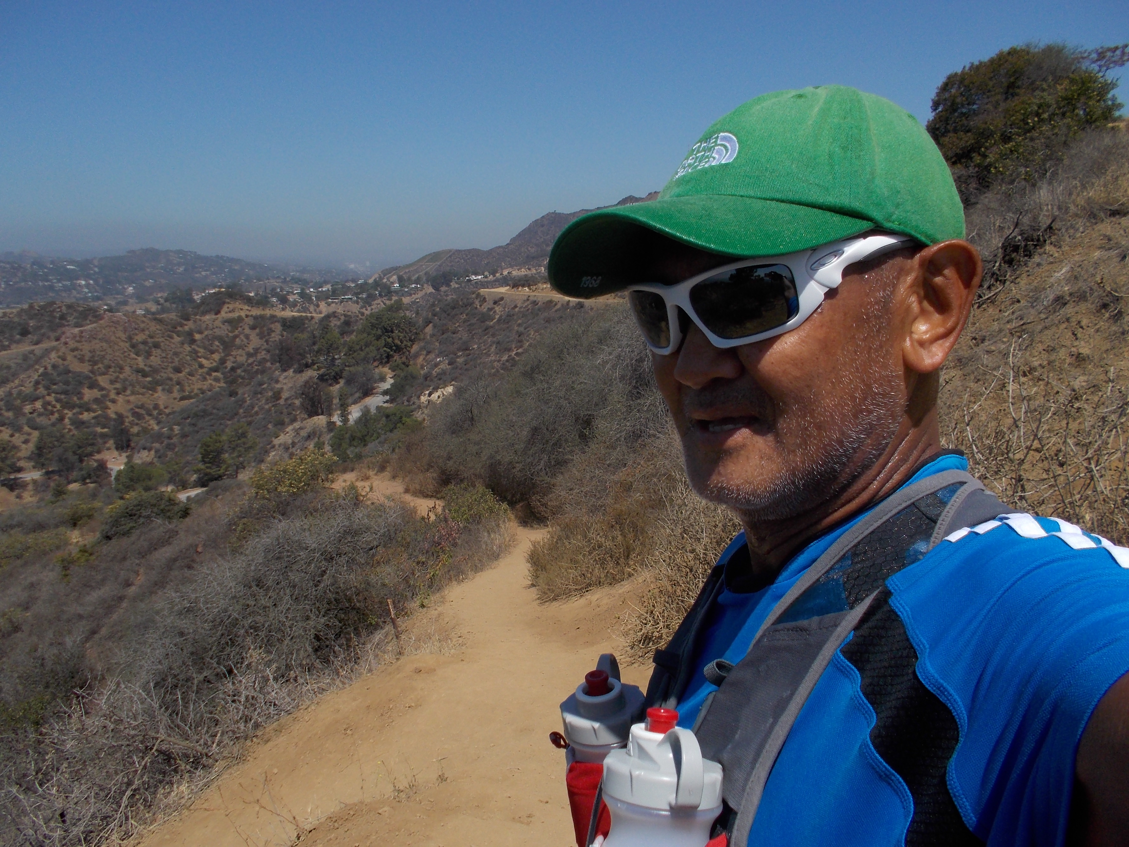
During my stay with my family in Los Angeles, California, my “playground” for my trail running are the mountain trails of Griffith Park; Verdugo Mountains; Echo Mountain, and Mt Lukens Trails. My daily runs vary from 7 miles (11K) up to 15 miles (24K).
Typical Trail In My Playground In CaliforniaClean Trails With Bench
The trails are usually wide, clean and dusty. I usually meet hikers and daily cyclists on their mountain bikes on these mountain trails. The elevation varies and very challenging but you don’t have any problems of big rocks, river/stream crossing, or big stones paved along the trails. But because of the nature of the landscape which is considered as desert environment, the place is hot during their summer season and I usually bring a lot of water for my hydration needs. Seldom you could see any streams or rivers or any natural feature where there is free-flowing of water.
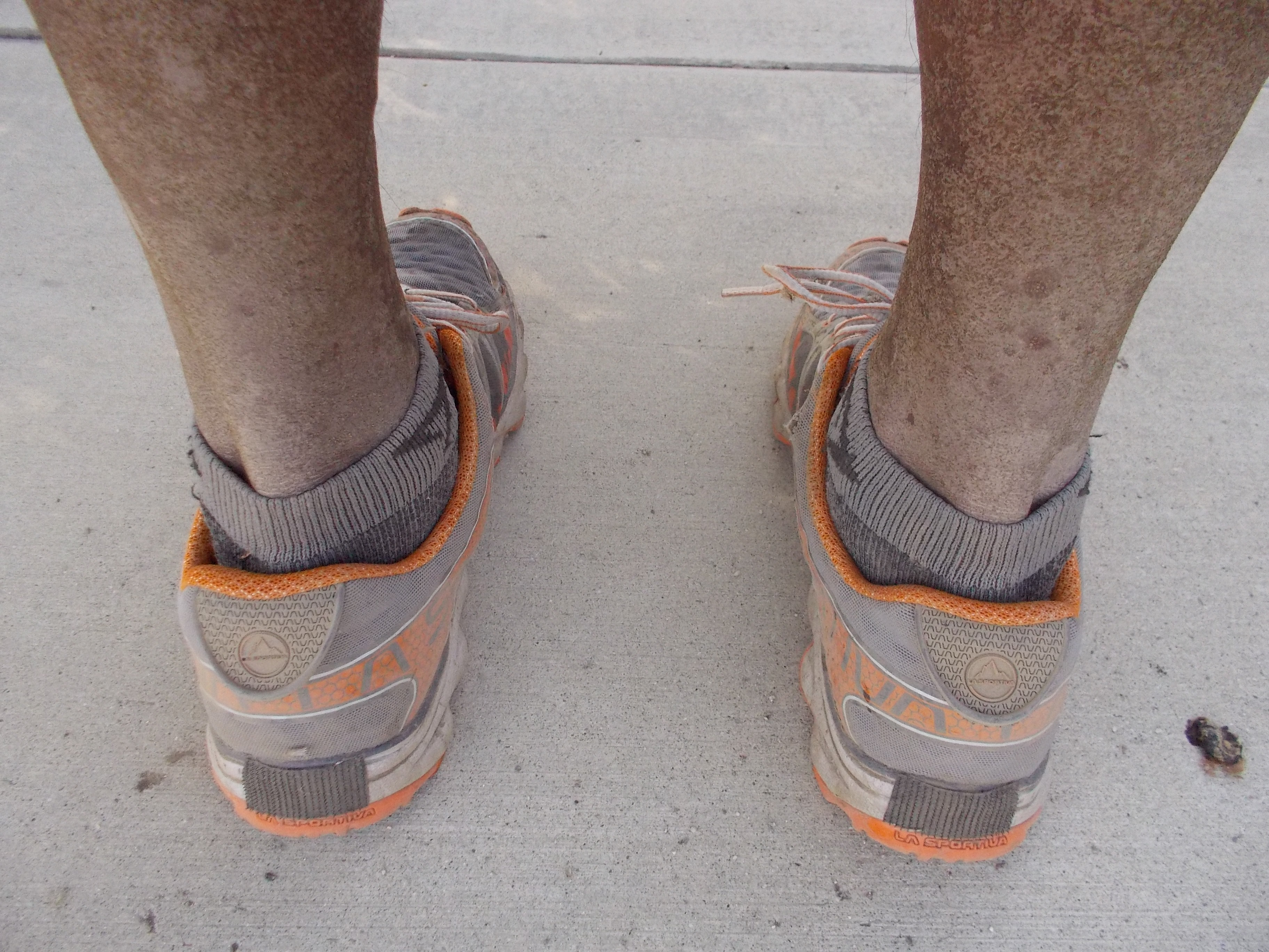
Photo Of My Legs On California Trails
There is no advantage of using a specific trail shoes on these mountain trails. I have observed on most hikers/runners on these trails that they are using road running shoes. Sometimes, I use road shoes on these trails and they give me the much needed traction on these trails.
The picture above shows the accumulation of dust that would stick on the back of my legs after my daily workouts on these trails.
As compared to my “playground” in the Philippines, the trails are usually mixture of single-track and slightly wider ones that could accommodate our local wooden sled pulled by carabaos and sometimes, the popularly known “All-Terrain Vehicles” (ATV). The single trails are the results of carabao’s and cow’s established route to the hills and mountains where they could eat grass and some trails would lead to water sources where they could drink or submerged their bodies during hot weather. There are also trails that are established due to the movement or flow of water from the peak of the mountain or hill during the rainy season.
Seldom you could see a well-maintained and well-established trails where the ground is flat, clean and dusty. Single track trails are sometimes covered with grasses and most of them cut through in the middle of tall grasses or what we call “cogon” grasses on the sides of the mountains.
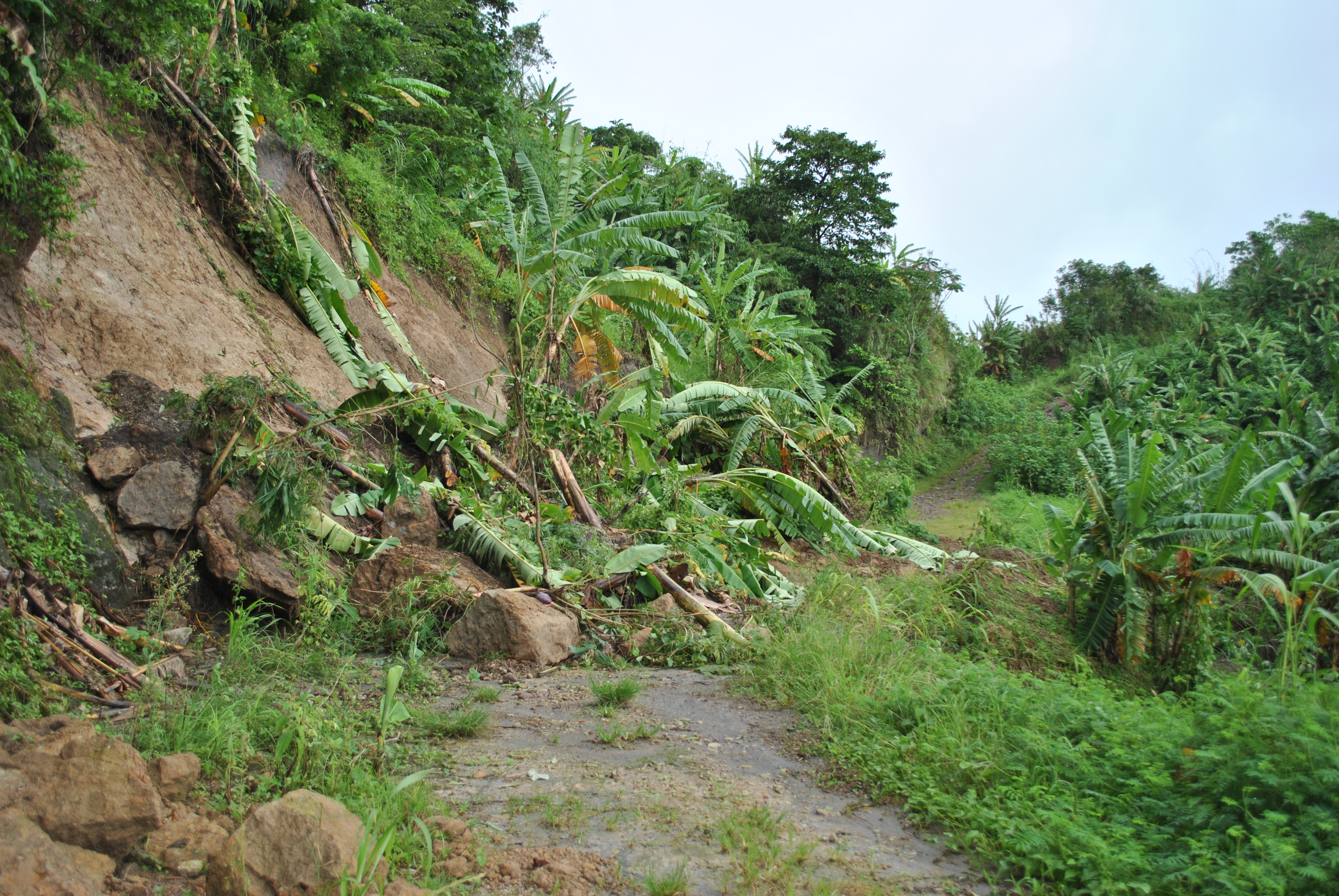
Sticky, Slippery & Muddy Trails Of The PhilippinesAnd Lots Of River/Stream CrossingsWorst Scenario….Landslides!Muddy Trail
During the rainy season (June-October/November), these trails are muddy, slippery, and sticky. It is very appropriate to use trail shoes to prevent one from sliding forward or worse, falling on the ground with your butt.
Streams would suddenly become a river with a strong current during rainy season. It is necessary to run with a companion or bring a rope which can be tied from the point of entry to the river to the other side and used as a “bridge rail” where one could hold so that one will not be swept by the strong current of the water.
It is expected that the muddy soil on the trail would stick on the soles of one’s shoes and would cause you to slow down in running. The added weight of the mud on your shoes would replicate your workout in the gym where your legs would be lifting an addition weight of about 3 pounds. This is one of reasons why I love to run on sticky/muddy trails—it will slow you down but your legs will benefit added weight as if you are doing your strength training in the gym.
There are lots of water streams where one could cool-off their tired legs or simply a good source of water for hydration needs.
But during the dry season, expect these muddy trails to be as hard as an asphalt/paved road but the unevenness of the ground would be very much beneficial in strengthening the smallest up to biggest muscles, tendons, and ligaments of your legs.
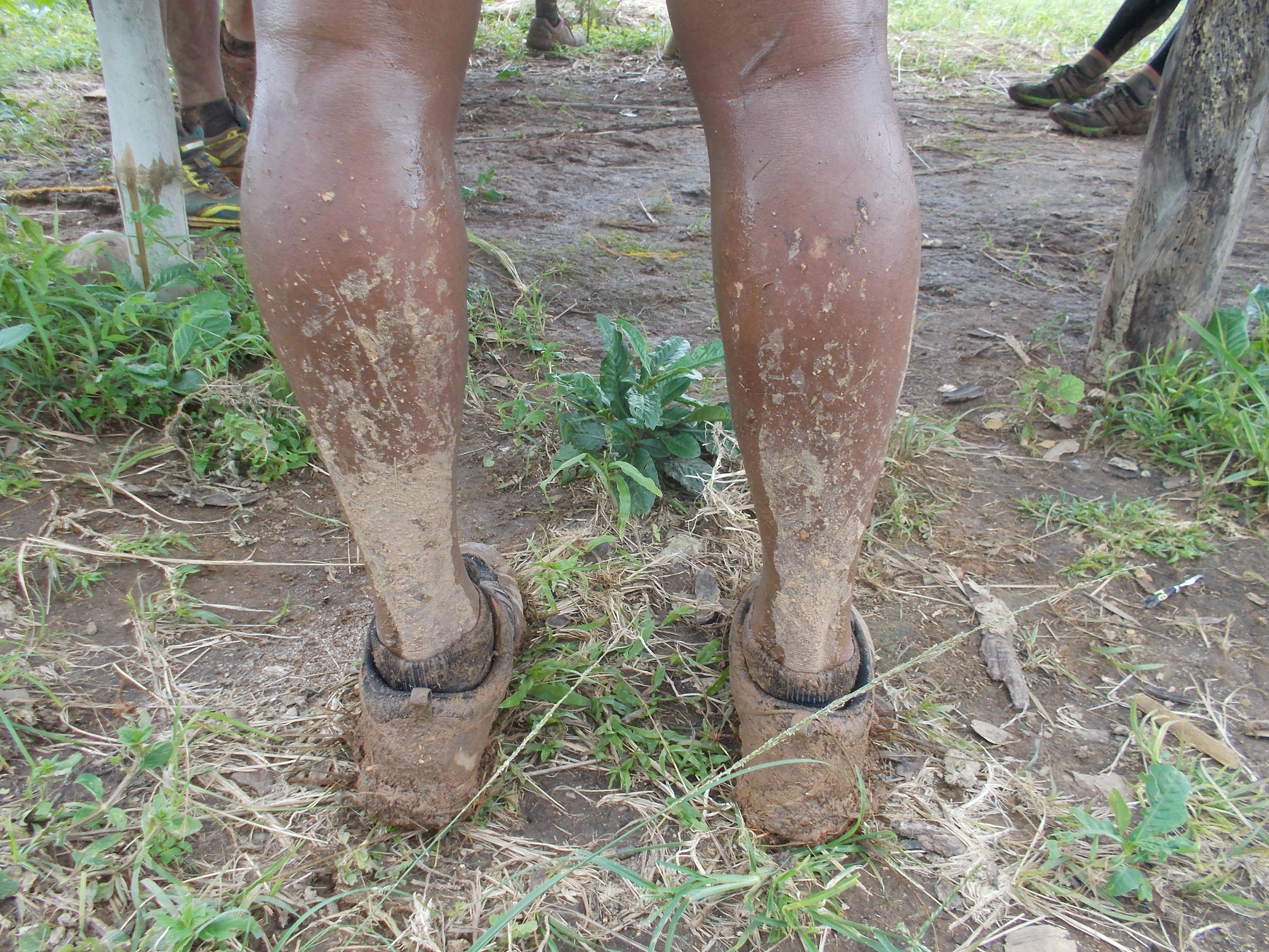
Back Of My Legs After Running A Mountain Trail In The Philippines
Thanks to the streams/rivers that I have to cross as I would easily wash my legs before I finally end up with my daily workout.
Now, if you ask me, which one is better—-running in my “playground” in California or in the Philippines? Both are good and the variety of trails works well with me. I would run on the trails in California with a faster time in covering a certain distance but definitely, running the trails in the Philippines would take me a much longer time in covering the same distance.
The most important thing in trail running is one’s ability to appreciate the outdoors, breath unpolluted air, enjoy the scenery and beauty of the surroundings, the challenge of unevenness of the trail, the variation of elevation, “engagement”/talking with the locals, and the joy of running with friends.
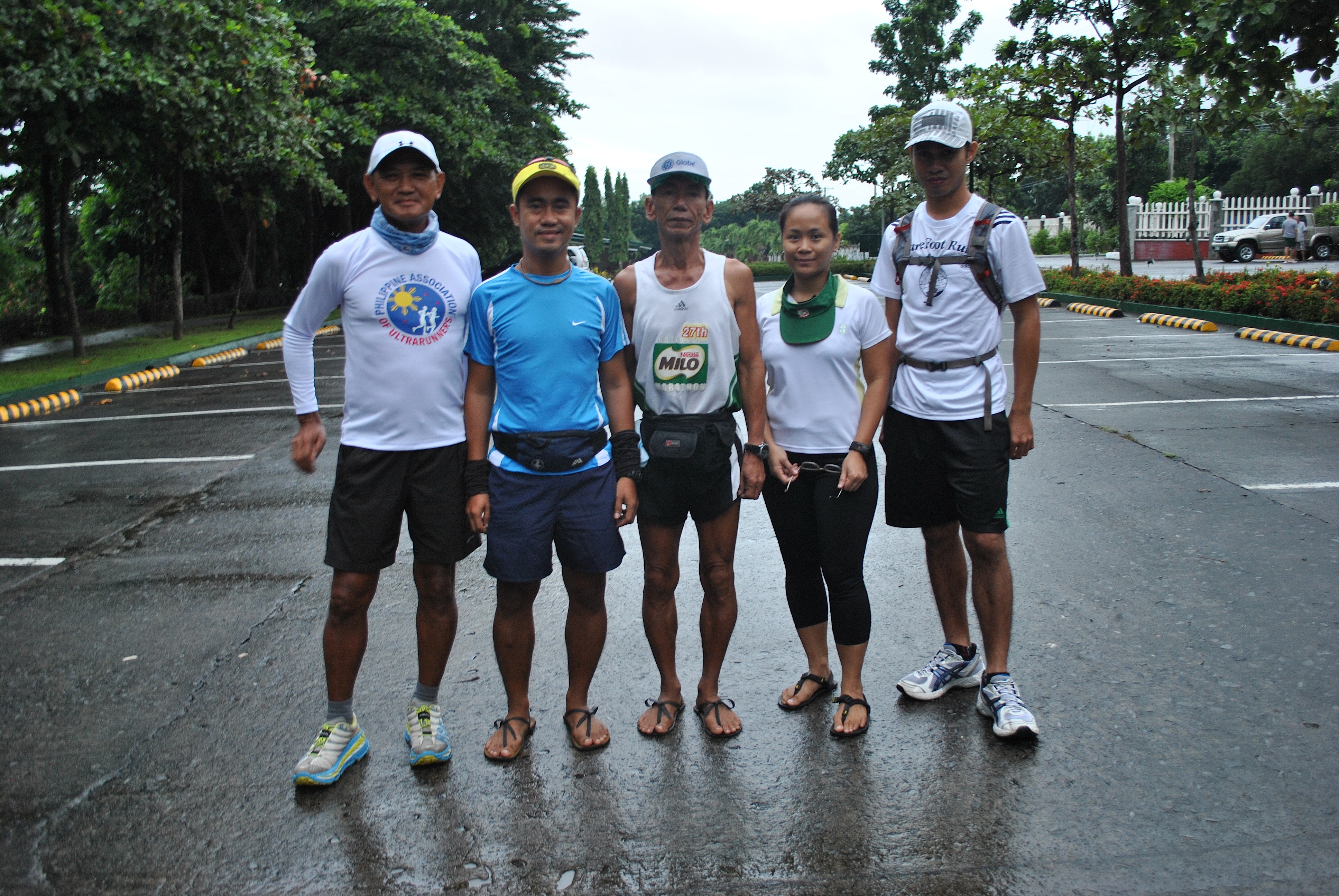
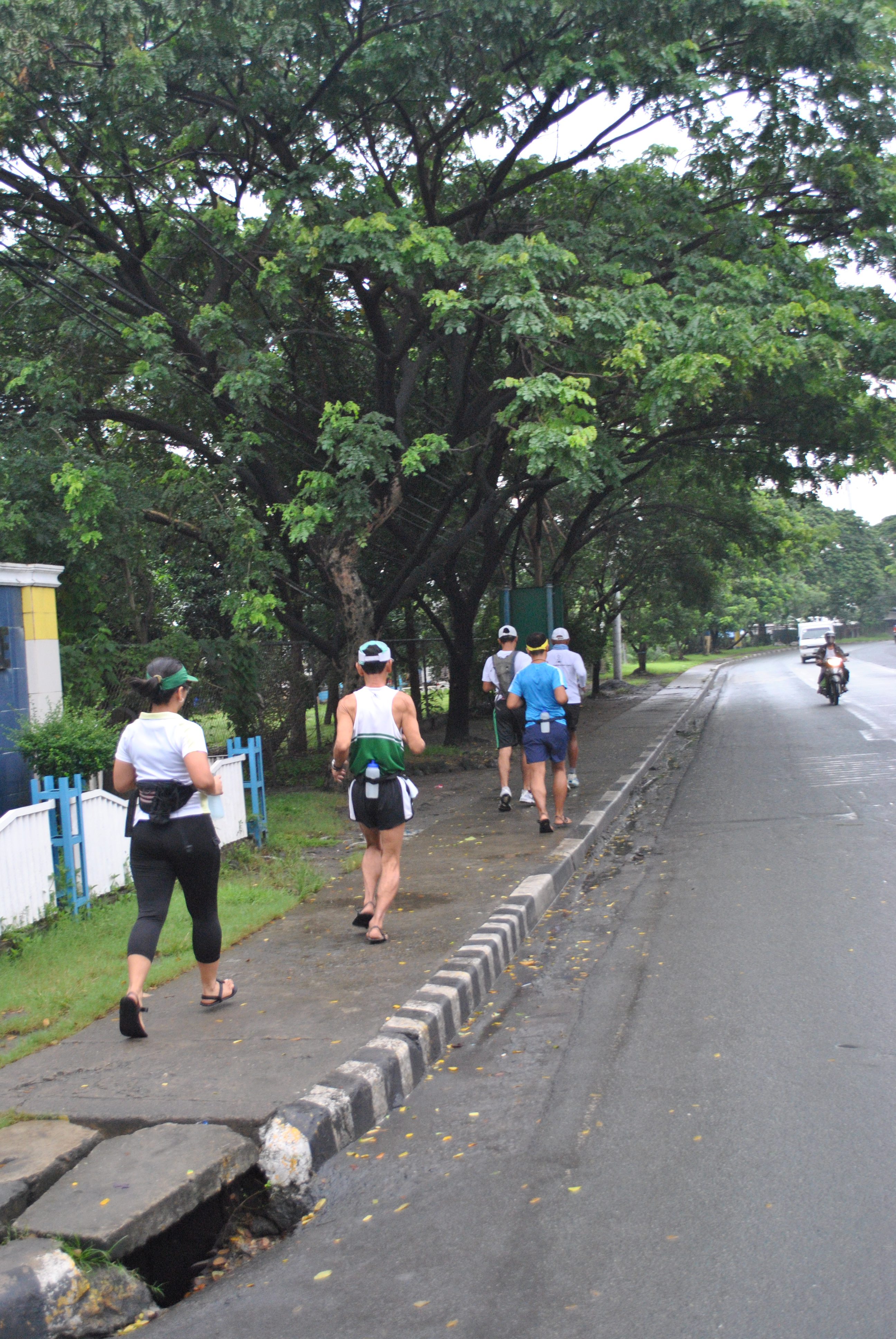
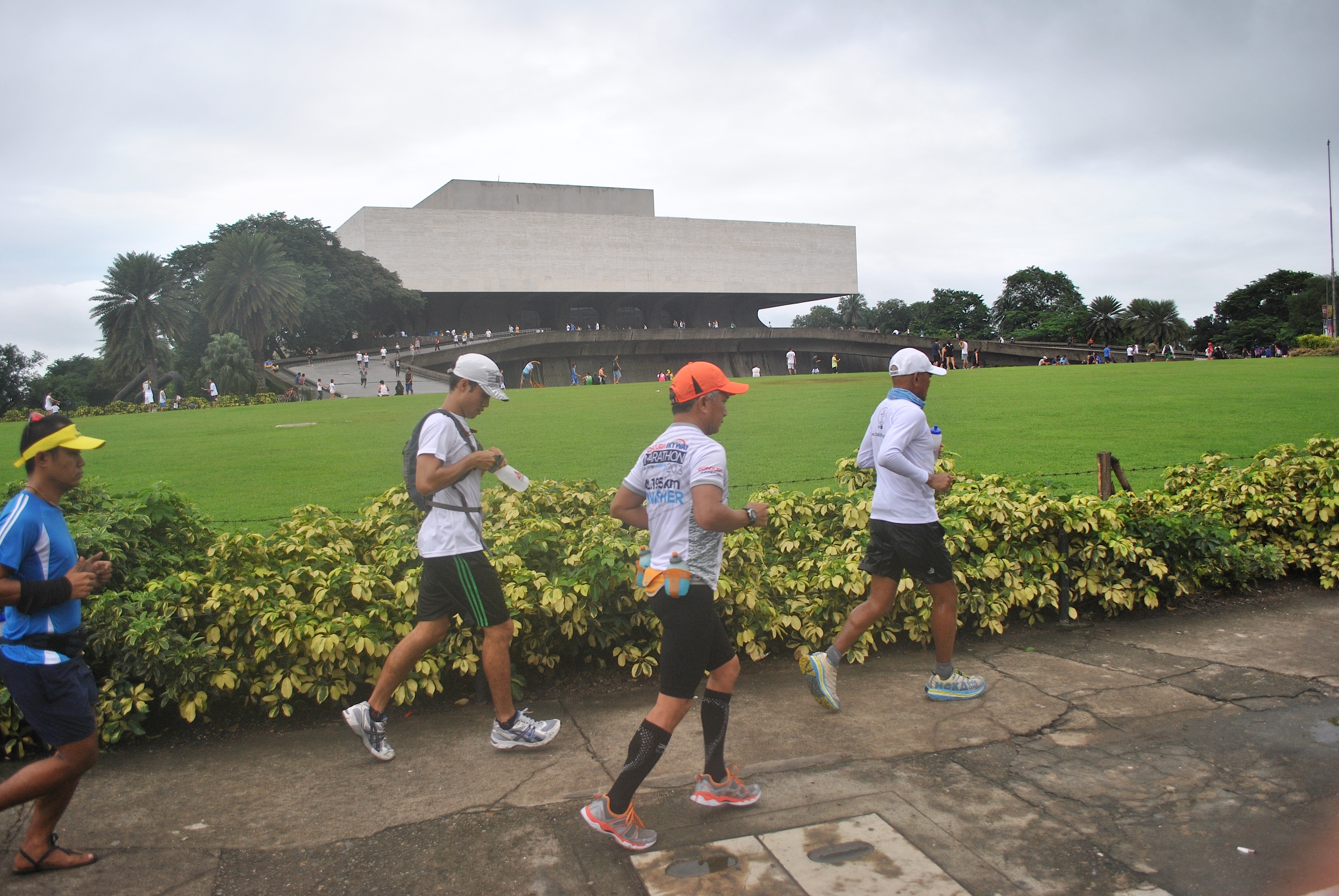
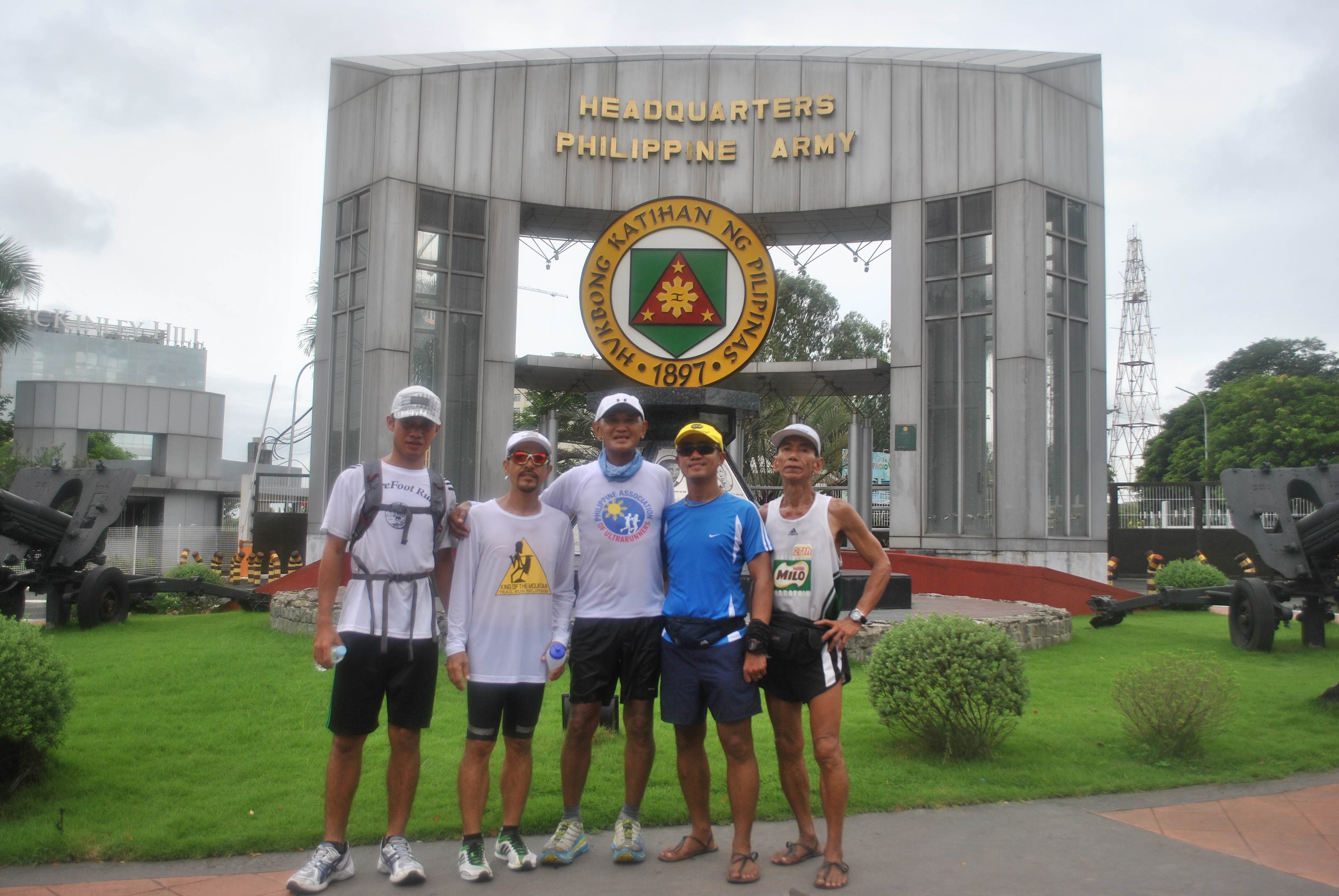
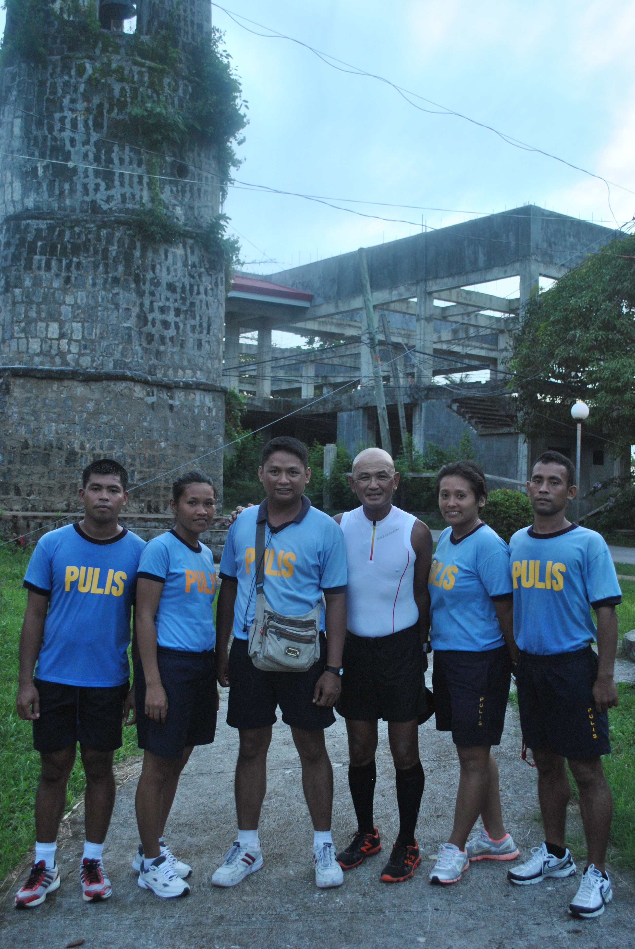
As I have announced in my previous post that I am joining the “One Million March” to Luneta Park, I arrived at the Starting Area in front of the Philippine Army Officers Clubhouse at 5:30 AM yesterday even if it was raining. I was joined by the Pascua Family with Retired Master Sargent Pascua from the Philippine Army and his son and daughter. The whole family was using minimalist sandals and Aumel, the son, finished 1st Runner-Up in the latest Fort Magsaysay To Dingalan, Aurora 65K Ultra Marathon Race.
BR With The Pascua Family @ The Starting Area
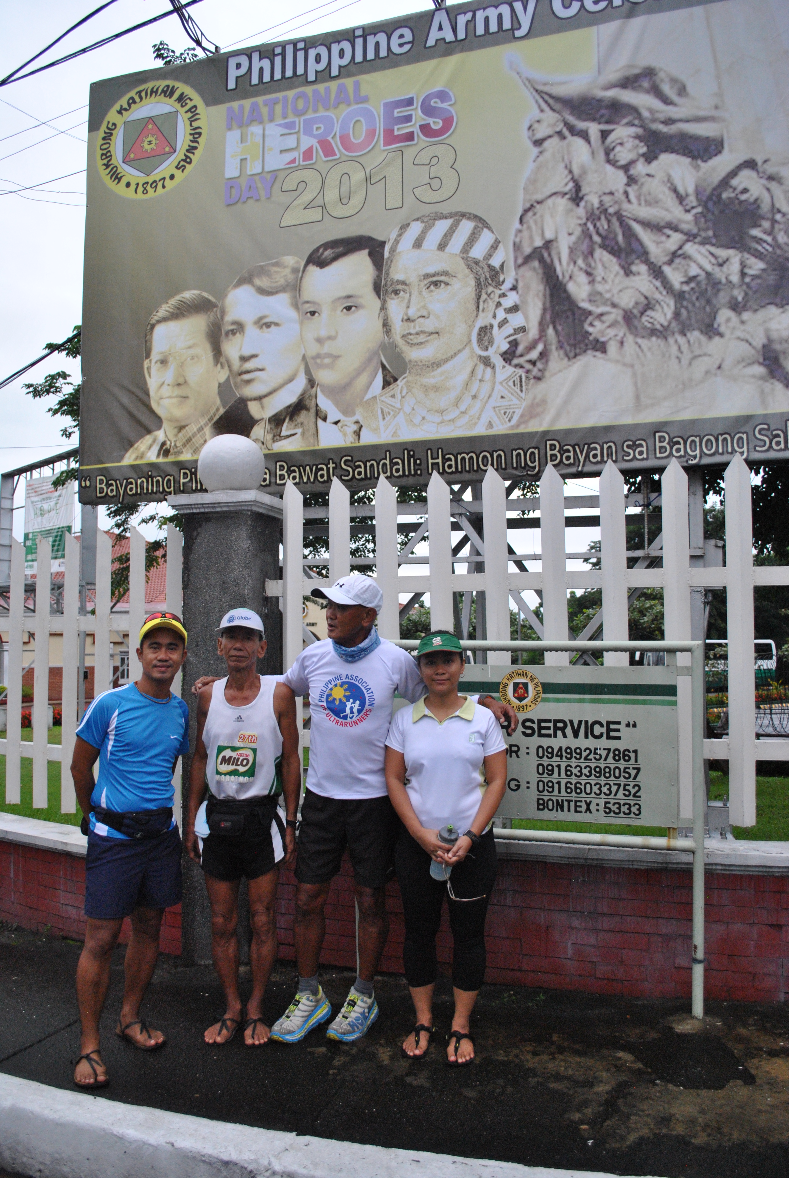
We left the starting area at 6:10 AM. Walked for about 400 meters towards the Pedestrian Gate of Fort Bonifacio and as soon as we hit Lawton Avenue and posed for a group picture in front of the PA Tarpualin, we were on our way to Luneta Park
Posing In Front Of The Philippine Army Tarp
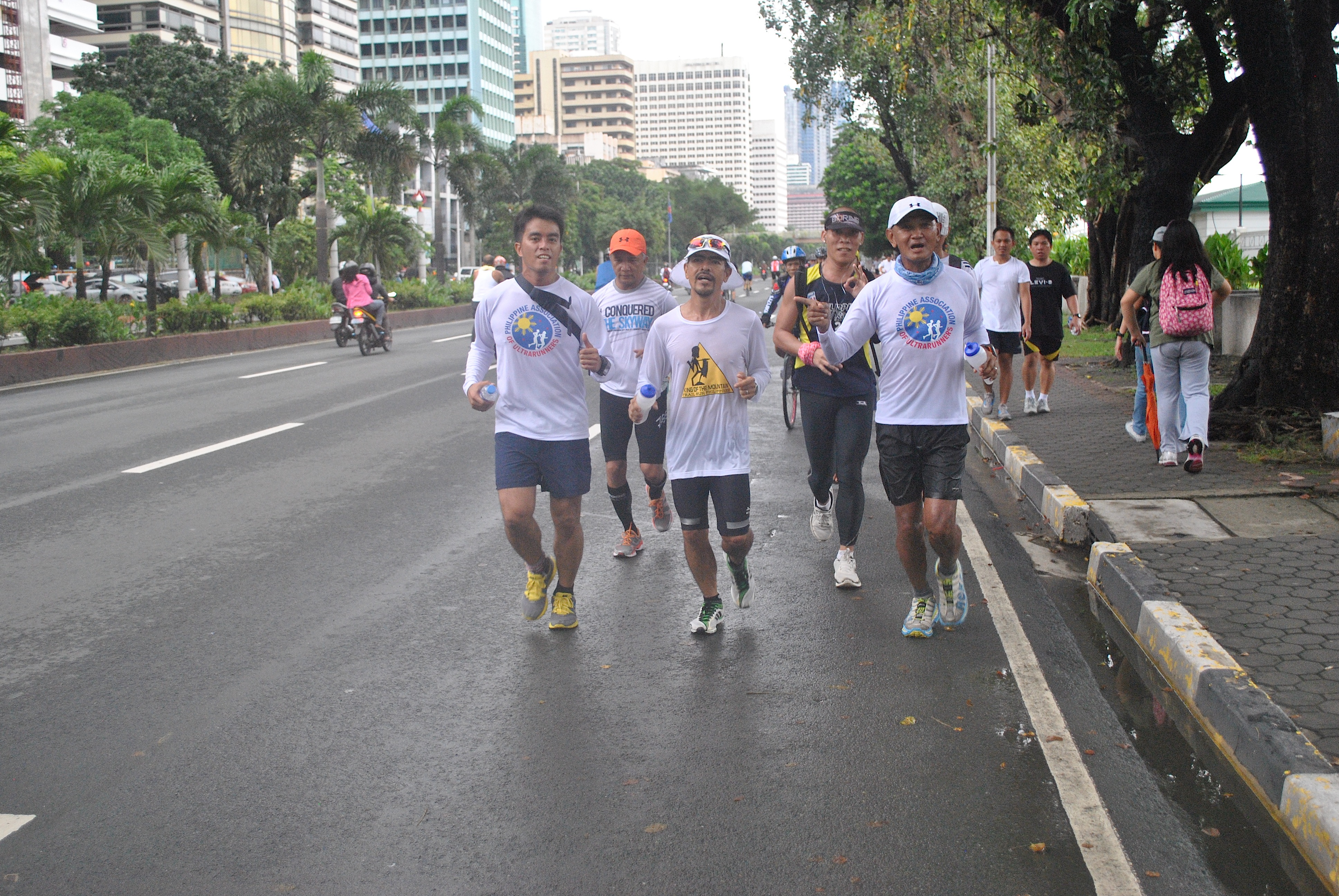
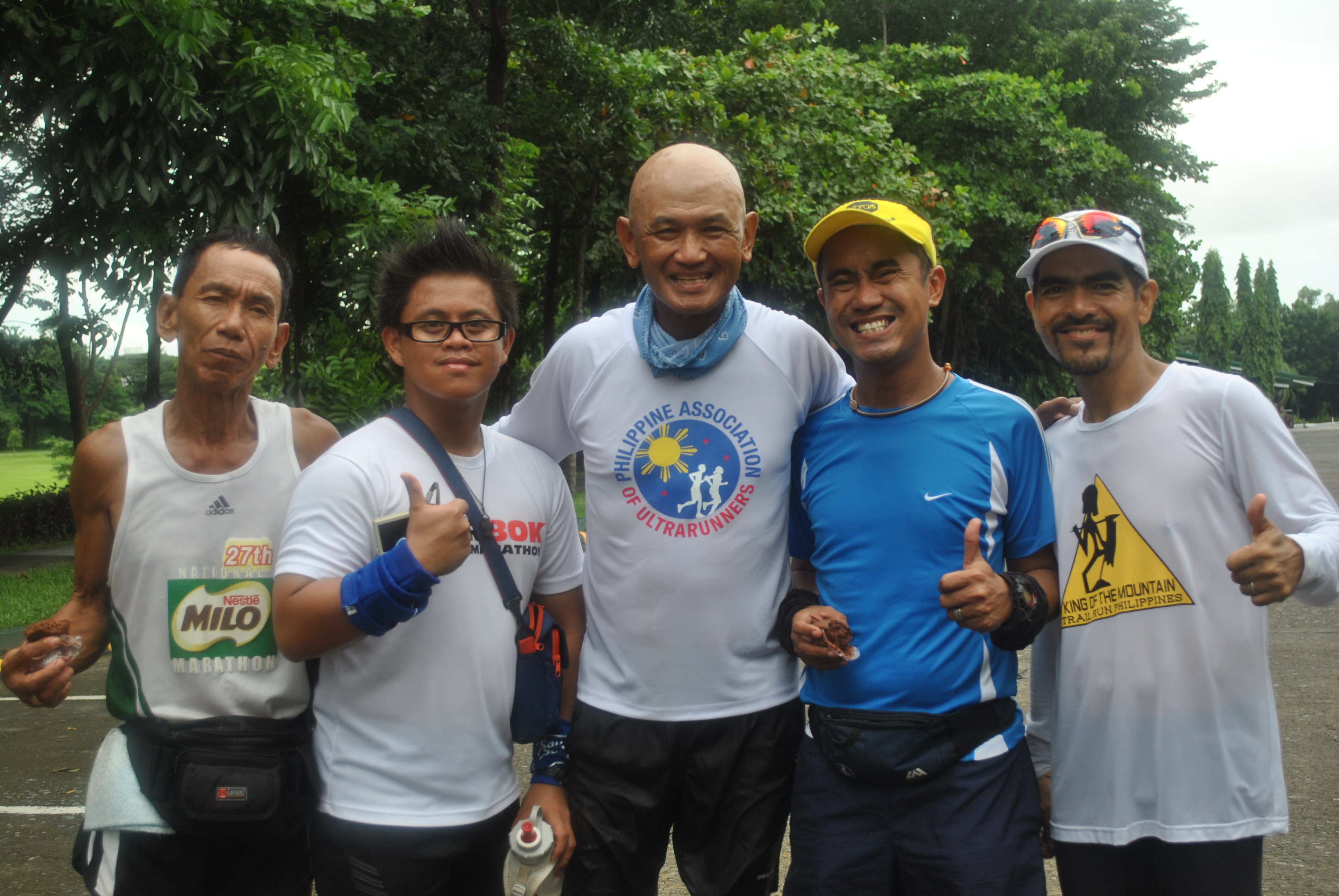
Graciano “Totoy” Santos, one of the “famous” ultra runners and member of the Philippine Association of Ultrarunners (PAU) was able to catch up with the group after 30 minutes of our run.
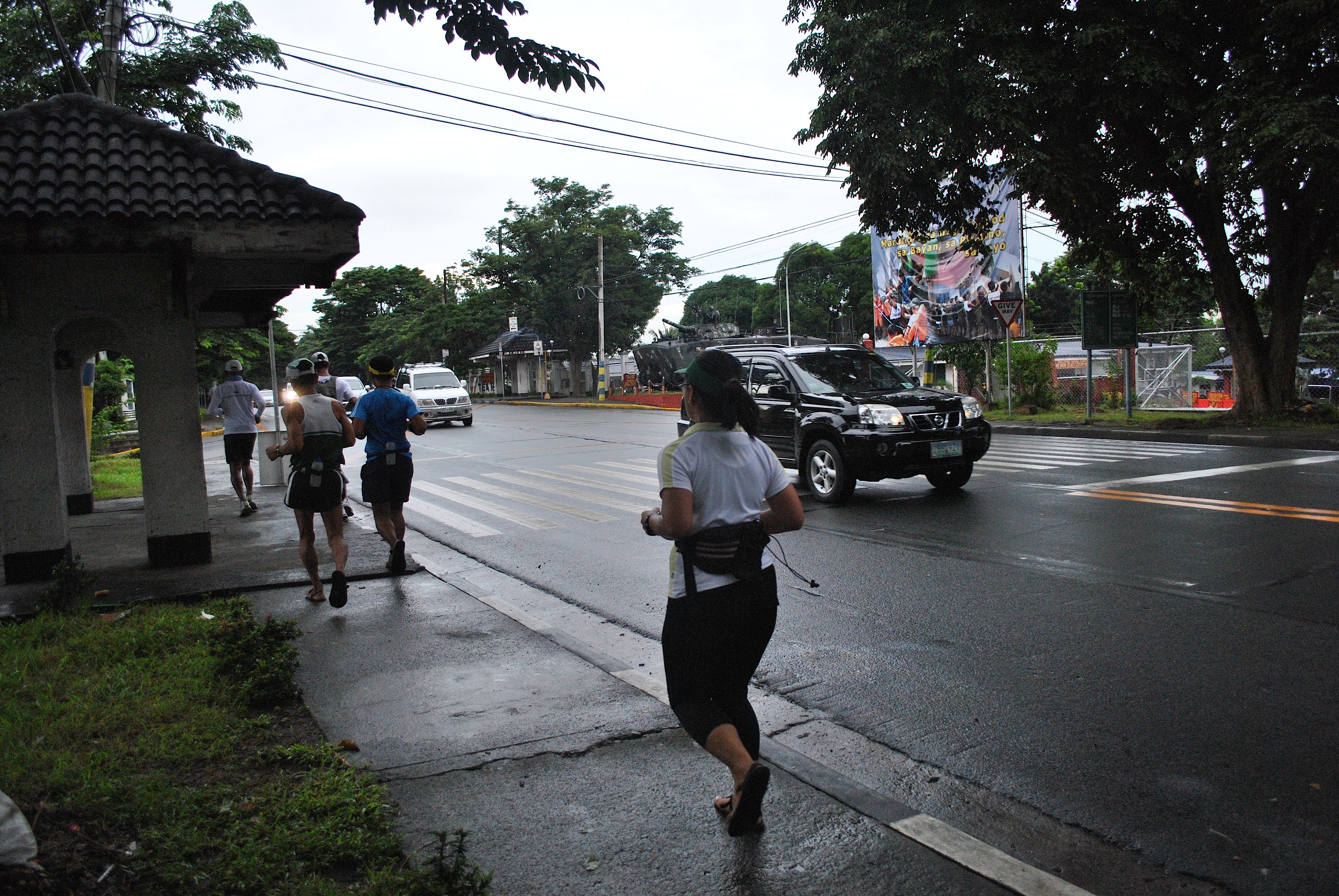
The group run through the Lawton Avenue on a westerly direction going to the Domestic Airport until we reached Roxas Boulevard. As soon as we reached the intersection of EDSA and Roxas Boulevard, we were met by Eric and Jessie. Eric is also a ultra marathoner who lives in Metro Manila while Jessie came all the way from General Santos City, South Cotabato (Mindanao). Jessie is an avid reader to this blog and he told me that he was inspired to be involved in running through the posts I’ve published in this blog.
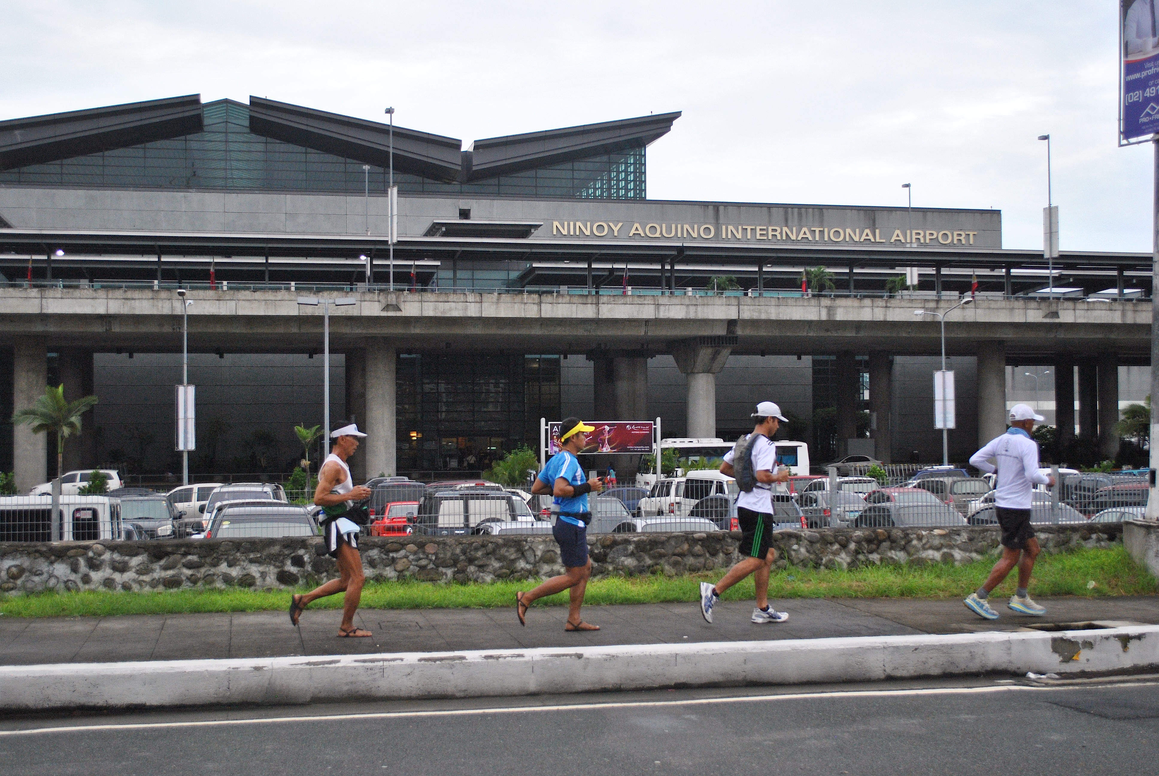
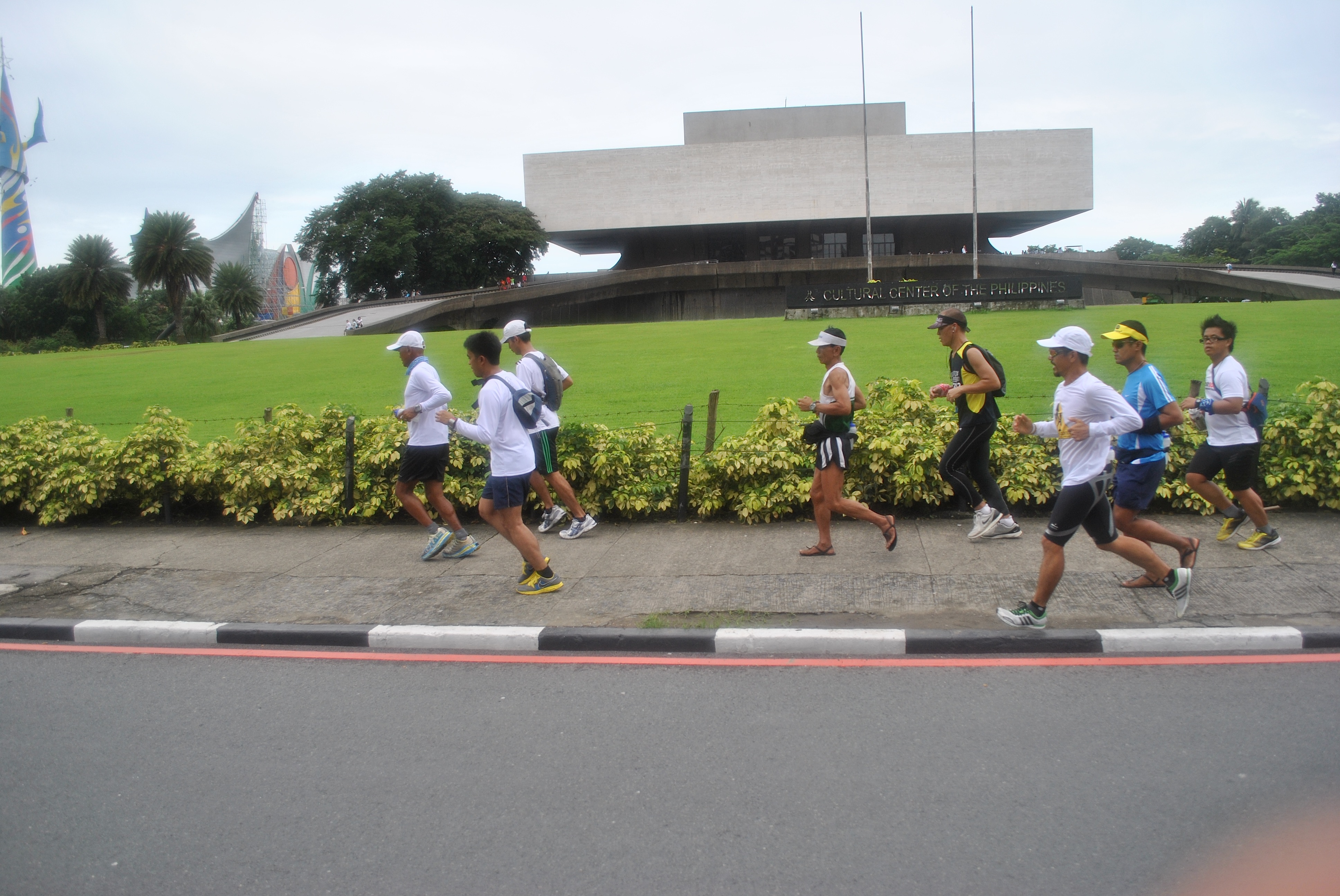
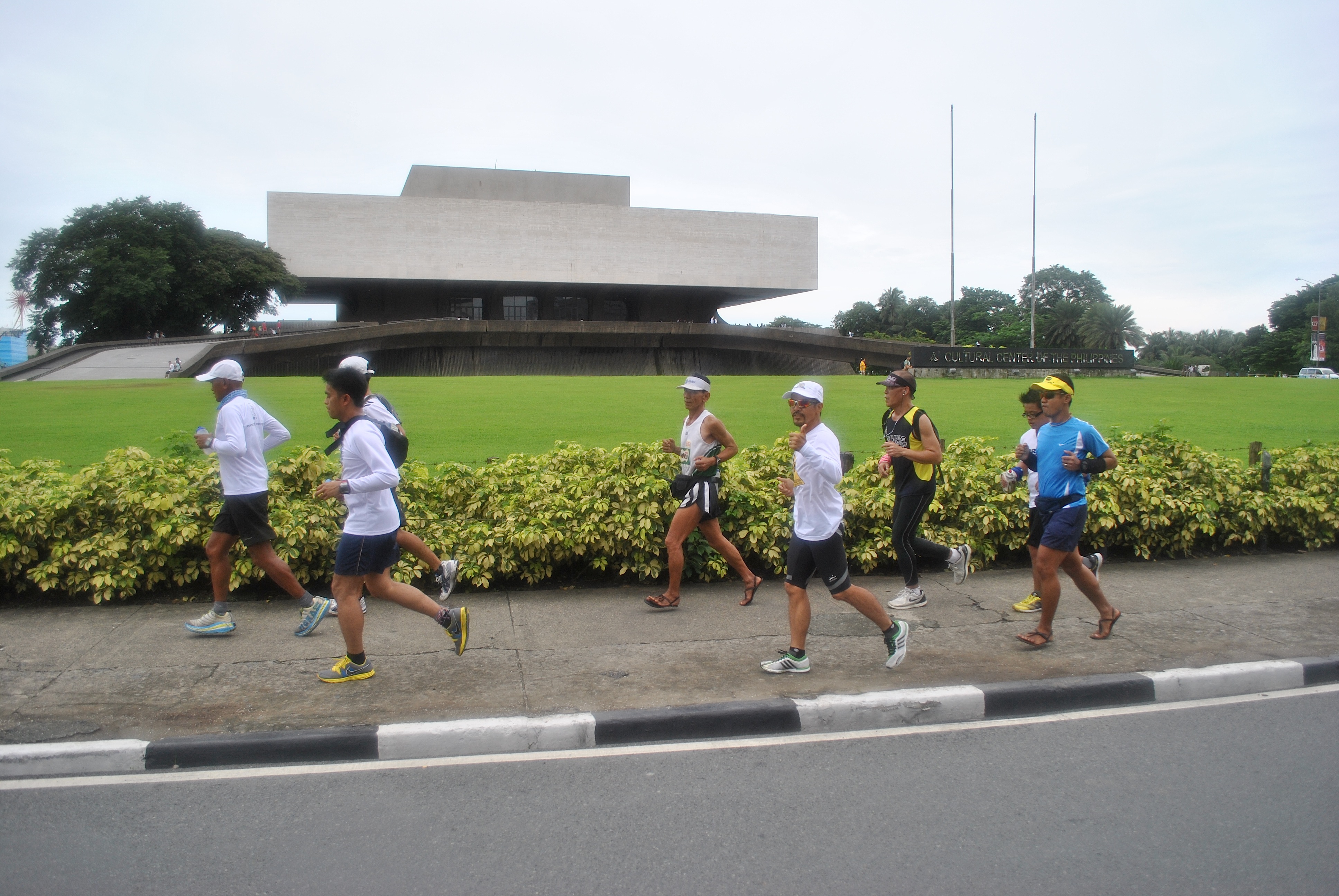
Running Along Lawton AvenueIn Front Of The Philippine Navy/PhilippineMarines’ HeadquartersAt The Vicinity Of Camp Villamor/Headquarters Philippine Air ForceIn Front of the NAIA #3 AirportIn Front of the Cultural Center Of The Philippines (CCP)
On the last 3 kilometers to Luneta Park, we were joined by more ultra runners: Mar Marilag, Benedict Meneses, and CJ Paran. These runners are finishers of the Bataan Death March Ultra Marathon Race and PAU members.
Ultra Runners In Action
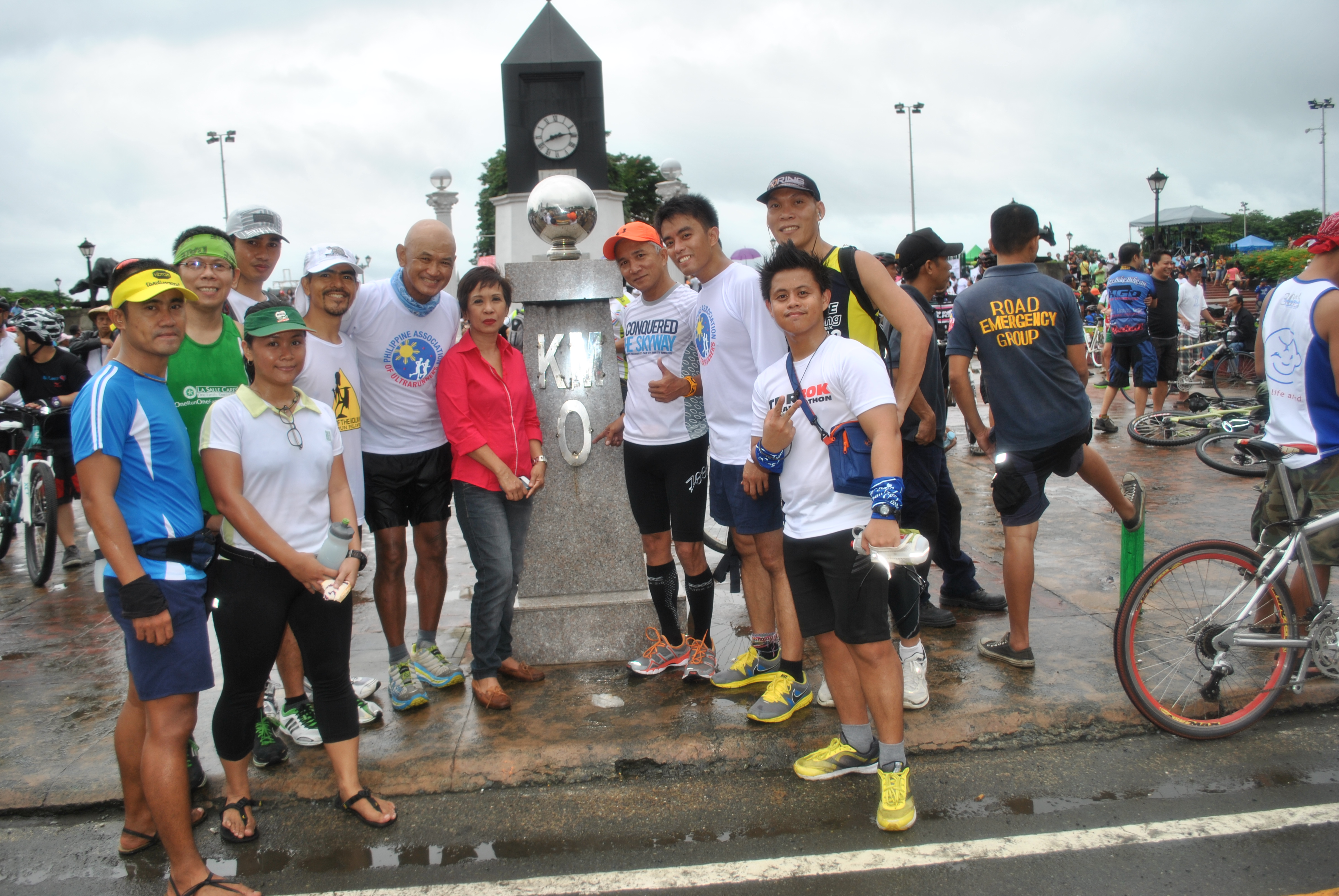
We reached our destination, Luneta Park’s Kilometer Post #0, in 1:50 hours for a distance of 13.5 kilometers. The time was 7:50 AM. The only time that we took some short walking breaks was when we had to cross major street intersections like Roxas Boulevard, EDSA, and Buendia Avenue.
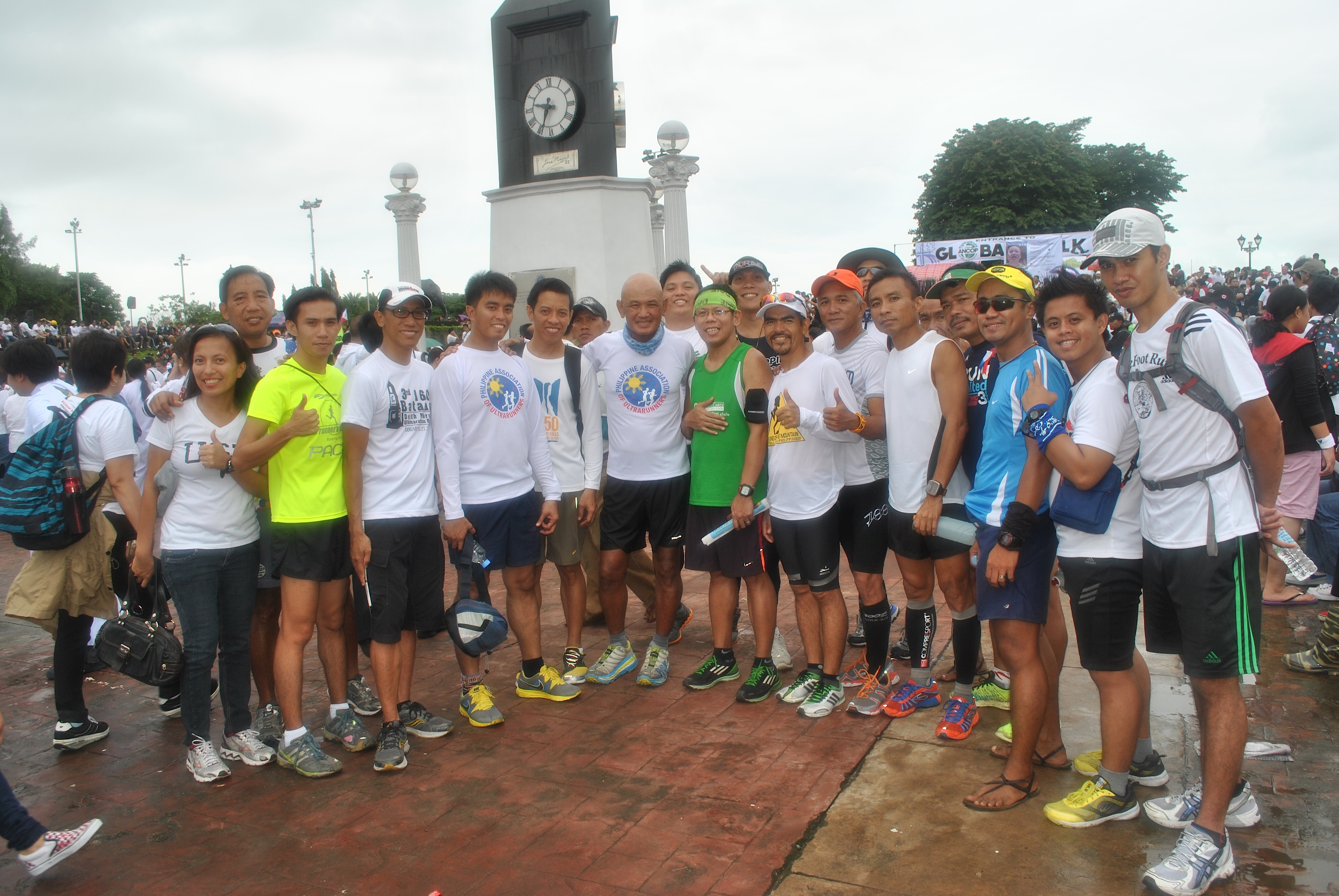
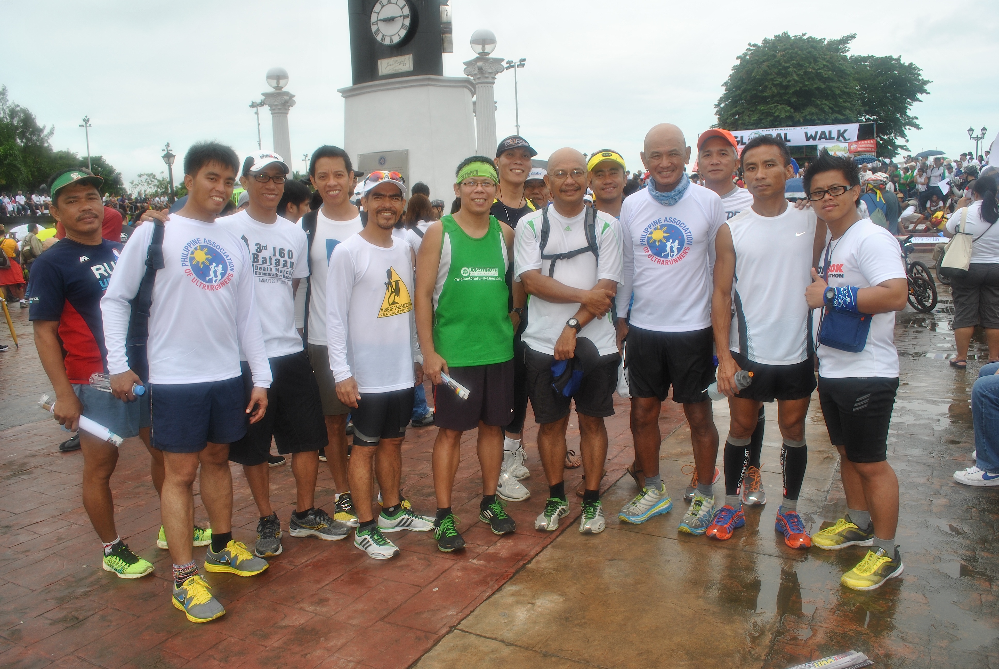
Picture With Ultra & Non-Ultra Runners @ Luneta ParkWith Ultra Runner & Blogger Father Picx Picardal
As soon as we reached Km Post #0, we had some “photo-ops” with some celebrities and runners and sharing of stories with the rest of the group.
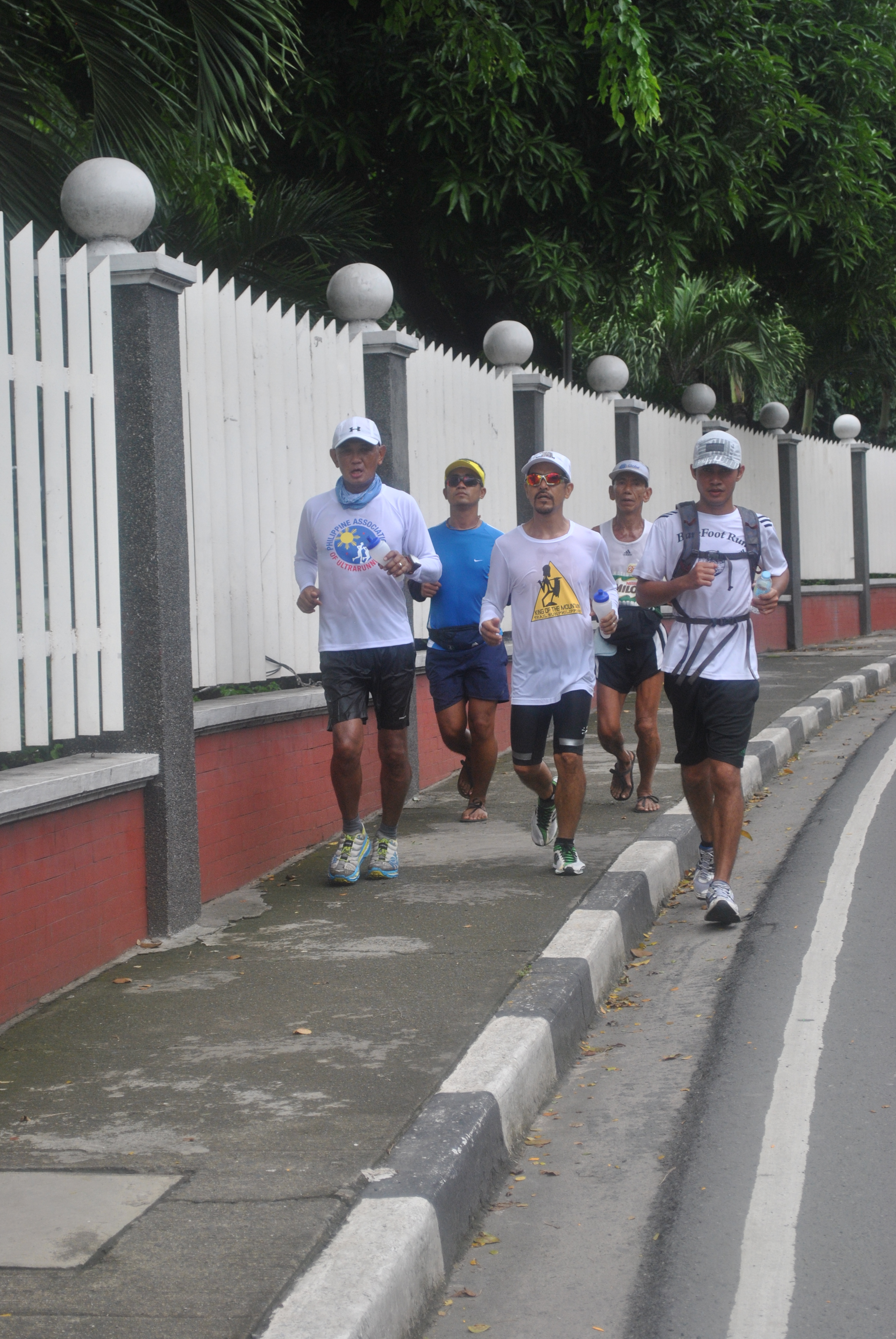
We stayed at Luneta until 9:35 AM and more people and marchers started to arrive at the Park. As we started to go back to where we started, we were met by more people going to the Park which forced us to just walk the first 1-2 kilometers of our run back to Fort Bonifacio.
Going Back To Fort Bonifacio
It was only when we were approaching the Headquarters of the Philippine Navy that we started to run! Mar Marilag, CJ Paran, Benedict Meneses and Eric joined us but later went on their way to reach their offices and their final destinations.
Taking It Easy Back To The Starting Area
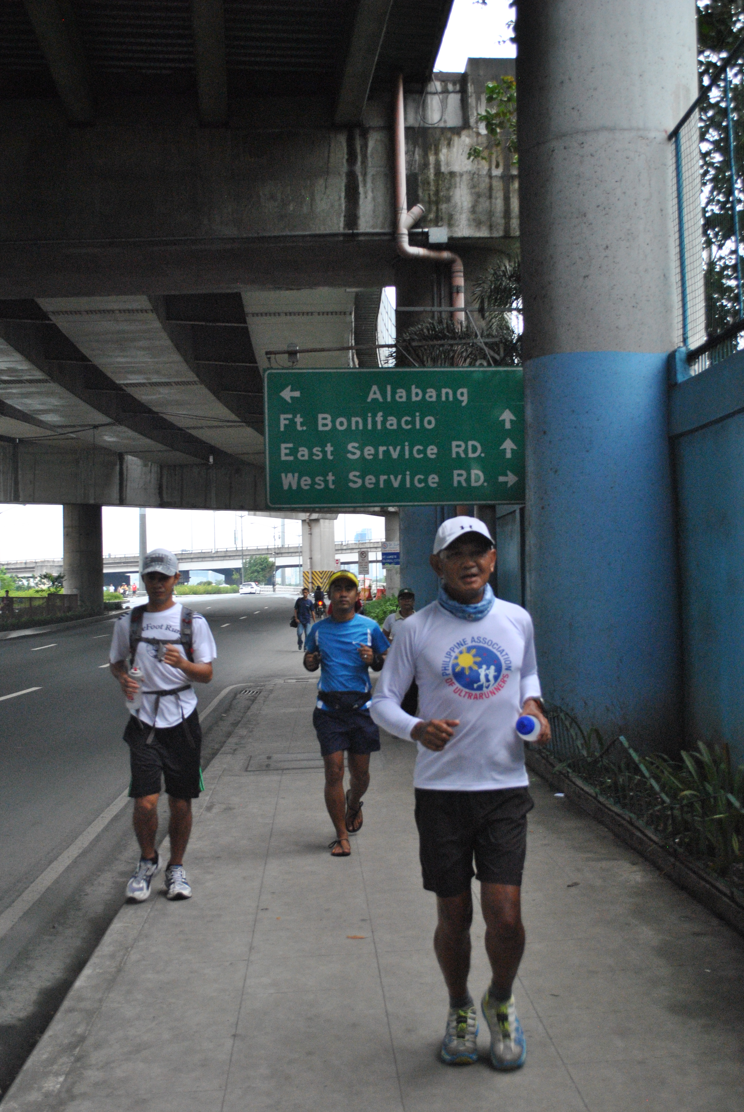
Instead of re-tracing our route to the Park, we decided to turn left at EDSA and reached the Pasong Tamo Avenue where we had to turn right and be able to reach Lawton Avenue. CJ Paran who works at the Office of the City Mayor of Pasay was kind enough to escort us in his turf. At the corner of EDSA and Pasong Tamo, we took a brief break to drink some ice cold Coke for our last 3-Kilometer push to the Finish Line!
Back At Lawton Avenue
At 11:30 AM, we reached our Finish Line and congratulated ourselves for a successful and safe 27K LSD in the busy streets in Metro Manila. It was Graciano Santos’ recovery run after finishing a 50K Ultra Race the previous day and my recovery run also for running along the mountain trails with ultra friends in my “playground” for almost 9 hours the previous day.
A Pose In Front Of Fort Bonifacio/Headquarters Philippine Army
The task has been done for the day—-To keep us counted for the “One Million March”! This event was created and organized through one of the Social Media platforms, Facebook, and as a Social Media user, this is my simple way to be a part and contribution to the objective of the event. Whether the event reached the targeted number of participants of the event or not, it has already sent a message that Social Media is very powerful tool in uniting the people from different sectors of the society in the country. The event was a success!
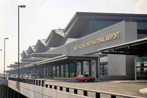
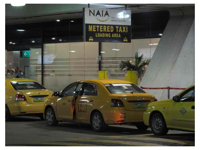
For the past weeks, I have been outside of Metro Manila traveling from one airport to another. I usually take Cebu Pacific and PAL Express flights as I could get promotional prices for these local flight carriers. By taking these carriers, one has to use the new Ninoy Aquino International Airport Terminal 3.
Ninoy Aquino International Airport Terminal 3 (Google Pictures)
Let me tell my readers my observations about the airports that I’ve used in my travels to the Visayas and Mindanao for the past weeks.
On the first week of this month, May, I went to Bacolod City to coordinate with the conduct of the 1st Negros Occidental 73K Ultra Marathon Race among the Provincial Government and the AFP units in the area. Since I was using the Cebu Pacific flight, I had to check-in at the Ninoy Aquino International Airport Terminal 3 for its first flight for the day, arriving thereat at 4:30 AM. I usually take a taxi ride from my place in Manila to the airport.
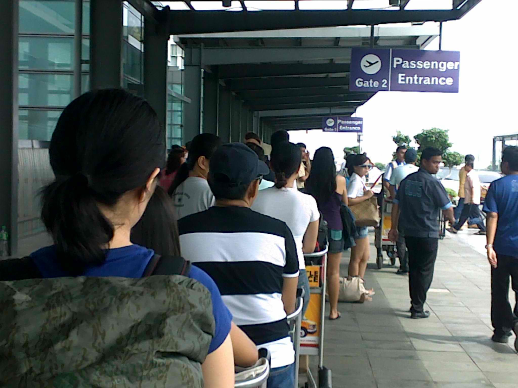
Long Line of Passengers Before The Entrance of the Terminal (Google Pictures)
The usual sight is always there—long lines of passengers trying to enter the airport even if there are two entrances at the Departure Area where the X-ray machines & metal detectors are located. I think there is something WRONG here. Why do you have to place an X-Ray machine & metal detectors for the passengers and baggage just at the entrance of the airport? In my trips abroad, I don’t see any X-Ray machines/Metal Detectors for passengers and baggage right at the entrance of the terminal/airport. Most of these X-Ray machines are located inside the airport or at the terminal’s lobby or sometimes, each of the airlines have their own X-Ray machine and personnel operating such equipment.
The air conditioning system inside the airport/terminal was not working. I thought it was just a temporary situation when I went to Bacolod City but on my next trip to Mindanao after one week, the air conditional system was still not working. For a new airport, it is surprising why its air conditioning system is not working. I really don’t know the reason why the airport authority and its management are allowing this thing to happen. It is summer time and it is annoying to be perspiring inside the airport while standing in line in front of the check-in personnel. Are they minimizing the cost of electricity? Is the management incompetent that they don’t care about the welfare of their customers?
I am glad that the bus that ferries passengers from the terminal to the plane are air-conditioned ones as it gives comfort to the passengers once they leave the terminal.
I am not complaining if there is NO free Wi-Fi in the airport. I am still the conservative type of passenger waiting for boarding at the airport reading a book or a magazine. You can count with your fingers among hundreds of passengers at the boarding area on those passengers reading a “printed” book (hardbound or paperback). What you see now are passengers using their SmartPhones to take pictures and update their Facebook account/s. Some just simply play games on their phones and iPad/Mini-iPads but sometimes I could see people who read books on their iBooks & Nooks!
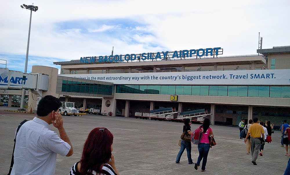
In Bacolod City, the new airport in Silay, Negros Occidental is very nice but it is very far from Bacolod City. I have only one complaint though. The air conditioning system was not working at the arrival area. Since my “contact” in the area was able to fetch me with a vehicle, I was not able to experience what it is like to commute from the Silay Airport to Bacolod City. I hope there are vans, UV Express, and taxis available at the airport for the tourists and other arriving passengers.
New Bacolod-Silay Airport (Google Pictures)
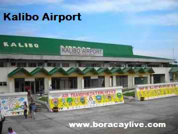
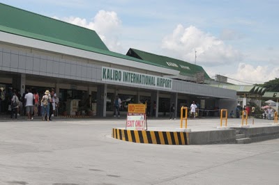
In Kalibo Airport, there is no change since I had my last trip here five (5) years ago. With additional international and local flights, the boarding area and the air conditioning system are still the same and I could hardly feel the cold air with the jam-packed passengers waiting for their respective flight. Although there is a second floor in the terminal area, the space is filled with stores, cafe and convenience stores. The passengers who don’t have seats at the boarding area have to go to the 2nd floor to wait for their boarding calls. There is a need to improve and expand the terminal with the increasing number of local and international flights due to the increasing number of tourists and visitors to Boracay Island.
Kalibo Airport (Google Pictures)Entrance To The New Kalibo International Airport (Google Pictures)
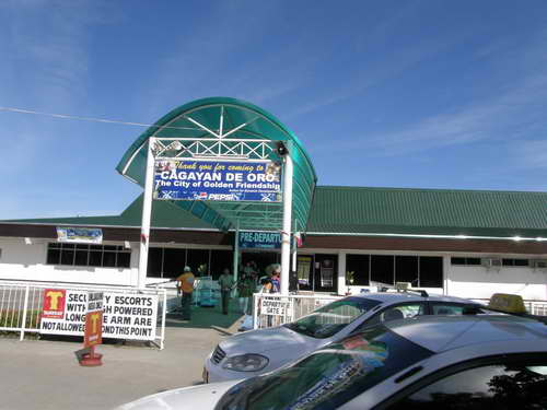
At the Lumbia Airport of Cagayan De Oro City (Misamis Oriental), it is still the same airport that I’ve been going through while I was still in the active military service. It was raining when the plane touched down and my shoes were wet when the rain created a small flooding at the tarmac as I approached the terminal. The baggage carousel is still the same small one where one has to wait for a longer time for the baggage to reach the carousel. The boarding area is still the same where some of the passengers would stand to wait if there are two flights about to take-off in few minutes between each other. Although I was in the comfort of the VIP Room at the departure area, the rest of the passengers were contended with the weak air conditioning.
Lumbia Airport, Cagayan De Oro (Google Pictures)
Airports are supposed to be the “mirror-image” of the place where the airport is located. However, it does not mean that the airport terminal should be warm, hot and humid like our climate but at least, it should be comfortable to everybody. There should be enough space, seats, and a reliable working air conditioning system so that passengers would not be perspiring/sweating while waiting in line in flight counters. It is very frustrating to see passengers sitting and lying on the floor to sleep inside the terminal.
The airport authority and management should not be trying to save power/energy to run those air conditioning system because each of the passenger is paying a terminal fee to address such cost to include maintenance, security, and toiletries in comfort rooms. Aside from its collection of terminal fees, the Airports have an appropriated budget for their Maintenance and Other Operating Expenses under the Department of Transportation and Communications. If I am not mistaken our International Airports in Metro Manila are the top clients of MERALCO (Manila Electric Company). (I am just wondering if our NAIA Terminals are up to date in the payment of their electric bills to MERALCO!)
Here comes the worst part if you are arriving in one of the Airport Terminals in Metro Manila. There are NO Bus Lines or Bus Transportation Lines that pick-up arriving passengers in front of the Terminals! Before when we had only ONE Airport Terminal, we had the so-called California Bus Lines and Love Bus which would pass along the airport’s terminal and whose route would go along the Metro Manila’s main streets and cities. Once you reach a Commercial District or City within Metro Manila, that’s the time you flagged down a Taxi and the driver would bring you to your final destination.
Airport (Yellow) Taxi (Google Images)
Those travel arrangements from the airport once you arrive in Manila are gone now. At present, it is either you get the services of a Rental Car, Airport Taxi, or from a regular Taxi. Obviously, the Airport Taxi (cars painted in yellow) is very expensive. I don’t use such transport service for obvious reason. If you intend to use the services of a regular Taxi (mostly colored/painted white), you should be smart and practical. It is suggested that you proceed to the Departure Area and make an Exit thereat and try to flag down those taxis that just dropped incoming passengers at the terminal. The drivers will not be choosy as they need a passenger once they leave the airport instead of nothing. Problem arises when you take the last flight inbound to Manila if you are coming from local destinations. Obviously, most of these last flights would arrive at the terminal at the same time and it would result to a longer line of passengers waiting for the regular taxi to arrive. Patience is needed in this kind of situation.
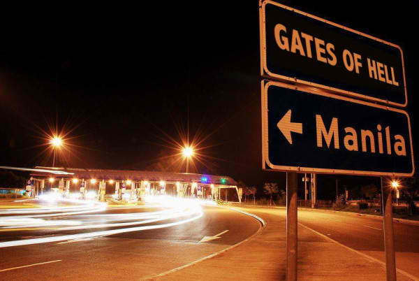
For those foreigners who would like to join our ultra races in the provinces (Luzon area) and choose to arrive in one of the airports/terminals in Metro Manila, Car Rental is the best option. But be careful. Be careful with those “fake” and/or “off duty” MMDA traffic enforcers as they might be attracted with the color of your skin and un-Filipino facial features. These notorious “fake” and/or “off duty” traffic enforcers would flag you down as you leave the Car Rental or a few blocks away and tell you that you can’t drive in our country without a Philippines Driver’s License. That is not true! You can use your country’s Driver’s License for a 30-day stay in the Philippines. If the traffic enforcer does not believe you, tell him that you are a friend of “Bald Runner” (Retired Major General Jovenal Narcise of the Philippine Army). If he still does not release you, then prepare to haggle for the amount of money you have to give for his coffee/snacks.
If he releases you after giving him some cash, then I would say, “Welcome to the Gates of Hell”.
I did not finish this race and I declared myself as Did Not Finish at Km 55. But as I promised in my past post where I mentioned my purpose in joining the race, I am here to make a Race Report and officially make a journal of what transpired before, during and after the race.
Start of Training & Preparation
I’ve never joined a TNF100 Phil event for the past five years but I have sponsored and sent my Elite Team Bald Runner to join the yearly event. Except for last year which was the first TNF 100 in Benguet-Baguio area, my elite runners had won the Team as well as the Individual Championship Awards.
Now, it is my turn to join this race as part of my preparation and training for another event. And since February of this year, I started to build-up my mileage and I enjoyed my “peak bagging” activities but these runs were less than the half-marathon distances.
The following significant races or runs were part of the mileage build-up for this race:
Bandit 50K Trail Run In Simi Valley, California on February 16, 2013 where I finished in 8:07+ hours
2013 BDM 102: Ran the first 50K in 8:20+ hours as the 50K Cut-Off Marshal.
Siquijor 75K Run last March 2013 where I was able to register a time of 13:23+ hours
Mt Ugo Trail 42K Marathon where I finished the race in 8:23+ hours
I was logging at least 10-12 kilometers every day and I had my trail runs on weekends that would last up to 6 hours.
For the months of March and April (2 weeks), I went up to Baguio City for five (5) times to recon the race route with ultra running friends. These recon activities were purely hiking in nature and some picture taking on what will be expected along the race route. On these recon hikes, I was able to test my nutrition, hydration, apparel, and race strategy depending on the terrain of a certain portion of the route.
Except for the portion where past runners would call the “mossy area” and the downhill route from Barangay Alang to the Bridal Veil or Aid Station #5 (AS5), I had already a familiarity of what to expect once I will be in the race. This part or portion of the course covers an estimated distance of 20 kilometers. The remaining 80 kilometers were part of my recon hikes on those days and weekends that I went up to Baguio City.
Tripping Accident
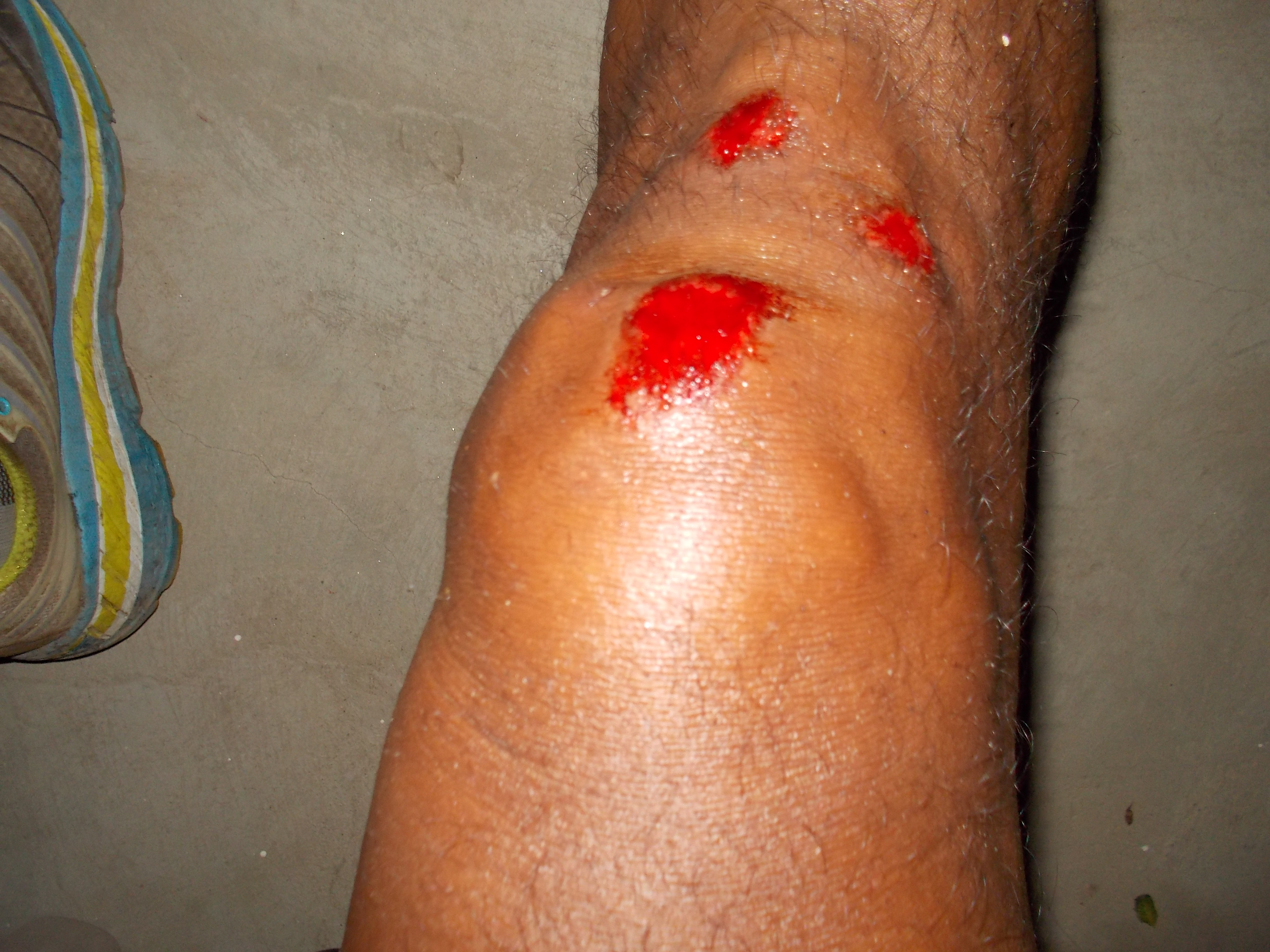
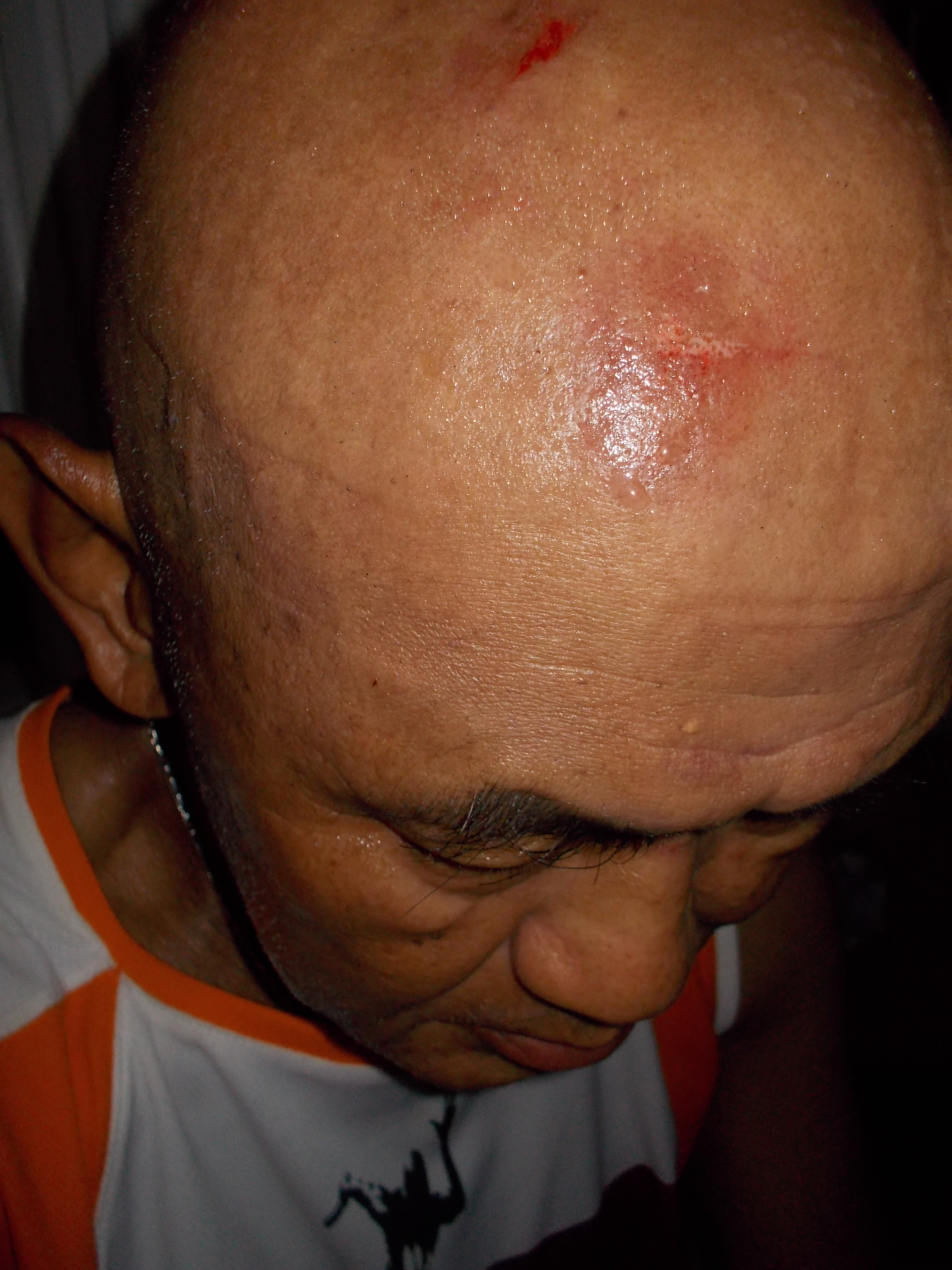
In the middle of March and two weeks before the Mt Ugo 42K Trail Marathon, I had a tripping accident which happened after running 14 kilometers of trails in the mountain of Bataan. It was already in the early evening and I was using my old headlight. I was already running on a paved road when I accidentally tripped a water hose laid across the road which was covered with a wood. I was not able to retain my balance and my right knee hit the ground first, my right arm was used to prevent my upper body from dropping to the ground but my arm collapsed and my head went crushing on the cemented road. I had 3 scrape wounds on my right knee and at least 3 scrape abrasions on the right side of my head.
I was able to recover immediately from the fall and tried to stand with the help of one of my elite runners who was with me in the run. We had to take a break by dropping by one of the “sari-sari” stores at the foot of the mountain and took a Coca-Cola drink and some biscuits as food. After 10 minutes of rest, together with my elite runner, we continued our run for the last 6 kilometers until we reached our training base camp.
On the following day, I could barely walked because of the infection brought by the wounds. For almost 2 weeks prior to the Mt Ugo Trail Marathon, I did not have any running workouts. However, I still managed to join the race in Kayapa, Nueva Ecija despite my lack of specific preparation for the race and the presence of pain on my right knee as a result of the tripping accident.
Shit Happens!Not On My Face!
Another Tripping Accident!
I really could not explain. Am I really getting old or something up above is telling me to stop running or am I simply hard-headed and crazy? Another tripping accident happened again barely one week to go before Race Day for the 2013 TNF 100. It happened during a night run where I was testing my new Headlight and new HOKA shoes. My right foot stepped on a shallow hole and my shoes front end hit the edge of the hole and it took away my balance. The healing wounds on my first tripping accident were the ones that hit the ground but I was able to use my right hand to prevent my whole upper body to hit the pavement. Yes, there was blood again on my legs and I was limping when I reached my place.
I still managed to have my last recon hike, one week before race day, despite my limp on my right leg. The last recon hike would cover the first 30K of the race on a Saturday and the last 25K on the following day, Sunday.
Race Strategy
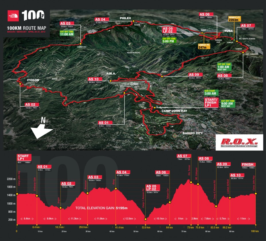
Since I am not confident on my running capability for the race because of the lack of long runs, tempo runs, and speed runs due to injuries brought about my tripping accidents, my target for the race was to try my best to finish within the cut-off time of 30 hours by following these time targets: (Note: Please refer to my previous post on the location of these places I am going to mention here. Thanks.)
Start To AS3 (Ampucao)—-Finish In 6 Hours
AS3 To AS5 (Camp 1/Bridal Veil)—-Finish In 6 Hours
AS5 To Cabuyao—-Finish In 9 Hours
Cabuyao To Camp 6—-Finish In 3 Hours
Camp 6 To Finish—-5-6 Hours
My estimates were based from the recon hikes that I’ve conducted. Except for the portion, AS3 To AS5, I know where I could run and jog and be able to shave off some of my time of running.
In my recon hikes, I had at least 12 hours of getting lost on the first 30K of the course and I knew that if I could run at least 5 kilometers every hour, I could reach Ampucao in 6 Hours. From Bridal Veil to Cabuyao, it took me almost 8 hours on pure hiking with rests. From Cabuyao To Camp 6, it took me 2:45 Hours during the day and I am confident to jog on the flatter trails with 3+ Hours as time to finish the portion. My recon hike from Camp 6 to the Finish Line (without those additional mileage inside the Camp John Hay Area) took me almost 4 Hours.
I took the risk of not knowing about the terrain in the “mossy forest” and the road from Barangay Alang to Camp 1/Bridal Veil due to the following reasons: (1) The trail inside the “mossy forest” was not yet available during those days when I had my recon hikes. The trail was newly cleaned few days before the race. (2) No available past runner/s or “guide” for the said part of the route join me in my attempted recon hike in the said place.
This part of the course proved to be my “waterloo” during the race but there are other more significant factors that simply sapped my strength during the race.
The bottomline of the Race Strategy was to run/jog the flatter sections, do power walking/hiking on the uphills, and keep the knees and quads from hurting on the downhills. I had to use my trekking poles to the maximum in order to be consistent on my pace.
Nutrition Strategy
Take a meal before the race and I did take a full breakfast meal of fried eggs, fried SPAM, and rice with coffee.
Eat while on power walking and never stop in-between AS just to eat. Ingest something that is solid every two hours. Eat while walking! At the AS, if you want to eat, make it fast and then take something to eat while on the road
Hydration Strategy
Drink if you think you are sweating a lot. Drink while chewing your food. If there are sources of water along the route, drink 1/2 full of hydration bottle and then fill up your bottles before resuming the race. Drink alternately with Gatorade. Drink Gatorade by sips or in small amount. Never fill the water bottle to the rim.
Running Apparel
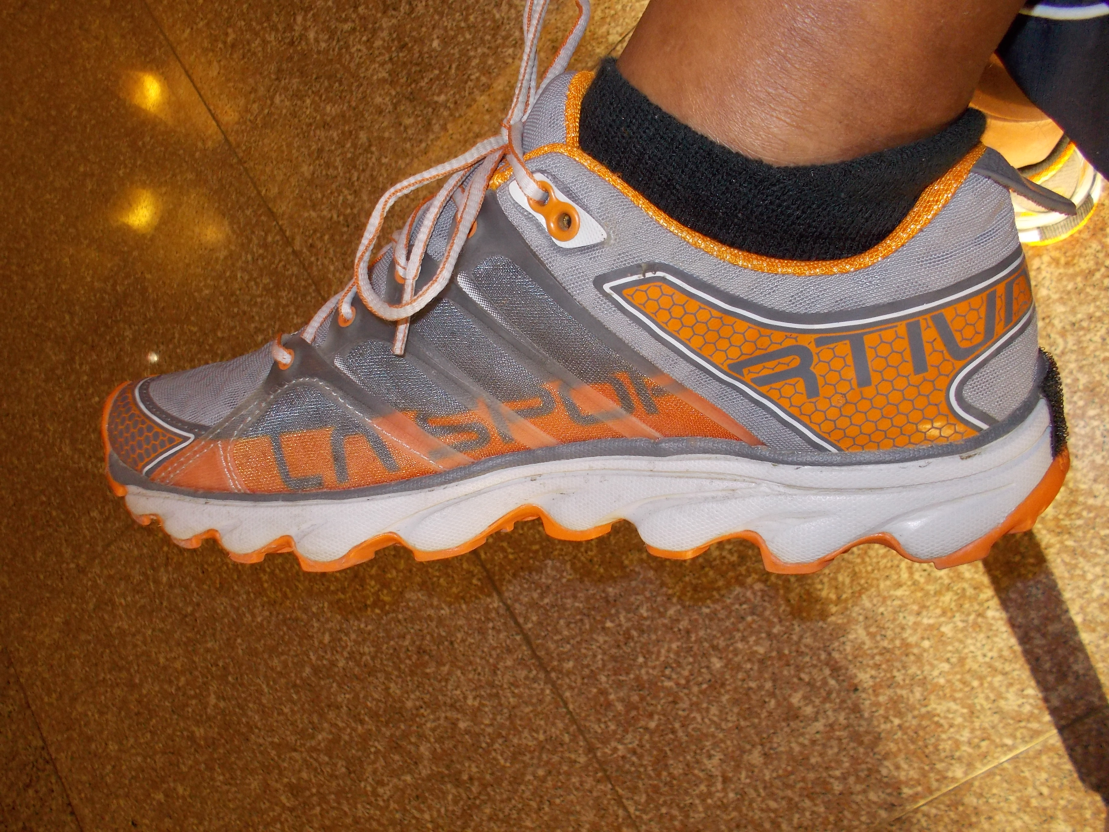
I bought my Helios/La Sportiva Shoes while I was in the USA last February for the sake of trying this Italian running shoe brand. I used them in my peak bagging workouts while I was in Los Angeles and like them. I appreciated more of its capabilities when I used them in my recon hikes most especially on the Cabuyao To Camp 6 route. While the rest of group on the hike were tripping and sliding as we went downhill, I did not experience any misstep, sliding or tripping. The structure of the sole was simply amazing as they really “gripped” on the ground and the pavement. I immediately decided to choose these shoes for the race. Drymax socks were used instead of my Eddie Bauer socks.
Helios By La Sportiva
In anticipation for moderate rain during race, I used my long-sleeved Patagonia baselayer which is colored dark green. (I had a light Poncho that weighs a garbage bag tucked in one of my hydration pockets, in case of rains.) The shirt is light and could easily dry up if it becomes wet with my perspiration or by the rain. I used a Salomon EXO compression tight shorts because of its high waist line and pockets. The compression feeling on its waist portion was perfect pressure applied on my core. It also served as an absorbent for my sweat from my upper body and prevented my feet and socks to be wet during the run. On top of the compression shorts, I used my black Patagonia Trail Shorts which have 5 pockets (two at the front; two at the back; and one zippered pocket on the right upper side behind the shorts). My cellphone (IPhone4) & reading glass were on my right front pocket; trail mix food was on my left front pocket; cereal, Gatorade powder and fruit bars were evenly distributed on the pockets behind my shorts.
Although I did not use my Salomon S LAB Hydration System during my recon hikes, I opted to use it because it has a whistle (mandatory equipment), string to tie my trekking poles, and lots of zippered pockets. My rain jacket was thinly folded inside the hydration compartment where the 1.5 liter bladder is supposed to be located. (I removed the 1.5 liter bladder and water hose to lessen the load and have more space for my trail food). My Nike reflectorized vest was thinly folded on the left zippered pocket while a light poncho was also folded on the right zippered pocket together with capsules of Pharmaton. Some trail foods were also stashed in the zippered back pocket of my hydration system. My lighting systems (old and new ones) from Black Diamond were stashed on the pockets of the hydration system.
I used calf sleeves from Zhensa for whatever it can do to my calf muscles, protect my exposed legs to small shrubs and sharp leaves of grasses, and absorb whatever sweat coming from my legs. I used some gaiters to prevent debris and small rocks from getting inside my shoes and they perfectly functioned well for the race.
I used also my favorite Buff placed on my neck to absorb my sweat coming from my head & used it to cover my nape from the heat of the sun and used an Under Armour Skull Cap on the early part of the race which fit well with the straps of my Black Diamond headlight. It also absorbed a lot of my sweat from my head. To anticipate the heat of the sun after I reached AS3, I switched to my Patagonia Legionnaires Cap.
Headlight System
I used the latest Black Diamond’s ICON Headlamp which I bought in the USA last February and I was satisfied with its performance. It has separate battery case that can accommodate 4 AA batteries. It has a long wire and heavier in weight but the illumination was perfect for night running. It brought so much confidence in me to run in the dark through its illumination and life/power expectancy from its batteries. The separate battery pack was perfectly stowed on the main compartment of my Salomon Hydration Pack. I have another old Black Diamond headlamp in my pack just in case of any contingency.
Lastly, I brought some strips of band-aids and antiseptic as my first -aid kit which was placed in the pocket where my poncho was located.
End of Part 1. Race Briefing & Race Proper to follow. Pictures To Be Inserted Later.
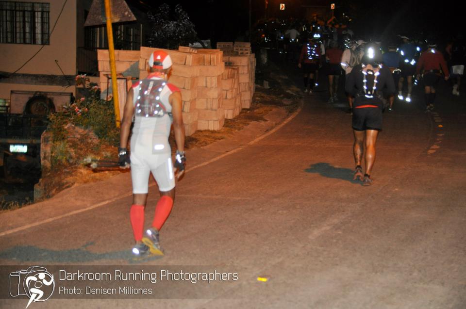
You always hear the usual greetings, “ Welcome to the Dark World of Ultra Running”, when you finish an ultra race. The way I understand the greetings or statement is that an ultra runner needs to run and finish the race at all cost with his/her strength within the prescribed cut-off time which can last till night time or till the next day. It also means that an ultra runner should also come into reality that running in darkness is part and parcel of being an ultra runner.
As I progressed from 50K distance to 100+kilometer distance races and in my personal experiences in my multi-day adventure runs, I learned to appreciate running at nighttime or in darkness. It came to a point that I have to train and run more kilometers in my training during nighttime. Slowly, I am starting to appreciate the meaning of the said greetings.
In the ultra races that I organize and direct, most especially on the 100-miler distances, like the BDM 160 and TD100, I observed that runners have the fear of darkness, moreso, when they have almost completed one half of the course. This is where I received information of runners of declaring themselves as DNF in the race.
Despite the completeness of lighting equipment of the runners, the fear of running in the darkness comes into their minds. What could be the reason why runners have the tendency to quit the race when darkness comes? If you ask me, I really don’t know why!
Some runners are afraid of dogs on the streets and trails during nighttime and I could understand their predicament. But based from stories from ultra runners, running in darkness alone saps the strength and mental fortitude of an ultra runner. Could it be that this observaton is only applicable to Pinoy ultra runners? I personally don’t believe so. I firmly believe that Pinoy ultra runners are brave to run in darkness.
So, how do we deal with the fear of darkness in ultra running?
In my experience as past military commander, darkness is always a friend of the troops. Soldiers move silently under the cover of darkness in order to “surprise” the enemy and ultimately, defeating them. Some runners also adopt such stealth tactics in ultra races when they put-off their headlights to “surprise” their targets as they get nearer and pass them. Always think that darkness is your constant ally during the run. Don’t believe on ghosts or vampires roaming around you waiting to strike you. There are no such things or creatures! If somebody appears in darkness and it is moving, most likely, it is a human being like you or an animal roaming around the place.
In this age of high technology, there are lighting equipment, i.e. headlamps and hand-held flashlights which have high and powerful illumination with lesser use of power/batteries. There are also batteries which can give extended period of constancy for the illumination needed for these headlamps. Get these “high-tech” headlamps and flashlights and use them in your night runs. It is advisable to use them during your training runs in order to find out for yourself if the advertised capabilities of these equipment are true or not. Never use “new” lighting equipment on race day. And bring extra batteries for your headlamps and flashlights. For better illumination on the course, use both your headlamp and hand-held flashlight. The headlamp is focused on the road/trail (where the feet are leading to) and the hand-held flashlight is directed on a wider-angle in front of you covering both sides of the road/trail.
Most of the time, fear of darkness is attributed or caused by human beings or animals you meet on the course of your run. In my experience, I usually wave my hand and start a conversation by greeting the individual with the usual “Good Evening” or saying, “We are in a middle of a “Fun Run” or “I am jogging to this place and I started from this place”. Always start the conversation and try to look them on their faces. But most of all, simply smile at them and show on your face that you are having fun and enjoying the run. As for stray dogs, simply walk and observe the movement of the dogs. Directing the light of your flashlight to the face of the barking dogs could also “stun” them temporarily.
Gaining 100% confidence running in darkness is through running the course on nighttime. If the course is not available or accessible, you can find a place that resembles the elevation or terrain of the course. Try running alone on this course using your headlamp and/or flashlight not once but as many as you can. Repetition of such workout during nighttime conditions the mind to be relaxed and focused.
Sometimes, having a “buddy” who trains with you could also give confidence and solve your problem of the fear of darkness. Get somebody who would be your pacer or somebody who have the same pace and strength as with you. But you must be always prepared for the “worst” scenario if your “buddy” declares himself as DNF. Get somebody as your “reserve” pacer or “buddy” or wait for another runner to pass you and stick with the said runner as you continue your run. Make that runner as your “point man” along the course.
If you are preparing for a 100K or 100-mile trail ultra marathon, running at nighttime should be your friend and ally.
Next topic…Fear Of Coldness…soon!
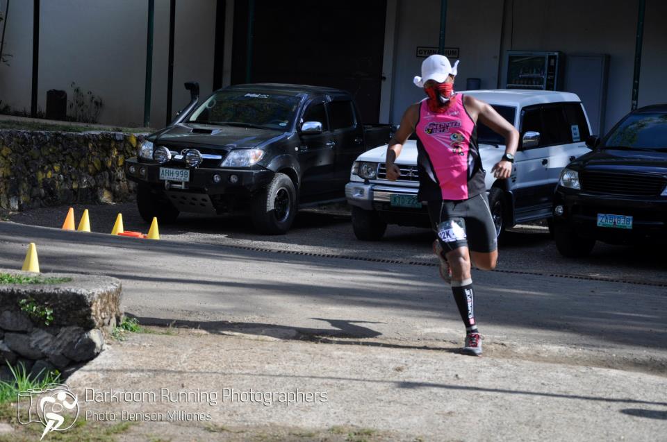
@Mt Ugo Trail Marathon (Photo Courtesy of Darkroom Running Photographers)
There are so many reasons why I joined this running event. Let me enumerate some.
1. Baguio City is the place where I started running seriously, in the early months of 1970. Being a college student of the University of the Philippines in Baguio and just passed the entry to the prestigious Philippine Military Academy, running had been part of my treatment for what the doctor had suggested to strengthen my weak lungs and heart. I was then 17 years old.
2. BRENT Run is organized and directed by very good friends who have passion in running. A week prior to the event, I was with Jingle Melanie Ku Marquez, the Race Organizer and Jonel Mendoza, the Race Director of the event, in a hiking trek to the TNF 100 route along the PHILEX Ridge in Barangay Ampucao, Itogon, Benguet. It was during our hike that the invitation to run the event was offered and I immediately accepted it. Thanks, Melanie & Jonel!
3. First time to enter and see BRENT School Campus. I have stayed for so long in Baguio City as a College Student, Cadet of PMA, Officer assigned in Region 1 from 1978-1983 and then PMA in 1986-1988 but I never had a change to glimpse at the said school. The Pink Sisters Convent is the farthest establishment that I’ve reached on the road that leads to the school campus. The campus has trails around its compound!
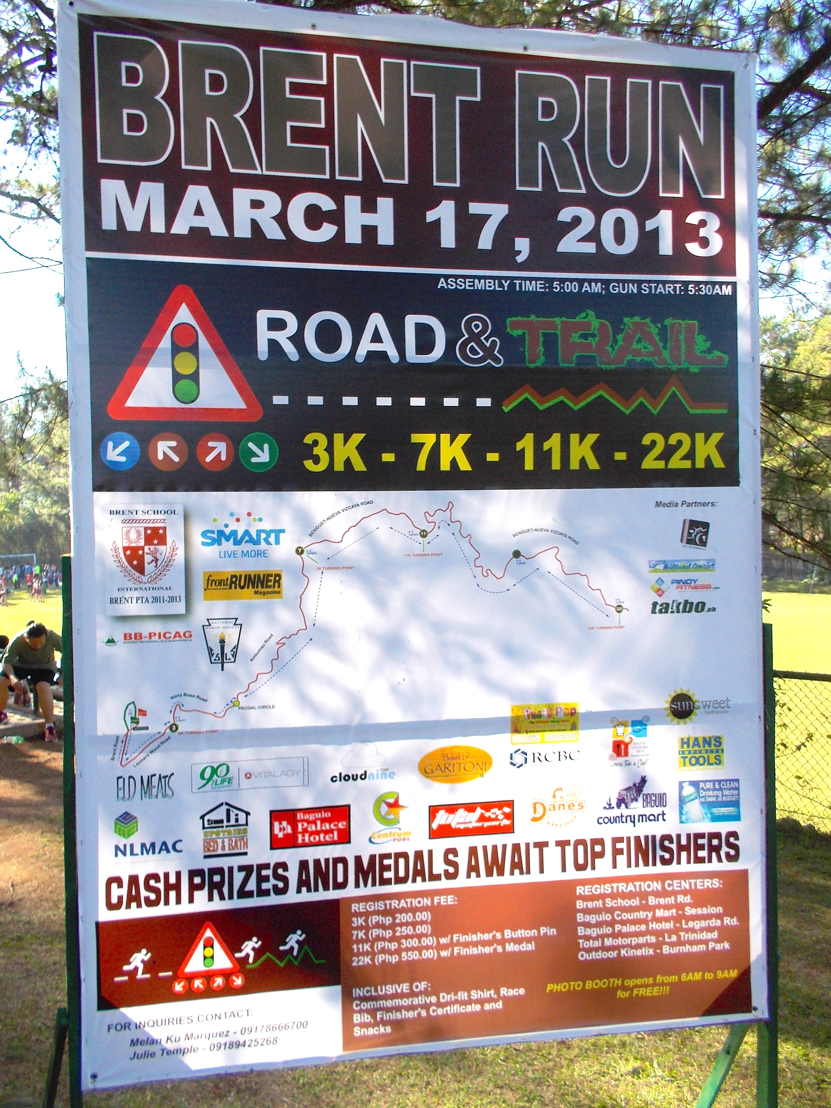
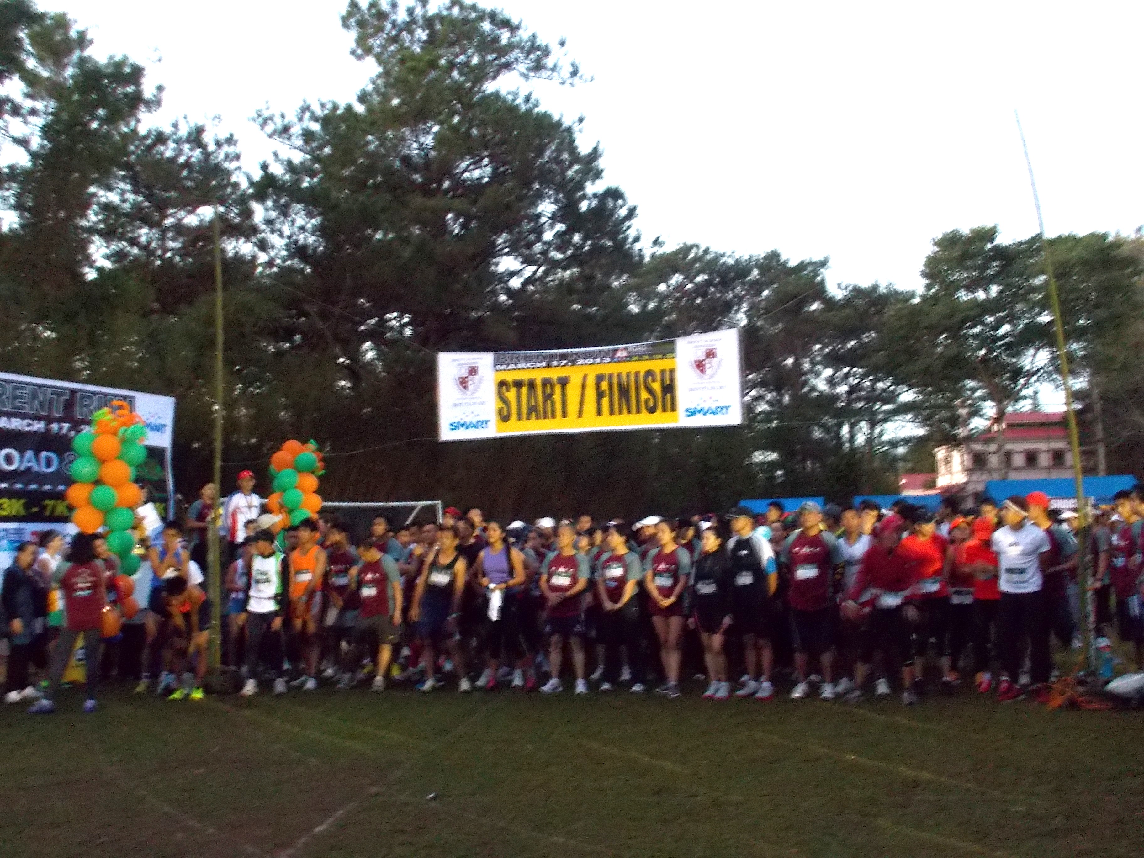
Starting Line Of The 7K Run
4. Find out how it feels to run shorter races after doing some ultras, trail runs, and peak bagging feats. I opted to run the 7K race and find out how my body would react to the altitude and the terrain. The plan was to run the race without walking, except while approaching the water stations to take a sip of water. I was glad I was able to stick to the plan and jogged on the uphills and tested my knees and quads on the downhills.
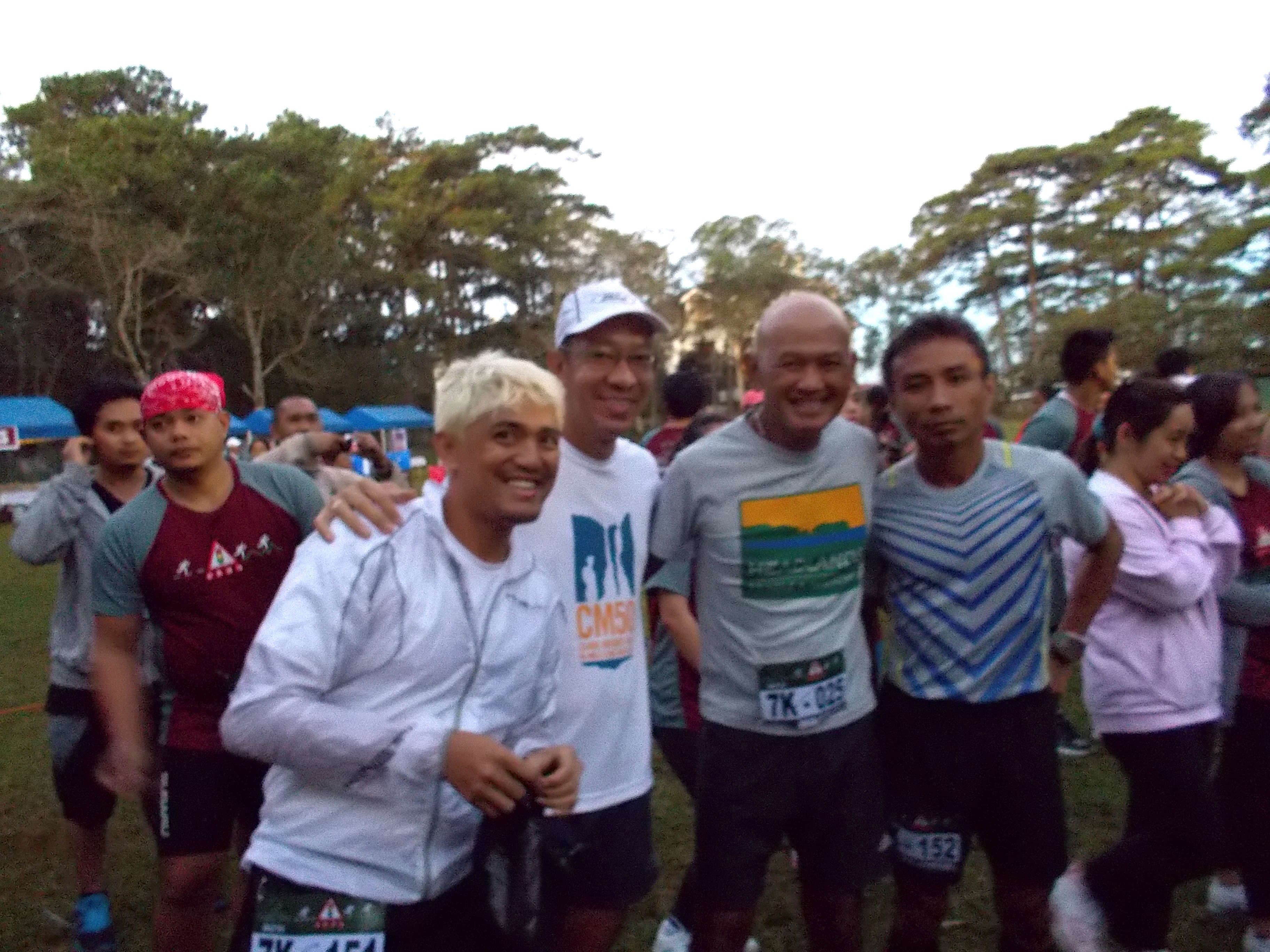
At The Back Of The Pack (Benj Termulo, Michael Lafuente, BR, Henry Laron)
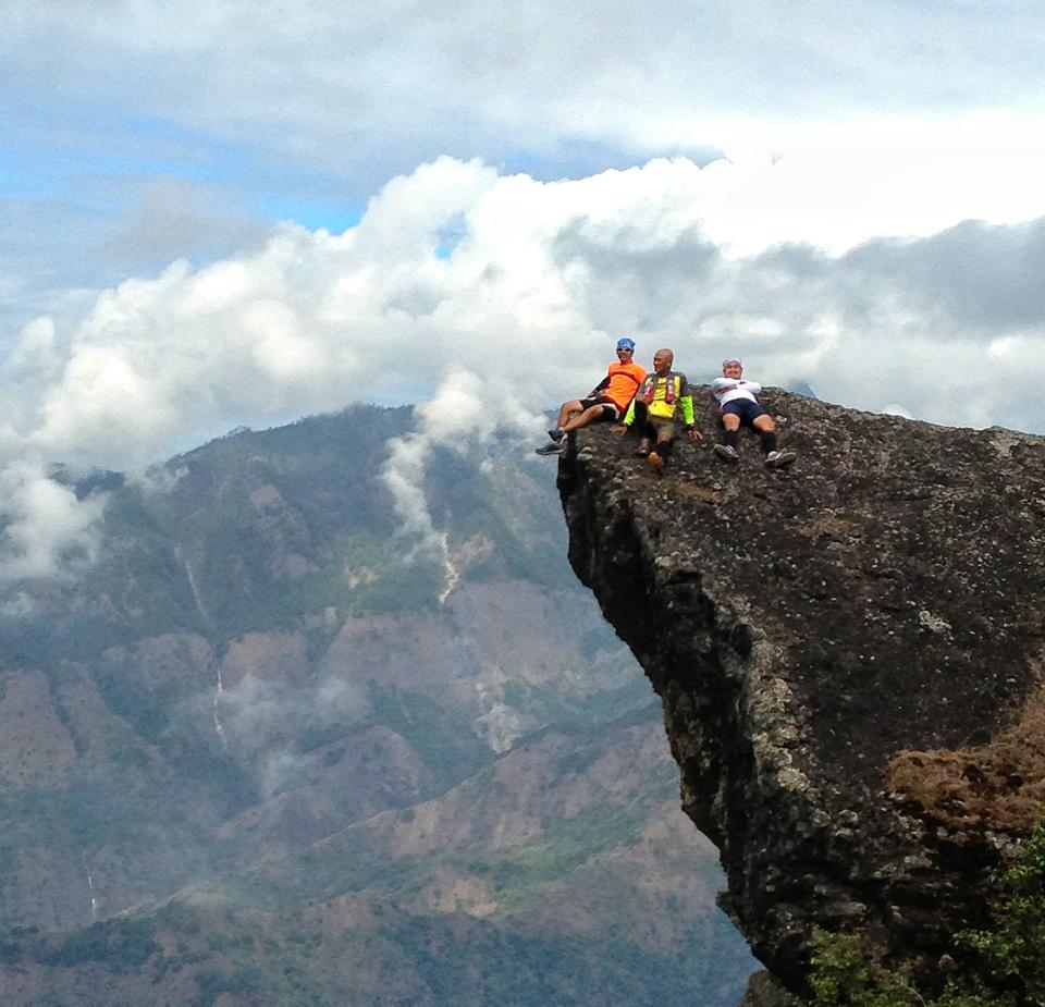
5. Running with ultra friends and having fun. Saturday, the day before the event, five of us (BR, Benj Termulo, Judge Henry Laron, Michael Lafuente, and Bong Alindada) had a hike from the Bridal Veil Falls in Camp 1, Tuba, Benguet (along Kennon Road) to Mt Kabuyao along the so-called Andolor Trail and peak bagging Mt Santo Tomas with an elevation of 2,245 meters above sea level, the highest peak in Baguio City. It took us 9 1/2 hours to finish the distance of 22 Kilometers. The group expected to make the BRENT Run as a recovery run for our tired legs!
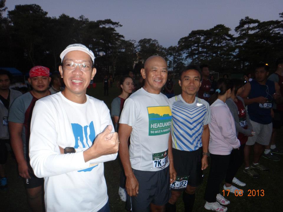
At The Back Of The Pack
6. But wait, it was also a “warm-up” run for another hike up to the mountains. After the run, we were scheduled to continue our mountain hike to the other side of Baguio City which is the so-called PHILEX Ridge. We were joined by another ultra runner from Manila, Ronnel Go, who opted to join the 22K race. After waiting for Ronnel Go to cross the finish line, we already enjoyed the breakfast food as part of the “loot” of the race and we were prepared for the next adventure hike. We finished our hike along the PHILEX Ridge in almost 5 hours!
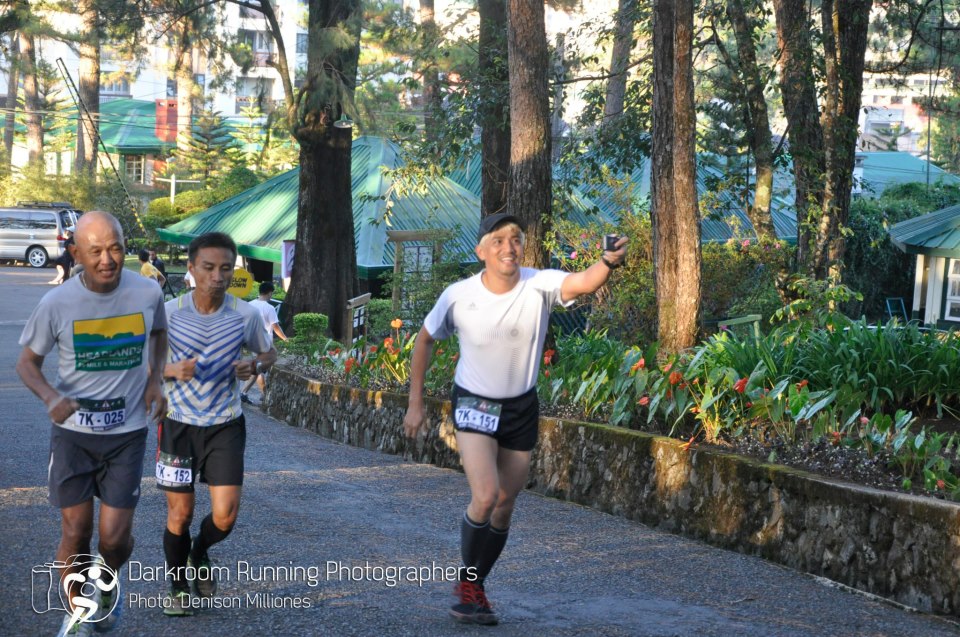
Last One Kilometer To The Finish Line (1 Kilometer Trail)
7. Getting back to the “basics” of road racing. It was nice going back to experience how it feels to be a “newbie” runner to join in a very simple set-up for a running event. Melanie and Jonel made the event so very simple yet fulfilling for the participants. Very orderly race for the safety of the runners and nice breakfast treat for all the finishers. But what makes it more memorable was for us to meet and gain more friends from Baguio City. What I appreciate most is the seriousness of the runners that I could hardly heard any complaints or “whine” or curse about running on those steep uphills along the course. Runners in Baguio City really love those challenging hills and inclines!
Good Job! (Ronnel Go)
8. Training Run for a Bigger Event. I finished the 7K Run in 52+ minutes and I take that result as my gauge for my future race within the area/region. Since the bigger event is an ultra race, making it within the range of 4-5 kilometers per hour as average speed for the event would be a nice goal.
If you ask me if I am going back for the next edition of this race, I would say “Yes”!
Congratulations to all the Finishers, to Melanie and Jonel, and to the whole Team of BRENT Run!
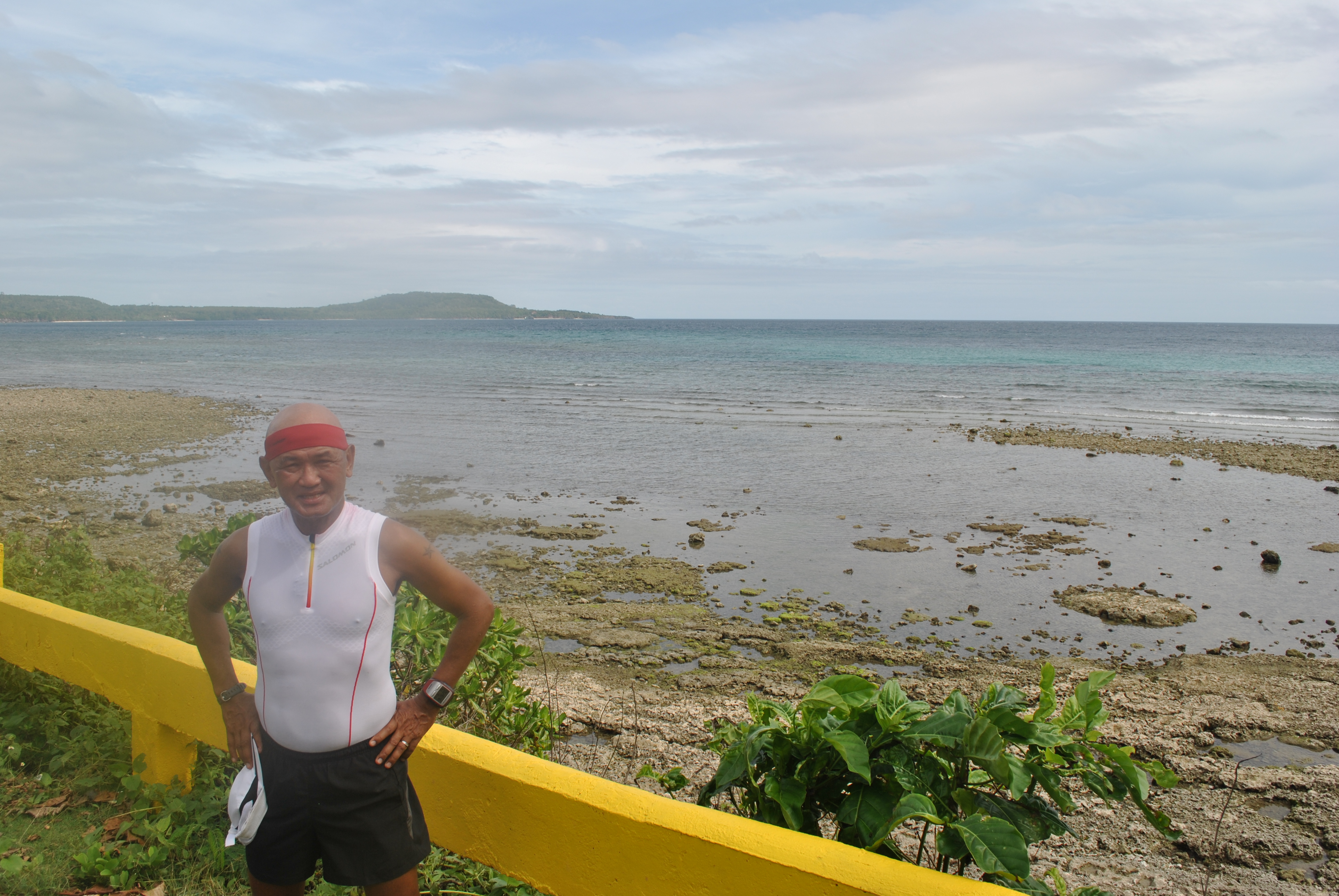
While I was the Division Commander of the 3rd Infantry Division of the Philippine Army, I had two chances to visit the island of Siquijor. First was when I called courtesy calls to the Provincial Governor of Negros Oriental and the Catholic Bishop of Dumaguete City. After my calls, I had a one-day trip to the island of Siquijor but never had a chance to visit other places except its capital town, Siquijor.
The 2nd time was when a newly-designated Chief of Staff of the AFP was honored by the Local Government of the Island being a native of the province. I was the Military Host for the Military Honors given to the former AFP Chief Staff General Alexander Yano and it was a chance for me to get around the island with the Provincial Governor and Guest of Honor. I can still remember that the whole party stayed in a beach resort being operated and owned by the local government which is located at the northeastern end of the island.
The Port Of Siquijor
Five years after that last visit, I decided to visit the island purposely to run around its circumferential road where all the municipalities would be visited. There was no intricate plan whatsoever except for the purchase of a round trip plane ticket to and from Dumaguete City. My visit and run was a low-key activity as I did not bother to call the running clubs in Dumaguete City and my contacts in the military.
While I was on a ferry boat to the island, I decided to call the Philippine Army’s Brigade Commander in the area and asked for some assistance in the island who would suggest a place to stay and where I could rent a multi-cab as my support vehicle. In a few minutes and exchanges of text messages, my arrival, stay, and itinerary in the island were all set and arranged.
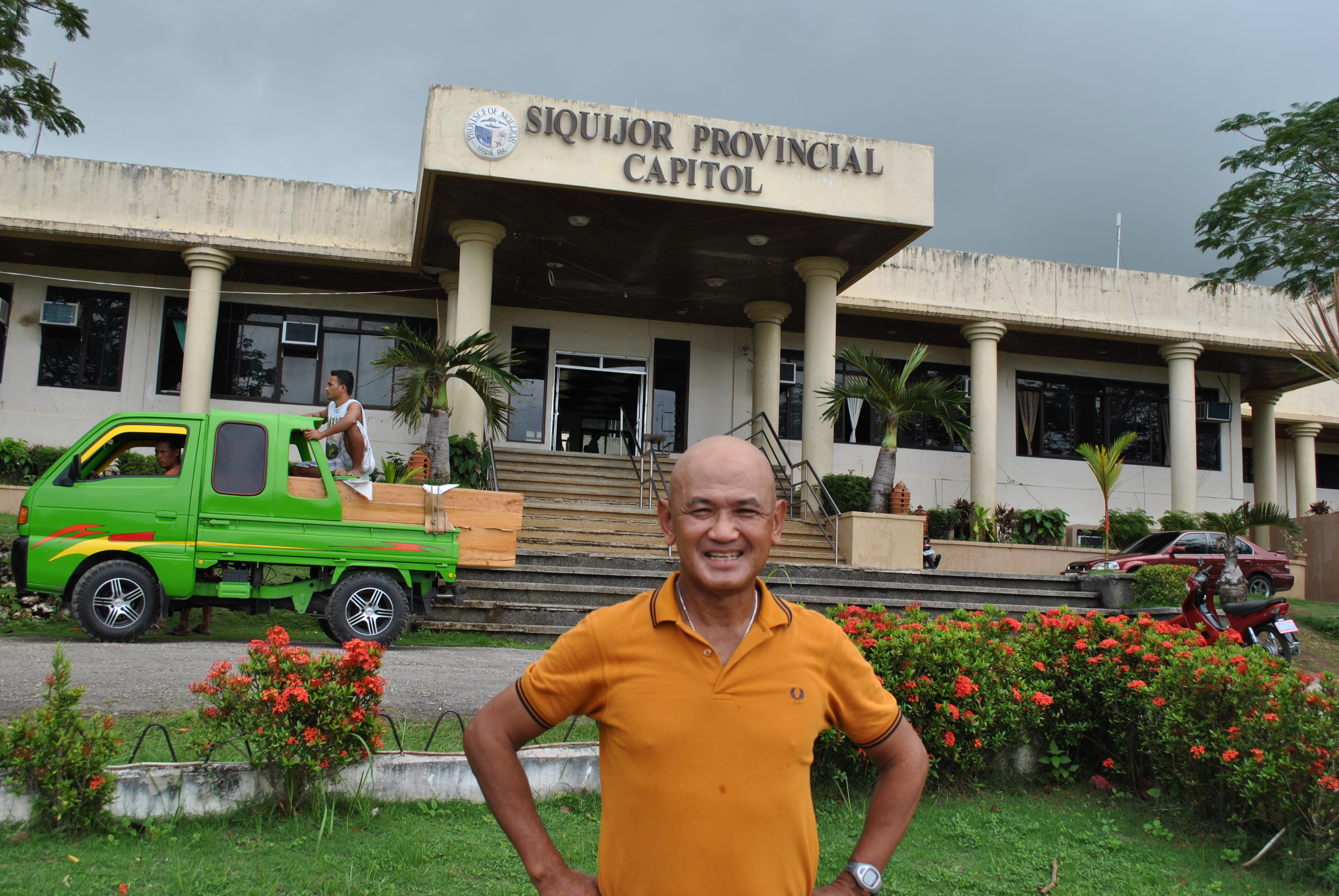
After Coordination With The Office of the Governor
As soon as I got out from the ferry boat, a police vehicle with 3 police personnel were at the pier waiting for me. The tallest among them is an Officer, Police Inspector Vincent Paul Dumaguing, who is the designated Operations Officer of the Provincial PNP Command. He hails from Davao City and a graduate of the PNP Academy.
I told Police Inspector Dumaguing about my purpose in the island and he was happy and excited to know it. His relatives happen to be runners, ultrarunners at that, in Davao City. He said that his relatives had been planning to run around the island if their schedule would permit and he was laughing because the honor for them to be the first runners to run around the island would not be given to them.
I requested that I should be brought first to the Provincial Governor or to any of the Local Government Official present in the Provincial Capitol for my courtesy call. It was unfortunate that the Governor was out of the province. But I was able to talk and explain my purpose for my stay and visit to the Provincial Tourism Officer who happens to be a lady. She was excited to hear and amazed that I would be running around the island on the following day after my arrival. I told her also of my plan to bring ultrarunners from around the country in the next few months for them to experience also what I’ve seen around the island. The lady promised to me that she will relay my plan and intention of conducting a running event to the Provincial Governor.
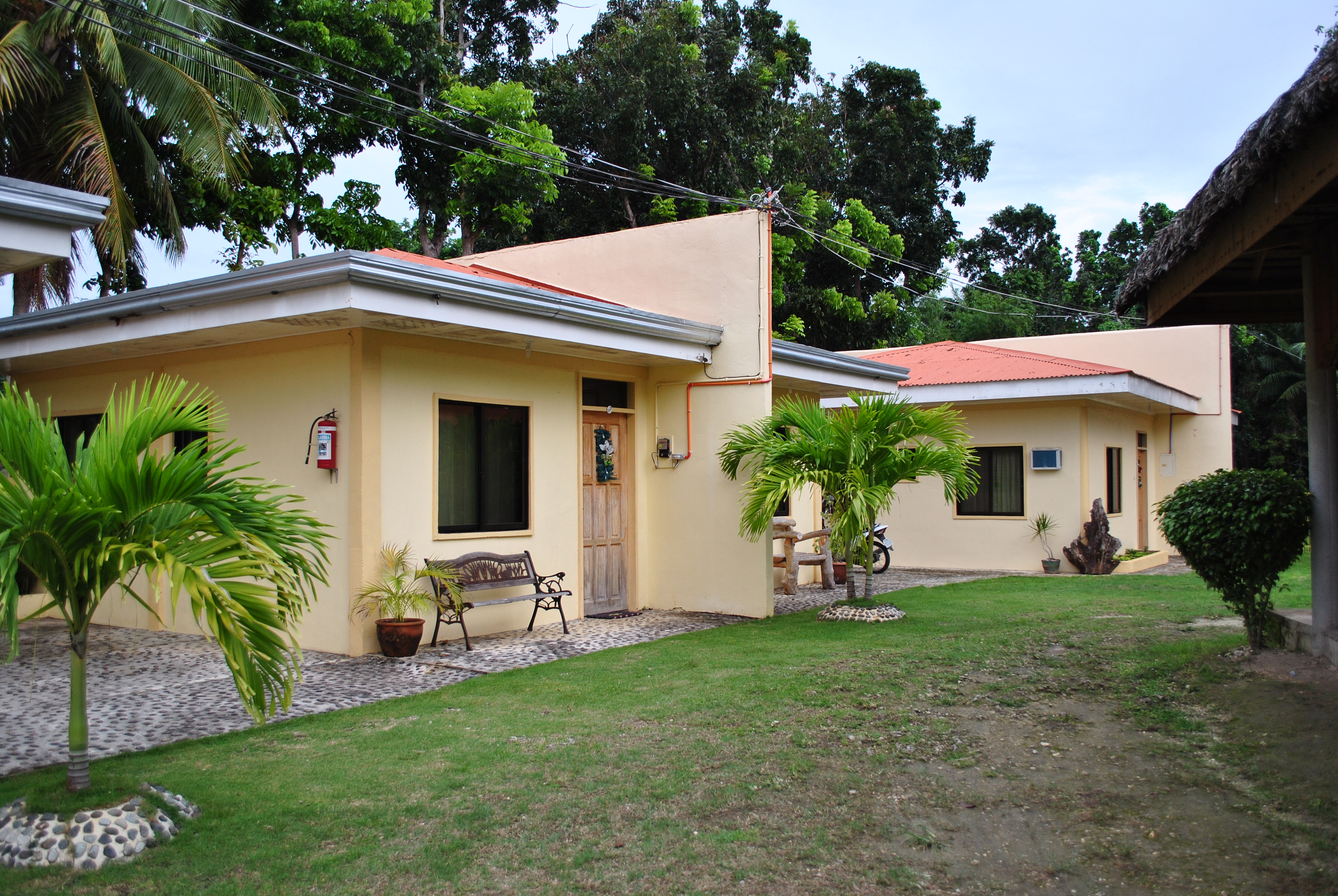
Replica Manor @ P850 A Day
P/Inspector Dumaguing knows those cheap places to stay as I requested him for a “homestay” type of accommodation. Although there is No Wi-Fi connection, you can’t go wrong with a P850 a day for an air-conditioned room which is near to the beach and the owner can cook any fresh food that you can buy from the fishermen around or from the public market. After I settled in my room, the owner of a multi-cab came knocking on my door and we made the deal fro me to rent his vehicle.
Later in the afternoon, I went to the public market to buy my water, soda drinks and food to bring during my run. The police car was my utility vehicle on my first day with P/Inspector Dumaguing as my guide. After coming from the public market, I made a briefing to P/Inspector Dumaguing about my schedule for the run. Time of Start was 4:00 AM at the Francis of Assisi Church Bell Tower which happens to be the Start Area of the Fun Runs being held in the island. My target time to finish was 12 hours for the 75K distance around the island.
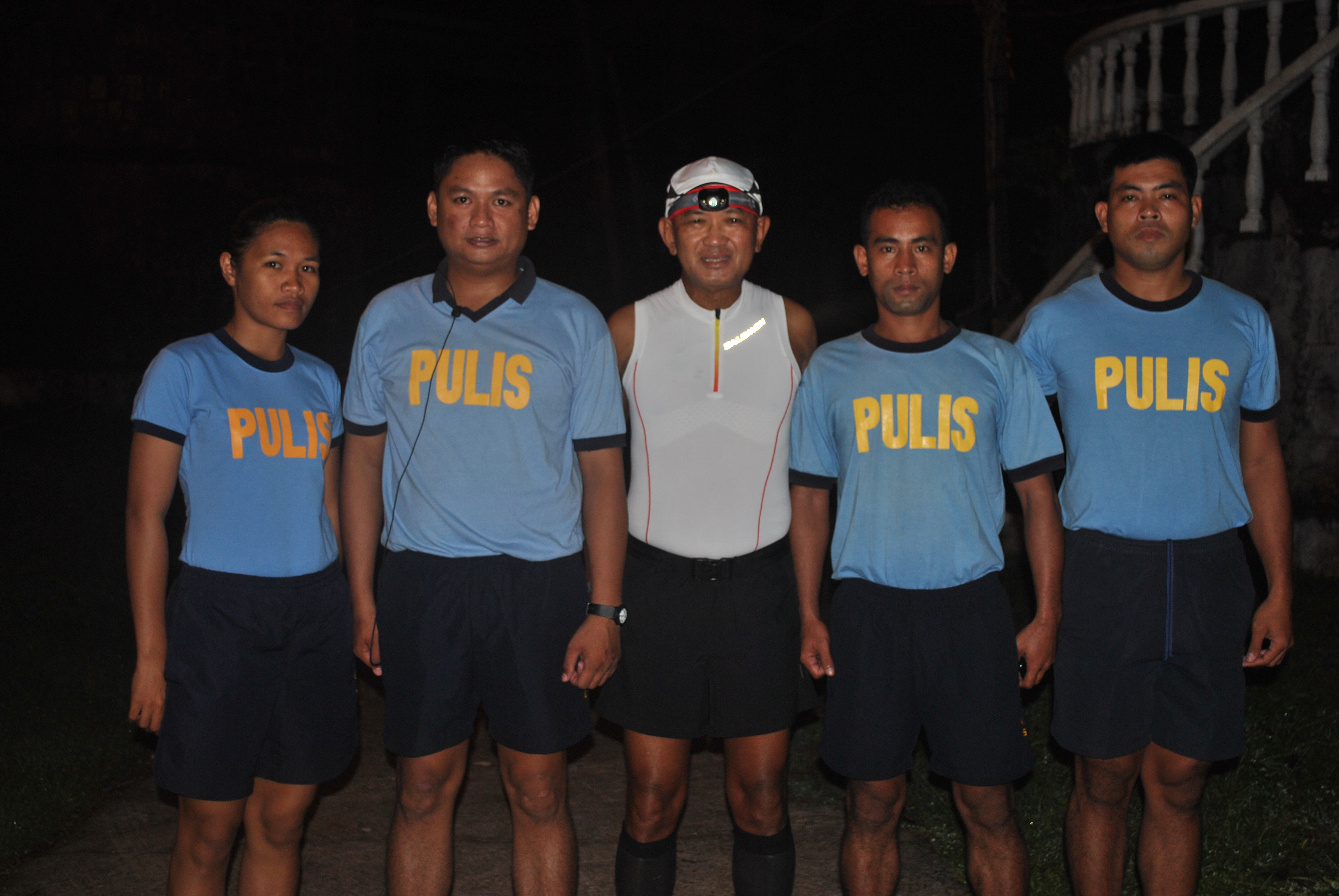
A Pose Before The Run With My PNP Escorts
I was fetched by the driver of the multi-cab at 3:30 AM and was brought to the starting area which is 2+ kilometers away. I was surprised to see P/Inspector Dumaguing with four (4) other Police Personnel in their athletic uniform telling me that they will join me in my run! Of course, they will do some relay as they wanted me to run with at least one of them as my guide/pacer or safety runner. I really appreciate their gesture to accompany me during the course of my running.
Four of us started from the starting area at about 4:00 AM and it was still dark. I was wearing my headlight but I observed that there is a motorcycle on the back of us giving us more illumination of the road ahead through its headlight. It was a slow and easy run from the start from Siquijor (The Capital Town of the Province) and the next town to hit was the Municipality of San Juan!
On Our Way To San Juan
San Juan is 10 kilometers away from Siquijor as we run the island in a counter-clockwise direction. San Juan is famous for its many beach resorts as the paved road is just a few meters from the shoreline. This town as compared to the other towns in the island is so blessed because of the abundance of water, from the ground, from the streams, and from the shore. The course is flat on this section and we can feel the cool breeze coming from the sea as we ran. Almost all the Resorts and Diving Spots are located on this town.
A Pose Infront Of The San Juan Police Headquarters (PO1 Emperado, PO1 Cordova, P/Inspector Dumaguing, PO1 Caulawon, PO1 Suan)
We stopped at the Municipal Hall of San Juan and we got inside the Municipal Police Station and I was introduced by P/Inspector Dumaguing to all the Police on duty. I found out later that P/Inspector Dumaguing sent a Flash Message to all the Municipal Police Stations that a “Running General” from the AFP will be running around the island on that day and he will drop by in their offices! Wow! It appears that I will some sort of inspecting their respective police stations for a surprise visit!
The next town is Lazi. This is where uphills and downhills would start but the scenery is becoming better because you have the sea on your right and the vegetation and hills on your left plus it was already daytime! I have to stop at the famous Enchanted Balite Tree which is believed to be more than 100 years old where its roots would be the source of fresh and cold water. This place is a famous tourist spot because of the clear water enclosed in a pond and the magnificent view of the huge tree’s trunk and roots!
From San Juan To LaziThe Elevation Started To Go Up Towards Lazi
I was able to stop by the Lazi Church and the famous Convent which happens to be the biggest in the entire country. After dropping by the Police Station, I was met by a person riding in tandem on a motorcycle. The person was Retired Captain (equivalent to Colonel) Monte in the Philippine Navy who is a native of Lazi and presently having his vacation as Balikbayan as he now resides in Las Vegas, Nevada with his family. I think we had a conversation lasting for about 15 minutes and he really knew me as a runner because we were classmates in one of the Senior Military Schooling/Courses when I was then a Lieutenant Colonel. Of course, he remembers that I was always the #1 in the Physical Fitness Test for the said Course.
Very Prominent Ads Every Before Town. It’s The Town’s Boundary Line
From Lazi, the next town is Maria. This is the more scenic than Lazi and the route is getting more exciting in terms of variety of elevation and the scenery. As I was running farther, the scenery was getinng more beautiful!
Maria is the location of the Provincial Government’s Beach Resort, called the Salagdoong Beach Resort, which is located in a vegetated/forested area and beach. The Resort is located 3 kilometers from the National Highway. I stopped running at the road that leads to the Resort from the Highway and rode at the multi-cab just to see and have a picture of the place. I’ve stayed in this place overnight at the Hotel Agripino when I was in the company of General Yano when he was the Chief of Staff of the AFP.
Swim & Wade On The Beach Every Time You Stop!
At the Salagdoong Beach Resort, we shared with the members of the PNP the simple packed lunch that I’ve prepared for the run. The food was enough for us to continue the adventure run as we had a chance to eat some snacks/bite foods from the sari-sari stores along the Highway.
I resumed my running from the point where I’ve stopped along the National Highway. At this point, the PNP personnel were already tired and they had to relieve themselves one by one but one of them maintained as my pacer/companion.
@ The Salagdoong Beach Resort In Maria, Siquijor
The beach scenery was simply amazing and I was tempted to stop and simply ran towards to the beach and dip my feet and body to the sea water. But I didn’t want to waste my time as I had to finish the run within 12 hours.
The next town is Enrique Villanueva. As practiced in other towns, I had to drop by the Police Station and meet the Chief of Police. The Chief of Police while he was in his car, was able to pass us from the area of Lazi. He could not believe that I was continouosly running and walking from Siquijor up to his municipality. The town’s poblacion is located near the beach/seacoast and from this place, you could see the islands of Bohol and Cebu.
Infront Of The Enrique Villanueva’s Poblacion & Municipal Hall
After a brief talk with the Chief of Police of Enrique Villanueva, I continued my run and walk as the elevation profile started to be rolling in nature, again! I knew in a matter of time, I would be entering the last town of the island which is Larena. Larena was the first capital town of the province when it was promulgated in 1971, however, after a year, the capital town was transfred to Siquijor.
Finally, On The Boundary Of The Last Town, Larena
Larena has also a lot of Beach Resorts to offer as I saw from the different Ads posted along the highway a few kilometers before I reached its Poblacion. Larena is a populated town which is considered as a commercial town with its seaport where most of the RO-RO and other freight ships would arrive and leave the place. I told PNP Inspector Dumaguing not to drop by the PNP Municipal Office anymore as I decided to continue my run in order to meet my target time of 12 hours to reach the finish line in Siquijor.
Getting Nearer To The Boundary Of Siquijor
From Larena, a distance of about 10 kilometers separates me from reaching the place where I started. I really enjoyed the view of the town as I could see another uphill climb from a distance as I left its Poblacion. On my right would be the nice view of the sea with lots of mangrove and a highway with limited number of vehicles plying on it. I could see a lot of motorcyle-riding people including women as if they own the whole highway.
Slowly and surely, I was inching my way towards the Poblacion of Siquijor. My Police escorts were happy that my adventure run is about to be finished and we were expecting and talking of what to order and eat at the place where I was staying once I crossed the finish line.
Finally, On My Last 10K!
I finally reached the place where I started at 4:30 PM, which means that it took me 14:30 hours to run around the island province of Siquijor, to include my rests and visit at the Salagdoong Beach Resort in Maria. As I was being transported to the place where I was staying, I’ve finally decided that I would conduct an Ultrarunning Event in this island as soon as possible. And by the way, the distance recorded in my Garmin Watch was exactly 75 Kilometers!
My Snappy Salute To These Fine Ladies & Gentlemen Of The PNP Siquijor
As a final note, I would like to thank the following PNP Personnel of the PNP Siquijor Command who patiently ran, walked, paced, and shared stories and laughter/fun in this memorable adventure run:
PNP Inspector Vincent Paul Dumaguing
PNP PO1 Jude June Emperado
PNP PO1 Bener Cordova
PO1 Flora Suan
PO1 Chessa Pearl Caulawon
This is my first Adventure Run for the year of 2013. See you in Siquijor soon!
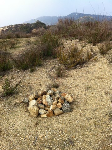
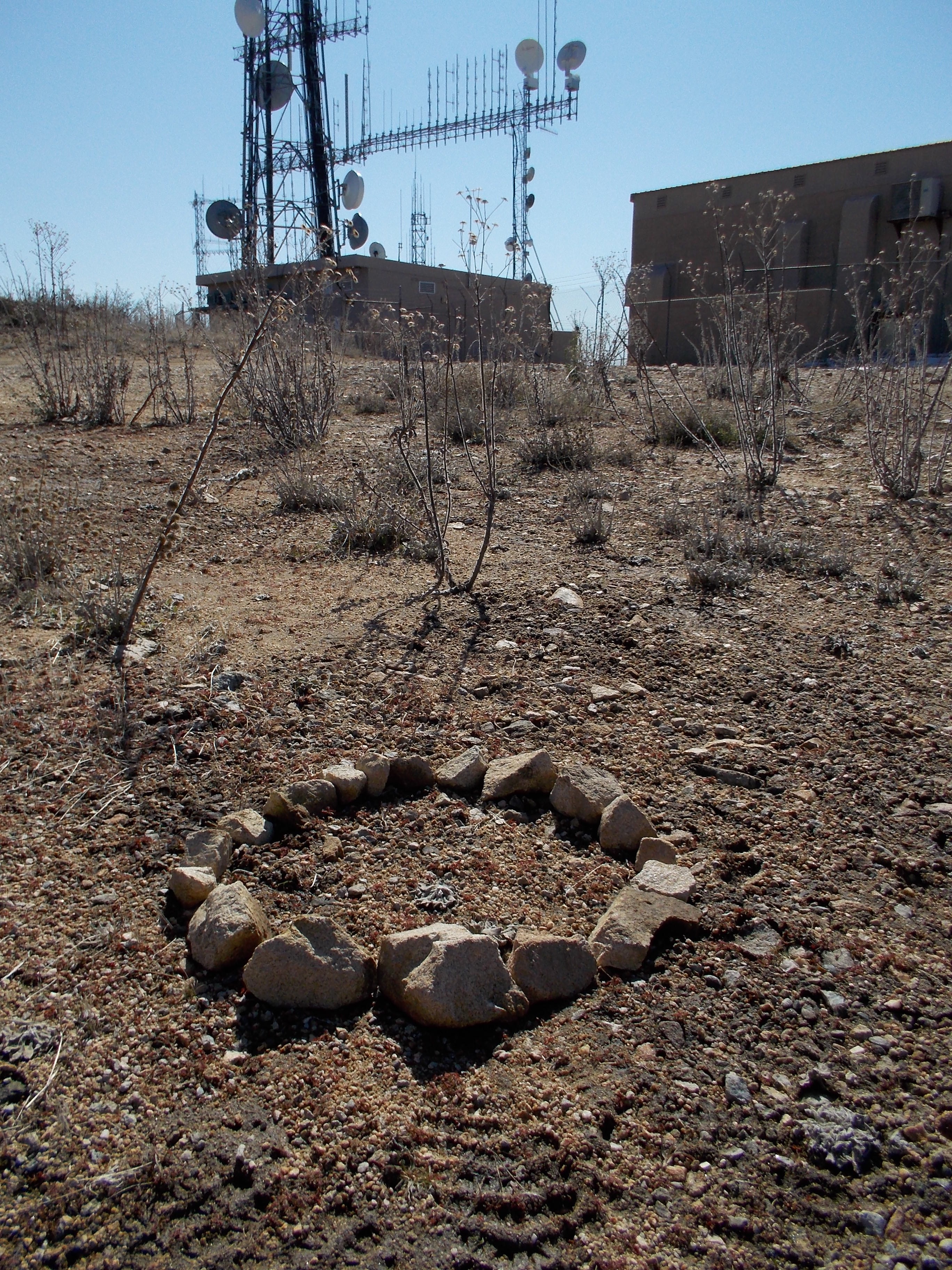
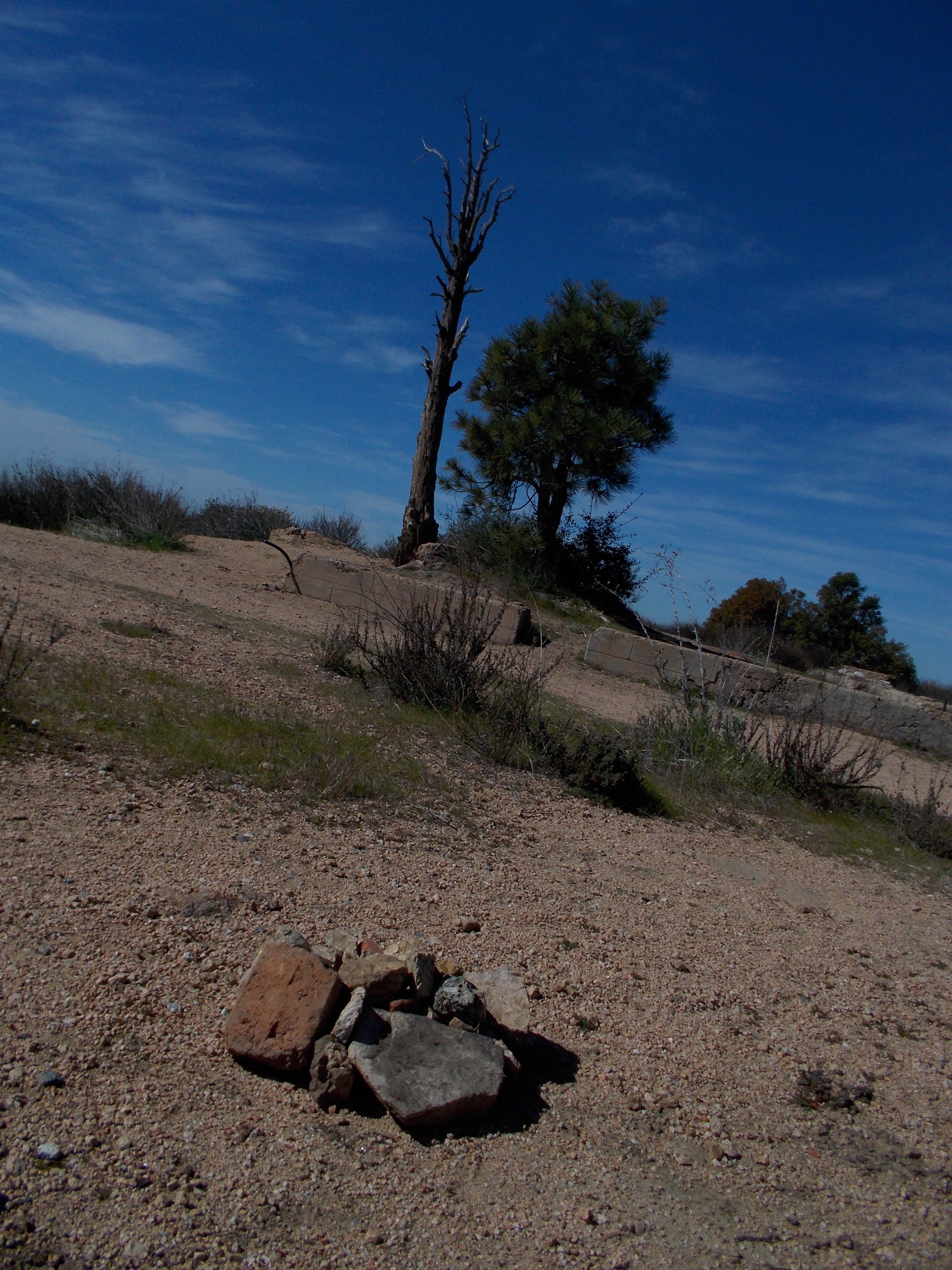
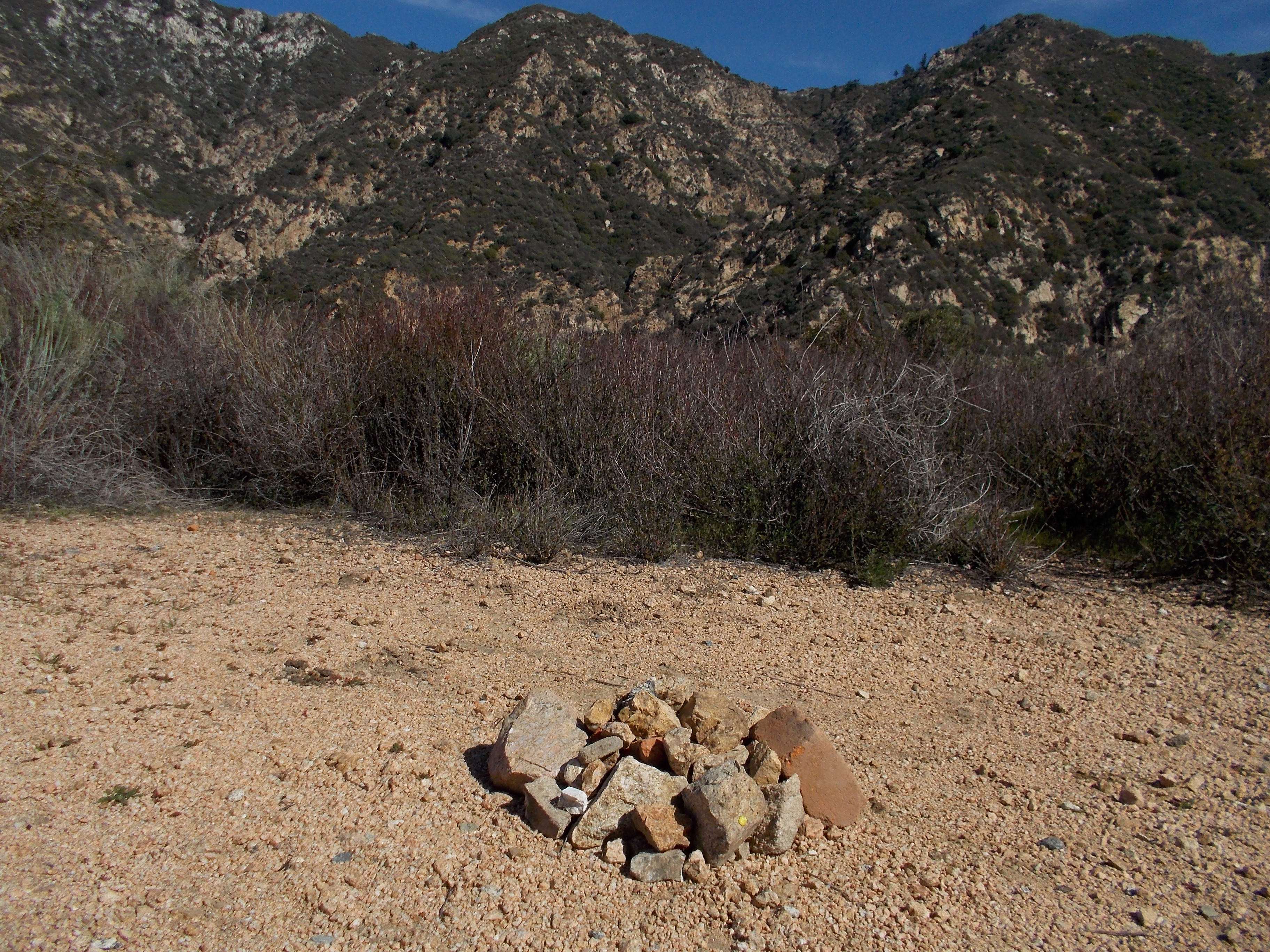
You can “google” the word if you want to know what the word means. These are stone or rocks being compiled or grouped together to form a certain structure. They are mostly made by men on top of mountains or hills or in a certain part of a trail. The cairns could be seen as a pile of stones and rocks or simply some formations of rocks or stones.
In the history of making cairns, there are so many meanings and purposes why people would make these structures. From one continent to another, their purposes are varied. Some are simply markers to signify that you are at the peak of the mountain/hill. Some would point to a certain direction; some would symbolize as a mark of honor to somebody; or some would simply wish good luck for one’s trip or hike in the mountains.
I am not sure if we practice on making cairns in our country. In my peak bagging activities last year, I haven’t seen any cairns on the peaks of the mountains that I visited. I think I might as well start the said practice of making cairns on the peak that I bagged or visited. Well, it takes some extra effort to collect such stones or rocks within the area of the peak of the mountain but the effort is worth if the purpose is well meant and comes from the heart.
So, I’ve started making some cairns on the peaks of hills and mountains that I’ve visited for the past days and weeks. These cairns had been dedicated to special friends in the ultra running community to wish them good luck in their present condition. Miguel De Alba is supposed to join the 2013 BDM 160 Ultra last January but due to an accident during the “test run” last December, he is now recuperating from a broken bone in his right leg. I have dedicated the cairns that I’ve made in one of the peaks of the Verdugo Mountains in Glendale, California and at the peak of Mt Lukens in Arcadia, California.
Cairn @ One of the Peaks at the Verdugo Mountains For Miguel De AlbaCairn @ The Peak of Mt Lukens For Miguel De Alba
In my visit to the Echo Mountain in Pasadena, California, I made a cairn for my good friend, Andre Blumberg of Hongkong, as a symbol of appreciation to the selfless support to my elite ultra runners for their participation to the Vibram Hongkong 100K Trail Run for the past two years. It is also my way of wishing him good luck for his participation in the 2013 Ultra Running Grand Slam in the United States.
Cairn @ The Peak of Echo Mountain (Pasadena, CA) For Andre BlumbergAnother View of the Cairn For Andre Blumberg
If ever you will be visiting on these places where I made some cairns for these gentlemen, you are requested to add more more rocks into them.
As I continue in my peak bagging feats, I will be making more cairns and feature their pictures in this blog. Their purpose will be to honor the “gods” of the mountain for them to keep us away from harm and danger and at the same time wish good luck to our hike/trek on the said mountain. And if you happen to see these cairns, you are enjoined to add more rocks into them.
See you on the mountain trails and peaks in the coming days, weeks and months!


You must be logged in to post a comment.