
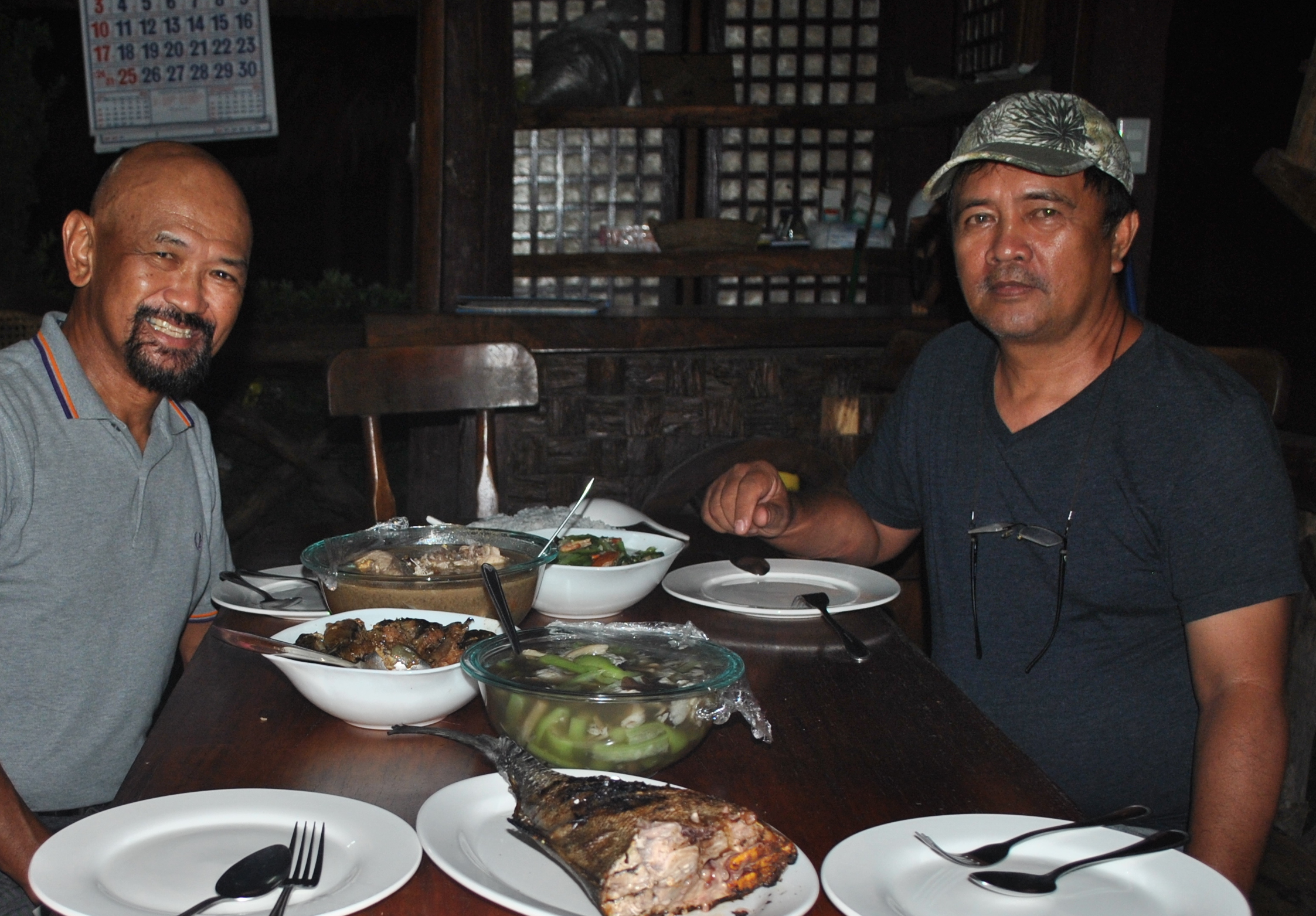
It was nice to renew my ties with the people that I’ve met during my active military service now that I am retired. The former Municipal Mayor “Lofre” Gironella of Salcedo, Ilocos Sur was my host during my stay in the area of Ilocos Sur for two days. I have found out that he was responsible in extending the paved road from the Poblacion of Salcedo to Barangay Bulala, Salcedo, a distance of 6 kilometers, and situated the road on the side of the mountain, thereby avoiding at least 13 river crossings at the Buaya River. The trip from Salcedo to the Poblacion Gregorio del Pilar had been shortened due to his efforts. I’ve seen also the presence of hanging bridges on top of the river which could be used by hikers when the river is too deep to be crossed. The former Mayor is fond of planting trees during his three terms and one could see how thick the forests in their mountains. He is proud to say that there is no illegal logging or “charcoal making” industry in his town.
I told him about my plans of hiking the General Aguinaldo Trail and promote its awareness to the public so that history will be remembered and tourism will boost in their area. He pledged to help my project in coming up with permanent markers along the route. He also briefed me on the prevailing security and peace and order situation in the area and the developments & infrastructural structures that were established since I left the place.Practically, almost all the road networks in the far-flung municipalities in Ilocos Sur are already inter-connected and the cellphone signal system in these areas are present and efficient.
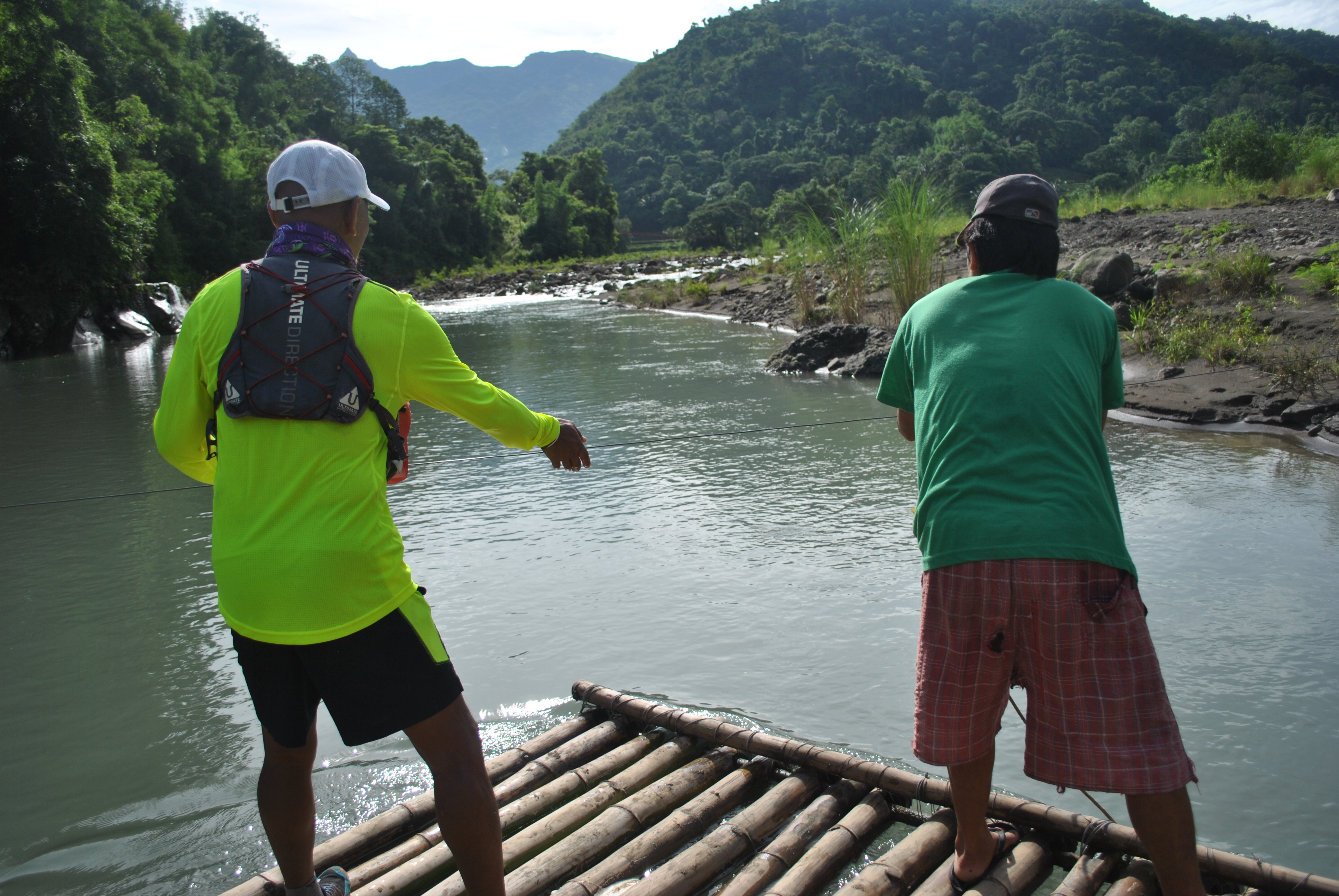
In my hike to the Poblacion of Gregorio del Pilar, I was able to talk to the Bamboo Raft Guy whose job is to bring motorcycle-riding persons across the river coming from both sides. It takes the Raft Guy (I forgot to get his name) about 30 seconds to pull the wire as the raft would move across the river. Each motorcycle-riding person would pay him Twenty Pesos (P 20.00) for the effort. He told me of another path/way if we don’t want to take his raft but just the same our feet would be damped and wet with lots of water falling from the side of the mountain where the trail is located. I know that his business is only good for the rainy season and soon his raft will be put into oblivion since Mayor Lofre told me that there is a plan to construct a concrete bridge so that there will be no more river crossings for hikers and vehicles between the towns of Salcedo and Gregorio Del Pilar.
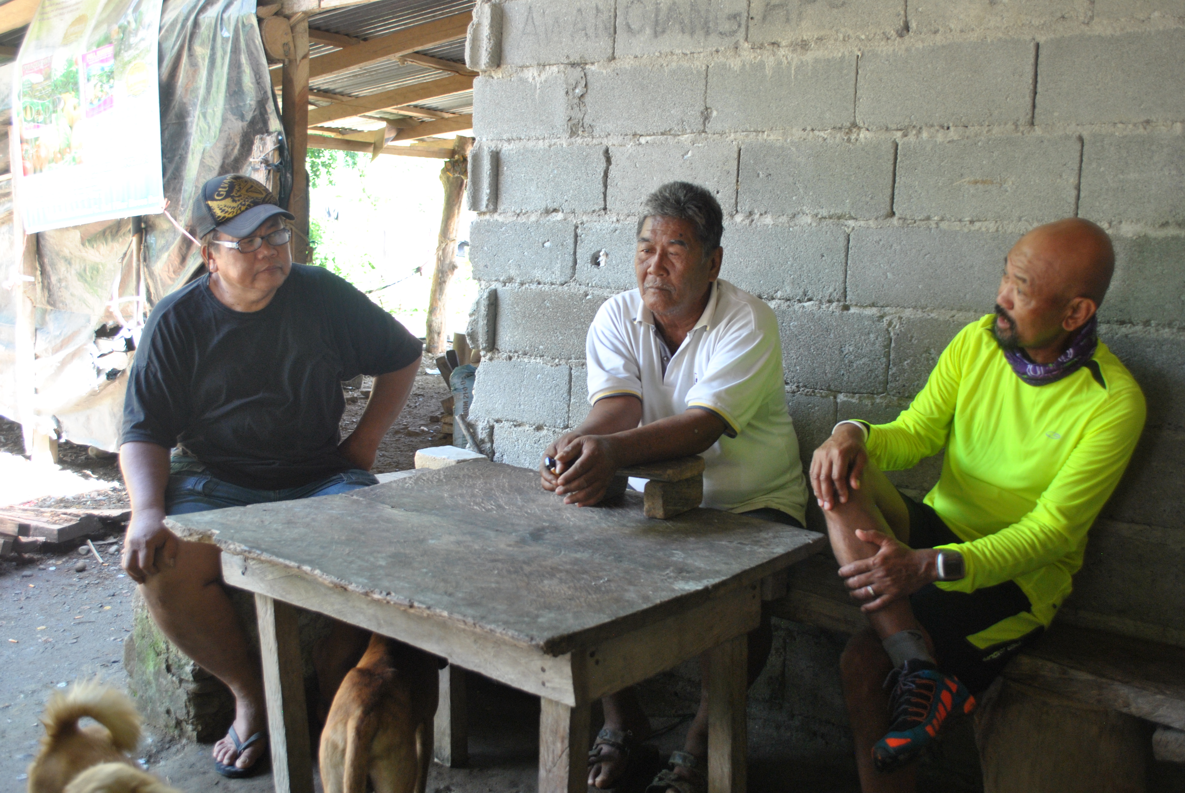
I saw a “sari-sari”/mini-store beside the road after I passed the intersection of Gregorio del Pilar and Sigay Roads. There was an old man sitting on a bench with his arms on the table in front of him. I asked him for two bottles of soft drinks and gave him my payment. I started the conversation in our dialect, Ilocano, and my short “pitstop” became longer to almost 45 minutes as we were joined by another guy who stopped by at the store with his motorcycle. As the conversation became longer, I found out that the guy with motorcycle is a retired Police/PNP and the owner of the store was also a CAFGU & Police Informant.
After introducing myself and telling them about my stint in the area in the mid-90s, they were able to recall and remember me of the things that I’ve done in the area. They remember that I’ve been constantly patrolling/hiking the Salcedo-Gregorio del Pilar route with my soldiers; provided Civil-Military Operations & Medical Missions in the Municipalities of Sigay and Gregorio del Pilar; but what is more significant for them to recall and remember is the realization of establishing a hiker’s camp near the peak of Mt Tirad, beside the spring water source in the mountain. They suspected me then as a “treasure hunter”, thus making the “camp” for my soldiers. However, I told them that the hiker’s camp was made as the “catalyst” for tourists to visit Mt Tirad and the Historical Marker where General Gregorio del Pilar was killed. Due to the Hiker’s Camp, it attracted visits of top officers and Generals of the AFP and PNP, then to the relatives of General Gregorio Del Pilar from Bulacan, then leading to an annual visits of the Cadet Corps of the Armed Forces of the Philippines/Cadets from the Philippine Military Academy (PMA), most of all, it became as “rest area” for the residents of Abra who would like to take a shortcut through Mt Tirad Pass. Both of them were nodding their heads as I was explaining to them that I was the “first” Tourism Officer in their area.
Macario Burgos, the Tourism Officer of Gregorio Del Pilar, gave a lot of vital information about the tourism developments in their town. Mang Gorio, a resident of Barangay Mabatano and whose residence is located on the trailhead to Mt Tirad Pass, died a few years after I left the place/area. Mang Gorio would tell me then the details on how the Filipino soldiers under General Gregorio del Pilar would prepare their defensive positions along the trails leading to the peak of the mountain and how they fought the Americans. He would also vividly relate the whole story on the Battle of Tirad Pass and how the young General was killed during the firefight.
Mr Burgos was six years old when I was assigned in the area and he would know me by my name from a soldier who happened to be my security detail from the time I was the Battalion Commander until I retired from the service. My security detail is married to a resident in Barangay Concepcion of the town who happens to be his Aunt. Obviously, he knows where I was assigned from the time my Battalion Headquarters left the area, in Mindanao, and before I retired from the military service.
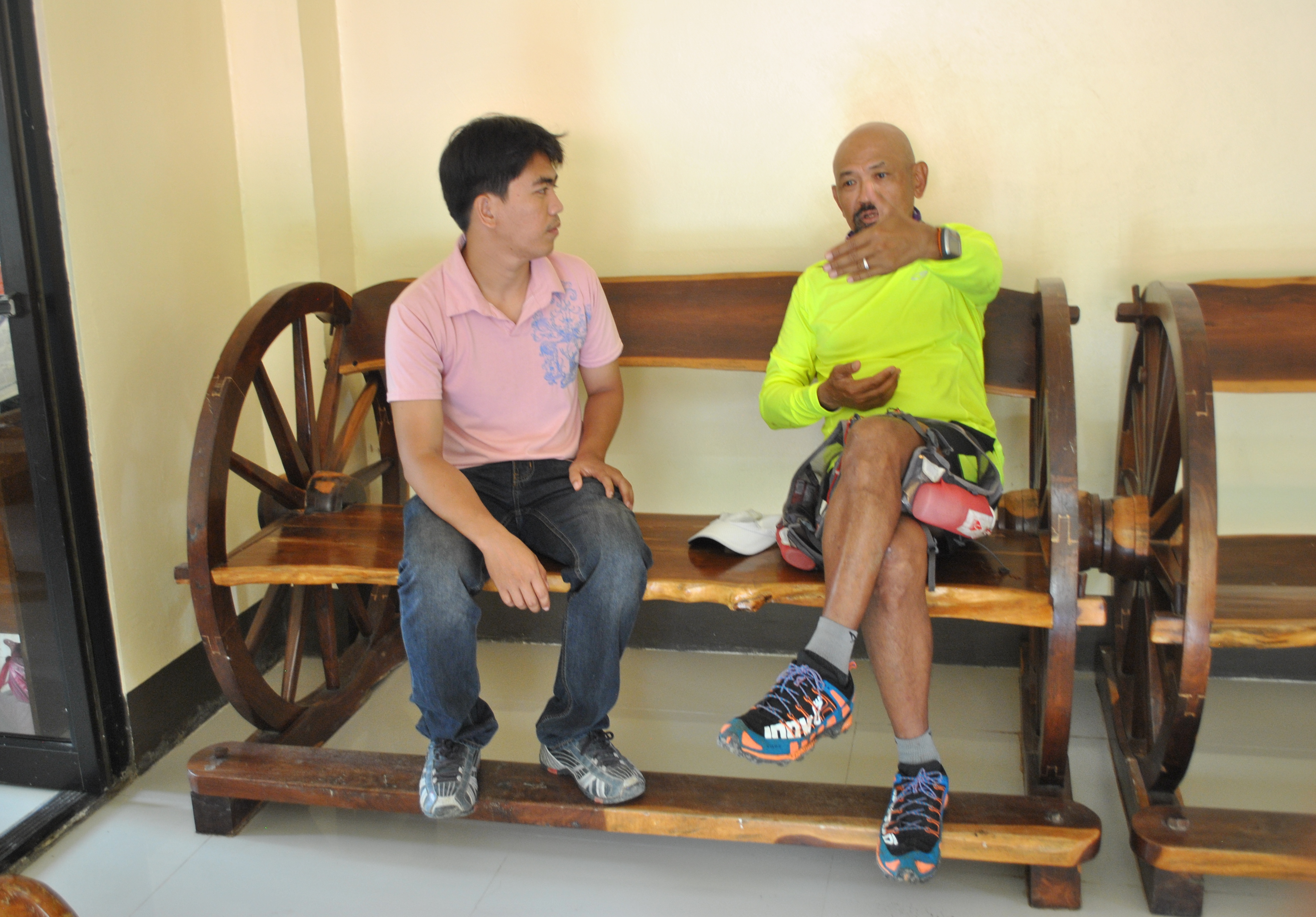
Macario updated me on the latest research he made on the Battle of Tirad Pass. He told me that the survivors of the Battle of Tirad Pass remained in the area and had their respective family instead of going back to the Tagalog Region. He mentioned at least five of them with their respective locations within the confines of the municipality. He even told me that the grandson of the US informant, Januarius Galut, who led the Americans to a trail to another mountain summit that outflanked the positions of the Filipino defenders of the mountain pass, made a research to prove that his grandfather was forced and under duress by the Americans to be used as a “guide”, instead of being known as a “traitor” who was paid by the invading forces. The Galut Clan are still presently residing in Sigay and within the boundary of Salcedo and Galimuyod.
He explained that there are no tourist facilities, like hotels, home stays , and restaurants within the Poblacion because the tourists would proceed immediately to the trailhead in Barangay Mabatano to register and pay a Permit Fee of Twenty Pesos (P 20.00) per person and then proceed to the General Greorio del Pilar Shrine/Monument or go to the peak of Mt Tirad, establish their camp by using their personal tents, sleep thereat overnight, go to the peak of Mt Tirad for photo-ops in the early morning the following day, and then go back to the Poblacion to catch up with the morning trips of jeeps to Candon City. It should be noted that Commercial Vehicles from the Poblacion of Gregorio del Pilar to Candon City is only available in the morning. The same commercial vehicles would go back to Gregorio Del Pilar in the afternoon, coming from Candon City. The Poblacion is thereby used as a “Drop-Off” point for arriving tourists in the afternoon and then as a “Departure Area” for the same tourists on the morning of the following day.
After I briefed Mr Burgos about my intention of re-visiting the place to re-trace the route that General Aguinaldo had taken at the turn of the 20th century, he told me about his story on his hike from the Poblacion Gregorio Del Pilar up to Cervantes, stating the trail condition, the distance and time/period he was able to cover the said distance. He told me that it took him 4 hours to hike from the Municipal Hall of Gregorio Del Pilar to the Poblacion of Quirino, a distance of about 22 kilometers. From Qurino to Cervantes, the trail that General Aguinaldo took is already a paved road where a small portion/river crossing before Cervantes is not yet paved. The distance from Qurino to Cervantes is 27 Kilometers. He added that the area that covers the route is peaceful.
Lastly, he reminded me that the Metal Plaque (A Dedication Message For The Hikers and People of Gregorio Del Pilar For The Construction of the Hikers’ Camp) that was carved and cemented on the face of big rock within the vicinity of the Hikers’ Camp near the peak of Mt Tirad is still there for me to see. That would be a nice mission for me to take a picture of it because my name and the name of the Municipal Mayor of Gregorio Del Pilar then were inscribed in the said plaque.
To be continued.
