In the military, there is a training or school for “Pathfinders” and they invaluable in airborne operations. They “Light The Way” for the incoming paratroopers and make sure that their landing zones are properly marked and safe. Such expertise and skill can be learned with a 3-week training in a Pathfinder’s School/Training Facility.
I had the chance to meet and see how these airborne soldiers were trained when I was in the US Army Infantry School in Fort Benning, Georgia, USA in the mid-80s.
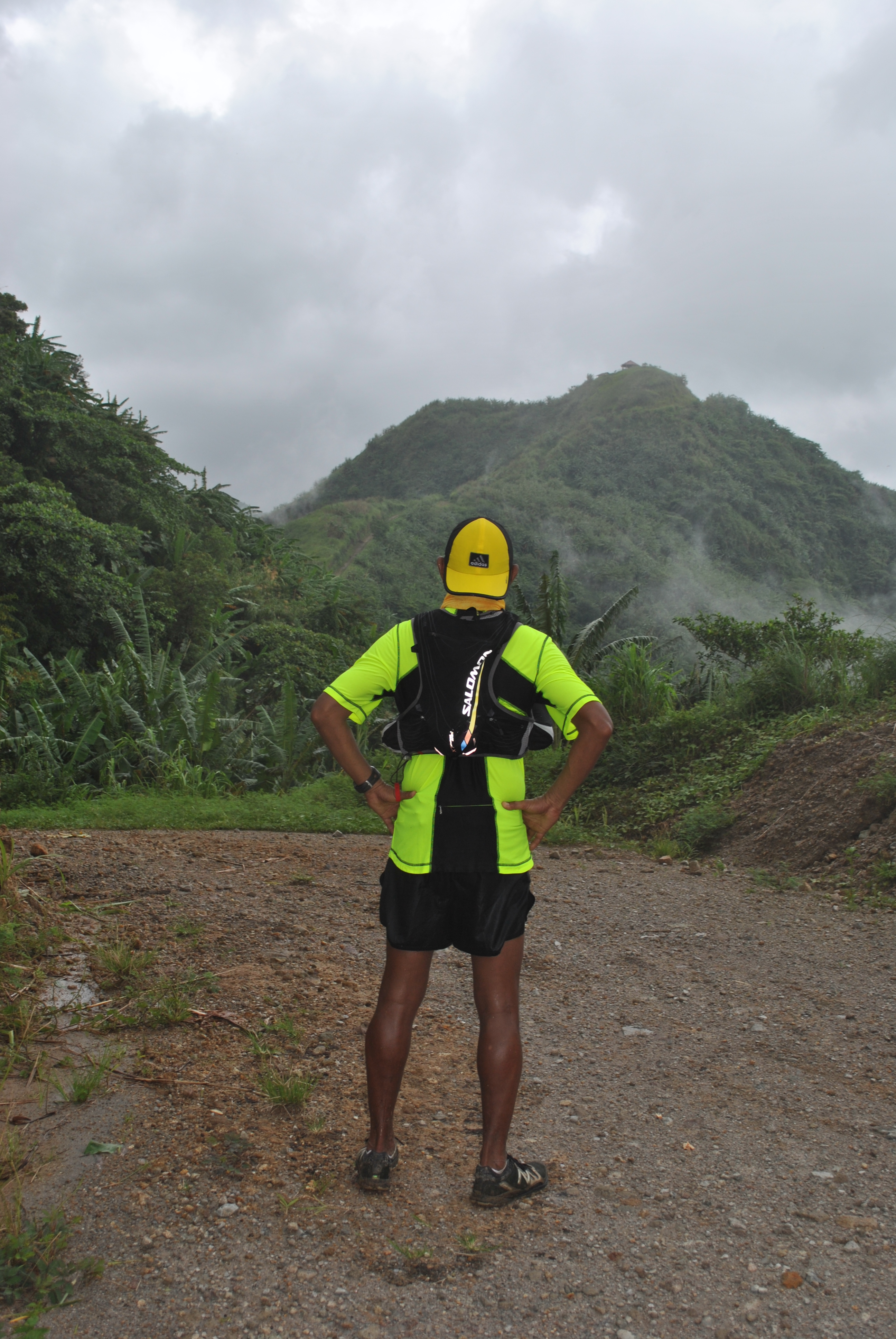
I did not realize that this will be my role as the promoter of ultrarunning/ultra marathon events in the country. Since I started to love ultra marathon, I have been a pathfinder for ultra routes whether it is on the roads and trails.
It was very convenient to be a “pathfinder” on the road ultras as I can easily pinpoint the route or place on the map and then actually run through the route on my own. Most of the ultra marathon events that I organize and direct were born or established this way–actually run the route and find out the elevation and distance.
As I shifted more on trail runs in the mid-part of this year, I practically transformed myself as a “pathfinder” in my playground. As I get farther and farther on the distance that I could cover during the day, I would take note of places where I could rest, refill my hydration bottles with water, “engage” people or residents along the route/trail, and establish distance markers or points.
It is the responsibility of the “pathfinder” that his “follow-on” forces will not be lost as he leads them to their “landing zones”. For the past weeks, I had been accepting interested runners to have a glimpse of my playground and most of the time, someone among the group gets lost. But I am glad some would find their way back to where we started or just keep still in their location until we find them where they are located. Sometimes, I would laugh and tell the person/s who got lost that they are my “offerings” to those spirits that guard the mountains!
As of now, the trails that I’ve “found” in the mountains are for training purposes for me and for those who are interested to see the place. I don’t usually invite runners to join me in my training in the mountains as most of them have family and work to attend to during the weekdays. For some, they have also their respective “playground” which is more accessible to them from their residences and offices.
Being a “pathfinder” is a hard task as it takes a lot of time of patience and discipline. But if you love nature and the outdoors, your time in the mountains looking for trails and other land features is worth the task as you can share it to other people to see and to feel.
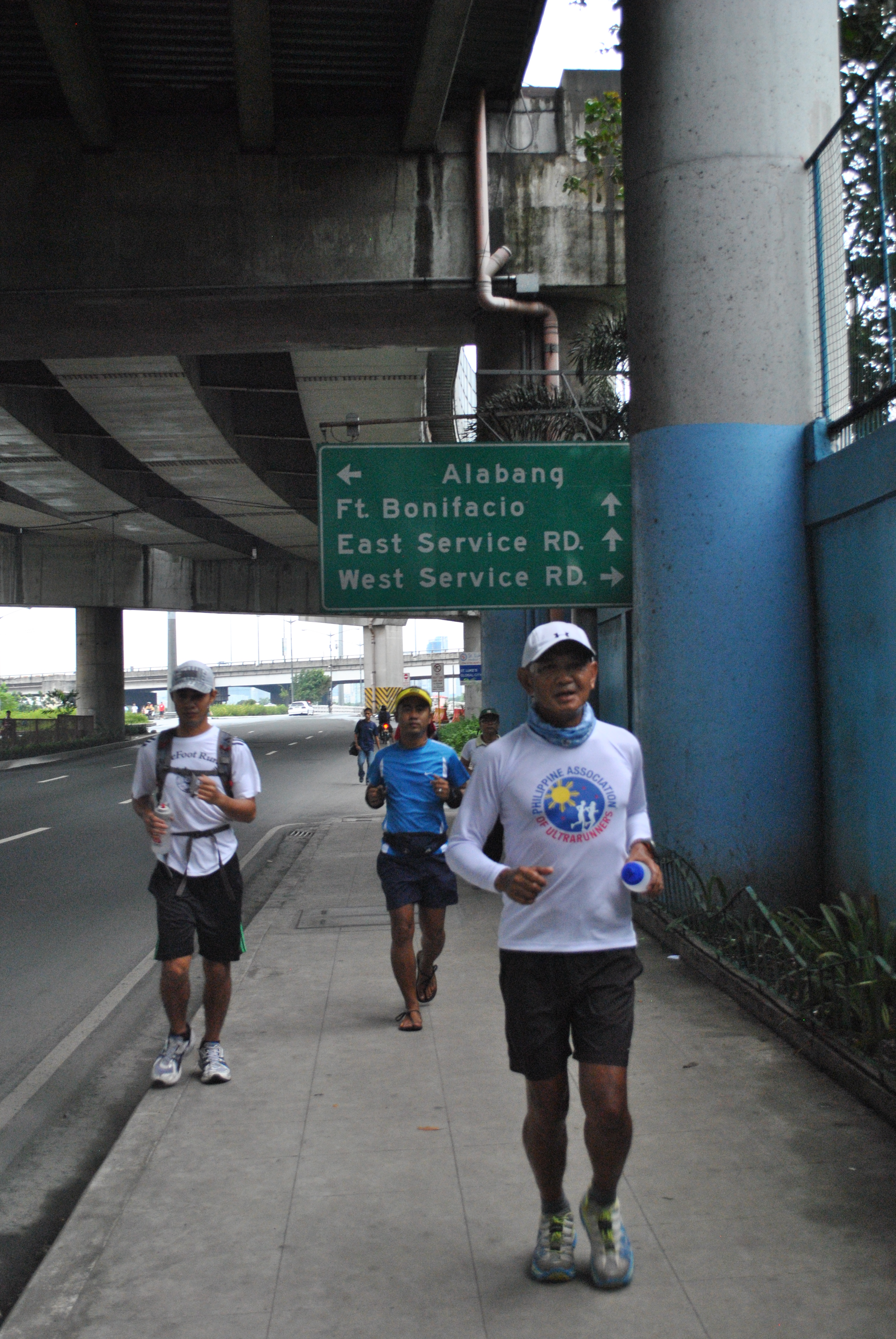
This is one of those days that I have decided to leave my GPS Watch/Garmin Forerunner 305 from my starting place. I just brought my hydration vest and two 20 oz. bottles with me where one bottle is filled with water and the other one is filled with First Endurance EFS Mix.
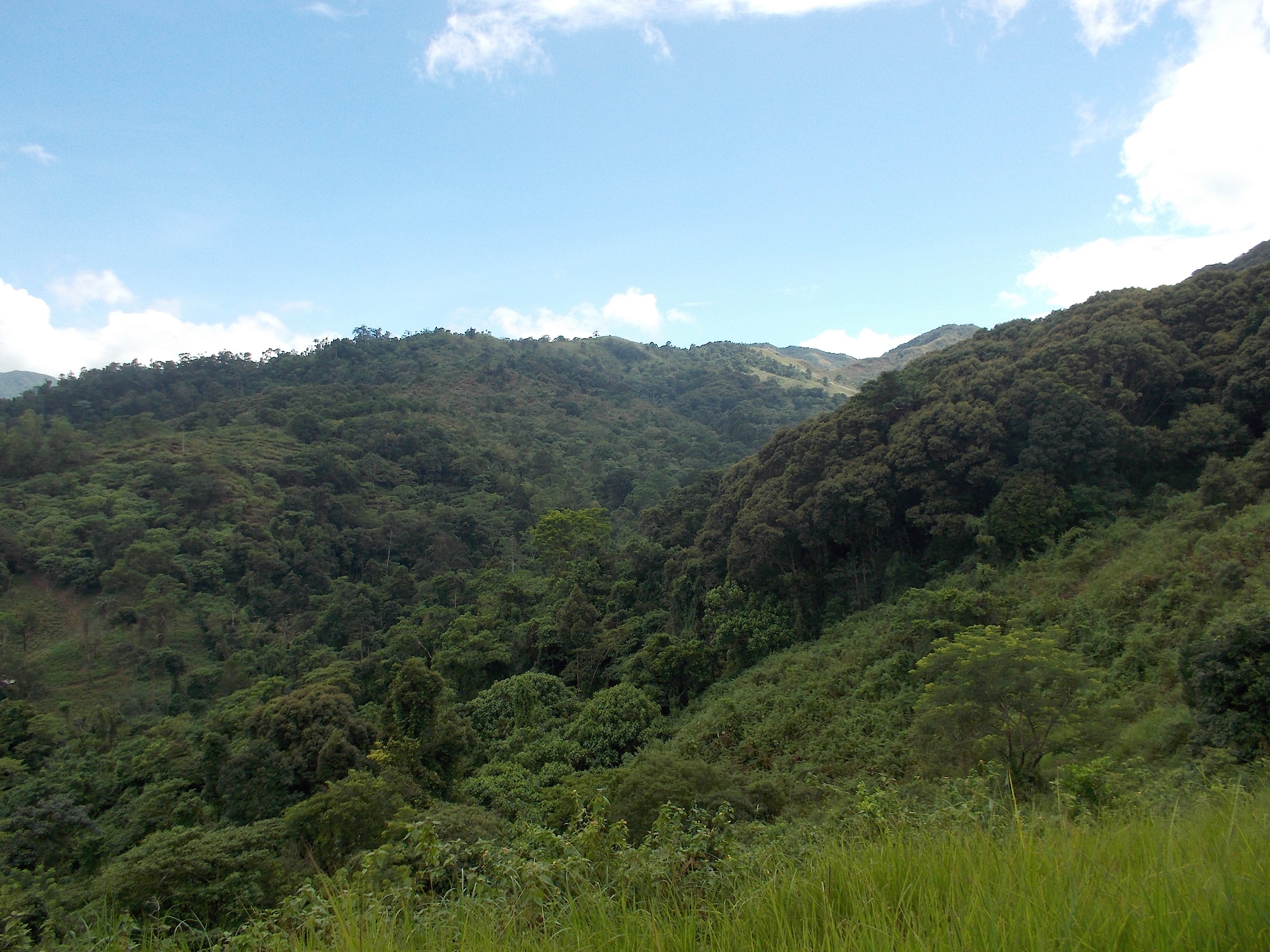
I selected the first trail course which I discovered in my “playground” and has a distance of 6.2 kilometers. It ends in a small hut on top of a hill which is near a steel antenna. I usually have my first “pit stop” in this place during my long runs. From this point, I would go back to where I started to complete a distance of 12.4 kilometers. Basically, it is an “out and back” course where the first half is an uphill/ascending to a higher elevation and the second half is descending to the place where I started.
I took off knowing what was the time of the day when I left the starting line. It was 3:20 PM. I comfortably started with a short brisk walk as the first few meters were steep incline for about 60 meters. After I was over with the steep road, I started to jog until I reached a stream to cross. From the other side of the stream, I started to jog continuously and I started to breath heavily. Then I started to perspire profusely and that is the signal that I have to take a sip on my energy mix and then with my water. I would estimate that I’ve been running for almost 22-25 minutes.
Before I would approach the last two kilometers to the hut & antenna where I would enter into the last gate of a fence, I would take another sip of my energy mix and water and continue to attack the ascending portions of the hills ahead.
I usually reach the hut/antenna in 1:20 hours during my regular running workouts in the area. Once I reached the turn-around point, I took again a sip of my hydration bottles and then simply walk around the hut for about 30 seconds and I am back again on the trail expecting to be faster on the downhill sections of the route.
I try my best to practice my downhill running technique, keep my balance and make quick decisions on where to land my feet considering that the trail is uneven and sometimes muddy and slippery.
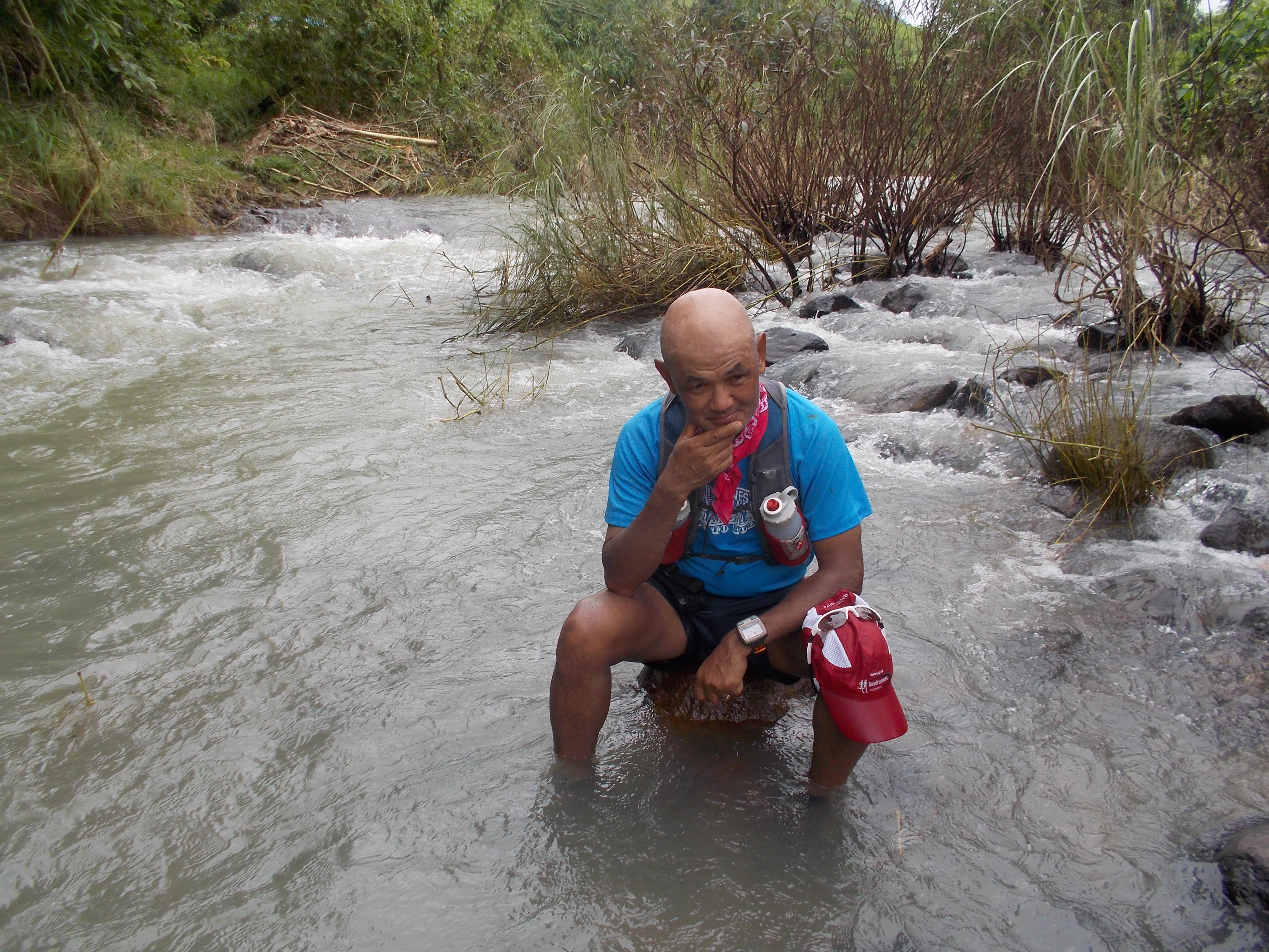
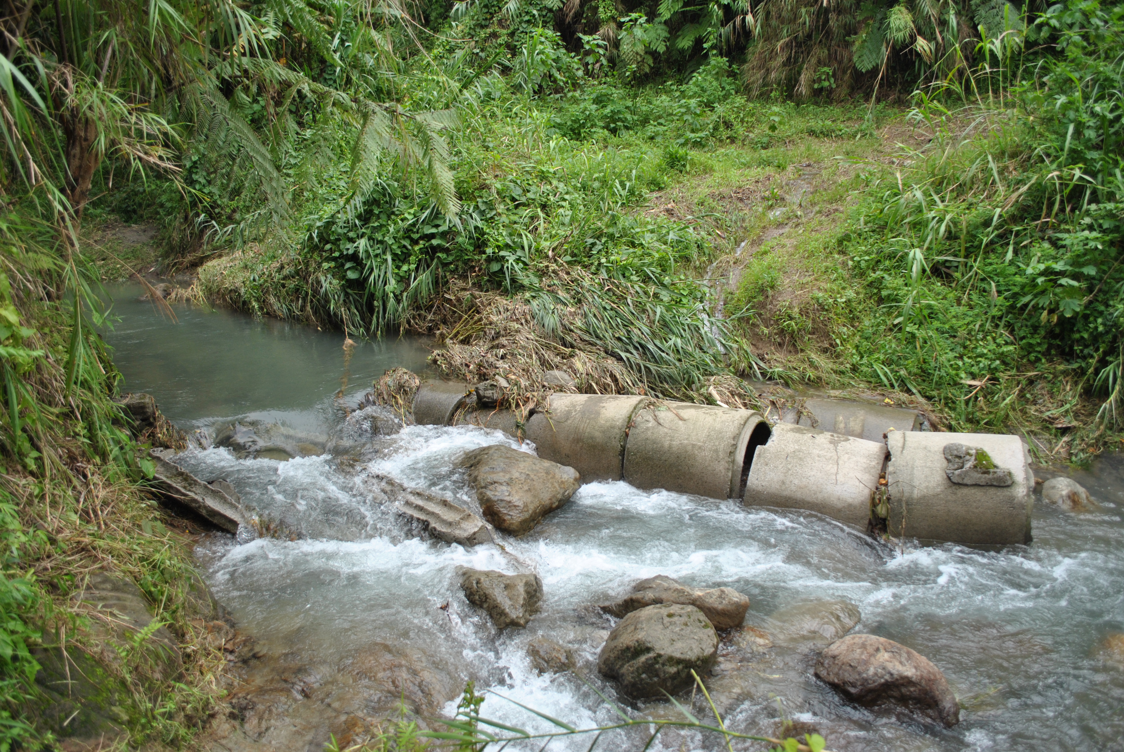
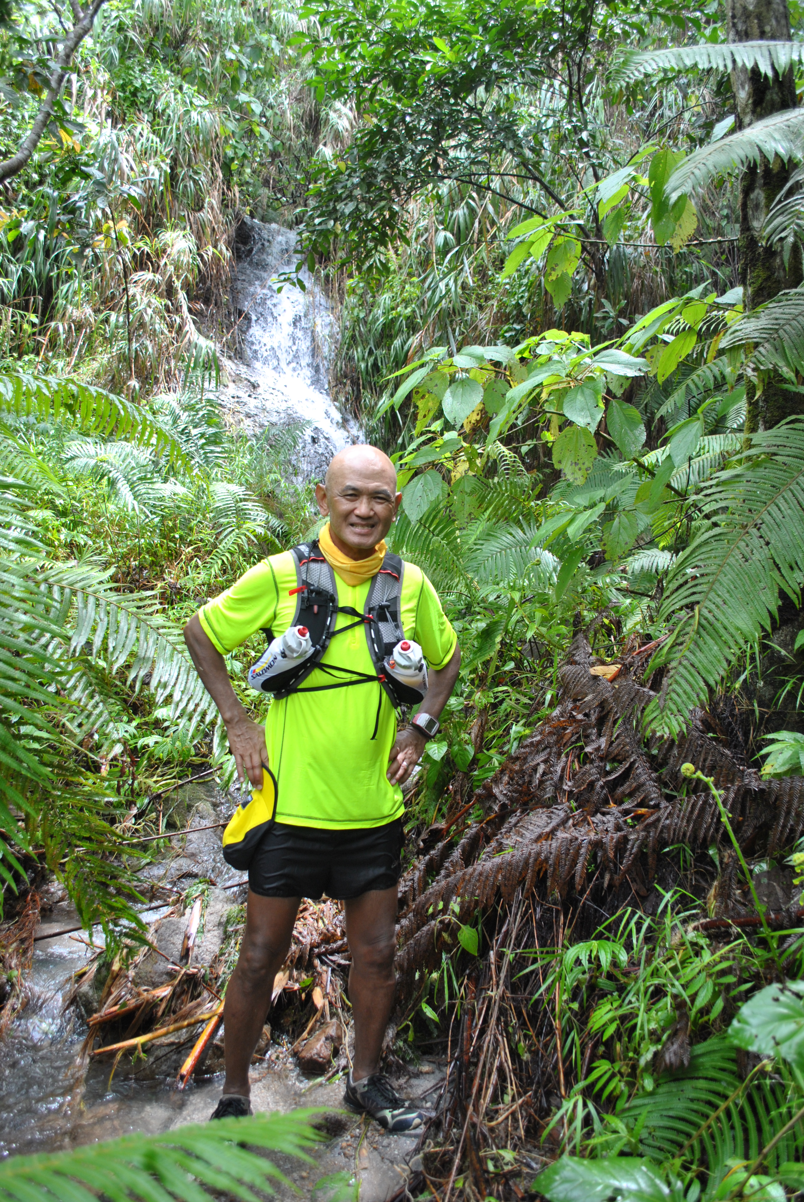
Since I’ve been running on this course for weeks and months already, I would know what to expect to most of the sections of the route. I even know how many more kilometers I would have to run and cover before I finally reach the stream that I’ve crossed. After crossing the stream, only one kilometer remains before the finish line. I usually stop and clean my legs and shoes from the flowing water of the stream. But for this time, I just crossed the stream and did not mind soaking my tired legs or washing my legs and shoes to clean them from the mud.
No Stopping On This Stream
Finally, I reached my finish line and immediately went inside the place where I am staying and looked for my watch. It was 5:30 in the afternoon. It means that it took me 2:10 hours to cover the distance of 12.4 kilometers. I was able to improve my time by 20 minutes!
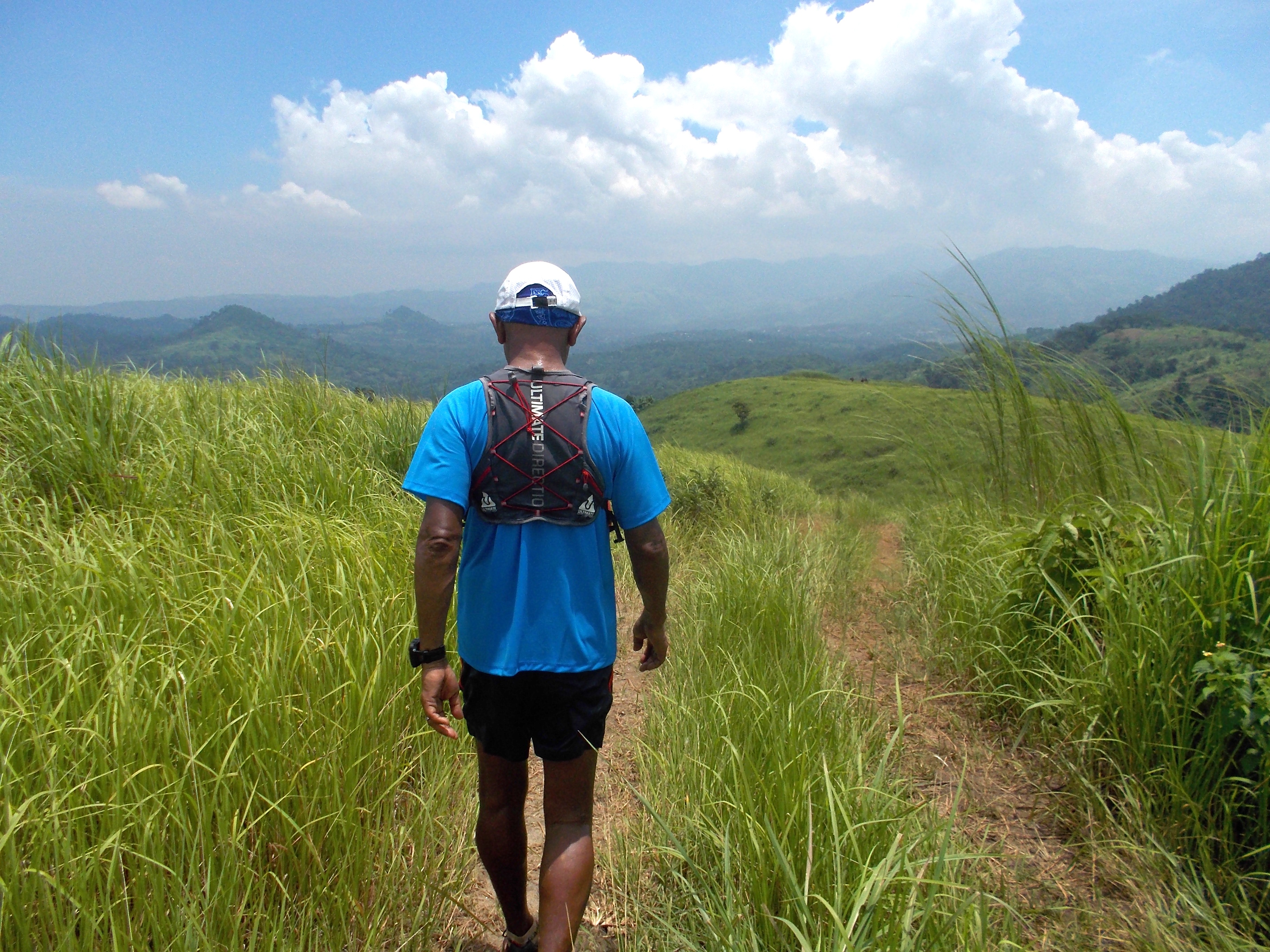
I usually prefer to run an “out and back” route in trying to look for trail routes in the mountains. I start with a comfortable distance of 5K (or One Hour ) from the point where I start my run. With the use of my GF305 GPS watch, once the watch registers a distance of 5 kilometers (or one hour), I would immediately turn-around and go back to where I started. In total, I was able to run a distance of 10 kilometers or two hours of running & hiking.
If my training program would call for 11-12 kilometers for my daily runs, I would try to run one-half of the said distance and then immediately turn-around to go back to where I started. I would do this for a couple of weeks and try to average the amount of time I would finish the said distance.
Once I am comfortable running the “out and back” distance, I would increase the distance with a minimum total distance of 5 kilometers and do the cycle of making myself comfortable in running the distance in a couple of weeks. I would then register the average time that I would finish the distance and try to find out if I am getting faster as I am getting comfortable with the said distance.
@My First Turn-Around Point
My present 28K (17.5 Miles) “out and back” course where I would do my trail long runs had been traced and explored for months! It was only when I became comfortable; measured the distance; and got the average time I would finish the course that I posted on Facebook about my “Playground”.
It is in this 28K “out and back” course where I do my long runs; speed play/”fartlek”, tempo runs, and progression runs. It is also on this course where I experiment on my hydration and nutrition. This is also the place where I test and evaluate my running kits and stuffs.
This is also the same course where I would bring my ultra running friends who want to train with me in my “playground”.
If you need to look for a place to run, just follow an “out and back” course. Whether it is the time or distance which you will consider on your first half of the run, turning around and going back to where you started will guaranty you a successful running workout. Make sure to increase the distance and time of your running workout after you are comfortable with your first “out and back” course in about 2-3 weeks duration. This is how you should increase your total weekly mileage.
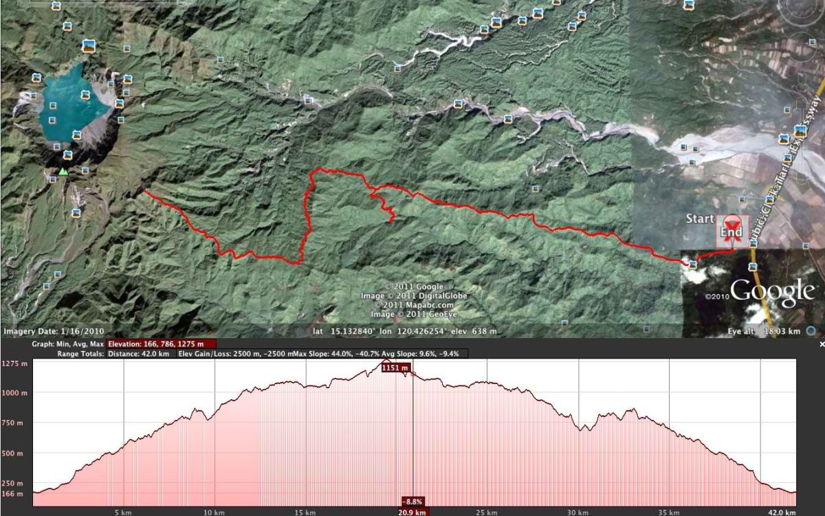
Are you joining this Sunday’s Clark-Miyamit 42K or 22K Trail Run? If you trained on the roads and not on the trails with the same elevation profile with that on the race course, I bet you will have a hard time catching your breath as you go up to the peak of Mt Miyamit and/or complete the course with more strength to reach the finish line. Moreso, if it will be your first time to visit the place on race day.
The course is basically an “up and down” course. Ultra trail runners usually call this kind of mountain running as “Fastest Known Time” or “FKT”. The faster you reach the peak of the mountain and then going back to where you started, the better and is the way to gauge your speed and strength in mountain trail running.
Start & Finish Area @ Ayala Construction Site
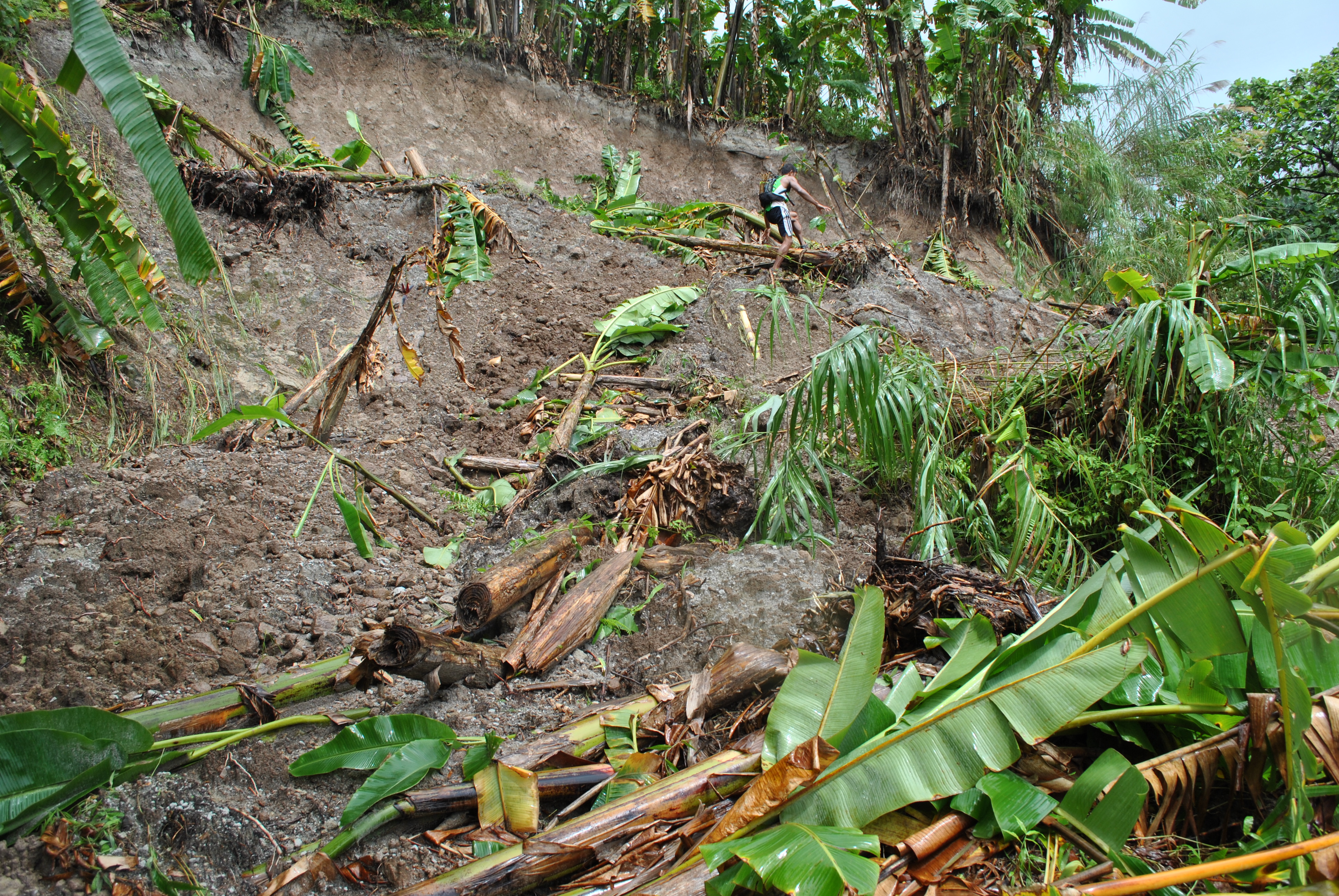
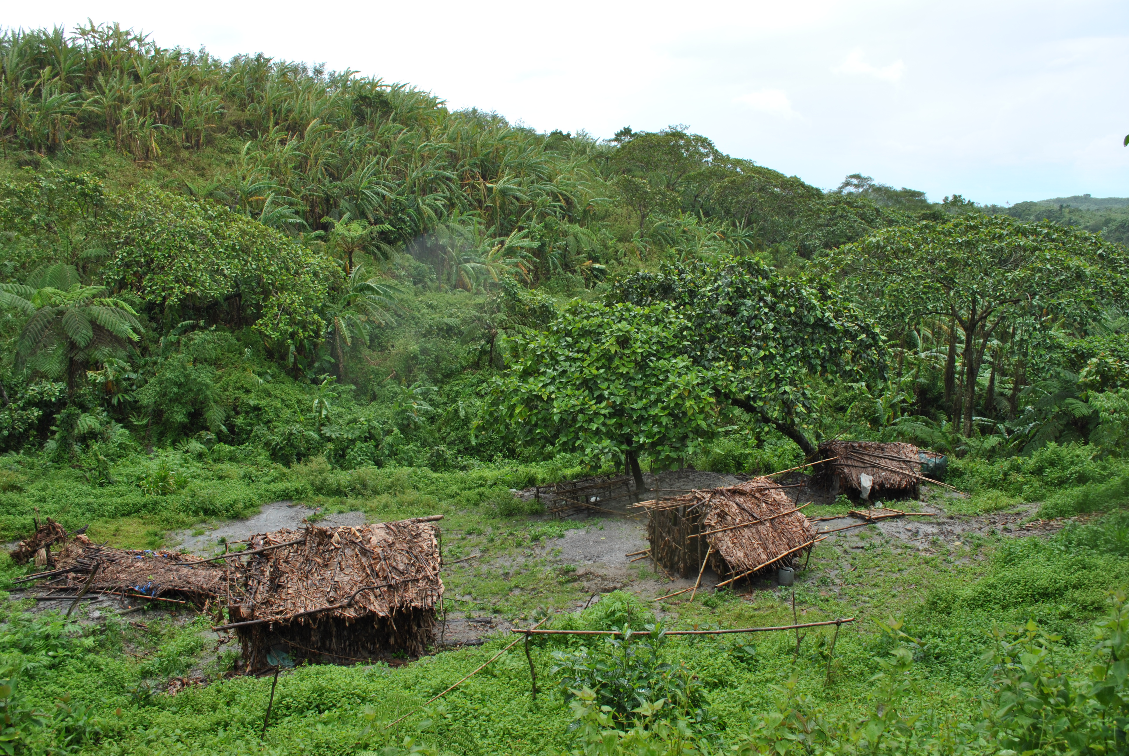
Last month, at the height of the latest typhoon that hit the area, I had a chance to run through the course for the nth time except for the last 4 kilometers before the peak of Mt Miyamit or turn-around point of the race course. My companions and I were not able to go through the trail due to thick vegetation that covered the trail and strong water on the streams that we have to cross.
We ran through the course for almost 34 kilometers in distance which took us 9 hours, to include our “pit stops” along the way and late lunch at the foot of Miyamit Falls. We also went to the View Deck for “photo-ops” and rest.
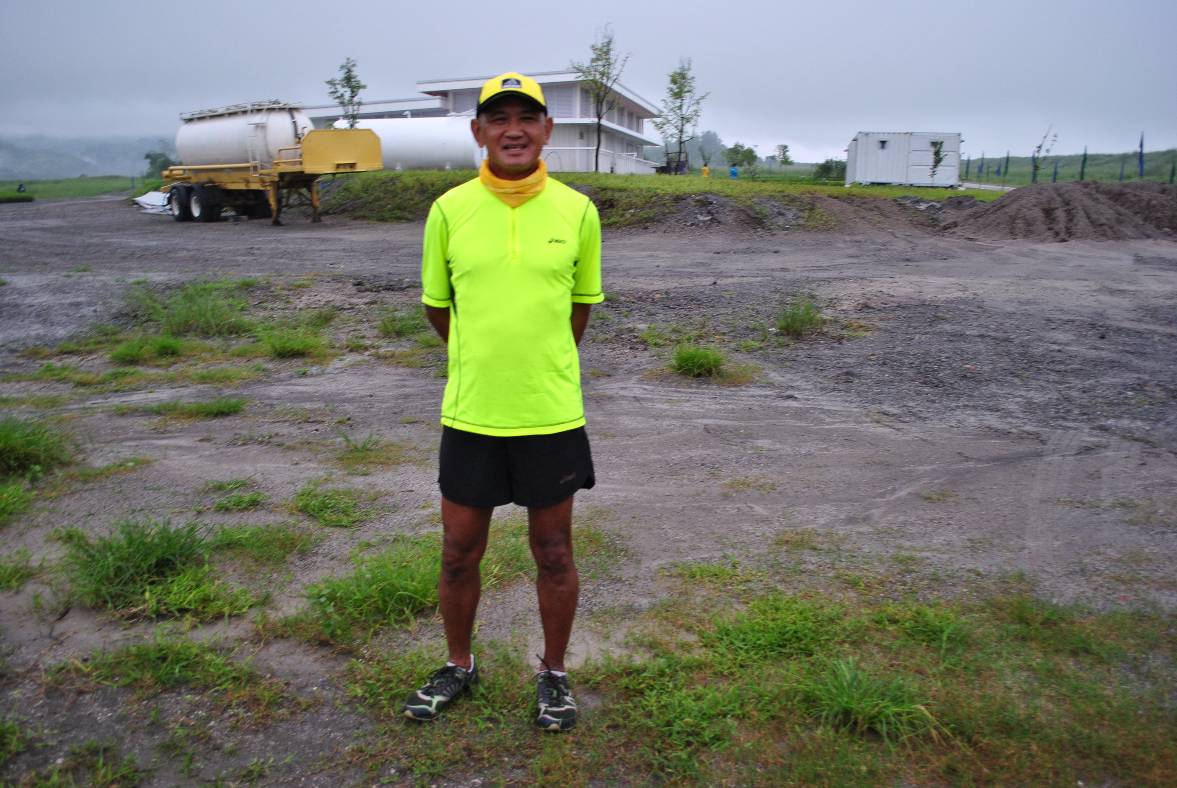
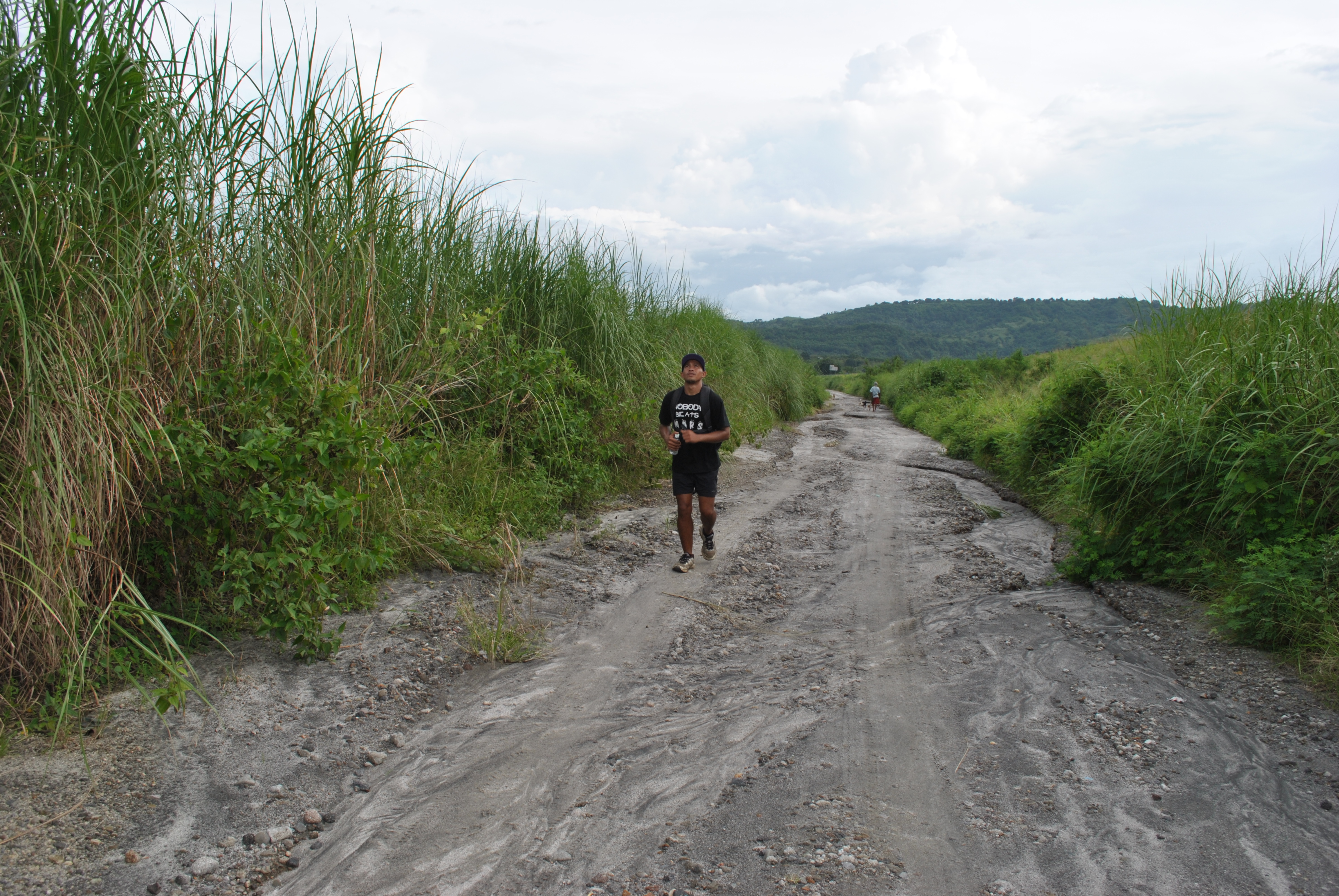
I was surprised that there are already “movements” and construction projects at Barangay Sapang Uwak, the trailhead of the road/trail going to Mt Miyamit. I had to park my vehicle at the Ayala Construction Headquarters where I was able to talk to the Security Guards and requested for my vehicle to park thereat. The construction area is just near the Porac Exit along the SCTEX.
The first kilometer is flat and downhill and as soon as we reached my usual parking area near the small bridge before reaching Sapang Uwak, we had to go through a checkpoint which is being controlled and administered by another company. I was received by a former Philippine Army Officer who is now the designated Officer-In-Charge of the Security Guards manning the said construction area. After a brief conversation, we continued our run to the center of the barangay. The OIC knows me personally as we had been together in one unit in the Philippine Army.
First & Last Kilometer Of The Course/Run
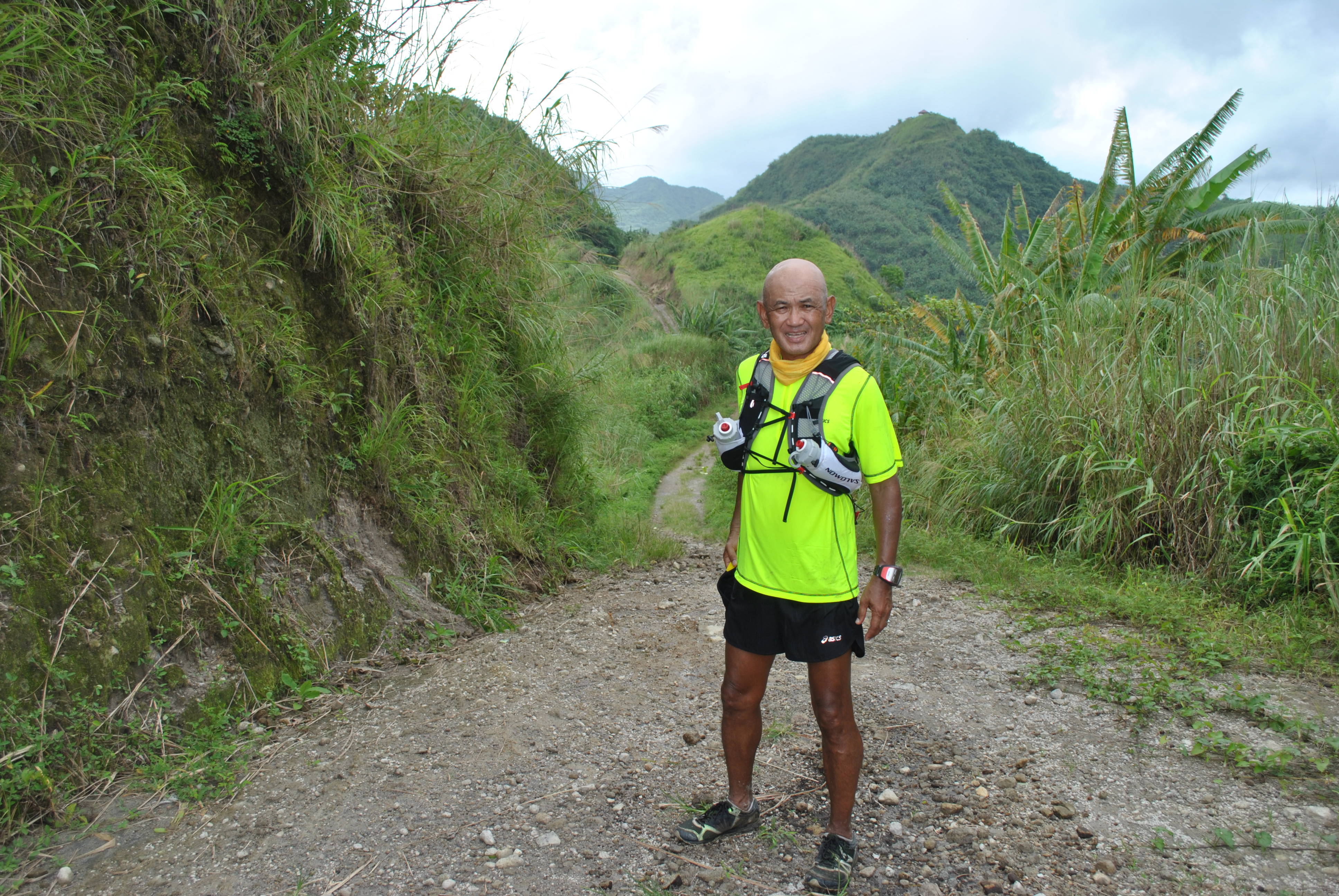
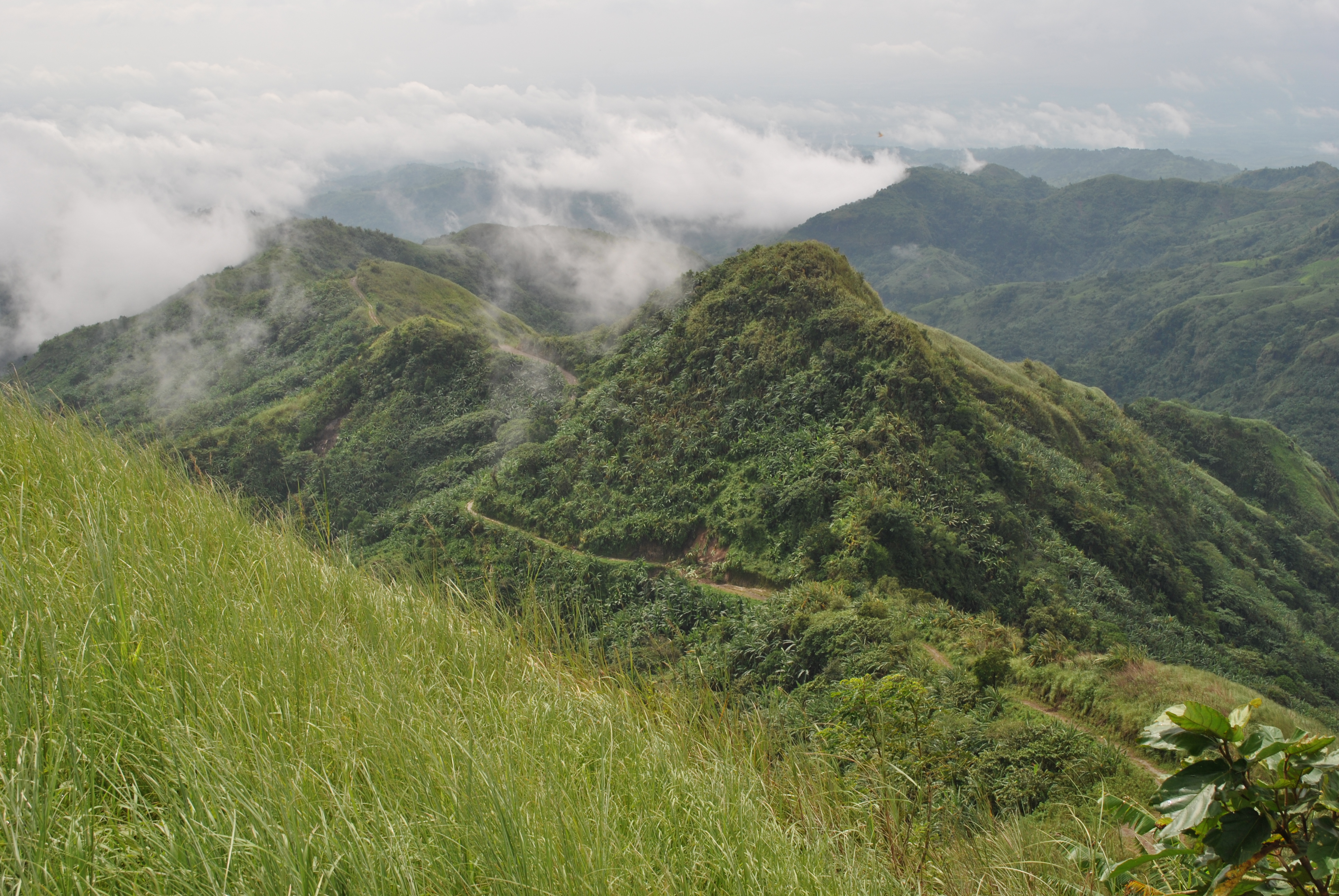
From the center and populated area of Barangay Sapang Uwak, we run, jogged and hike all the way to the View Deck; after some rest, photo-ops, and eating some snacks, we continued our run to the peak of Mt Miyamit hoping that we could reach the turn-around point which is 10 kilometers from the View Deck. We did not reach the turn-around point and we need about 4.5 kilometers more. We have to turn-around when we could no longer see any trail due to thick vegetation. From that point, we went to the Falls and had our brief lunch and photo-ops. After our lunch, we went back to where we started.
Patience Is The Key To Reach The TopTop View Of The Route/Trail Taken From The View DeckWhere Is Danin? Be Careful With This LandslideHuts Made Of Banana LeavesSlippery Part To & From Miyamit FallsTrio Los Bandidos @ Miyamit Falls
For the benefit of those who will be joining this Sunday’s 1st edition of the Clark-Miyamit Trail Marathon & 22K Trail Run who have not visited or recon the place/route, I have the following insights:
Looking at the Elevation Profile, whether you are joining the 42K or 22K race, it is an “up and down” or “FKT” run/race.
Depending on your training and preparation of this race, take it easy on the uphills and make-up for the slower time that you register on the first half by running stronger on the last half.
Always think safety during your run. There are places where the ground is slippery along the course/trails. Take time to hike instead of running along these slippery portions of the trail.
This event is NOT a Picnic or Hiking/Outing for you to socialize with other runners. This is a RACE. However, in case of emergency or accident where a runner is involved, find time to assist or help the victim.
Runners have a bad practice of consuming the whole cut-off time to finish the race. If you can finish the race faster than the prescribed cut-off time, please do so with all your remaining effort. The marshals and volunteers would like to go home as early as possible also.
The tribe/locals residing on this mountainous location are “notorious” in asking money, food, or anything from visitors in the area. Be aware and know what to do.
Apply trail etiquette and the time-tested “Leave No Trace” doctrine in this event.
Still Fresh & Strong As We Approached The Finish Line
I will be joining this race and I will be on a Race Mode. It means that socializing with other runners will be limited at the start and finish areas only. I will not engage in a lengthy conversation with any runner if one decides to run side by side with me. My feet and pace will do the talking, the same strategy that I applied when I joined the Pagsanjan To Majayjay 50K Road Ultra Race last September 1, 2013.
This race will again be a test and evaluation for my new training. My modest goal is to finish within the upper 50% of the total runners without any injury or “issues” during the race.
Good luck to all the CM42K & 22K runners! By joining this trail race, you are already a winner to me!
In my road runs, I find it more relaxing and comforting when running alone enjoying the scenery of the things that I could see along the road. I would concentrate on my running form and let my legs and feet land on the ground as if they are well-oiled machine pumping until I need to slow down my pace or just simply have my walking breaks. In the comfort of road running, everything is automatic and I could cruise along with my comfortable pace.
In my trail runs, I always have the company of one or two of my athletes/”trainees” as my safety runners or pacers. I don’t run along the mountain trails alone and it is my number one rule in trail running. You may never know when shit happens!
Some of my friends started to ask about my “playground” in trail running when I started posting my pictures on Facebook and they showed some interest in trying to find out about the place and experience what it is like to run in such place. Anybody can go to this place as it is open to the public but one needs to inform the barangay or the village that you are there to run or hike.
It took me some time to figure out and discover a trail loop that ends up to a distance of 18 miles or 28+kilometers which could be extended up to 50 kilometers. But the 18-mile loop is already a very challenging route that would take me 6 to 6 1/2 hours of pure trail running. How I wish I could get the correct cumulative ascent descent in meters/feet on this course.
I really do not invite runners or my running friends to this place. I let my friends do the initiative to personally contact me through Facebook (Personal/Private Message) or simply send me a SMS if they are interested to join me in my weekend trail runs in this place.
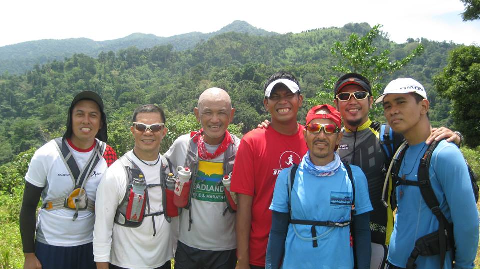
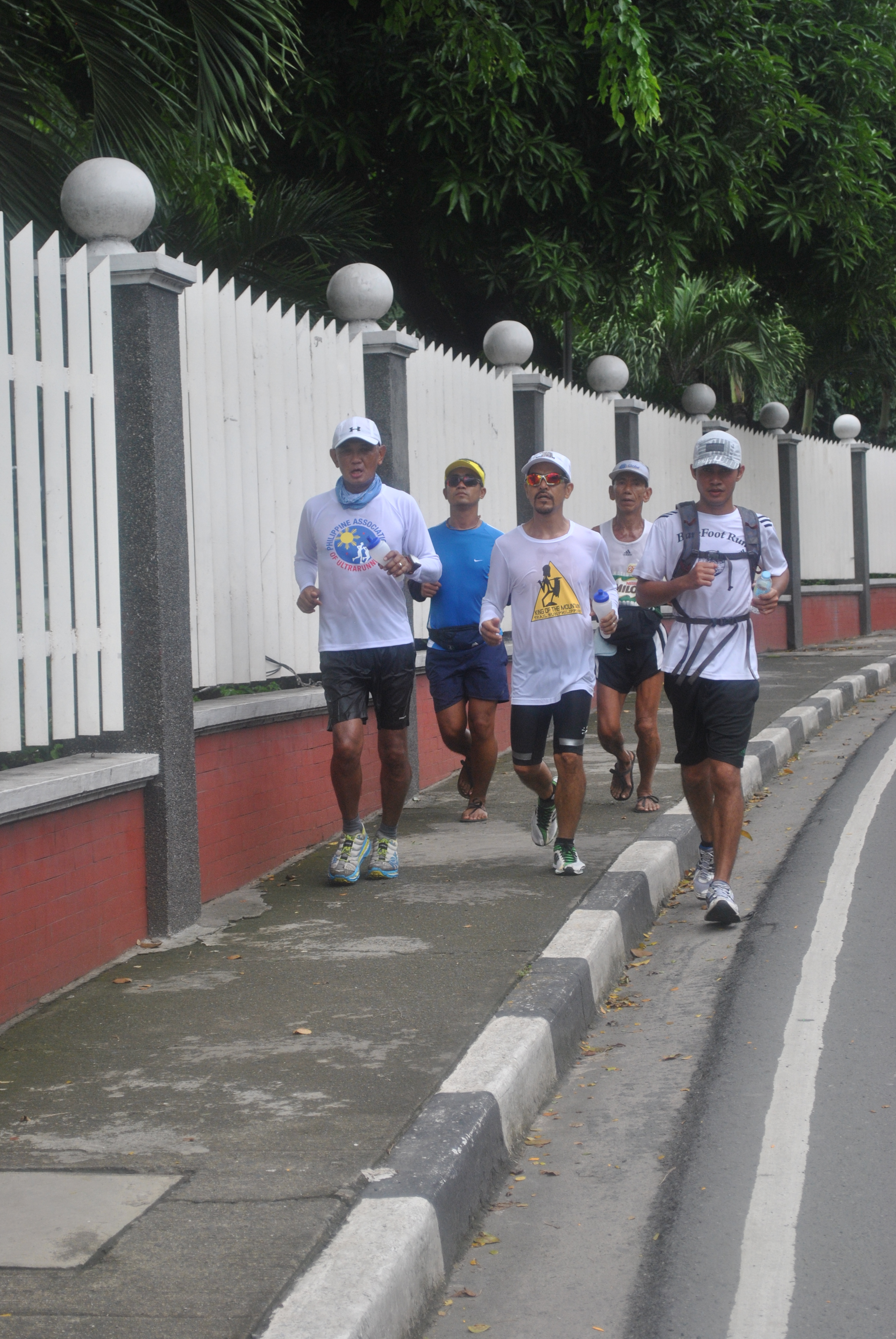
Last Saturday, one of the “usual suspects” in my Ultra Races decided to have his Birthday Run in the company of his friends and some of my ultra friends also contacted me that they would like to join me in my weekend runs. So, on that day, our group consisted of seven runners with one pacer and one sweeper, nine runners in all.
We started the run after breakfast at around 7:00 AM. The first 200 meters of the course is an uphill where nobody would dare to run and I usually use this uphill climb as my warm-up hike. After the first kilometer, everybody would cross a river and all our shoes would be soaked and wet. After crossing the river and with a heavier shoes, the group would start to jog and run for a slight uphill within a single-track trail covered with grass.
The trail is a semi-technical trail where you need to keep your sight on the ground and decide quickly where you would want your feet to land. There are streams to cross and muddy portions where you must avoid or let your shoes be buried in deep mud. There are some dogs and there are some herd of cows and carabaos. The cows, even if they are tied with a rope, would run after us during our runs. The carabaos are more calm when their bodies are completely soaked in some mud pools along the route. Just don’t mind the smell when you pass these mud pools!
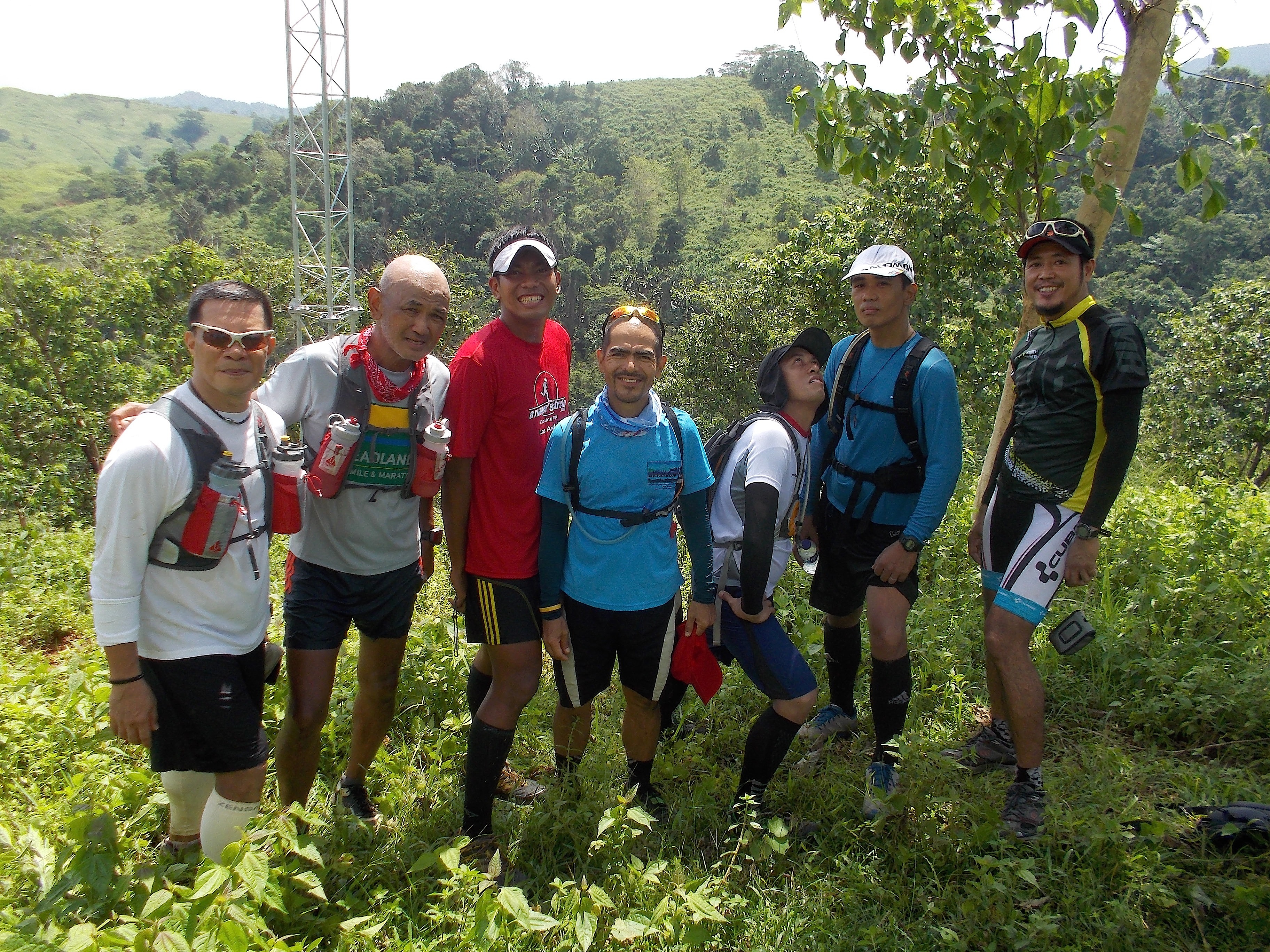
Seven Runners @ The First Antenna
We usually reach our first stop after 1:10-1:15 hours of running in a nipa shed/hut with benches around it and the registered distance in our GPS watch is 6.2 kilometers. An antenna (weather or radio signal purpose) is located near the hut. We usually have our first picture taking in this place and spend at least 5 minutes of stay in this place.
From this 1st antenna, we go downhill towards another river and after crossing the said river, it is all uphill again. Once we reach a wider trail road, our next goal to reach is the other antenna which is located 7 kilometers away from the first one which is located in a higher elevation. Hence, I call this trail loop as “Two-Antenna” Trail Loop.
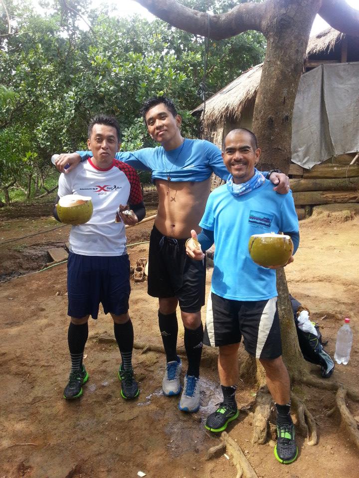
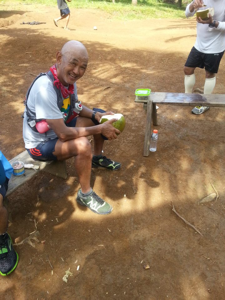
Fresh Coconut Juice In Mang Mario’s Farm (Photo By Ronnel Go)Somebody Is Telling Me Some Jokes! (Photo By Ronnel Go)
After the uphills, downhills and some flat areas, we would cross two big streams until we reach the farm of one of the locals, Mang Mario. This is where we refill our bottles with water; have a taste of fresh coconut juice direct from the tree; hydrate & eat some snack food we carried and another chance to take pictures. I usually talk to Mang Mario and his wife and later give him some packs of “Pentagon” Cigarettes, his favorite brand, and some cash to pay for our coconut fruits before we leave his farm. Well, for the past 2 months that I’ve been dropping by in his farm in my runs, Mang Mario and I became friends and he knows what runners would need when we stop in his place. He would offer his benches for us to sit and order his son to pick some coconuts immediately. This is a result of my “sardines approach” in winning some of my friends in the mountains.
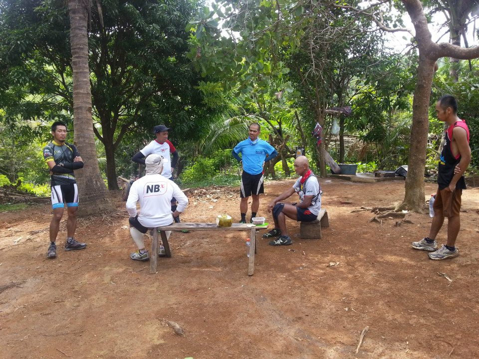
Serious Discussions On Trail Running & Ultras (Photo By Ronnel Go)
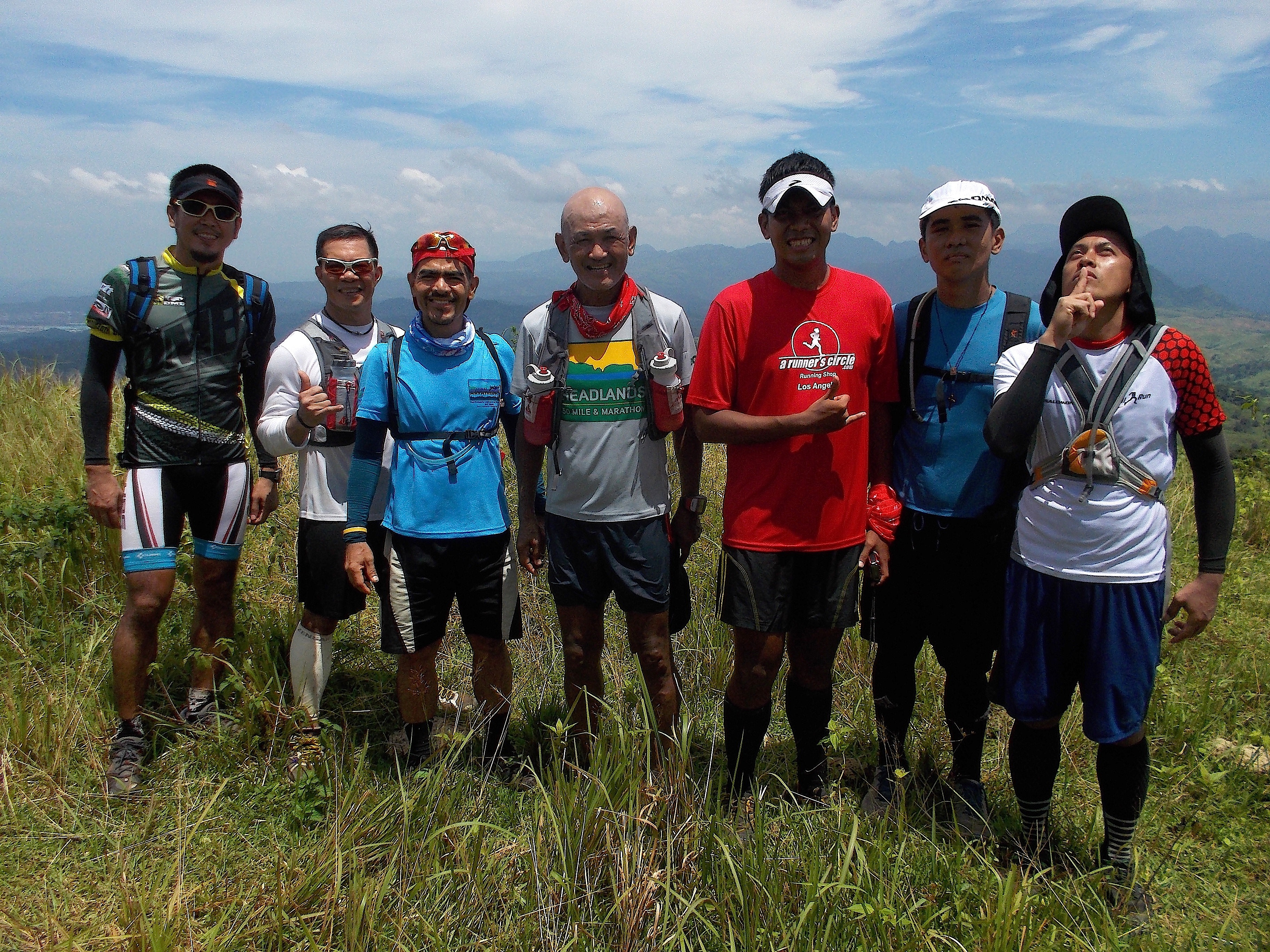
After one kilometer of uphill climb from Mang Mario’s place, we would reach the 2nd antenna and the scenery of the place where we came from (1st antenna) is just amazing! It calls for another group picture with the antenna and the grassland/mountains around as background!
At The Second Antenna
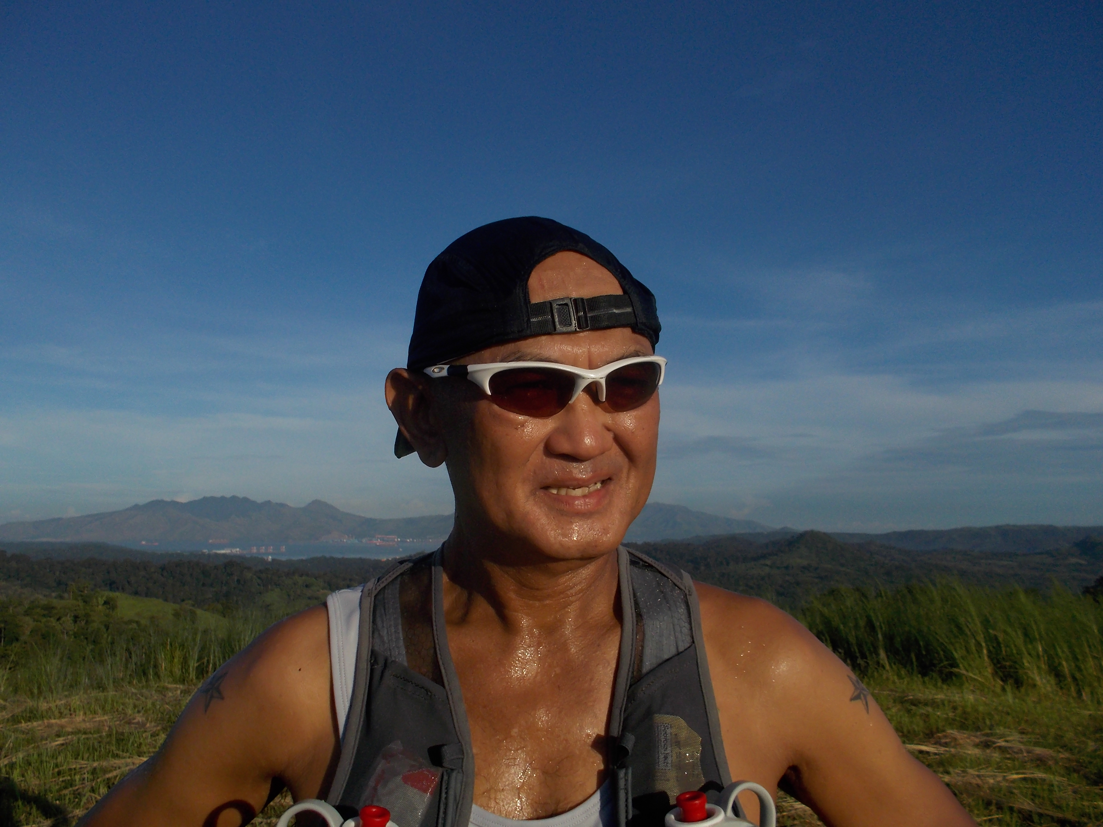
The next two kilometers will be steeper climbs until we reach the highest point of the course which is registered at 550 meters above sea level. I consider this place as the halfway/turn-around point of the course. The scenery is getting better as we go higher in elevation and it calls for another group picture! This is where we eat the remainder of our trail foods with some “ice drops” which we call “Joy-Joy”. They give joy for the tongue and mouth because of its sweet and cold taste. They are “life savers” when the heat of the sun is almost under our heads!
Closer View of the Runners (Photo By Roy Garcia)
After 10 minutes of rest, it’s time to go down to a “roller coaster” elevation of hills until we reach the 1st antenna but the place all around are grassland where there are no trees to provide us with cover from the heat of the sun. The distance is 7 kilometers from the turn-around point to the 1st antenna. This is where we fight it out with the heat of the sun, from the hot air and from the heat of the ground with what remains in our water/hydration bottles. This is also a stretch of the course where the runners would race with one another to reach the 1st antenna. Well, I usually position myself at the back of the pack with the “sweeper” behind me all the way to the first river/stream that we crossed! This would prevent the new ones to this course not to get lost when one could not see the runner in front of him.
At The Highest Elevation Of The Course
It is good that the house of one of the “cowboys” or cattle caretakers, which is also a friend that I came to develop and know since I started running in this area, is located near the 1st antenna. This is where we can have our re-supply of water which is enough to bring us to where we started.
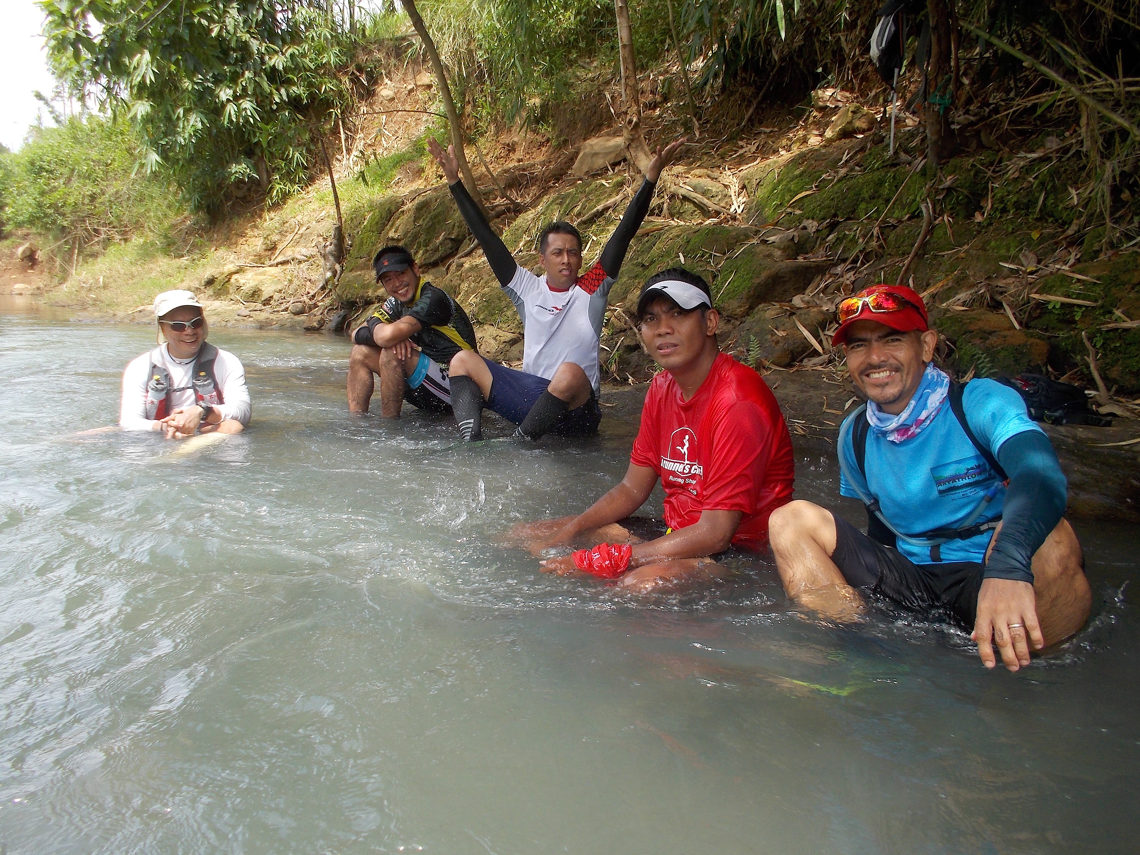
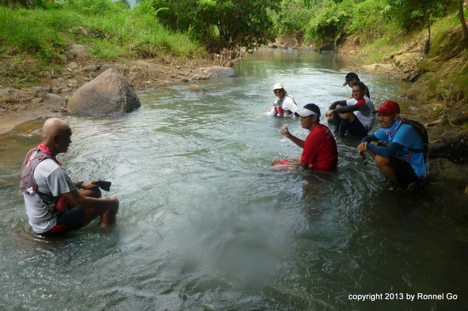
From the 1st antenna, everything will be relatively downhill and the distance to the first river is 6 kilometers. Reaching the first river is a relief for everybody. We would check our watches and we could not believe that we spent 6 1/2 hours along the course. We thought that we just spent 3-4 hours of having fun in the mountains! It is in this river that we start cleaning our shoes from the mud; cleaning our feet and legs; and simply soaking our tired legs with cold and refreshing flowing water while waiting for the last runner and “sweeper” to arrive.
Cooling Off Our Tired LegsMy Position With The Group In The River (Photo By Ronnel Go)
Ice-cold Coca Cola drinks would be our initial “prize” for finishing the run and followed with a recovery meal which would also serve as another “carbo-loading” feast for the next day’s long run!
What I like with my running friends when they are with me in my “playground” is that I could not hear any words of complaint from them even when there is an intense heat from the sun in the middle of the day or when the trails are slippery during inclement weather/rainy days where some would fall on their knees or butts.
These runners are “hardcore” and “monsters” on the trails!
If you are interested to experience what these runners went through, there will be a scheduled trail running 101 training camp for a day which is strictly limited to only 10 runners. Further announcements on this event will be made through Facebook.
Most of my training runs are done in the mountain trails with the assumption that the mountains in the Philippines are public domain and owned by the government. Some of the other mountains are declared as National Parks but one could see the lack of administration and governance of these parks. I have yet to see a mountain that is well-managed with trails that are well-maintained.
Trails in the mountains start as footpaths of hunters/locals as they look for food in the forest, whether they are wild animals or wild edible plants or root crops. These footpaths usually become as the “passageway or open canal” for the water that comes from the peak of the mountain during the rainy season. The current of the flowing water going down the slope of the mountain would create a more pronounced extraction of earth from the ground. And the cycle continues with the footpaths of more hunters and the flow of water during the rainy season.
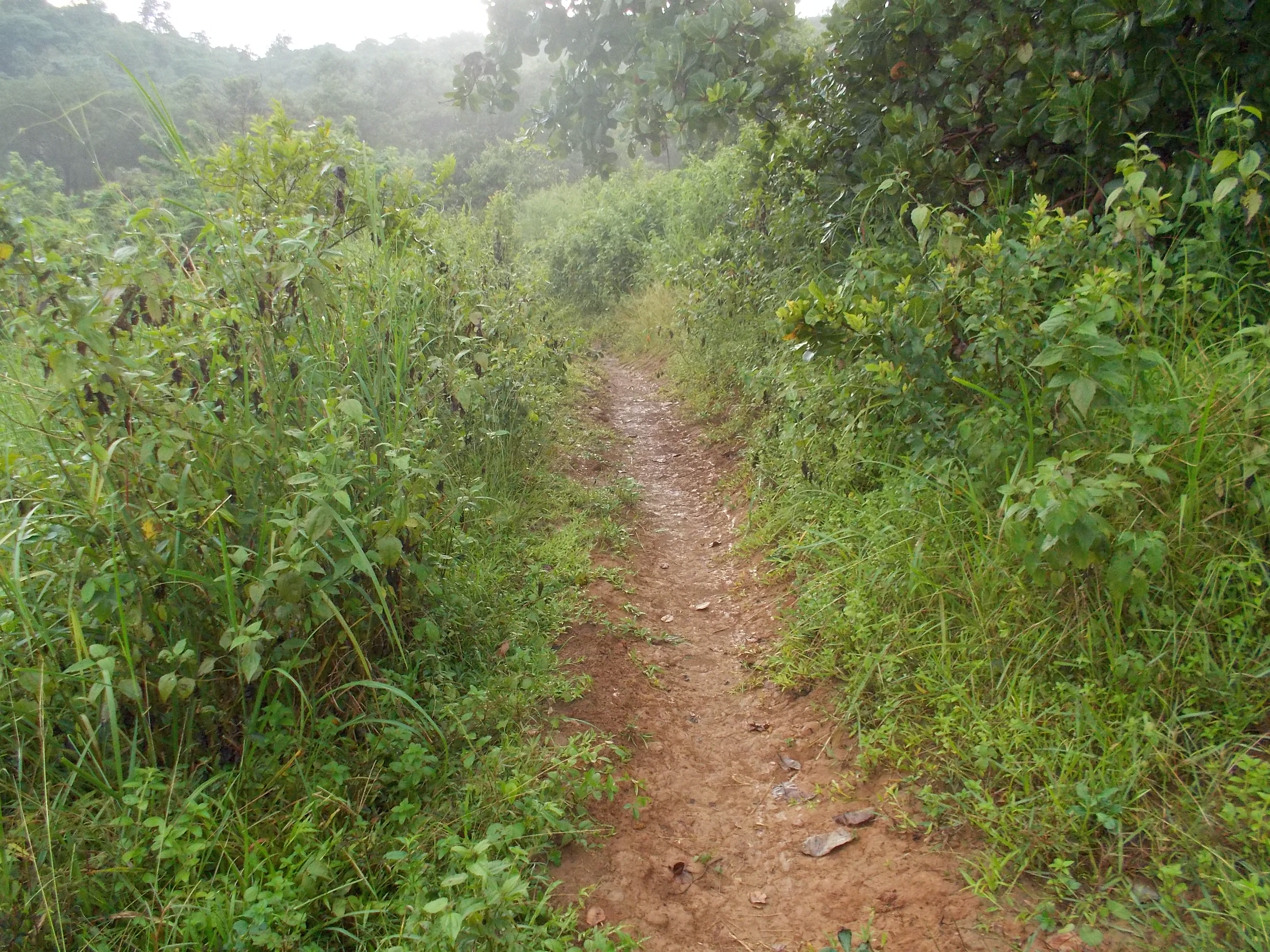
Typical Single-Track Trail In My Playground
Once these trails would widen, they give an opportunity for the locals to bring their domesticated animals where they could feed them with the available grass on the slopes. Some would bring their sleds being pulled by their carabaos or cows to bring cut trees from the forest for the construction of their houses and for fuel in cooking their foods.
Now, these mountains are being invaded by “illegal” settlers where they could start to raise their crops and animals. Worst, if these mountains and trails are the regular route of the insurgents and other bandits/cattle rustlers.
Trail Work/Cleaning In Progress
But one thing that I’ve observed in my training along the trails is that there is no accountable/responsible entity that has the job to maintain these trails. It could be the local Barangay unit but it seldom dips its authority in maintaining such trails. The maintenance of these trails are bestowed on the initiative of those locals who have interests in those mountains but not on a regular basis.
What is my point? If one is a regular visitor of a mountain and uses the trail, he/she must be a part in the maintenance of such trail. It is either by volunteering to clean the trail of debris and trash or by preserving such trail by not making another footpath. (Remember that another footpath would result to another “passageway” of water coming from the top of the mountain!)
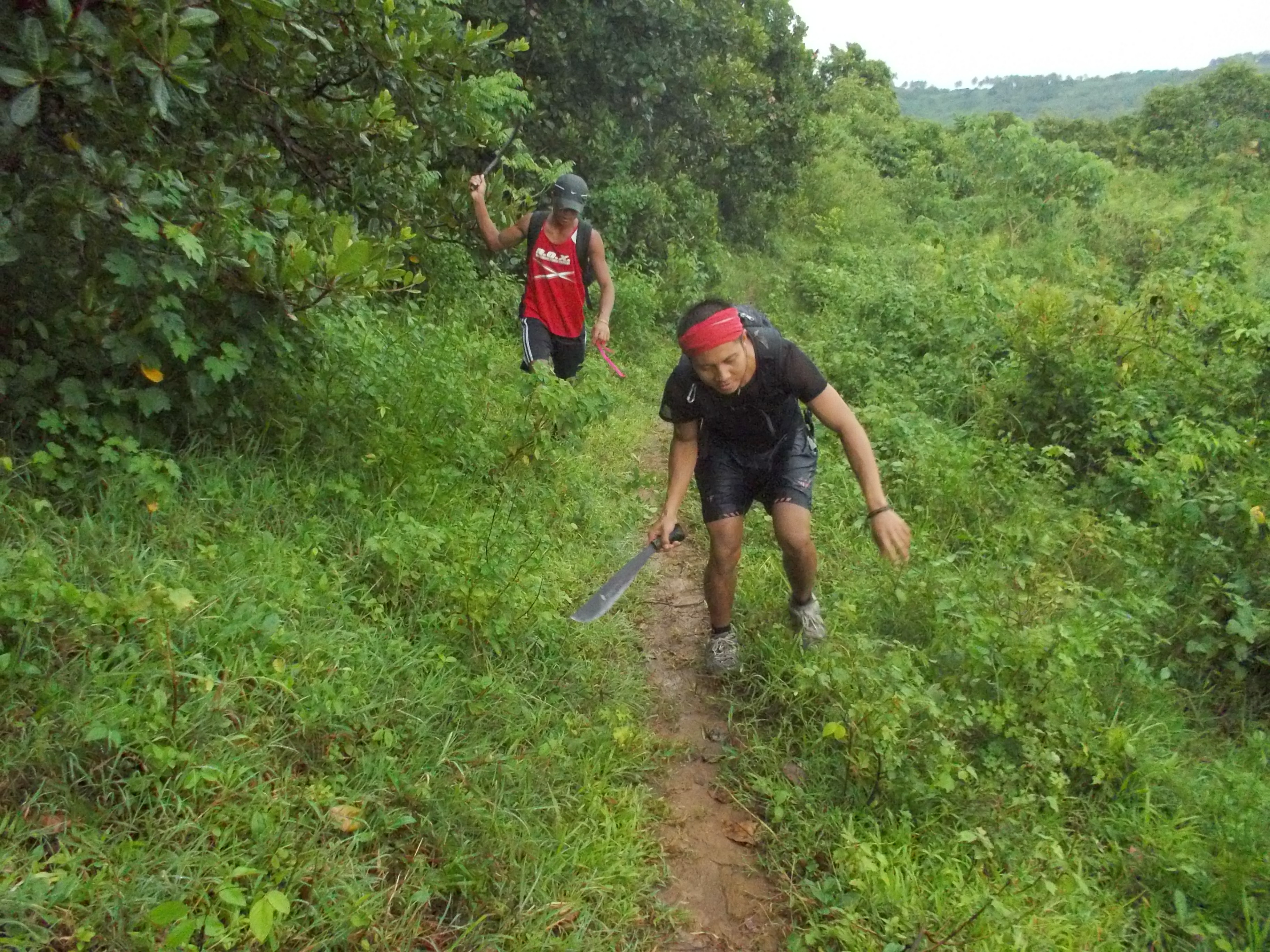
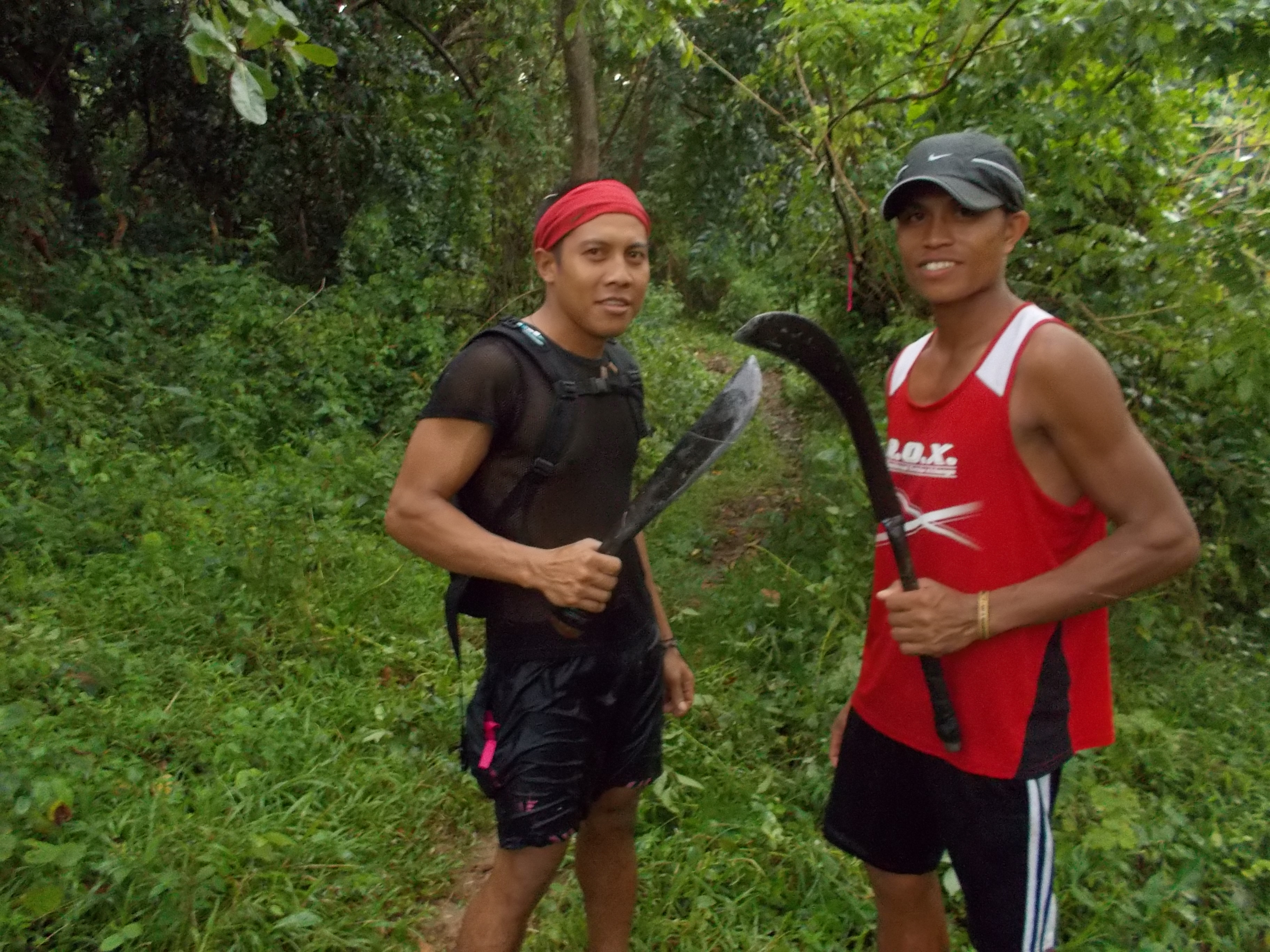
“Diego Bandidos” As Work Force
So, for this week, I made a commitment to maintain the trails that I’ve been using for my training. This scheduled trail work will be done once in two weeks in my “playground”. We have started to cut some plants and grasses on the sides of the trails and during the dry season, we will try to flatten the trails and make some of them to be wider. I already bought some tools for this purpose.
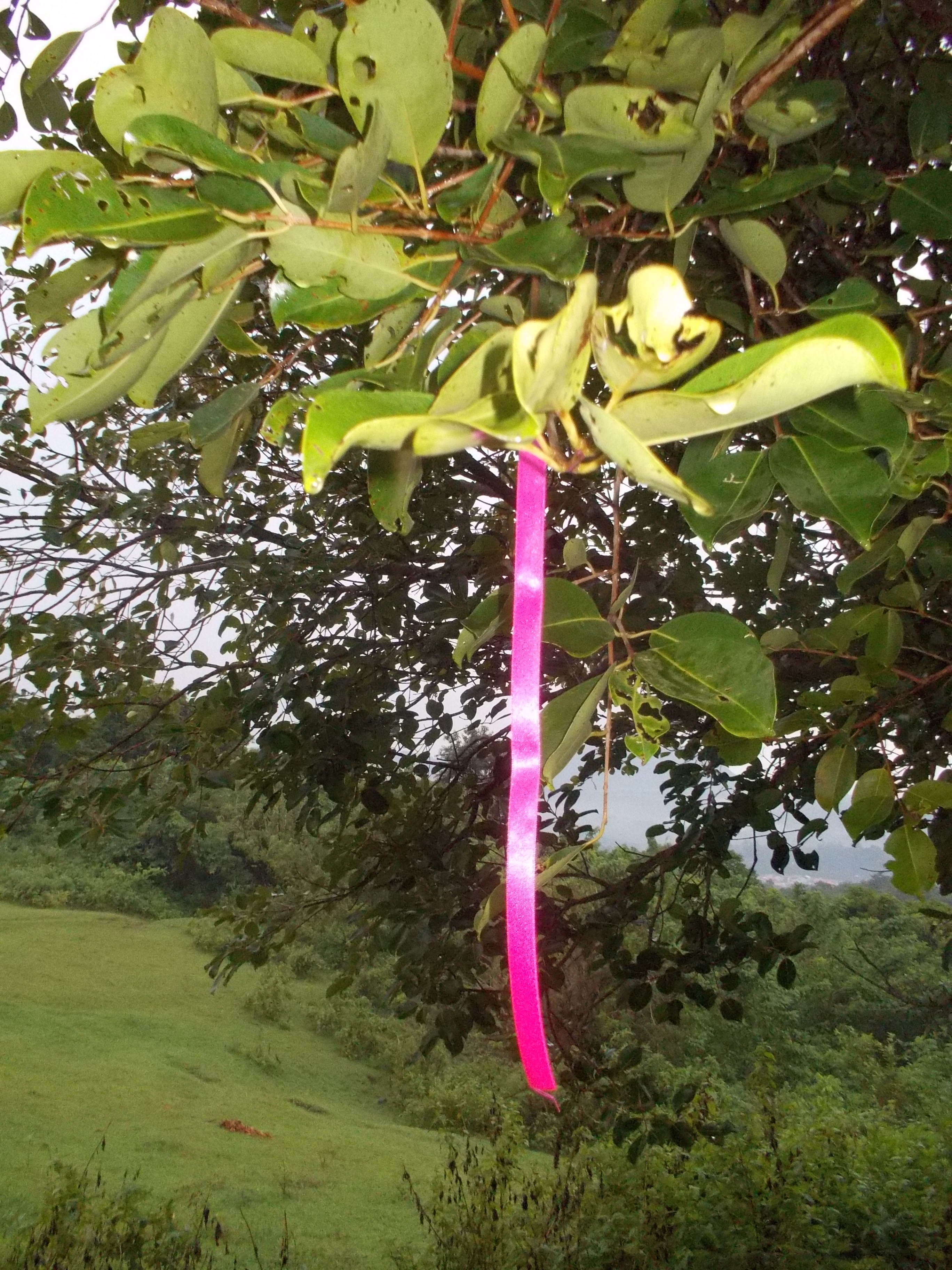
“PINK” Color Signature In My Trail Events
Lastly, I placed some pink ribbons as initial markers for the turns and bends along the trail with the hope that my friends will not get lost during their runs. More markers/ribbons will be placed in my future runs in the place.
Salomon XT Advanced Skin 5 S-Lab Hydration Pack was available in the market (USA) in February 2011 but I was able to purchase it through a friend in Hongkong last May 2012. It costs me $185.00 and up to this date, this item/product is not yet available in the Philippine market.
Since it is a Salomon product, it was used by Kilian Jornet in his previous Champion Finishes at the yearly Ultra Trail Du Mont Blanc 166K Race (UTMB) and met the requirements of the necessary hydration vest and pack for a runner joining the said event. It has an insulated 1.5-Liter water bladder & tube; thermal blanket; whistle; trekking pole strap; and lots of zippered pockets where the bigger pocket at the back can fit a light jacket/windbreaker. It has also two big pockets on each of the front straps which are not symmetrical in placement where additional water bottles could be secured.
With the 1.5-Liter water bladder on the back portion plus additional two bottles in the front pockets, I could carry 2.5 liters of liquid in my trail runs using the said hydration pack. The other 2.5-Liter space is allocated for the zippered pockets where I can stash a light jacket/windbreaker, foods/energy bars, headlight, and gels.
The whole pack weighs at 21 ounces or 593 grams, without the emergency blanket and two bottles for the front strap pockets. But when it is worn with the necessary contents in its pockets, it keeps a very snugged fit to the body with the weight of the pack more concentrated on the upper back/shoulders. The fit to the body can be adjusted by two elastic straps that connect the two shoulder straps.
After more than one year of using it in races and training runs, I can say the following:
1. It is a very expensive buy as compared to the newer hydration vests available in the market.
2. The whole pack (without the accessories & contents) is heavy as compared to other hydration packs/vests.
3. After not using the pack for few months, the zippers on the pockets got stuck and I could hardly open the pockets. Dried sweat and dirt might have contributed to this condition but it took me sometime to figure it out on how to loosen the zippers. If one of the zippers will be broken, it will be the end of this pack.
4. Sometime, I have a hard time “hooking” the two elastic front straps on the edge of the other shoulder strap.
5. There are times also that I would hit the edges of the two bottles placed on the front straps’ pockets with my moving arms while running. Instead of trying to clip my moving arms towards my torso while running, I would open up my elbows outwards in order not to hit the bottles.
Front View Of The Salomon Skin S-LAB Hydration Pack
The front view of the hydration pack would show the two elastic straps with a hook (colored red) on each end. It shows also the two pockets on the shoulder straps which can accommodate 20-oz. or taller water bottles. It is observed that the two pockets are asymmetrically positioned with one another. The pockets are not upright but slightly slanted under the armpits.
Back View of the Salomon Skin S-LAB Hydration Pack
The back portion of the pack shows the big letters of the brand Salomon. The whole pack sits on the back much higher than any of the other brands of hydration pack/vest which a big advantage of this product. There is no “bouncing” feeling of the pack on the body when one is running.
The last advantage of wearing this item is to send a Big Fashion Statement to the other runners, not as a fast and strong runner, but as somebody who can afford to buy what is not available in the local market!
The Ultimate Direction’s Anton Krupicka (AK) Signature Series Hydration Pack/Vest is a “sold-out” item in the USA starting last November 2012 and the next orders available on their Website/On Line would be available on January/February 2013. But Andre Blumberg who joined in last year’s Taklang Damulag 100-Mile Endurance Run (TD100) gave this hydration pack/race vest as a gift last December 2012. Since then, it was my favorite choice in my weekend long runs in the mountains.
This product is being manufactured in the Philippines (but not available yet in the local market) in a place near the Starting Area of the yearly Bataan Death March 102K & 160K Ultra Marathon Race in Mariveles, Bataan. The price is $89.00, a way lot cheaper than the Salomon’s Advanced Skin 5 S-LAB Hydration Pack.
It is the lightest and most “minimalist” hydration pack/vest in the market which weighs 6 ounces/170 grams without the bottles. The pack comes with two 20-oz bottles only. There is no water bladder but the back part of the pack can accommodate a 1.5-Liter water bladder.
Front View: Ultimate Direction (UD) Anton Krupicka (AK) Signature Series Hydration Vest
There are two small zippered pockets on the lower back portions of the pack and lots of more small pockets (4 pockets in all) on the front of the pack. I seldom use the zippered pockets on the back of the pack that can accommodate some energy gels but I prefer to use those small expandable pockets on the shoulder straps for my small camera and gels. I have no problems with the zippers even if the whole pack is dirty for using it almost every weekend without washing it. Most of the pockets’ openings are secured with Velcro strips which are very easy to open & close.
Back View: UD Anton Krupicka Signature Series Hydration Vest
I have never used the back pocket of the pack for a water bladder but I got very favorable feedback from other runners who do such. According to them, it gives them a good balance and nice snugged feeling of the pack with 2 bottles in front and a water bladder on the back. The pack has an elastic rope/string with a hook on the back part which can secure a light jacket or a poncho or a windbreaker.
As compared with the Salomon Hydration Pack, I don’t have any problems with the UD AK Hydration Race/Vest with regards to the movements of my arms while running. The placement of the bottles on the front straps does not even create any “chafing” on my chest or nipples. Even the snap locks on the straps on my chest could be easily “linked” easily even with my eyes are closed.
So, to choose which one is better among the two hydration packs, the Ultimate Direction’s AK Hydration Pack/Race Vest is a winner!
Almost 3 years ago during the Race Briefing of the 1st Taklang Damulag 100-Mile Endurance Run (TD 100) in Fort Magsaysay, I mentioned about having a choice of preference in ultra marathon distance race for a runner. I intimated that a runner must be able to experience a road and a trail ultra race but I went further to suggest that at a certain point in one’s running career, an ultra runner or ultra marathoner must be able to specialize and concentrate in only ONE kind of an ultra event.
This is the very reason why I started to organize the first TD 100 in Fort Magsaysay and the rest is history. For the past two years, only 10 runners have earned the most-coveted TD100 Silver-Gold Buckle.
Going back on my topic. I recalled that I was “baptized” into the world of ultra running with my first ultra race which was the Bulldog 50K Trail Run in Malibu, California. Much to my delight to come up with a trail run in the Philippines, I had some reservations in trying to discover some trails in our mountains and outside Metro Manila. Instead, I took comfort in the conduct of an ultra marathon race on the road. Thus, the Bataan Death March 102K Ultra came into being.
However, my love for the trails was still in my mind and being assigned in Fort Magsaysay during my military days, I made some meetings and coordination with my former Command/Unit which is based in the said camp which resulted with the 1st TD100 Endurance Run.
It was a satisfaction on my part after the first TD100 event was conducted. Local runners have now a choice of being an ultra runner and be able to test his/her limits of endurance in running. For a road ultra, the BDM 160 serves as the goal. For a trail ultra, the TD 100 serves also as a goal.
I firmly believe that these ultra events serve as “jumping boards” for the local runners to prepare them for more challenging ultras abroad. They are more accessible and more economical rather than having your first “hundred” in another country.
As an advise to the younger runners, you have to try what it takes to be a road and trail runner. But in your later part of your running career when you have the speed and strength, I highly suggest for you to go outdoors and into the mountains and concentrate on the trails.
You have been running and hiking for almost 6 hours along the mountain trails and then suddenly you made a wrong turn to a trail that is not a part of the course and then after running for about 400-500 meters or a few minutes from the turn, you realize that you are lost. You begin to panic and feel frustrated. You make a decision and you seem to be confused. In reality, you don’t know what to do!
Such situation always happen in a training run in the mountains which could be easily corrected and solved by other runners within the group. It is also a situation that happens in mountain or ultra trail races.
I always say that it is a normal occurrence when a runner gets lost on a trail during a race and there is no need to complain to the Race Director/Organizer, most specially in ultra distances. In truth, the runner himself/herself should be blamed for his mistake of being lost on the trail.
In my experience as a trail runner, I have followed “common sense” practices for me not to get lost along the trail and if ever I would be lost, there are also suggested things that should be done.
The following are the “preventive measures” to avoid being lost on the trails and suggestions to correct the situation:
1. Don’t attempt to go alone on a trail that you are not familiar with. Register in the Barangay Hall and get a “guide” if you are new to the place.
2. Run with a group and make sure that somebody in the group is familiar with the trails in the area.
3. Inform your family, relatives, and friends about your activity and always make sure that you bring your cell phone with you.
4. You should orient yourself in the place by knowing where are the North, South, East & West directions. Look around and find structures or key terrain features (hill peaks, mountain peaks, forested areas, grassy areas, water falls, creeks, rivers, sea shore, fences, highway or main roads) in relation to the directions. In short, you should know basic orienteering & map reading.
5. If you are in a training run with a group, make sure that you can keep up with the pace with the runner in front of you. Keeping pace with the runner in front of you means that you could see his/her back every turn of the trail.
6. If ever you don’t see the back of the runner in front of you, you can start shouting at the said runner to warn him that you are lost or tell him to slow down. Don’t be ashamed to shout the guy in front of you or to the rest of the group. It would be a smart idea to always bring a whistle in your trail runs.
7. If you are in a middle of a pack and you took a wrong turn and notice that you are lost, you have to re-trace you way back to the exact point or place where you made the wrong turn. Stay calm and don’t panic. Take a deep breath, rest, hydrate and take some food while waiting for the other runners who are running way behind you.
8. If you can not wait for the other runners behind you to arrive, observe your surroundings and try to find out the right trail by looking on the marks of soles of running shoes on the trail. If you can’t see any marks of shoes because the trail is covered with grass, follow such trail for a few meters and you might be surprised that it could be the trail that would lead you to the rest of the runners.
9. In an “out and back” and “loop” courses, find time to observe your surroundings on the first half of the course even if it will make you slower in your pace. Find time to appreciate the beauty of the outdoors and try to absorb them to your mind. On your way back to where you have started, the things that you observed on the first half will come in handy if in case you think you are lost on the trails.
10. If you are joining an ultra trail race, it is highly recommended to conduct a recon of the course by simply walking/hiking through it. Take some pictures of places where there are turns or physical and/or natural features which you can see along the route like streams, rivers, waterfalls, bridges, unusual plants/trees, grasslands, big rocks, rock formations, huts/houses, uphill & downhill sections of the course and most importantly, establish your own “marker” every 10K of the route.
Take Note Of Waterfalls, Whether They Are Small Or Not, Along The Trails
11. In a well-marked trail race or run, shit happens. Surprisingly, markers or ribbons are altered or stolen by locals or people within the neighborhood, mostly by kids who make fun or play with them. Sometimes, there are also (front) runners who would remove them as part of their “collection of souvenirs”. There are instances also that markers are improperly placed along the route. The worst scenario is when these markers become wet due to rains or inclement weather that the color becomes the same with the surroundings, most especially during nighttime.
12. If there is a website of the ultra trail event, study the details posted and confirm/validate them in your recon/walk-through along the course. Some runners would laminate the data of the trail course printed on a piece of paper and had it handy in their pockets or in their hydration vest.
13. If you don’t have the luxury of time to conduct your recon, look for blogs of finishers of this race and you will find a lot of information that would help you to familiarize yourself with the course and event.
14. If you have friends who have finished this race, try to talk to them or contact them through e-mail or through the Social Media platforms. Ultra runners are very helpful to “newbies” when it comes to getting their experiences in finishing the race.
15. You might also consider joining a friend who trains with you in an ultra race to be a participant of the event. Having a partner in training and in a race is more comforting than running alone.
16. Lastly, if you are not well-trained or prepared for an ultra trail race, don’t make an attempt. You will be wasting your hard-earned money and effort.
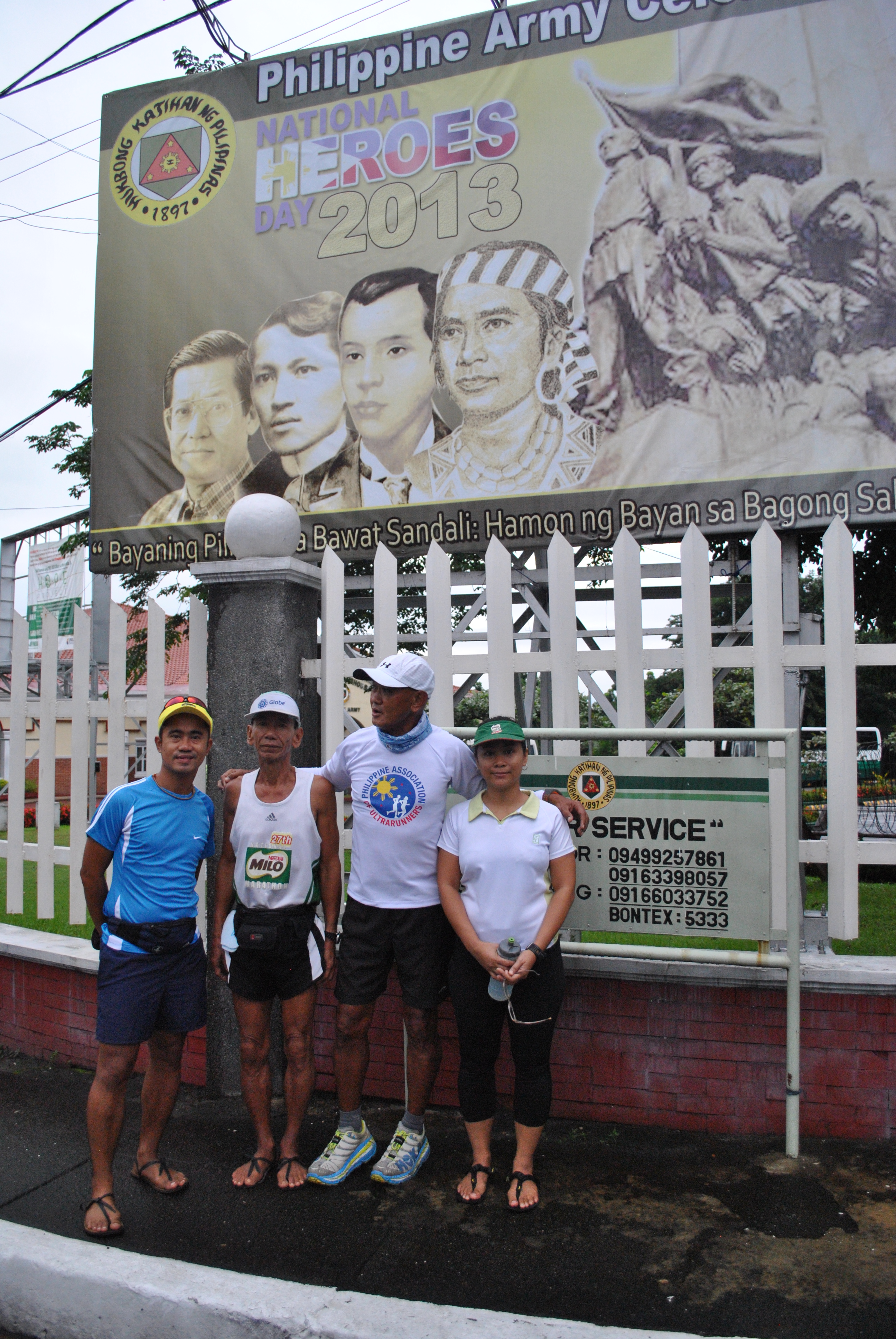
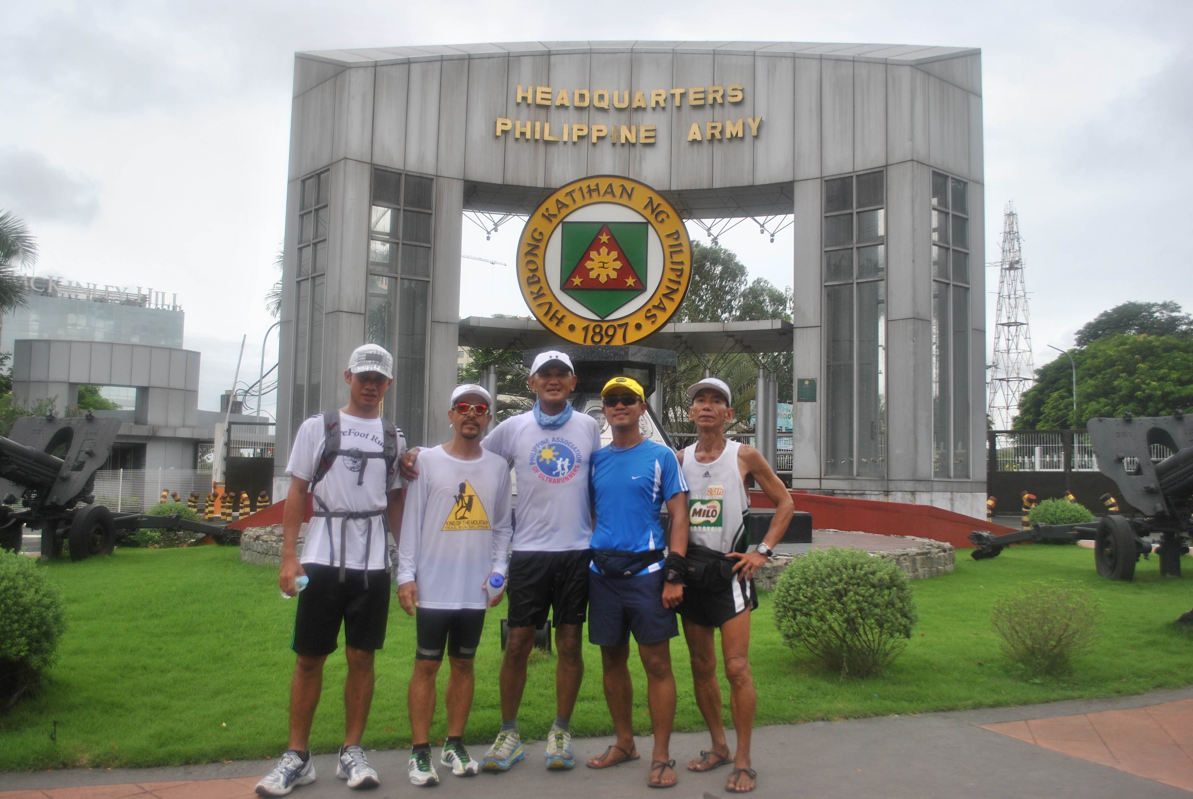
As I have announced in my previous post that I am joining the “One Million March” to Luneta Park, I arrived at the Starting Area in front of the Philippine Army Officers Clubhouse at 5:30 AM yesterday even if it was raining. I was joined by the Pascua Family with Retired Master Sargent Pascua from the Philippine Army and his son and daughter. The whole family was using minimalist sandals and Aumel, the son, finished 1st Runner-Up in the latest Fort Magsaysay To Dingalan, Aurora 65K Ultra Marathon Race.
BR With The Pascua Family @ The Starting Area
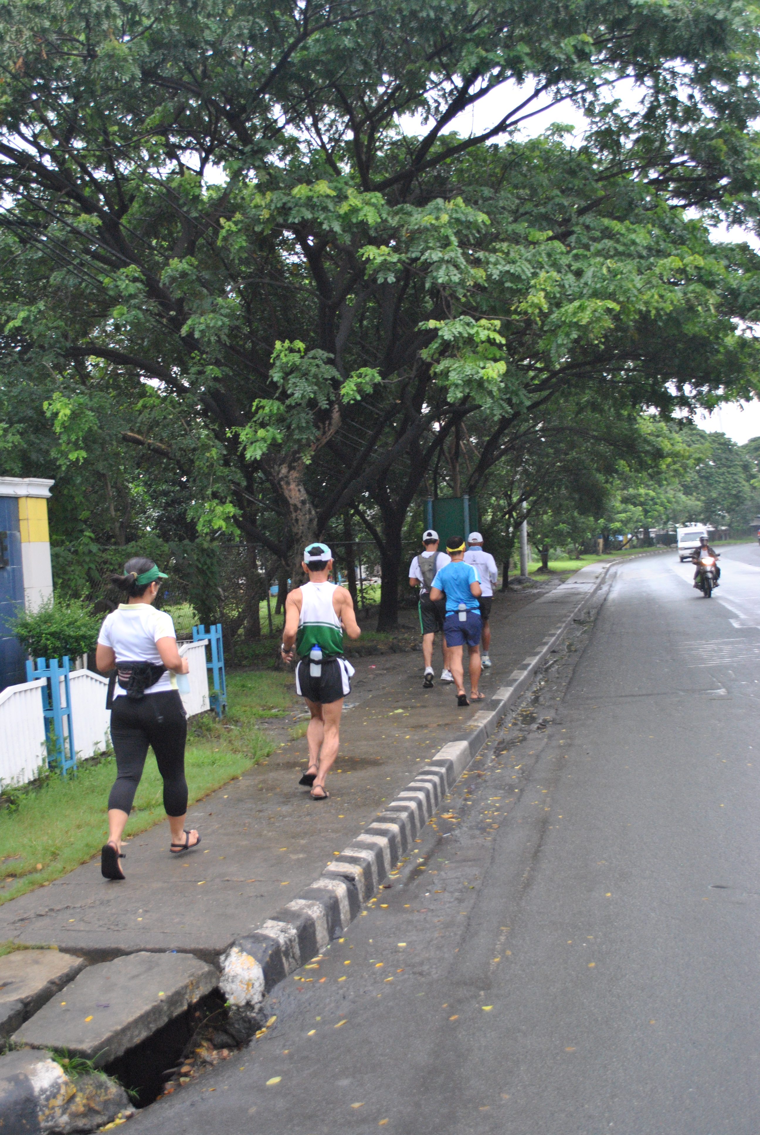
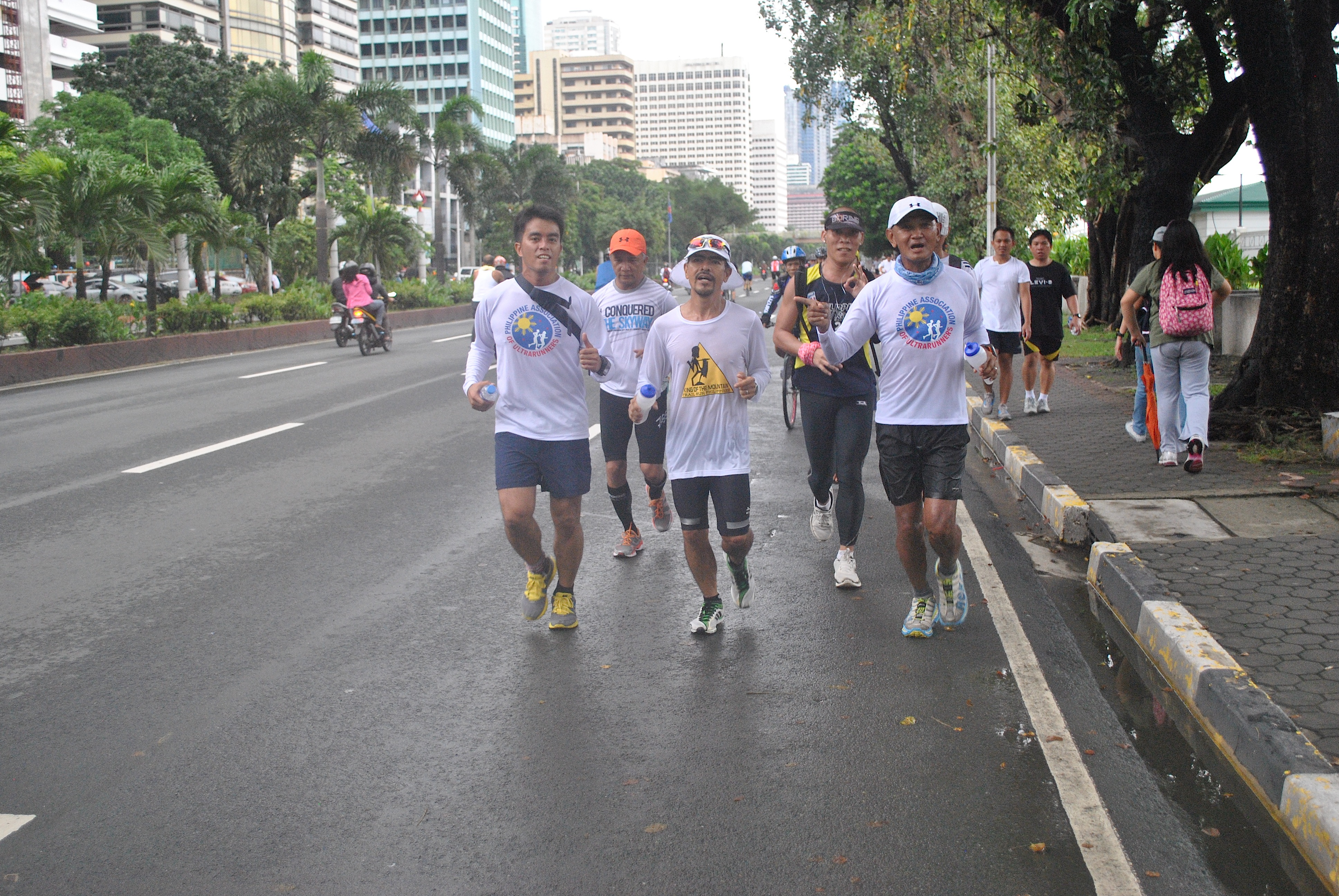
We left the starting area at 6:10 AM. Walked for about 400 meters towards the Pedestrian Gate of Fort Bonifacio and as soon as we hit Lawton Avenue and posed for a group picture in front of the PA Tarpualin, we were on our way to Luneta Park
Posing In Front Of The Philippine Army Tarp
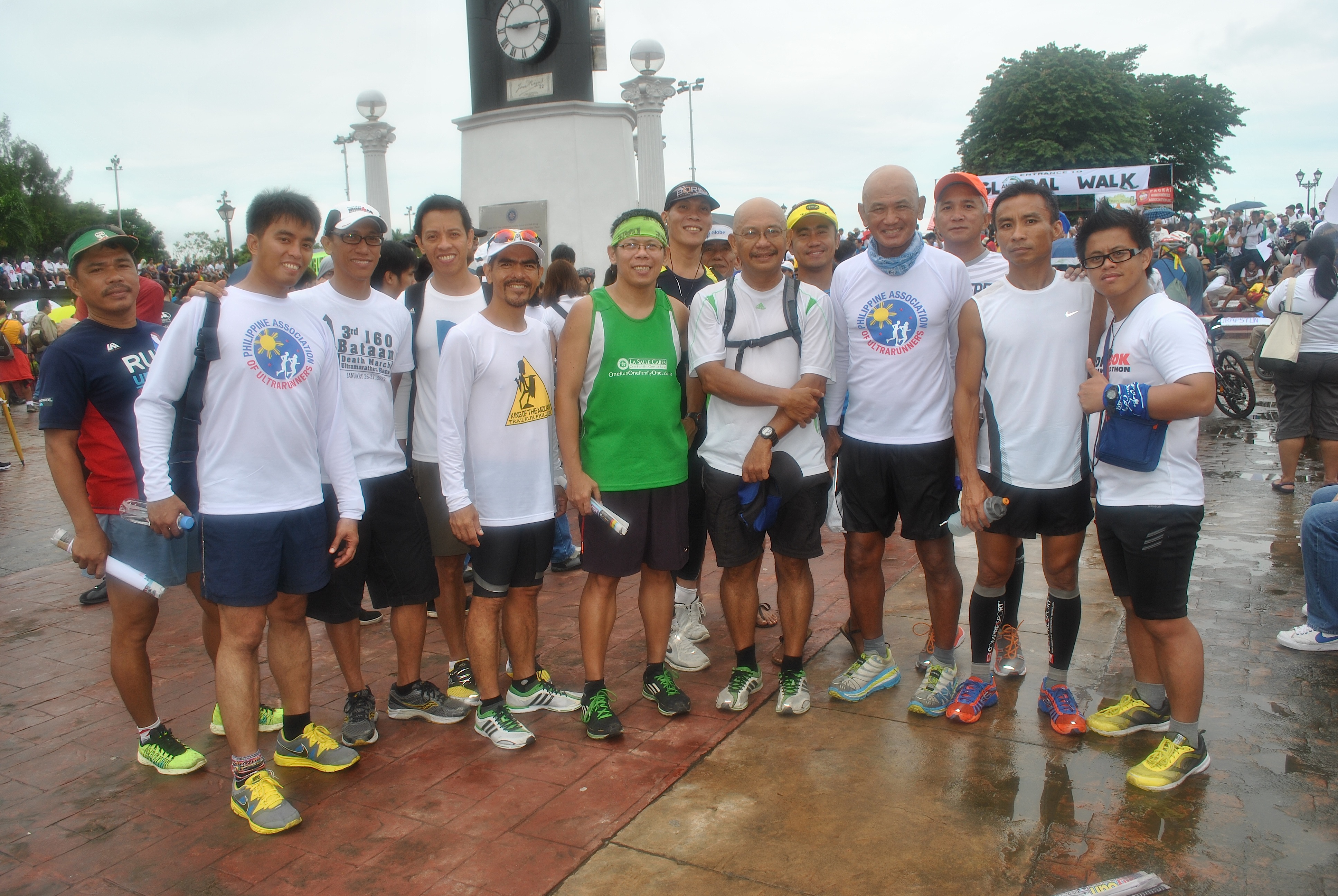
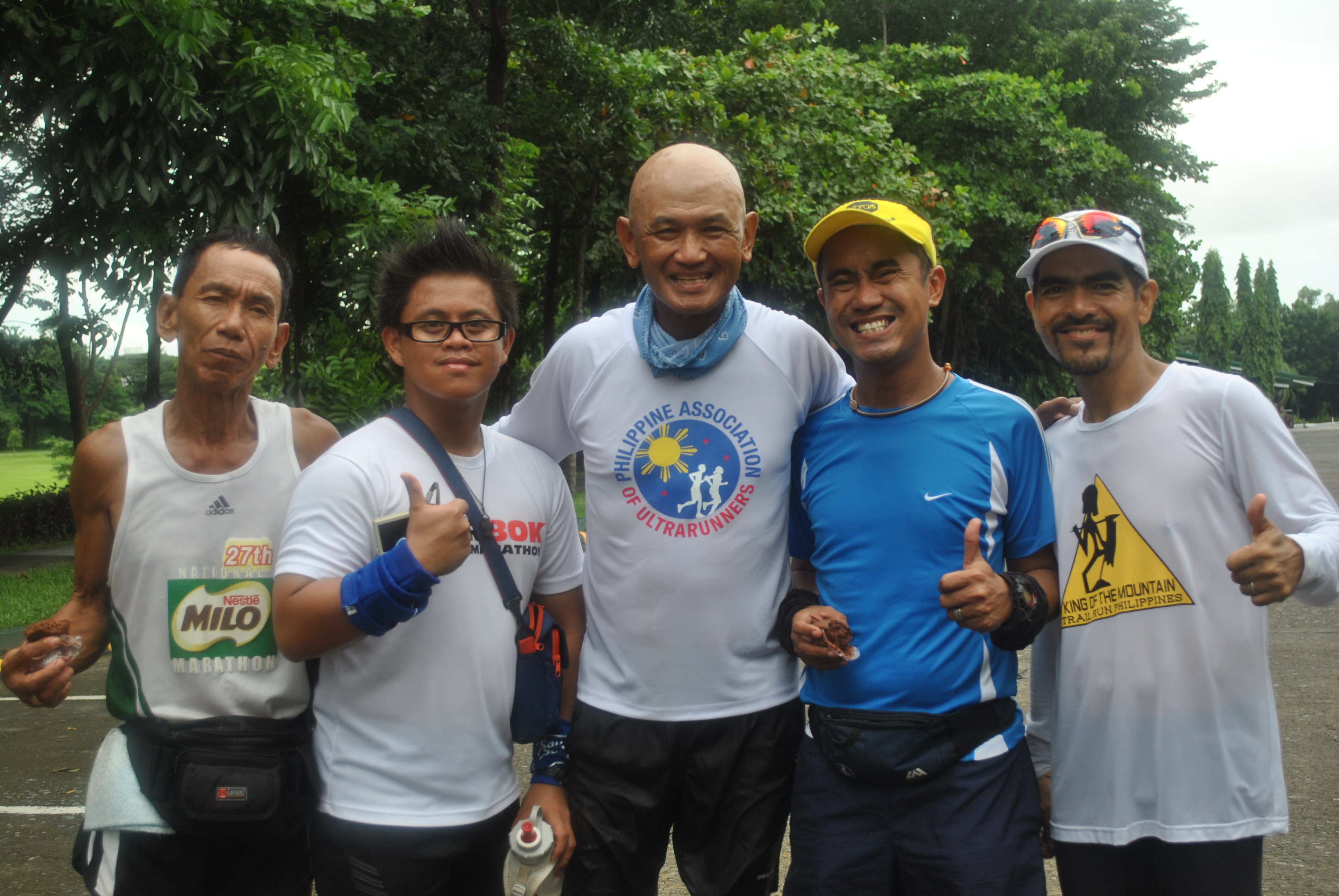
Graciano “Totoy” Santos, one of the “famous” ultra runners and member of the Philippine Association of Ultrarunners (PAU) was able to catch up with the group after 30 minutes of our run.
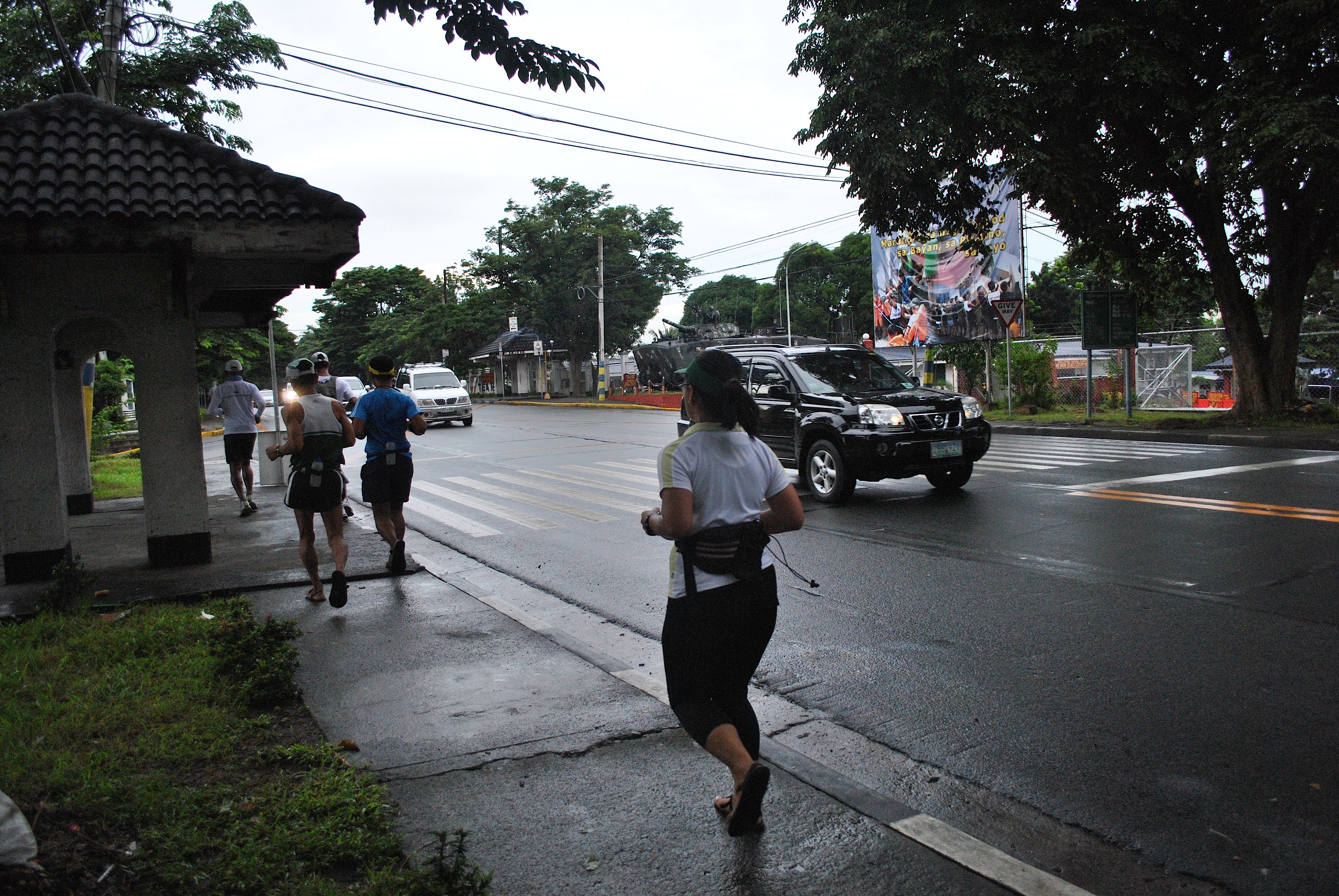
The group run through the Lawton Avenue on a westerly direction going to the Domestic Airport until we reached Roxas Boulevard. As soon as we reached the intersection of EDSA and Roxas Boulevard, we were met by Eric and Jessie. Eric is also a ultra marathoner who lives in Metro Manila while Jessie came all the way from General Santos City, South Cotabato (Mindanao). Jessie is an avid reader to this blog and he told me that he was inspired to be involved in running through the posts I’ve published in this blog.
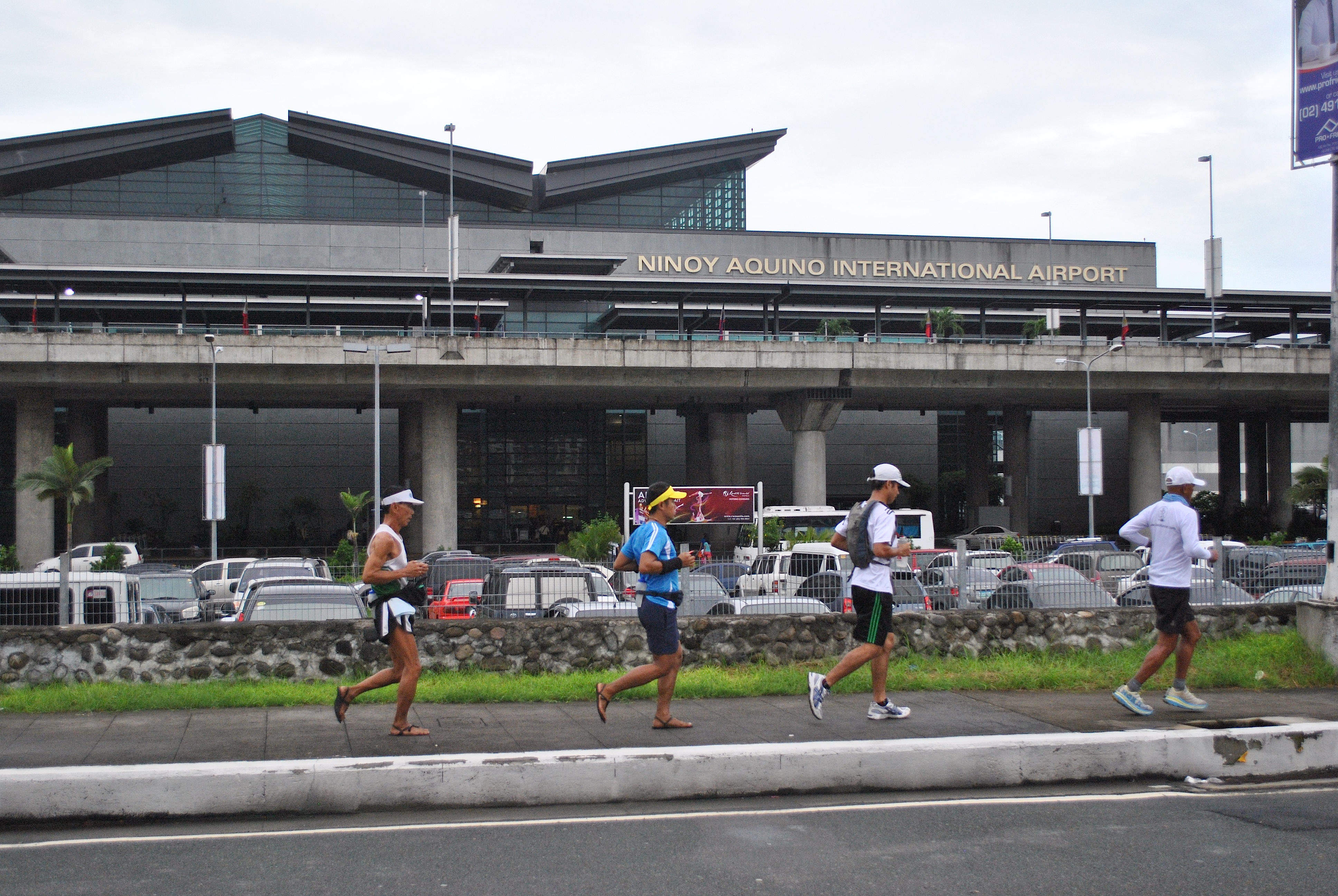
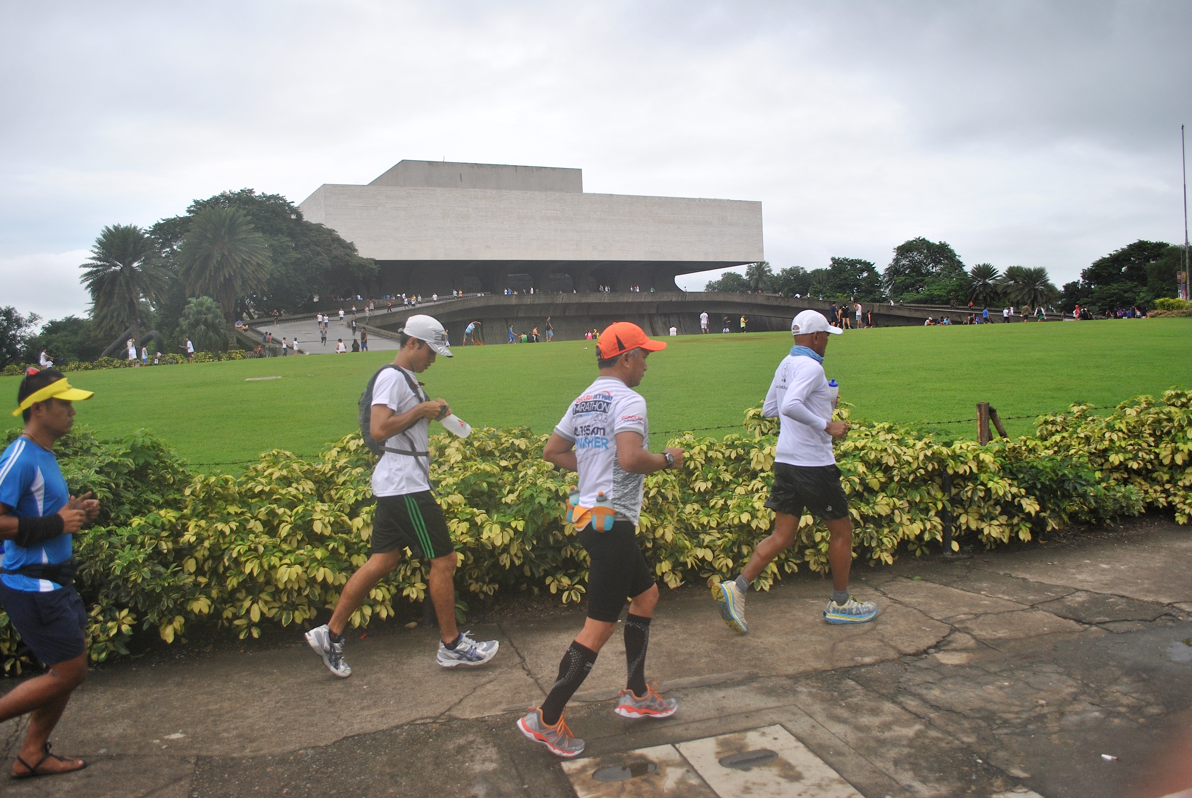
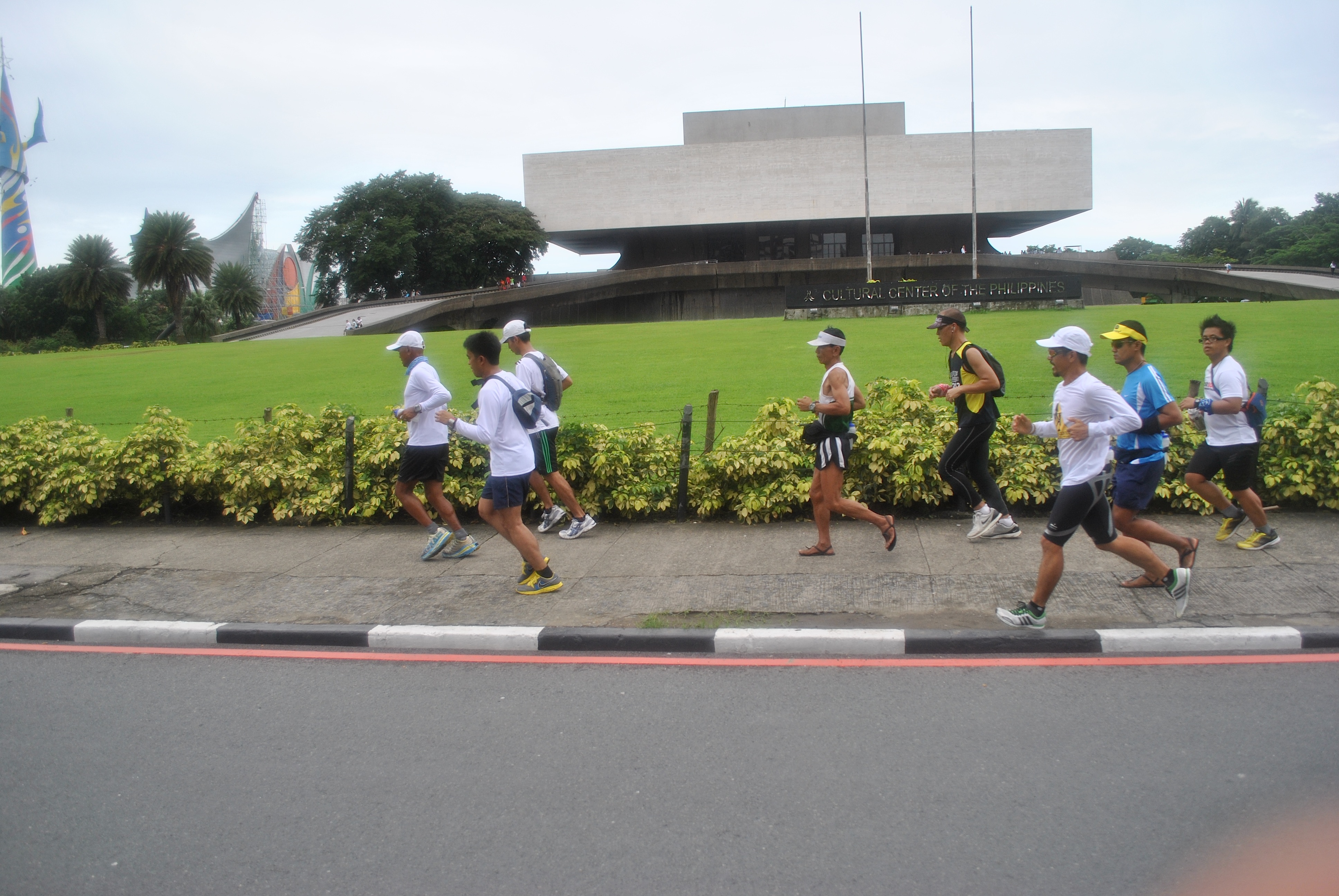
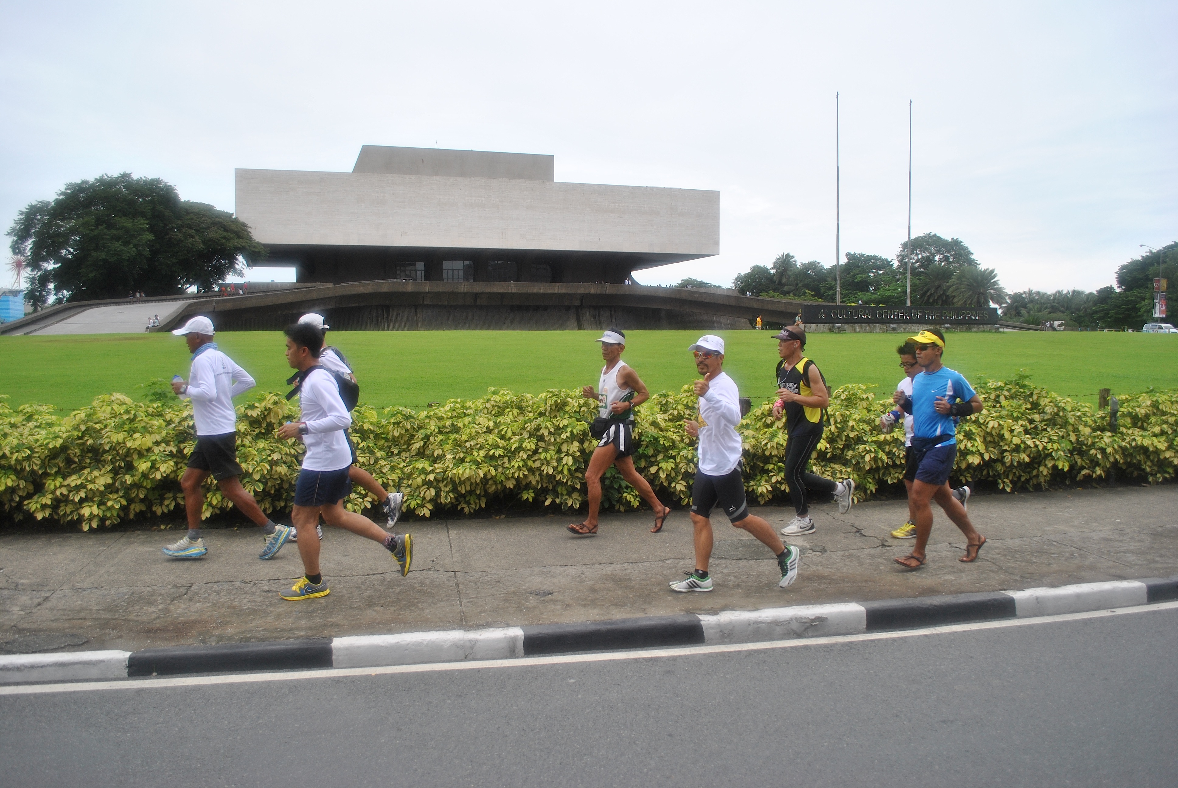
Running Along Lawton AvenueIn Front Of The Philippine Navy/PhilippineMarines’ HeadquartersAt The Vicinity Of Camp Villamor/Headquarters Philippine Air ForceIn Front of the NAIA #3 AirportIn Front of the Cultural Center Of The Philippines (CCP)
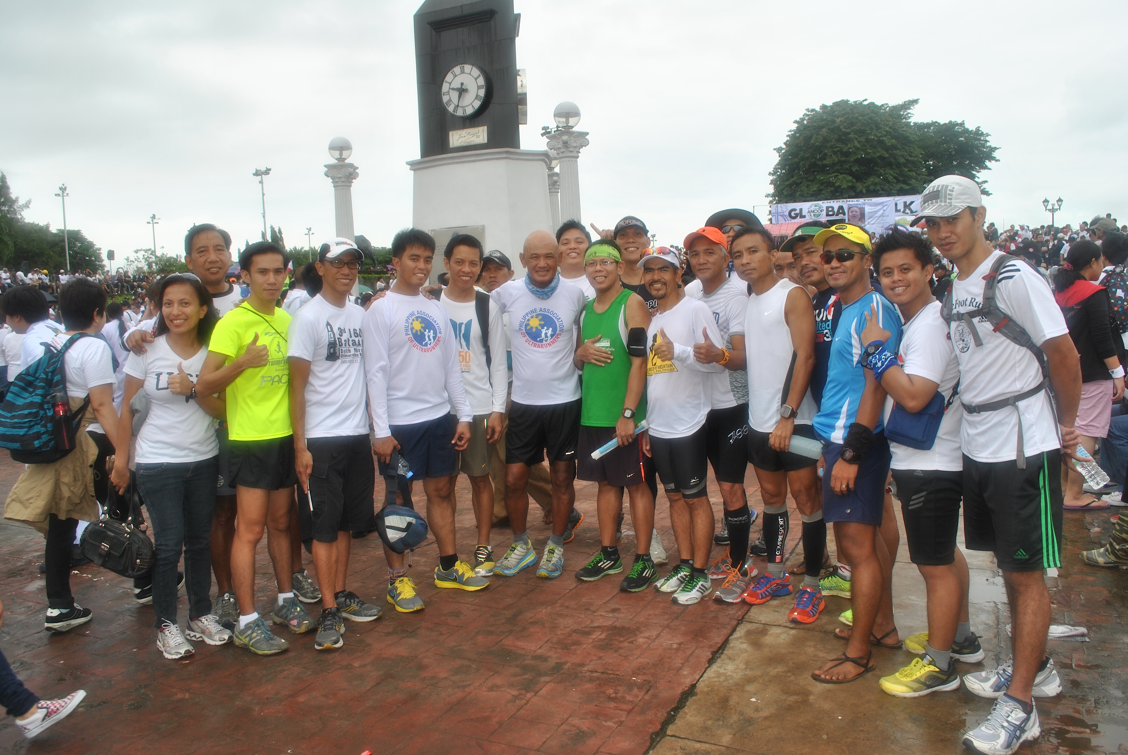
On the last 3 kilometers to Luneta Park, we were joined by more ultra runners: Mar Marilag, Benedict Meneses, and CJ Paran. These runners are finishers of the Bataan Death March Ultra Marathon Race and PAU members.
Ultra Runners In Action
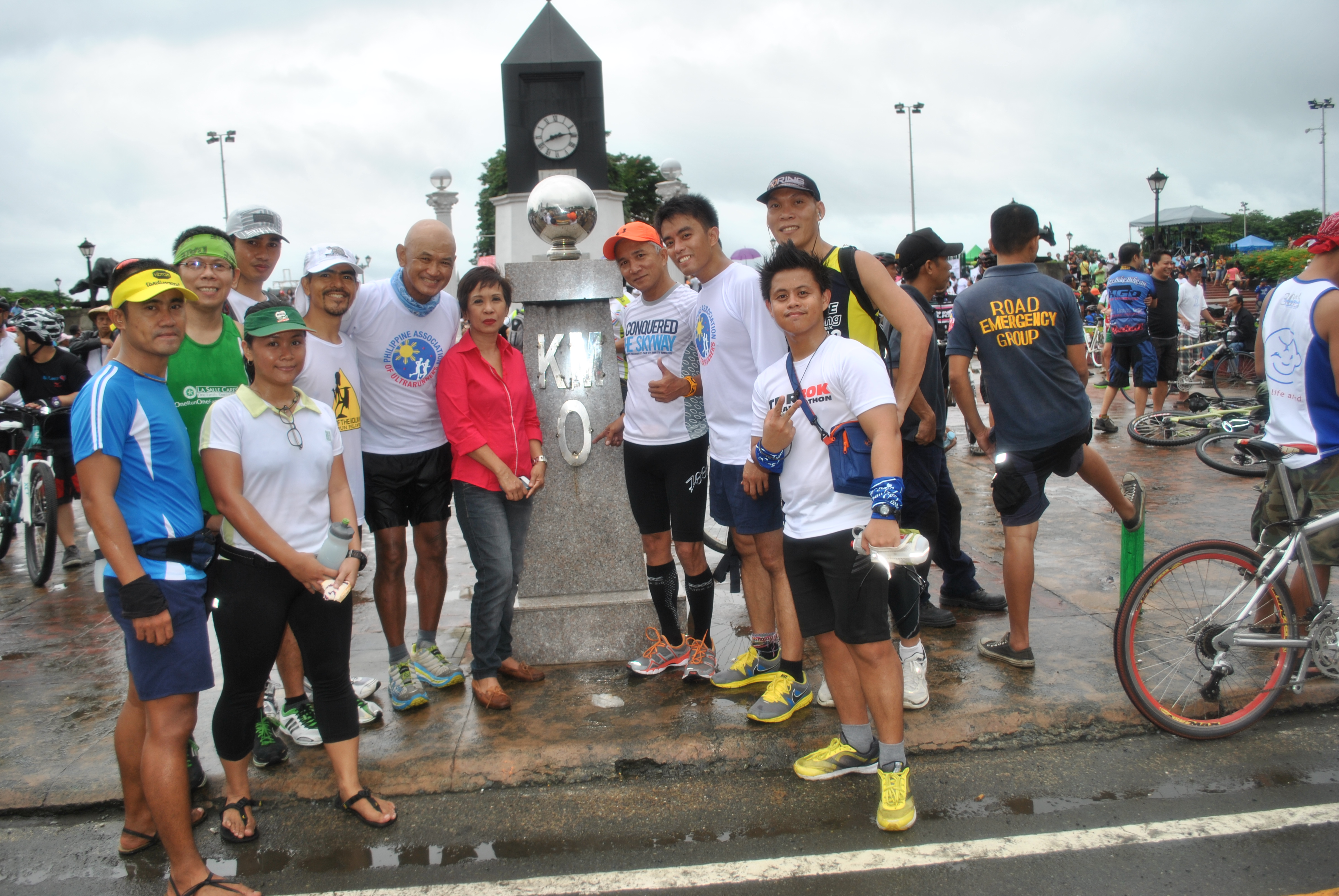
We reached our destination, Luneta Park’s Kilometer Post #0, in 1:50 hours for a distance of 13.5 kilometers. The time was 7:50 AM. The only time that we took some short walking breaks was when we had to cross major street intersections like Roxas Boulevard, EDSA, and Buendia Avenue.
Picture With Ultra & Non-Ultra Runners @ Luneta ParkWith Ultra Runner & Blogger Father Picx Picardal
As soon as we reached Km Post #0, we had some “photo-ops” with some celebrities and runners and sharing of stories with the rest of the group.
We stayed at Luneta until 9:35 AM and more people and marchers started to arrive at the Park. As we started to go back to where we started, we were met by more people going to the Park which forced us to just walk the first 1-2 kilometers of our run back to Fort Bonifacio.
Going Back To Fort Bonifacio
It was only when we were approaching the Headquarters of the Philippine Navy that we started to run! Mar Marilag, CJ Paran, Benedict Meneses and Eric joined us but later went on their way to reach their offices and their final destinations.
Taking It Easy Back To The Starting Area
Instead of re-tracing our route to the Park, we decided to turn left at EDSA and reached the Pasong Tamo Avenue where we had to turn right and be able to reach Lawton Avenue. CJ Paran who works at the Office of the City Mayor of Pasay was kind enough to escort us in his turf. At the corner of EDSA and Pasong Tamo, we took a brief break to drink some ice cold Coke for our last 3-Kilometer push to the Finish Line!
Back At Lawton Avenue
At 11:30 AM, we reached our Finish Line and congratulated ourselves for a successful and safe 27K LSD in the busy streets in Metro Manila. It was Graciano Santos’ recovery run after finishing a 50K Ultra Race the previous day and my recovery run also for running along the mountain trails with ultra friends in my “playground” for almost 9 hours the previous day.
A Pose In Front Of Fort Bonifacio/Headquarters Philippine Army
The task has been done for the day—-To keep us counted for the “One Million March”! This event was created and organized through one of the Social Media platforms, Facebook, and as a Social Media user, this is my simple way to be a part and contribution to the objective of the event. Whether the event reached the targeted number of participants of the event or not, it has already sent a message that Social Media is very powerful tool in uniting the people from different sectors of the society in the country. The event was a success!


You must be logged in to post a comment.