
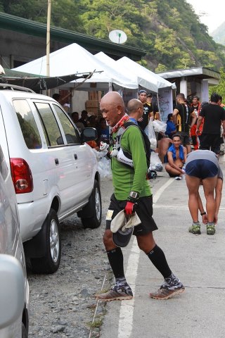
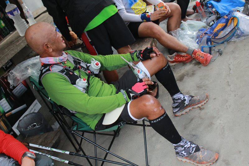
Dreaming…
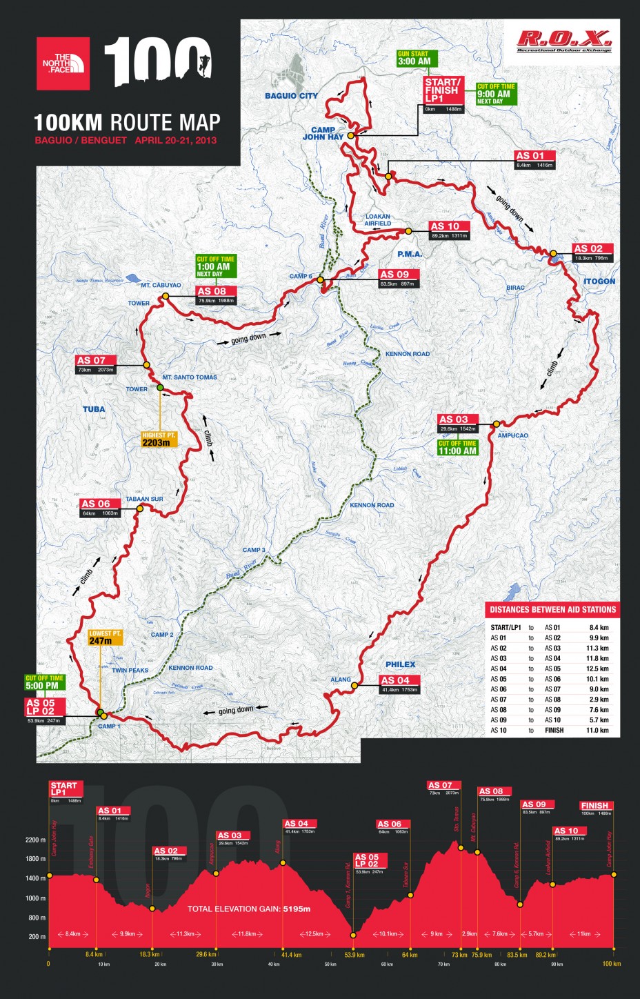
For the benefit of those readers and newbie participants in this race who do not know what is in store for them in the next 46 kilometers of the race from the AS5 @ the Bridal Veil Falls in Camp 1, Tuba, Benguet up to the Finish Line, I will continue with this Race Report and transform it as a Recon Report of such part of the course.
AS5 To AS6 (Camp 1 To Barangay Tabaan Sur)
Crossing the Hanging Bridge at the Bridal Veil Fall in Camp 1, Tuba, Benguet along Kennon Road officially starts another challenging uphill climb which is considered as the most challenging part of the course. Based from my capabilities, I considered the AS4 to AS5, 12-Kilometer downhill route, from Barangay Alang to Camp 1 as the most difficult and hardest part of the course due to the downhill nature of the route and the heat of the sun in the early afternoon.
I am really weak in downhill running as I try to shorten my strides and put more braking efforts to my feet once they land on the ground for the simple reason that I don’t want to put more pressure to my aching and old knees and quad muscles. I have not yet fully strengthen my leg muscles since I was injured on my left knee two years ago. But I’ve started going to the gym for the past months but it became inconsistent after I had my tripping accidents.
However, my strength lies more on power hiking on uphill climbs and could keep up with the pace of younger trail runners. But after coming down from Barangay Alang, my strength just simply dwindled down and I knew it will take some more time and power-enhancing calories to regain my strength.
So let’s go back to the description of the route. After crossing the hanging bridge at the Bridal Veil Falls, it is a single track trail that is continuously uphill until it reaches a wider dirt road where you can see a house directly across such road. Turn right on the wider road until the road ends on the backyard of a house. There is a single track road on the left of the house that goes uphill that leads to a building structure which is a Chapel. On the left side of the chapel is a single-track trail that leads to another continuous uphill climb which is about 2-3 kilometers. Some of the trails are located on the edge of vegetable gardens being maintained by the locals.
The single track uphill trail leads to a wider dirt road where you have to turn right. My HR usually reaches to almost 200 beats per minute before I would reach this wide dirt road. This wider dirt road is a downhill where one could easily jog until you reach a wooden gate and a house with a store. Follow this road and always take the left turn if there is a Y-road/intersection. If you turn right, most likely you will be going back to Kennon Road. Those left turn intersection will lead you to another uphill climb—the direction you have to take to reach the summit/peak of Mount Santo Tomas.
There will be a concrete uphill road that will finally bring you to the Barangay Hall of Tabaan Sur, Tuba, Benguet. At this point, you have reached AS6 which has a distance of 10 kilometers from the Bridal Veil Falls. If you ask me, it would take me 3-4 hours to cover such distance with pure hiking.
AS6 To AS7 (Brgy Tabaan Sur To Mt Santo Tomas)
This is the route from the Barangay Hall of Tabaan Sur to the road that leads to the peak of Mount Santo Tomas which is few meters from the Power Antenna located at the peak of the mountain. The road leads to the 2nd Chapel and later to a Citrus Plantation. After the Citrus Plantation, it is a continuous assault on a single-track trail to the peak of Mount Santo Tomas and one has to pass the last Vegetable Garden before the uphill assault. However, there are flatter parts of the course but the trail is too narrow that every runner should be careful for any missteps. It will be dark and nighttime on this part of the course that a runner must have a very strong headlight to be able to see the different TNF markers stapled on the trees and inserted on the blades of the grasses on both sides of the trail.
Once a runner reached a remnant of cable wires used in the transport of logs from the mountain, one has to turn right to a steep and short switchback downhill trail. Once you are down to a flatter trail, this trail will lead you to a wider trail and you are about one kilometer from the peak of Mt Santo Tomas
A runner would barely notice the old and abandoned PLDT relay station building after going through an uphill climb. From this old building and group of tower/antenna, one has to be on the road that leads to the summit of the mountain and AS7 is within reach. I am not sure if I can manage to cover this part of the course in 3-4 hours which is 9 kilometers in distance.
AS7 To AS8 (Mt Santo Tomas To Cabuyao)
This is the paved road from the peak of Mount Santo Tomas to the lower nearby mountain of Cabuyao which is seen from afar as downhill but on the last kilometer to the Cabuyao Aid Station, a runner will expect a slight uphill climb which is the last one in the mountain. Don’t be fooled with the distance of 2.9 kilometers as stated in the Course Map in between these two Aid Stations. Actually, the distance is 4 kilometers. So, if you still have 30 minutes remaining of your cut-off time before 1:00 AM, you have to run for your life as if somebody is chasing to kill you and give your 101% effort on this part of the course. Once you are safe at AS8, everything will be an easy and slow ride up to the finish line.
AS8 To AS9 (Cabuyao To Camp 6)
This is a rocky, very steep and tricky single track downhill trail for the first 4 kilometers and most of the runners will be slower and some will stumble, slide and accidentally kneel to the loose small rocks or grasses on the sides of the trail. This where you will feel your legs to be trembling from fatigue on every step you take on those rocks, small and big ones! But for the remaining parts of the trail, it will be flatter on the side of the mountain as you pass the water impounding & pumping facility and the hanging bridges in the area. The sounds of the passing vehicles along Kennon Road will be nice music to your ears and the lights from the houses at Camp 6 would be the most satisfying sight that you would see after running/jogging and hiking in the mountains for the past 9-10 hours! You will be happy if you can reach AS9 which is your entry to Kennon Road in 3-4 hours. You will cross your last hanging bridge here after crossing some hanging bridges on this leg of the course. The distance covered on this portion of the course is almost 8 kilometers.
AS9 To AS10 (Camp 6 To Airport Road)
The uphill climb at Camp 6 to the northern side of PMA/Fort Del Pilar will be the last “torture” portion of the course. The runners will be running along alleys in-between rows of houses built on the side of the mountain. Finally, concrete uphill steps outside the group of houses will officially start one’s last “torture” climb on the race course. The trails to take here are the ones that leads to a higher elevation and these trails are always turning to the right!
All the runners’ feeling here is to ask themselves if they can still make it to the finish line within the cut-off time or for them to simply declare DNF in the race but on the other side of their negative thoughts, runners would be happy that after this uphill climb, all the remaining parts of the route will be relatively flat. It is just a matter of mental toughness, patience and self-determination that will propel each runner to reach the Finish Line. They will be happy that it is already daybreak for the next day and the weather is cooler and the sights around are more refreshing.
There are two things that I like in this place. First, when I hear the barking of dogs from the quarters of the Officers assigned in PMA and, and secondly, when I reach & stop for a drink break on a hose that has a continuous flow of cold water which is few meters away from AS10. This part of the course has a distance of almost 6 kilometers with the first half as the steepest parts.
AS10 To Finish (Airport Road To Camp John Hay)
I consider this as one’s “cool down” run where you can jog and walk alternately all the way on the side road of the airport/runway and into the subdivision after leaving the airport area. After some trails and painted/numbered pine trees, you are in a slightly uphill course until you reach the periphery of Barangay Scout Barrio. From there, a tour on the different trails inside Camp John Hay will be ahead of you. No matter if the distance is 5, 6, or 7 kilometers and there is no need to complain and ask from the marshals/volunteers if the Finish Line is near or how many kilometers more to go before you reach the Finish Line. What matters most is that you are going to make it within the cut-off time of 30 hours and start to imagine that Finisher’s Medal to be awarded to you once you cross the finish line. And most of all, think of a story line and description on what will be the composition of your “status” on Facebook! You have 11 kilometers to compose your story and “status” on Facebook along this last leg of the course.
Conclusion
It is not enough to rely on this Recon Report if you want to really know the exact situation and terrain of the course. One has to actually recon the place and get familiarity of what to expect. Familiarity of the place will greatly contribute to one’s confidence to finish the race. However, one has to consider again other factors such as: physical & mental preparation; nutrition; hydration; apparel/equipment; and pacing.
I understand that on Race Day, the trail will be properly marked with TNF Logo markers and reflectorized paints and strips and there is NO need for a detailed description of the trails. But I think this description that I made in this post will be a great help for those who will start their training in a few weeks time. You might laugh but I will be ONE of those who will start such training as soon as possible!
Whether it will be the same course for next year or not, the “basics” are still the same—-uphills; downhills; “fueling” yourself; and the high altitude elevation of the course.
Keep on running!
(Next—Part 4: Lessons Learned; Observations; and Things To Be Improved)

It is basically going to be almost the same race route for next year. 🙂 Just letting you know. Chances of changing the route is 80% same and 20% will be changed.
LikeLike